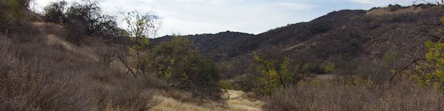
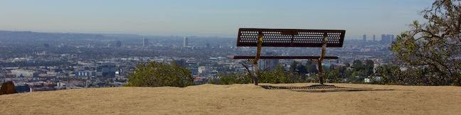
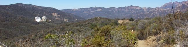
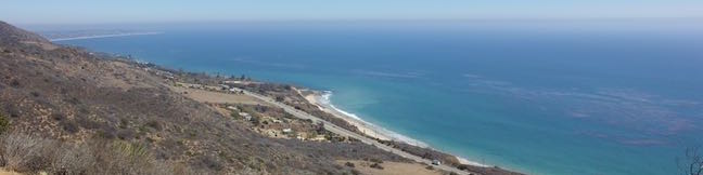
Hikes in the Santa Monica Mountains

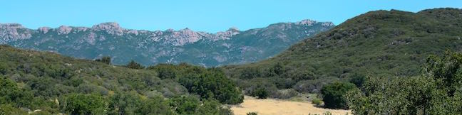
Stretching through Malibu toward downtown Los Angeles, the Santa Monica Mountains are a beautiful coastal range packed with enticing trails. Santa Monica Mountains National Recreation Area spans 40 miles west to east across Los Angeles and Ventura Counties from Point Mugu to Griffith Park. A network of federal, state, and city parks protect over 150,000 acres of the Santa Monica Mountains, offering miles and miles of hiking trails. ... Read more.
Corbin Canyon Park in the Santa Monica Mountains
Corbin Canyon Park is a less visited pocket of Topange State Park in the Santa Monica Mountains. The 328-acre parcel stretches into the mountains from neighborhoods in Tarzana and Woodland Hills, presenting a small offering of trails that are isolated from longer routes through the Santa Monica Mountains. Corbin Canyon hosts trails for a pleasant and manageable 2. ...Read more.
Distance: 2.05 miles · Elevation change: 150 feet
By: Published: December 15, 2016 Last updated: December 5, 2025
Griffith Observatory via East Observatory Trail in Griffith Park
Griffith Observatory sits on a ridge between Vermont Canyon Road and Western Canyon Road on the slopes of Mount Hollywood in Griffith Park. Griffith Observatory is a true Los Angeles landmark that can be appreciated by arriving by trail instead of driving up the park roads. Take West Observatory Trail if you wish to hike to Griffith Observatory from Western Canyon or follow these directions to hike to Griffith Observatory from Vermont Canyon Road. ...Read more.
Distance: 1.5 miles · Elevation change: 380 feet
By: Published: December 5, 2016 Last updated: April 9, 2026
Arroyo Sequit in the Santa Monica Mountains
Take a trip to Arroyo Sequit Park to hike a short loop through a tucked-away pocket of the Santa Monica Mountains, The park is situated along Mulholland Highway inland of Leo Carrillo State Park and below the range's most rugged peaks. The surroundings for this 2.05 miles hike are beautiful. Arroyo Sequit Nature Trail has 285 feet of elevation change, winding over and around the upper reaches of a canyon carved by the East Fork of Arroyo Sequit. ...Read more.
Distance: 2.05 miles · Elevation change: 285 feet
By: Published: September 14, 2016 Last updated: December 6, 2025
Nicholas Flat Trail – Willow Creek Trail Loop to Ocean Vista in Leo Carrillo State Park
At the west end of Malibu where Mulholland Highway meets PCH, you'll find Leo Carrillo State Park. Well known for its beaches and surfing, this park has offerings for hikers too, like the trek up Nicholas Flat Trail to an oak-wrapped grassland with a small pond, which is 7 miles round trip or more. For a shorter hike, combine the bottom of Nicholas Flat Trail with Willow Creek Trail, for a 2. ...Read more.
Distance: 2.05 miles · Elevation change: 620 feet
By: Published: September 13, 2016 Last updated: December 9, 2025
Nicholas Flat Trail in Leo Carrillo State Park and Nicholas Flat Natural Preserve
Nicholas Flat Trail is a three-mile long 'ocean to mountains' trail beginning within Leo Carrillo State Park, just across PCH from a famous beach at the west end of Malibu. The single-track trail travels up a coastal ridge past two vista points (and lots of other ocean views) to reach Nicholas Flat, where grassy meadows are rimmed by oak trees. A small network of trails offer different routes through Nicholas Flat Natural Preserve. ...Read more.
Distance: 7 miles · Elevation change: 1685 feet
By: Published: September 13, 2016 Last updated: April 9, 2026