Corral Canyon Loop Hike Santa Monica Mountains Malibu Los Angeles trail Pacific Ocean views coral canyon
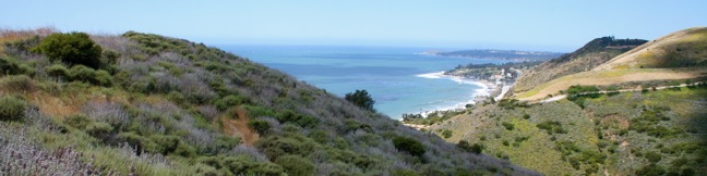
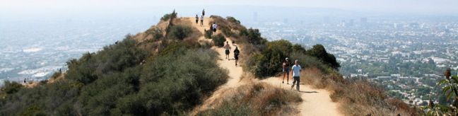
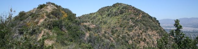
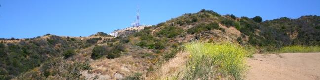
The 1,000-acre Corral Canyon Park protects a span of the Santa Monica Mountains between Dan Blocker Beach and Malibu Creek State Park. This is the only canyon on the Los Angeles County side of the range that remains undeveloped from the ridge top down to PCH, allowing the 2.5-mile loop through the park to plunge hikers in to a world of natural scenery and vegetation. Corral Canyon Loop... Read more.
My Hikes IconAn green hiker icon marks the links to add this hike to your my hikes lists OK! Remove from my hikes
OK! Add to trails I want to hike
TagsA green icon depicting a tags represents a list of words and phrases that this content is tagged with Tagged with · Malibu · Mountains Recreation and Conservation Authority · Ocean Views · Dog-Friendly Trails · Santa Monica Mountains
Hike DistanceA green icon of a hiker used to label information about the length of the hike Distance: 2.5 miles · Elevation change: 525 feet
By: Published: Last updated: December 28, 2020
Runyon Canyon Park Hollywood Hike dog park dog-friendly Runyon Canyon Park is one of the most popular hiking destinations in Los Angeles best hike LA
Runyon Canyon Park is one of the most popular hiking destinations in Los Angeles and often shows up on publishers' lists of best hikes in LA. This 130-acre dog park is located in Hollywood on the east end of the Santa Monica Mountains, providing hikers with a few overlapping loops and great views over Hollywood. For a quick Runyon Canyon hike, try a 1.9-mile loop with 500 feet of... Read more.
My Hikes IconAn green hiker icon marks the links to add this hike to your my hikes lists OK! Add to trails I’ve hiked
OK! Add to trails I want to hike
TagsA green icon depicting a tags represents a list of words and phrases that this content is tagged with Tagged with · Free Trails · Hollywood · Dog-Friendly Trails · Santa Monica Mountains
Hike DistanceA green icon of a hiker used to label information about the length of the hike Distance: 2.65 miles · Elevation change: 700 feet
By: Published: Last updated: May 13, 2025
Cahuenga Peak Hike Griffith Peak Hollywood Sign trail Wonder View Griffith Park Hollywood Sign Wonder View Trail Wisdom Tree Hike Burbank Peak
Cahuenga Peak is the highest summit in Griffith Park with excellent views of Los Angeles, Burbank, and that iconic landmark - the Hollywood Sign. Visit the Cahuenga Peak, Burbank Peak, and Mount Lee on a rugged two-trail outing. Burbank Peak Trail (formerly Wonder View Trail) climbs from the west, passing a mini-summit viewpoint on the ridge of Cahuenga Peak known as Burbank Peak (home... Read more.
My Hikes IconAn green hiker icon marks the links to add this hike to your my hikes lists OK! Add to trails I’ve hiked
OK! Add to trails I want to hike
TagsA green icon depicting a tags represents a list of words and phrases that this content is tagged with Tagged with · Free Trails · Hollywood · Summits · Dog-Friendly Trails · Griffith Park · Santa Monica Mountains
Hike DistanceA green icon of a hiker used to label information about the length of the hike Distance: 3 miles · Elevation change: 875 feet
By: Published: Last updated: May 13, 2025
Hollywood Sign Hike Griffith Park Los Angeles Canyon Drive Franklin trail Lake Hollywood
Want to hike to the Hollywood Sign? One way to get there is a 6.4-mile hike through Griffith Park that summits Mount Lee directly behind the iconic lettering. Beyond just gazing up at the sign, the hike offers the opposite perspective, a chance to look down at the city below. The moderate day hike gains 1,050 feet of elevation over wide fire roads, and the last mile is actually paved. ... Read more.
My Hikes IconAn green hiker icon marks the links to add this hike to your my hikes lists OK! Add to trails I’ve hiked
OK! Remove from my hikes
TagsA green icon depicting a tags represents a list of words and phrases that this content is tagged with Tagged with · Free Trails · Hollywood · Summits · Dog-Friendly Trails · Griffith Park · Santa Monica Mountains
Hike DistanceA green icon of a hiker used to label information about the length of the hike Distance: 6.4 miles · Elevation change: 1050 feet
By: Published: Last updated: May 13, 2025
Santa Ynez Falls Santa Ynez Canyon Topanga State Park Pacific Palisades Waterfall Hike Los Angeles
Santa Ynez Falls Trail follows a shaded creek to a gorge containing a short waterfall. This 2.5-mile hike is a popular family outing because it is fairly level (just 250 feet of elevation change) and interesting enough to hold a child's attention for the duration. Santa Ynez Falls is one of the Los Angeles waterfall hikes. The hike begins from a free trailhead into Topanga State... Read more.
My Hikes IconAn green hiker icon marks the links to add this hike to your my hikes lists OK! Add to trails I’ve hiked
OK! Add to trails I want to hike
TagsA green icon depicting a tags represents a list of words and phrases that this content is tagged with Tagged with · Creeks · Free Trails · Pacific Palisades · Waterfalls · Los Angeles Waterfalls · Santa Monica Mountains · Topanga State Park
Hike DistanceA green icon of a hiker used to label information about the length of the hike Distance: 2.5 miles · Elevation change: 250 feet
By: Published: Last updated: June 11, 2019