Primrose Lake Trail Sequoia National Park backcountry hike
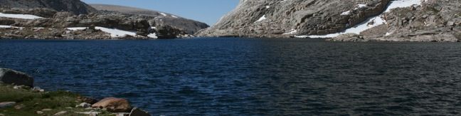
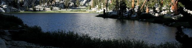
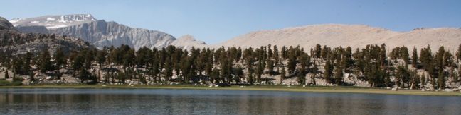
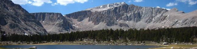
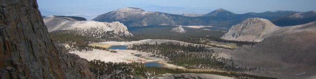
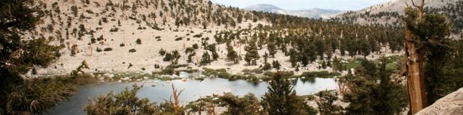
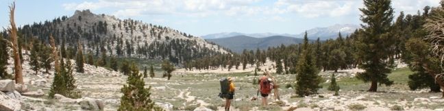
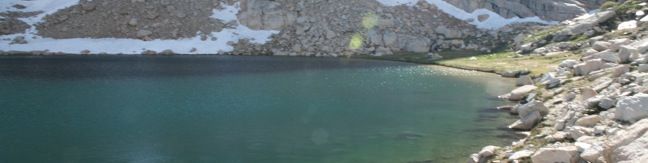
If you are hiking to Sky Blue Lake in the high mountain backcountry of Sequoia National Park, There are nearby lakes worth visiting. Primrose Lake, is located just off the side of Miter Basin and is a scenic destination. To get to Primrose Lake, follow Upper Rock Creek to Miter Basin. Pass the Major General on the right and turn left up the last cirque before the ridge that separates Primrose... Read more.
OK! Add to trails I’ve hiked
OK! Add to trails I want to hike
Tagged with · Backpacking · Free Trails · Lakes · Lone Pine · National Parks · Off Trail
Distance: 28 miles · Elevation change: 2350 feet
By: Published: Last updated: June 3, 2017
Sky Blue Lake Trail Sequoia National Park Sierra Nevada Mountains California
A remote and picturesque basin on the west side of Sequoia National Park rises to a large lake with waters so deep and blue you will think you are staring up at the heavens. The trek up Miter Basin begins at Rock Creek Meadow, nine miles from the nearest trailhead. Those making the hike typically stay overnight in the area, and nearby Lower Soldier Lake offers great camping for... Read more.
OK! Add to trails I’ve hiked
OK! Add to trails I want to hike
Tagged with · Backpacking · Creeks · Lakes · Lone Pine · National Parks · Off Trail · Pacific Crest Trail · Waterfalls
Distance: 26 miles · Elevation change: 2350 feet
By: Published: Last updated: June 3, 2017
New Army Pass sierra nevada mountains sequoia national park hiking trail john muir wilderness
New Army Pass lies at the end of Cottonwood Lakes Trail, 7.5 miles from Horseshoe Meadow. The pass provides off-trail ascents to two nearby summits, Mount Langley and Cirque Peak. A trail down the northwest side of the pass ventures into Sequoia National Park with access to countless backcountry destinations including Lower Soldier Lake, Sky Blue Lake, and Mount Pickering. Lower Soldier... Read more.
OK! Add to trails I’ve hiked
OK! Add to trails I want to hike
Tagged with · Backpacking · Free Trails · John Muir Wilderness · Lakes · Lone Pine · National Parks · Pacific Crest Trail
Distance: 19.2 miles · Elevation change: 2300 feet
By: Published: Last updated: May 13, 2025
Lower Soldier Lake Trail Sequoia National Park hike Inyo National Forest backcountry backpacking
Lower Soldier Lake lies at 10,800 feet on the eastern edge of Sequoia National Park. This is a favored place for backpackers to bed down, and for good reason. A host of trails and off-trail targets make this a prime base camp. The nearest trailhead is Horseshoe Meadow in the Golden Trout Wilderness, which offers two routes to Lower Soldier Lake. About half a mile separates the start of the... Read more.
OK! Add to trails I’ve hiked
OK! Add to trails I want to hike
Tagged with · Backpacking · Free Trails · Golden Trout Wilderness · Lakes · Lone Pine · National Parks · Pacific Crest Trail
Distance: 19.2 miles · Elevation change: 2350 feet
By: Published: Last updated: June 3, 2017
Cirque Peak Trail Sierra Nevada Mountains Summit Hike California Cottonwood Lakes Inyo National Forest Golden Trout Wilderness John Muir Wilderness
Cirque Peak can be reached from either Cottonwood Pass Trail or Cottonwood Lakes Trail. The mountain rises between the two, straddling the divide of the Golden Trout and John Muir Wildernesses. The summit boasts an excellent panorama with a good look at Mount Langley to the north, the Cottonwood Lakes to the east, and the sprawling Sierra to the west. By far the easiest approach to Cirque... Read more.
OK! Add to trails I’ve hiked
OK! Add to trails I want to hike
Tagged with · Backpacking · Free Trails · Golden Trout Wilderness · John Muir Wilderness · Lone Pine · Off Trail · Summits
Distance: 19 miles · Elevation change: 2900 feet
By: Published: Last updated: December 21, 2017
Sierra Lakes Old Cottonwood Creek Trail Golden Trout Wilderness hike John Muir Wilderness Lone Pine South Fork Lakes
Old Cottonwood Creek Trail breaks from the popular Cottonwood Lakes Trail for a more secluded hike into Cottonwood Basin, visiting pristine meadows, alpine lakes, flowing creeks, and amber forests. The trail provides a lovely 8-mile day hike to South Fork Lake, with several options to extend to nearby lakes and peaks. Take Cottonwood Lakes Trail from Horseshoe Meadow as it runs downhill... Read more.
OK! Add to trails I’ve hiked
OK! Add to trails I want to hike
Tagged with · Creeks · Free Trails · Golden Trout Wilderness · John Muir Wilderness · Lakes · Lone Pine
Distance: 9 miles · Elevation change: 1150 feet
By: Published: Last updated: December 21, 2017
Mount Langley 14er Sierra Nevada High Peaks Hike Sequoia National Park backcountry backpacking summit Mount Langley Mt. Langley summit hike Mt Langley
Rising to 14,042 feet, Mount Langley is less than five hundred feet shorter than Mount Whitney but receives far fewer visitors. While the lottery to get a permit for Mount Whitney can be challenging and competitive, Mount Langley's hikers can easily get a free permit on the day of their hike. The summit provides expansive views, solitude, and a deep feeling of accomplishment. At least... Read more.
OK! Add to trails I’ve hiked
OK! Add to trails I want to hike
Tagged with · Backpacking · Free Trails · John Muir Wilderness · Lone Pine · National Parks · Off Trail · Summits
Distance: 22 miles · Elevation change: 4000 feet
By: Published: Last updated: February 5, 2024
Cottonwood Lakes Trail Inyo National Forest John Muir Wilderness Sierra lake hike
Cottonwood Lakes Trail provides a scenic romp through the Southeastern Sierra with alpine lakes and mountain views. Located south of Mount Whitney and west of the city of Lone Pine, the trail travels through the Golden Trout Wilderness and the John Muir Wilderness to end at the border of Sequoia National Park. This is a superb trail for day hikers and backpackers alike. The first mile... Read more.
OK! Add to trails I’ve hiked
OK! Add to trails I want to hike
Tagged with · Creeks · Free Trails · Golden Trout Wilderness · John Muir Wilderness · Lakes · Lone Pine
Distance: 15 miles · Elevation change: 2350 feet
By: Published: Last updated: January 16, 2018
Chicken Spring Lake Trail Golden Trout Wilderness Inyo National Forest Hike Sierra Nevada Mountains Cottonwood Pass
This mountain lake is 0.6 miles from Cottonwood Pass, making it an easy 8.2-mile round trip hike from Horseshoe Meadow. With just 1,330 feet of elevation gain en route to the lake, this is a desirable destination for day-hikers and a good first camp for backpackers. Follow Cottonwood Pass Trail to a junction at the pass with Pacific Crest Trail. Turn right and continue through a rocky... Read more.
OK! Remove from my hikes
OK! Add to trails I want to hike
Tagged with · Free Trails · Golden Trout Wilderness · Lakes · Lone Pine · Pacific Crest Trail
Distance: 8.2 miles · Elevation change: 1330 feet
By: Published: Last updated: December 21, 2017
Cottonwood Pass Trail Golden Trout Wilderness hike backpacking Sierra trails
At an elevation of 11,200 feet, Cottonwood Pass serves as a gateway to the Golden Trout Wilderness and Sequoia National Park. The pass is reached via a 3.5-mile one way trail from Horseshoe Meadow, which has an elevation of 10,000 feet, making this is one of the easiest passes for hikers to reach in the Eastern Sierra. A view of Trail Peak from Horseshoe Meadow Pick up the trail at... Read more.
OK! Add to trails I’ve hiked
OK! Add to trails I want to hike
Tagged with · Free Trails · Golden Trout Wilderness · Lone Pine · Pacific Crest Trail
Distance: 7 miles · Elevation change: 1200 feet
By: Published: Last updated: January 16, 2018