Mount Fremount Lookout Trail Mount Rainier National Park hike Washington Sunrise Frozen Lake Sourdough Ridge trek
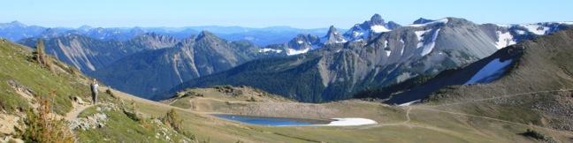
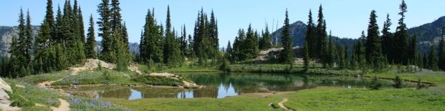
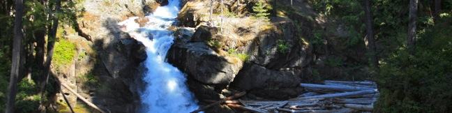
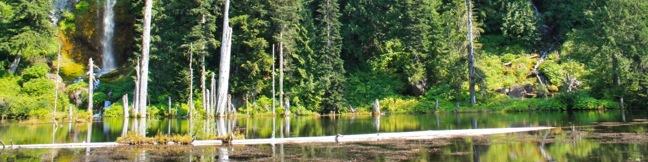
Mount Fremont houses the nearest fire lookout tower to Mount Rainier. On a clear day, the lookout promises some of the park's best views of Mount Rainier and the surrounding Cascade Mountains. The 6-mile round trip hike from the Sunrise Lodge and Visitor Center to Mount Fremont Lookout is exceptionally scenic and fulfilling, with 800 feet of elevation gain. Lupines in the field above... Read more.
OK! Add to trails I’ve hiked
OK! Add to trails I want to hike
Tagged with · Cascade Range · Lookout Towers · National Parks · Summits
Distance: 6 miles · Elevation change: 800 feet
By: Published: Last updated: December 21, 2017
Naches Peak Loop Trail Mount Rainier National Park hiking Washington wildflower hike
The bloom of wildflowers on Naches Peak Loop is the #1 draw to this trail. An extraordinary carpet of purple lupines and other colorful flowers appearing along this trail each summer. The fact that Naches Peak Loop stands out among other trails in Mount Rainier National Park, which has lots of great places to see wildflowers, tells you that this trail is something special. The 3.75-mile... Read more.
OK! Add to trails I’ve hiked
OK! Add to trails I want to hike
Tagged with · Cascade Range · Lakes · National Parks · Pacific Crest Trail · Wenatche National Forest · Wildflowers
Distance: 3.75 miles · Elevation change: 575 feet
By: Published: Last updated: December 21, 2017
Silver Falls Trail Mount Rainier National Park hike Washington hike Ohanapecosh campground
If you are itching to hike through a forest that is a postcard of the northwest, Silver Falls Loop Trail is for you. To make things even better, the 3-mile circuit (with 300 feet of elevation gain) also visits a thundering 70-foot waterfall on Ohanapecosh River. This is a premier woodland hike in the southeast corner of Mount Rainier National Park. Depart from Ohanapecosh Visitor Center... Read more.
OK! Add to trails I’ve hiked
OK! Add to trails I want to hike
Tagged with · Cascade Range · National Parks · Nature Trails · Waterfalls
Distance: 3 miles · Elevation change: 300 feet
By: Published: Last updated: January 16, 2018
Lave Canyon hike Mount Saint Helens National Monument Gifford Pinchot National Forest Washington
With a name like Lava Canyon, you aren't likely to overlook this trail in the blast zone of Mount Saint Helens. What can you expect from this hike? For starters, you'll travel down a narrow canyon with precarious edges and exiting waterfall views. Then you'll cross the canyon on a suspension bridge that bounces and sways a bit too much for comfort. If that sounds good, get ready for an... Read more.
OK! Add to trails I’ve hiked
OK! Add to trails I want to hike
Tagged with · Cascade Range · Creeks · Gifford Pinchot National Forest · Lava
Distance: 1.25 miles · Elevation change: 250 feet
By: Published: Last updated: November 7, 2018
June Lake Trail Washington hike Mount Saint Helens National Monument Gifford Pinchot National Forest
You know you're hiking in a special place when the trail to a waterfall-filled lake in the shadow of America's most famous volcano is not the area's must-do hike. With so many exceptional trails in Washington's Cascade Mountains, June Lake Trail could easily be overlooked. This 2.6-mile hike visits a shallow subalpine lake on the southern slopes of Mount Saint Helens. There is 450 feet of... Read more.
OK! Add to trails I’ve hiked
OK! Add to trails I want to hike
Tagged with · Cascade Range · Gifford Pinchot National Forest · Lakes · Waterfalls
Distance: 2.6 miles · Elevation change: 450 feet
By: Published: Last updated: November 7, 2018
Ape Caves Trail Washington hike Mount Saint Helens National Monument Gifford Pinchot National Forest Ape Tube
Do you want to go on a long hike in a dark tunnel? Ape Cave is the place. Ape Cave is one of the longest lava tubes in the world, measuring approximately 2.5 miles from end to end. Hikers may travel unguided through the lava tube. Make just a few preparations and Ape Cave will deliver a one-of-a-kind adventure. From the cave's main entrance, visitors have two options: Head down to... Read more.
OK! Add to trails I’ve hiked
OK! Add to trails I want to hike
Tagged with · Cascade Range · Caves · Gifford Pinchot National Forest · Lava · Lava Tubes
Distance: 3.75 miles · Elevation change: 400 feet
By: Published: Last updated: January 1, 2019
Trail of two forests hike Washington lava forest tunnel Mount Saint Helens National Volcanic Monument Washington Gifford Pinchot National Forest
Trail of Two Forests offers a window into two time periods of forestation shaped by nearby Mount Saint Helens. The current forest is obvious - moss, fern, trees, and fighting shrubs that have regrown over lava that covered this land approximately 2,000 years ago. The second forest is ghosts of trees that once stood here. As slow-moving molten lava cooled, it surrounded trees and began to... Read more.
OK! Add to trails I’ve hiked
OK! Add to trails I want to hike
Tagged with · Cascade Range · Gifford Pinchot National Forest · Lava · Lava Tubes · Nature Trails · Tree Molds
Distance: 0.25 miles · Elevation change: 25 feet
By: Published: Last updated: April 26, 2019
Wahclella Falls Trail Waterfall hike Portland Oregon Columbia River Gorge Tanner Creek
If you were designing a landscape just for waterfalls, you would end up with something not unlike the Columbia River Gorge. Dozens of waterfalls spill from the basalt cliffs in this region. The abundance of water creates mossy natural retreats that could barely be matched even if you were designing a landscape from scratch. Multnomah Falls is the tallest waterfall in the area, and while... Read more.
OK! Add to trails I’ve hiked
OK! Add to trails I want to hike
Tagged with · Cascade Range · Columbia River Gorge National Scenic Area · Free Trails · Waterfalls
Distance: 2 miles · Elevation change: 250 feet
By: Published: Last updated: July 27, 2023
Multnomah Falls Trail Waterfall hike Portland Oregon Columbia River Gorge
Multnomah Falls is the tallest waterfall in Oregon and one of the tallest year-round waterfalls in the United States. The 620-foot waterfall is grand, beautiful, and easy to reach, making it one of the most popular outdoor attractions in the Pacific Northwest. Located in the Columbia River Gorge on the Washington - Oregon border, 30 miles east of Portland, Multnomah Falls offers something... Read more.
OK! Add to trails I’ve hiked
OK! Add to trails I want to hike
Tagged with · Cascade Range · Columbia River Gorge National Scenic Area · Free Trails · Waterfalls
Distance: 0.4 miles · Elevation change: 25 feet
By: Published: Last updated: December 4, 2018
Bridge to Nowhere hike Los Angeles San Gabriel Mountains Angeles National Forest California trail
For outdoor-loving Angelinos, Bridge to Nowhere is the affectionate name of a local treasure, an abandoned bridge on a washed-away road in the San Gabriel Mountains that spans across the East Fork of the San Gabriel River. You'll find excessive fun on this 10-mile round trip hike with 900 feet of elevation change. The trail uses several river fords to reach the Bridge to Nowhere, adding... Read more.
By: Published: Last updated: May 19, 2024