Smith Mountain Upper Bear Creek Trail Los Angeles San Gabriel Mountains Angeles National Forest California summit hike San Gabriel Mountains National Monument
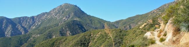
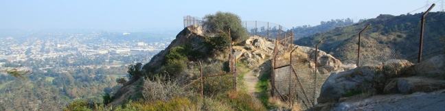
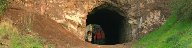
If someone wrote a book about hiking Smith Mountain, it would be called A Tale of Two Trails. It was the most gradual of times, it was the steepest of climbs... This classic hike in the San Gabriel Mountains begins with three miles of single track that easily gain a thousand feet to Smith Saddle. What follows is an 800-foot scramble to the summit in less than half a mile. The two segments... Read more.
By: Published: Last updated: May 20, 2017
Inferno Cone Trail Craters of the Moon National Monument Idaho cinder cone hike
Inferno Cone Trail is a short but steep path up the cinder cone at the center of the scenic loop drive in Crater of the Moon National Monument. This 6,181-foot summit provides a panoramic view of the surrounding volcanic landscape. Inferno Cone Trail is just half a mile round trip with 160 feet of elevation gain. The killer overview of Craters of the Moon is well worth the effort. As... Read more.
OK! Add to trails I’ve hiked
OK! Add to trails I want to hike
Tagged with · Cinder Cones · Lava · Summits
Distance: 0.5 miles · Elevation change: 160 feet
By: Published: Last updated: January 15, 2024
Caves Trail in Craters of the Moon National Monument, Idaho, A hike above and below the surface of a lava flow exploring Indian Tunnel, Dewdrop Cave, Boy Scout Cave, and Beauty Cave - lava tube, lava cave, lava tunnel hiking
One of the coolest things to do anywhere there are lava flows is hike through lava tubes. This makes Caves Trail the most exciting hike in Craters of the Moon National Monument. The 1.6-mile hike visits four lava tubes, that each provide a unique experience. A sign at the trailhead explains: The Craters of the Moon landscape is more than just surface volcanic features. Below ground there... Read more.
OK! Add to trails I’ve hiked
OK! Add to trails I want to hike
Tagged with · Caves · Lava · Lava Tubes
Distance: 1.6 miles · Elevation change: 75 feet
By: Published: Last updated: January 15, 2024
Old Zoo Picnic Area Griffith Park Los Angeles California Hollywood abandoned zoo ruins old LA zoo hike
The old zoo in Griffith Park is one of the strangest ruins in Los Angeles (putting it in the running for strangest ruins worldwide). When the Los Angeles Zoo opened at its current location in the 1960s, the former zoo, a few miles away was not torn down or destroyed. Instead, the zoo was abandoned and converted into a picnic area. Explore one of LA's best off-the-beaten-path... Read more.
OK! Add to trails I’ve hiked
OK! Add to trails I want to hike
Tagged with · Free Trails · Picnic Area · Ruins · Dog-Friendly Trails · Griffith Park · Santa Monica Mountains
Distance: 0.5 miles · Elevation change: 50 feet
By: Published: Last updated: December 7, 2018
Bee Rock Trail hike Griffith Park Los Angeles California Hollywood
Bee Rock is a unique hive-shaped outcropping towering over the east side of Griffith Park. From the top of the rock, you have a commanding view over the park and the city beyond. The observation area atop Bee Rock is surrounded by a tall chain-link fence, protecting visitors from the steep drop-offs on all sides, while meshing up the panoramic views. The shortest route to the top climbs... Read more.
OK! Add to trails I’ve hiked
OK! Add to trails I want to hike
Tagged with · Free Trails · Dog-Friendly Trails · Griffith Park · Santa Monica Mountains
Distance: 2.6 miles · Elevation change: 600 feet
By: Published: Last updated: December 7, 2018
Bronson Cave Trail hike Griffith Park Los Angeles California bat cave hiking Hollywood Bronson Caves
Bronson Cave is one of Hollywood's favorite filming locations. The man-made tunnel is carved into the rock wall of an old quarry in Griffith Park. Bronson Cave‘s most famous role came in the 1960s, playing the entrance of the Batcave in the Batman TV series. The cave continues to be cast in television shows and movies. Thanks to a very short trail, it is about as easy to see Bronson Cave... Read more.
OK! Add to trails I’ve hiked
OK! Add to trails I want to hike
Tagged with · Caves · Free Trails · Hollywood · Dog-Friendly Trails · Griffith Park · Santa Monica Mountains
Distance: 0.65 miles · Elevation change: 50 feet
By: Published: Last updated: December 7, 2018
Baldwin Hills Scenic Overlook Trail Culver City hike Los Angeles California scenic viewpoint state park steps staircase hike LA vista, exercise, workout, stairs
Baldwin Hills Scenic Overlook provides a grand view over LA from a steep hill south of Culver City. The unique perspective looks north over the Los Angeles Basin that extends from Santa Monica Bay to the west, across the Hollywood Hills toward downtown Los Angeles and the San Gabriel Mountains to the east. At Baldwin Hills Scenic Overlook State Park you don't choose between taking the... Read more.
By: Published: Last updated: May 21, 2017
Quarry Loop hike Pirate Trail Mariposa Loop Forrestal Reserve hiking Palos Verdes Peninsula Los Angeles
On the southwest side of the Palos Verdes Peninsula, Forrestal Nature Reserve protects 155-acres of green space on the cliffs above the Pacific. Within the park, Quarry Loop circles an old basalt quarry and provides tons of ocean views. The hike combines four trails (Quarry Trail, Basalt Trail, Mariposa Trail, and Pirate Trail) on a short 1.25-mile loop. Walk through the yellow gate at... Read more.
OK! Add to trails I’ve hiked
OK! Add to trails I want to hike
Tagged with · Free Trails · Ocean Views · Rancho Palos Verdes · Dog-Friendly Trails · Palos Verdes Peninsula
Distance: 1.25 miles · Elevation change: 325 feet
By: Published: Last updated: May 21, 2017
Upper Winter Creek Trail Santa Anita Canyon Hoegees Camp Loop hike Chantry Flats San Gabriel Mountains Los Angeles National Forest Arcadia Mount Wilson Mt. Wilson
If you have hiked Santa Anita Canyon Loop, you probably wondered, were can I find more great trails like this? The answer is Upper Winter Creek Trail, a 2.75-mile track on the east wall of Santa Anita Canyon with 600 feet of elevation change. Upper Winter Creek Trail can be used to replace Lower Winter Creek Trail on Santa Anita Canyon Loop to create a slightly larger ten-mile loop that... Read more.
By: Published: Last updated: June 11, 2019
Skyline Trail Mount Rainier National Park hike Washington Paradise Panorama Point Skyline Trail Loop
Is there a better hike in Mount Rainier National Park than Skyline Trail? The hike begins from Paradise, a perfectly named destination on the southern slope of Mount Rainier. Loop up to Panorama Point, a stunning viewpoint that is about as close to the summit of Rainier as you can get without an ice ax. The trail passes snowfields, streams, waterfalls, and fields of alpine flowers. On a... Read more.
OK! Add to trails I’ve hiked
OK! Add to trails I want to hike
Tagged with · Cascade Range · National Parks · Wildflowers
Distance: 5.5 miles · Elevation change: 1625 feet
By: Published: Last updated: December 21, 2017