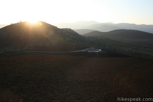
Inferno Cone Trail is a short but steep path up the cinder cone at the center of the scenic loop drive in Crater of the Moon National Monument. This 6,181-foot summit provides a panoramic view of the surrounding volcanic landscape. Inferno Cone Trail is just half a mile round trip with 160 feet of elevation gain. The killer overview of Craters of the Moon is well worth the effort.
As you begin hiking up Inferno Cone, you might wonder how the great heap of cinder was created. A panel at Inferno Cone Overlook explains:
Cinder cones form when gas-rich volcanic froth erupts high into the air and then piles in a mound.
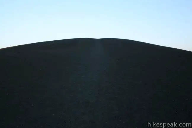
As you power your way up Inferno Cone Trail, keep in mind that you are walking on the settled fragments of a massive volcanic explosion. This hike is short and the directions are simple. Start at Inferno Cone Overlook and march up the worn track ascending the dark rock of the face of the cinder cone. When you get to the top, simply walk around and enjoy the views.

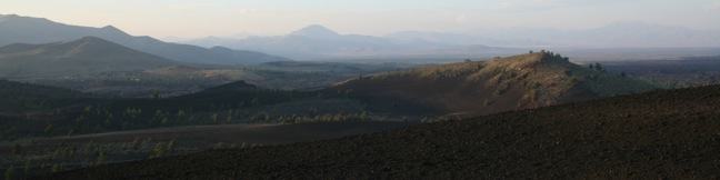
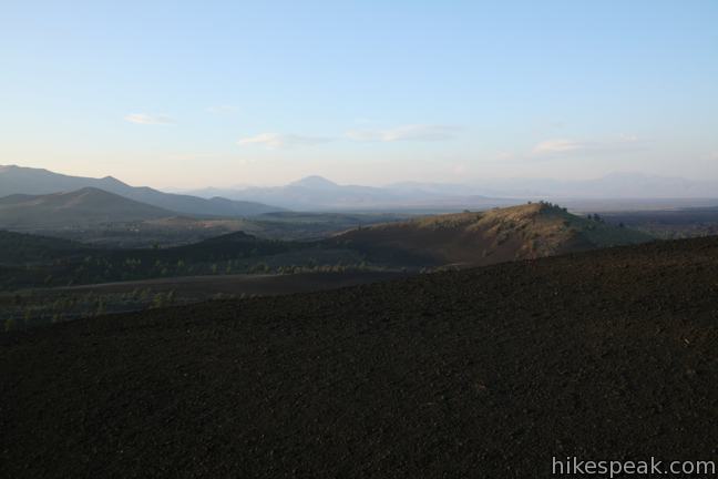
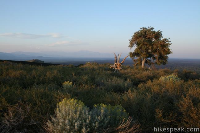
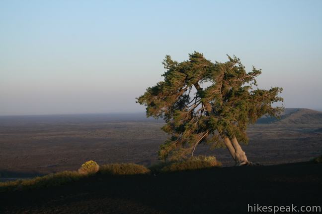
You will not find a crater on the top of the cone. The source of the eruption was buried by the collection of wind-swept cinders. What you will find is an excellent overview of the Great Rift, the volcanic area preserved by Craters of the Moon National Monument. To the east is a long stretching lava field. Big Cinder Cone, visible to the south, rises to 6,515 and is considered to be one of the worlds largest purely basaltic cinder cones. Silent Cone and Snow Cone are visible to the west, and other cinder cones can be admired to the north. The views are wide in every direction from this 6,181-foot cone. A single tree, an iron-willed juniper, rises above a patch of sagebrush on the round summit, which is the only thing capable of obscuring the panoramic views.
Leave Inferno Cone the same way you came up. You can see the trailhead from the top of the cone, so there is no risk of getting lost.
A national park entrance fee is charged to to reach this trail in Craters of the Moon National Monument (which is $20 per vehicle as of 2024). Interagency passes are accepted. No trail permit is required. Dogs are not allowed.
Directions to the Trailhead
- Whether you approach Craters of the Moon from Blackfoot along Interstate 15 to the east or from Twin Falls along Interstate 84 to the west, it is an approximately 90 minute drive off the freeway to Craters of the Moon National Monument.
- Craters of the Moon is located along US Route 20/26/93 (three routes in one), 19 miles southwest of the town of Arco and 24 miles northwest of the town of Carey.
- Turn into the main entrance for the monument on the south side of the road and proceed 2.8 miles into the park to the trailhead.
- The hike begins from Inferno Cone Overlook, located on the left, 0.8 miles after the split in loop road.
Trailhead Location
Trailhead address: Loop Road, Craters of the Moon National Monument, Arco, ID 83213
Trailhead coordinates: 43.44488, -113.555657 (43° 26′ 41.57″N 113° 33′ 20.36″W)
View Craters of the Moon in a larger map
Or view a regional map of surrounding Idaho trails and campgrounds.

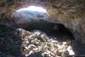 | Caves Trail This 1.6-mile hike travels above and below the surface, exploring lava tubes in the Great Rift Lava Flow. |
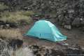 | Lava Flow Campground This seasonal 51-site campground sits on a lava field near the entrance to Craters of the Moon National Monument. |
Common Questions about Inferno Cone Trail in Craters of the Moon National Monument
- Is the trail open?
- Yes. You should expect to find that Inferno Cone Trail is open. There are no recent reports of trail closures. If you discover that the trail is closed, please help your fellow hikers by reporting a closure.
- Do I need a permit for this hike?
- Yes. National Monument Entrance Fee.
- How much time does this hike take?
- It takes approximately 15 minutes to hike Inferno Cone Trail. Individual hiking times vary. Add extra time for breaks and taking in the views.
- How long is this hike?
- The hike to Inferno Cone Trail is a 0.5 mile out and back with 160 feet of elevation change.
- Are dogs allowed on this trail?
- No, dogs are likely not allowed on Inferno Cone Trail. The trail is primarily open to hikers.
- Is Inferno Cone Trail good for kids?
- Yes, this hike is likely suitable for children. It is relatively short (0.5 miles) with manageable elevation gain.
- Does this trail go to a summit?
- Yes, Inferno Cone Trail reaches a summit with panoramic views.
- Where is the trailhead located?
- The trailhead for Inferno Cone Trail is located in Arco, Idaho.
Trailhead Address:
Craters of the Moon National Monument
Arco, Idaho 83213
Trailhead Coordinates:
43.44488, -113.555657 - What are the driving directions to the start of the hike?
To get to the trailhead: Whether you approach Craters of the Moon from Blackfoot along Interstate 15 to the east or from Twin Falls along Interstate 84 to the west, it is an approximately 90 minute drive off the freeway to Craters of the Moon National Monument. Craters of the Moon is located along US Route 20/26/93 (three routes in one), 19 miles southwest of the town of Arco and 24 miles northwest of the town of Carey. Turn into the main entrance for the monument on the south side of the road and proceed 2.8 miles into the park to the trailhead. The hike begins from Inferno Cone Overlook, located on the left, 0.8 miles after the split in loop road.
View custom Google Maps directions from your current location.
- Are there other trails near Inferno Cone Trail?
- Yes, you can find other nearby hikes using the Hikespeak Hike Finder Map.

4 Comments on Inferno Cone Trail in Craters of the Moon National Monument
What hikers are saying:
✨ Generated summary of user commentsThis unique terrain inspires a sense of wonder and leaves visitors eager to explore more of the surrounding Idaho landscape.
[…] morning sun at the top of the Inferno Cone. “Inferno Cone Trail is a short but steep path up the cinder cone at the center of the scenic loop drive in Crater of […]
how come craters of the moon is the only place from idaho you have on here boise has great trails not to mention the Green Belt all the way through boise along the boise river??
jw
-blaine
Believe me, I am hoping to hike a lot more in Idaho!
[…] Inferno Cone is a black hill you can hike up to see a tree growing up top and red rocks, like an oasis. The link mentions the fantastic view from on top this hill. It’s true, so bring a camera. So you won’t be like me, and too tired to go up a second time with a camera. […]