Tubb Canyon Trail to Big Spring in Anza-Borrego Desert State Park
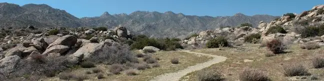
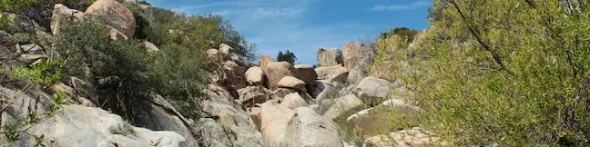
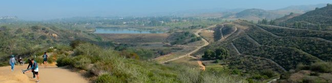
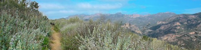
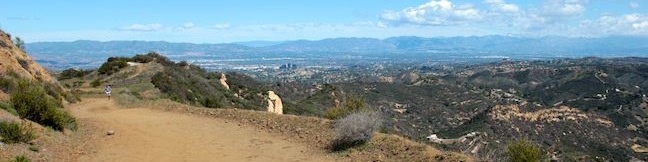
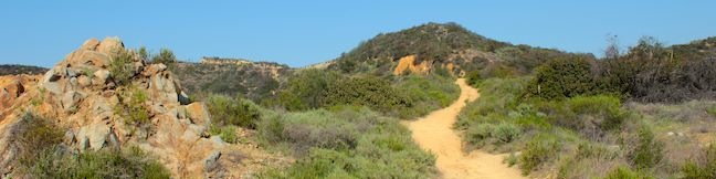
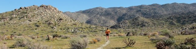
Driving around Anza-Borrego Desert State Park, you will pass quite a few unnamed or unmarked footpaths heading off somewhere into the desert. If you are curious enough to venture down one of these mysterious trails, make your way to Tubb Canyon. Located near Culp Valley Primitive Campground in the San Ysidro Mountains on the west side of the park, Tubb Canyon Trail offers an easy 1. ...Read more.
Distance: 1.5 miles · Elevation change: 200 feet
By: Published: April 7, 2013 Last updated: April 9, 2026
Culp Valley Loop to Culp Valley Overlook and Peña Springs in Anza-Borrego Desert State Park
If you like mountain views without a mountainous amount of effort, set out on Culp Valley Loop. This 2.2-mile hike with 200 feet of elevation change begins from Culp Valley Primitive Campground in the San Ysidro Mountains west of Borrego Springs. The campground is just off Montezuma Highway, the main road into the park from the west, making Culp Valley Loop a convenient first stop for Anza-Borrego Desert State Park visitors coming from Los Angeles, San Diego, or somewhere in between. ...Read more.
Distance: 2.2 miles · Elevation change: 200 feet
By: Published: April 6, 2013 Last updated: April 8, 2026
Observatory Trail in Cleveland National Forest
Within the Cleveland National Forest on Palomar Mountain is a trail through a pleasant woodland that has broad valley vistas en route to a world-renowned destination. What more could you want? Strap on your hiking boots and set out up Observatory Trail, which is 2.2 miles long from point to point with 700 feet of elevation gain. The trail starts at Observatory Campground and ends just outside the Palomar Observatory. ...Read more.
Distance: 5.1 miles · Elevation change: 700 feet
By: Published: April 3, 2013 Last updated: April 9, 2026
Indian Flats Trail to East Fork San Luis Rey River in Cleveland National Forest
Located in the Cleveland National Forest near Warner Springs, The live oak-shaded Atáxam Mámta'ash Campground (formerly know as Indian Flats) is the start of a short trail to a trickling river fork. It is a 0.5-mile round trip hike from the campground goes down to the East Fork of the San Luis Rey River, which flows down a mountain slope covered in granite boulders. ...Read more.
Distance: 0.5 miles · Elevation change: 75 feet
By: Published: April 2, 2013 Last updated: April 9, 2026
Lake View Loop & East Ridge Overlook in Peters Canyon Regional Park
Peters Canyon Regional Park is an Orange County Park preserving 354 acres of open space including the 55-acre Peters Canyon Reservoir. A gradual 2.7-mile loop around the reservoir is popular trail with joggers and dog walkers. Other trails in the park allow visitors to hike even farther. The 5.7-mile East Ridge Loop is an expansion of the Lake View Loop that delivers a grand tour of the park. ...Read more.
Distance: 3.65 miles · Elevation change: 200 feet
By: Published: March 28, 2013 Last updated: December 5, 2025
Nicholas Flat via Malibu Springs Trail in the Santa Monica Mountains
Near the west end of Mulholland Highway north of Leo Carrillo State Park, you will find an almost hidden trailhead for Malibu Springs Trail. This spring-loaded single track is faint and overgrown in areas, providing a sense of adventure as you take in fantastic views of the highest peaks Santa Monica Mountains. At the end of an arduous climb, you will drop down to Nicholas Flat in Nicholas Flat Natural Preserve. ...Read more.
Distance: 7 miles · Elevation change: 1425 feet
By: Published: March 22, 2013 Last updated: April 9, 2026
Mesa Peak from Malibu Canyon Road (Piuma Trailhead) in the Santa Monica Mountains
A mesa is defined as a flat-topped hill with steep sides. A peak is defined as the pointed top of a mountain. Put these contradictions together and you get a subtle summit with substantial ocean views. This short perch on a mesa-like ridge behind Pepperdine University in Malibu delivers panoramic views over the surrounding Santa Monica Mountains. The hike to Mesa Peak up the steep sides of the mesa begins from the Piuma Trailhead in Malibu Creek State Park and follows 2. ...Read more.
Distance: 6.5 miles · Elevation change: 1375 feet
By: Published: March 15, 2013 Last updated: December 9, 2025
Calabasas Peak via Calabasas – Cold Creek Trail in the Santa Monica Mountains
Before it was called Calabasas - Cold Creek Trail, this single track on the northwest side of Calabasas Peak was called the Secret Trail. Well the secret is out and this 4.5-mile round trip trek is a pleasure that all hikers should discover! Tackle 750 feet of elevation change as you cross ridges and ravines topped by sandstone minarets, eventually reaching a 2,163-foot summit with 360 degree views over the Santa Monica Mountains. ...Read more.
Distance: 4.5 miles · Elevation change: 750 feet
By: Published: March 13, 2013 Last updated: April 9, 2026
Mount Baden-Powell in the San Gabriel Mountains
Mount Baden-Powell is a special summit in the San Gabriel Mountains. It is one of the range's tallest peaks at 9,399 feet and holds particular importance to the Boy Scouts of America because it memorializes the lofty accomplishments of Lord Baden-Powell who founded the Scout Movement. The views are lofty too, lording over an expanse of rugged mountains framed the San Gabriel Valley to the south and the Mojave Desert to the north. ...Read more.
Distance: 8.25 miles · Elevation change: 2834 feet
By: Published: March 8, 2013 Last updated: December 9, 2025
Hastain Trail in Franklin Canyon Park
If you are looking for a nice loop hike in the Santa Monica Mountains above Beverly Hills, give Hastain Trail in Franklin Canyon Park a try. Hastain Trail can actually be used for two loops, one easy 1.8-mile loop with 350 feet of elevation gain and one moderate 2.2-mile option with 550 feet of elevation gain. Each trek is a satisfying way to explore Franklin Canyon Park. ...Read more.
Distance: 2.2 miles · Elevation change: 550 feet
By: Published: March 6, 2013 Last updated: April 8, 2026