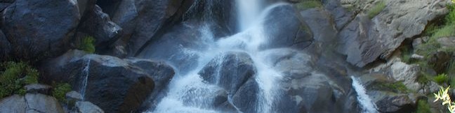
Roaring River Falls in Kings Canyon National Park
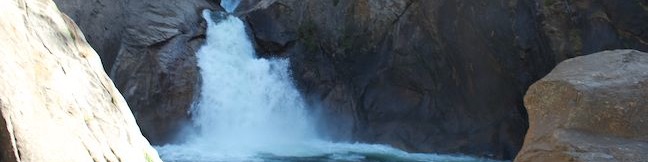
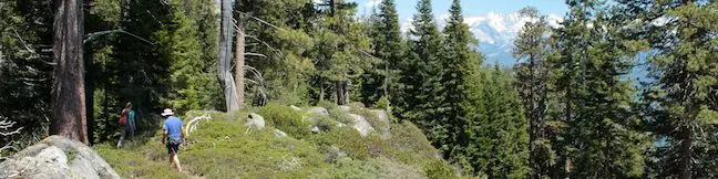
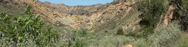
Of course it is Yosemite Valley that rules the Sierra when it comes to waterfalls, but Kings Canyon has some regal waterfalls of its own, like Roaring River Falls. Located just off Generals Highway in the Cedar Grove Area of Kings Canyon National Park, the short but violent waterfall can be reached on a paved 0.3-mile round trip hike. Roaring River Falls makes a quick, rewarding outing and a worthwhile stop for anyone driving into Kings Canyon. ...Read more.
Distance: 0.3 miles · Elevation change: 25 feet
By: Published: June 11, 2013 Last updated: December 5, 2025
Hart Tree and Fallen Goliath Loop in the Redwood Mountain Grove in Kings Canyon National Park
Despite being the world's largest grove of giant sequoias, the Redwood Mountain Grove receives far fewer visitors than the Giant Forest and the General Grant Grove. Those that do visit are in for a treat. Redwood Mountain Grove is a haven for hikers. Three long trails exploring the Redwood Mountain Grove (Sugar Bowl Trail, Redwood Creek Trail, and Hart Tree Trail) can be coupled to form three different loops through the peaceful grove. ...Read more.
Distance: 8.3 miles · Elevation change: 925 feet
By: Published: June 10, 2013 Last updated: April 27, 2026
Buena Vista Peak in Kings Canyon National Park
What's taller than a giant sequoia? In the Redwood Mountain Grove, the world's largest sequoia grove, the something taller is Buena Vista Peak, a granite summit that rises above the big trees. The hike to the top of Buena Vista Peak is just 2 miles round trip with 420 feet of elevation gain, making it one of the easier summits to reach in the Sierra. ...Read more.
Distance: 2 miles · Elevation change: 420 feet
By: Published: June 6, 2013 Last updated: April 27, 2026
Panoramic Point in Kings Canyon National Park
In the Sierra Nevada Mountains, sometimes you have to hike a great distance to a great view, and sometimes you don't. Panoramic Point is the latter. The outstanding overlook can be reached via a paved 0.5-mile round trip hike with one switchback. The views are worthy of the name, looking northeast over Kings Canyon and surrounding snowy peaks. The trailhead is just a couple miles from Grant Village in the Grant Grove Area of Kings Canyon National Park, making it an easy-to-reach trailhead for an easy hike to views that are easy on the eyes! ...Read more.
Tagged with · Grant Grove · National Parks
Distance: 0.5 miles · Elevation change: 100 feet
By: Published: June 5, 2013 Last updated: December 5, 2025
Grizzly Falls in Sequoia National Forest
If you are driving down Generals Highway to the Cedar Grove Area of Kings Canyon National Park, you should feel compelled to check out Grizzly Falls. The obscured view of the 80-foot waterfall from the road should be incentive enough for you to stop, and you can get to the base of Grizzly Falls via a super short and easy 0.1-mile round trip stroll. ...Read more.
Distance: 0.1 miles · Elevation change: 35 feet
By: Published: June 4, 2013 Last updated: December 5, 2025
Sugar Pine and Bobcat Point Trails Loop in Sequoia National Park
Isn't it comforting to know that even in the Giant Forest, the most visited area of Sequoia National Park, you can still find a wonderful trail where you might not bump into another hiker? Starting from the busy parking area at Crescent Meadow, Sugar Pine Trail heads away from that beautiful sequoia-lined meadow to seek out other interesting natural features away from the big trees. ...Read more.
Tagged with · Giant Forest · Morteros · National Parks
Distance: 1.5 miles · Elevation change: 250 feet
By: Published: June 2, 2013 Last updated: April 6, 2026
Big Trees Trail in Sequoia National Park
Big Trees Trail offers an easy, educational, and beautiful hike through giant sequoias in Sequoia National Park's Giant Forest. Big Trees Trail is a level and paved nature trail circling 0.8 miles beneath towering sequoias along the edges of Round Meadow. Handicapped visitors can park at a convenient lot near Round Meadow for a 1-mile wheelchair-friendly hike. ...Read more.
Distance: 1.4 miles · Elevation change: 50 feet
By: Published: May 31, 2013 Last updated: December 5, 2025
Hanging Rock in Sequoia National Park
Hanging Rock Trail might be one of the easiest trails to overlook in Sequoia National Park, but there are many reasons why you shouldn't. To start with, you'll find a fun giant sequoia at the trailhead that has been burned out like a chimney with two gaps big enough to climb in and out of. The hike to Hanging Rock also has some of the park's best views of Moro Rock, Sequoia's most famous granite dome. ...Read more.
Tagged with · Giant Forest · National Parks
Distance: 0.35 miles · Elevation change: 100 feet
By: Published: May 30, 2013 Last updated: December 5, 2025
Headlands Trail in Harmony Headlands State Park
Harmony Headlands State Park preserves 784 acres along California's Central Coast between Cayucos and Cambria. Setting out from Highway One, a gradual 4.5-mile lollipop loop through the park crosses a coastal valley to reach picturesque ocean bluffs. The easy bench-lined hike ascends about 85 feet up a wide dirt road before descending 135 feet to the coast where a footpath can be used to explore the rugged oceanfront. ...Read more.
Distance: 4.5 miles · Elevation change: 135 feet
By: Published: May 23, 2013 Last updated: April 8, 2026
Towsley View Loop Trail in Ed Davis Park in Towsley Canyon
Ed Davis Park in Towsley Canyon is an impressive segment of Santa Clarita Woodlands Park, located on the north side of the Santa Susana Mountains at the north end of Los Angeles County. The trailhead is located just off the 5 Freeway north of the San Fernando Valley, not far from Six Flags Magic Mountain. You don't need a ticket for an adventure in this park, which has its share of natural attractions, like the narrows of Towsley Gorge and seeps of oil and liquid asphalt that pool along the trail. ...Read more.
Distance: 5.4 miles · Elevation change: 1075 feet
By: Published: May 13, 2013 Last updated: April 8, 2026