Moraine Trail to Fallen Leaf Lake in Lake Tahoe Basin National Forest Lands
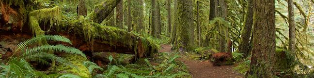
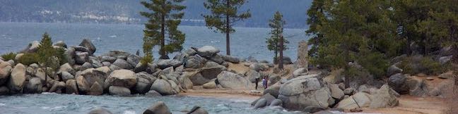
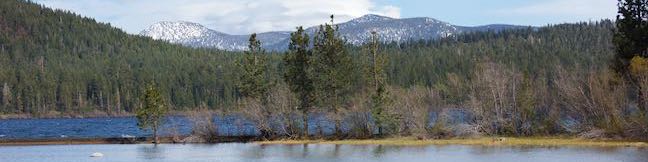
What's better than hiking by a lovely creek - maybe hiking by a lovely lake. You can do both on Moraine Trail, visiting Fallen Leaf Lake and Taylor Creek in the Lake Tahoe Basin National Forest Lands near South Lake Tahoe. This easy and level loop is 1.1 miles long, including a short side trail to Fallen Leaf Lake Dam. The mountain-cradled Fallen Leaf Lake is located just south of Lake Tahoe. ...Read more.
Distance: 1.1 miles · Elevation change: 35 feet
By: Published: July 26, 2023 Last updated: April 18, 2026
Way of the Mono Trail in Sierra National Forest
Interpretive trails are usually good places to appreciate the finer features of a forest, but they tend to lack grand vistas. This is not the case with Way of the Mono Trail, which rises to a splendid view over Bass Lake, a beauty in the Sierra Nevada Mountains south of Yosemite National Park. Way of the Mono Trail is a 0.6-mile loop with 140 feet of elevation change. ...Read more.
Distance: 0.6 miles · Elevation change: 140 feet
By: Published: June 30, 2021 Last updated: April 12, 2026
Maple Ridge Loop in Silver Falls State Park
Maple Ridge Loop travels behind two breathtaking waterfalls and goes through miles of wonderful forest in Silver Falls State Park. This 2.8-mile loop (with 375 feet of elevation change) is a combination of two trails, Canyon Trail and Maple Ridge Trail. Canyon Trail goes down the trough carved by South Fork Silver Creek, taking hikers amazingly close to South Falls and Lower South Falls. ...Read more.
Distance: 2.8 miles · Elevation change: 375 feet
By: Published: June 14, 2021 Last updated: April 17, 2026
Whalen Island Loop Trail in Clay Myers State Natural Area at Whalen Island
What is Whalen Island? It's not quite an island. It's not quite on Oregon's ocean shore. What it is... is a place that is unique, soothing, and beautiful. Wrapped be beaches and shaded by shore pines, Whalen Island sits at the heart of Sand Lake Estuary. Whalen Island – which only becomes an island during seasonal high tides - is just inland from the ocean (close enough to see the waves) on the Tillamook Coast between Cape Lookout and Pacific City. ...Read more.
Distance: 1.5 miles · Elevation change: 40 feet
By: Published: June 11, 2021 Last updated: February 18, 2026
Munson Creek Falls Trail in Munson Creek Falls State Natural Site
Measuring 319 feet tall, Munson Creek Falls is no tiny trickler. In fact, this is Oregon's tallest waterfall west of the Willamette River. Munson Creek Falls has picturesque silky tiers framed by canyon greenery. The trek to the waterfall, Munson Creek Falls Trail, is just a quarter mile long (half a mile round trip) with 90 feet of elevation change. ...Read more.
Distance: 0.5 miles · Elevation change: 90 feet
By: Published: May 26, 2021 Last updated: December 5, 2025
Oceanside Beach to Tunnel Beach in Oceanside Beach State Recreation Site
If you find yourself in Oceanside, a small community on the Oregon coast west of Tillamook, you are bound to spend some of the day at Oceanside Beach. This inviting stretch of sand looks out at the wild and lovely islands known as the Three Arch Rocks. Beach goers can enjoy all the usual fun in the sand. Plus, Oceanside Beach State Recreation Site has something unique. ...Read more.
Distance: 0.8 miles · Elevation change: 20 feet
By: Published: May 25, 2021 Last updated: December 5, 2025
Old Salmon River Trail in Mount Hood National Forest
After just one bend on Old Salmon River Trail, you will already feel deep within the old-growth forest that surrounds the Salmon River as it flowing through Mount Hood National Forest. This Pacific Northwest woodland feels timeless, or perhaps from another time altogether, with its tall, century-old Douglas firs absolutely covered in green moss. Old Salmon River Trail is 2. ...Read more.
Distance: 5.1 miles · Elevation change: 175 feet
By: Published: August 10, 2020 Last updated: April 18, 2026
Trillium Lake Trail in Mount Hood National Forest
With monumental Mount Hood rising above its northern shore, Trillium Lake is a picturesque and popular destination for camping, hiking, and fun on the water. The summit of Mount Hood is just 7.5 miles from Trillium Lake and the famed Timberline Lodge can be spotted on its slopes. Hike an easy 2-mile loop around this scenic 63-acre lake in Mount Hood National Forest near Government Camp, Oregon. ...Read more.
Distance: 2.05 miles · Elevation change: 15 feet
By: Published: January 30, 2020 Last updated: April 18, 2026
Mirror Lake Trail in Mount Hood National Forest
What makes Mirror Lake Trail such a popular hike? For starters, it is very approachable. The trailhead is just off Highway 26 by Ski Bowl West in Government Camp, Oregon. The creek-crossing hike through a forest of firs is appealing too. The main reason people are drawn to this 4.3-mile round trip hike (with 550 feet of elevation change) is sure to be the potential for postcard views of Mount Hood, rising tall over its own reflection in Mirror Lake. ...Read more.
Distance: 4.3 miles · Elevation change: 550 feet
By: Published: January 26, 2020 Last updated: May 1, 2026
Chimney Beach Trail in Lake Tahoe
Before your visit to Lake Tahoe goes up in smoke, take a hike to Chimney Beach - where a standing-on-its-own fireplace and chimney serve as an unsual landmark for a lovely little cove. The brick chimney is all that's left of an old cabin built in the sand between boulder-strewn points on the east shore of Lake Tahoe. If curiosity about the chimney draws you to Chimney Beach, the beautiful lake views and clear turquoise water will be what keeps you hanging around. ...Read more.
Distance: 1.1 miles · Elevation change: 215 feet
By: Published: July 30, 2019 Last updated: January 8, 2026