
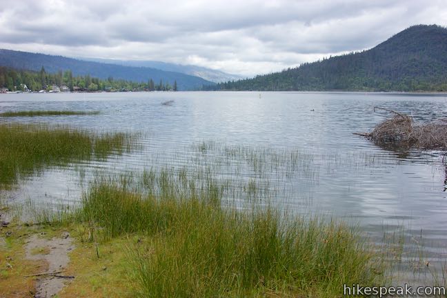
Interpretive trails are usually good places to appreciate the finer features of a forest, but they tend to lack grand vistas. This is not the case with Way of the Mono Trail, which rises to a splendid view over Bass Lake, a beauty in the Sierra Nevada Mountains south of Yosemite National Park. Way of the Mono Trail is a 0.6-mile loop with 140 feet of elevation change. Panels along this single-track trail highlight several native trees and detail how the Mono, who were the first tribes to live in this place, made use of the different plants.
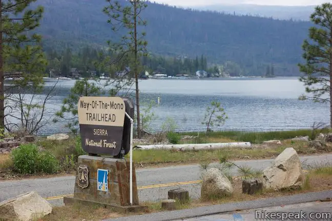
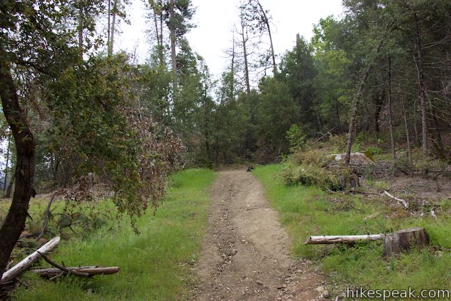
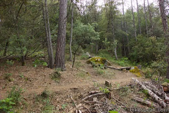
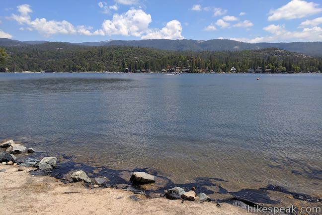
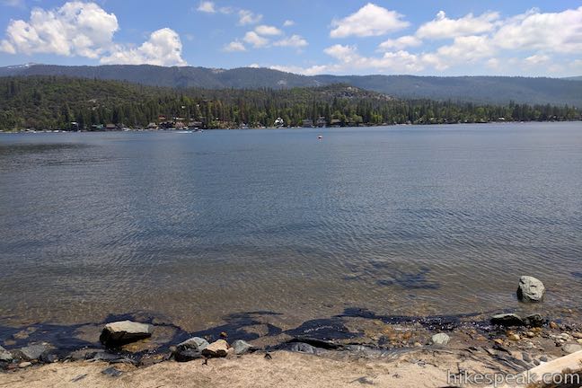
Things begin from the Way-Of-The-Mono Trailhead in Sierra National Forest, located on the east end of the south shore of Bass Lake. The trailhead has a parking area just off Road 222, directly across from the lakefront Little Denver Church Day Use Area (it is easy to visit park areas on the shore of Bass Lake in combination with Way of the Mono Trail).
The loop trail connects to both sides of the trailhead parking area. If you want to read the interpretive panels in order, hike the loop in a counter-clockwise direction. Begin from the right (northwest) side of the trailhead next to the bench and information board. In addition to providing a well-sequenced narrative, this direction saves the lake views for the descent.
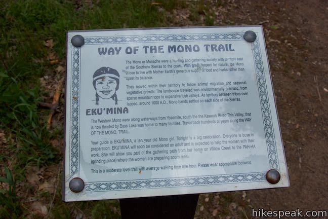
Begin up the trail, stopping to read the first panel, which explains how the Mono people were a society of hunters and gatherers who lived in an area that extended from the east and west sides of the Southern Sierra:
They moved within their territory to follow animal migration and seasonal vegetable growth. The landscape traveled was environmentally dramatic, from sparse mountaintops to expansive lush valleys. As territory between tribes overlapped, around 1000 A.D., Mono bands settled on each side of the Sierra. …This valley, which is now flooded by Bass Lake, was home to many families.
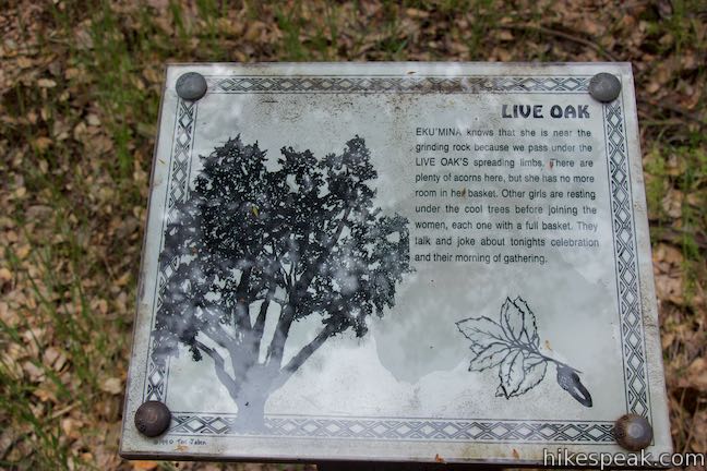
The panels along the trail invite you to imagine what life was like for these first inhabitants. Learn how they made use of different forest resources. In an effort to relate to younger hikers, the panels tells the story of the Mono people from the perspective of a 10-year-old Mono girl who is preparing to celebrate a coming of age ceremony.
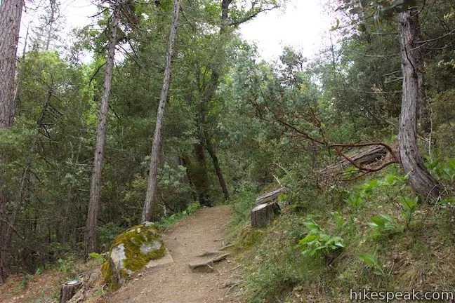
Continue up the trail to the next panel, which highlights the ponderosa pine. Beyond that, every so often, the trail passes another panel, focusing on white fir, poison oak, Manzanita, black oak, sugar pine, live oak, and soaproot. The panels for each plant explain how they were integrated into the lives of the Mono people. The Manzanita trees, for example, had berries that could be used to make juice.
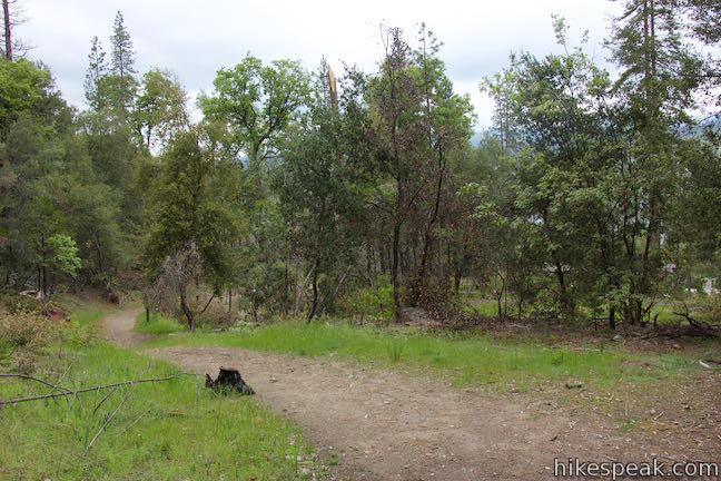
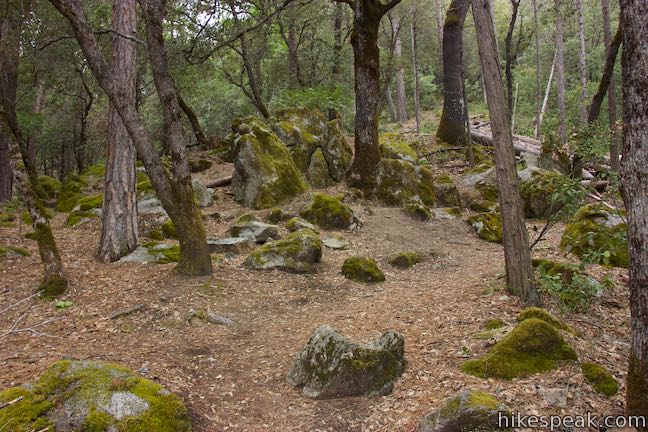
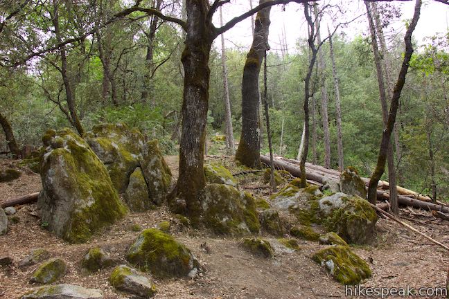
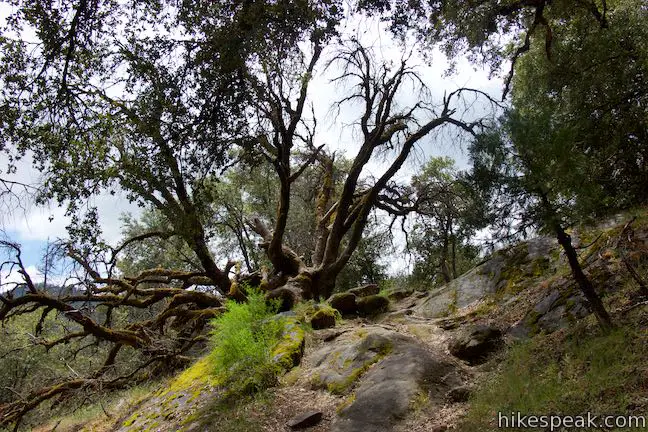
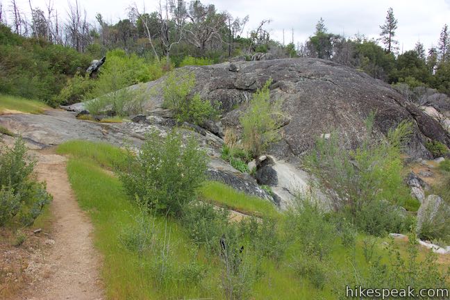
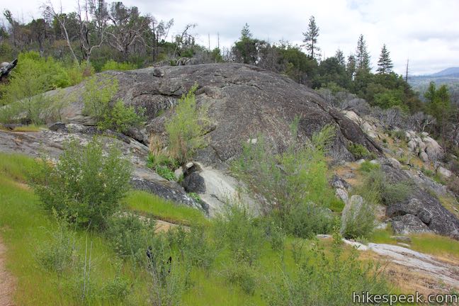
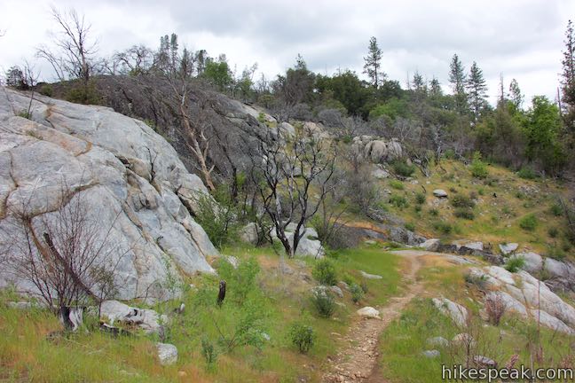
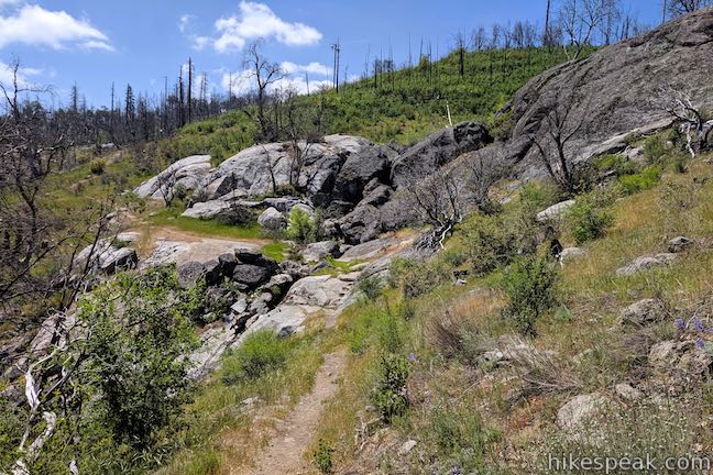
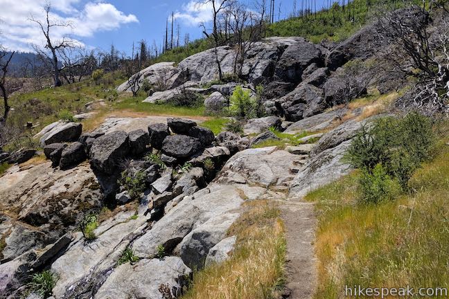
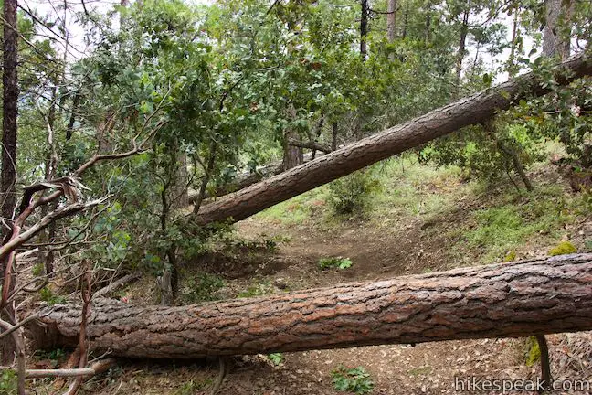
Follow the trail up through a string of tight switchbacks. Allow the nicely moss-decorated boulders to distract you from the effort of the short ascent. Make your way up through the lovely forest of oaks and conifers, appreciating each panel along the way.
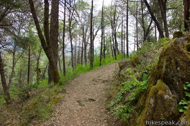
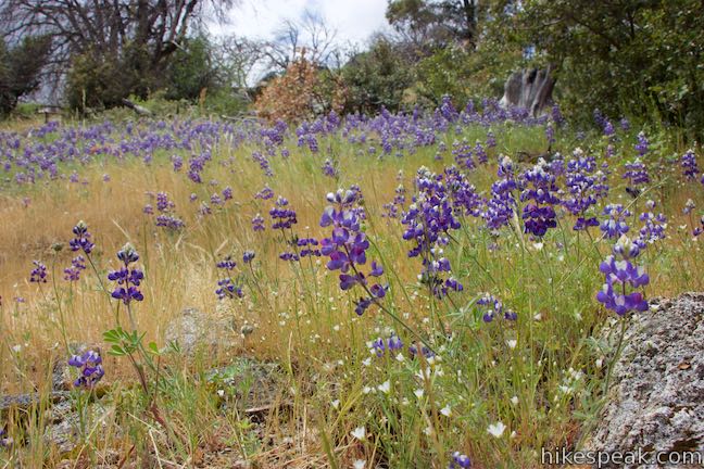
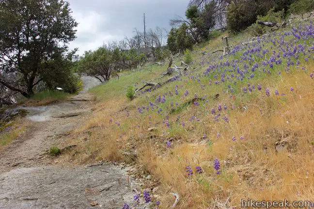
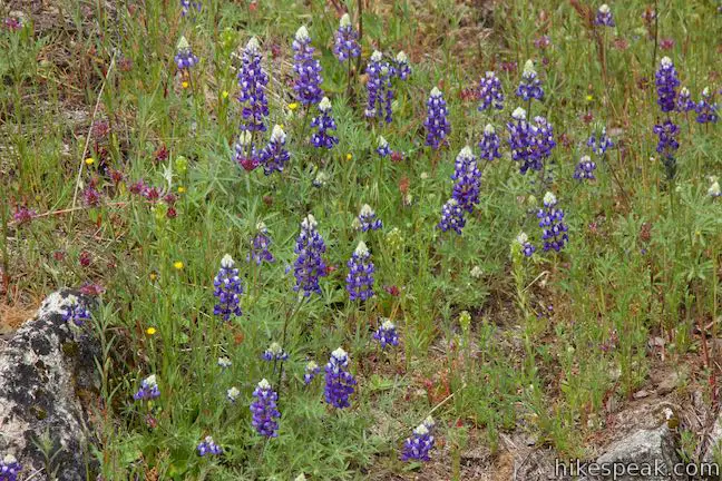
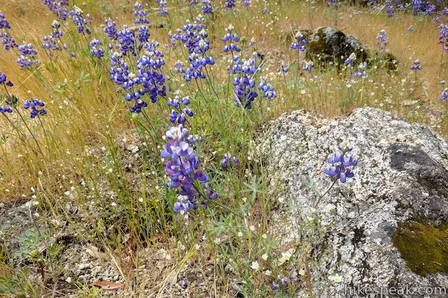
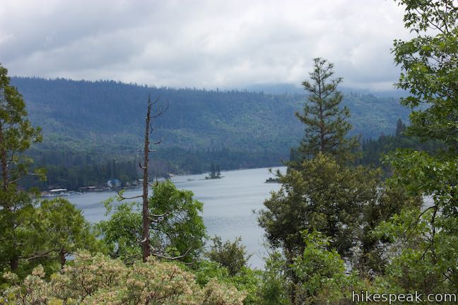
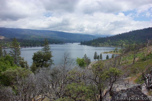
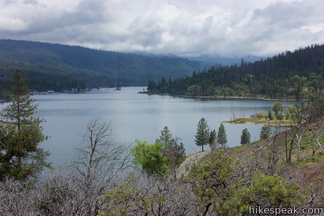
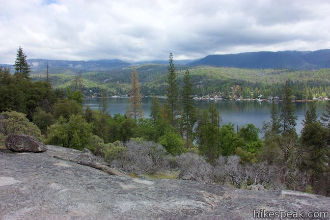
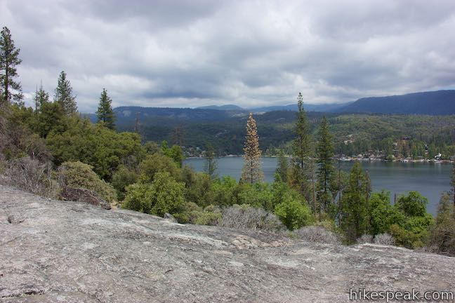
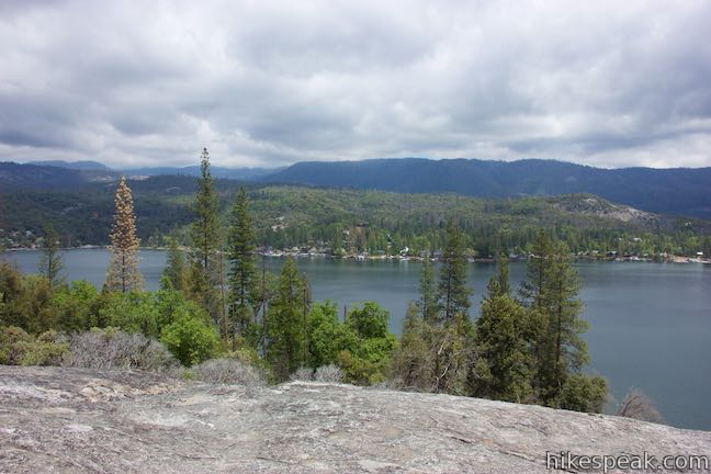
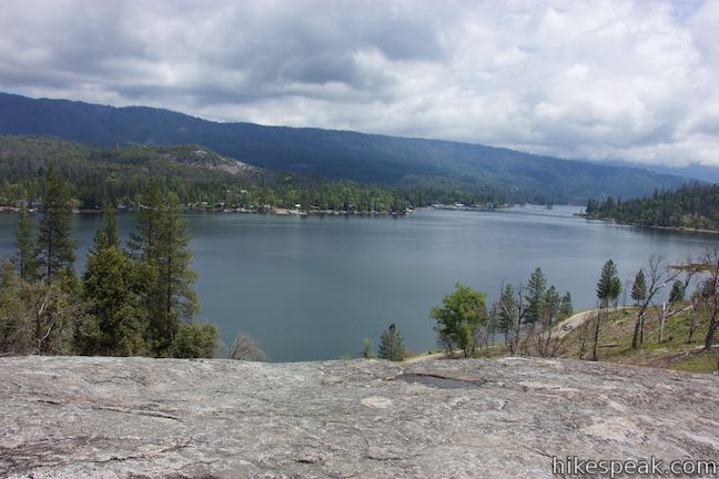
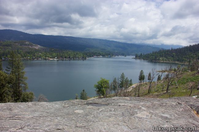
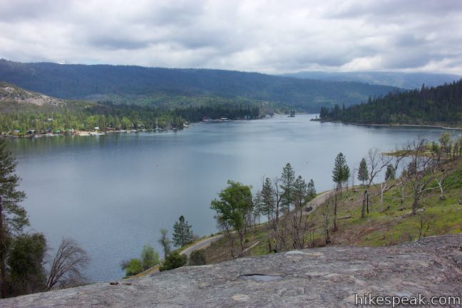
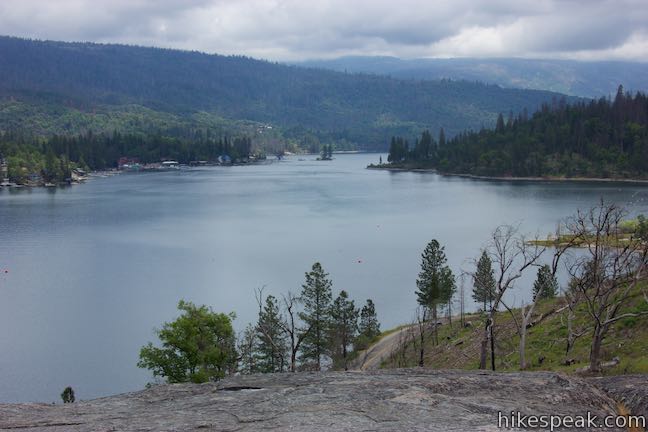
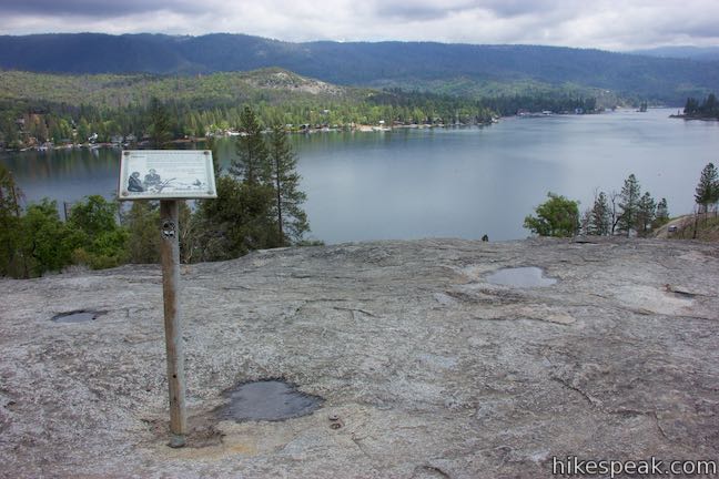
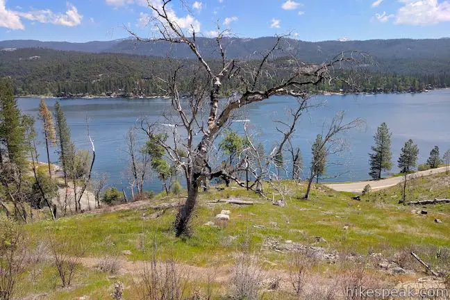
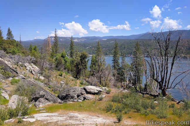
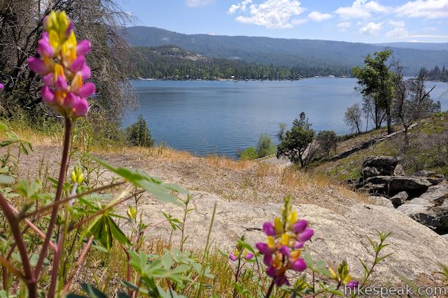
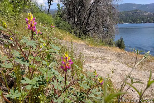
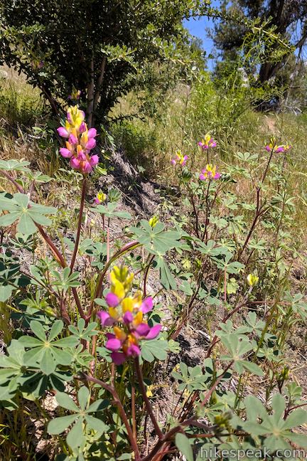
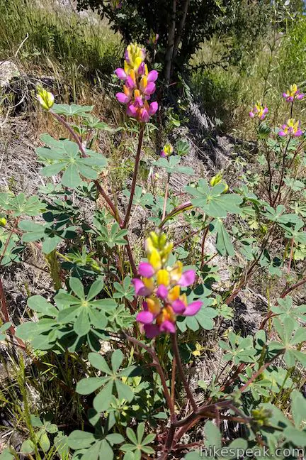
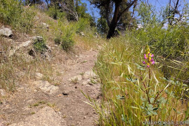
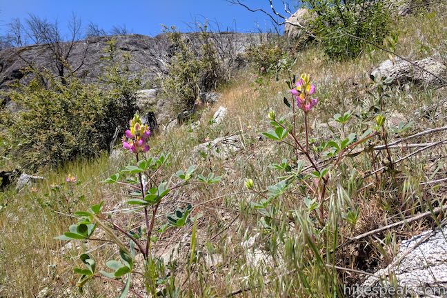
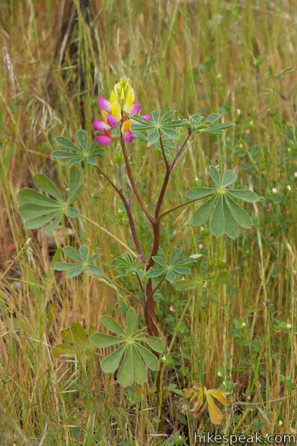
After 0.2 miles, Way of the Mono Trail leaves the forest for exposed slopes with few trees. In the spring and early summer, lupines bloom in the grasses beside your path. Hike up across a granite outcropping that is named (or at least nicknamed) Mono Rock. This is the high point of the loop at 3,530 feet.
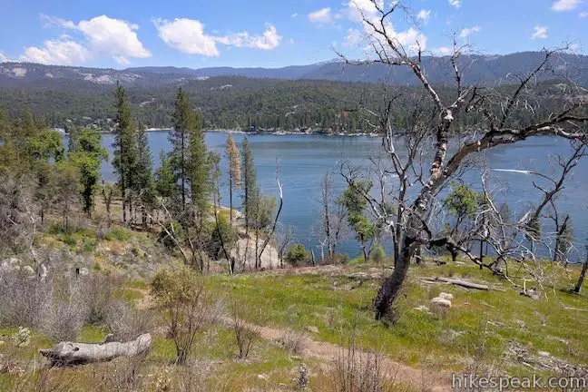
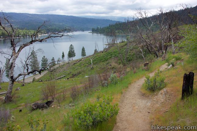
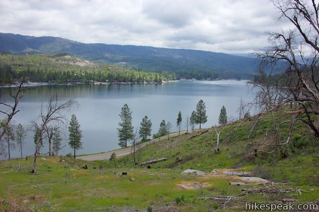
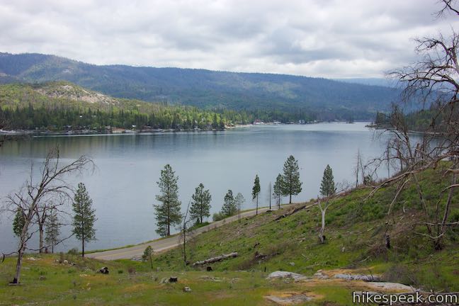
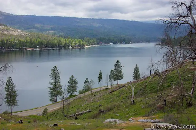
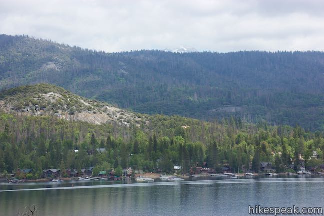
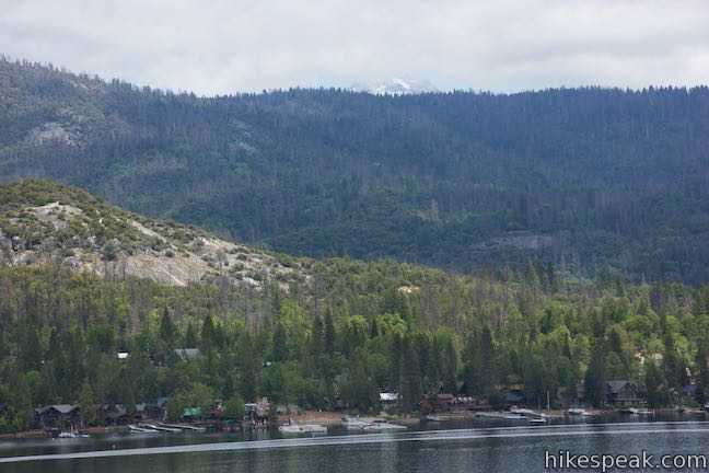
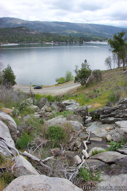
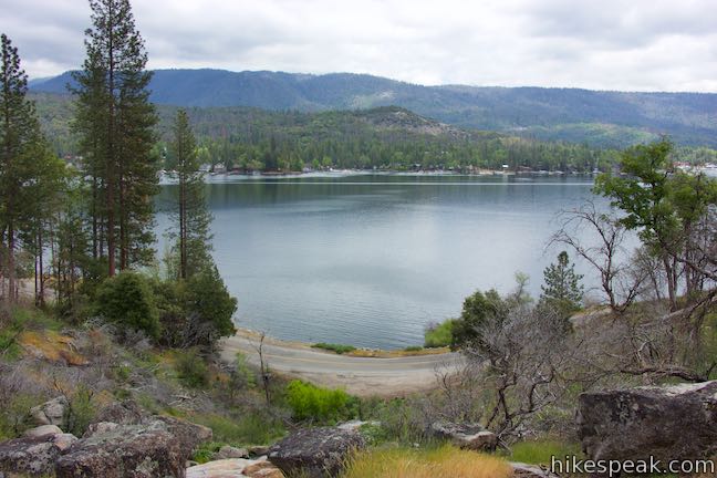
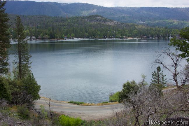
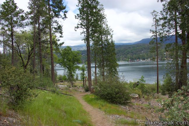
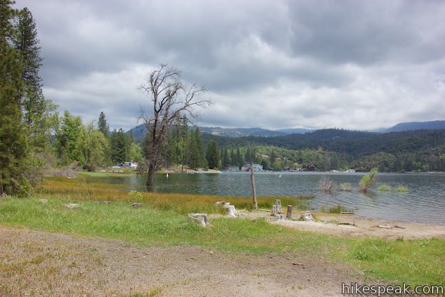
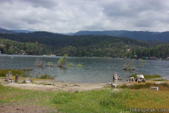
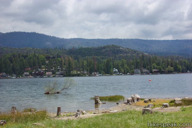
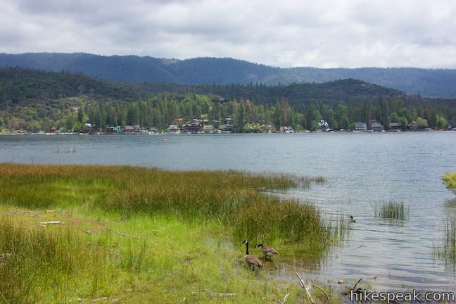
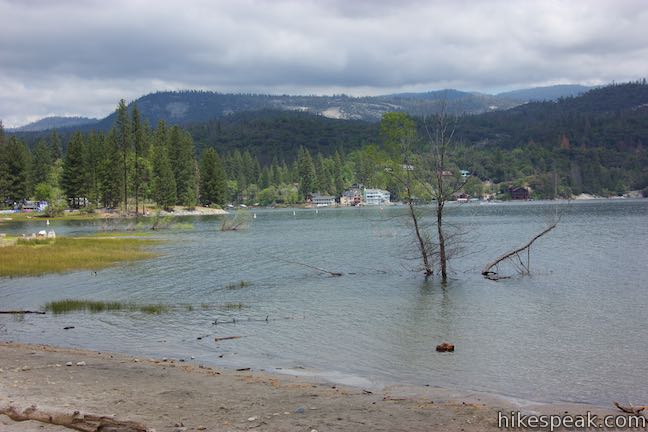
Enjoy 180-degree views (or maybe closer to 270-degree views) over beautiful Bass Lake. Gaze southeast down Bass Lake Reservoir, where tapered evergreen-covered ridges frame its cool blue water. The far end of the lake looks gorgeous. Resorts and homes in the town of Bass Lake hug the shore on the opposite side of the lake. Forest-covered ridges rise above the lake. Snowy mountain crowns appear in the distance to the north.
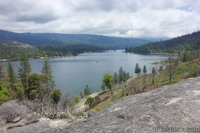
This dome-shaped granite outcropping makes for a tranquil setting. From this height, the lake seems quiet and peaceful. Now for a mental challenge; can you imagine what Crane Valley looked like in the time of the Moro, before the lake was there? Bass Lake was created when the valley was dammed at the start of the 20th century. This hike’s interpretive panels explained how to the Mono made use of everything the forest had to provide. A panel describing the people who came after the Mono might say that they didn’t so much learn to live off what the land had to offer as the did change the land to suit their needs. The reservoir is beautiful, in any case.
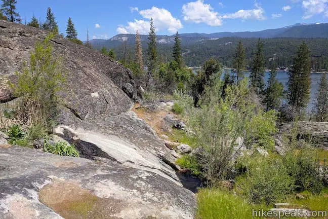
If you can pull your eyes off the views all around you, you will notice bowl-shaped depressions in the granite underfoot. These grinding bowls, called morteros (or mortars) were used by Native Americans to grind nuts and seeds into meal. An information panel explains how the grinding holes were important tools:
Acorns are placed in depressions made from many hours of pounding and grinding with a large rock. The large rounded rocks are smoothed by the environment in nearby creeks. The acorn flour is washed on grass mats through White Fir or Cedar boughs, then put in water tight baskets. Water is added to the flour and hot rocks are placed in the basket to cook acorn meal.
This is the final panel along Way of the Mono Trail, located at its high point, halfway through the loop (0.3 miles from the start). The second half of the loop lacks reading material, but makes up for it with lovely lake views and a couple fun stream crossings.
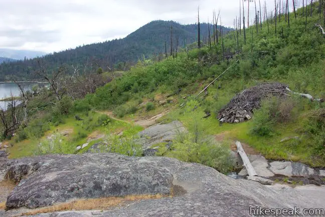
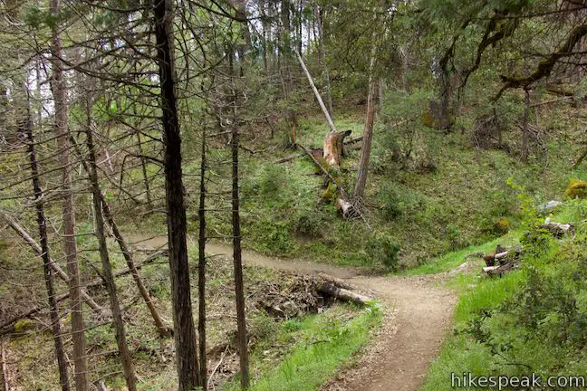
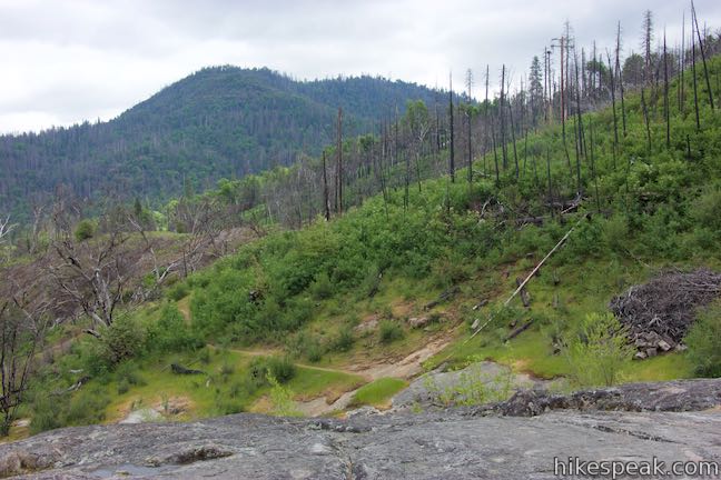
The trail isn’t super defined as you go across the granite dome, but just keep moving in the same southward direction. Below the dome, the trail will be visible where it leaves the granite and becomes a more distinguished single-track again. Behind the trail to the south, past a ridge or two, Goat Mountain rises to a nice evergreen crown.
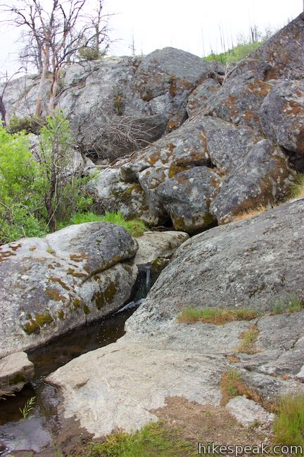
Step down the south side of the granite, dropping off the side of the rock toward a small creek. You can probably just hop across, or there should be a log to use for the crossing. It is unlikely that there will be too much water.
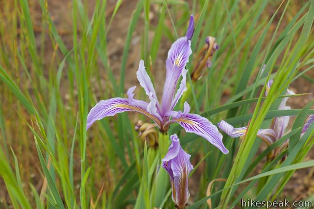
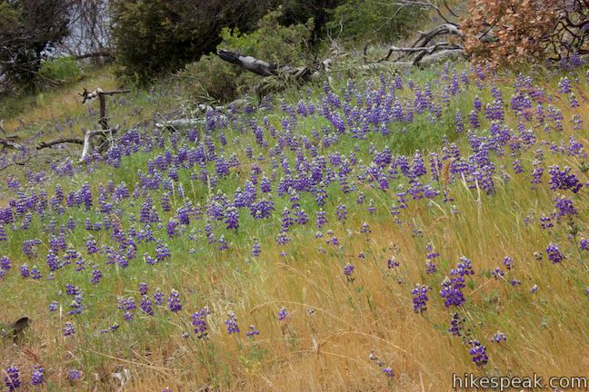
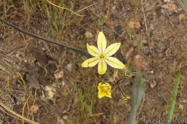
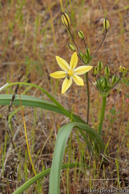
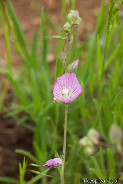
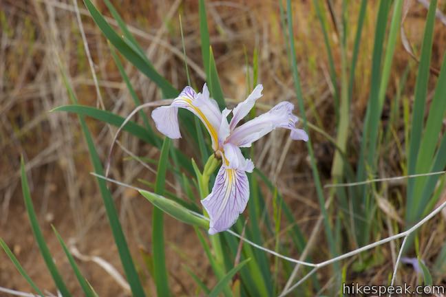
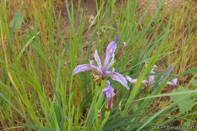
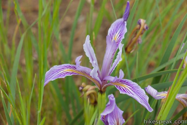
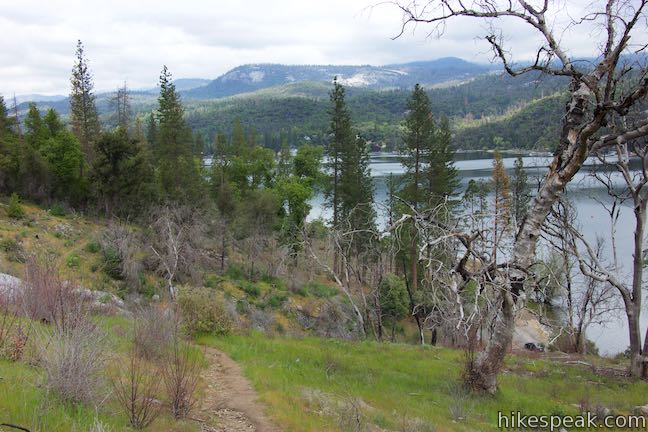
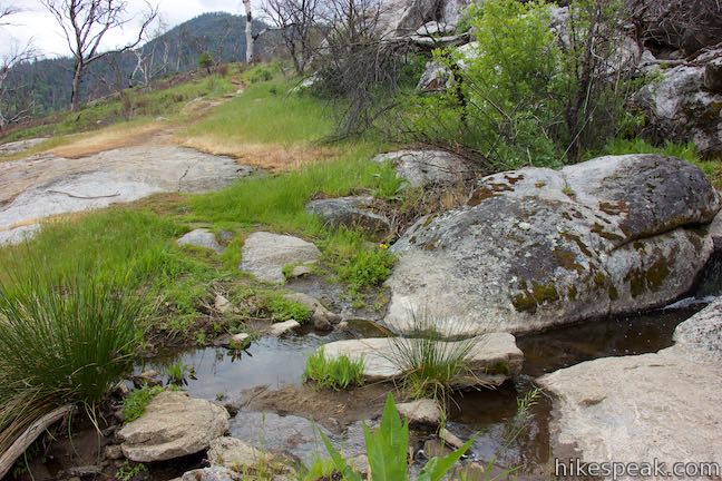
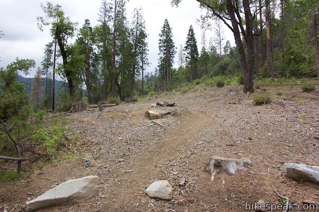
Pick up the dirt single track crossing through brush and hike out to a switchback. The trail turns left and makes its way across the slope below the granite dome at the top of the loop. The mountainside has a scattering of old fire-charred trees, but the vegetation is mostly open to lots of lake views. The exposed east-facing slope is also home to a bouquet of summer wildflowers like irises, yellow stars, checkerbloom, and a couple lovely varieties of lupines.
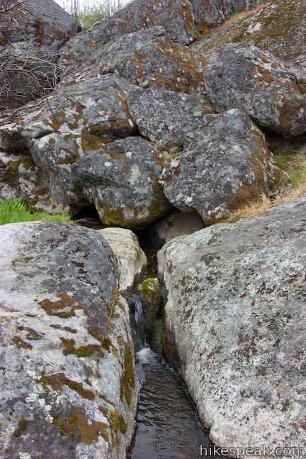
Pass underneath the granite dome (remember standing on top of the loop’s high viewpoint). The creek that you crossed above slips out through a jumbled pile of boulders that resemble a talus cave. Hop across the little creek and watch the water spill down a granite slide. After very heavy rains, the diminutive creek could swell to something showy through these granite features.
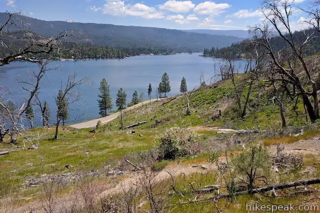
The fun stream crossing is 0.45 miles from the start of the hike. This is also a good spot to look down on Road 222 as it hugs the shore of Bass Lake. Take in one last view over the lake before the trail enters the forest again. While not as dense as the woods at the start of the loop, you can enjoy a bit of shade over the final stretch of the trail as it makes its way back down to the trailhead to close the loop.
Way of the Mono Trail offers history, nature, spring wildflowers, and stellar views of Bass Lake. Given the easy commitment of just 0.6 miles with 140 feet of elevation change, Way of the Mono Trail would be worth hiking for the views alone! Way of the Mono Trail is closed to motor vehicles, horses, and pack stock, but you can bring a dog. Bikes appear to be allowed as well (although this probably isn’t the most appropriate trail for bikes). If you would like to stay longer in the area, lakefront campgrounds and picnic areas are just across the road from trailhead.
Directions to the Trailhead
- Take Highway 41 to Yosemite Forks, which is located 3.4 miles north of the main intersection in Oakhurst and 12.3 miles from the south entrance of Yosemite National Park by Mariposa Grove.
- Leave Highway 41 in Yosemite Forks and head east on Road 222, following signs for Bass Lake.
- This will be a right turn if you are driving up from Oakhurst.
- Drive 3.5 miles on Road 222 to an important intersection.
- Straight ahead, Road 222 turns into Road 274 and goes along the north shore of Bass Lake.
- Don't go straight.
- Turn right to remain on Road 222.
- Drive 1/3 of a mile to the first major intersection after a couple roads on the right into a development of cabins.
- Turn right again, following a sign for: Bass Lake Ranger Station Camping and Day Use Information.
- You will still on Road 222 (now also called South Shore Road), despite the two right turns.
- Drive 1 mile to the trailhead parking area on the right, which is half a mile after the Bass Lake Recreation Office for Sierra National Forest (also on the right).
- Pull into the lot with the sign for Way-of-the-Mono Trailhead, located across Road 222 from Little Denver Church Day Use Area.
Trailhead Location
Trailhead address: Way-of-the-Mono Trailhead, Road 222, Bass Lake, CA 93604Trailhead coordinates: 37.3219, -119.5781 (37° 19′ 18.8″N 119° 34′ 41.2″W)
View Sierra National Forest in a larger map
Or view a regional map of surrounding Sierra Nevada trails and campgrounds.


Bass Lake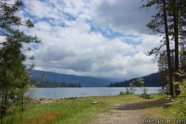


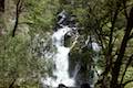 | Lewis Creek Trail to Corlieu Falls This 0.8-mile round trip hike travels down along a rushing creek to a viewing platform in front of an enthusiastic, cascading waterfall. |
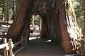
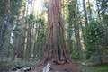 | Big Ed Tree Trail This 0.2-mile hike is quite short, but visits a tree that is quite big - part of the Nelder Grove of Giant Sequoias in Sierra National Forest. |
 | Bull Buck Tree Trail This 0.8-mile loop leaves from Nelder Grove Campground and leads to a single giant sequoia with an incredibly broad base. |
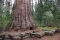
 | Shadow of the Giants Trail This 1.1-mile nature trail visits giants sequoias and imparts wisdom about the great trees and their surroundings. |
 | Mariposa Grove of Giant Sequoias This 1.6-mile hike (or longer) visits the biggest trees in Yosemite. |
 | More trails in the Sierra Nevada Mountains Explore other destinations around Yosemite National Park and the rest of the range. |
 | Nelder Grove Campground This 7-site campground offers cozy nights in a partially logged grove of giant sequoias in Sierra National Forest. |
Common Questions about Way of the Mono Trail in Sierra National Forest
- Is the trail open?
- Yes. You should expect to find that Way of the Mono Trail is open. There are no recent reports of trail closures. If you discover that the trail is closed, please help your fellow hikers by reporting a closure.
- Is this trail free to access?
- Yes, Way of the Mono Trail is free to access. No entrance fee, pass, or permit is required. If you discover that access rules have changed, please provide feedback on your experience.
- How much time does this hike take?
- It takes approximately 15 minutes to hike Way of the Mono Trail. Individual hiking times vary. Add extra time for breaks and taking in the views.
- How long is this hike?
- The hike to Way of the Mono Trail is a 0.6 mile loop with 140 feet of elevation change.
- Are dogs allowed on this trail?
- Yes, dogs are allowed on Way of the Mono Trail. The trail is open to hikers, dogs, bikes.
- Is Way of the Mono Trail good for kids?
- Yes, this hike is likely suitable for children. It is relatively short (0.6 miles) with manageable elevation gain.
- Is there a lake on this hike?
- Yes, Way of the Mono Trail visits a lake.
- Where is the trailhead located?
- The trailhead for Way of the Mono Trail is located in Bass Lake, CA.
Trailhead Address:
Road 222
Bass Lake, CA 93604
Trailhead Coordinates:
37.3219, -119.5781 - What are the driving directions to the start of the hike?
To get to the trailhead: Take Highway 41 to Yosemite Forks, which is located 3.4 miles north of the main intersection in Oakhurst and 12.3 miles from the south entrance of Yosemite National Park by Mariposa Grove. Leave Highway 41 in Yosemite Forks and head east on Road 222, following signs for Bass Lake. This will be a right turn if you are driving up from Oakhurst. Drive 3.5 miles on Road 222 to an important intersection. Straight ahead, Road 222 turns into Road 274 and goes along the north shore of Bass Lake. Don't go straight. Turn right to remain on Road 222. Drive 1/3 of a mile to the first major intersection after a couple roads on the right into a development of cabins. Turn right again, following a sign for: Bass Lake Ranger Station Camping and Day Use Information. You will still on Road 222 (now also called South Shore Road), despite the two right turns. Drive 1 mile to the trailhead parking area on the right, which is half a mile after the Bass Lake Recreation Office for Sierra National Forest (also on the right). Pull into the lot with the sign for Way-of-the-Mono Trailhead, located across Road 222 from Little Denver Church Day Use Area.
View custom Google Maps directions from your current location.
- Are there other trails near Way of the Mono Trail?
- Yes, you can find other nearby hikes using the Hikespeak Hike Finder Map.

Go the extra miles...
Submit a rating of this hike to go with your comment. Contribute to the average trail rating.