What’s better than hiking by a lovely creek – maybe hiking by a lovely lake. You can do both on Moraine Trail, visiting Fallen Leaf Lake and Taylor Creek in the Lake Tahoe Basin National Forest Lands near South Lake Tahoe. This easy and level loop is 1.1 miles long, including a short side trail to Fallen Leaf Lake Dam.
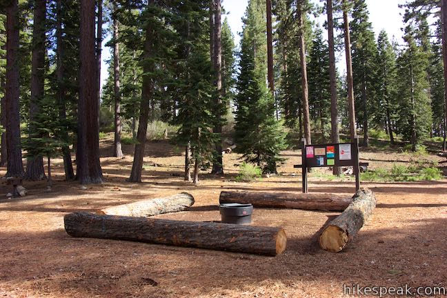
The mountain-cradled Fallen Leaf Lake is located just south of Lake Tahoe. The hike the the lake’s edge on Moraine Trail begins from a day use parking area within Fallen Leaf Campground, located by the north end of Fallen Leaf Lake.
The campground sits in a stretch of land, about 1 1/3 miles across, in between Lake Tahoe and Fallen Leaf Lake. That short distance is all that separates Fallen Leaf Lake from the much larger Lake Tahoe. Were it not for the glacier-created terminal moraine explored on this loop, Fallen Leaf Lake might have been a bay on Lake Tahoe.
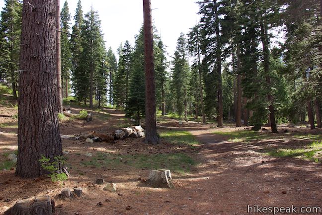
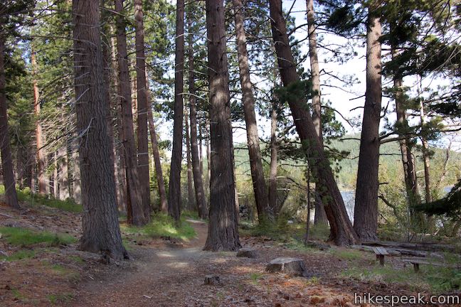
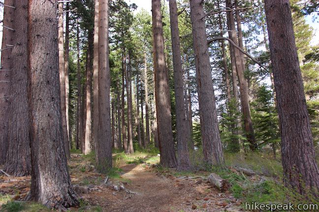
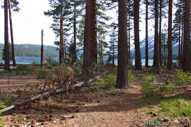
Moraine Trail sets out southward from the parking area. Walk into an airy pine forest, traveling along the right side of a bump in the terrain. After less than a hundred yards, come to a split in the trail. The loop begins here. A sign reading “Moraine Trail” has an arrow pointing to the right. The trail to the left goes straight to Fallen Leaf Lake and will be your return route. Follow the arrow and turn right on Moraine Trail toward Taylor Creek. In the late spring, red spikes of the fungi called snow plant appear on the forest floor. Bleeding hearts flower as the months turn to summer.

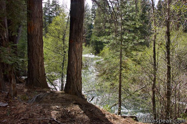
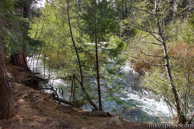
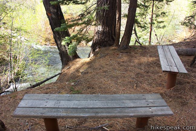
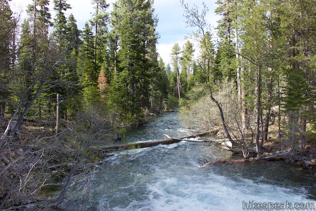
Walk along the trail as it finds the shoulder of Taylor Creek. A quarter-mile from the trailhead, come to a pair of benches on the bank above the creek. The benches are positioned in an L-shape, presenting a sweeping look over the water coursing through the forest.
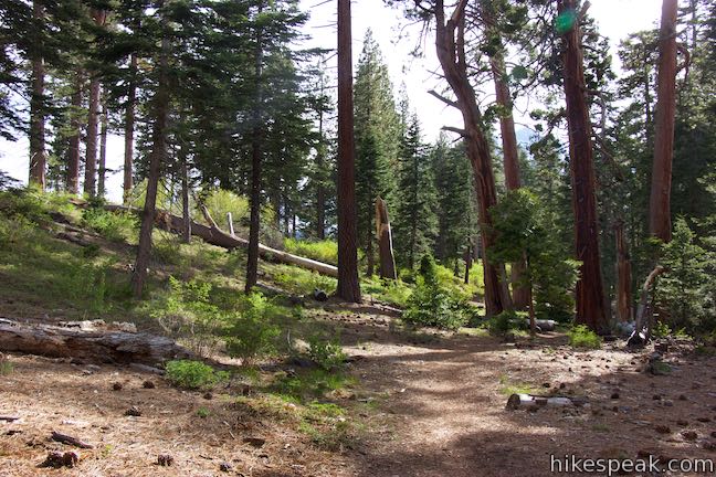
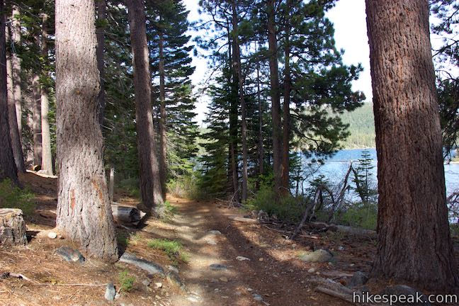
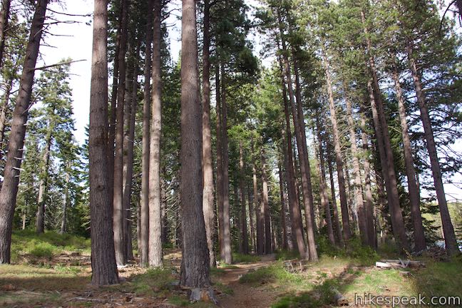
Continue along the dirt single track, which provides a soft path padded by pine needles. In short order (and 1/3 of a mile from the start), the trail passes a burnt-out pine tree (and a tall one at that) on the right side of the trail, beside the bank of the creek. You can step right inside the black, hollow tree trunk.

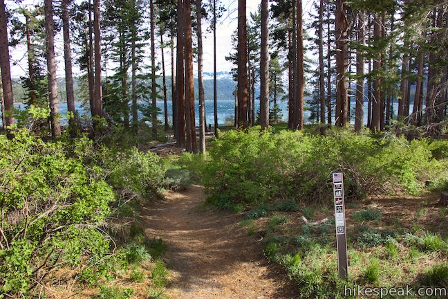
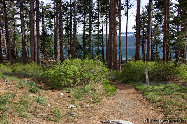
Proceed up the trail and approach a forest clearing that is home to a trail junction, half a mile from the start. To the left, Moraine Trail finds Fallen Leaf Lake for the loop back to the trailhead. To see the origin of Taylor Creek and get a nice look at Fallen Leaf Lake, turn right at the junction and make your way to the dam at the outflow of the lake.

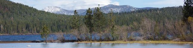
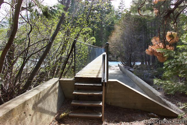
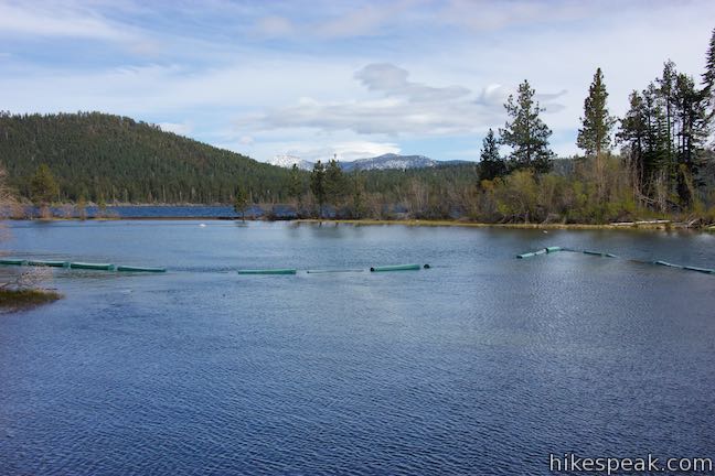
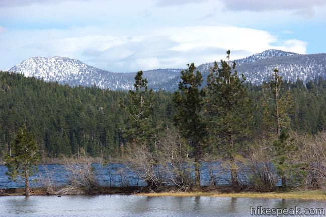
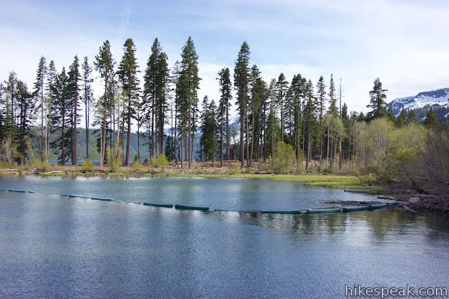
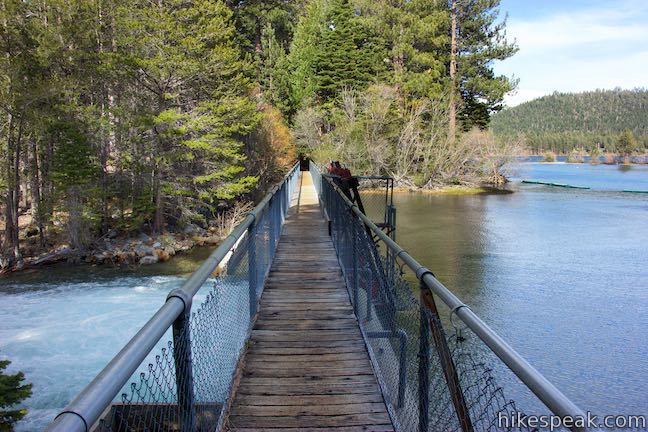
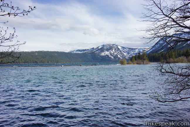
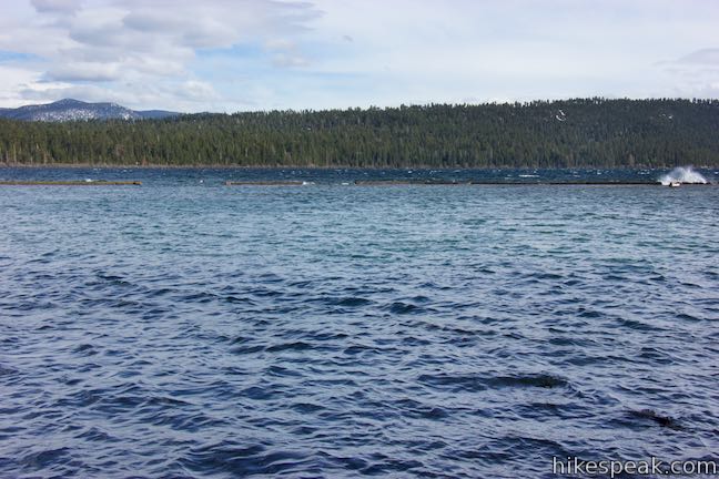
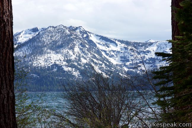
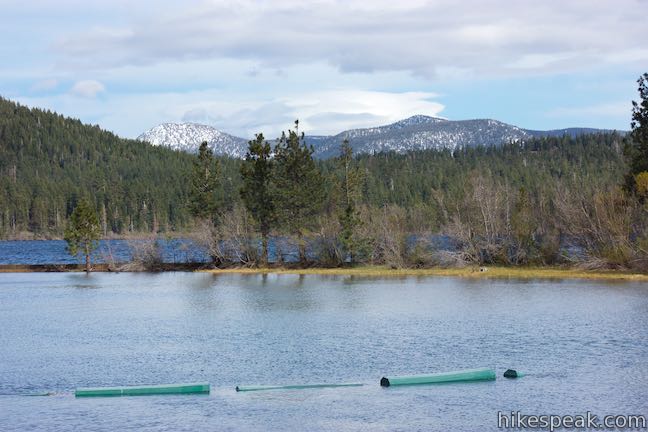
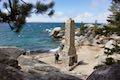
Walk about 50 yards over to the start of Fallen Leaf Lake Dam, which is itself about 50 yards long. The dam, which was built in 1934, has a wood plank walkway with chain-link fencing on both sides. Water spills from the north side, forming the start of Taylor Creek. Looking in the other direction, you will see a lot of blue water in Fallen Leaf Lake. Just to the south, a pine-covered point and a break wall separate the larger lake from the water flowing toward the dam. Look across the lake toward the evergreen ridge on the far side, which is backed by mountains that may be blanketed in snow.
Past the far end of the dam, the trail continues up to a T-junction. Unless you’re looking to explore more of the area, turn around when you get to the end of the dam. Backtrack to the junction in the clearing. The first half of Moraine Trail that bordered Taylor Creek is to the left. Go to the right to see the next half of Moraine Trail along Fallen Leaf Lake.
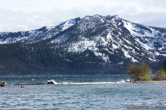
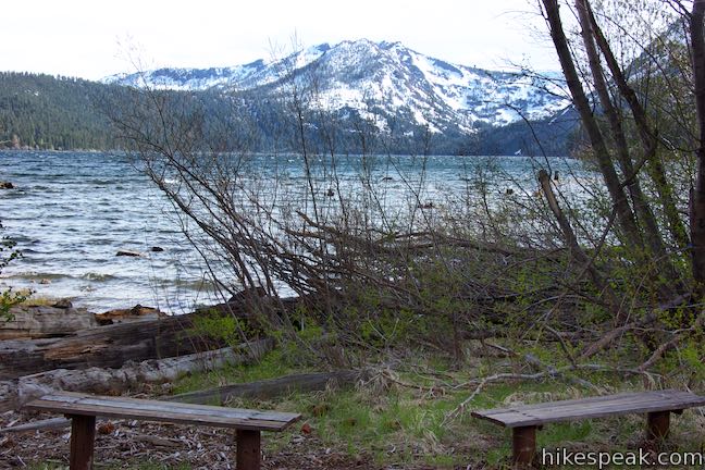
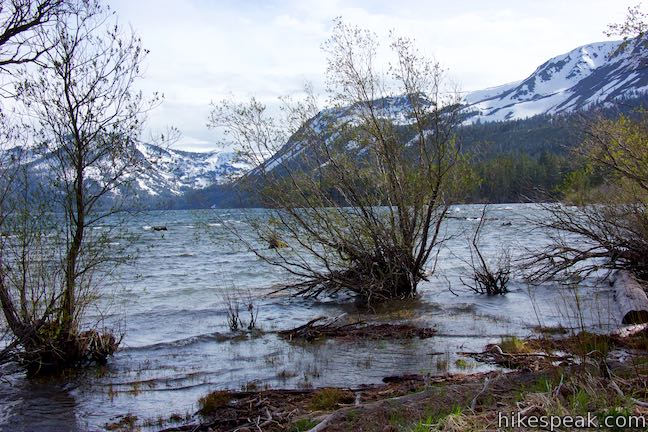
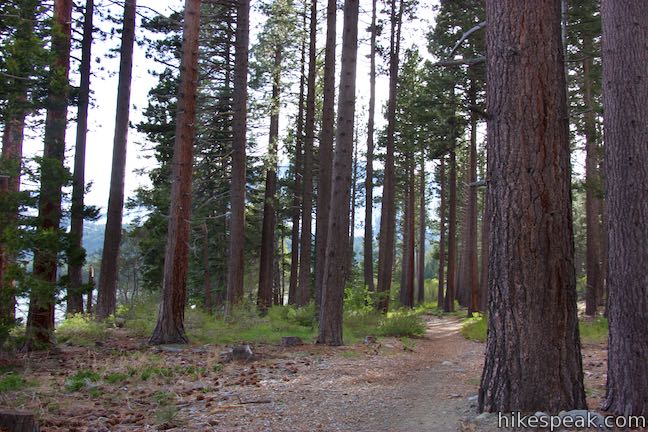
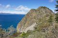
A thin row of trees and brush are all the separate the trail from the lake shore. A tenth of a mile past the junction, the trees open up to make a nice window looking out over the lake. In another twelfth of mile, the trail passes a bench by the water’s edge. Have a seat and look south down the lake. The blue water stretches for nearly 3 miles from end to end. The thumb-shaped lake is 0.9 miles across from east to west. At the far end, pine-filled slopes rise to Angora Peak, which is capped with a multi-point crown.

Continue hiking east along the trail and approach the very north end of the lake. Here you will find an unmarked junction, 0.95 miles from the start of the hike. Although there is a path continuing straight along the shore that might be scenic to explore, this is where the Moraine Trail leaves the water. To complete the short loop, turn left and leave the lake to return to the trailhead.

As you make your way through the last 0.15 miles of the hike, stop and look behind you. Admire this great perspective straight down Fallen Leaf Lake. Hike north over a short rise. The ever-so-subtle gain in elevation provides ample over-the-shoulder views toward the lake. The glaciers that carved Fallen Leaf Lake stopped right here, depositing the land between Fallen Leaf Lake and Lake Tahoe.
Make your way to the junction where the loop began. Turn right and hike the final 0.05 miles to complete this 1.1-mile outing with 35 feet of elevation change.
Guidelines: Moraine Trail is open to hikers, horses, and bikes. Dogs are welcome too. Motor vehicles and motorized equipment are forbidden. Overnight parking is not allowed at the day use parking area, so finish your hike by sundown. Trailers and long RVs are also not permitted in the day use parking lot. Picnic tables can be found alongside the day use parking. Fallen Leaf Campground is in active bear country (along with Moraine Trail). Avoid leaving scented items like food, trash, and toiletries in your vehicle. Place these items in bear storage lockers (or leave them at home).
Although you must drive through a fee station for Fallen Leaf Campground, no fee is charged to park at the day use area. The campground closes in the winter season (which is long in Lake Tahoe, running from mid-October to mid-May), making it impossible to drive to the day use parking area by the trailhead. During that period, park along Fallen Leaf Lake Road outside the campground and walk through the campground to the trailhead.
Directions to the Trailhead
- From the state line in South Lake Tahoe, take Lake Tahoe Boulevard (Highway 50) west for 5 miles to Tahoe Village and turn right onto Emerald Bay Road (Highway 89), heading northwest toward Tahoe City.
- Drive 3 miles (passing through Camp Richardson), and turn left onto Fallen Leaf Lake Road.
- Drive 2/3 of a mile to the entrance to Fallen Leaf Campground.
- Make two right turns to approach the campground entrance booth.
- Drive through the campground for 2/3 of a mile on the campground road, going north, then west, then south to approach the day use parking area, which is on the right between campsite 72 and campsite 75.
Trailhead Location
Trailhead address: Fallen Leaf Campground, 2165 Fallen Leaf Road, South Lake Tahoe, CA 96150
Trailhead coordinates: 38.92348, -120.0547 (38° 55′ 24.5″N 120° 03′ 16.9″W)
View Lake Tahoe in a larger map
Or view a regional map of surrounding Sierra Nevada trails and campgrounds.


 | Cave Rock Trail This 0.9-mile hike above the east shore of Lake Tahoe finishes with a scramble up a rocky crown that has panoramic views. |
 | Chimney Beach Trail This 1.1-hike descends to a scenic and unique cove on the shore of Lake Tahoe that houses a stand-along chimney lingering from an old cabin. |
 | Hikes in the Sierra Nevada Mountains Explore more trail in the range's great national parks, national forests, and other park lands. |
 | Fallen Leaf Campground This large campground winds through a forest of towering pines near South Lake Tahoe and a quarter mile from beautiful Fallen Leaf Lake. |
- Moraine Trail on fatmap.com (opens in a new tab)
- Moraine Trail on tahoeactivities.com (opens in a new tab)
- Moraine Trail on hikingproject.com (opens in a new tab)
- Moraine Trail on alltrails.com (opens in a new tab)
- Fallen Leaf Lake on wikipedia.org (opens in a new tab)
- The official Forest Service webpage for Moraine Trail (opens in a new tab)
Common Questions about Moraine Trail to Fallen Leaf Lake in Lake Tahoe Basin National Forest Lands
- Is the trail open?
- Yes. You should expect to find that Moraine Trail is open. There are no recent reports of trail closures. If you discover that the trail is closed, please help your fellow hikers by reporting a closure.
- Is this trail free to access?
- Yes, Moraine Trail is free to access. No entrance fee, pass, or permit is required. If you discover that access rules have changed, please provide feedback on your experience.
- How much time does this hike take?
- It takes approximately 30 minutes to hike Moraine Trail. Individual hiking times vary. Add extra time for breaks and taking in the views.
- How long is this hike?
- The hike to Moraine Trail is a 1.1 mile loop with 35 feet of elevation change.
- Are dogs allowed on this trail?
- Yes, dogs are allowed on Moraine Trail. The trail is open to hikers, dogs, bikes.
- Is Moraine Trail good for kids?
- Yes, this hike is likely suitable for children. It is relatively short (1.1 miles) with manageable elevation gain.
- Is there a lake on this hike?
- Yes, Moraine Trail visits a lake.
- Where is the trailhead located?
- The trailhead for Moraine Trail is located in South Lake Tahoe, CA.
Trailhead Address:
2165 Fallen Leaf Road
South Lake Tahoe, CA 96150
Trailhead Coordinates:
38.92348, -120.0547 - What are the driving directions to the start of the hike?
To get to the trailhead: From the state line in South Lake Tahoe, take Lake Tahoe Boulevard (Highway 50) west for 5 miles to Tahoe Village and turn right onto Emerald Bay Road (Highway 89), heading northwest toward Tahoe City. Drive 3 miles (passing through Camp Richardson), and turn left onto Fallen Leaf Lake Road. Drive 2/3 of a mile to the entrance to Fallen Leaf Campground. Make two right turns to approach the campground entrance booth. Drive through the campground for 2/3 of a mile on the campground road, going north, then west, then south to approach the day use parking area, which is on the right between campsite 72 and campsite 75.
View custom Google Maps directions from your current location.
- Are there other trails near Moraine Trail?
- Yes, you can find other nearby hikes using the Hikespeak Hike Finder Map.

Thanks for this detailed and vivid trail guide! I love how you painted a clear picture of the scenery—from the airy pine forest to the tranquil benches by Taylor Creek. It’s amazing to think that a glacier’s path is the reason Fallen Leaf Lake exists separately from Lake Tahoe. This sounds like a peaceful and rewarding short hike, especially with those stunning views of Angora Peak. Adding this to my Lake Tahoe list for sure!