Cave Rock Trail in Lake Tahoe
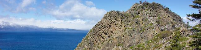
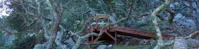
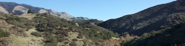
Gaze out from Route 50 as it travels along the southeast side of Lake Tahoe and you'll find nice views of the lakeshore and its surrounding mountains. Seven miles up from the state border in South Lake Tahoe, Nevada Route 50 slips through a tunnel in a tall pointed ridge of volcanic rock. The road itself is scenic, but the sight of Cave Rock should have you speculating how superb things must look from the top. ...Read more.
Distance: 0.9 miles · Elevation change: 165 feet
By: Published: July 25, 2019 Last updated: April 15, 2026
Crater Rim Drive to Keanakāko‘i Crater and Overlook Trail in Hawai‘i Volcanoes National Park
In the summer of 2018, Hawaiʻi Volcanoes National Park experienced the most dramatic volcanic activity in it's more than century long history. Land considered stable was humbled and demolished. When the earth stopped exploding and when the shaking of 60,000 earthquakes ceased, Crater Rim Drive, the road that ringed Kīlauea, was ruined in many places. ...Read more.
Tagged with · National Parks · Volcano · Volcanoes
Distance: 2.15 miles · Elevation change: 100 feet
By: Published: June 13, 2019 Last updated: April 9, 2026
Kīpukapuaulu Trail in Hawai‘i Volcanoes National Park
Filled with bold volcanic features and landscapes reinvented by eruptions, Hawaiʻi Volcanoes National Park might seem an unlikely place to find a deep-rooted forest packed with plant diversity and a thriving bird population. Kīpukapuaulu rises like an oasis, framed the less-fertile lands forged by more recent lava flows. Kīpukapuaulu Trail is a 1. ...Read more.
Distance: 1.2 miles · Elevation change: 185 feet
By: Published: May 2, 2019 Last updated: April 7, 2026
Sulphur Banks Trail – Crater Rim Trail Loop in Hawai‘i Volcanoes National Park
Kīlauea Volcano underwent major transformations when it erupted in the summer of 2018. See changed landscapes in and around Kīlauea Caldera from Steaming Bluff, where steam escapes from hot spots just below your feet! Behind the bluff, a hydrothermal area called Sulphur Banks displays colorful mineral deposits, accompanied by eggy smells. Sulphur Banks Trail – Crater Rim Trail Loop starts from Kīlauea Visitor Center, takes a boardwalk through the Sulphur Banks, stops at Steaming Bluff, and then circles back through rainforest along Crater Rim Trail. ...Read more.
Distance: 1.6 miles · Elevation change: 50 feet
By: Published: April 25, 2019 Last updated: April 18, 2026
Hōlei Sea Arch in Hawai‘i Volcanoes National Park
Hawai‘i Volcanoes National Park protects a changing landscape. This is true from the eruptive developments at Kīlauea Caldera all the way down to the ocean erosion at Hōlei Sea Arch. How much longer will this 90-foot tall bridge of basalt withstand the surf? Take a short walk - 100 yards each way - to Hōlei Sea Arch and see it while you can! Hōlei Sea Arch is 22 scenic miles from Kīlauea Visitor Center at the bottom of Chain of Craters Road. ...Read more.
Tagged with · Arches · National Parks · Ocean Views · Volcano
Distance: 0.1 miles · Elevation change: 15 feet
By: Published: April 16, 2019 Last updated: December 6, 2025
Pu‘u Loa Petroglyphs Trail in Hawai‘i Volcanoes National Park
Pu‘u Loa Petroglyphs Trail puts recent geological history and human history on full display. This level 1.4-mile hike crosses a pahoehoe lava flow to a boardwalk loop through an exciting area with thousands of petroglyphs carved by early Hawaiians. The petroglyphs honor the births of those that lived here hundreds of years ago. This short trek in Hawai‘i Volcanoes National Park is sure to inspire curiosity in the not-so-distant past. ...Read more.
Tagged with · National Parks · Petroglyphs · Volcano
Distance: 1.4 miles · Elevation change: 25 feet
By: Published: April 16, 2019 Last updated: April 26, 2026
Lemon Grove & “M” Trails Loop on Cerro San Luis in San Luis Obispo
The mountain named Cerro San Luis is one of the top places to hike in San Luis Obispo, and its trailhead is actually in walking distance from downtown SLO. If you're drawn to the large white “M” on the side of the mountain, you're in luck! Not only is the “M” reachable as an extension of the hike to the summit, but thanks to trail created in 2017, hikers can touch the “M” at the top of a loop. ...Read more.
Tagged with · Free Trails · Morros
Distance: 2.4 miles · Elevation change: 560 feet
By: Published: April 2, 2019 Last updated: April 18, 2026
Creek Bypass Trail Loop in Reservoir Canyon Natural Reserve
During the late teens of the 22nd century, San Luis Obispo has developed Reservoir Canyon Natural Reserve into a versatile hiking destination, with upgraded trails and features. Reservoir Canyon Trail and Summit Trail deliver great half-day hikes. However, a shorter option exists that packs Reservoir Canyon into a one-mile experience with 150 feet of elevation change. ...Read more.
Distance: 1 mile · Elevation change: 150 feet
By: Published: February 12, 2019 Last updated: April 18, 2026
Hedge Creek Falls in Dunsmuir
Hedge Creek Falls is a 35-foot waterfall pouring over a basalt overhang into a wooded ravine above the Sacramento River south of Mount Shasta. A short trail leads to the waterfall from a trailhead right beside an Interstate 5 offramp in Dunsmuir, so this waterfall hike makes a great break from highway travel. The fun trail actually passes behind the waterfall, going underneath the overhang, and continues down to a Sacramento River Overlook, resulting in a never-a-dull-moment 0. ...Read more.
Distance: 0.6 miles · Elevation change: 130 feet
By: Published: February 4, 2019 Last updated: December 5, 2025
Longridge Park in Sherman Oaks
The Santa Monica Mountains have significant parks with great hiking getaways. Often overlooked are smaller undeveloped pockets within the mountains that offer quick escapes from the stresses of Los Angeles. Longridge Park in Sherman Oaks is the latter, a 50-acre park with a 0.2-mile long use-trail. Longridge Trail has ridge-top views throughout its short run, like perspectives north across the San Fernando Valley and east toward the Griffith Park end of the range. ...Read more.
Distance: 0.4 miles · Elevation change: 75 feet
By: Published: January 14, 2019 Last updated: April 8, 2026