Old Salmon River Trail
in Mount Hood National Forest
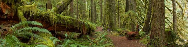
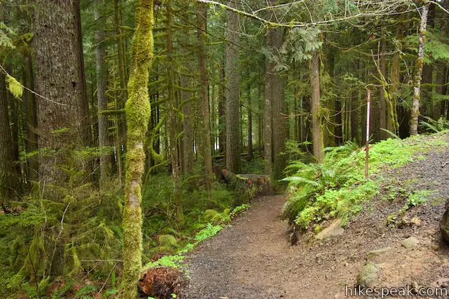
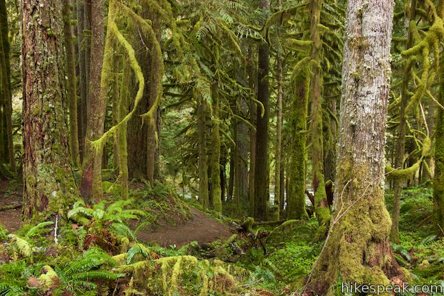
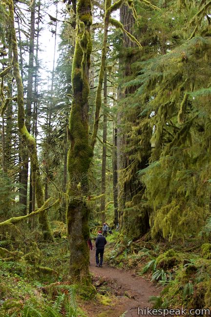
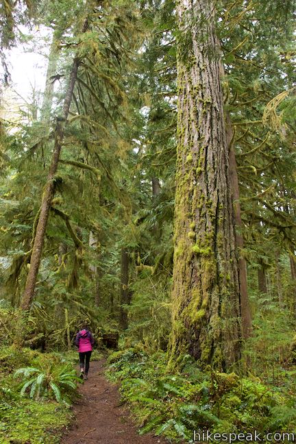
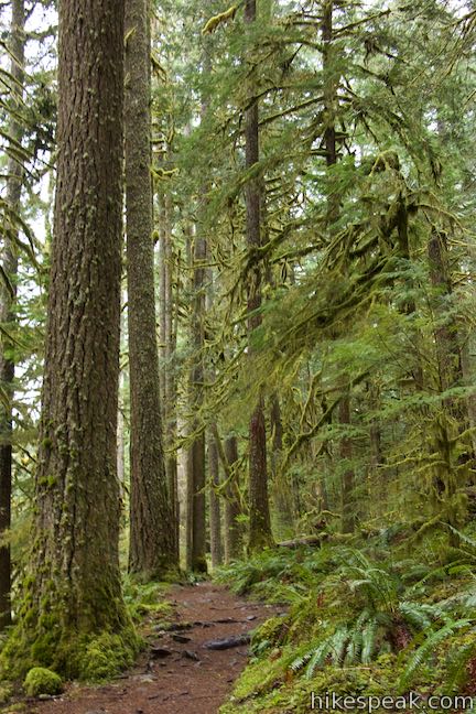
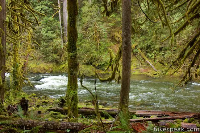
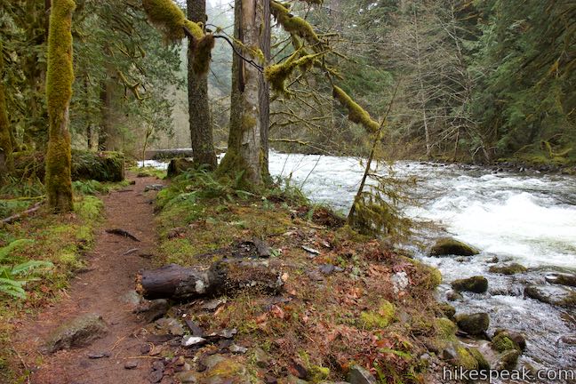
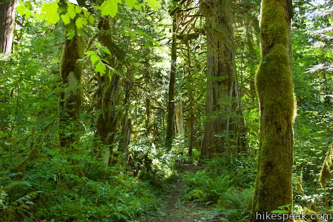
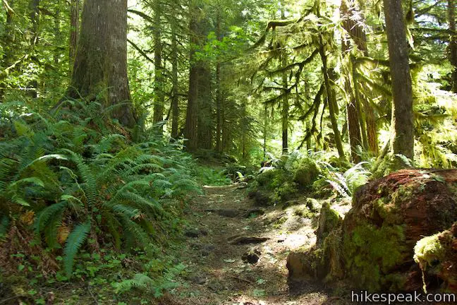
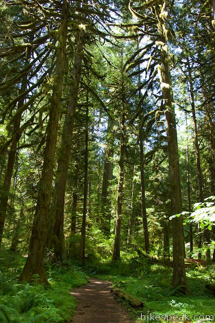
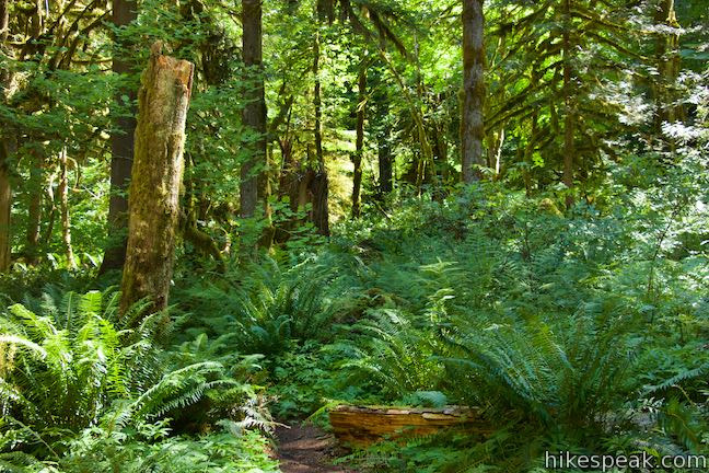
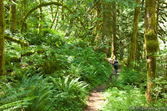
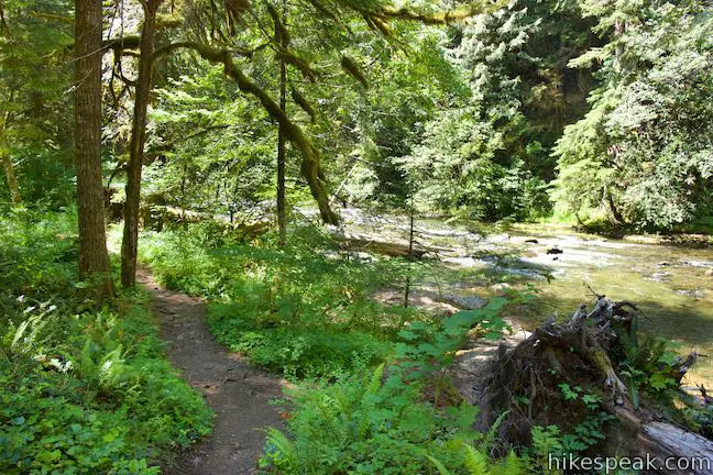
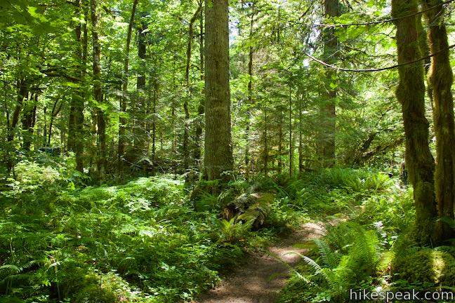
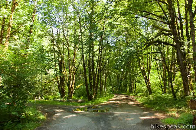
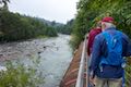
After just one bend on Old Salmon River Trail, you will already feel deep within the old-growth forest that surrounds the Salmon River as it flowing through Mount Hood National Forest. This Pacific Northwest woodland feels timeless, or perhaps from another time altogether, with its tall, century-old Douglas firs absolutely covered in green moss.
Old Salmon River Trail is 2.55 miles long between two trailheads on Salmon River Road, taking a mostly level course along the river with 175 feet of elevation change.
How far is this hike? You decide. The whole outing is 5.1 miles round trip. Near the southern end, the trail crosses Green Canyon Campground, which has a picnic area and a bathroom. Use the campground as a turnaround point creates a 4.35-mile round trip hike. Shorter outings are also possible. The trail borders the road for a short stretch near the middle and numerous paths connect to the trail from turnouts along Salmon River Road. There are multiple places to start or stop a hike on Old Salmon River Trail. Car shuttles can be arranged with two vehicles.
The directions offered here set out from the official trailhead at the north end of Old Salmon River Trail. This is the first trailhead along Salmon River Road when driving in from Welches, Oregon along Highway 26. Beyond Green Canyon Campground, the trail extends to Salmon River Bridge, where Salmon River Road crosses the flow.
Looking at a map of this trail, you might be discouraged to see that it hugs close to the road most of the time. Don’t be. Despite the proximity, you won’t see or hear traffic out on the trail. The density of the forest, the slope down from the road, and the soothing sound of the river all help to make Salmon River Road disappear.
The basic directions for Old Salmon River Trail are:
- Set out from Old Salmon River Trailhead (0 miles)
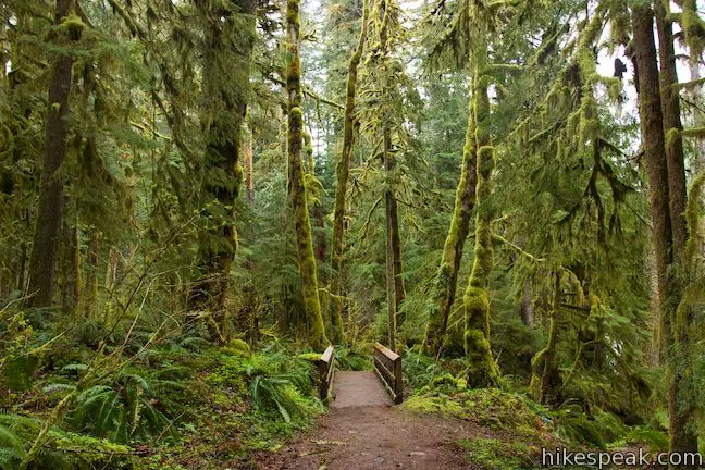
- Cross the first footbridge as the Salmon River comes into view (0.1 miles)
- Ascend stairs to the left of a small clearing along the riverbank (0.5 miles)
- Cross two bridges over streams that flow down to the Salmon River (0.7 miles)
- Explore a short path on the right leading to an access point along the Salmon River (0.75 miles)
- Rock hop across a seasonal stream (1.1 miles)
- Pass paths out to an island in the river flow (1.3 miles)
- Begin bordering Salmon River Road across from the Salmon River Slab climbing area (1.4 miles)
- Part from the west side of the road as the trail goes back into the forest (1.5 miles)
- Cross one more footbridge (1.9 miles)
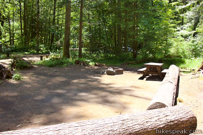
- Pass the edge of Green Canyon Campground (2 miles)
- Come to a path on the left to a picnic area by the campground (2.15 miles)
- Turn here to visit the picnic area and then hike back, using Green Canyon Campground as the south end of the hike (4.35 miles round trip)
- Breeze past the picnic area and continue another 0.3 miles to Salmon River West Trailhead at the Salmon River Bridge (5.1 miles round trip)
Start from Old Salmon River Trailhead, which is 2.7 miles up Salmon River Road from Highway 26 in Welches, about 17 miles past Sandy on the drive from Portland to Government Camp.
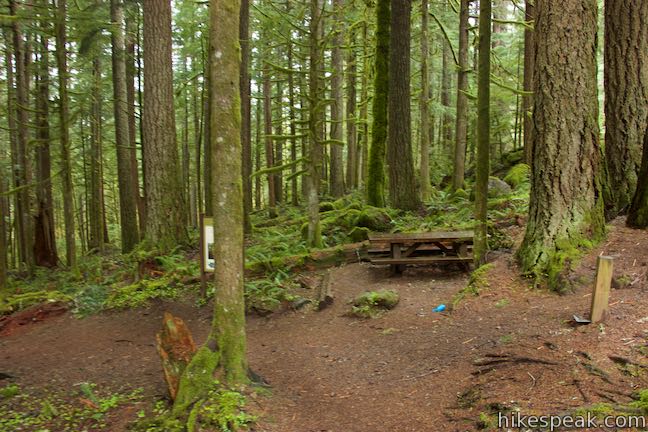
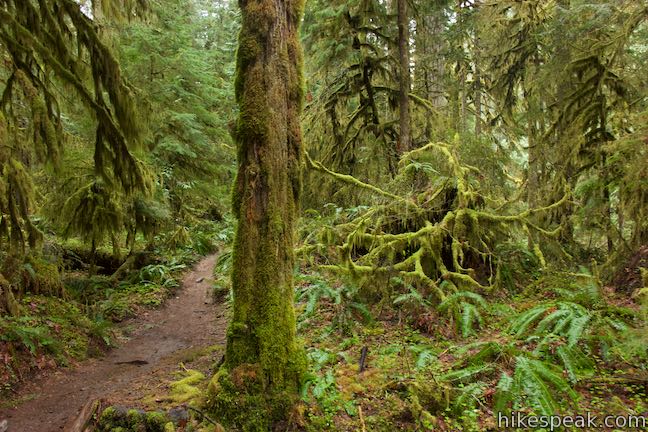
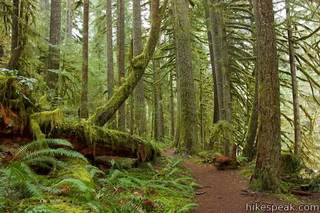
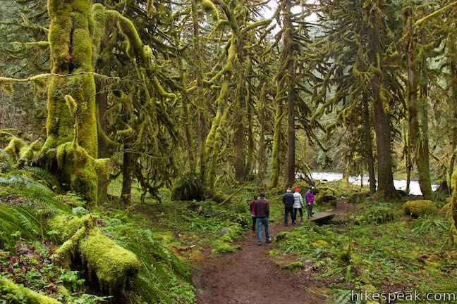
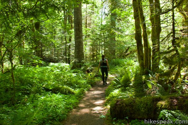
Hike down to a picnic table where the trail bends to the left and angles southwest toward the river, becoming absorbed by a damp and verdant woods where the tree trunks and branches are covered in mossy growth. The sides of the trail are blanketed in the green of sword ferns and oxalis (wood sorrel).
A national forest sign by the picnic table highlights some of the features of this special forest:
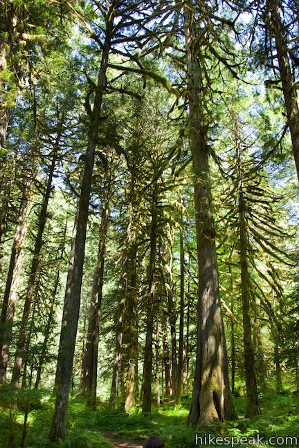
You are standing in a rare forest – but one much like those that once dominated the Pacific Northwest. It’s an old-growth forest, where some of the trees are more than 150 years in age. In addition to these grand trees, old-growth forests have lots of dead wood, many layers in the canopy, and a colorful medley of plant and animal life.
This old forest is a fortunate place to be. The sign explains that climate change is pushing old-growth forests to their limits, making it harder for them to survive. As climate change worsens, old-growth forests become even more important. The forests’ cool shade creates vital refuges for animals. The abundant plant life removes CO2 from the atmosphere to help curb climate change. Conserving of old-growth forests is part of the mission of the US Forest Service.
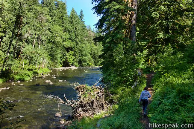
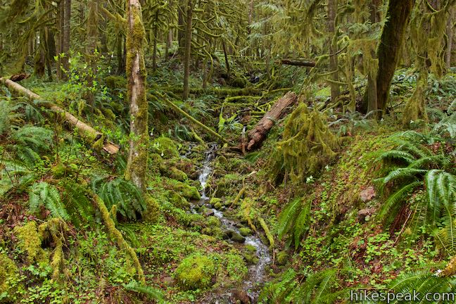
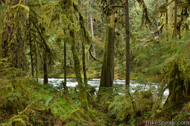
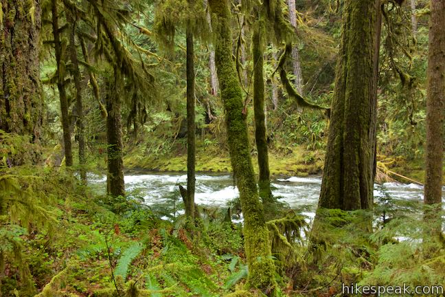
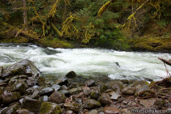
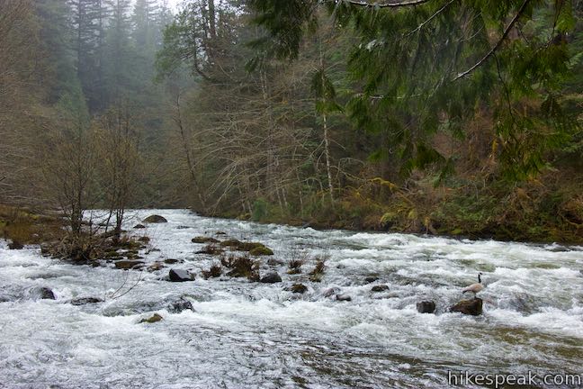
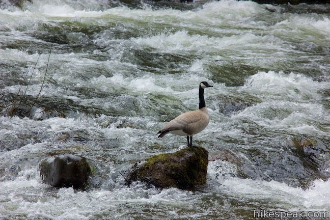
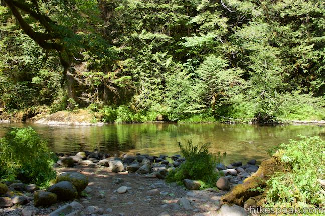
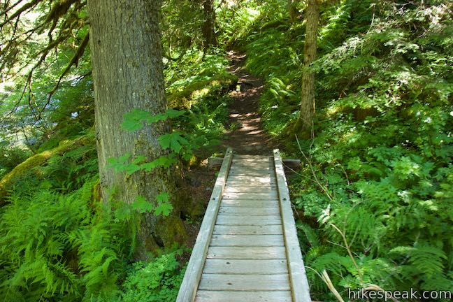
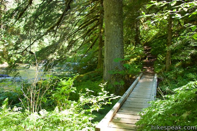
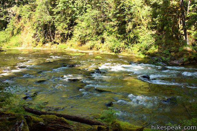
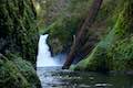
Proceed down the trail across an early footbridge. Look to the left to see a small stream flowing down a depression in the forest. The trail gains greater and greater views of the Salmon River, which slides over short rapids as it passes through the forest.
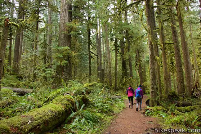
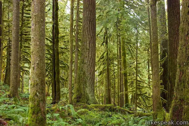
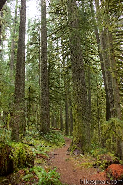
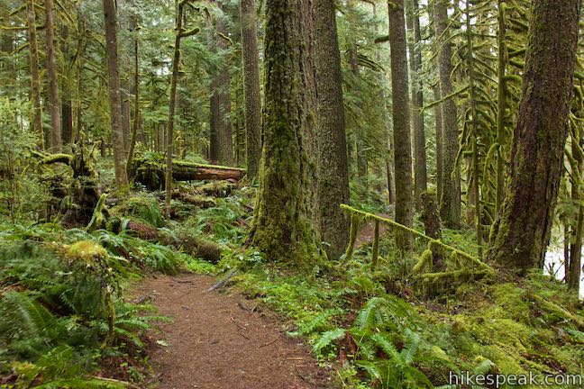
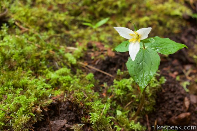
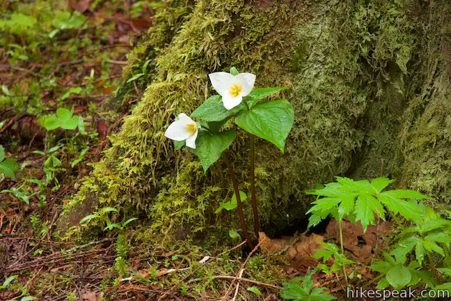
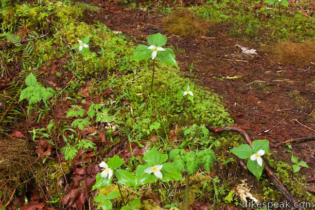
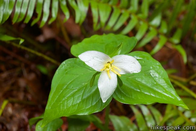
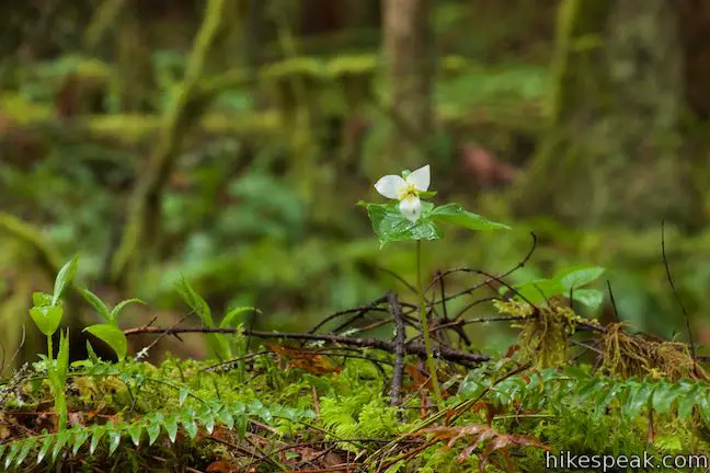
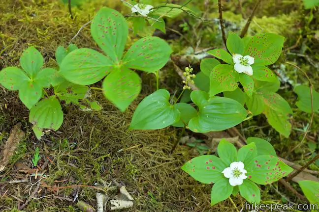
Mighty Douglas firs, western red cedars, and western hemlock rise high above Old Salmon River Trail. In the spring and summer, keep an eye on the forest floor for flowers with three white pedals – the cheerful blooms of trillium.
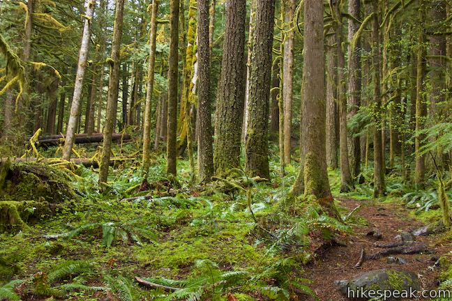
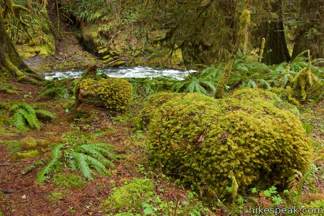
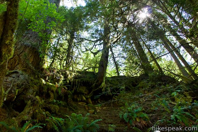
Pieces of old trees are strewn around the ground. Great fallen tree trunks and stumps give new life to the forest. Take a close look as the trail passes several stumps that host fascinating miniature forests of saplings, moss, and ferns. The forest service sign by the trailhead has a term for this new growth from old trees – old growth nurse logs.
Fallen and decaying logs are one of the structural elements of an old-growth forest. They provide homes for insects, amphibians, and small mammals. Fungi thrive in this habitat. As the log decays, it becomes a “nurse” to young trees.
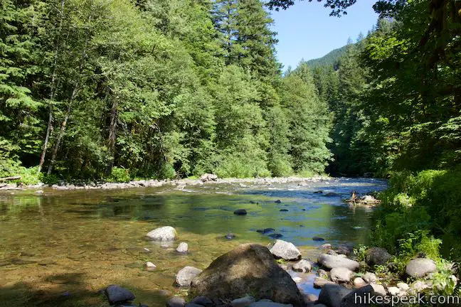
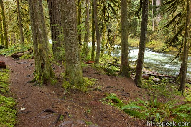
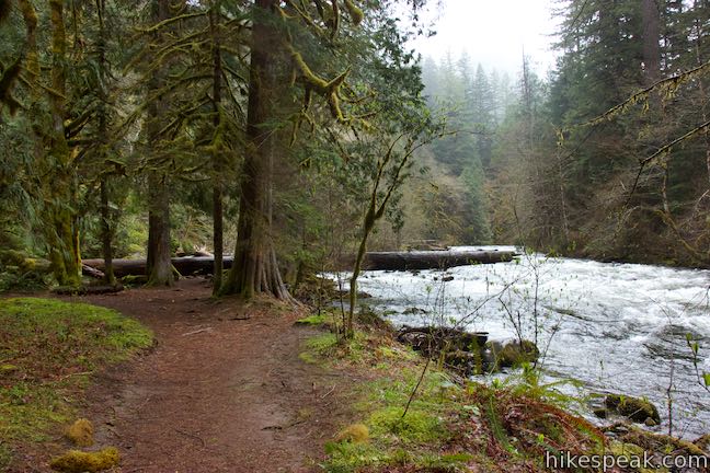
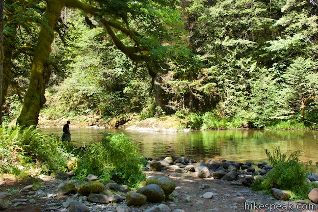
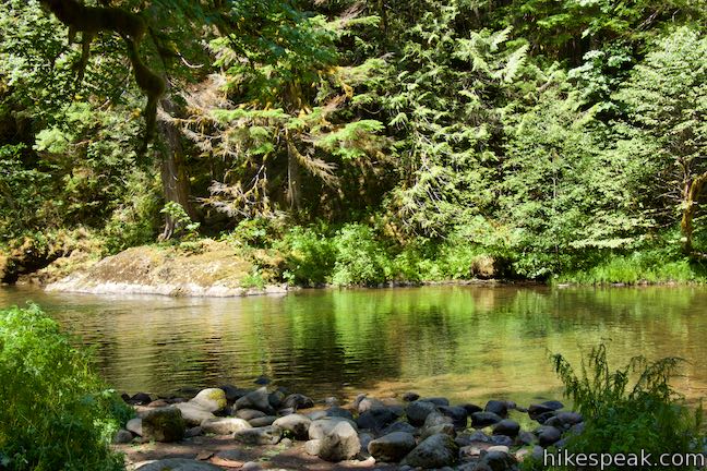
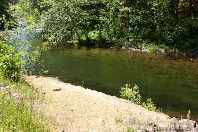
Make your way down to the edge of the Salmon River where bigleaf maple, vine maple, and alders thrive along the riverbank. Cross a small stream and begin moving up a flatter and more open area alongside the river. This is a great spot to climb up on logs and find views of the river as it flows by.

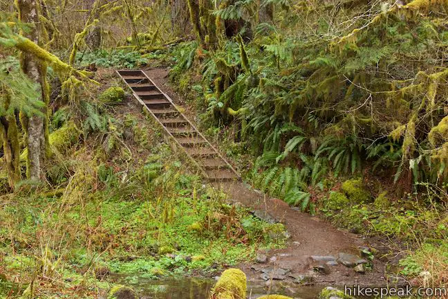
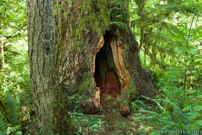
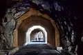
The trail proceeds to the left toward a flight of wooden steps. Ascend these stairs, half a mile from the trailhead to come to a hollowed-out tree. Step inside the tree if you are a child or a child at heart. The trail curves to the right and heads south again along a bank above the Salmon River.
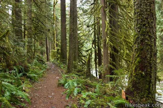
Old Salmon River Trail squeezes across a steep bank above the river crossing a pair of bridges. The first bridge, 2/3 of a mile from the trailhead, spans a cascading stream that springs from a pipe that takes the water underneath Salmon River Road. After the second bridge, the steep terrain transitions back to the more tapered forest that appeared along the start of the trail, providing a lovely woodland passage.
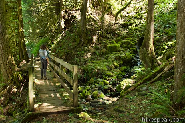
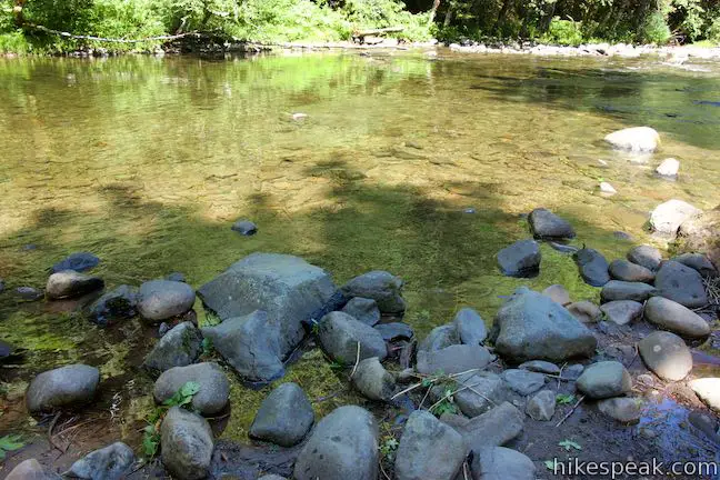
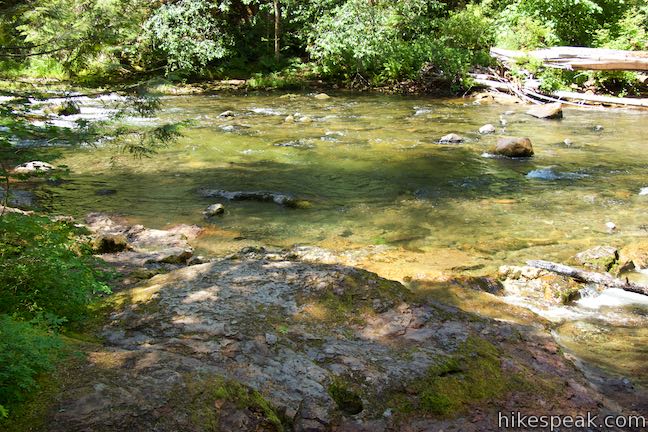
Just past the bridges, come to a short path on the right that descends to a nice spot on the shore of Salmon River. The water is fairly calm in front of this beach-like area, making it a tranquil place to take a break and have a snack.
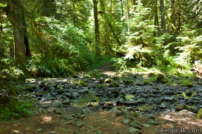
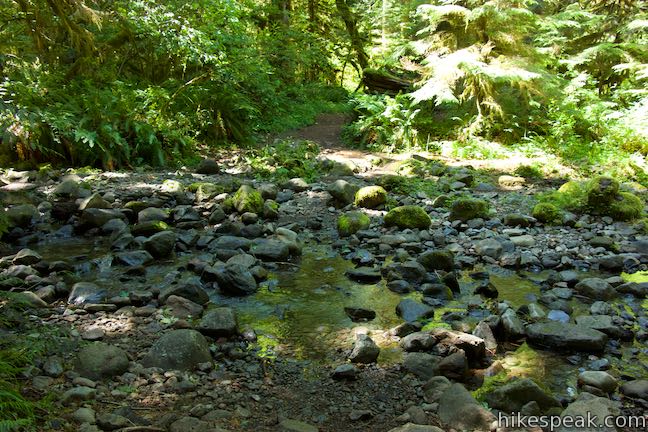
Continue up the trail to a spot, 1.1 miles from the trailhead, that will either be memorable or forgettable. During much of the year, you can simply walk across a wide dry creek bed. A line of rocks create a rock-hopping path if some water is present. At the peak of the rainy season, you’ll need to “ford the river or caulk the wagon” – or at least be prepared to get your feet wet.
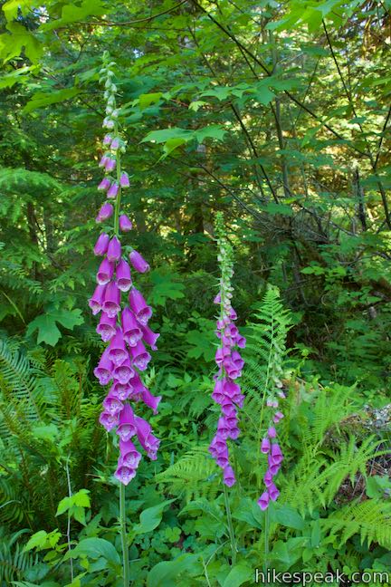
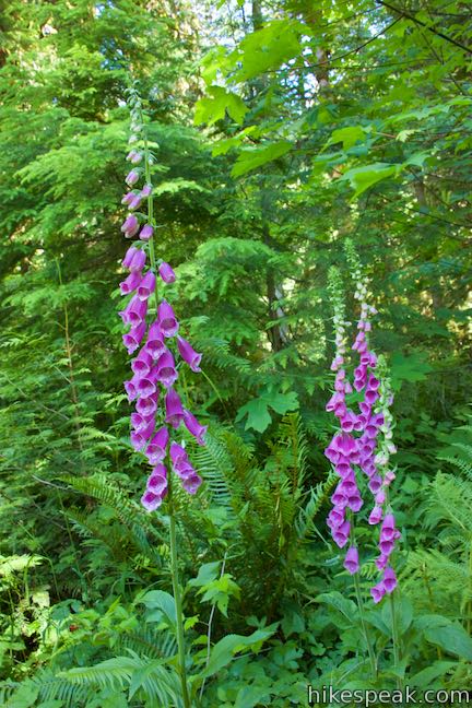
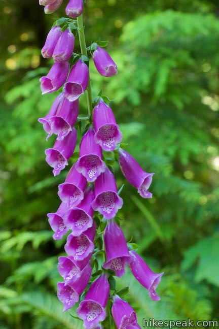
At around 1 1/4 miles from the trailhead, pass the first of a couple paths venturing out to the right that go across a mostly dry river channel out to a forest island along the river. The next stretch of trail gets decorated by the tall purple blooms of foxgloves.
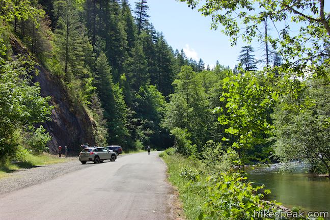
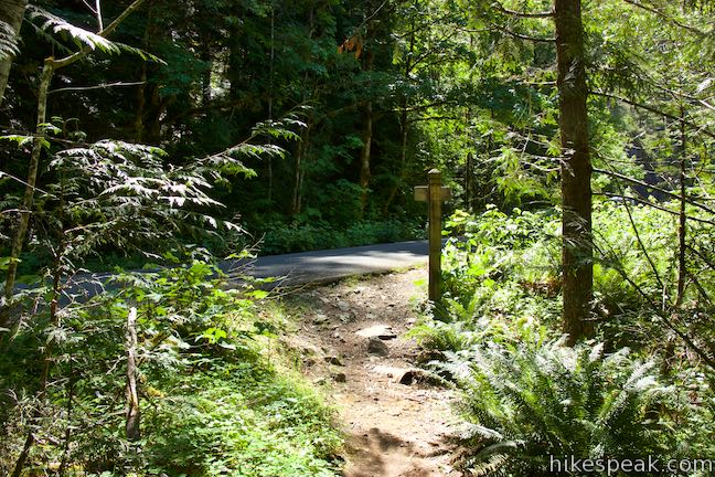
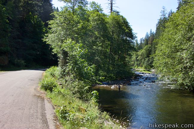
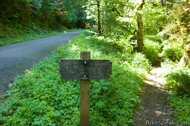
At 1.4 miles from the start, Old Salmon River Trail exits the trees and meets Salmon River Road. This isn’t the end of the trail, so don’t turn back! Instead, walk a tenth of a mile along the right side of the road. To your right, look for anglers along the riverbank casting for fish. A rock face rising to the left, on the other side of the road, is a popular rock climbing spot called Salmon River Slab.
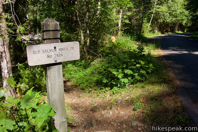
Head back into the forest where the trail resumes, marked by a sign reading, “Old Salmon River Trail 742A.” Leave the new road for old growth and make your way through more gorgeous trees. The trail passes rocky beaches along the river. As you enjoy the river views, spot salmonberry and thimbleberry bushes blossoming in sunny patches along the bank.
A tenth of a mile past one more little footbridge, and 2 miles from the trailhead, come to the edge of Green Canyon Campground. Campsite 9 (of 15) borders the trail just across from a gleaming stretch of the Salmon River. Anyone staying at the campground can walk right out of their campsite and onto Old Salmon River Trail.
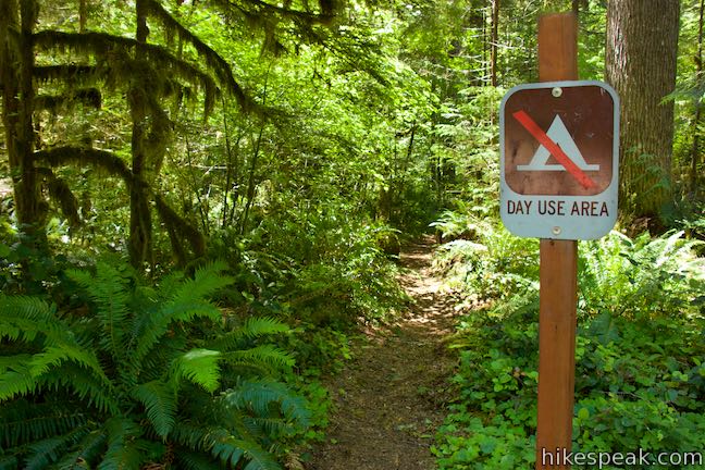
Proceed down the trail, which plots a course across the top of the riverbank behind the campsites. After another 0.15 miles, a not-so-easy-to-spot path branches off to the left.
If you take this path…
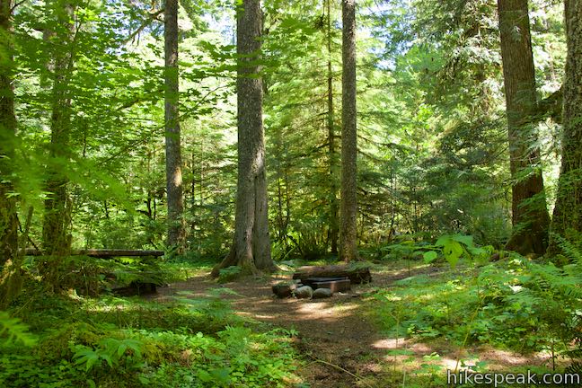
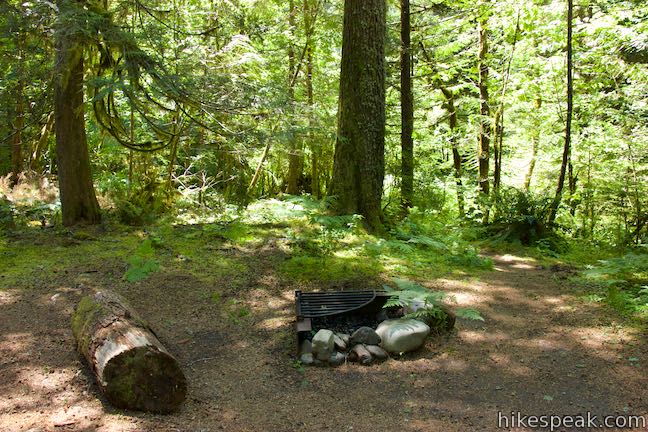
The path meanders through some trees to a picnic site by the entrance of Green Canyon Campground. This day-use area makes a decent turnaround point or alternative starting point. A few parking spaces are available for the day use area. A road through the campground serves as another route back to the trail beside campsite 9. Make your way back to the trailhead at the north end of Old Salmon River Trail for a 4.35-mile round trip hike.
If you skip the path…
The trail proceeds another 0.3 miles around a few bends in the Salmon River. The trail comes to an end as you reach Salmon River West Trailhead where Salmon River Road crosses the Salmon River. Across the road, Salmon River Trail (not to be confused with Old Salmon River Trail) ventures 14 miles up into the Salmon-Huckleberry Wilderness Area. Parking spaces for about ten vehicles are available here for people attempting that longer hike or arranging a shuttle on Old Salmon River Trail. Unless you’re prepared to keep going, turn around and hike back down the river the way you came for a 5.1-mile round trip hike.
Note: Mount Hood National Forest maps consider Green Canyon Campground the be the official end of Old Salmon River Trail. The southern extension of the trail between the campground and Salmon River West Trailhead is technically the first part of Salmon River Trail and not the last part of Old Salmon River Trail. However, if you want to hike all the way up the river to the bridge (possibly setting up a car shuttle), it’s easiest to treat these 0.55 miles as a natural extension of Old Salmon River Trail.
Dogs are allowed on Old Salmon River Trail as are mountain bikes (although the trail doesn’t seem popular with bikes). Old Salmon River Trail is within the Zigzag District of Mount Hood National Forest and a Northwest Forest Pass is required to park at the trailheads.
Directions to the Trailhead
- From the west, take Highway 26 to Sandy.
- Drive another 17 miles up Highway 26 (Mount Hood Highway) to the small community of Welches.
- Turn right onto Salmon River Road, which comes 1/4 mile before the Zigzag Ranger Station.
- Drive 2.7 miles up Salmon River Road to Old Salmon River Trailhead, which is the first trailhead on the right.
- If you wish to drive farther up Salmon River Road, it is 1.3 miles to Salmon River Slab, 1.9 miles to Green Canyon Campground, or 2.3 miles to Salmon River West Trailhead.
Trailhead Location
Trailhead address: Old Salmon River Trailhead, Salmon River Road, Welches, OR 97067
Trailhead coordinates: 45.3085, -121.9432 (45° 18′ 30.6″N 121° 56′ 35.5″W)
View Old Salmon River Trail in a larger map
Or view a regional map of surrounding Oregon trails and campgrounds.


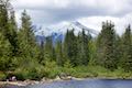 | Mirror Lake Trail This 4.3-mile lollipop loop hike crosses forest streams and ascends to a small lake reflecting big views of Mount Hood. |
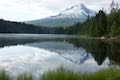 | Trillium Lake Trail This easy 2-mile hike circles the shores of a picturesque lake in the forest below Mount Hood. |
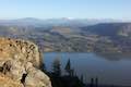 | Angel's Rest This 4.8-mile hike ascends to a panoramic landing with spectacular views across Columbia River Gorge (particularly at sunrise). |
 | Pipeline Trail This easy and enticing 2.8-mile hike along Hood River crosses a catwalk atop a penstock flume pipeline. |
 | Mosier Twin Tunnels This 2 to 9.5-mile hike ventures up Historic Columbia River Highway State Trail to a pair of tunnels carved into basalt cliffs on the side of Columbia River Gorge. |
 | Eagle Creek Trail This 4.55-mile hike ventures up a beautiful and dramatic canyon to impressive waterfalls like Metlako Falls, Lower Punchbowl Falls, and Punchbowl Falls. |
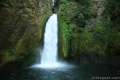 | Wahclella Falls This 2-mile hike visits a sublime waterfall in a canyon within the Columbia River Gorge. |
 | Multnomah Falls This 0.4 to 2.6-mile hike visits Oregon's tallest (and probably most visited) waterfall, offering something to hikers of all abilities. |
 | More trails in Oregon Explore other hikes in the Columbia River Gorge and different regions of Oregon. |
 | Trillium Lake Campground Located just miles from Government Camp, this campground has 57 sites sitting in the evergreens by Trillium Lake below Mount Hood. |
- A Magical Old-Growth Forest Hike Just an Hour from Portland - Old Salmon River Trail article on pdxmonthly.com (opens in a new tab)
- Old Salmon River Trail on oregonhikers.org (opens in a new tab)
- Old Salmon River Trail on hikingproject.com (opens in a new tab)
- Old Salmon River Trail on theoutbound.com (opens in a new tab)
- Old Salmon River Trail on hikelandia.com (opens in a new tab)
- Salmon River on wikipedia.org (opens in a new tab)
- The official Mount Hood National Forest webpage for Old Salmon River Trail (opens in a new tab)
- The Mount Hood National Forest map and description (pdf) for Old Salmon River Trail (opens in a new tab)
Common Questions about Old Salmon River Trail in Mount Hood National Forest
- Is the trail open?
- Yes. You should expect to find that Old Salmon River Trail is open. There are no recent reports of trail closures. If you discover that the trail is closed, please help your fellow hikers by reporting a closure.
- Do I need a permit for this hike?
- Yes. Northwest Forest Pass Required.
- How much time does this hike take?
- It takes approximately 2 hours 15 minutes to hike Old Salmon River Trail. Individual hiking times vary. Add extra time for breaks and taking in the views.
- How long is this hike?
- The hike to Old Salmon River Trail is a 5.1 mile out and back with 175 feet of elevation change.
- Are dogs allowed on this trail?
- Yes, dogs are allowed on Old Salmon River Trail. The trail is open to hikers, dogs, bikes.
- What mountain range is this trail in?
- Old Salmon River Trail is located in the Cascade Range.
- Where is the trailhead located?
- The trailhead for Old Salmon River Trail is located in Welches, Oregon.
Trailhead Address:
Salmon River Road
Welches, Oregon 97067
Trailhead Coordinates:
45.3085, -121.9432 - What are the driving directions to the start of the hike?
To get to the trailhead: From the west, take Highway 26 to Sandy. Drive another 17 miles up Highway 26 (Mount Hood Highway) to the small community of Welches. Turn right onto Salmon River Road, which comes 1/4 mile before the Zigzag Ranger Station. Drive 2.7 miles up Salmon River Road to Old Salmon River Trailhead, which is the first trailhead on the right.
If you wish to drive farther up Salmon River Road, it is 1.3 miles to Salmon River Slab, 1.9 miles to Green Canyon Campground, or 2.3 miles to Salmon River West Trailhead.
View custom Google Maps directions from your current location.
- Are there other trails near Old Salmon River Trail?
- Yes, you can find other nearby hikes using the Hikespeak Hike Finder Map.

Go the extra miles...
Submit a rating of this hike to go with your comment. Contribute to the average trail rating.