Wildflowers in Los Angeles
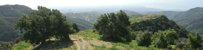
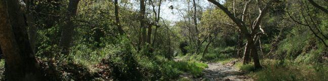
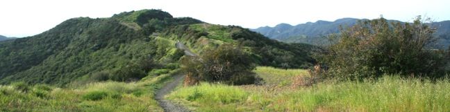
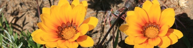
Wildflowers in the Santa Monica Mountains, San Gabriel Mountains and other open areas of Los Angeles County bloom each spring adding splashes of color along the area's trails. Some flowers can be seen into the summer and fall. Below are some examples of common wildflowers that appear beside Los Angeles hiking trails. The flowers are listed alphabetically with a link to the trails where they were seen. ...Read more.
Tagged with · Wildflowers
By: Published: April 29, 2010 Last updated: April 9, 2026
Lower Canyonback Trail in the Santa Monica Mountains
Lower Canyonback Trail crosses Canyonback Ridge between Brentwood and a development of estate homes built along the ridge. The trail offers views of west Los Angeles, Santa Monica Bay, and neighboring ridges in the Santa Monica Mountains. The Getty Museum to the east is also in view and on the same plane with trail. From the top of Kenter Avenue to Mountain Gate Country Club Estates is 4. ...Read more.
Distance: 4.2 miles · Elevation change: 500 feet
By: Published: April 28, 2010 Last updated: December 5, 2025
Upper Canyonback Trail in the Santa Monica Mountains
Canyonback Ridge runs north to south in the area of the Santa Monica Mountains known as the Big Wild. The ridge is located east of Mandeville Canyon near San Vicente Mountain. Much like the neighboring ridges, Westridge, Sullivan Ridge, and Temescal Ridge, there is both a wide fire road and a narrow single-track running along Canyonback Ridge allowing hikers to choose their own adventure on the trail. ...Read more.
Distance: 3 miles · Elevation change: 200 feet
By: Published: April 28, 2010 Last updated: May 20, 2026
Mulholland Drive to San Vicente Mountain in the Santa Monica Mountains
The shortest route up San Vicente Mountain approaches the peak from the east. This 2-mile round trip hike follows an unpaved portion of Mulholland Drive and climbs just 335 feet. In the 1950s, San Vicente Mountain was used to defend Los Angeles from soviet missile attacks. Like Mount Disappointment in the San Gabriel Mountains and White Point on the Palos Verdes Peninsula, San Vicente Mountain was used as a Nike missile defense site to detect and intersect missiles directed at Los Angeles. ...Read more.
Distance: 2 miles · Elevation change: 335 feet
By: Published: April 13, 2010 Last updated: April 9, 2026
Topanga Lookout in the Santa Monica Mountains
At a saddle in the Santa Monica Mountains 2,375 feet above the Pacific Ocean and 3 miles from the coast, the Backbone Trail crosses Stunt Road, creating a high trailhead for nearby destinations. Topanga Lookout, the former site of a fire tower, stands above Red Rock Canyon Park and continues to offer fine views of the Santa Monica Mountains, Calabasas, and the Santa Susana Mountains. ...Read more.
Distance: 2 miles · Elevation change: 160 feet
By: Published: April 8, 2010 Last updated: April 18, 2026
Saddle Peak in the Santa Monica Mountains
At a saddle in the Santa Monica Mountains 2,375 feet above the Pacific Ocean and three miles from the coast, the Backbone Trail crosses Stunt Road, creating a high trailhead for nearby destinations like Saddle Peak. The 2-mile round trip hike to the summit climbs just 450 feet but offers fantastic views of Malibu and the Santa Monica Mountains. A spring bloom of gazanias (invasive) along the Backbone Trail Pick up the Backbone Trail and go west up the center of the V formed by the intersection of Stunt Road and Schueren Road. ...Read more.
Distance: 2 miles · Elevation change: 450 feet
By: Published: April 8, 2010 Last updated: April 18, 2026
Rustic Canyon’s Murphy Ranch in the Santa Monica Mountains
In the 1930s, Nazi sympathizers built a refuge in the Pacific Palisades. Herr Schmidt, Winona and Norman Stephens, and their followers occupied a self-contained stronghold in what is now Rustic Canyon between Sullivan Ridge and Will Rodgers State Park. Murphy Ranch was designed to serve as a hold out for fans of the Third Reich waiting for America to fall to the Nazis. ...Read more.
Distance: 3.85 miles · Elevation change: 325 feet
By: Published: April 6, 2010 Last updated: December 5, 2025
Sullivan Ridge in the Santa Monica Mountains
Sullivan Ridge rises between Rustic Canyon and Sullivan Canyon east of Will Rogers State Park in a region of the Santa Monica Mountains aptly named the Big Wild. A 6.3-mile long fire road runs along the ridge, accompanied by a single-track trail that diverges from the road to explore more of Sullivan Ridge. A prominent lone-standing live oak along the road makes a natural turnaround point and a 7. ...Read more.
Distance: 12.6 miles · Elevation change: 1350 feet
By: Published: April 5, 2010 Last updated: December 5, 2025
Sullivan Canyon in the Santa Monica Mountains
Sullivan Canyon runs north to south in the Santa Monica Mountains east of Will Rodgers State Park. This 8.5-mile round trip hike departs from a residential street a couple miles north of Sunset Boulevard and follows a wide trail up the center of a sycamore-filled canyon. Sullivan Canyon A green wall across Queensferry Road marks the start of the hike. ...Read more.
Distance: 8.5 miles · Elevation change: 950 feet
By: Published: April 5, 2010 Last updated: December 5, 2025
Westridge Trail to San Vicente Mountain in the Santa Monica Mountains
In the 1950s, San Vicente Mountain served as a mountaintop military installation to defend Los Angeles from soviet missile attacks. Today, the 1,960-foot peak provides visitors with a look back at this chapter in the city's history, along with a great view of West LA and the Santa Monica Mountains. Westridge Fire Road leads to San Vicente Mountain and is a popular path for mountain bikers, trail runners, and dog walkers (dogs are permitted off-leash in Westridge-Canyonback Wilderness Park under their owner's supervision). ...Read more.
Distance: 7.4 miles · Elevation change: 730 feet
By: Published: March 25, 2010 Last updated: April 7, 2026