Winnetka Ridge Trail Santa Monica Mountains hike Woodland Hills Winnetka Avenue Trail Topanga State Park
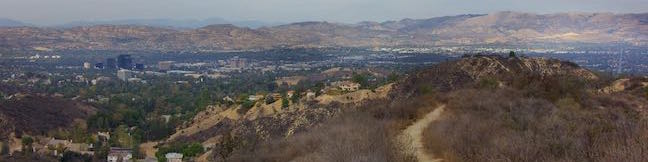
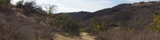
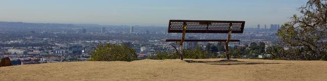
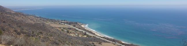
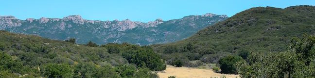
If you like ridge top views without the effort of hiking all the way up a ridge, make your way to the end of Winnetka Avenue in Woodland Hills. From there, Winnetka Ridge Trail runs south along the spine of a ridge into the Santa Monica Mountains. The ridge stands above the west side of Corbin Canyon and delivers broad views over the San Fernando Valley. After 3/4 of a mile, Winnetka Ridge... Read more.
My Hikes: Completed hikeA green icon of shows a picture of a landscape with a check mark in the upper right corner, signifying that this is a hike you would like to put on your completed list.OK! Add to trails I've hiked
My Hikes: Want to hikeA green icon of shows a picture of a landscape with a heart in the upper right corner, signifying that this is a hike you would like to put on your to-do list.OK! Add to trails I want to hike
TagsA green icon depicting a tags represents a list of words and phrases that this content is tagged with Tagged with · Free Trails · Woodland Hills · Dog-Friendly Trails · Mountain Biking Trails · Santa Monica Mountains · Topanga State Park
Hike DistanceA green icon of a hiker used to label information about the length of the hike Distance: 1.5 miles · Elevation change: 200 feet
By: Published: Last updated: January 17, 2018
Corbin Canyon Trail Santa Monica Mountains hike Tarzana California Corbin Canyon Park Hike Woodland Hills Los Angeles
Corbin Canyon Park is a less visited pocket of Topange State Park in the Santa Monica Mountains. The 328-acre parcel stretches into the mountains from neighborhoods in Tarzana and Woodland Hills, presenting a small offering of trails that are isolated from longer routes through the Santa Monica Mountains. Corbin Canyon hosts trails for a pleasant and manageable 2.05-mile partial loop with... Read more.
My Hikes: Completed hikeA green icon of shows a picture of a landscape with a check mark in the upper right corner, signifying that this is a hike you would like to put on your completed list.OK! Add to trails I've hiked
My Hikes: Want to hikeA green icon of shows a picture of a landscape with a heart in the upper right corner, signifying that this is a hike you would like to put on your to-do list.OK! Add to trails I want to hike
TagsA green icon depicting a tags represents a list of words and phrases that this content is tagged with Tagged with · Free Trails · Tarzana · Woodland Hills · Dog-Friendly Trails · Mountain Biking Trails · Santa Monica Mountains · Topanga State Park
Hike DistanceA green icon of a hiker used to label information about the length of the hike Distance: 2.05 miles · Elevation change: 150 feet
By: Published: Last updated: January 17, 2018
Griffith Observatory East Observatory Trail Griffith Park Vermont Canyon hike to Griffith Observatory Los Angeles California
Griffith Observatory sits on a ridge between Vermont Canyon Road and Western Canyon Road on the slopes of Mount Hollywood in Griffith Park. Griffith Observatory is a true Los Angeles landmark that can be appreciated by arriving by trail instead of driving up the park roads. Take West Observatory Trail if you wish to hike to Griffith Observatory from Western Canyon or follow these directions... Read more.
My Hikes: Completed hikeA green icon of shows a picture of a landscape with a check mark in the upper right corner, signifying that this is a hike you would like to put on your completed list.OK! Add to trails I've hiked
My Hikes: Want to hikeA green icon of shows a picture of a landscape with a heart in the upper right corner, signifying that this is a hike you would like to put on your to-do list.OK! Add to trails I want to hike
TagsA green icon depicting a tags represents a list of words and phrases that this content is tagged with Tagged with · Free Trails · Hollywood · Observatories · Dog-Friendly Trails · Griffith Park · Santa Monica Mountains
Hike DistanceA green icon of a hiker used to label information about the length of the hike Distance: 1.5 miles · Elevation change: 380 feet
By: Published: Last updated: May 13, 2025
Castle Lake Campground Shasta-Trinity National Forest Mount Shasta Camping
Find this cozy six-site campground set within a forest of pines and other conifers near Castle Lake, a beautiful glacial cirque lake in Shasta-Trinity National Forest. Castle Lake Campground makes a convenient base camp for hikes leaving from Castle Lake and the campground is a 20-minute drive from the city of Mount Shasta along Interstate 5. Castle Lake Campground The six sites at... Read more.
TagsA green icon depicting a tags represents a list of words and phrases that this content is tagged with Tagged with · Klamath Mountains · Lakes · Shasta-Trinity National Forest · Tent Camping
By: Published: Last updated: February 4, 2019
Castle Peak Hike Castle Peak Route Castle Peak Trail Heart Lake Hike Shasta-Trinity National Forest California
The short hike from Castle Lake to Heart Lake explores a scenic part of Shasta-Trinity National Forest near Mount Shasta. The fun doesn't need to stop once you reach that endearing lake. Hike off trail up a ridge from Heart Lake to a summit with extraordinary views that has been given the unofficial name of Castle Peak. You will feel like royalty when you stand on this mountaintop, taking... Read more.
My Hikes: Completed hikeA green icon of shows a picture of a landscape with a check mark in the upper right corner, signifying that this is a hike you would like to put on your completed list.OK! Add to trails I've hiked
My Hikes: Want to hikeA green icon of shows a picture of a landscape with a heart in the upper right corner, signifying that this is a hike you would like to put on your to-do list.OK! Add to trails I want to hike
TagsA green icon depicting a tags represents a list of words and phrases that this content is tagged with Tagged with · Klamath Mountains · Lakes · Shasta-Trinity National Forest
Hike DistanceA green icon of a hiker used to label information about the length of the hike Distance: 3.2 miles · Elevation change: 1180 feet
By: Published: Last updated: May 13, 2025
Heart Lake Trail Little Castle Lake Trail Heart Lake Hike Shasta-Trinity National Forest California
You are bound to fall in love with the hike to Heart Lake. This pint-sized heart-shaped attraction in the Castle Crags Wilderness of Shasta-Trinity National Forest boasts views of Mount Shasta, Black Butte, and surrounding Klamath Mountains. The hike to Heart Lake begins from a trailhead at Castle Lake, a larger mountain lake wrapped by pines and granite cliffs. For a two-lake trek, you can... Read more.
My Hikes: Completed hikeA green icon of shows a picture of a landscape with a check mark in the upper right corner, signifying that this is a hike you would like to put on your completed list.OK! Add to trails I've hiked
My Hikes: Want to hikeA green icon of shows a picture of a landscape with a heart in the upper right corner, signifying that this is a hike you would like to put on your to-do list.OK! Add to trails I want to hike
TagsA green icon depicting a tags represents a list of words and phrases that this content is tagged with Tagged with · Klamath Mountains · Lakes · Shasta-Trinity National Forest
Hike DistanceA green icon of a hiker used to label information about the length of the hike Distance: 2.9 miles · Elevation change: 645 feet
By: Published: Last updated: May 13, 2025
Oso Flaco Lake Trail Oceano Dunes SCRA Nipomo Dunes Hike San Luis Obispo California
Oso Flaco Lake Trail in Oceano Dunes SVRA offers a hike with easy-going appeal. The nearly level trail takes a boardwalk over a 75-acre birdlife-boasting lake and across sand dunes to a tucked-away beach and a viewpoint overlooking the Guadalupe-Nipomo Dunes. These are the largest dunes on the coast of Southern California, but Oso Flaco Lake Trail is a short hike at just 2-miles round trip.... Read more.
My Hikes: Completed hikeA green icon of shows a picture of a landscape with a check mark in the upper right corner, signifying that this is a hike you would like to put on your completed list.OK! Add to trails I've hiked
My Hikes: Want to hikeA green icon of shows a picture of a landscape with a heart in the upper right corner, signifying that this is a hike you would like to put on your to-do list.OK! Add to trails I want to hike
TagsA green icon depicting a tags represents a list of words and phrases that this content is tagged with Tagged with · Arroyo Grande · Beaches · California State Parks · Lakes · Nipomo · Ocean Views · Oceano Dunes State Vehicular Recreation Area · Sand Dunes · Wheelchair-Friendly
Hike DistanceA green icon of a hiker used to label information about the length of the hike Distance: 2 miles · Elevation change: 25 feet
By: Published: Last updated: January 24, 2018
Arroyo Sequit Park Santa Monica Mountains National Recreation Area Arroyo Sequit Nature Trail
Take a trip to Arroyo Sequit Park to hike a short loop through a tucked-away pocket of the Santa Monica Mountains, The park is situated along Mulholland Highway inland of Leo Carrillo State Park and below the range's most rugged peaks. The surroundings for this 2.05 miles hike are beautiful. Arroyo Sequit Nature Trail has 285 feet of elevation change, winding over and around the upper... Read more.
My Hikes: Completed hikeA green icon of shows a picture of a landscape with a check mark in the upper right corner, signifying that this is a hike you would like to put on your completed list.OK! Add to trails I've hiked
My Hikes: Want to hikeA green icon of shows a picture of a landscape with a heart in the upper right corner, signifying that this is a hike you would like to put on your to-do list.OK! Add to trails I want to hike
TagsA green icon depicting a tags represents a list of words and phrases that this content is tagged with Tagged with · Arroyo Sequit Park · Closed · Free Trails · Malibu · Santa Monica Mountains National Recreation Area · Wildflowers · Dog-Friendly Trails · Santa Monica Mountains
Hike DistanceA green icon of a hiker used to label information about the length of the hike Distance: 2.05 miles · Elevation change: 285 feet
By: Published: Last updated: February 5, 2025
Nicholas Flat Trail Willow Creek Trail Ocean Vista Hike Malibu Leo Carrillo State Park Scenic Loop hike Santa Monica Mountains
At the west end of Malibu where Mulholland Highway meets PCH, you'll find Leo Carrillo State Park. Well known for its beaches and surfing, this park has offerings for hikers too, like the trek up Nicholas Flat Trail to an oak-wrapped grassland with a small pond, which is 7 miles round trip or more. For a shorter hike, combine the bottom of Nicholas Flat Trail with Willow Creek Trail, for a... Read more.
My Hikes: Completed hikeA green icon of shows a picture of a landscape with a check mark in the upper right corner, signifying that this is a hike you would like to put on your completed list.OK! Add to trails I've hiked
My Hikes: Want to hikeA green icon of shows a picture of a landscape with a heart in the upper right corner, signifying that this is a hike you would like to put on your to-do list.OK! Add to trails I want to hike
TagsA green icon depicting a tags represents a list of words and phrases that this content is tagged with Tagged with · California State Parks · Leo Carrillo State Park · Malibu · Ocean Views · Santa Monica Mountains
Hike DistanceA green icon of a hiker used to label information about the length of the hike Distance: 2.05 miles · Elevation change: 620 feet
By: Published: Last updated: October 8, 2024
Nicholas Flat Trail Hike Malibu Leo Carrillo State Park Nicholas Flat Natural Preserve Santa Monica Mountains California
Nicholas Flat Trail is a three-mile long 'ocean to mountains' trail beginning within Leo Carrillo State Park, just across PCH from a famous beach at the west end of Malibu. The single-track trail travels up a coastal ridge past two vista points (and lots of other ocean views) to reach Nicholas Flat, where grassy meadows are rimmed by oak trees. A small network of trails offer different... Read more.
My Hikes: Completed hikeA green icon of shows a picture of a landscape with a check mark in the upper right corner, signifying that this is a hike you would like to put on your completed list.OK! Add to trails I've hiked
My Hikes: Want to hikeA green icon of shows a picture of a landscape with a heart in the upper right corner, signifying that this is a hike you would like to put on your to-do list.OK! Add to trails I want to hike
TagsA green icon depicting a tags represents a list of words and phrases that this content is tagged with Tagged with · California State Parks · Leo Carrillo State Park · Malibu · Nicholas Flat Natural Preserve · Ocean Views · Santa Monica Mountains
Hike DistanceA green icon of a hiker used to label information about the length of the hike Distance: 7 miles · Elevation change: 1685 feet
By: Published: Last updated: October 8, 2024