Sand Dollar Beach in Los Padres National Forest (Big Sur)
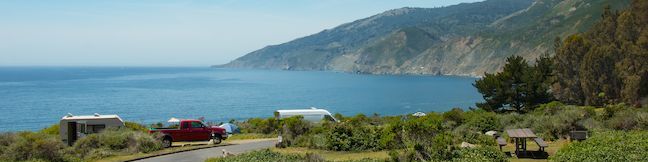
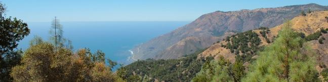
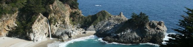
Big Sur has a dramatic rocky coastline that's stunning to look at, but can be challenging to access. Where do you go when you want to take a good walk on the beach? To dip your toes in Big Sur's sand, there may be nowhere better to visit than Sand Dollar Beach. This half-mile long beach (or longer if the tide is out) is a crescent-shaped arc of pale sand between the blue water of the Pacific Ocean and the orange rock of tall sea cliffs. ...Read more.
Distance: 0.5 miles · Elevation change: 125 feet
By: Published: July 8, 2014 Last updated: December 5, 2025
Kirk Creek Campground in Los Padres National Forest (Big Sur)
Kirk Creek Campground might as well be called Amazing Ocean Views Campground. This national forest campground is perched atop ocean bluffs that are over 100-foot tall and overlook miles and miles of Pacific Ocean along the beautiful Big Sur coastline. Kirk Creek Campground is a stunning place to put up a tent or park an RV and is sure to be a treat for anyone able to stay here on a trip through Big Sur. ...Read more.
By: Published: July 7, 2014 Last updated: April 13, 2026
Canyon Falls in Julia Pfeiffer Burns State Park
Julia Pfeiffer Burns State Park in Big Sur has a word famous waterfall named McWay Falls, which tumbles off a coastal bluff straight into the Pacific Ocean in a display of unique natural beauty. The park has a second waterfall too, just inland from McWay Falls, with the more generic name of Canyon Falls. This lovely little waterfall can't rival McWay for postcard beauty, but the 0. ...Read more.
Distance: 0.9 miles · Elevation change: 225 feet
By: Published: June 30, 2014 Last updated: December 7, 2025
Pacific Valley Bluff Trail in Los Padres National Forest (Big Sur)
This short, level hike in Big Sur's Los Padres National Forest ventures to the end of a grassy point topped by a crown of spiked boulders. The bluff offers fantastic views of the coves and rocky sea stacks up and down the rugged coastline of Big Sur. The trailhead is conveniently located along Highway One, and at 1.1 miles round trip with 50 feet of elevation change, the views far outweigh the effort. ...Read more.
Distance: 1.1 miles · Elevation change: 50 feet
By: Published: February 28, 2013 Last updated: December 9, 2025
Cruickshank Trail in the Silver Peak Wilderness
For backpackers and day hikers, Cruickshank Trail offers an extraordinary opportunity to explore the wilderness off Highway One on the beautiful Big Sur Coast. The single track starts by climbing to lofty ocean views, and then heads inland along a canyon wall with relaxing pockets of oaks and redwoods toward a handful of trail camps. The excellent trail to Upper Cruickshank Camp crosses diverse scenery for a 5-mile round trip hike with 1,150 feet of elevation gain, and there are several possible extensions. ...Read more.
Distance: 5 miles · Elevation change: 1150 feet
By: Published: September 17, 2012 Last updated: April 16, 2026
Buckeye Trail in the Silver Peak Wilderness
It can sound like hyperbole when you try to put into words the breathtaking, jaw-dropping stop-you-in-your tracks ocean views found on trails in Big Sur. Never the less, Buckeye Trail has absolutely extraordinary views over the Pacific that you need to see to believe. Rising above Highway One, the trail ventures through the Silver Peak Wilderness, ascending coastal canyons and ridges to panoramic vistas and a number of trail camps. ...Read more.
Distance: 6.5 miles · Elevation change: 1450 feet
By: Published: September 16, 2012 Last updated: April 16, 2026
Salmon Creek Falls in Los Padres National Forest
Salmon Creek Trail is a popular track with backpackers venturing deep into the Silver Peak Wilderness in the Monterey District of Los Padres National Forest, but you only need to hike a quarter mile round trip from Highway One to see a beautiful 120-foot waterfall. Unlike the trail overlooking beautiful McWay Falls farther up the Big Sur Coast, this hike brings you up close and person with a powerful cascade pouring down the Santa Lucia Mountains. ...Read more.
Distance: 0.25 miles · Elevation change: 60 feet
By: Published: May 28, 2010 Last updated: December 9, 2025
Jade Cove and Plaskett Rock Point in Los Padres National Forest (Big Sur)
Along the bluffs of the Big Sur Coast protected by Los Padres National Forest is a scenic and easy ocean-view hike. Jade Cove and Plaskett Rock Point are just south of Plaskett Creek Campground on the west side of Highway One. Visited together, they form a 1.5-mile hike. This hike has two trailheads. Both are unmarked a somewhat difficult to spot. From Plaskett Creek Campground drive a quarter mile south and scan the west side of the road for the Plaskett Rock Point trailhead. ...Read more.
Distance: 1.5 miles · Elevation change: 150 feet
By: Published: May 28, 2010 Last updated: April 9, 2026
Partington Cove in Julia Pfeiffer Burns State Park
A great way to explore the dramatic waterfront on the Big Sur coast is to take a hike down the action-packed Partington Cove Trail. Partington Cove is part of Julia Pfeiffer Burns State Park begins from Highway One, just north of McWay Falls. Partington Cove Trail The 1.5-mile hike to Partington Cove begins at the top of a gated fire road on the west side of Highway One and descends toward the coast to a junction at an information kiosk 0. ...Read more.
Distance: 1.5 miles · Elevation change: 270 feet
By: Published: May 27, 2010 Last updated: April 8, 2026
McWay Falls in Julia Pfeiffer Burns State Park
The overlook trail for McWay Falls is a must-stop for anyone taking the scenic drive up Highway One along the Big Sur Coast. The waterfall is stunning, dropping some 80 feet onto a pristine beach in an enchanting cove. It is a short 0.6-mile round trip hike to a viewpoint for McWay Falls, which can be reached directly from Highway One or from parking areas withing Julia Pfieffer Burns State Park. ...Read more.
Distance: 0.6 miles · Elevation change: 50 feet
By: Published: May 26, 2010 Last updated: April 8, 2026