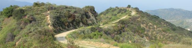
Fryman Canyon loop hike Wilacre Park Betty B. Dearing Trail Laurel Canyon Los Angeles Coldwater Canyon Tree People Hollywood Hills Studio City
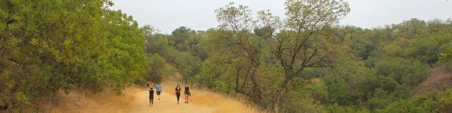
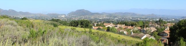
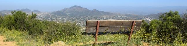
What to go for a hike but don't have time to leave Los Angeles? If you live near the Hollywood Hills or Studio City, Fryman Canyon may be the perfect place to get an hour of outdoor exercise. The 3-mile loop on Betty B. Dearing Trail passes through Wilacre Park in Lower Fryman Canyon and Coldwater Canyon Park, dishing out just 450 feet of elevation gain. The loop covers a variety of... Read more.
By: Published: Last updated: January 14, 2019
Emma Wood State Beach Campground Ventura County California RV camp camper camping
Want to beach camp in Ventura, California? For RV campers, the place to go is Emma Wood State Beach. The park offers 90 beachfront campsites, ocean fishing, a reliable surf break, and a 1.5-mile hiking trail loop. Ready for a beach escape? The campground in this 115-acre park is popular, booking up solid throughout the summer. The sites run along a cobblestone beach with easy access to... Read more.
By: Published: Last updated: February 5, 2025
Emma Wood State Beach hike Ventura County Ocean's Edge Trail River's Edge Trail Ventura River Estuary Seaside Wilderness Park
Emma Wood State Beach borders both the Pacific Ocean and the Ventura River. There is an estuary where the two meet, where you can sprawl out on soft sand and watch the gathering marine birds. See the beach, the river, and the estuary on a level and easy 1.5-mile loop through Emma Wood State Beach and the adjacent Seaside Wilderness Park in Ventura. Starting within the 115-acre state... Read more.
By: Published: Last updated: February 12, 2018
Beaudry Motorway Loop hike Tonga Peak Verdugo Mountains Trail Los Angeles
On the east end of the Verdugo Mountains between Glendale and Burbank, there is a scenic 6.15-mile loop on wide dirt service roads. North and South Beaudry Motorways circle past Tongva Peak and Mount Thom, which rise above the micro-range's eastern ridges. The high point of the loop, and a highlight of the hike, is a scenic overlook on the 2,656-foot summit of Tongva Peak. There are big... Read more.
By: Published: Last updated: December 7, 2018
Panorama Trail Yosemite National Park
Panorama Trail is a nearly 10-mile long point-to-point hike from the top to the bottom of Yosemite Valley. Starting at Glacier Point and ending at Happy Isles, the trail descends 3,200 feet and is filled with sensational views. You could not pick a more panoramic start for Panorama Trail than Glacier Point, a spectacular drive-up overlook atop the south wall of Yosemite Valley. The trail... Read more.
By: Published: Last updated: May 13, 2025
Angel Vista Rosewood Trail Thousand Oaks California
The boldly named Angel Vista is one of the top viewpoints in the Santa Monica Mountains, a coastal range running between Los Angeles and Ventura. Angel Vista soars over Thousand Oaks, presenting panoramic views of the west end of the range, which includes the Boney Mountains, the rocky crown of Santa Monicas. A few trails lead to the vista point, including the 7.6-mile round trip trek up... Read more.
By: Published: Last updated: January 10, 2018
Angel Vista West Los Robles Trail Thousand Oaks California hike
Los Robles Trail in Thousand Oaks crosses a chaparral-covered mountainside leading to Angel Vista, one of the premier overlooks on the north side of the Santa Monica Mountains. There are a few routes to the viewpoint, including this 7.6-mile round trip hike up the east end of West Los Robles Trail. The hike charts a steady course along a mountain slope, gaining 800 feet to reach the vista... Read more.
By: Published: Last updated: April 26, 2017
Montecito Peak hike Cold Springs Trail Santa Barbara California Montecito Mountain Summit Cold Spring
The Santa Ynez Mountains form a verdant backdrop behind Santa Barbara. One of the highest summits in the range is Montecito Peak, which offers sensational views over the coastal cities below and the Pacific Ocean beyond. The 3,214-foot peak can be reached via a demanding 7.1-mile round trip hike with 2,450 feet of elevation change. It is quite a trek, but the ever-expanding ocean views will... Read more.
By: Published: Last updated: April 26, 2017
Charmlee Wilderness Park hiking trail Malibu California Ocean overlook old ranch ruins Charmlee Hike
Charmlee Wilderness Park is perched on a bluff overlooking Malibu's alluring coast. Operated by the Mountains Recreation and Conservation Authority (previously the city of Malibu), this 590-acre park has eight miles of interwoven trails, making it easy to build your own hike between two to four miles, easy to moderate. In spring, Charmlee puts on a champion's display of wildflowers. The... Read more.
By: Published: Last updated: May 13, 2025
Johnson Ranch Open Space loop hike San Luis Obispo trail Johnson Ranch Trail
Johnson Ranch Open Space preserves 242 acres of old ranch land just south of San Luis Obispo. The 3.7-mile Johnson Ranch Loop explores the municipal open space, which is dominated by rolling grassy hills accented by serpentine rocks. A shortcut can be used to trim the hike to 2.5 miles. There is 200 feet of total elevation between the high and low points of the hike, a distance that is... Read more.
By: Published: Last updated: April 2, 2019