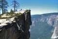
Glacier Point is probably the most incredibly viewpoint in Yosemite National Park (rivaled closely by Tunnel View), but it isn’t the only viewpoint along Glacier Point Road. Washburn Point is located 3/4 of a miles from the end of Glacier Point Road, south of Glacier Point. Its vistas are similar to Glacier Point, and since you have to pass Washburn Point to get out to Glacier Point, it’s definitely worth stopping for this added perspective of great Yosemite landscapes. Unless you don’t like amazing views…
From a parking area off Glacier Point Road, a flight of a couple dozen stone steps leads down to the best views from Washburn Point. As compared to Glacier Point, this is a shorter walk to the overlook, but a longer flight of steps.
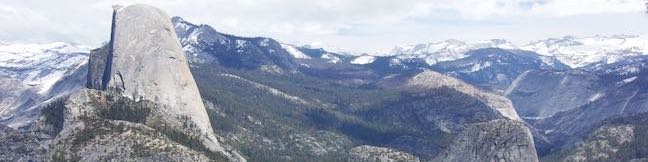
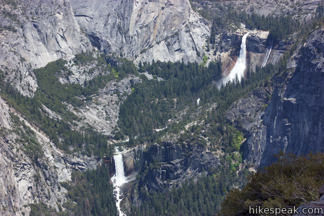
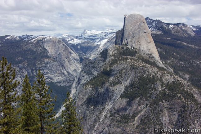
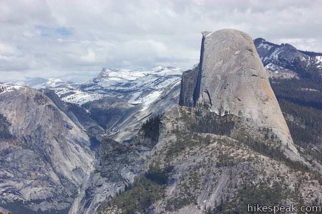
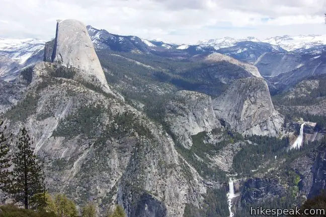
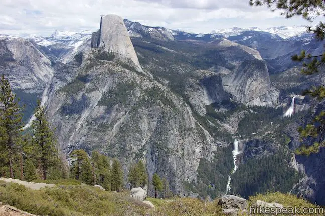
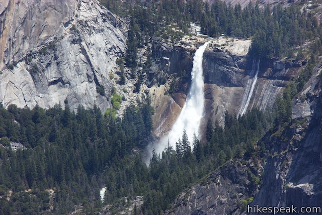
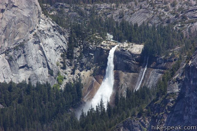
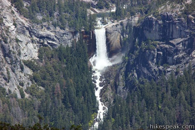
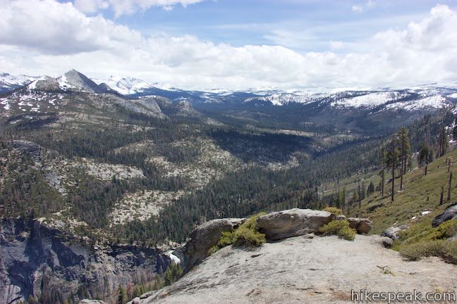
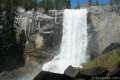
Glacier Point’s perspective of Half Dome is legendary, showcasing some of the sheer front face. Washburn Point has an almost exactly profile angle of Half Dome. Enjoy this unique side view of Half Dome and then look to the right, where Nevada Fall and Vernal Fall spill down the Merced River. Washburn Point is a bit more in line with these two waterfalls than Glacier Point, so the view of these stacked waterfalls is a little better (as observed by the National Park Service). Liberty Cap rises next to Nevada Fall, the upper of the two. Nevada Fall is 594 feet tall and Vernal Fall has a 317-foot single drop. Both can be visited along the Mist Trail. The two waterfalls do look fantastic from this perch.
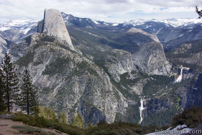
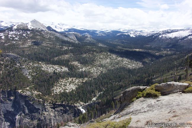
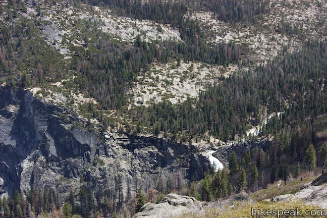
To the southeast, spot the top of Illilouette Falls, backed by higher peaks in the Clark Range. Panorama Trail can be seen zig-zagging up the forest slope on the far side of Illilouette Falls.
Unlike Glacier Point, Washburn Point does not have views over Yosemite Valley, so Yosemite Falls, for example, is not in view. Washburn Point is located at 7,450 feet, about 250 feet above Glacier Point, so the view is somewhat loftier.
A panel at the overlook offers this description of the Clark Range and the Merced River visible from Washburn Point:
Melting snow from the Clark Range and the Sierra Crest swells the Merced River and Vernal and Nevada Falls in spring and early summer. The range is named for Galen Clark (1814-1910), Yosemite’s first Guardian.
Galen Clark also the founder of Wawona Hotel by Wawona Meadow.
Glacier Point Road closes seasonally due to snow. The road usually closes in November and opens back up some time in May or early June. When the road is open, the drive out to Glacier Point and Washburn Point is definitely worthwhile. Check the status of road conditions before attempting the drive.
In the winter, Washburn Point can be visited on skis (and could be a good spot to turn around before the drop to Glacier Point). Washburn Point does not have any facilities, so continue on to Glacier Point for the bathrooms and gift shop. A park entrance fee is required to access Washburn Point in Yosemite National Park.
To get to Washburn Point: Take Wawona Road (Route 41) to the bottom of Glacier Point Road, about 9 miles south of Yosemite Valley and 17 miles from the south entrance. Turn east up Glacier Point Road and drive 14 1/4 miles to Washburn Point, which has a parking area on the right. The trailhead for Taft Point is 1 1/4 miles before Washburn Point and Glacier Point is located at the end of the road, 3/4 of a mile beyond Washburn Point.
Washburn Point address: Glacier Point Road, Yosemite National Park, CA 95389
Washburn Point coordinates: 37.7204, -119.5730 (37° 43′ 13.4″N 119° 34′ 22.8″W)
Use the map below to view the overlook and get directions:
Or view Sierra Nevada trails and campgrounds in a larger map

 | Taft Point Trail This 2-mile round trip hike visits an overlook on the south wall of Yosemite Valley with fascinating rock fissures carved into the exposed granite. |
 | Panorama Trail This nearly 10-mile long one-way hike travels from Glacier Point down to Yosemite Valley in the most scenic way possible. |
 | The Mist Trail to Vernal Fall and Nevada Fall This 1.8 to 6.1-mile hike takes an exciting course past two of Yosemite’s prize waterfalls. |
 | Half Dome This epic 16-mile hike climbs 4,800 feet on one of Yosemite’s most popular and most challenging trails. |
 | More trails in the Sierra Nevada Mountains Explore other destinations in Yosemite National Park and the rest of the range. |
 | Yosemite National Park Campgrounds Thirteen campgrounds with over 1,600 total sites are spread throughout the park to facilitate your visit, including Camp 4. |
 | Housekeeping Camp What’s not a hotel and not a campground? Housekeeping Camp offers a different type of lodging in the middle of Yosemite Valley. |

[…] first stopped at Washburn Point, thinking it was Glacier, and found it to be much less crowded than the final lookout. We were able […]