On the path to Half Dome, Yosemite’s most imposing bucket list hike, are two impressive waterfalls coursing down the Merced River. The Mist Trail provides the steepest most intimate experience of Vernal Fall and Nevada Fall. John Muir Trail takes a more gradual route to the top of Nevada Fall and is the most practical route for those continuing to Half Dome.
Day hikes on the Mist Trail come with a few good options:
- For a moderate 1.8-mile hike with 400 feet of elevation gain, turn around at the footbridge below Vernal Fall
- For more fun, hike 3.3 miles round trip to the top of Vernal Fall, tackling 1,000 feet of elevation gain that includes an unforgettable stretch of steep stone steps in the mist of the waterfall
- An ideal lollipop loop to the top of Nevada Fall involves hiking up the Mist Trail and down John Muir Trail, a 6.1-mile trek with 1,925 feet of elevation gain
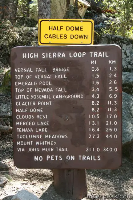
If those aren’t enough, get a permit, clear your schedule, and make the 16-mile 4,800-foot ascent on Half Dome. Another possible extension is the 10-mile one way hike up Panorama Trail to Glacier Point.
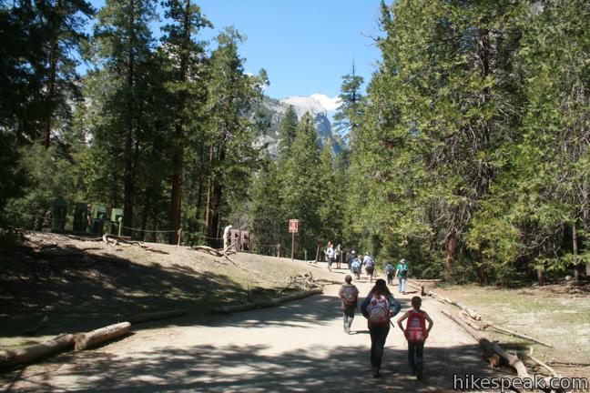
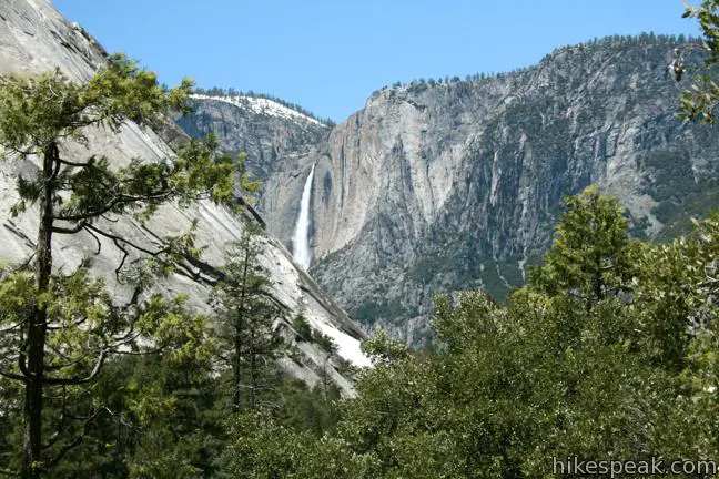
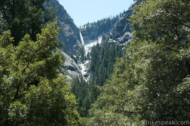
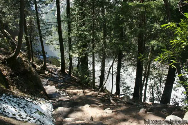
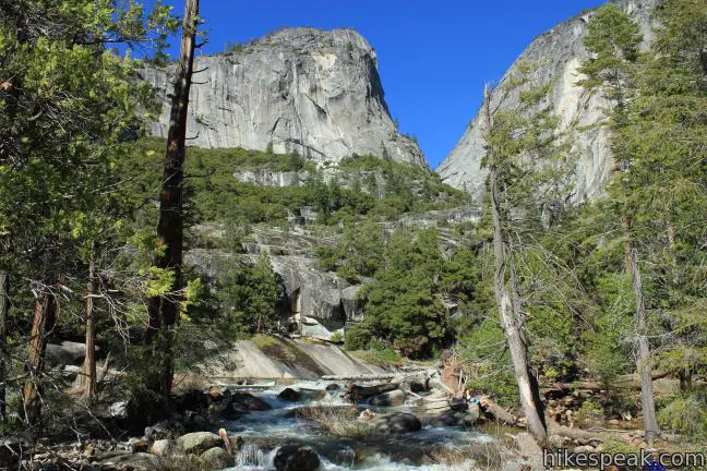
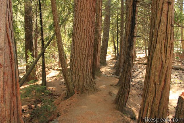
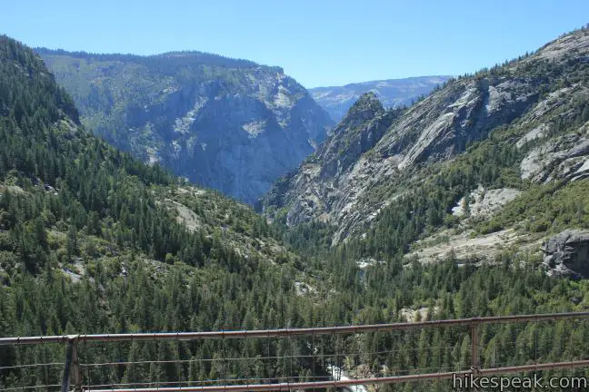
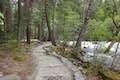
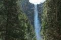
From Happy Isles Shuttle Stop near Curry Village, walk east across the bridge over the Merced River and turn right up the Mist Trail (passing the trail to the Happy Isles before crossing the bridge). The Mist Trail is a wide trail that is paved for the first 0.9 miles to the Vernal Fall Footbridge. Hike through a mixed forest dominated by California bays up to a ledge around a bend in the river shaped like a backward C. When the trail turn left, look back down the valley for a distant perspective of Upper Yosemite Fall. Another gleaming waterfall is just ahead. Illilouette Falls tumbles down a side canyon to the south.
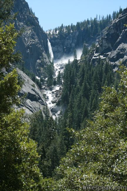
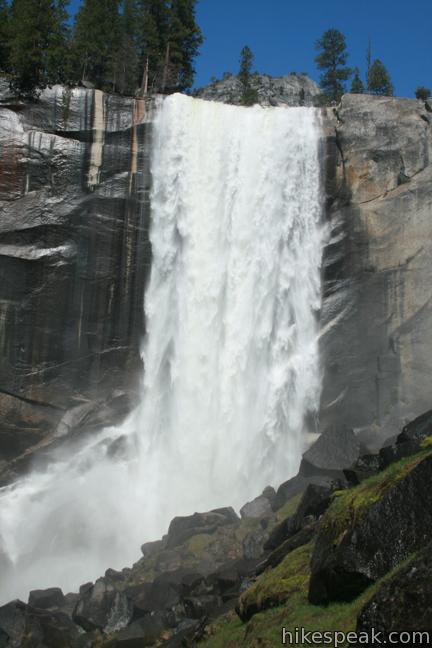
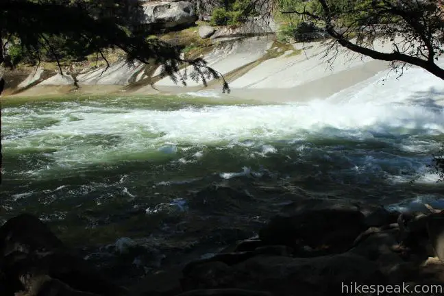
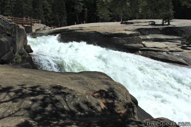
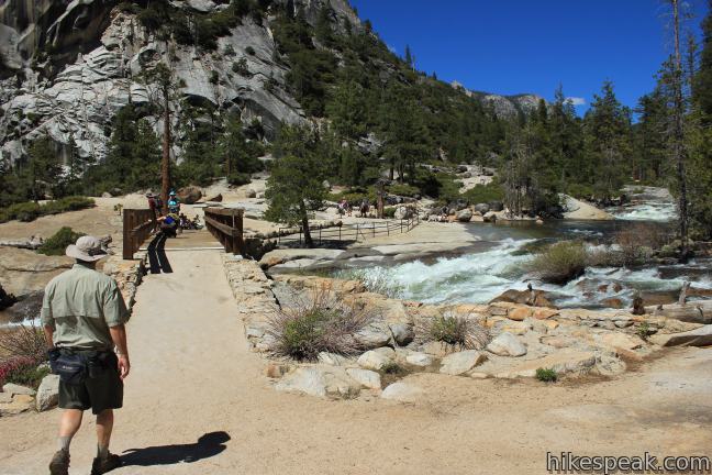
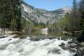
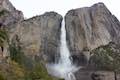
Since you can’t go more than half a mile on this trail without seeing a waterfall, you will quickly arrive at Vernal Fall Footbridge, with a view up the Merced River toward Vernal Fall.
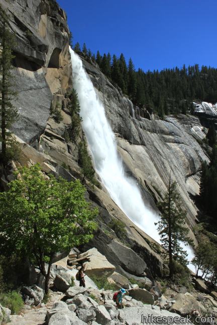
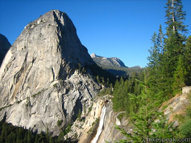
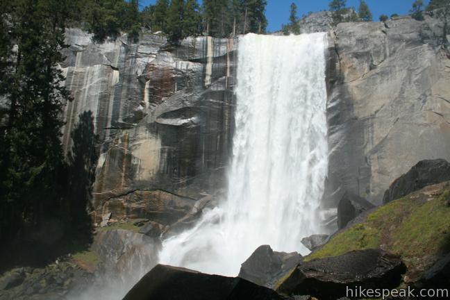
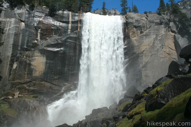
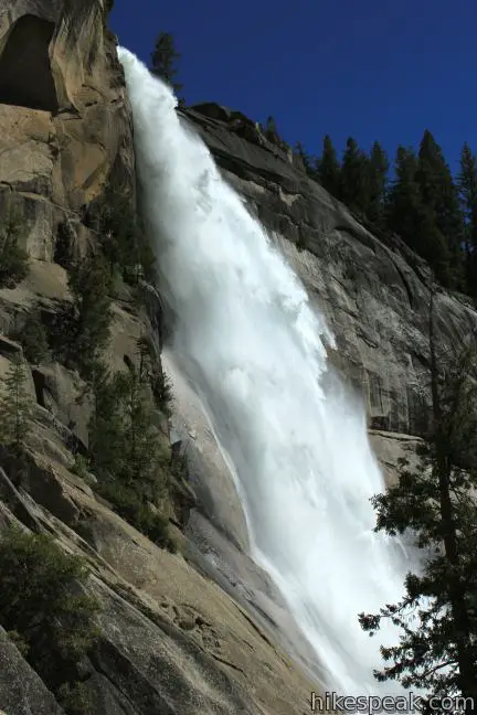
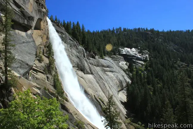
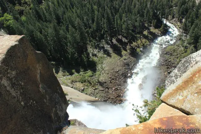
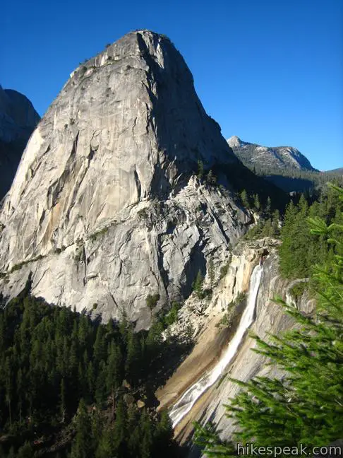
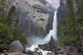
A million years ago, Vernal Fall and Nevada Fall were created by ice age glaciers. In areas where the bedrock showed weakness, glaciers spreading down the Merced River Valley dug away loose rock. The hard granite that remained formed steep cliffs, including the 317-foot drop of Vernal Fall and the 594-foot drop of Vernal Fall just upriver.
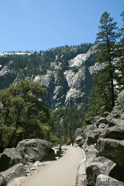
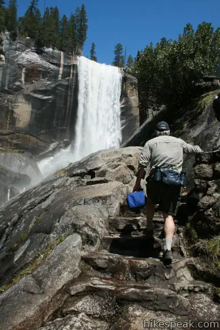
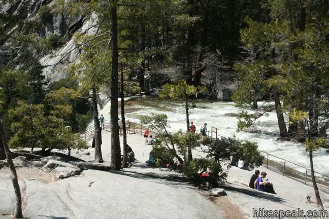
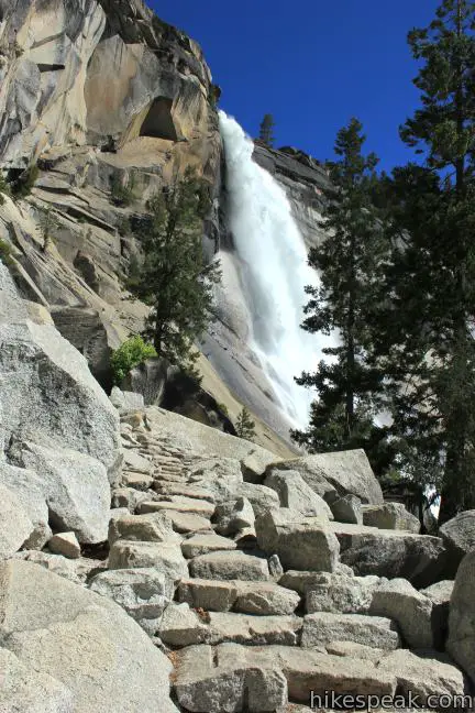
Cross Vernal Fall Footbridge and return to the forest to find drinking fountains and bathrooms. For an even better view of Vernal Fall, continue another quarter mile over gradual terrain to the bottom of the steps to the top of Vernal Falls.
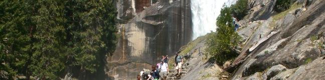
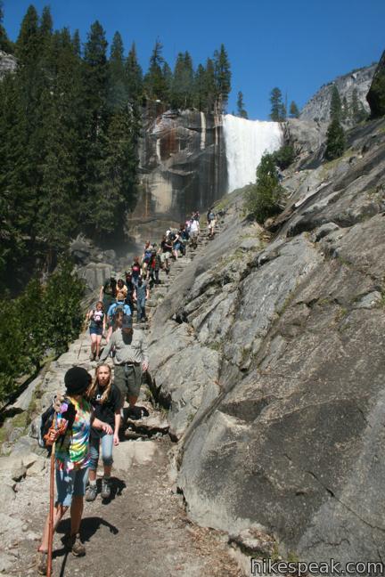
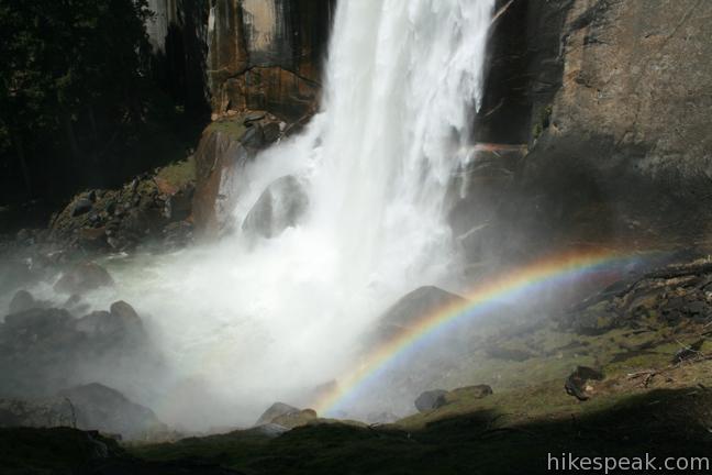
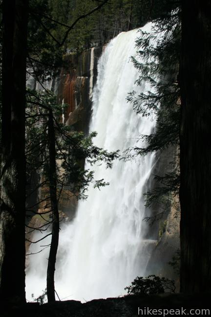
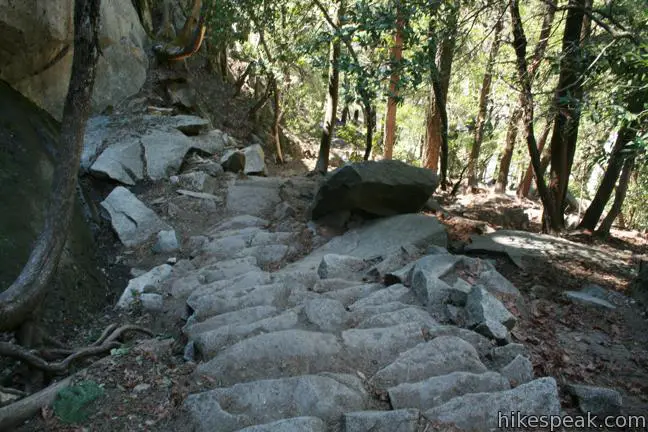
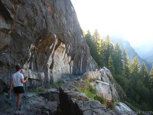
From here, the hike becomes strenuous. When the waterfall is at full blast in the spring, the Mist Trail is as cool and exciting a trek as you will find anywhere. It is amazing to be so close to such a powerful force of nature. Make your way up stone steps, pressing through gusts of refreshing spray to climb up the right side of the canyon. Reach a cluster of trees and climb a final staircase along a rock face even with the falls.
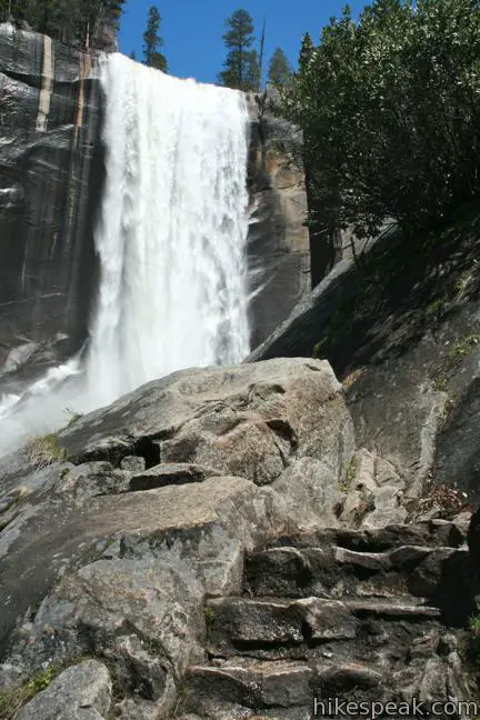
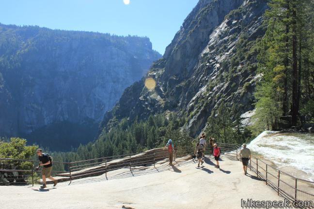
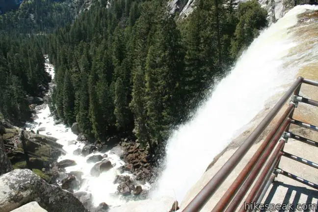
Leave the stairs and walk down a broad granite slab to a metal railing at an observation area next to the top of the falls. Take in an up-close perspective of the rushing water. The hikers on the trail below look tiny from the top of this thundering waterfall.
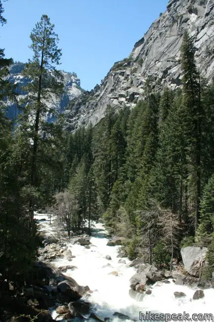
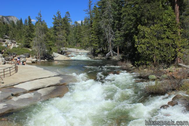
To continue to Nevada Fall, follow the trail along the right side of Emerald Pool, a wide stretch of the Merced River between the waterfalls. Pass another bathroom, and a junction with a connector trail heading up the John Muir Trail at Clark Point. Take a bridge across the Merced River above Emerald Pool and a slickrock cascade called the Silver Apron. Leave the water and cross through a pine forest, eventually returning to the river near the base of Nevada Fall. Embark up more stone steps to the left of Nevada Fall just below a massive granite dome named Liberty Cap.
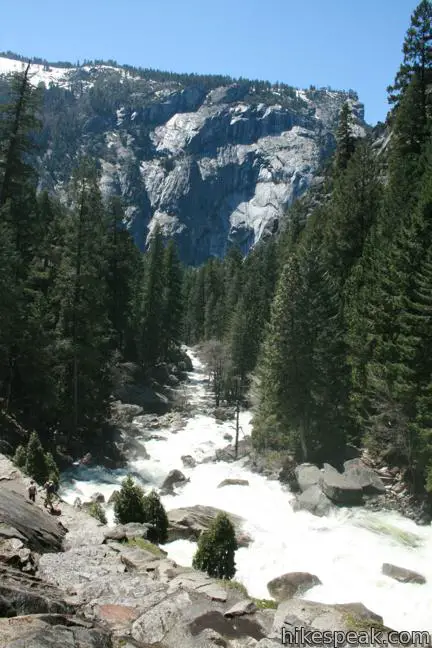
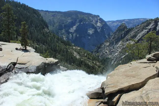
Mist Trail is a punishing but majestic climb. At the top of the Mist Trail (by another bathroom), turn right on John Muir Trail (Half Dome is to the left) and hike a quarter mile to the top of Nevada Fall. Sit beside the pool above the waterfall or venture down to an overlook alongside the brink of the waterfall.
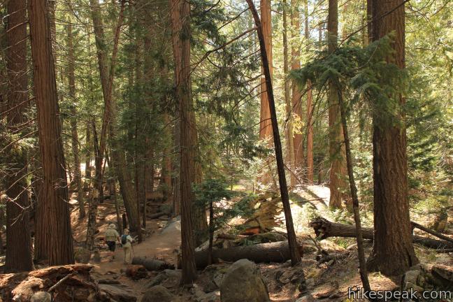
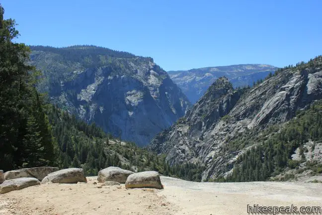
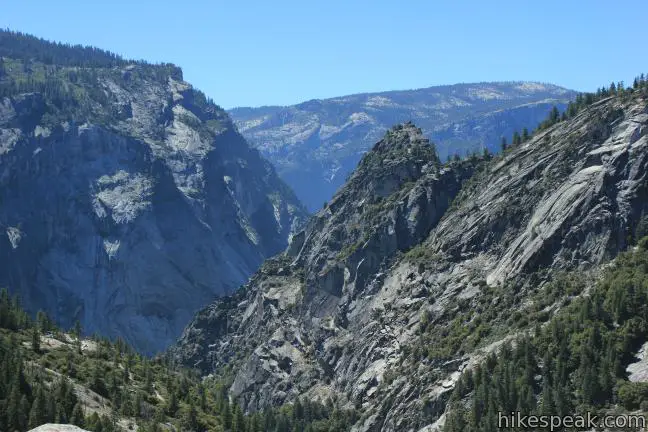
To loop back to the trailhead via John Muir Trail, leave the fine perch by cross a wooden bridge just above the 594-foot waterfall. Take John Muir Trail south through a pine forest on the edge of the bowl hollowed out by Nevada Fall. This stretch of the trail has excellent views of Nevada Fall and the Liberty Cap dome.
Follow an impressive stone walkway along the edge of the canyon to reach Clark Point. Turn right to descend to Emerald Pool if you wish to repeat the bottom of the Mist Trail alongside Vernal Fall. Otherwise, progress down a long series of switchbacks to the trail junction below Vernal Fall.
The Mist Trail – John Muir Trail Loop provides a memorable excursion in Yosemite National Park past two prize waterfalls. Check for trail closures that might affect your hike in the winter. There are numerous places to enjoy a picnic lunch along the trail. No permit is required to hike to the falls, but one is now required to hike to the top of Half Dome. Another great hike is to take a bus up to Glacier Point and hike Panorama Trail down to the Mist Trail. An entrance fee is charged to reach the trailhead in Yosemite National Park.
The basic directions for the Mist Trail – John Muir Trail Loop are:
- Cross Vernal Fall Footbridge (0 miles)
- Stay left on Mist Trail past John Muir Trail (1.05 miles)
- Reach the brink of Vernal Fall (1.65 miles)
- Come to the top of Mist Trail and turn right toward Nevada Fall (2.9 miles)
- Stand at the brink of Nevada Fall (3.1 miles)
- Cross the bridge over Merced River and continue on John Muir Trail (3.15 miles)
- Stay to the right by the bottom of Panorama Trail (3.4 miles)
- Cross Clark Point above a connector trail down to Mist Trail (4.3 miles)
- Continue down John Muir Trail to a junction with Mist Trail and turn left (5.05 miles)
- Cross Vernal Fall Footbridge (5.2 miles)
- Return to the trailhead (6.1 miles)
Directions to the Trailhead
- Drive into Yosemite Valley and park at Curry Village or another available parking area near Yosemite Village.
- Take the free park shuttle to the Happy Isles Shuttle Stop and walk across the Merced River to the start of the Mist Trail.
Trailhead Location
Trailhead address: Happy Isle Loop Road, Yosemite National Park, CA 95389
Trailhead coordinates: 37.732178, -119.558036 (37° 43′ 55.84″N 119° 33′ 28.92″W)
View Yosemite National Park in a larger map
Or view a regional map of surrounding Sierra Nevada trails and campgrounds.


 | Half Dome This epic 16-mile hike climbs 4,800 feet on one of Yosemite's most popular and most challenging trails. |
 | Happy Isles This easy 0.75-mile hike explores a pair of islands in the Merced River at the east end of Yosemite Valley. |
 | Panorama Trail This nearly 10-mile long one-way hike travels from Glacier Point down to Yosemite Valley in the most scenic way possible, ending with the Mist Trail. |
 | Mirror Lake This 2 to 2.8-mile hike visits a reflective pool on the east end of Yosemite Valley. |
 | Lower Yosemite Fall Trail This 1.2-mile hike delivers visitors to the base of the tallest waterfall in North America. The experience is not to be missed. |
 | Yosemite Falls Trail This 3.5 to 7.1-mile hike rises from Yosemite Valley past Columbia Rock to unforgettable views of Upper Yosemite Fall. |
 | Bridalveil Fall Trail This easy paved half-mile trail visits the base of a 620-foot single-drop waterfall on the south side of Yosemite Valley. |
 | More trails in the Sierra Nevada Mountains Explore other destinations in Yosemite National Park and the rest of the range. |
 | Yosemite National Park Campgrounds Thirteen campgrounds with over 1,600 total sites are spread throughout the park to facilitate your visit. |
 | Housekeeping Camp What's not a hotel and not a campground? Housekeeping Camp offers a different type of lodging in the middle of Yosemite Valley. |
Common Questions about The Mist Trail to Vernal Fall and Nevada Fall in Yosemite National Park
- Is the trail open?
- Yes. You should expect to find that Mist Trail is open. There are no recent reports of trail closures. If you discover that the trail is closed, please help your fellow hikers by reporting a closure.
- Do I need a permit for this hike?
- Yes. National Park Entrance Fee.
- How much time does this hike take?
- It takes approximately 3 hours 45 minutes to hike Mist Trail. Individual hiking times vary. Add extra time for breaks and taking in the views.
- How long is this hike?
- The hike to Mist Trail is a 6.1 mile out and back / loop with 1925 feet of elevation change.
- Are dogs allowed on this trail?
- No, dogs are likely not allowed on Mist Trail. The trail is primarily open to hikers.
- Will I see a waterfall on this hike?
- Yes, Mist Trail features a waterfall.
- Where is the trailhead located?
- The trailhead for Mist Trail is located in Yosemite National Park, CA.
Trailhead Address:
Happy Isle Loop Road
Yosemite National Park, CA 95389
Trailhead Coordinates:
37.732178, -119.558036 - What are the driving directions to the start of the hike?
To get to the trailhead: Drive into Yosemite Valley and park at Curry Village or another available parking area near Yosemite Village. Take the free park shuttle to the Happy Isles Shuttle Stop and walk across the Merced River to the start of the Mist Trail.
View custom Google Maps directions from your current location.
- Are there other trails near Mist Trail?
- Yes, you can find other nearby hikes using the Hikespeak Hike Finder Map.

7 Comments on The Mist Trail to Vernal Fall and Nevada Fall in Yosemite National Park
What hikers are saying:
✨ Generated summary of user commentsThis trail offers an exciting adventure through Yosemite National Park, where visitors find the scenery amazing and consider it a favorite part of their journey. Unique sights like a rectangular-shaped tree trunk near Nevada Falls add to the memorable experience. Marilyn warns, stay away from the water to avoid the risk of being swept away.
“It was amazing.” Jump to comment ↓
I hiked up to half dome when I was in college! This was my favorite part of the hike.
Hi!
I’m planning hiking JMT = 05/28/2015 to 06/15/2015. I’m petite woman 5.2 height, 100 pounds. I’ve done a lot research, reading books, blogs, purchasing maps, watching videos, using google earth 3D, etc. However, I haven’t get a clear answer about crossing creeks or streams at JMT.
Are any serious (deep, dangerous)creek/stream from Happy Isles to Red’s Meadow Resort? The Shadow Creek and Shadow Bridge (from pictures) are a concern to me. Could you please let me know if I’ll have trouble crossing Shadow Creek or ANY OTHER creek or stream along JMT trail from HAPPY ILSES to RED’S MEADOW during May 28/2015 to June 15/2015? Considering my height/weight and carrying a 40 pounds backpack too?
How cold (average) will be during the night considering the time of the year? May28 to June 25/2015
Please!!!! Help me with your answers!! Thank you so much! Sincerely, Nayara Jones
Hi Nayara. I am also in the 5’2″ club (a little shy of) and hiked down the JMT from Half Dome (went up via the Mist Trail). There is no crossing of the river other than over bridges. No one should go anywhere near the water as those who do risk being swept away.
Has anyone taken a photo of that tree on top of Nevada Falls (near the falls) that is growing out of a crevice with a rectangular-shaped rather than round-shaped trunk? If so, I’d like to see your photograph. It was amazing.
I see hiking as the most exciting part of adventure. And too in YNP. Anyway, great tips ahead.
Has anyone taken a photo of that tree on top of Nevada Falls (near the falls) that is growing out of a crevice with a rectangular-shaped rather than round-shaped trunk?
We are planning on hiking the mist trail john Muir loop this Saturday oct 18- just checking to make sure the Trails are open and if we need a permit to hike this part of the JMT- please let me know thank u