Westridge Trail to San Vicente Mountain
in the Santa Monica Mountains
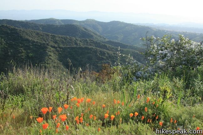
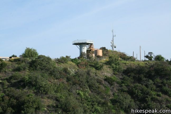
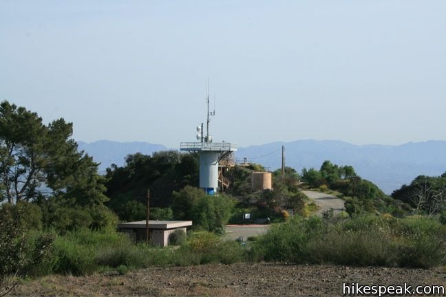
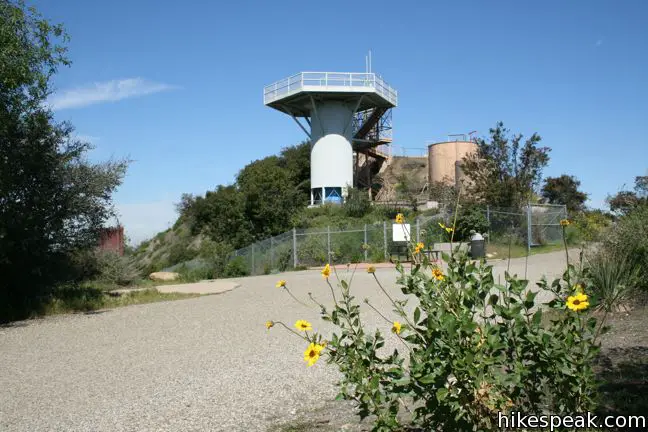
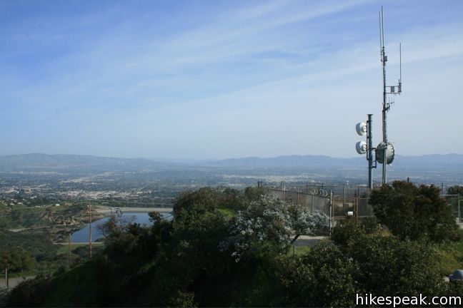
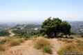
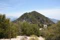
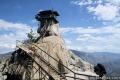
In the 1950s, San Vicente Mountain served as a mountaintop military installation to defend Los Angeles from soviet missile attacks. Today, the 1,960-foot peak provides visitors with a look back at this chapter in the city’s history, along with a great view of West LA and the Santa Monica Mountains.
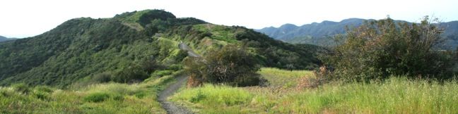
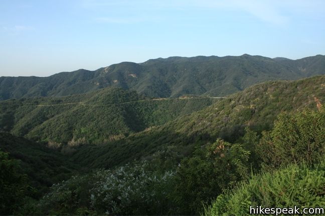
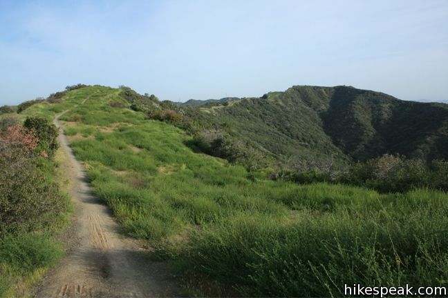
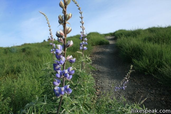
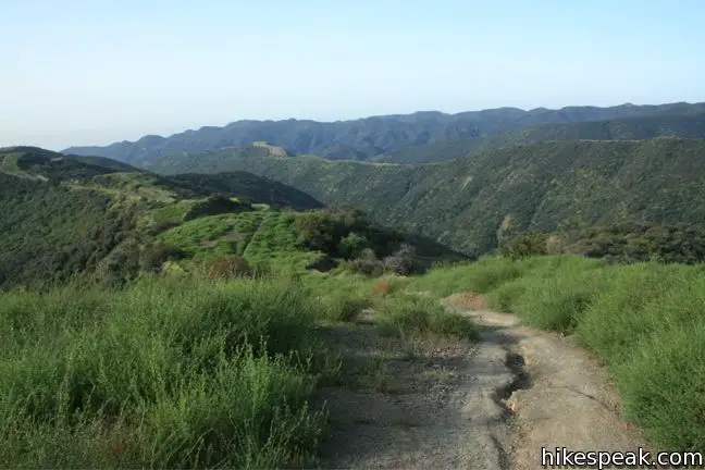
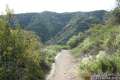
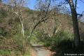
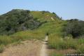
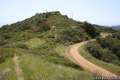
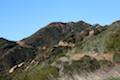
Westridge Fire Road leads to San Vicente Mountain and is a popular path for mountain bikers, trail runners, and dog walkers (dogs are permitted off-leash in Westridge-Canyonback Wilderness Park under their owner’s supervision). A single-track trail runs parallel to the fire road, exploring the ups and down of the top of the ridge, and offering an enjoyable alternative for hikers. It is easy to switch back and forth between the two routes on this 7.4-mile round trip hike with 730 feet of elevation gain.
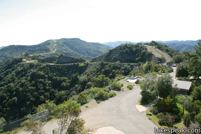
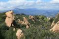
From the top of Westridge Road, Westridge Fire Road (also called Westridge Trail and West Mandeville Fire Road) leaves a bountiful Brentwood neighborhood and heads north, weaving along the west side of the ridge. To the southeast, Downtown LA and Century City rise above the skyline. To the west, the trail overlooks Sullivan Canyon and the opposing Sullivan Ridge, where hikers can be seen along Sullivan Ridge Fire Road.
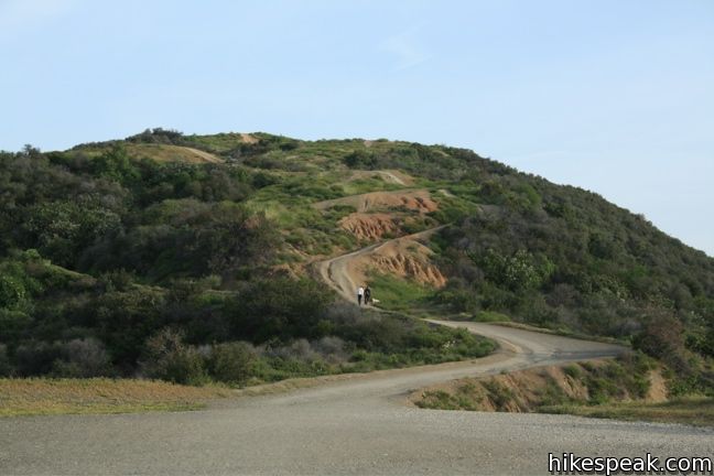
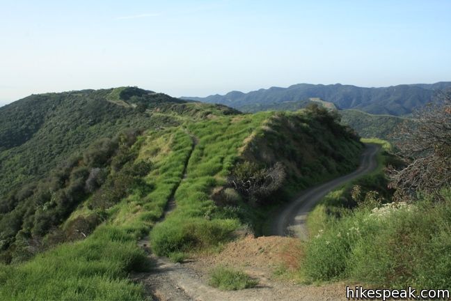
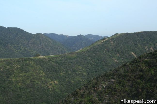
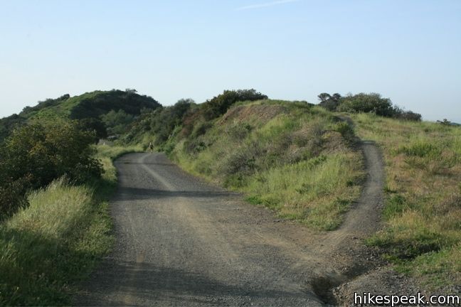
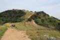
Westridge Trail climbs gradually through Westridge-Canyonback Wilderness Park. There are no confusing junctions to worry about along the way, allowing you to enjoy the vast scenery. Three-quarters of a mile from San Vicente Mountain, the old lookout tower comes into view. A quarter mile later, a DWP road joins Westridge Fire Road, coming up from Mandeville Canyon to the east (an alternate route to the summit). Enter San Vicente Mountain Park and continue half a mile along the spine of the ridge to reach the peak.
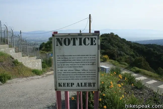
Like Mount Disappointment in the San Gabriel Mountains and White Point on the Palos Verdes Peninsula, San Vicente Mountain was used as a Nike missile defense site during the cold war to detect and intersect Russian missiles directed at Los Angeles.
After a decade, Nike missiles were made obsolete by long-range technology, but the Santa Monica Mountains Conservancy has done an excellent job preserving this old site, adding informative panels to keep this history alive.
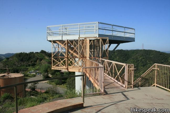
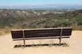
The summit remains wrapped in fencing, but in spite of its history, San Vicente Mountain is a very peaceful spot. There are several benches and tables spread out around the old buildings, along with restrooms and a water fountain, making San Vicente Mountain perfect for a picnic.
North of the old installations is an unpaved section of Mulholland Drive, which allows hikers to reach San Vicente Mountain from other points of entry. Residents of the valley can hike to the peak from a trailhead at the southern end of Reseda Boulevard and those traveling the 405 can exit at Skirball Center Drive, head west on Mulholland Drive till the pavement ends, and hike one miles to San Vicente Mountain via unpaved Mulholland Drive (the shortest route to the summit).

After enjoying San Vicente Mountain, return the way you came to complete this 7.4-mile hike with 730 feet of elevation gain. Dogs and mountain bikes are welcome. No fee or permit is required, so get out and enjoy!
To get to the trailhead: From Sunset Boulevard, 2.3 miles west of the 405, turn north at the light onto Mandeville Canyon Road. After 1/3 mile turn left onto Westridge Road. Drive uphill on Westridge Road for 2.3 miles to road’s end. There is parking at the trailhead and along the road outside the park.
Trailhead address: Westridge Road & West Mandeville Fire Road, Los Angeles, CA 90049
Trailhead coordinates: 34.08542, -118.50894 (34° 05′ 07.51″N 118° 30′ 32.18″W)
(Westridge Fire Road is in Purple.)
View Santa Monica Mountains in a larger map
Or view a regional map of surrounding Los Angeles trails and campgrounds.


 | Mulholland Drive to San Vicente Mountain This 2-mile hike approaches the peak from the east and offers views to the north and south en route to the old Nike Missile site. |
 | Mandeville Canyon to San Vicente Mountain Loop This 5-mile hike incorporating a few trails, taking a DWP road up to Westridge to visit San Vicente Mountain, before crossing Mulholland Drive and Canyonback Ridge to return to Mandeville Canyon via Hollyhock Fire Road. |
 | Lower Canyonback Trail This 4.2 mile hike ascends Canyonback Ridge from Kenter Avenue in Brentwood to the Mountain Gate Country Club Estates. |
 | Upper Canyonback Trail This 3 mile hike descends Canyonback Ridge from Mulholland Drive to the Mountain Gate Country Club Estates. |
 | Sullivan Canyon This 8.5-mile round trip hike follows a wide trail up the center of a sycamore-filled canyon. |
 | Sullivan Ridge A prominent lone-standing Live Oak along Sullivan Ridge makes a natural turnaround point and a 7.5 to 8.3 mile round trip hike. |
 | Temescal Canyon This 2.6-mile loop offers a variety of scenery and decent exercise, despite its relative brevity. |
 | Murphy Ranch This 3.85-mile loop descending from Sullivan Ridge Fire Road into Rustic Canyon to abandoned buildings that had unusual occupants. |
 | Caballero Canyon Trail This 3.4-mile round trip hike ascends a canyon on the north side of the Santa Monica Mountains with views over the San Fernando Valley. |
 | More trails in the Santa Monica Mountains Explore other destinations in the range. |
 | San Gabriel Peak from Mount Disappointment Fire Road This 6,161 foot peak is reachable via a 4-mile round trip hike from Mount Disappointment Fire Road. |
 | Temescal Peak This 5.8 to 7.6-mile hike ascends Temescal Ridge to a summit with sweeping views over Topanga State Park and the Santa Monica Mountains. |
 | Stunt High Trail to Saddle Peak This 7.5-mile hike combines Stunt High Trail and a section of the Backbone Trail to visit the 6th tallest summit in the Santa Monica Mountains. |
 | Calabasas Peak This 3.6-mile hike travels an easy-to-follow fire road, climbing 900 feet to panoramic views of the Santa Monica Mountains and San Fernando Valley. |
 | Needles Lookout in Giant Sequoia National Monument This 5-mile hike visits a fire tower with unbeatable views of the region. |
Nice write up.
I hiked the 7.4mi Westridge Fire Road to San Vicente Peak and the Nike missile center. When I got to the top the 1 mi section of Mulholland Drive, mentioned here, on the other side was open to drive all the way to the site. The road is closed after dark.
[…] hike is the Westridge Trail to San Vicente Mountain. In the 1950’s, San Vicente Mountain served as a mountain top military installation to defend […]
My boyfriend and I took our two dogs to this trail yesterday and it was, by far, the best hiking experience we’ve had off leash with our pups. So many other fellow responsible dog owners with their pups off leash and all getting along beautifully! Pit bulls, terrier mixes, shepherds, collies–ALL off leash and having a great time getting exercise in the fresh air of the Santa Monica Mountains. Definitely our new favorite hiking trail!
dogs off leash by karen
*WARNING* – my dog was bitten by a baby rattlesnake on Sat. 29 Mar 2014 on this hike. It would seem that rattlesnake season is starting early this year. Be careful with your dogs!!!
Hey DG, I was thinking about taking my dog hiking here this weekend but am concerned about rattlesnakes. Was your dog on or off the trail and on or off leash?
A great trail marred by irresponsible dog owners who don’t clean up after their pets: The single track is literally an open sewer in sections – easily the worst in LA. Judging by the expensive vehicles parked in the lot, bourgeois westsiders are used to their maids cleaning up.
The dog poop issue is mostly in the first mile or less. Great place to take dogs off leash, and a really pretty hike. Not very challenging perfect for someone who wants something a bit longer and tougher than a beach hike.
Which is the highest altitude around San Vicente Mountain and Westridge area? And high high, it said 730 ft but everywhere?
Temescal Peak is the highest around this area at 2,126 feet, but the summit isn’t especially prominent.
beware, young rattlesnakes are present. My dog just got bit by one.
I hiked the ridge trail in and the fire road out. Despite the heat, it was a great hike and the destination was just wonderful. I could have spent quite a bit of time at the top of the missile site, just taking in the 360 view. Very peaceful as noted. And the ridge trail is a great workout! (But I do wonder .. are all the little poop baggies really better for the environment than using a stick and pushing your dog’s doo off the trail? Or picking up the colorful little bags on the way bag? If I allowed my children to leave behind so much garbage, I do believe there would be a few complaints.
We moved out of Los Angeles a few years ago but come back periodically.This time on our return we hiked at Westridge and saw so many piles of dog poop. We even saw a girl who let her dog poop and then just walked away. What’s wrong with you people, you keep it up eventually they’re going to charge you a fee to come in and hike along that trail. The problem is not the dogs it’s the people. People ignoring the rules, then you start whining and complaining when fees are imposed. Overcrowded and over irresponsible. Pick up your dog’s poop. If you’re fit enough to come to the trail then you are fit enough to bend over with a bag and pick up your pile of dogshit. Soon people who come without dogs will look at people with dogs as being irresponsible and then you’ll be stereotyped even though you may not be one of those irresponsible idiots. If this continues the outcome will not be pretty.
[…] Seco Trail, the Altadena Crest Trail and the Eaton Canyon Trail, or take in the ocean view at Westridge Trail. We’ve got more options here. Make sure to do your research online first, because some trails, […]