Rivas Canyon
in the Santa Monica Mountains
Rivas Canyon lies between Will Rogers State Park and Temescal Gateway Park. Rivas Canyon Trail crosses the ridge east of Temescal Canyon and travels down rustic Rivas Canyon to connect the two parks on a single-track that is 2.1 miles from end to end with 480 feet of elevation between the high and low points of the trail.

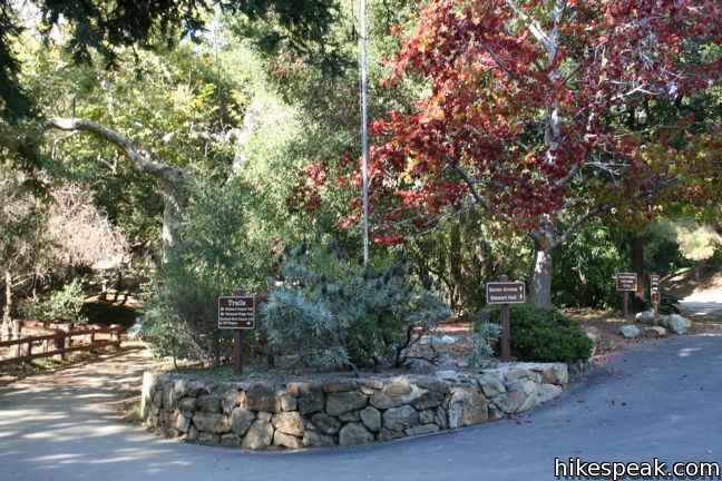
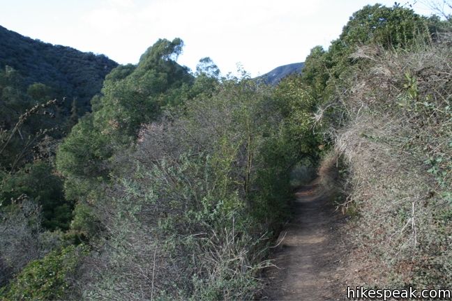
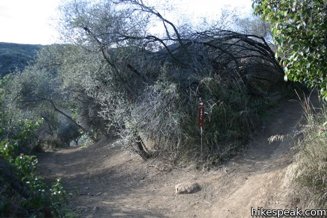
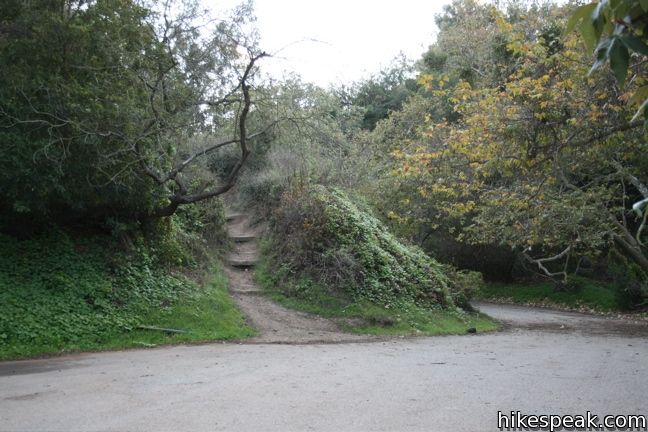
This scenic trail can be accessed from both parks. To reach the trail from the west end at Temescal Gateway Park, first walk 0.15 miles north of the entrance up Temescal Canyon Trail. This is the main road in the center of the canyon. Look for a dirt single track on the right labeled Rivas Canyon. Turn right and begin hiking up the east side of the canyon. The trail climbs chaparral-covered slopes up a ridge protruding into Temescal Canyon. Saplings arch over the trail to provide intermittent shade. A quarter mile up, continue right through a junction, following the sign for Rivas Canyon.
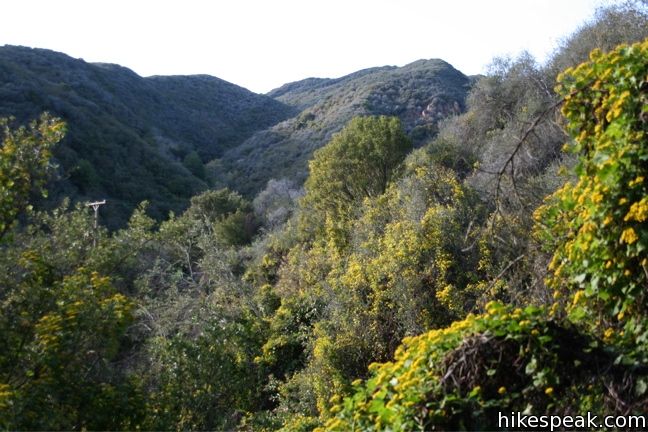
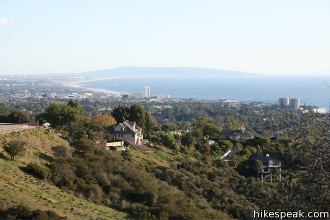
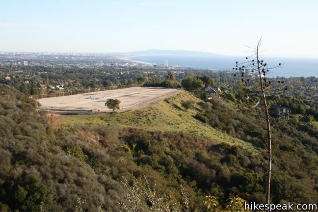
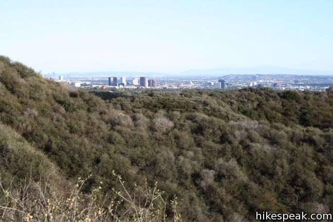
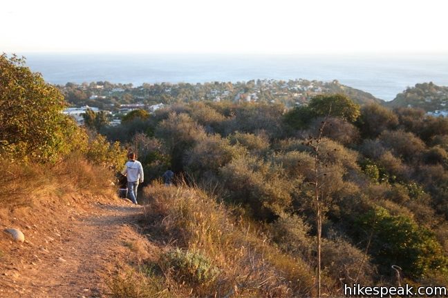
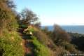
Half a mile above the canyon floor, the trail gains the ridge, rewarding hikers with excellent views over the Pacific Ocean, Santa Monica Bay, and Palos Verdes Peninsula. This is a perfect place to watch the sunset if you happen to be hiking (back) this way at that time.

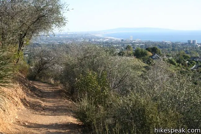
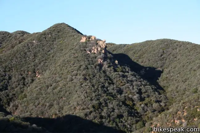
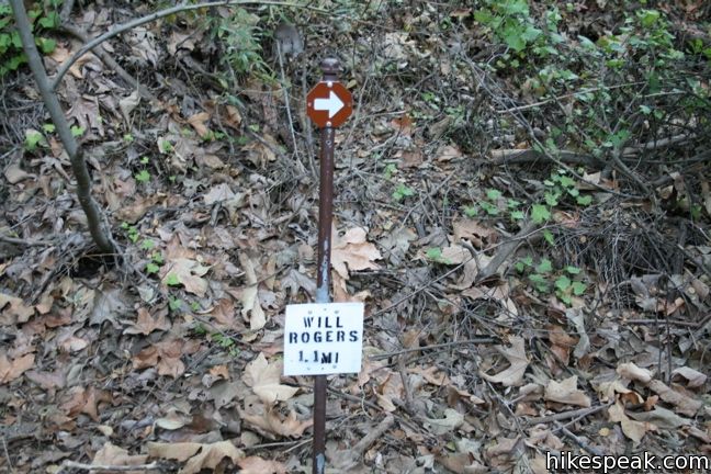
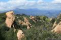
Progress east across the ridge, reaching a high point of 780 feet before descending 300 feet into Rivas Canyon over half a mile of switchbacks. The ivy-covered slopes lead to a junction at the canyon bottom. Turn right following a sign that reads, “WILL ROGERS 1.1 MI.”
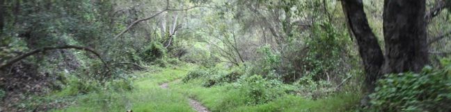
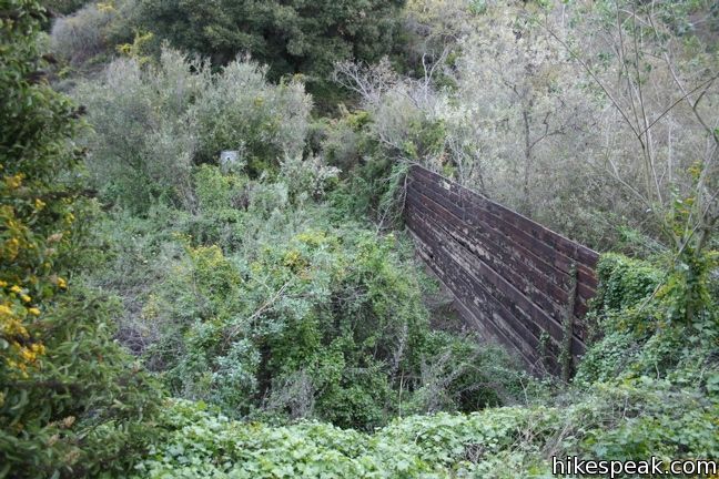
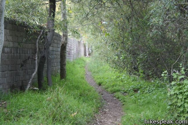
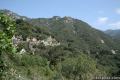
The easy-to-follow single track progresses southward down the lush, secluded bottom of Rivas Canyon through a thriving oak woodland. Cross a patch of tall sycamores before coming to the edge of a Pacific Palisades neighborhood lower in the canyon. The trail passes alongside a brick wall that leads to the paved cul-de-sac at the top of Rivas Canyon Road. Across the road, Rivas Canyon Trail continues another 0.2 miles up to Will Rogers State Park. If you are headed back to Temescal Canyon, feel free to turn around here; make your way back up Rivas Canyon and over the ridge, creating a 3.8-mile round trip hike with 480 feet of elevation between the top of the ridge and the bottom of the canyon.
A fee is charged for parking within Temescal Gateway Park at $12 per vehicle (Price as of 2024), but there is free street parking outside the park. Those who park in the lot should exercise caution passing through the intersection with the camera that issues tickets to those who do not come to a full stop.
Directions to the Trailhead
Temescal Gateway Park Trailhead:
- You'll find Temescal Gateway Park at the north end of Temescal Canyon Road at the intersection with Sunset Boulevard, one mile from PCH.
- Free parking is located along Temescal Canyon Road and Sunset Blvd and pay parking inside the park.
Will Rogers State Park Trailhead:
- Take Sunset Boulevard to Will Rogers State Park Road, located 4.5 miles west of the 405 and three miles east of PCH.
- At the light, turn north on Will Rogers State Park Road.
- Drive 3/4 of a mile up the mountainside to the park entrance.
- Pull past the gate and park in the lot on the left.
Trailhead Location
Trailhead address: Temescal Gateway Park, Sunset Boulevard & Temescal Canyon Road, Pacific Palisades, CA 90272
Trailhead coordinates: 34.055895, -118.528326 (34° 03′ 21.22″N 118° 31′ 41.97″W)
Trailhead address: Will Rogers State Park Trailhead, 1501 Will Rogers State Park Road, Pacific Palisades, CA 90272
Trailhead coordinates: 34.054774, -118.510087 (34° 03′ 17.18″N 118° 30′ 36.31″W)
View Santa Monica Mountains in a larger map
Or view a regional map of surrounding Los Angeles trails and campgrounds.


 | Temescal Canyon This 2.6-mile loop offers a variety of scenery and decent exercise, despite its relative brevity. |
 | Skull Rock This 1.5-mile hike descends Temescal Ridge to a head-shaped formation with great views over Santa Monica Bay. |
 | Santa Ynez Falls This 2.5-mile follows a shaded creek to a gorge containing a short waterfall. |
 | Parker Mesa Overlook This steep out-and-back hike rewards the effort with excellent views of the Pacific Ocean. |
 | Los Liones Trail This hike visits a lust canyon with ocean views, a potential start of the hike to Parker Mesa Overlook. |
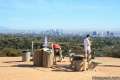 | Inspiration Point This easy 2.25-mile loop in Will Rogers State Historic Park leads to an overlook with views from Santa Monica Bay to downtown LA. |
 | Murphy Ranch This 3.85-mile loop descending from Sullivan Ridge Fire Road into Rustic Canyon, where hikers can visit abandoned buildings with unusual occupants. |
 | More trails in the Santa Monica Mountains Explore other destinations in the range. |
 | Saddle Peak from Stunt High Trail This 7.5-mile hike combines Stunt High Trail and a section of the Backbone Trail to visit the 6th tallest summit in the Santa Monica Mountains. |
 | Zuma Canyon Ocean View - Canyon View Trails Loop This 3.1-mile loop demands more effort than Zuma Canyon Trail and provides great ocean and canyon views. |
 | Talepop Loop This 4.75-mile hike climbs 500 feet over a scenic mountain between Liberty Canyon and Las Virgenes Canyon on the north end of Malibu Creek State Park. |
 | Santa Anita Canyon Loop This 9.5-mile loop visits two peaceful creeks in sylvan canyons, passing a 60-foot waterfall and plenty of beautiful wilderness. |
Common Questions about Rivas Canyon in the Santa Monica Mountains
- Is the trail open?
- Yes. You should expect to find that Rivas Canyon Trail is open. There are no recent reports of trail closures. If you discover that the trail is closed, please help your fellow hikers by reporting a closure.
- Do I need a permit for this hike?
- Yes. Park Entrance Fee.
- How much time does this hike take?
- It takes approximately 2 hours to hike Rivas Canyon Trail. Individual hiking times vary. Add extra time for breaks and taking in the views.
- How long is this hike?
- The hike to Rivas Canyon Trail is a 4.2 mile out and back with 480 feet of elevation change.
- Are dogs allowed on this trail?
- No, dogs are likely not allowed on Rivas Canyon Trail. The trail is primarily open to hikers.
- Are there ocean views on this hike?
- Yes, Rivas Canyon Trail offers views of the ocean.
- What mountain range is this trail in?
- Rivas Canyon Trail is located in the Santa Monica Mountains.
- Where is the trailhead located?
- The trailhead for Rivas Canyon Trail is located in Pacific Palisades, CA.
Trailhead Address:
Sunset Boulevard & Temescal Canyon Road
Pacific Palisades, CA 90272
Trailhead Coordinates:
34.055895, -118.528326 - What are the driving directions to the start of the hike?
To get to the trailhead: Temescal Gateway Park Trailhead: You'll find Temescal Gateway Park at the north end of Temescal Canyon Road at the intersection with Sunset Boulevard, one mile from PCH. Free parking is located along Temescal Canyon Road and Sunset Blvd and pay parking inside the park.
Will Rogers State Park Trailhead: Take Sunset Boulevard to Will Rogers State Park Road, located 4.5 miles west of the 405 and three miles east of PCH. At the light, turn north on Will Rogers State Park Road. Drive 3/4 of a mile up the mountainside to the park entrance. Pull past the gate and park in the lot on the left.
View custom Google Maps directions from your current location.
- Are there other trails near Rivas Canyon Trail?
- Yes, you can find other nearby hikes using the Hikespeak Hike Finder Map.

I’m not sure why this only got three stars? This was a great hike. HOWEVER, most people DIDN’T have their dogs on leashes. One dog came at my husband and I…NOT acceptable! People, the law is leash your dogs. You’re going to spoil it for others who do when they decide to change these trails to NO DOGS. Other than that it was a lot of fun.
Hi-
The rating is an average of votes provided by readers, so it changes over time. Feel free to contribute your own rating.