Mount Baldy
in the San Gabriel Mountains
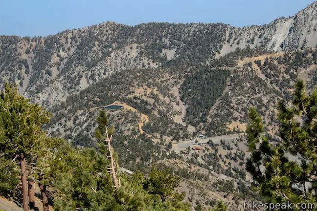
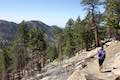
Mount Baldy, Old Baldy, or more formally, Mount San Antonio — whatever you call this mountain, the trek to the summit is considered a right of passage for SoCal hikers. Baldy towers over the San Gabriel Mountains and is the highest point in the range. The far-reaching panoramic views found at the exposed 10,064-foot summit attract plenty of hikers. Two major routes go to the top:
Both hikes depart from Manker Flats and can be combined into one scenic and challenging 11.3-mile loop with 3,900 feet of elevation gain.
To hike the loop:
- Park along Mount Baldy Road just past Manker Flats Campground at the bottom of Falls Road (0 miles)
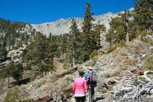
- Start hiking up the paved road toward San Antonio Falls (0.6 miles)
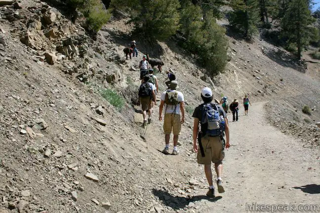
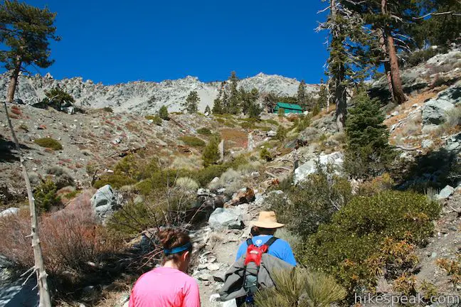
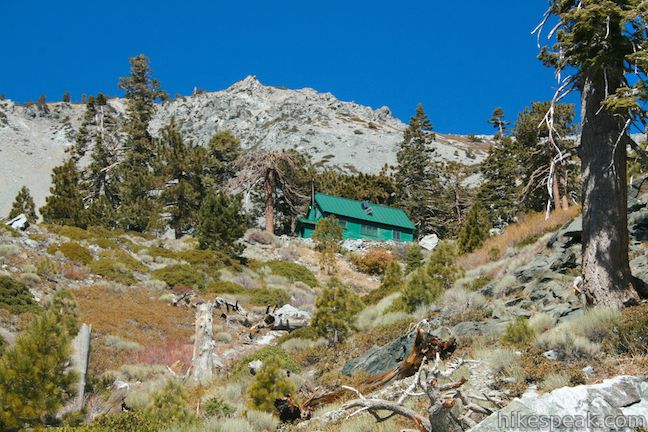
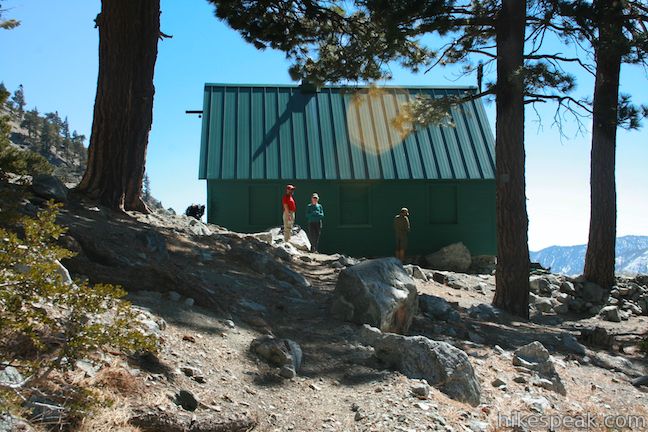
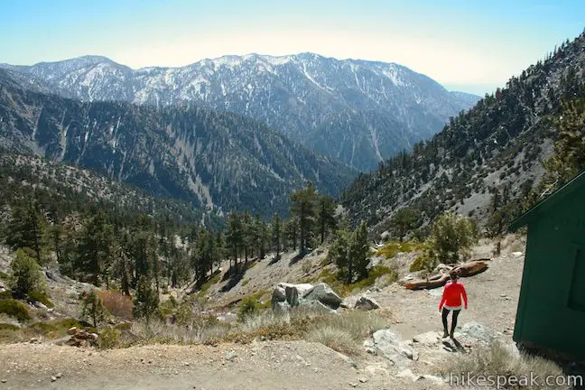
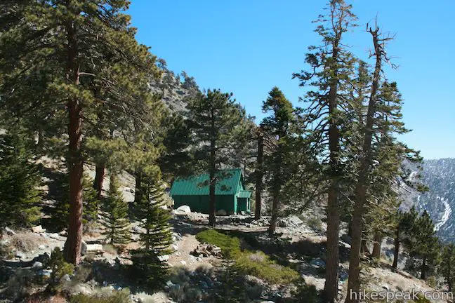
- A third of a mile past the falls, turn left up a narrow unmarked trail and hike up to the Sierra Club Ski Hut (2.6 miles)
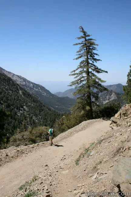
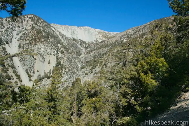
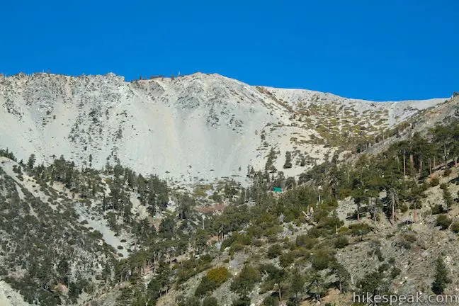
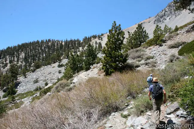
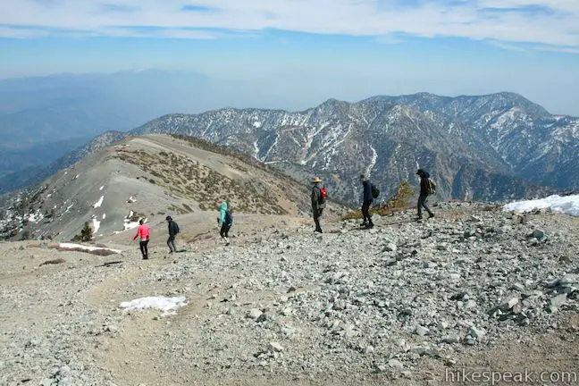
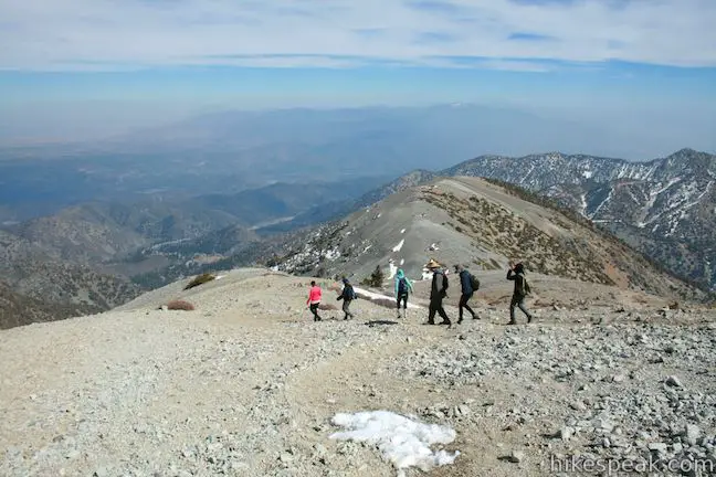
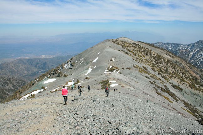
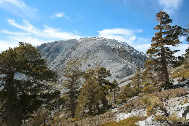
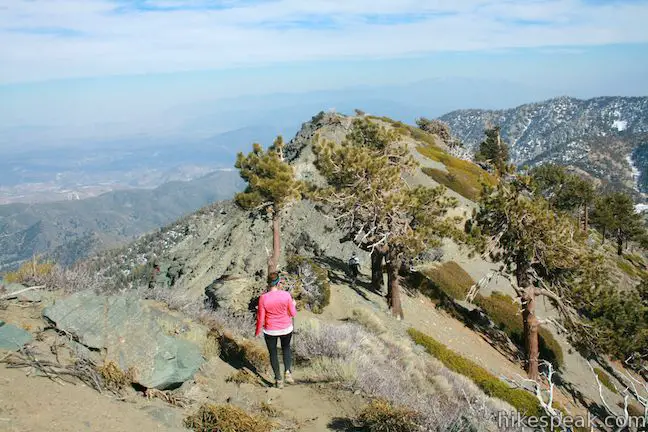
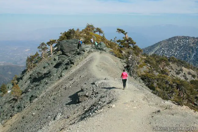
- Cross Baldy Bowl and hike north up a ridge to the summit (4.5 miles)
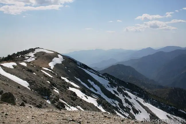
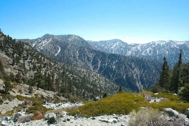
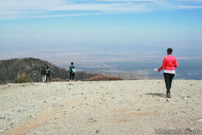
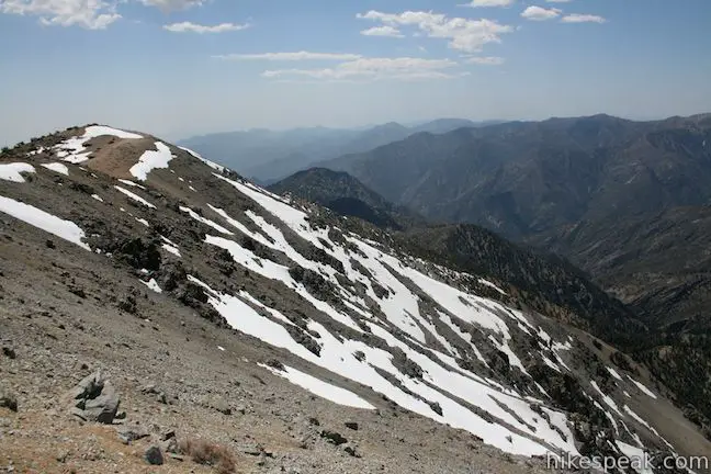
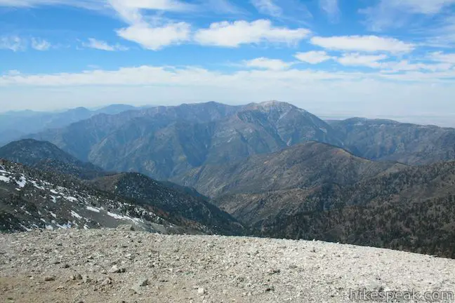
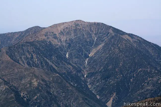
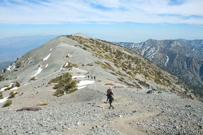
- Enjoy the view from the highest summit in the San Gabriel Mountains
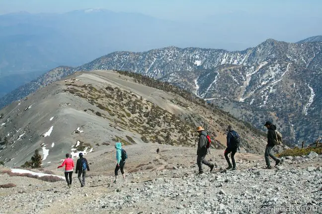
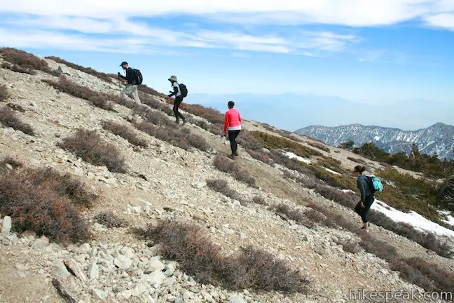
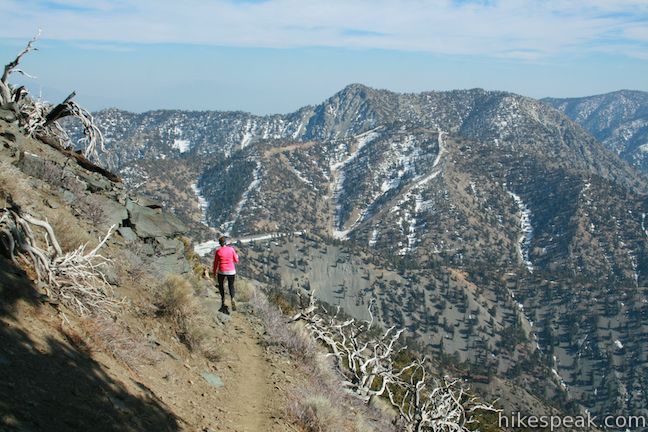
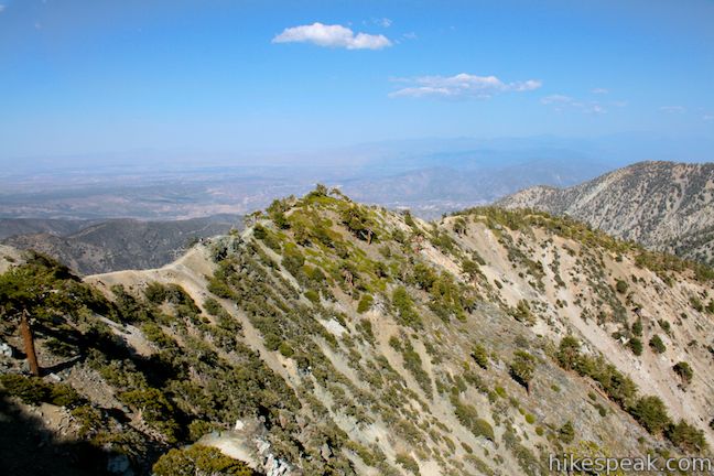
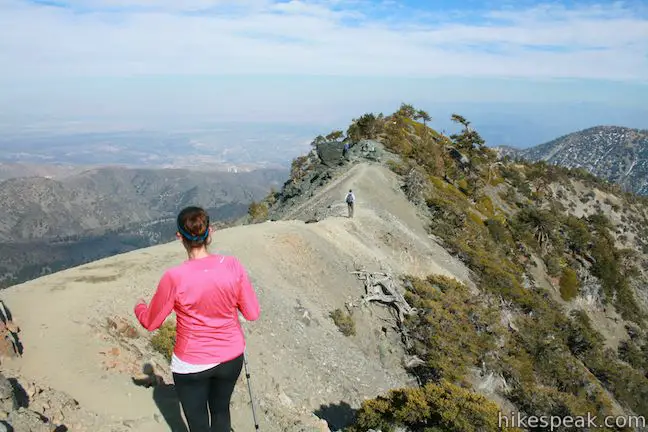
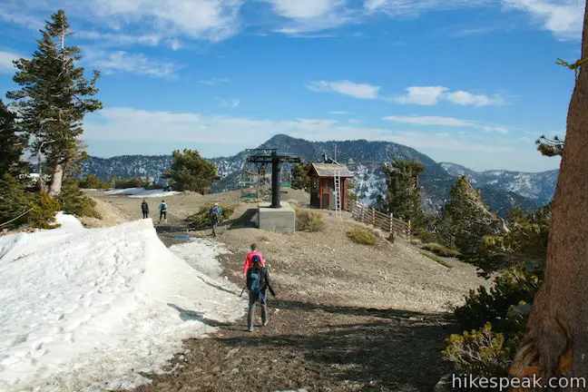
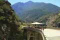
- Descend eastward down Devil’s Backbone Trail across a daunting ridge to Baldy Notch (7.8 miles)
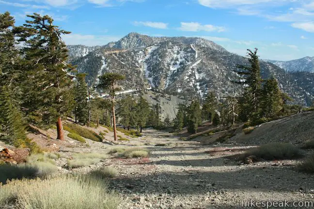
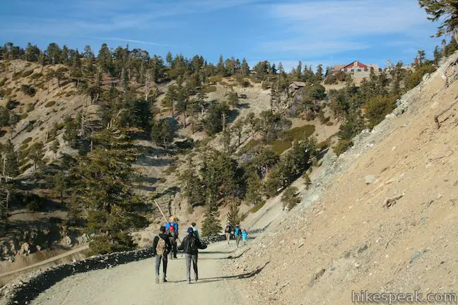
- Descend the dirt road next to the operating ski lift, passing San Antonio Falls to return to the trailhead (11.3 miles)
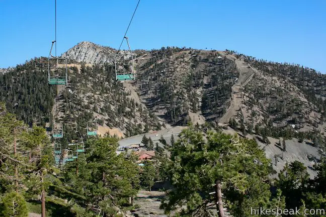
A ski lift can be used to fly up to Baldy Notch and back. The round trip cost of the lift is $25 round trip for adults, $20 for youths age 13 to 17, $15 for children under 12 (must be at least 40″ tall), and $15 for seniors over 65 (prices as of 2018). The lift cuts 1,500 vertical feet out of the hike (which is cheating) and omits the least interesting segment of the hike (so using it is understandable for those short on energy or time). The lift operates seven days a week and tickets may be booked in advance.
Different routes and starting points create a variety of lengths for hikes to Mount Baldy. The shortest hike to the summit, requiring the use of the ski lift, is 6.6 miles round trip with 2,350 feet of elevation gain and involves hiking up and back on Devil’s Backbone Trail. However, if you begin at the bottom of the mountain and hike up to Baldy Notch before crossing Devil’s Backbone Trail, that hike to the summit is 13.6 miles round trip. To complicate things further, if you do not start hiking from the trailhead shared with Baldy Bowl Trail, you can park farther up at the bottom of the ski lift and use a connection trail to reach the dirt road leading to Baldy Notch, cutting out 1.2 miles of trail each way (see the Manker Flats to Baldy Notch report for more information on this variation). The trail that passes the Sierra Club Ski Hut to reach the summit is 4.5-miles long (9 miles round trip).
When you decide to visit Baldy, consider all options including the recommended 11.3-mile loop. Each trail to the top has strenuous passages, but no rock climbing is required to reach the large bald summit. Dangerous winter conditions on Mount Baldy should be avoided.
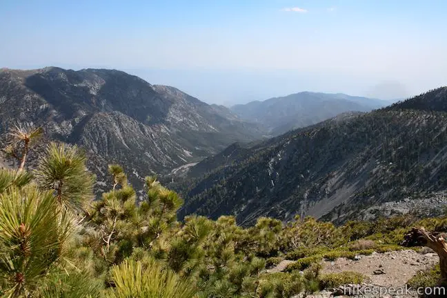
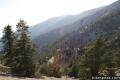
Mount Baldy has clear views looking miles in every direction. Southern California’s other principal peaks (Mount San Jacinto, Mount San Gorgonio, and Santiago Peak) are all in view as well as a long list of peaks and valleys in the San Gabriel Mountains.
Directions to the Trailhead
- Take the 210 east to Baseline Road (exit 52).
- Turn left at the light at the end of the ramp on to Baseline Road.
- Make the next right on to Padua Avenue.
- Drive 1.7 miles and turn right onto Mount Baldy Road (at a traffic light).
- Continue 7 miles up Mount Baldy Road through Mount Baldy Village (where there is a visitor center). and follow the road for another 4.4 miles up the mountain past Manker Flats Campground to the bottom of Falls Road on the left.
- Park along Mount Baldy Road, display an adventure pass (a national forest or interagency day use pass), and begin hiking up Falls Road.
Trailhead Location
Trailhead address: Mount Baldy Road & Falls Road, Angeles National Forest, Mount Baldy, CA 91759
Trailhead coordinates: 34.266172, -117.62684 (34° 15′ 58.21″N 117° 37′ 36.62″W)
View Mount Baldy in a larger map
Or view a regional map of surrounding Los Angeles trails and campgrounds.
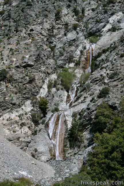
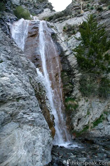
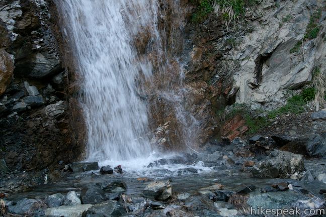
San Antonio Falls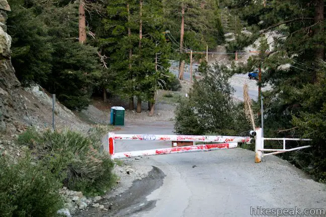

Baldy Bowl - Ski Hut Trail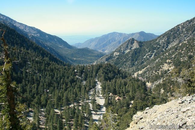

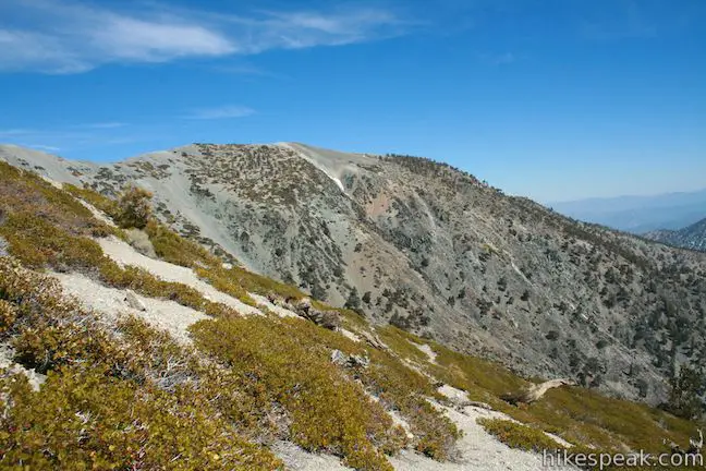
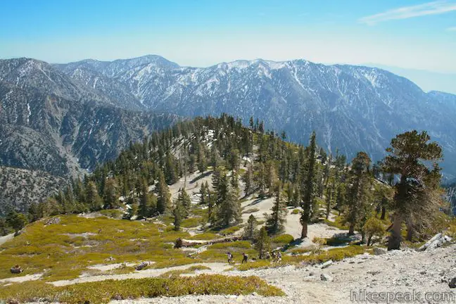

Views from the summit of Mount Baldy
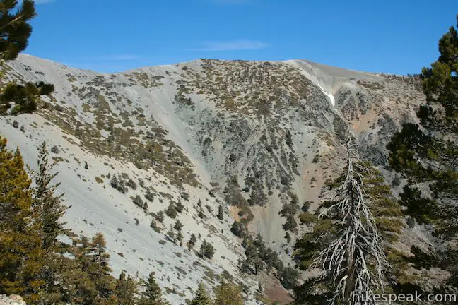
Devil's Backbone Trail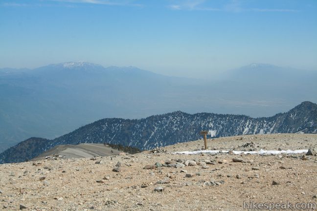


The trail down from Baldy Notch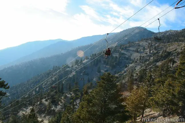

 | Icehouse Canyon Trail to Icehouse Saddle This 7.2-mile hike climbs 2,600 feet through a picturesque canyon to a saddle with panoramic views and extended hiking opportunities. |
 | Baldy Notch To hike the scenic Devil's Backbone to Mount Baldy, you must pass through Baldy Notch. You can hike to the notch, or take a ski lift. |
 | Baldy Bowl - Ski Hut The Baldy Bowl - Ski Hut Trail offers a steep but scenic ascent up the south side of Mount Baldy, crossing 4.5 miles and 3900 feet to the summit. |
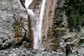 | San Antonio Falls This 1.4-mile hike visits a multi-tier waterfall along the trail to Mount Baldy. |
| Baldy Notch To hike the scenic Devil's Backbone to Mount Baldy, you must pass through Baldy Notch. You can hike to the notch, or take a ski lift. |
 | Bridge to Nowhere This adventurous 10-mile round trip hike reaches an abandoned and out-of-place bridge with a unique history. |
 | More trails in the San Gabriel Mountains Explore other destinations in the range. |
 | Mount Baden-Powell This 8.25-mile round trip hike ascends 2,834 feet to one of the tallest summits in the San Gabriel Mountains and a monument to Lord Baden-Powell, a BSA icon and the founder of the Scout Movement. |
 | Twin Peaks & Mount Waterman This 11.65-mile hike extends a loop over Mount Waterman by dropping across a saddle and ascending to Twin Peaks, a panoramic summit in the center of the San Gabriel Mountains. |
 | Sandstone Peak This 6.25-mile loop summits the tallest peak in the Santa Monica Mountains. |
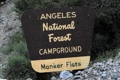 | Manker Flats Twenty-one sites service campers at the base of Mount Baldy. The grounds are nothing exciting, but if want a staging area for your ascent, this is it. |
Common Questions about Mount Baldy in the San Gabriel Mountains
- Is the trail open?
- Yes. You should expect to find that Mount Baldy Loop is open. There are no recent reports of trail closures. If you discover that the trail is closed, please help your fellow hikers by reporting a closure.
- Do I need a permit for this hike?
- Yes. National Forest Adventure Pass.
- How much time does this hike take?
- It takes approximately 7 hours to hike Mount Baldy Loop. Individual hiking times vary. Add extra time for breaks and taking in the views.
- How long is this hike?
- The hike to Mount Baldy Loop is a 11.3 mile loop with 3900 feet of elevation change.
- Are dogs allowed on this trail?
- Yes, dogs are allowed on Mount Baldy Loop. The trail is open to hikers, dogs.
- Is Mount Baldy Loop a difficult hike?
- This hike should be considered strenuous. Hikers should be prepared for a workout covering 11.3 miles and 3900 feet of climbing.
- Does this trail go to a summit?
- Yes, Mount Baldy Loop reaches a summit with panoramic views.
- What mountain range is this trail in?
- Mount Baldy Loop is located in the San Gabriel Mountains.
- Where is the trailhead located?
- The trailhead for Mount Baldy Loop is located in Mt. Baldy, CA.
Trailhead Address:
Mount Baldy Road & Falls Road
Mt. Baldy, CA 91759
Trailhead Coordinates:
34.266172, -117.62684 - What are the driving directions to the start of the hike?
To get to the trailhead: Take the 210 east to Baseline Road (exit 52). Turn left at the light at the end of the ramp on to Baseline Road. Make the next right on to Padua Avenue. Drive 1.7 miles and turn right onto Mount Baldy Road (at a traffic light). Continue 7 miles up Mount Baldy Road through Mount Baldy Village (where there is a visitor center). and follow the road for another 4.4 miles up the mountain past Manker Flats Campground to the bottom of Falls Road on the left. Park along Mount Baldy Road, display an adventure pass (a national forest or interagency day use pass), and begin hiking up Falls Road.
View custom Google Maps directions from your current location.
- Are there other trails near Mount Baldy Loop?
- Yes, you can find other nearby hikes using the Hikespeak Hike Finder Map.

64 Comments on Mount Baldy in the San Gabriel Mountains
What hikers are saying:
✨ Generated summary of user commentsHikers describe this climb as a strenuous but rewarding challenge offering spectacular views of the ocean and desert. The Devil's Backbone section features steep drop-offs and narrow ridges that require focus, particularly if hiking with dogs that might pull on leashes. Ramona advises wearing hiking boots for the loose rocks and carrying at least 3 to 4 liters of water because the trail lacks natural water sources.
What type of foot gear do you recommend? The wife wants to wear running shoes. We’re hiking Sunday July 13th and climbed Cucamonga peak last month. Any other gear recommendations? Thanks
Running shoes can work if they’ve got good traction and you’re not too worried about your ankles. However, hiking boots will really help to get through the rocky and steep parts on this hike. If you’re doing that much hiking, I’d recommend getting a pair of decent hiking boots. I’ve been wearing Merrell’s Moab boots for a few years now and really like them, but you should find a pair that feels right for you. This is a long hike so bring plenty of water and wear/pack layers because conditions at the top can be different from the conditions at the bottom. Hiking poles will be helpful too. Hope that helps.
I wore my “heavy” (for shoes) trail runners (NB 910) when we just did South Fork to the summit of San Gorgonio last weekend, up the Dollar Lake trail and down the Dry Lake trail (24 miles, 4700 elevation). I carried my big pack (albeit mostly empty) with water to make it weigh in at about 24 lbs. I had no problems at all with shoes although this was the first time I’d ditched my boots in favor of the shoes. Traction with them was excellent, much better than my boots (Scarpa Mustangs) and near the end of the day I was glad of the reduced weight. Only kicked one rock on the side of my leg that would have been protected by boots, otherwise the shoes were as good or better than boots.
I just finished the Baldy loop wearing my Vibrams (“five-finger shoes”), and I ran the downhill slopes that weren’t too steep without falls or scrapes. I’ve been doing this on Baldy off and on for four years now. Thus, heavy boots are not necessary, unless there is snow on the ground.
I did Devils Backbone in my Vibrams-all good, no problems ?
Are dogs allowed on the trail to mt baldy.
They sure are. Just bear in mind that this long hike can be tough for dogs.
Yes they are, just don’t be that person who only brings what they think will be “enough” water for their dog. I’ve seen several dogs on the verge of heatstroke because their owners were barely carrying any water for themselves, let alone their pups.
With lots of water, your dog will be a very happy pup on that hike
Do you need parking permit and where do you get it? Thanks.
Unless things have changed recently, an Adventure Pass is still needed for each vehicle. They are $5 for the day or $30 for a year. You can buy one at any Big 5 or from several other retailers. On your drive up to the trailhead, you can pick one up from the Mount Baldy Visitor Center in Mt. Baldy Village. Enjoy the hike!
[…] Go to Hikespeak.com for turn-by-turn trail directions […]
I want to arrive early on a weekday morning around 6am do you know if there is accessible parking at that hour?
Good plan! At that hour, you won’t have any problem parking along Mount Baldy Road at the bottom of Falls Road. There’s no access gate or other impediment to parking.
But please be advised, finding parking can be prohibitive should you arrive past 7 on a weekend.
[…] hike up Mt. Baldy, the highest peak in the San Gabriel Mountains. It would be a long hike (the loop trail is just over 11 miles) and also one that would challenge my fears about elevations as the peak […]
Would it be dangerous to hike Mt. Baldy in early August? I’m sure it’ll be hot, which is okay, but what about forest fires?
Thanks,
Justin
Hi I would like to know how may total miles to hike Mount Baldy? and what’s the earliest time of day possible to start the hike? Thank you
Is there any snow on the ground at the base of the summit as of today (1-9-15)?
Are there any trail camps to make it a three day event, for a boy scout merit badge? Looking at memorial day weekend trip. Thanks in advance.
What is some of the best and most primary type of gear i should bring if I plan to go around the months of March or April? And how difficult would you say it is for a mountain dog. And could you camp up on the mountain?
Can this hike be done this time of year? (is there snow??) Planning on hiking week-end of March 21-22, 2015
Hiked the loop today, March 10th. Very pleasant weather, 65 deg at the summit, clear, and a slight breeze. You will encounter snow on the trail above the ski hut (8300 ft Elev). Recommend attachments on your shoes like yaktrac to prevent slides or falls. Weekdays minimal hikers, only saw 6 hikers above the ski hut….lots of solitude and tranquility. Enjoy!
[…] Mount Baldy, which is the highest point in the San Gabriel Mountains, serves as a ski resort in the winter months and is located just an hour east of LA (map here). Before embarking on this trek, we read many articles and heard many stories about how to hike this 10,064 foot summit and in the end, we concluded that ascending via Baldy Bowl and descending along The Devil’s Backbone, making for an 11.3 mile hike, was the best route – we stand by this decision (Great post about the various trail options here.) […]
Snow and ice would not be unusual in March and it could be dangerous even with good equipment (crampons, ice axe, maybe skis w/skins, etc.) if there is much on the roads and trail. The downhill ski area is still open, I think, so you might have trouble dodging skiers and finding the trail on this side and the trail from the fire road to the hut. People have been lost on an icy Devil’s Backbone. This loop would not be my choice right now (look for a hike at lower elevations).
As far as dogs, I’ve had them on Baldy, but the jagged rocks are hard on the pads of their paws, especially those on the trail around the Sierra Club Ski Hut and the bowl. You might want to consider boots for dogs as the pads can take a long time to heal, even for a “mountain dog.” Keep looking at those paws. The biggest problem with the dogs is the water so you, and perhaps they as well with a doggie pack, must carry enough as the only places you’ll find it on this loop is the spring above the hut and the notch (top of the lower lift in the ski area).
Before I die, I want to do the summit from Mount Baldy Village, about twice the distance of this loop and a few thousand more feet to climb; no water on this trail once you leave the canyon. This and Ice House Canyon might be a good place to hike while you are waiting for the snow and ice to clear higher up; I saw Big Horn Sheep on the trail a few miles up from the village having a much better time than I was (had a thigh muscle, injured in a motorcycle accident, go into spasm near the top and turned back when my companions were met on their way down). Good times had by all for the most part, though, unless you get into some trouble.
I’m thinking of going up the Mt. Baldy trail next week but possibly running into a mountain lion or a bear gives me some serious pause. Is my fear warranted?
Seriously?! Don’t let this stop you from hiking! Fear not warranted – unless maybe you are a cat or a chuhuahua or a toddler hiking alone. Far more people are injured in vending machine accidents every year than in bear or lion accidents. Just read up on what to do if you encounter wildlife and go enjoy the trail!
I am thinking of hiking Mt. Baldy next weekend – April 25, 2015. Is there snow (cleats needed?) and how is the weather? How long does the 11.3 mile loop take for an average speed hiker?
Snow should not be an issue. Give yourself the whole day to complete the hike.
I’m new to California. Does this hike require some sort of permit or pass that I need to purchase?
While the requirements have been changing, an Adventure Pass has been needed for this hike, which can be picked up in Mount Baldy Village on the way to the trailhead (among other places).
Great write-up! Are there any campgrounds to make this an overnight trip?
Hi, does it make sense to start the hike very early with headlamps in order to get on top for sunrise?
Is it better to have devil’s backbone for descending part or for ascending part. I am not sure if I should go from San Antonio’s Fall side, which will make the devil’s backbone for descend. It I start from the ski lift side, then it will be for ascend. Which will be fun to do.
Fair question. People go both directions, but I’ve only ever started by going up The Baldy Bowl – Sky Hut Trail. This gives you really nice views looking out over the surroundings as you come down Devil’s Backbone Trail. Enjoy the hike, whichever route you take…
I love how you two just completely ignore the main commenter, it is like my family talking over me like I am not in the same room with them. XD
[…] first time I hiked Mount Baldy (otherwise known as Mount San Antonio) was my first time exploring the San Gabriel Mountains. We […]
Are there any groups or guides for the Mt Baldy hike? Or is it marked well enough to do alone? I hiked the Bridge to Nowhere last week and the trails were non existent in some places.
Hey there, we are planning an overnight trip to Baldy in 2 weeks. We are going to camp off the trail and want to know of any good flat smooth camping spots at the top of the Summit or close by. Also is there any source of water to fill up water bottles while on Baldy Bowl or Devils Backbone Trail? Thanks
Whats the weather looks like in Mid November ? Thank you.
Quick question. On your post I see we park along side of the road so we don’t have pay any parking ticket right ?
Is Mt. Baldy open right now, are the trails accessible in good running shoes. And how fast can I get up down the 11 mile loop?
I would like to hike up Mt Baldy but mountain lions/bears are a concern of mine. Has anybody seen any while on the hike?
No worries about these animals, the only mammals that were spotted there were big horn sheep and that was during spring or summertime. But be mindful of the devil’s backbone trail, its kinda steep and there’s a portion where you’ll step on an 8 to 12 foot width ridge. The view anywhere is spectacular.
ID LIKE TO KNOW IF I COULD TAG ALONG ON A SNOW TREK UP BALDY, I HAVE HIKED BALDY A FEW TIMES BUT WANT TO HIKE IT IN THE SNOW
I would like to hike Mount Baldy sometime during the week of April.18th ….. I will more than likely be hiking alone ….. Is there many people hiking that I may be able to follow at that time of the morning (7:00am) during the week.
Candas, have you hiked Mount Baldy yet? How was the trail?
Assuming you do not use the lift, how long would the loop hike take?
This is a full day hike. Pack a lunch and set aside 6 hours to be safe.
Are there trails for side by sides and ATVs in the area of Mount Baldy?
Great hike. On a very clear day you can see easily see Catalina and the ocean, the Mojave desert, and if you have a sharp enough eye, the silhouette of the downtown LA skyrises. I recommend poles, but make sure you REALLY shorten them on the uphill so that you don’t tire out your sholders. You should be reaching out with your poles, not out AND up. Lots of good rest spots on the way up. Unless you’re a mountain goat, save a lot of energy for that last mile to the top. That’s when you get your cardio in.
If you have a really bad fear of heights or vertigo I don’t recommend going on the Devil’s Backbone. I’m really sure of my footing and heights don’t scare me, but there’s this one segment with a pretty steep drop that puts some respect in me. I wouldn’t call it dangerous though because if you’re not dicking around and focus on each step then there’s no way you’ll fall.
Really not sure why the trail is rated so low.
I go up the ski hut route because I’d rather have a steep incline than a steep decline even though it takes more effort. You climb about a thousand feet each mile to get to the peak. The trail marker says 3.5 miles from Manker Flats to the peak, but that’s some bs lol (a friend’s GPS clocked it at over 4 mi.). Maybe it’s 3.5 mi. viewed overhead, without taking into account the incline (I don’t have to explain what a hypotenuse is).
I see a lot of posts between March and July, is November a good month to hike Mt Baldy? Any comments on weather are appreciated we are going 11/12
Fall can be a fine time to hike in the San Gabriels, but snow and ice can add additional danger to this hike, particularly on the Devil’s Backbone. Check the weather before you head out and be prepared to turn back early if conditions are not safe.
Loved the write up, and detailed information.
I backpacked Mt. Baldy last September, and used the old trail that starts behind the church in Baldy Village.
Here is a video if interested.
https://www.youtube.com/watch?v=mG2rNWo3EaE
Is there still snow at the peak of Mt. Baldy now? (today is April 21, 2017)
Meg, Did you get an answer to your question about the snow? I’m planning to do it this Sunday and couldn’t find info. Thanks.
The Mount Wilson Towercam (a handy resource) shows that Mount Baldy is snow-free!
[…] 5 a.m. on a Thursday, and while the world was sleeping, 130 of us were awake at the trailhead at Mt. Baldy. There was a little bit of trail magic that morning. I stepped out and could instantly smell the […]
I new to hiking. My friend and I just hiked Baden Powell about a week ago. I was in pain, not her. I want to hike Mt. Baldy in November. What can I do to prepare myself a longer hike? What can I do for my legs my knees? I know the altitude gain had me breathing harder going up the mountain. Coming down was it as bad. I just need to get ready. I gave her my word and I don’t want to back out of it.
Mount Baden Powell is a pretty ambitious hike. If you made it up that, Baldy should be in reach. My advise would be to keep hiking. Start with hikes that are comfortable and then build up the distance and elevation that you tackle. Something like Mount Waterman could be a good hike to train on.
Hiked to the summit on 11/25/17, it was a steep climb all the way to the top. Late start at 10 am prompt us to take the 1st lift, 10:15 to 1:00 pm hike to the summit. Well worth the climb. At 1:30 pm we left the summit, we completed the loop at 4:45 pm. It was just as steep going down the mountain as it was up. No snow, no wind and it was a beautiful day 70 degrees for the high with a light breeze at times. Devil’s backbone was not scary at all but would be in the snow or wind for sure. I had no effect from the elevation gain. A lot of loose rocks on the trail. I recommend if you have bad knees, back or ankles to wear the appropriate support. The difference between Mt Badin Powell and this hike is Badin Powell has switch backs and flat spots to catch your breath, Baldy is straight up. Baldy has great directional signs. There was no water so bring at the minimum 3L to 4L, no bugs, I recommend hiking shoes or boots. I would say this hike is strenuous for the experienced hiker. Ideally, I would have liked to start at 7am and end at around 2 or 3 pm. I loved this hike and would do it again, well worth the challenge. Five stars
[…] more detailed information on this hike, see Hikespeak’s post, which I used to plan my own trip. Note that you will need to purchase a pass for the national […]
FYI old baldy trail is completely different from the loop. You don’t want anyone hiking old baldy trail on their first try.
Is it slippery on devils backbone. I’m thinking of bringing my Dog but she tends to pull on leash a lot. Would it be safer to leave her at home
There are steep drop-offs along the Devil’s Backbone. If you’re dog might pull you down the mountain, better to leave your dog at home. This would be a very long outing for a lot of dogs.