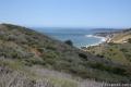
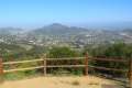
Mesa Peak from Malibu Canyon Road (Piuma Trailhead) in the Santa Monica Mountains

A mesa is defined as a flat-topped hill with steep sides. A peak is defined as the pointed top of a mountain. Put these contradictions together and you get a subtle summit with substantial ocean views. This short perch on a mesa-like ridge behind Pepperdine University in Malibu delivers panoramic views over the surrounding Santa Monica Mountains. The hike to Mesa Peak up the steep sides of the mesa begins from the Piuma Trailhead in Malibu Creek State Park and follows 2.7 miles of the Backbone Trail. In all, the superbly scenic hike to Mesa Peak is 6.5 miles round trip with 1,375 feet of elevation gain.
- To make the hike longer, add a visit McAuley Peak for a 7.25-mile outing.
- As an alternative route to Mesa Peak with less elevation change, set out from the west end of Mesa Peak Motorway and hike from Corral Canyon Road to Mesa Peak.
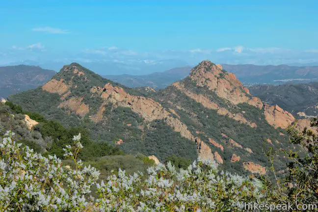
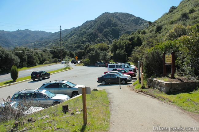
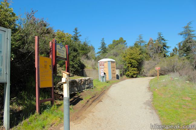
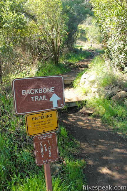
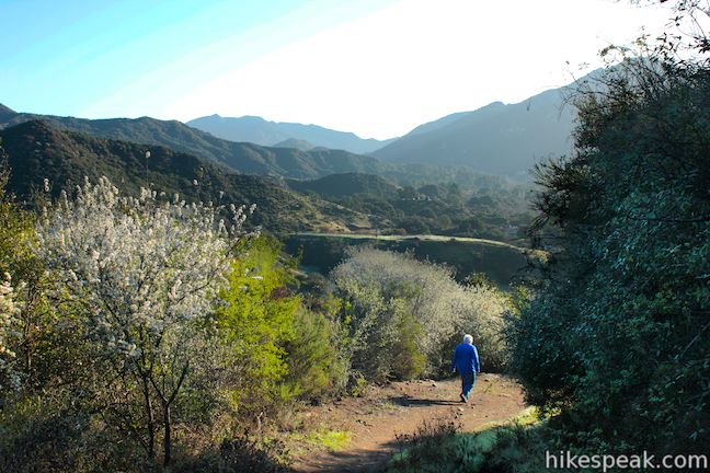
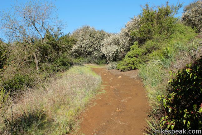
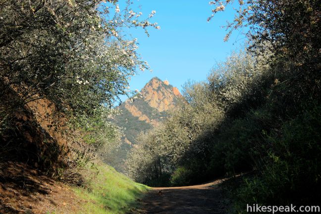
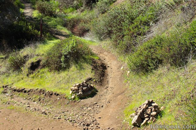
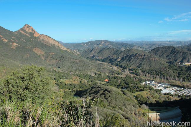
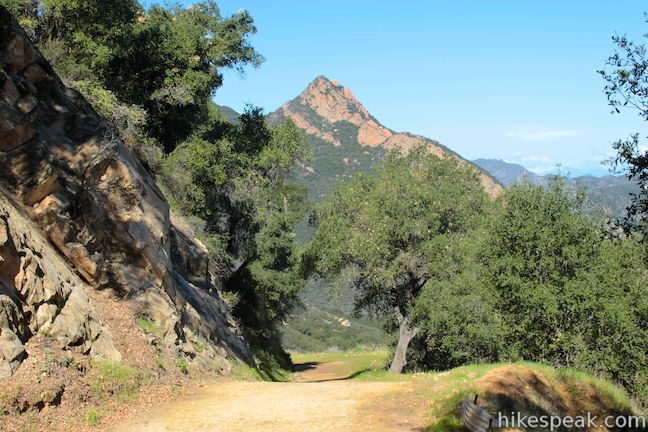
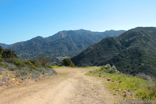
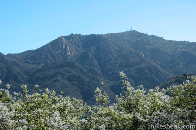
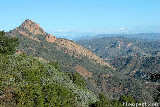
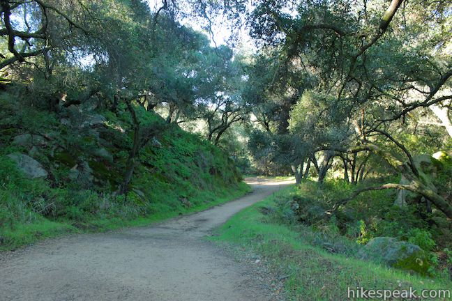
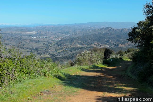
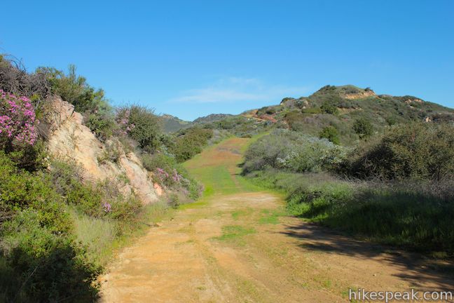
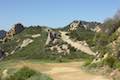
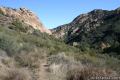
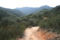
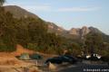
The hike begins from a trailhead on Malibu Canyon Road at the south end of Malibu Creek State Park about four miles from the Pacific Ocean. Set out from the Piuma Trailhead, pass a bathroom, and make an immediate left at a marked junction to begin up the Backbone Trail. The first leg of the hike is 2/3 of a mile of dirt single track leading to a wide dirt road, Mesa Peak Motorway. Along the single track, you will gradually ascend a mountain slope with over-the-shoulder views north toward Agoura Hills. The trail crosses a rocky gap and passes through chaparral above a small dam. Ahead there are views of Brents Mountain, a rugged twin peak of orange rock with a white cross on top that you will see throughout the hike.
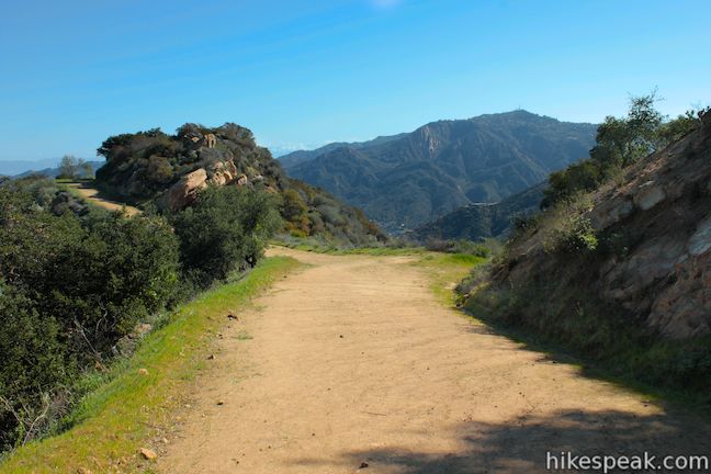
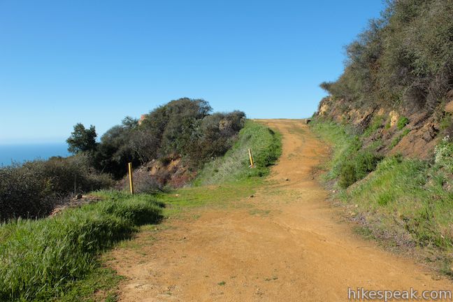
At the end of the single track, 2/3 of a mile from the start, turn left up a wide dirt road, which immediately launches into a horseshoe bend to the left, leading higher up the mountain. The dirt road is fairly steep in places, but the views improve as you climb, so make a point to stop and enjoy the scenery any time you need to catch your breath.
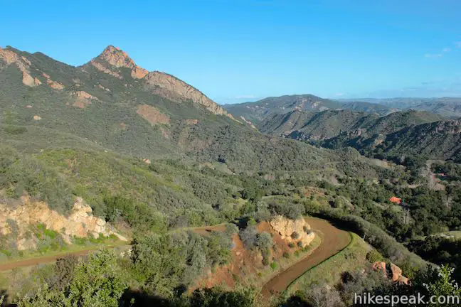
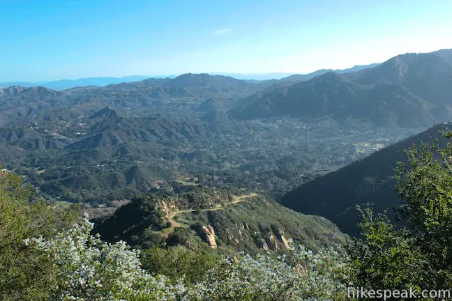
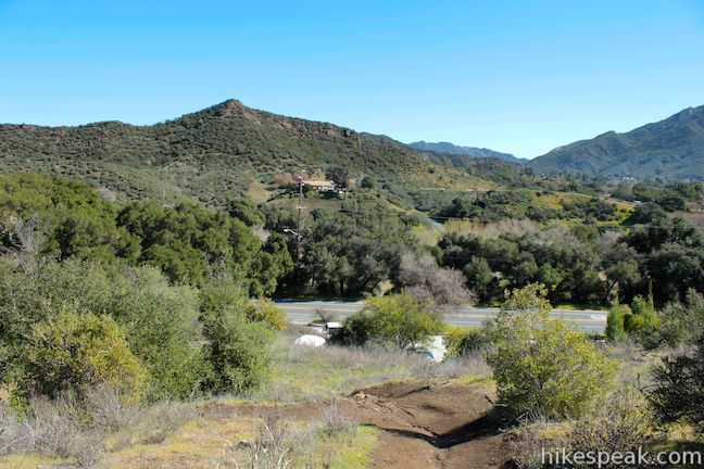
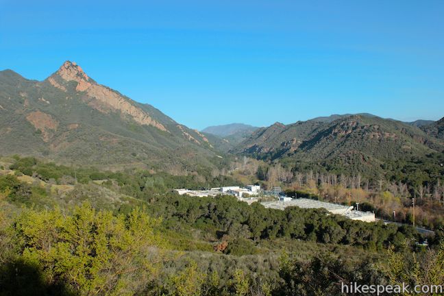
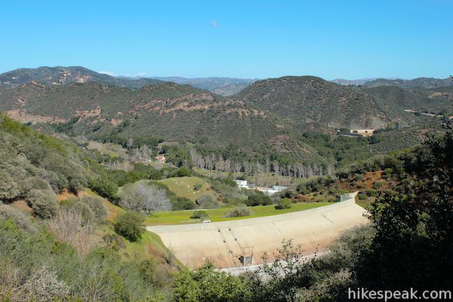
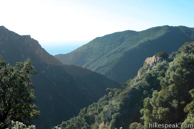
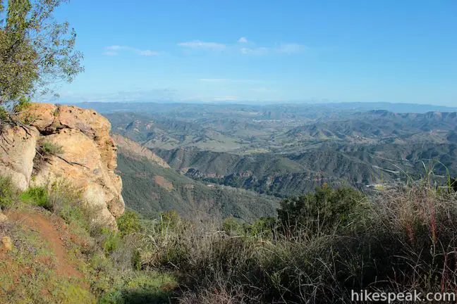
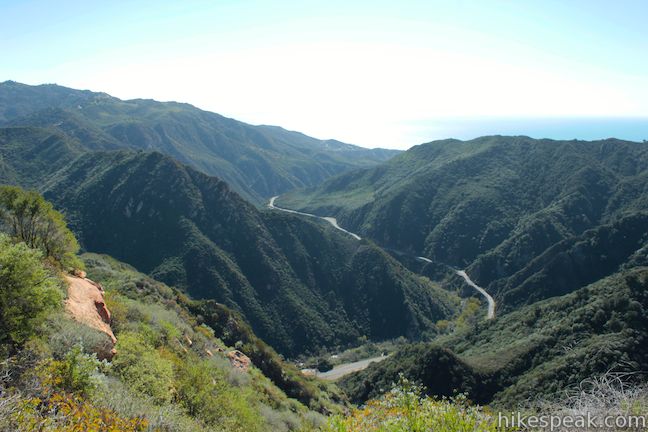
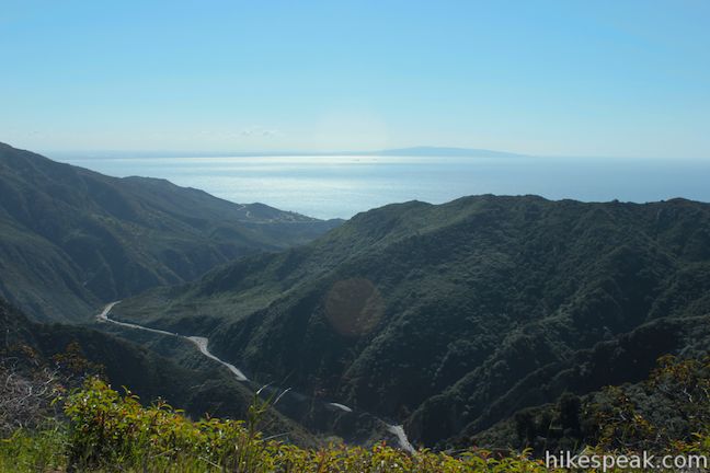
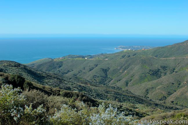
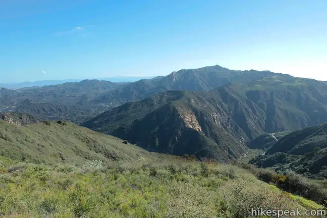
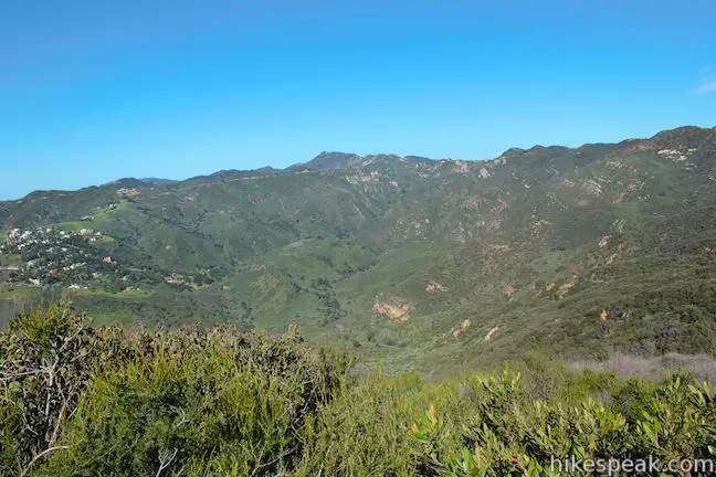
When you’ve hiked 0.45 miles up Mesa Peak Motorway (the wide section of the Backbone Trail), a bend to the right will offer open views east toward the 2,805-foot summit of Saddle Peak. Rounding the bend, get a new view down Malibu Canyon, where steep rock walls drop to Malibu Creek on its run to the Pacific.
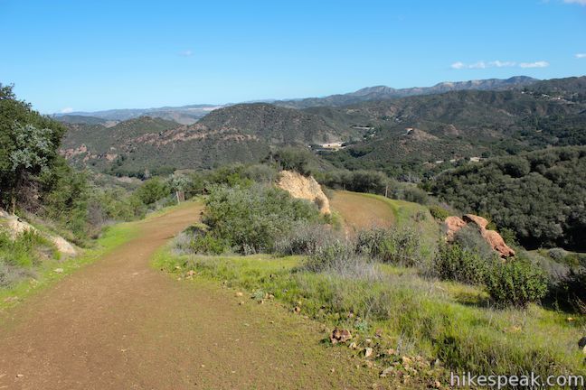
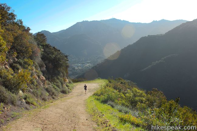
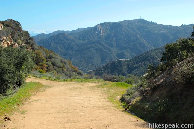
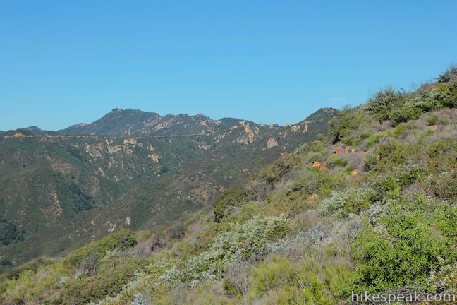
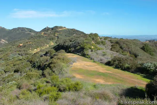
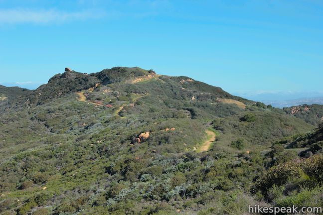
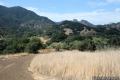
The trail progresses along a ridge above Malibu Canyon that offers alternating views either south and east toward Malibu Creek and Saddle Peak or north and west toward Brents Mountain and Agoura Hills. Wherever you look, the sight is a delight.
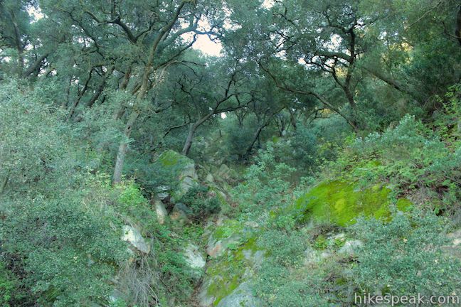
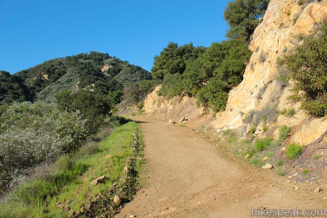
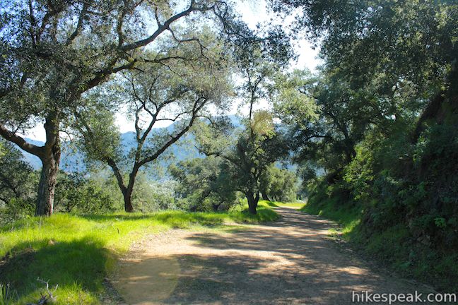
Pass a small holding tank about 1.4 miles from the start and continue up the road. Cross through an oak woodland, 1.85 miles from the start, where boulders below the trees are covered in moss and ferns. While there are several nice bunches of live oaks along this mostly sun-exposed hike, this is the most impressive.
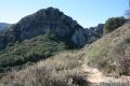
The road pushes higher up the mountain and at 2.1 miles you get an impressive view back down over the lower part of the trail where you got the first views into Malibu Canyon. Now 600 feet below, the trail serves as a good reference point for appreciating the grandeur of these mountains.
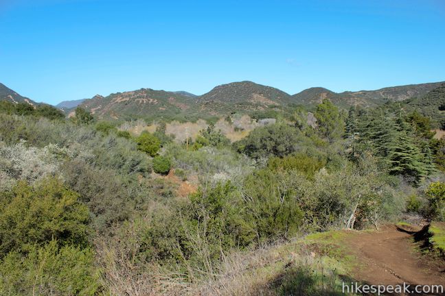
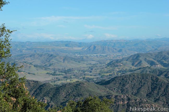
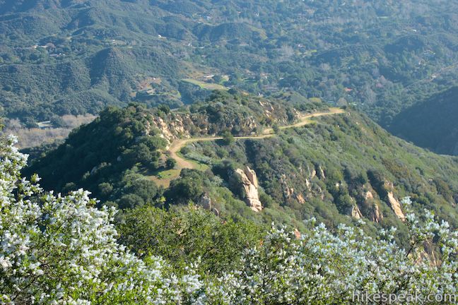
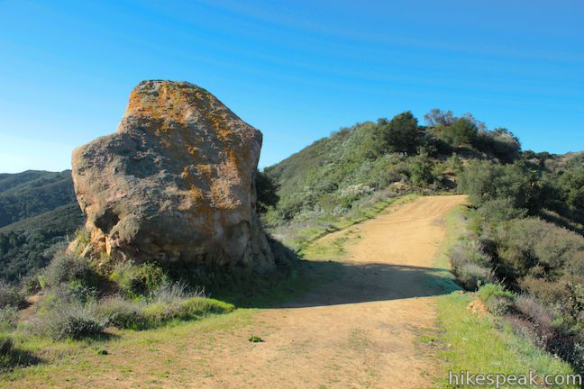
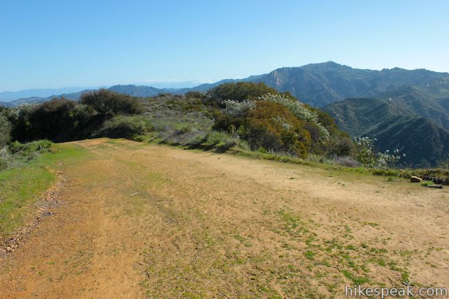
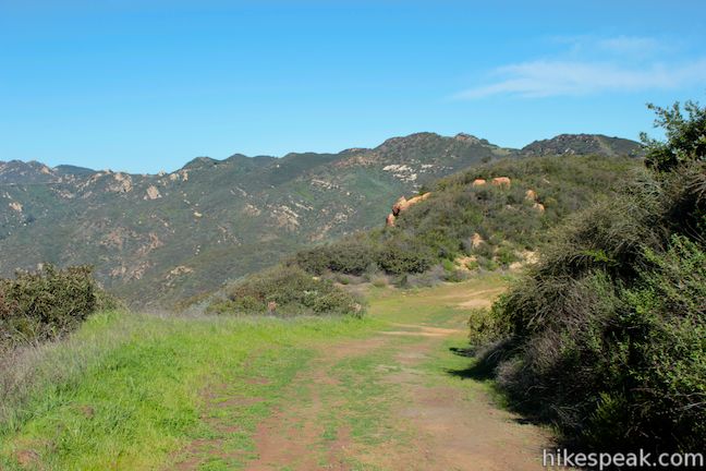
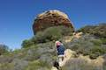
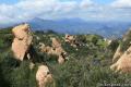
The Backbone Trail continues up the mountainside, passing a saddle on a ridge marked by a tall orange boulder (2.25 miles from the start). Past the rock you will gain a view of the mesa, a flatter section of the mountains to the south.
After hiking just over 2 miles up Mesa Peak Motorway, and 2.7 miles from the start, you will come to an important split in the road. The Backbone Trail (Mesa Peak Motorway) continues to the right (west) for another 2.8 miles to Corral Canyon Road (a possible trailhead for another hike along the west end of Mesa Peak Motorway to Mesa Peak), passing McAuley Peak after a quarter mile. Puerco Motorway heads south, descending to Mesa Peak. Turn left down Puerco Motorway to reach the summit of Mesa Peak.
Mesa Peak is actually at a lower elevation than the junction along the Backbone Trail (itself around 1,865 feet), but the small summit presents broader ocean views. To reach it, hike south down Puerco Road. Stay to the left at the following junction, passing a connector trail to the westbound side of the Backbone Trail (Mesa Peak Motorway).
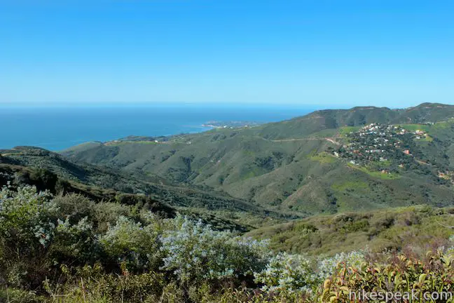
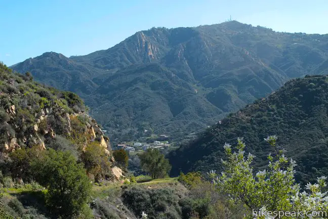
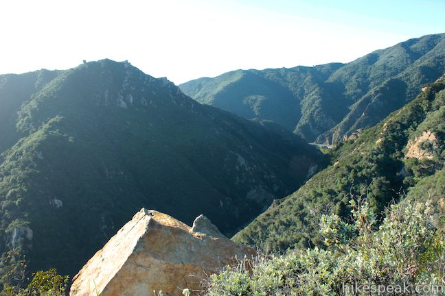
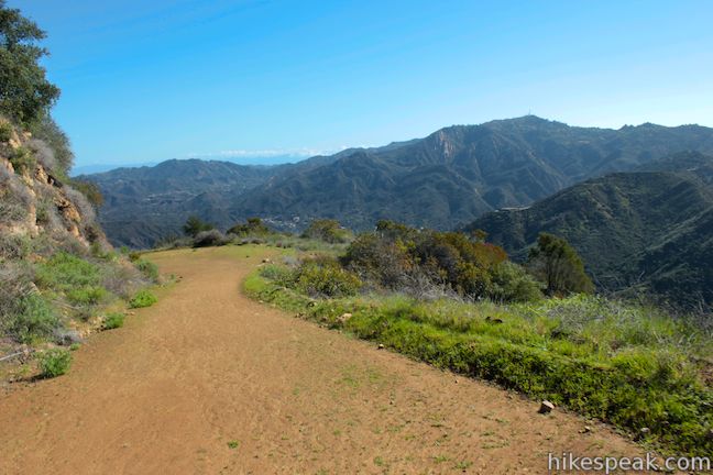
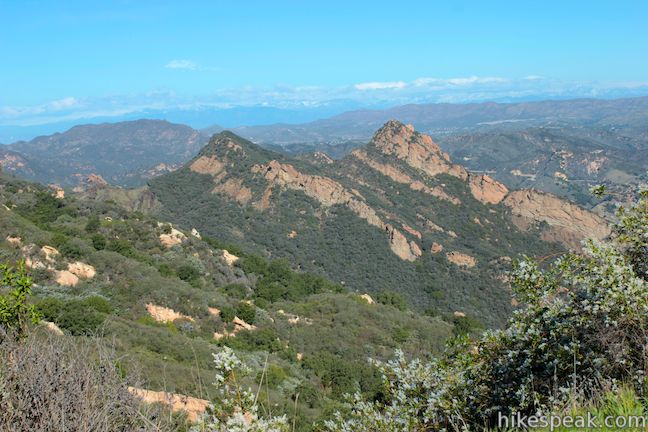
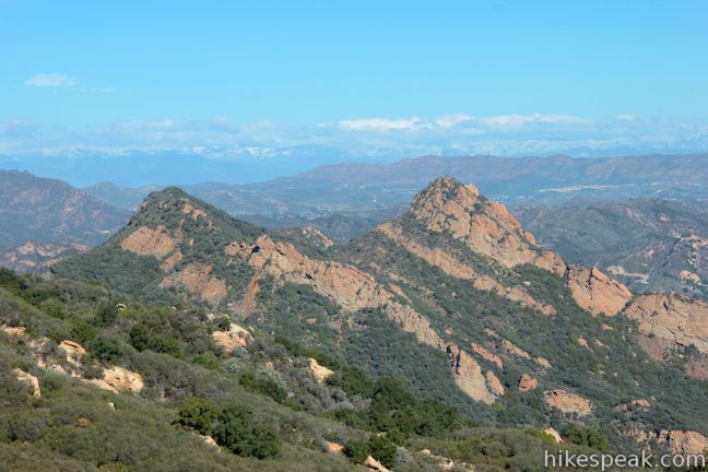
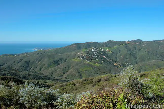
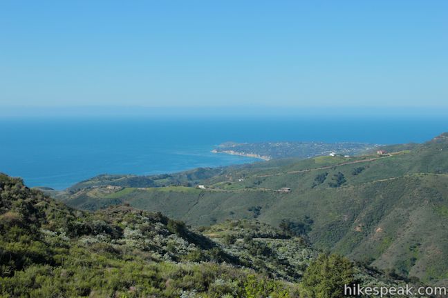
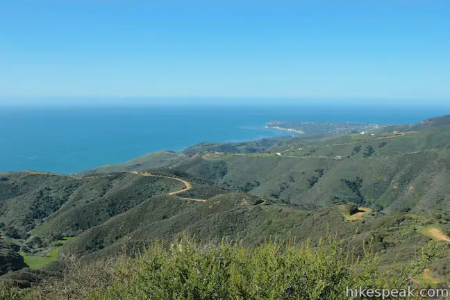
As you hike down Puerco Motorway you will be struck by ocean views. Gaze southwest down Corral Canyon toward the blue waters of the Pacific Ocean. You can see up the coast to Point Dume. Across Corral Canyon, you will spot Corral Canyon Road running along the top of the opposing ridge. A mountainous ridge runs along the top of the canyon that is crossed by the west side of Mesa Peak Motorway. The 2,824-foot Castro Peak is the high summit rising above the canyon.
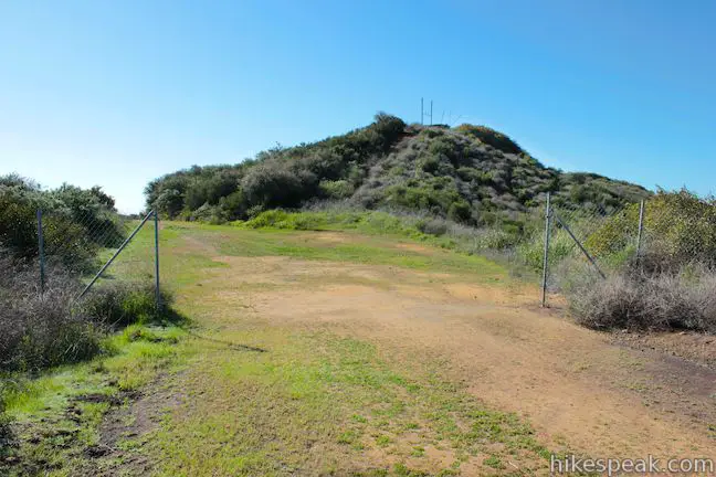
About a quarter mile down Puerco Motorway, pass a state park boundary sign that lets you know that you are exiting Malibu Creek State Park. Continue hiking toward Mesa Peak.
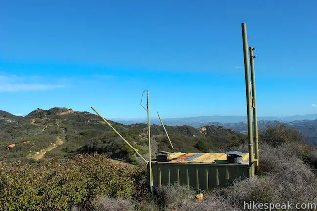
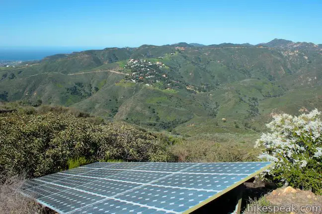
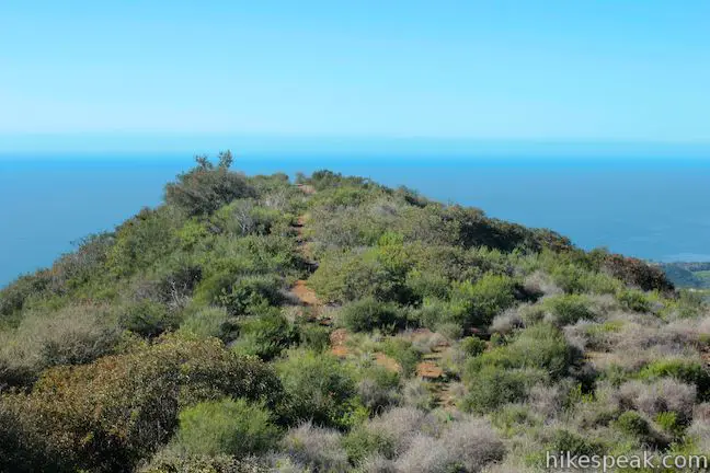
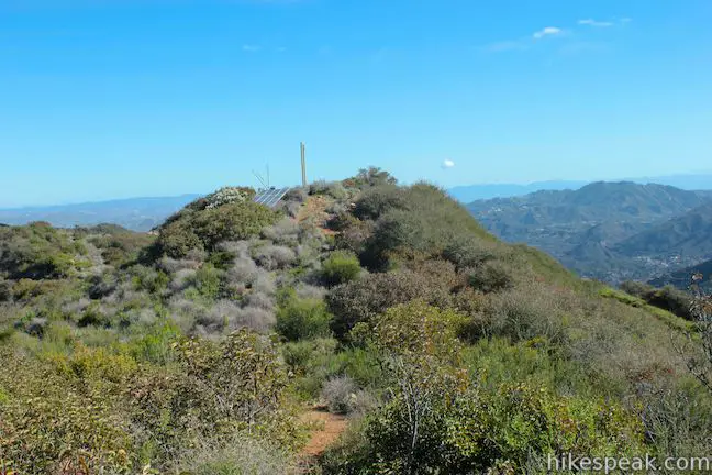
When you pass through a fence, 0.4 miles down Puerco Motorway (and 3.1 miles from the start), the small summit of Mesa Peak will be right in front of you. Walk a few hundred feet, leave Puerco Motorway, and take the path to the right up the bump that is the summit of Mesa Peak. A small building sits on the 1,844-foot summit along with a solar panel.
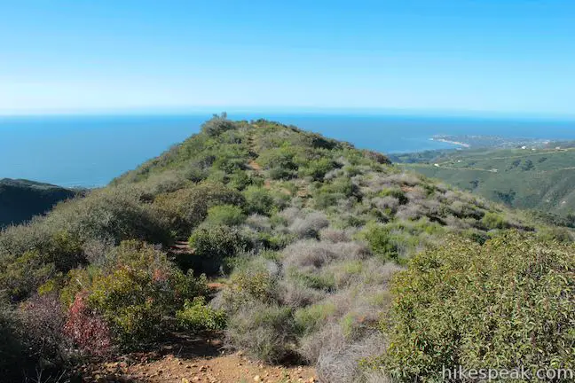
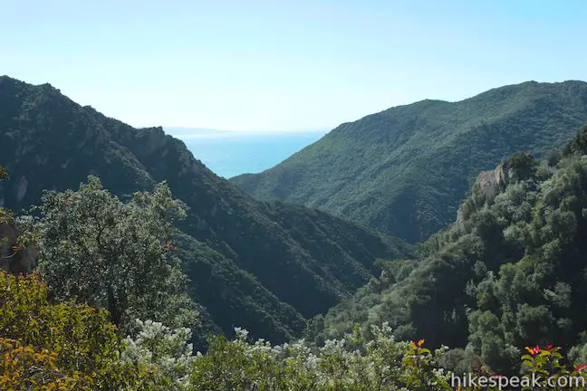
From the summit of Mesa Peak, you will be drawn down a footpath to a lower summit just to the south that offers a mighty view over the Pacific Ocean. You can look west over Corral Canyon, south over Puerco Canyon, southeast over Malibu Canyon and east toward Saddle Peak. After hiking 3.25 miles, it is a worthy panorama!
When you’re through being mesmerized with the view from Mesa Peak, hike back the way you came. You will go uphill back to Mesa Peak Motorway and turn right. After that, it is all downhill! Dogs are not permitted on this hike, but mountain bikes are allowed to use these trails. A $12 California State Parks day use fee is charged to park a vehicle at the trailhead (price as of 2018), but no permit is required to hike to Mesa Peak, so get out and enjoy!
The basic directions for this hike to Mesa Peak:
- Follow signs for the Backbone Trail to leave Piuma trailhead on a single track (0 miles)
- Turn left up Mesa Peak Motorway (0.66 miles)
- Turn left down Puerco Motorway (2.7 miles)
- Stay to the left as a western fork joins Puerco Motorway (2.77 miles)
- Leave Puerco Motorway on a short path up to the summit (3.17 miles)
- Continue past the summit down a short path to a point with great ocean views (3.25 miles)
Directions to the Trailhead
- From PCH in Malibu, drive inland on Malibu Canyon Road for 4.5 miles.
- Turn left into the parking area for the Piuma Trailhead on the west side of the road.
- From the north, take the 101 Freeway to exit 32 for Las Virgenes Canyon Road in Agoura Hills.
- Drive south for 5 miles on Las Virgenes Canyon Road (which becomes Malibu Canyon Road).
- Turn right into the parking area for Malibu Creek State Park's Piuma Trailhead.
- The turnout is 0.1 miles south of Piuma Road and 1.6 miles south of the main entrance for Malibu Creek State Park.
Trailhead Location
Trailhead address: Malibu Canyon Road, Agoura Hills, CA 91301
Trailhead coordinates: 34.07994, -118.7038 (34° 04′ 47.8″N 118° 42′ 13.7″W)
View Santa Monica Mountains in a larger map
Or view a regional map of surrounding Los Angeles trails and campgrounds.


 | McAuley Peak from Piuma Trailhead This 6.15-mile round trip hike ascends the Backbone Trail to a panoramic summit with a cool rock formation. |
 | Mesa Peak from Corral Canyon Road This 6.5-mile hike travels along a ridge adorned with sandstone outcroppings to approach a peak with ocean views over Malibu. Shorten the outing to 5.35 miles round trip by stopping at a crest above Mesa Peak with a prominent boulder. |
 | M*A*S*H Set This hike visits the site where the exteriors of the television show MASH were filmed, a 4.75-mile trek from the park entrance. |
 | Lost Cabin Trail This 1.5-mile round trip extension to the MASH set hike dead-ends in a mountain canyon at the site of a now nonexistent cabin. |
 | Grassland Trail to Crags Road and Rock Pool This easy 3-mile hike enters Malibu Creek State Park on South Grassland Trail, then forms a loop around Crags Road to visit Rock Pool. |
 | Talepop Loop This 4.75-mile hike climbs 500 feet over a scenic mountain between Liberty Canyon and Las Virgenes Canyon on the north end of Malibu Creek State Park. |
 | Cistern, Lookout, and Cage Creek Trails This team of single tracks make a scenic descent to Century Lake in Malibu Creek State Park, providing a short loop or longer hikes to other destinations. |
 | Corral Canyon This 2.5-mile loop offers ocean and canyon views from a unspoiled section of the Santa Monica Mountains in Malibu. |
 | Upper Solstice Canyon This 5.5 to 6.5-mile hike travels the Backbone Trail across Upper Solstice Canyon from Corral Canyon Road to Castro Crest, with the option to hike an extra half mile up Newton Road toward Castro Peak. |
 | Solstice Canyon This two-mile out and back hike is easy and level, and visits the ruins of a burned down ranch and a small waterfall. |
 | More trails in the Santa Monica Mountains Explore other destinations in the range. |
 | Saddle Peak from Stunt High Trail This 7.5-mile hike combines Stunt High Trail and a section of the Backbone Trail to visit the 6th tallest summit in the Santa Monica Mountains. |
 | Parker Mesa Overlook from Paseo Miramar This steep 5.7-mile out-and-back begins down the ridge south of the overlook and delivers knockout ocean views. |
 | Sandstone Peak This 6-mile loop summits the tallest peak in the Santa Monica Mountains. |
 | Angel Vista via West Los Robles Trail This 7.6-mile round trip hike is a more gradual route to the overlook on the north side of the Santa Monica mountains. |
 | Tuna Canyon Park This 1.6 to 5.1-mile hike offers spectacular ocean views from a less-visited park between Topanga and Malibu. |
 | Malibu Creek State Park The year-round campground has 63 sites with picnic tables, fire rings, flush toilets, coin showers, and a dump station. |
Common Questions about Mesa Peak from Malibu Canyon Road (Piuma Trailhead) in the Santa Monica Mountains
- Is the trail open?
- Yes. You should expect to find that Backbone Trail & Puerco Motorway to Mesa Peak is open. There are no recent reports of trail closures. If you discover that the trail is closed, please help your fellow hikers by reporting a closure.
- Do I need a permit for this hike?
- Yes. State Park Day Use Fee.
- How much time does this hike take?
- It takes approximately 3 hours 30 minutes to hike Backbone Trail & Puerco Motorway to Mesa Peak. Individual hiking times vary. Add extra time for breaks and taking in the views.
- How long is this hike?
- The hike to Backbone Trail & Puerco Motorway to Mesa Peak is a 6.5 mile out and back with 1375 feet of elevation change.
- Are dogs allowed on this trail?
- No, dogs are likely not allowed on Backbone Trail & Puerco Motorway to Mesa Peak. The trail is primarily open to hikers, bikes.
- Are there ocean views on this hike?
- Yes, Backbone Trail & Puerco Motorway to Mesa Peak offers views of the ocean.
- Does this trail go to a summit?
- Yes, Backbone Trail & Puerco Motorway to Mesa Peak reaches a summit with panoramic views.
- What mountain range is this trail in?
- Backbone Trail & Puerco Motorway to Mesa Peak is located in the Santa Monica Mountains.
- Where is the trailhead located?
- The trailhead for Backbone Trail & Puerco Motorway to Mesa Peak is located in Agoura Hills, CA.
Trailhead Address:
Malibu Canyon Road
Agoura Hills, CA 91301
Trailhead Coordinates:
34.07994, -118.7038 - What are the driving directions to the start of the hike?
To get to the trailhead: From PCH in Malibu, drive inland on Malibu Canyon Road for 4.5 miles. Turn left into the parking area for the Piuma Trailhead on the west side of the road.
From the north, take the 101 Freeway to exit 32 for Las Virgenes Canyon Road in Agoura Hills. Drive south for 5 miles on Las Virgenes Canyon Road (which becomes Malibu Canyon Road). Turn right into the parking area for Malibu Creek State Park's Piuma Trailhead. The turnout is 0.1 miles south of Piuma Road and 1.6 miles south of the main entrance for Malibu Creek State Park.
View custom Google Maps directions from your current location.
- Are there other trails near Backbone Trail & Puerco Motorway to Mesa Peak?
- Yes, you can find other nearby hikes using the Hikespeak Hike Finder Map.

6 Comments on Mesa Peak from Malibu Canyon Road (Piuma Trailhead) in the Santa Monica Mountains
What hikers are saying:
✨ Generated summary of user commentsHikers find this trail to be an underrated gem that rewards a steady climb with changing vistas of Malibu Canyon and local peaks. Dan recommends starting early to take advantage of morning shade before the sun hits the exposed fire road. While highway noise persists, the presence of soaring hawks and deer creates a peaceful atmosphere for those navigating the rocky sections. You can avoid the parking fee by looking for spots north of the trailhead at Piuma Road.
My boy scout troop is planning for a overnight hike for June. My scouts are new to hiking for the most part except myself and my older backpack crew. I am looking for an area that is a easy hike for new hikers no more than 5 miles for a overnight stay with some shade tree cover from sun and maybe some water nearby with a nice view if any. Please let me know and I may be contacted at 562-900-6971 (City of Norwalk).
[…] Leading up to this weeks’ climb, we had both read and been told that the Mesa Peak hike in Malibu State Park was notoriously challenging, which we were initially excited about. The day started a little later […]
I think this hike is underrated.
First, if you want to avoid the $10 parking fee, there are places to park just north of the trail head at Piuma Rd. That is already an extra half star.
To be more serious, I try to rate hikes on a set of criteria that matter to me and may matter to other hikers.
Trail condition. This trail is in excellent condition. There are a few rocky sections and some ruts from recent rain runoff, but mostly flat and easy to maneuver.
Hiker condition. This hike is pretty much an unrelenting slog uphill for the first two miles. Be in good shape, or take your time. This is one hike that tests you on the way down as well. make sure your quads are toned. If not, they’ll complain.
Aesthetics. None of the views on this hike is breathtaking, but there are a lot of awesome sights along the way. The Hikespeak description covers them well, but the changing vistas (east to Saddle Peak, south down Malibu Canyon, northwest to an antenna-covered peak that I can’t identify, are all great. Views to the ocean were obscured by the marine layer today, but I expect on good days they are pleasing, though I don’t get excited about seeing the ocean from miles away.
You never quite escape highway noise, but there are plenty of places where birdsong predominates. At one point I thought I might reach up and touch a soaring hawk, and a few minutes later a white-tailed doe was standing in the middle of the fire road. She stared at me, then bolted gracefully down a steep slope to one side.
Go early, and you’ll have a lot of shade on the way up, but most will be gone on the way down.
I’d rate this hike a 4+. Maybe 4.5.
Glad you enjoyed it. I hope you contributed to the trail rating.
The peak with the antennas on it was probably Castro Peak.
[…] Mesa Peak is the next best hiking place in Malibu that you need to try. […]
Just had one question, bike ridding is excellent for this trail?