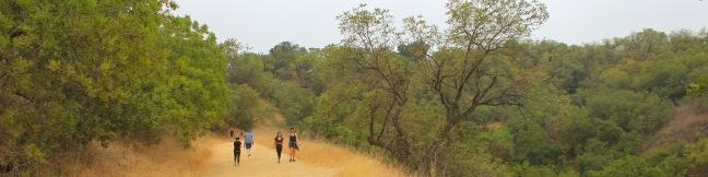
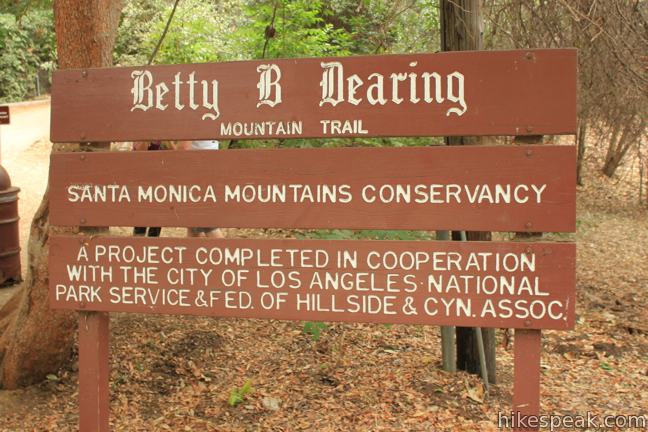
What to go for a hike but don’t have time to leave Los Angeles? If you live near the Hollywood Hills or Studio City, Fryman Canyon may be the perfect place to get an hour of outdoor exercise. The 3-mile loop on Betty B. Dearing Trail passes through Wilacre Park in Lower Fryman Canyon and Coldwater Canyon Park, dishing out just 450 feet of elevation gain. The loop covers a variety of surfaces, like dirt roads and residential streets, to create an easy urban hike away from the hustle and bustle of the city.
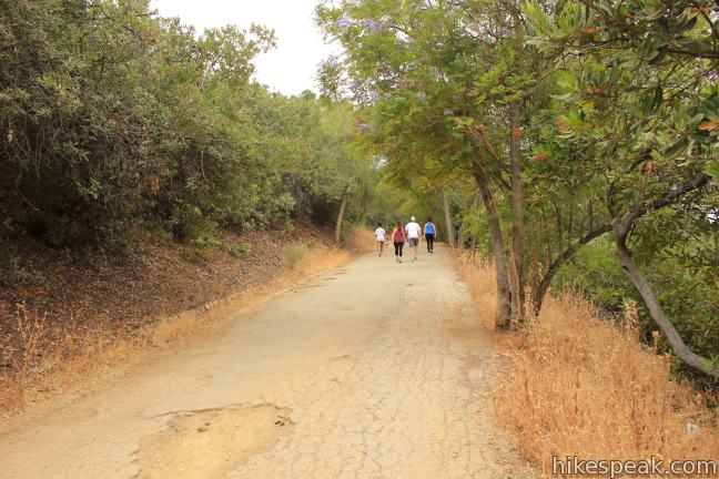
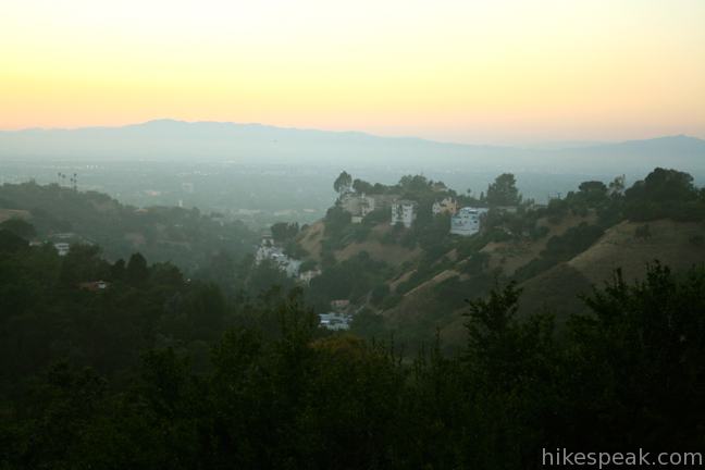
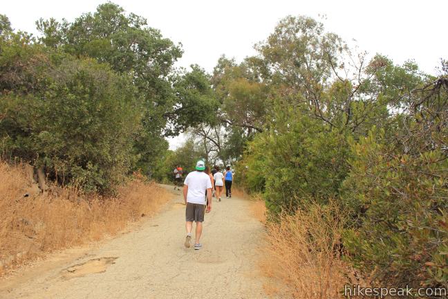
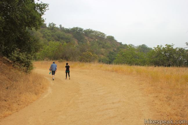
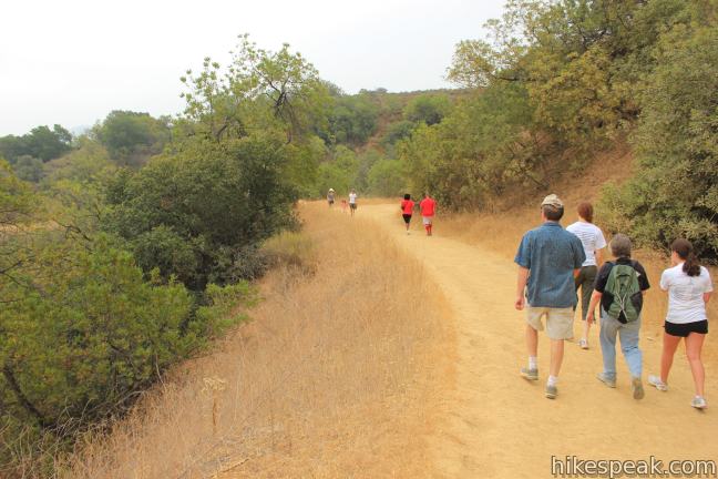
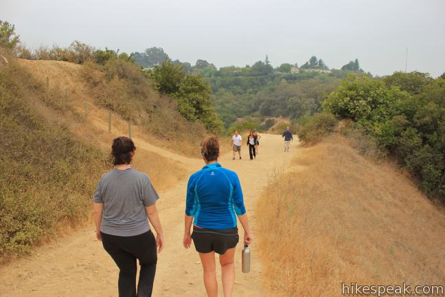
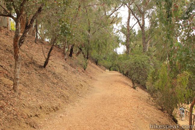
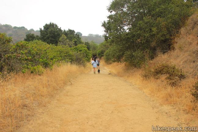
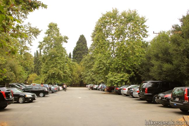
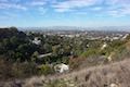
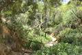
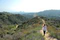
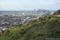
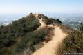
Start from a large parking area at the intersection of Laurel Canyon Boulevard and Fryman Road, 3/4 of a mile south of Ventura Boulevard. Pay $3 to park your vehicle and begin hiking up Betty B. Dearing Mountain Trail. Chaparral and California black walnut trees arch over the wide trail, providing early shade. As you head west up the canyon ridge, you will have views through the trees over the Valley cities to the north. The trail reaches a landing just over a mile from the start that offers broad clear views over Sherman Oaks to the west. Before reaching the cushy dirt trail, you’ll have to make your way up almost half a mile of pavement at the start of Betty B. Dearing Trail. This stretch also accounts for about half of the hike’s elevation gain, before the trail tapers off.
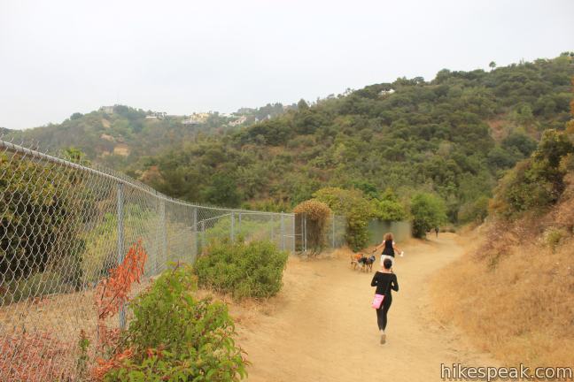
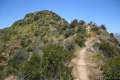
Like other trails in the Hollywood Hills (such as Runyon Canyon), Fryman Canyon Loop is quite popular with trail runners and hikers. Even if you did not know the way, you could probably just go with the flow of the foot traffic to get around the loop. Despite this easy situation, there are a couple options to consider along the way.
The first variable is U-Vanu Trail, which breaks off from Betty B. Dearing Trail at an unmarked junction on the left, 1/3 of a mile from the trailhead. This dirt single track rolls over the ridge, paralleling Betty B. Dearing Trail for a mile, with marginally higher views over Fryman Canyon (and some escape from the crowds). The trails reunited as Betty B. Dearing Trail turns downhill across a saddle, 0.15 miles from the next decision point on the loop.
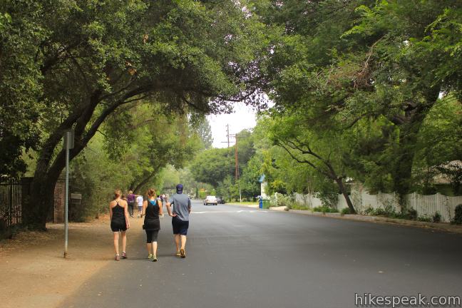
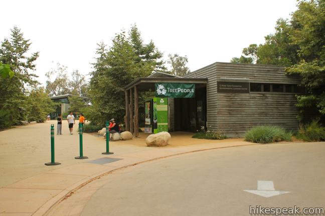
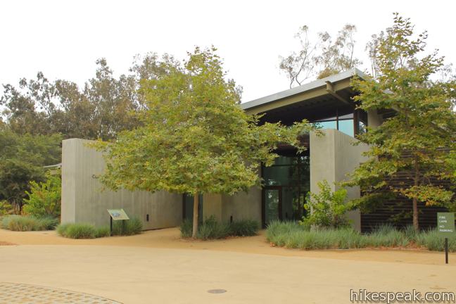
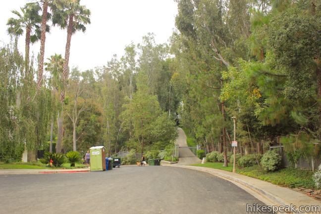
The simple loop route is to stick with Betty B. Dearing Trail, passing straight below the park headquarters for Tree People. The trail heads downhill for another half mile to Iredell Lane, where hikers walk 0.7 miles down residential streets to return to the trailhead. Note: If you wish to avoid walking through the neighborhood, you can switch things up by hiking out and back on Betty B. Dearing Trail and U-Vanu Trail. The expanded loop option is to take a brief trip off Betty B. Dearing Trail and hike up to the Tree People headquarters in Coldwater Canyon Park along Mulholland Drive. In addition to some loftier views, Tree People offers information on water conservation and forestation in urban environments. There are picnic tables and a drinking fountain if you need a break.
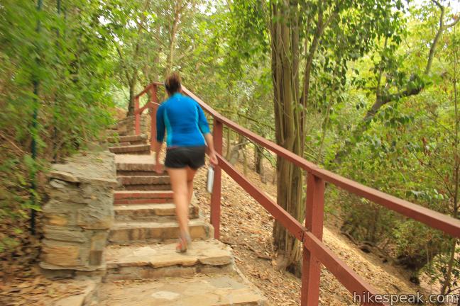
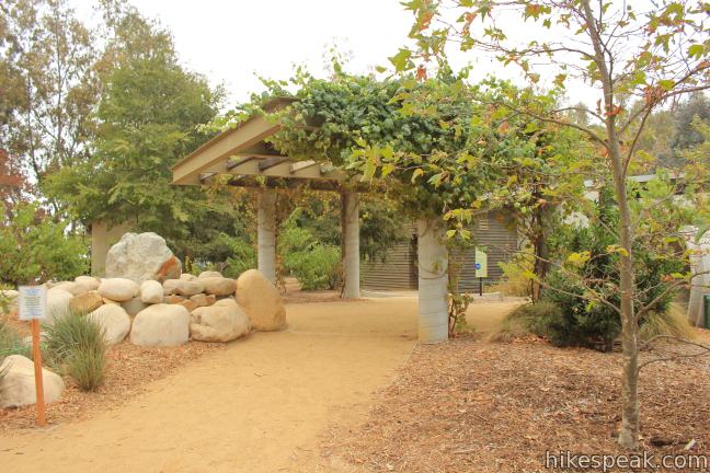
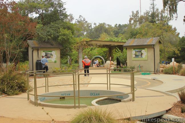
To get to and from the Tree People headquarters, turn up Oak Trail, a wide dirt trail on the right, 1.4 miles from the start and not long after the junction with U-Vanu Trail (on the left). Head west up Oak Trail until you see a stone staircase on the left. Here you may take the steps up to the headquarters. After walking through the gardens and learning about water usage practices, walk to the southeast side of Tree People’s facilities where another dirt trail heads back down the hillside. After just a few hundred feet, this connector trail ends at Betty B. Dearing Trail. Turn right to rejoin the loop, not far from where you strayed up Oak Trail. This venture adds about a third of a mile to the hike (and about fifty feet of elevation gain), bringing the total distance up to three miles.
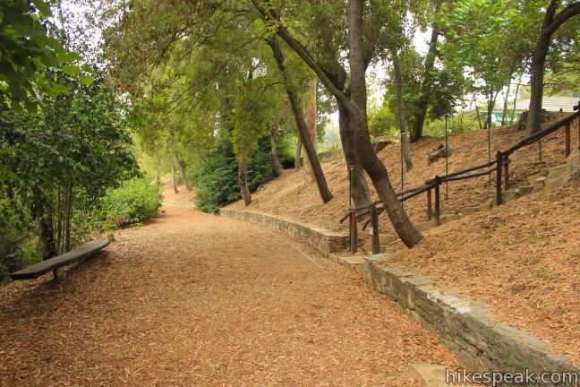
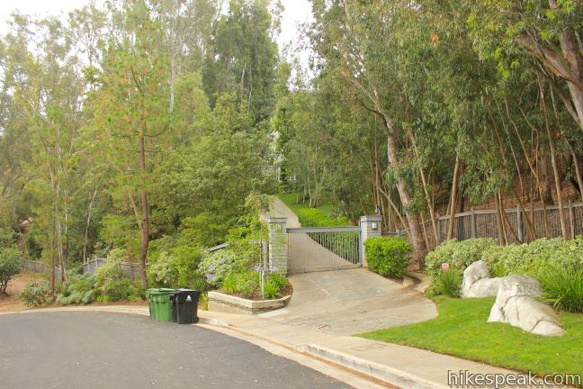
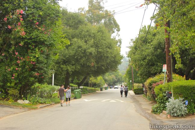
From the junction beneath the Tree People headquarters, Betty B. Dearing Trail heads eastward and downhill through Coldwater Canyon Park, coming to an end after half a mile at a cul-de-sac at the top of Iredell Lane. Walk down the lane past homes tucked away in the wooded hillside that may be occupied by Hollywood celebrities.
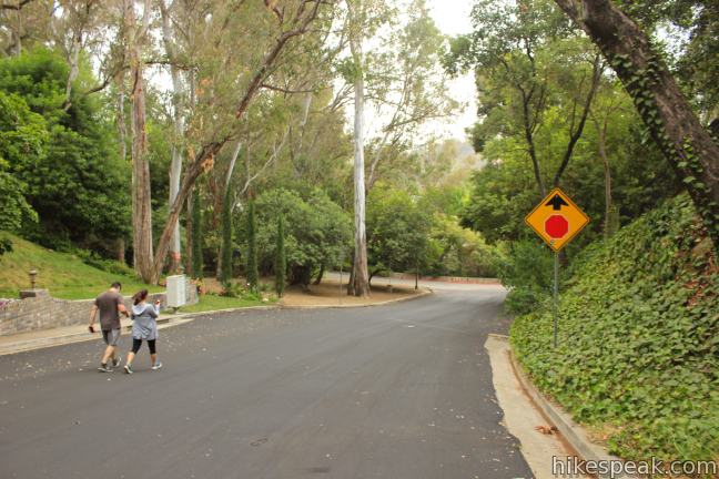
After 0.2 miles, turn right on Iredell Road to continue downhill. The road levels out and comes to a T at Fryman Road. Turn left and walk 0.2 miles back to the trailhead parking area to complete Fryman Canyon Loop.
Dogs are permitted on a leash, but mountain bikes are prohibited on the trail. To find hiking that’s close to home for many Angelenos, get on over to Fryman Canyon Loop. As of 2014, parking at the trailhead is free, thanks to a fee-removing greement between the Mountains Recreation and Conservation Authority and the County of Los Angeles. No permit is required to hike this trail, so get out and enjoy!
To get to the trailhead: Make your way to the intersection with Fryman Road on Laurel Canyon Boulevard, 1.3 miles north of Mulholland Boulevard, and 0.7 miles south of Ventura Boulevard and 1.5 miles south of the 101 Freeway (exit 14). Turn west on Fryman Road and make an immediate right into the parking are at the start to Betty B. Dearing Trail.
Trailhead address: 3453 Fryman Road, Studio City, CA 91604
Trailhead coordinates: 34.13325, -118.39175 (34° 07′ 59.7″N 118° 23′ 30.3″W)
View Santa Monica Mountains in a larger map
Or view a regional map of surrounding Los Angeles trails and campgrounds.

 | Longridge Park This short hike on an undeveloped ridge in the Santa Monica Mountains has sweeping views over the San Fernando Valley. |
 | Dixie Canyon Park This 0.55-mile hike forms a partial loop in a small wooded canyon on the Sherman Oaks side of the Santa Monica Mountains. |
 | Franklin Canyon Lake Loop & Chaparral Trail This 2.5-mile hike loops around Franklin Canyon Lake and ascends Chaparral Trail (optionally) for an overview of Franklin Canyon. |
 | Hastain Trail This pair of short loops explore Franklin Canyon Park and ridges in the Santa Monica Mountains above Beverly Hills. |
 | Trebek Open Space This 2.5-mile hike incorporated Bantam Trail and Castair Trail in a park adjacent to Runyon Canyon. |
 | Runyon Canyon Tour Hollywood's most popular dog park on loops of various lengths, offering good exercise and views over Los Angeles. |
 | Cahuenga Peak This 3-mile hike on Burbank Peak Trail and Aileen Getty Ridge Trail ascends to Cahuenga Peak and the adjacent Mount Lee, home of the Hollywood Sign. |
 | Mount Lee and the Hollywood Sign This 6.4-mile hike crosses Griffith Park from Canyon Drive to the top of Mount Lee directly behind the landmark Hollywood Sign. |
 | More trails in Los Angeles Explore other hiking destinations around Los Angeles. |
I understand and have seen a trail that goes to a rain forest. It starts a little after you get to the houses on your loop (Iredell lane)> do you know how long it takes to get there and how is it when you do get there?
Alan
From just below the top of Iredell Lane, the Betty Dearing Trail continues 2-Miles east to Mulholland Drive and Laurel Hills. This is where the rainforest is and the “Thing”. The trail is about .5 to .75 miles down from the Tree People HQ depending on where you start. Here is a link to a 6-Mile O&B loop from Tree People to Laurel Hills (It does not include Laurel Canyon and Fryman). There are a few turnoffs but as long as you stay on the main trail and keep right, you’ll get there. Make a hard right when passing a directional sign stating Rainforest. The sign will be on your left and you will have come from the Rainforest. There is a drinking fountain in the parking lot at Laurel Hills. https://strava.app.link/Md1QhFZSEW
I replied previously but don’t see it posted, so I will try again. The Trail to Lautel Hills and Mulholland is also the Betty Dearing trail. From the Tree People HQ, you head down the hill to the top of Iredell Lane, now walking on a street in a residential neighborhood, the trailhead is about 40 yards on your right. The trail extends about 2 miles to the east. There are a few turnoff options but if you stay on the main trail and keep to your right, you will end up at the parking lot and overlook at Laurel Hills. There is a drinking fountain there. This trail is MUCH less traveled than the main loop and you can connect both for a longer hike/run. Hope this helps. Here is a link to the O&B route: https://strava.app.link/mWfp6Tg4HW
I have been hiking at Fryman for more than 15 years. There are many people who ignore the ON LEASH LAW in the canyon and let their mutts run wild. I have been charged by pit bulls and when you say something to these people they cuss you out. I have not seen a ticket given and when I talked to the Rangers they say we have enough signs or we’ll get on it. But never do as I just saw three people with their crapping dogs off leash this morning. Mr. Ranger, come under cover not be so obvious and you’ll catch these stupid women. Thats right its mostly women who do this. Also, actress Lea Thompson Deutsch who lives on Iredell and owns a horse. they take their horse on the trail but never clean up the crap.
The park Ranger, David Aceves at Fryman Canyon is harassing woman on the trail. It’s also terrifying because he only does this when they are alone and jogging by in shorts and a sports bra. My family attorney has said to keep record of this behavior. A few of my friends have video and phone conversation recordings of Mr. Aceves abusive behavior. If it continues we will file a lawsuit against the county of Los Angeles for sexual harassment.
I saw a ranger, presumably him, doing a fantastic job giving a ticket to a trio of vapid looking “women” in sports bras for leaving their dog crap on the trail. Maybe he’s not harassing anyone and is actually doing his job. Ever stop to think that someone who is getting stopped by a park ranger just MAY have done something to warrant it? And it’s possible that just MAYBE they had a bad attitude about it so they decided to say they were being harassed? Lots of possibilities here.
Amen–thank goodness the rangers are doing their job.
I just don’t understand why people feel the need to point out the sex of whoever is doing something wrong… or take it a step further and call a group of strangers “vapid” or “stupid” women. When you come at it from that angle it sorta makes you sound like you’ve got some deep rooted stereotypes about women. Maybe you’re noticing more women than men are walking with their dogs off leash and not picking up after them because more women own dogs. Dogs make some women feel safe and pets activate/satisfy motherly instincts.
I agree that this is all incredibly rude to other people and honestly dangerous and unhealthy for dogs and other animals. But could we maybe not try to use things that bother us as a way to reinforce mysoginistic stereotypes on literally every corner and comment section of the goddamn internet?
I just want to live in a world where I can spend a day doing mundane things without having to defend myself and 53% of that world’s population from biased preconceived notions about our intentions, intelligence, awareness, and capability.
Hi Ms. PC – you have a point but – I think that the person was under the assumption that most often it is men who are thoughtless and inconsiderate – the Jails prove this – so it isn’t unlikely that the Gals have a few shortcomings relative to men and it’s an exception which shouldn’t hurt any bodies sensibilities . Men & Women are different – Thank Goodness
Lol. You’re so sexist and dull minded. You and Jim, both. Pathetic.
[…] after we stopped at Lucky Puppy to pick up Caramel and Moses, we just swung around the corner to Fryman Canyon. Shannon has done this loop before with her own dogs because she lives nearby, but one of her dogs […]
where r the hrs?
Too many dogs crapping on the trail while their owners crap on about being harassed for being selfish. Who’d have thought?
[…] More info about Fryman Loop. […]
Is there a secret way to get into Franklin Canyon? Coming up from Studio City I take coldwater and take a right by Tree People crossing Mullholland. The light to get into Franklin is endless. I went through it today after waiting on that 15 ft. Of land with cars whizzing by in front and behind me for 3_4 minutes. What’s the deal?