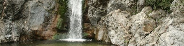
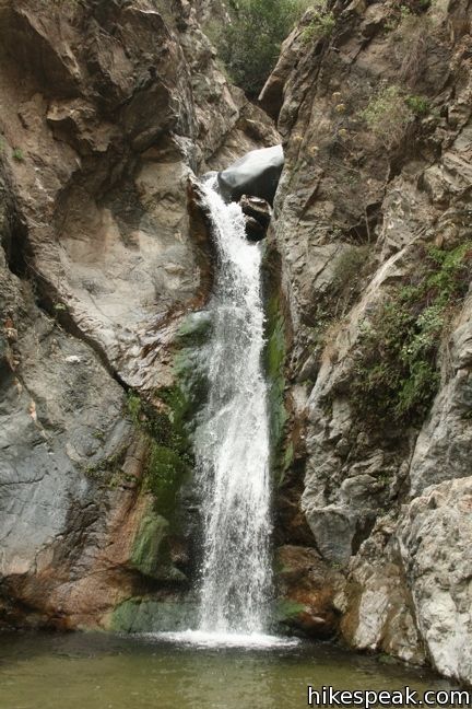
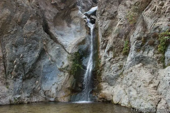
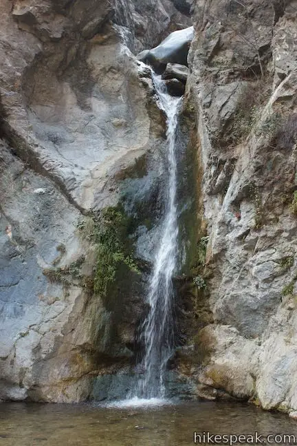
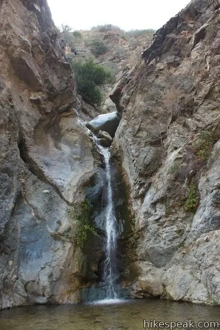
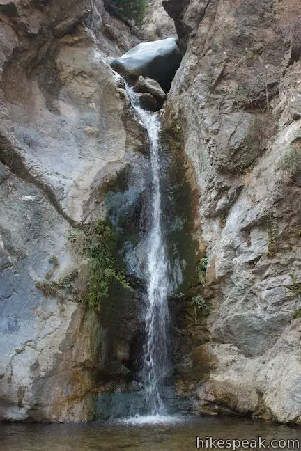
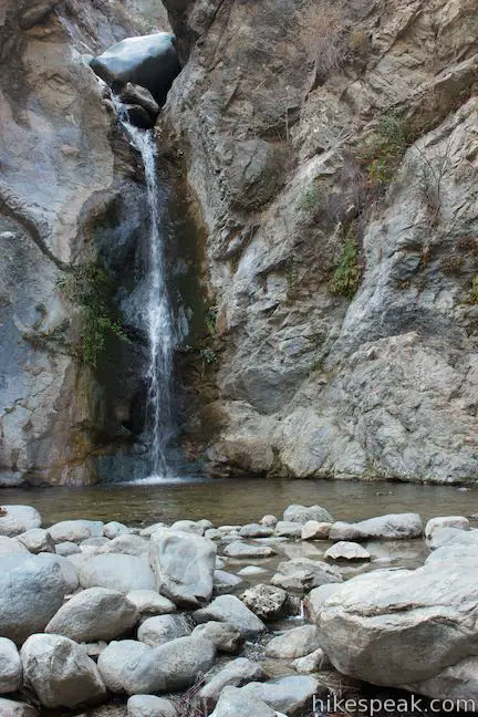
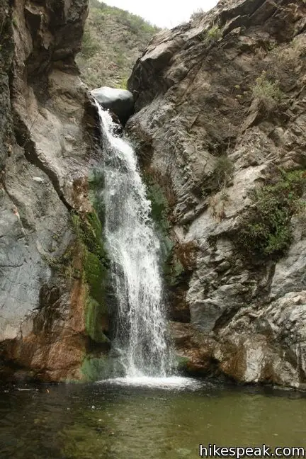
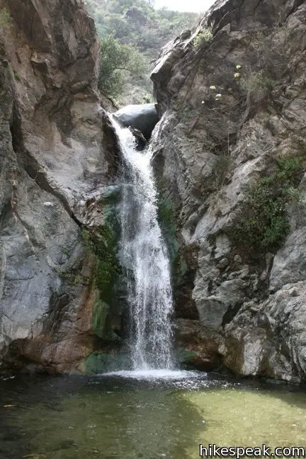
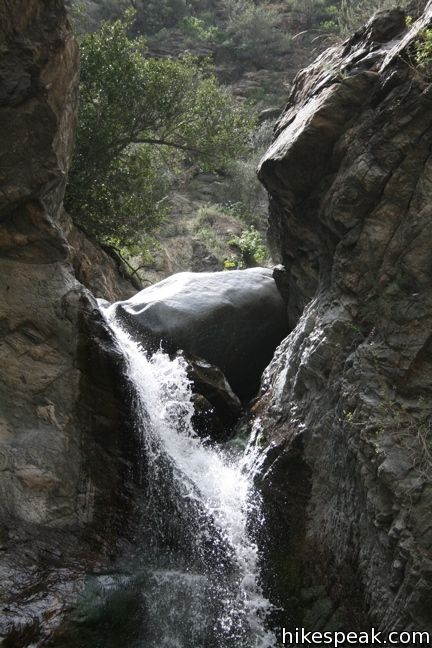
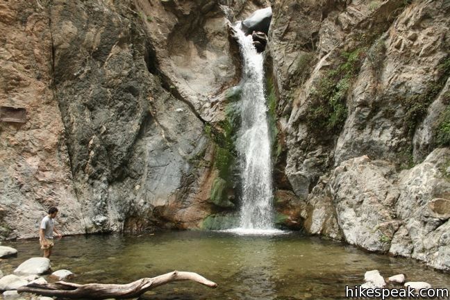
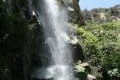
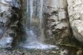
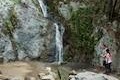
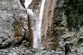
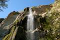
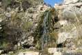
The forty-foot waterfall in Eaton Canyon fills an amphitheater at the top of Eaton Canyon Trail, tumbling into a wide pool that you can rest alongside or wade in. The waist-deep water is so refreshing, you are likely to see hikers in bathing suits on a warm day.
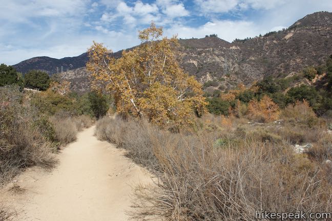
The hike to Eaton Canyon Falls can be summed up this way: 1.1 miles of wide flat, relatively uneventful dirt trail, followed by 0.65 miles of single track up a narrow canyon that is adventurous and fun (forming a 3.5 mile round trip hike with 375 feet of elevation change).
- Eaton Canyon Falls is one of the Los Angeles waterfall hikes.
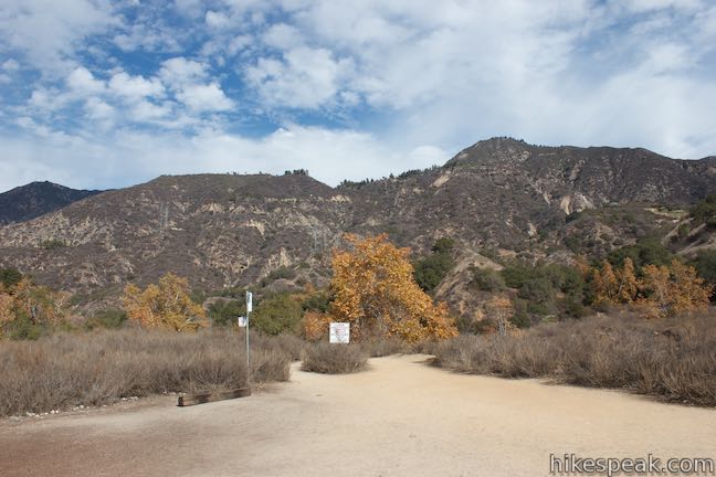
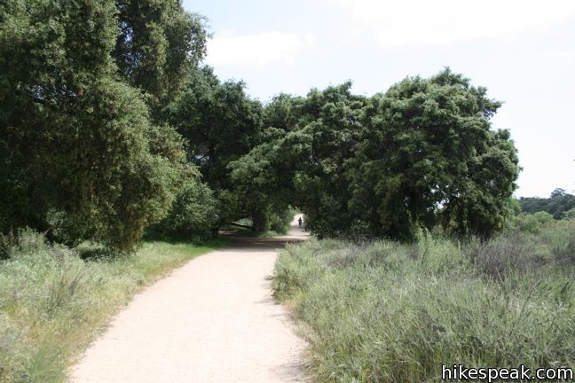
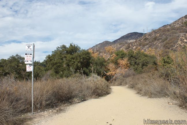
Begin up Eaton Canyon Trail from Eaton Canyon Natural Area Park and Nature Center, which is located just off Altadena Drive and is a place you might go to walk a dog or push around a stroller with big serious wheels. The easy paths draw many visitors to the park for just that purpose.
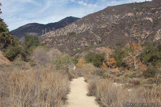
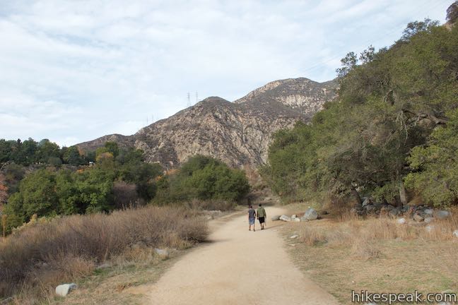
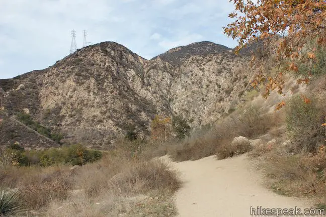
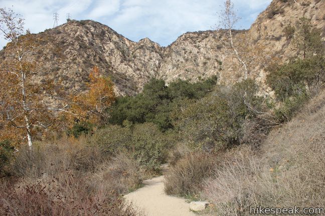
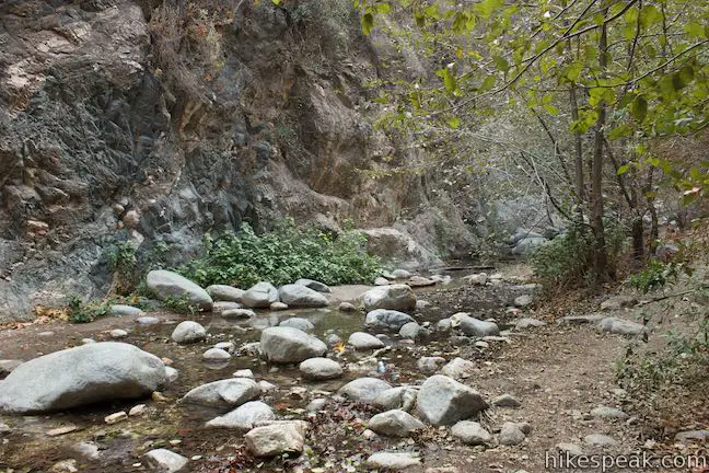
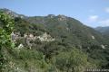
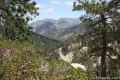
Follow Eaton Canyon Trail north along a typically dry creek bed, Eaton Wash. Pass a few shaded thickets and plenty of sun along the way. In front of you, rise the San Gabriel Mountains. The trail will take you right to the foot of these mountains.
Eaton Canyon Trail crosses Eaton Wash after 0.2 miles and then turns left below a canopy of trees.
At 0.55 miles from the start, come to a junction with Horse Trail. Stay to the left to continue up Eaton Canyon Trail. Horse Trail (also known as Walnut Canyon Trail) heads up the side of the canyon to the east, reaching Mount Wilson Toll Road (a toll-free hiking trail) after 0.6 miles.
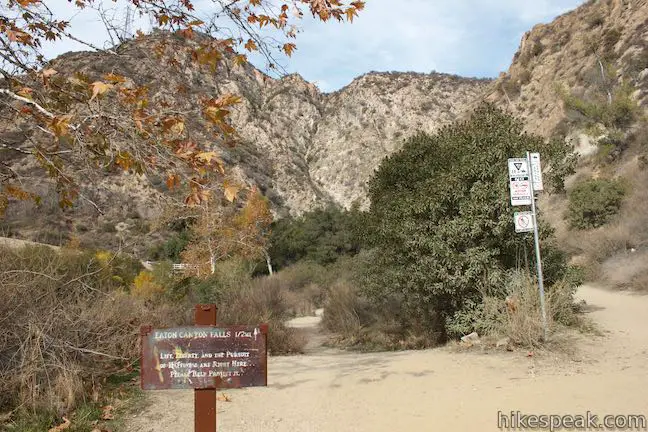
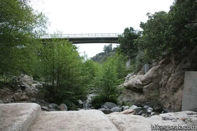
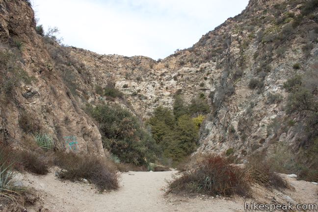
Come to another marked junction, 1.1 miles up Eaton Canyon Trail. The split appears as the trail approaches a white concrete bridge on Mount Wilson Toll Road, crossing over the top of Eaton Canyon Trail. The trail to the right connects to Mount Wilson Toll Road, which runs all the way to the summit of Mount Wilson. The trail also reaches Henninger Flats, a scenic perch covered in pine trees with a visitor information center, campground, lookout tower, and tree nursery operated by the Los Angeles County Fire Department. To continue to Eaton Canyon Falls, stay to the left, following an arrow for the waterfall. Pass below the bridge to enter the San Gabriel Mountains.
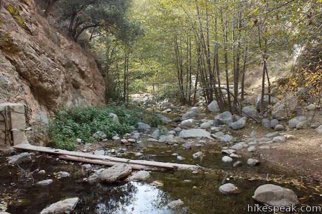
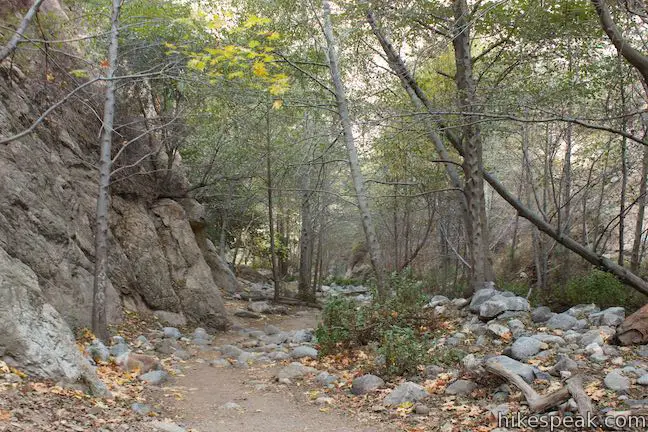
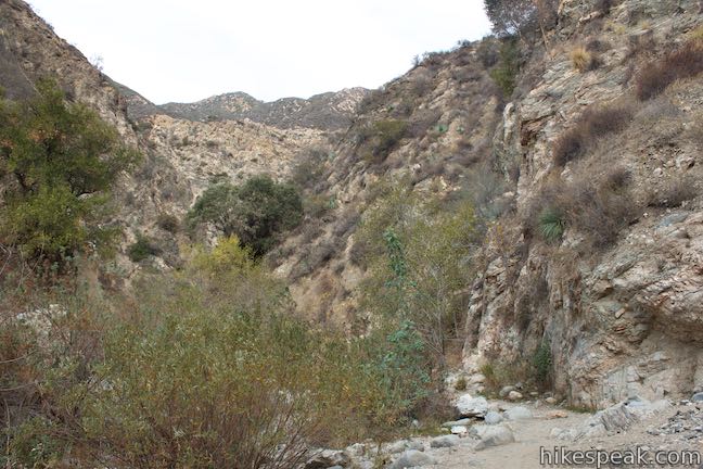
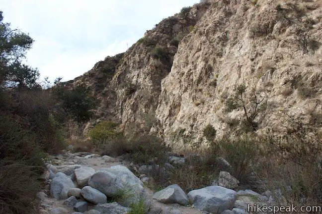
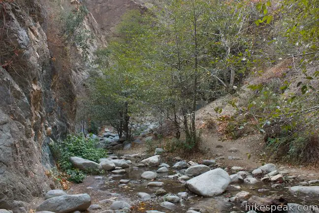
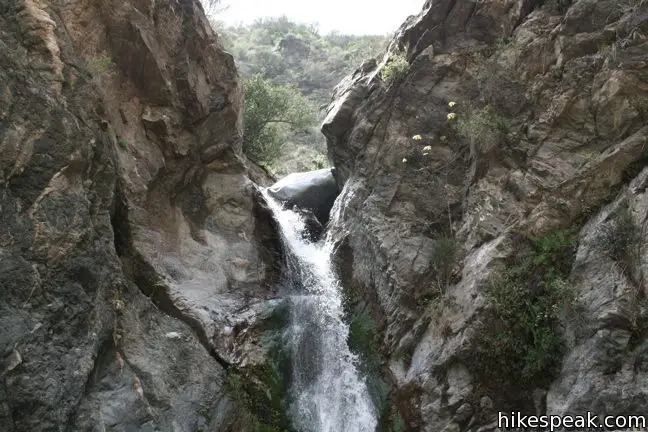
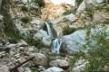
Once you pass beneath the bridge, the hike changes drastically. You are suddenly hiking up a canyon, crossing from bank to bank up a winding creek. Be especially careful on this section of the trail, which crosses rugged terrain.
This enjoyable stretch is over far too quickly because the falls are just 0.6 miles past the bridge.
Eaton Canyon Trail comes around a bend to the left and hits the back of the canyon, where Eaton Falls makes a 40-foot single drop into a wide shallow pool. Have a seat on a boulder or a log and admire the waterfall. You can also pop off your boots and wade into the water to get a little closer.
Continuing above Eaton Canyon Falls is dangerous and not advised, so turn around at the waterfall for 3.5 mile round trip hike with 375 feet of elevation change.
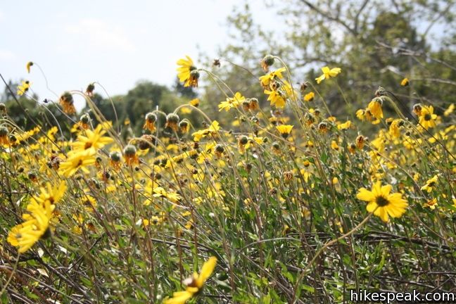
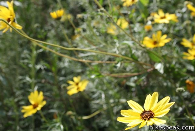
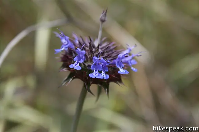
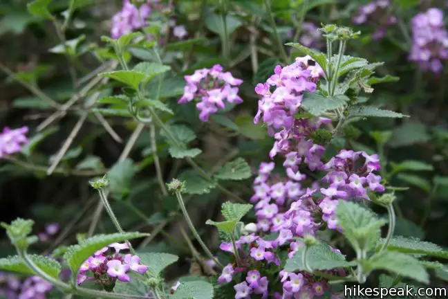
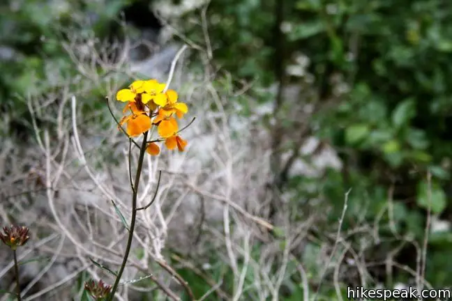
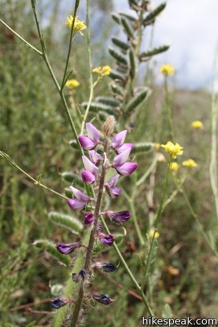
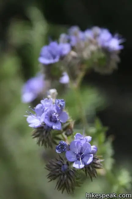
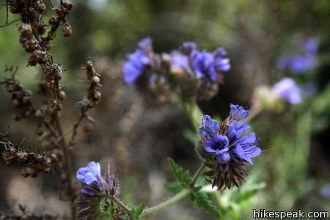
Eaton Canyon Trail is well marked and easy to follow. Along with a powerful waterfall, spring brings a bountiful bloom to the park, filling the sides of the trail with fern leaf phacelia, chia, and other flowers.
Dogs are welcome in Eaton Canyon Park and on Eaton Canyon Trail to the waterfall. No fee or permit is required to visit Eaton Canyon Falls, so get out and enjoy!
To get to the trailhead: Take the Altadena exit off the 210 Freeway in Pasadena. Head north on Altadena Drive. The Eaton Canyon Nature Area is a couple miles up the road on the right past New York Drive. Pull into the park, leave your vehicle in the lot by the nature center and start hiking north.
Trailhead address: 1750 North Altadena Drive, Pasadena, CA 91107
Trailhead coordinates: 34.17832, -118.09663 (34° 10′ 42″N 118° 05′ 47.9″W)
You may also view a regional map of surrounding Los Angeles trails and campgrounds.


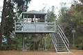 | Henninger Flats via Mount Wilson Toll Road This 6-mile round trip hike ascends 1,325 feet to a trail camp, tree nursery, lookout tower, and visitor center on a landing in the San Gabriel Mountains operated by the Los Angeles County Fire Department. The hike can easily be extended to 8.7 miles by exploring a loop above Henninger Flats. |
 | Santa Anita Canyon Loop This 9.5-mile loop visits two peaceful creeks in sylvan canyons, passing a 60-foot waterfall and plenty of beautiful wilderness. |
 | Sturtevant Falls in the San Gabriel Mountains This 3.3-mile hike visits a 60-foot waterfall and a lush cottage-lined canyon. |
 | Mount Waterman The 5.5 to 6 miler can be completed as an out and back hike or a loop, traveling through a pine forest to a round summit. Add six miles to the hike by dropping across a saddle and climbing to the summit of Twin Peaks. |
 | Cooper Canyon Falls This 3-mile hike leaves from Buckhorn Campground and visits a short waterfall in an enchanting glen of tall pines. |
 | Dawn Mine This 6-mile hike from Millard Campground leads past Millard Falls to an old gold mine. |
 | Rubio Canyon Trail This 1.3-mile round trip hike ventures into a rustic canyon to a double waterfall. |
 | More trails in the San Gabriel Mountains Explore other destinations in the range. |
 | Fish Canyon Falls This 4.8-mile round trip hike leaves from an active rock quarry and progresses up a beautiful canyon to a mesmerizing multi-tiered waterfall. |
 | Millard Falls This one mile hike visits a 50-foot waterfall up one of the most scenic canyons in the range. |
 | Monrovia Falls This 1.6-mile to 3-mile hike in Monrovia Canyon Park follows an enchanting canyon up to the base of the 30-foot waterfall. |
 | San Antonio Falls This 1.4-mile hike visits a multi-tier waterfall along the trail to Mount Baldy. |
 | Escondido Falls This 3.8-mile out and back hike visits a 200-foot waterfall that is split into two tiers. The upper tier is 150 feet tall and stunning after a rainstorm. |
 | Paradise Falls This 40-foot waterfall is located within Wildwood Park in Thousand Oaks and is reachable via several trails. |
 | More waterfalls around Los Angeles Explore other waterfalls in the Santa Monica and San Gabriel Mountains. |
[…] Hikespeak.com […]
How do you make a reservation to hike Eaton Canyon trail
Reservations.lacounty.gov make an account, once logged in click on the ‘Activity’ option and make the reservation
Do we still need a reservations for Eaton falls?
would it be good to go here around the first week of oct?? or dangerous? any feedback would be greatly appreciated.
I hiked this on a Saturday during the summer and it was incredibly packed. Although that was annoying, it was a testament to how beautiful the trail is. Also, bring a pair of shoes you can get wet, or a pair of sandals so you can ford the river fifteen times without a lot of waiting.
The best hike in Pasadena. It was always fun going in the summer time to the second water fall. We were careful helping each other and we made it 2 times. I think my phone didnt have a camera on it like back in the day so i couldnt take pictures. The graffiti helped you make it ontop of the second waterfall. You can slide down on it or climb on it a bit more and you can jump off of it. It was deeper and higher so it was a lot of fun. They said you can still go to a third waterfall but it was lame and not worth the trip. But boy was it FUN! Now i just visit Henninger flats early mornings to enjoy the view. Stay safe. Great read.
This was a beautiful, scenic hike that started easy and got more rugged as we neared the waterfall. There was plenty of running water in the end of June, but there were way too many people to truly enjoy the beauty of the hike. When we reached the waterfall, there were at least 200 people crowding around it. Be careful crossing the stream, those rocks can be slippery!
It is a lovely hike but I would like to check it out during the week instead of the weekend. It was incredibly busy here today, Sunday. It was still nice but at the actual falls there was 150 people which was really too may. (People were littering. I picked up what I saw.) It is so lovely and cool as soon as you reach the wooded areas.
I hiked this trail over the weekend and LOVED it. It wasn’t too crowded, but the creek was pretty dried up because it’s the middle of August. Lots of smaller trails off the main trail you can check out, too! Would love to do this again in the autumn and spring when there’s more water.
You can check out some pics and a full review on my trip here: http://apartment402.tumblr.com/post/30393381402/eatoncanyon
Hey folks – Eaton Canyon is beautiful, but *please* go only on the marked trails. There is *no* safe trail to the second waterfall, and every year, folks die trying to get there. Most recently, a 17-year-old girl fell and died. Enjoy the canyon, but stay alive! If nothing else, think what pulling your mangled corpse out of the canyon will do to the rescue crews,
There is no maintained trail to this waterfall on Forest Service Land. The trails are user created and have become very dangerous due to people climbing the unstable rock. People come to this area unprepared and with little thought for safety causing multiple rescues each week and 8 fatalities in the last three years. Please take this hike off your list.
I think you are thinking about the upper falls hike, which is indeed very dangerous. This lower falls hike is relatively easy and beautiful (though very crowded on the weekends).
I have been to the upper falls may of times even camp at one. People die because they don’t know what they are doing or try to show off. Hiking is not a game, it can show u life you never seen before or take ur own life.
Which waterfall are you talking about? 1st or 2nd.?
I am a participant in a 12 week exercise program for pre-diabetics conducted by the kinesiology dept. of Cal. State Northridge. We are in the 11 week and the program has been granted for an extension. Most of the exercise takes place inside, with the exception of walks, jogs,etc. outside on the facility premises. Recently we went on a 6 6mi. hike in Echo Canyon. We are looking for other exercises to do outside the classroom that would be in keeping with the physical fitness goals of the program. In past years I’ve gone on day hikes in the Angeles Forest conducted by the Forest Rangers and Sierra Club. Does anyone know if these day hikes are stll being done?
Will there still be a lot of people around this time of year (MARCH)? And is the waterfall still running? I’m planning to go here for Spring break.
They have done a lot with this trail and looks a lot better than it did a year or so ago with the graffiti and rundown facilities. The trail IS rocky, but definitely manageable for someone with good health, balance and proper foot ware. We walked it just today after the rain last night and witnessed several small rock slides, so do be careful and keep your eyes and ears open.
The best time to go is during the week between 7:30-10:00AM. Any later and you start to run into crowds. I would never do this hike on the weekend, the trail is too crowded and not enjoyable once you get to the falls (which become a swimming hole/hang out area).
If you must go on a weekend, I recommend going right at sunrise or at 8AM at the very latest to enjoy a quieter hike.
Hello,
Are the falls running now (June)?
Yes, I was there about 2 weeks ago and there was plenty of water at the falls and people rock climbing down the face of the falls.
was there June 28, to many people, litter all over. people just don’t care.
Is it safe walking to the 1st waterfall? I know going up the 2nd is very dangerous. Any comments? Thanks.
Hi I wanted to visit and was wondering if anyone has taken a child…my daughter is 7 and just wanted to know if it was safe enough for her?
where does Eaton Canyon begins, starting from San Fernando Valley
What is difficulty and length of this hike?
Please could you tell me how long of a hike is from the parking lot to Eaton Falls? thank you
yes, it is safe for your children if supervised.
I just went out there Yesterday (Saturday). It was packed. I am a first time hiker and it was not to difficult. I would say its about 3 miles round-trip. And yes, it is safe for your children if supervised. There was many children hiking with their parents.
Just did Eaton Canyon today. Boy, was it packed! Kids, Grannies and everyone in between. Still, it’s a pleasant and easy hike, the falls had some water and there is plenty of shade still. I suspect it will be brown and dry within a month or so, but enjoy it while you can!
Hi,
I want to make sure the hike to the waterfall is still open. Also, is there water? And, any ideas how crowded it will be on Mother’s Day? Thanks.
CAn you fish?
I would not recommend this hike to anyone. The trail was PACKED there were hundreds of people. It was extremely dirty and the entire trail smelled of dog poop. I will never go back here.
[…] Rundown for the Eaton Canyon Trail […]
I was there today. I believe they have CLOSED the upper falls due to injuries and deaths. There’s a whole bunch of signs saying as much. The lower falls are nothing like the pictures on this page. Just basically a creek with a bit of running water. It’s a nice enough hike and some nice water under the bridge, but this is NOT the falls you think it is from this entry.
I hiked up to the falls today. After the recent rains, the falls were beautiful – just like the pictures.
Is it good for small children. What about animals or bugs.
It is good to bring young children on but might be difficult to go too far toward the falls. It is at least one mile def more from the parking lot to the waterfall. I would recommend not going in hot weather as the initial large horse trail to the bridge where the hiking trail begins is not covered by shade and can be extremely hot in the Summer. If you are bringing a kid who you have to carry at some point, I would recommend just exploring the creek and some of the trail with them but not attempting to carry them to the waterfall and back unless you are extremely ripped and a CrossFit athlete. I would wait until the kid is about 8 or 9 to go to the waterfall. A good alternative hike for a younger kid is the Monrovia canyon fall hike which can be shortened by driving your car past the rangers box and all the way up past the cabin to the top level parking. Then you can enter the hiking trail to the left. I have seen people successfully take walking children on this trail.
Most convenient trail in Pasadena!! I have a route that I run at least twice a week that adds another 1/2 mile to the length of the trail(for extra bonus brownie points run up the hill past the bridge, turn around once youre at the gate and then hit the waterfall trail). BUT AS mentioned if you do not get there before 8am be prepared to deal with people-packed trails. Honestly as a runner it doesnt bother me, I just go around everbody and listen to my music. Im not much of a complainer either, although I see a lot of them on this post ^^^ ?? anyways suffice to say, this trail is totally worth it. I go through about 1.5L of water every time, so if you are a Water-holic like me bring about that much for yourself (as well as each adult member of your group, unless theyre a small child theyll probably go through less than .5L) nothing worse than running out of water halfway through a run/hike.
Rather than that, there’s not too much left to say! Be safe, hike smart, keep dogs on leashes, keep an eye on your kids, and enjoy the beautiful view of one of Pasadena’s honeyholes.
Thinking of taking my family, and would to know if there is any water or waterfall at this time
Yes. Go and enjoy!
Can we go to the falls via the mount wilson toll road? Can people get inside the locked gate? I saw a locked gate on google maps/
Hi,
If you’re taking about the gate at 2260 Pinecrest Drive, Altadena, CA 91001 (described on the hike to Henninger Flats), it is possible to start from that trailhead, but it is easier to find parking by the nature center and start hiking from there.
Do not park at nature center. It isn’t safe my car was broken into. The staff at nature center were utterly as useless as the police. Apparently this happens once a month and nothing is being done about it.
Is this hike safe now? Also, how crowded is it around this time of year, in the winter?
Nice hike, but as others have said, its pretty crowded. With all the rains we’ve had of late (Feb. 2019) the waterfall really had a lot of water volume. But the other effect is that the stream/river in the canyon was quite swollen. Its necessary to cross it @6-7 times, depending upon what route you take and your feet will get wet. The rocks are slippery so if you’re taking children be very careful. At some crossing points there was a line waiting to cross, there were so many people.
You now need to .ake reservations to get in the canyon. Forget weekends. It’s crazy.
Do I have to make reservations as of today, 6/28/21? If so, how do I make them? I am not seeing any current links or info on this.
As of August 2021 they no longer require reservations – https://parks.lacounty.gov/eaton-canyon-natural-area-and-nature-center/
As of August 2021 they no longer require reservations – https://parks.lacounty.gov/eaton-canyon-natural-area-and-nature-center/
On March 14, 2022, we went to this place like you do on weekends, everything is nice for walking, putting your feet in the river, the only bad thing is that they stole my car, they opened it and took cash and a bank card.