Hikes in Devils Postpile National Monument

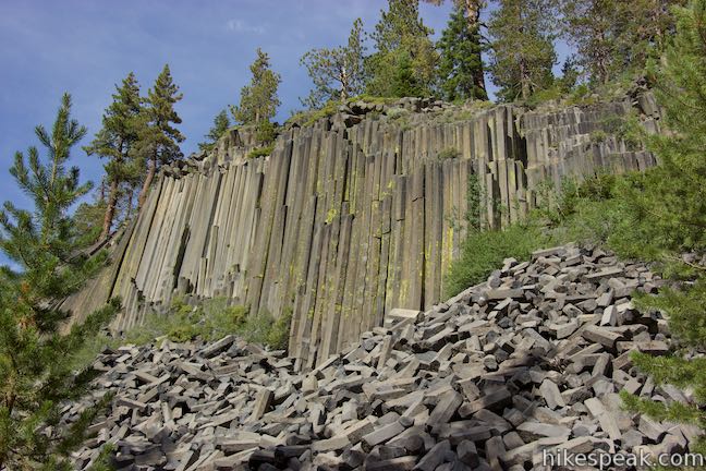
Devils Postpile National Monument is located near Mammoth Lakes in the Eastern Sierra Nevada Mountains. At the south end of the monument, you’ll find the lovely 101-foot tall Rainbow Falls. The monument’s main attraction is the Devils Postpile Formation, which has unique 60-foot tall cliffs made of basalt columns.

Devils Postpile National Monument is surrounded by Inyo National Forest (which includes Ansel Adams Wilderness). The park is shaped similar to a column of basalt. Looking down from above, the park is a long north-south rectangle that covers 800 acres.

Devils Postpile National Monument
Devils Postpile

Devils Postpile was protected as part of Yosemite National Park in 1890, but it lost that protection 15 years when plans were put forth to destroy the postpile formation. The park guide explains:

Originally part of Yosemite National Park, Devils Postpile lost its protective status in 1905 with pressure from local mining interests. They planned to dynamite the postpile to make a rock dam on the river. This threatened not only the postpile formation and falls, but this vital watershed. Activists persuaded President William Howard Haft to restore federal protection to Devils Postpile and Rainbow Falls by proclaiming the national monument in 1911.

Postpile National Monument Hiking in

This group of trails in Devils Postpile National Monument all start from the same trailhead at the north end of the monument. Each trail links to its own report complete with photos, maps, directions, and all the other information needed to locate and enjoy these trails. An interactive map showing the location of each trail is also provided.

Devils PostpileDevils Postpile
This 1 to 1.35-mile hike visits the columnar basalt cliff that Devils Postpile National Monument is named after, with top-down and bottom-up views of the impressive formation. The hike can be extended to include Rainbow Falls at the south end of the monument.
Rainbow Falls
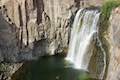
Rainbow Falls
This hike of 5.1 miles or more passes the Devils Postpile Formation to reach an attractive 101-foot waterfall with rainbows in its mist.
Minaret Falls
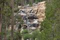
Minaret Falls
This 3-mile hike from Devils Postpile National Monument connects with Pacific Crest Trail to reach the base of a waterfall that tumbles and slides down a rocky slope.


Camping in Postpile National Monument

Devils Postpile National Monument CampgroundDevils Postpile National Monument Campground
This 21-site first-come first-serve campground provides camping in a pine forest next the Middle Fork San Joaquin River near the trailhead for Devils Postpile National Monument.


View Sierra Nevada trails and campground in a larger map
Or explore hikes around Devils Postpile National Monument on the Hike Finder Map
hikespeak
Fallen Leaf Lake Moraine Trail Lake Tahoe Basin South Lake Tahoe Hike
What's better than hiking by a lovely creek - maybe hiking by a lovely lake. You can do both on Moraine Trail, visiting Fallen Leaf Lake and Taylor Creek in the Lake Tahoe Basin National Forest Lands near South Lake Tahoe. This easy and level loop is 1.1 miles long, including a short side trail to Fallen Leaf Lake Dam. The mountain-cradled Fallen Leaf Lake is located just south of Lake... Read more.
OK! Add to trails I’ve hiked
OK! Add to trails I want to hike
Tagged with · Free Trails · Lake Tahoe Basin National Forest Lands · Lakes · South Lake Tahoe
Distance: 1.1 miles · Elevation change: 35 feet
By: Published: Last updated: July 26, 2023
Way of the Mono Trail Sierra National Forest Bass Lake View Hike Oakhurst California
Interpretive trails are usually good places to appreciate the finer features of a forest, but they tend to lack grand vistas. This is not the case with Way of the Mono Trail, which rises to a splendid view over Bass Lake, a beauty in the Sierra Nevada Mountains south of Yosemite National Park. Way of the Mono Trail is a 0.6-mile loop with 140 feet of elevation change. Panels along this... Read more.
OK! Add to trails I’ve hiked
OK! Add to trails I want to hike
Tagged with · Bass Lake · Free Trails · Lakes · Morteros · Native American Heritage · Nature Trails · Oakhurst
Distance: 0.6 miles · Elevation change: 140 feet
By: Published: Last updated: June 30, 2021
Chimney Beach Trail Lake Tahoe Nevada Chimney Beach Hike Humboldt-Toiyabe National Forest
Before your visit to Lake Tahoe goes up in smoke, take a hike to Chimney Beach - where a standing-on-its-own fireplace and chimney serve as an unsual landmark for a lovely little cove. The brick chimney is all that's left of an old cabin built in the sand between boulder-strewn points on the east shore of Lake Tahoe. If curiosity about the chimney draws you to Chimney Beach, the beautiful... Read more.
OK! Add to trails I’ve hiked
OK! Add to trails I want to hike
Tagged with · Beaches · Carson City · Free Trails · Ruins · South Lake Tahoe
Distance: 1.1 miles · Elevation change: 215 feet
By: Published: Last updated: July 26, 2023
Cave Rock Trail Lake Tahoe Nevada Overlook Hike
Gaze out from Route 50 as it travels along the southeast side of Lake Tahoe and you'll find nice views of the lakeshore and its surrounding mountains. Seven miles up from the state border in South Lake Tahoe, Nevada Route 50 slips through a tunnel in a tall pointed ridge of volcanic rock. The road itself is scenic, but the sight of Cave Rock should have you speculating how superb things must... Read more.
OK! Add to trails I’ve hiked
OK! Add to trails I want to hike
Tagged with · Free Trails · Glenbrook · South Lake Tahoe · Summits
Distance: 0.9 miles · Elevation change: 165 feet
By: Published: Last updated: July 26, 2023
Columbia Rock Yosemite National Park Columbia Rock Viewpoint Yosemite Falls Trail Hike Yosemite Valley California
Yosemite Valley looks great from the bottom up, the top down, and even the middle out. For this neither-up-nor-down view over Yosemite Valley, visit Columbia Rock, a viewpoint on Yosemite Falls Trail perched about thousand feet up the north wall of Yosemite Valley. The hike from Camp 4 up to Columbia Rock is 2.2 miles round trip with 985 feet of elevation change. Of course, continuing up... Read more.
OK! Add to trails I’ve hiked
OK! Add to trails I want to hike
Tagged with · National Parks · Yosemite Valley
Distance: 2.2 miles · Elevation change: 985 feet
By: Published: Last updated: January 31, 2018