Twin Peaks and Mount Waterman
in the San Gabriel Mountains
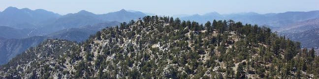
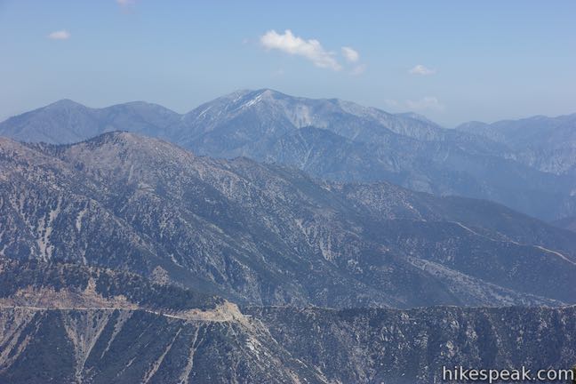
The double-crested mountain of Twin Peaks is located close to the absolute center of the San Gabriel Mountains, making it an ideal mountain for catching big views over the range, including high points like Mount Wilson, Mount Baldy, and a slew of other summits. A trail leads to the 7,761-foot summit of Twin Peaks East, the higher of Twin Peak’s sibling summits. Cross Mount Waterman on the hike to Twin Peaks for an alluring two-summit outing through a beautiful section of Angeles National Forest and San Gabriel Mountains National Monument.
This hike to Twin Peaks is 11.65 miles round trip (plus any additional exploring) with lots of elevation change. It starts with a 905-foot ascent up most of Mount Waterman. Before the true 1,230-foot climb to the summit of Twin Peaks, you must descend over eleven hundred feet to a saddle between the mountains. On the way back, you’ll drop to the saddle and then ascend just over fifteen hundred feet to the top of Mount Waterman before finishing with a 1,265-foot descent back to the trailhead. In total, that’s 3,640 feet of ups and downs. This hike is most definitely a workout (a great training hike), and is satisfyingly scenic and remote.
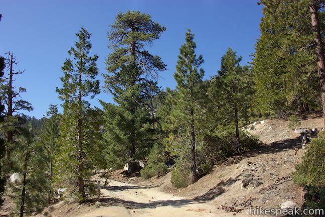
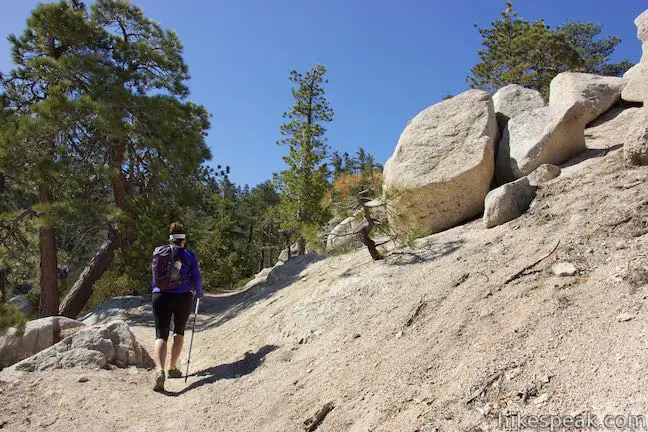
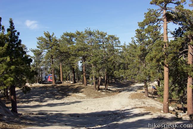
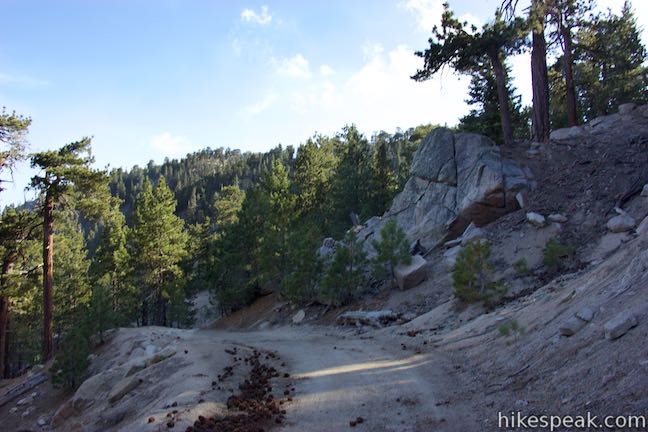
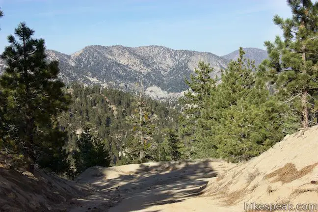
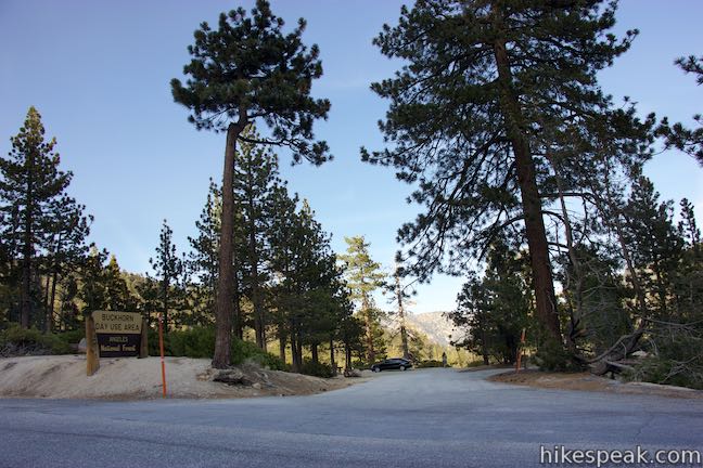
Park at a large turnout along Angeles Crest Highway and walk east down the road. As you approach Buckhorn Day Use Area (a spot for picnics), cross Angeles Highway to a white gate at the start of a dirt road up Mount Waterman (Mount Waterman Road). Walk 150 yards up this road and turn onto Mount Waterman Trail, a dirt single track splitting off to the left. Mount Waterman Road continues up Mount Waterman and can be used at the end of this hike as a return route across the summit.
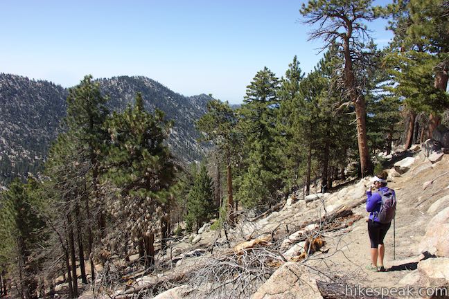
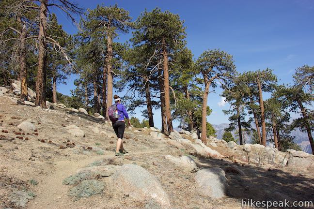
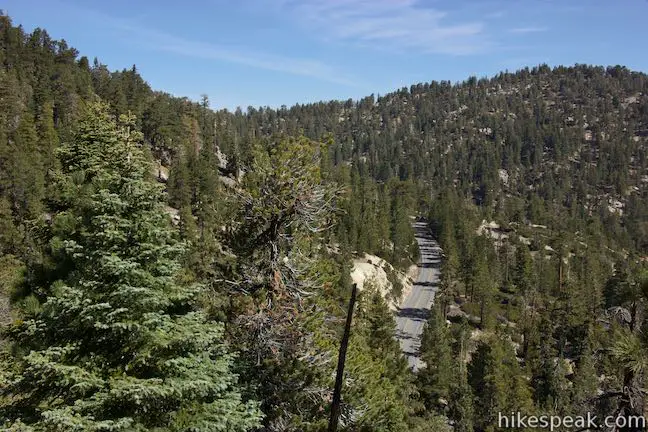
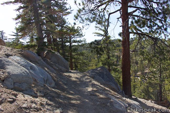
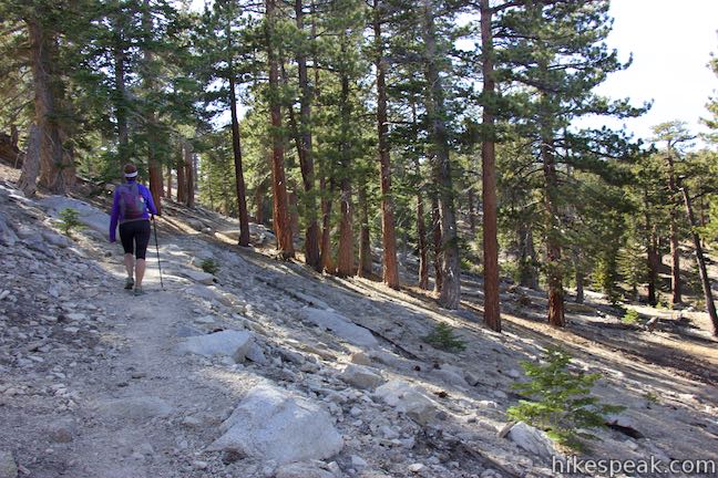
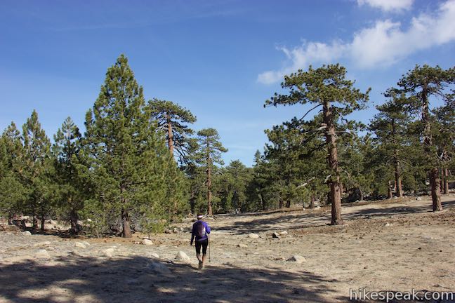
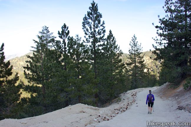
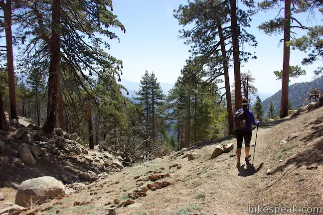
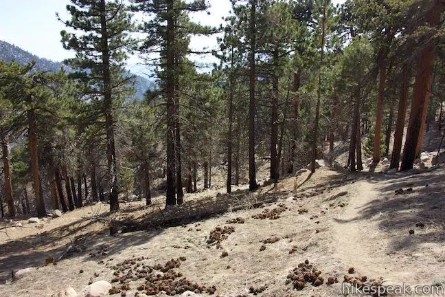
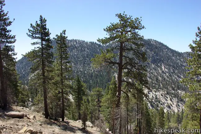
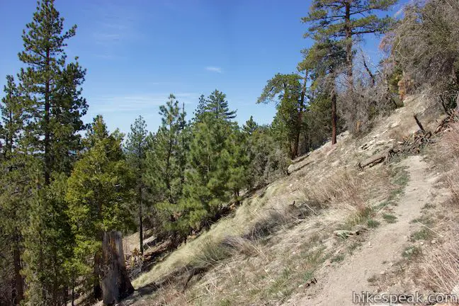
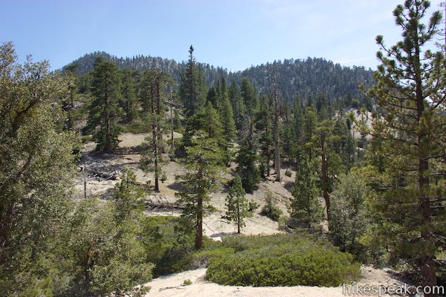
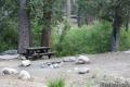
Mount Waterman Trail runs parallel to Angeles Crest Highway at the start, passing a picnic table at the quarter mile mark that is tucked into the pines along a boulder-covered drainage. The trail curves uphill away from the sounds of passing motorists to gain broader views. Look northeast over Buckhorn Campground toward the mountains making up Pleasant View Ridge. The ascent is gradual and Mount Waterman Trail is well formed, providing a nice hike up. The trail passes through a forest of incense cedars and Jeffrey pines that offer enjoyable mountain aromas.
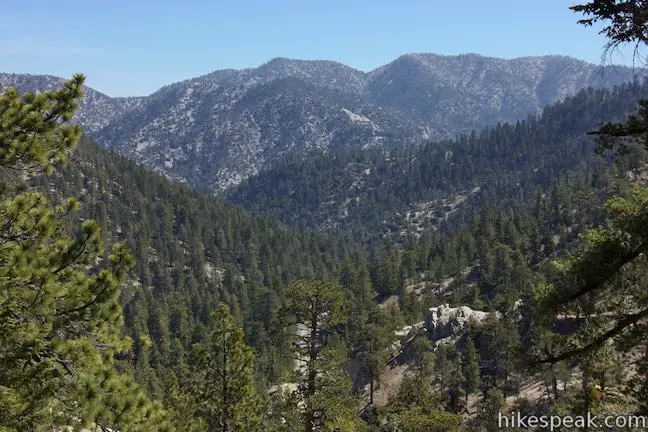
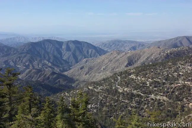
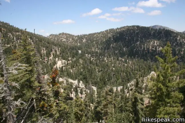
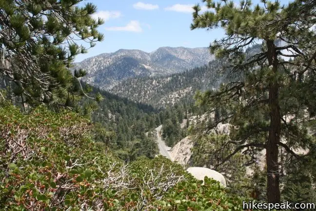
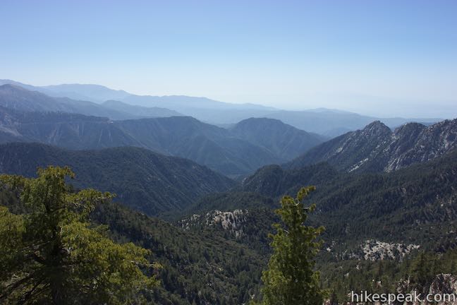
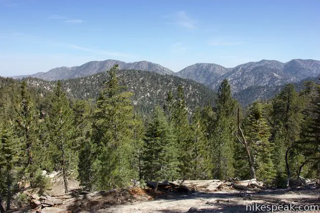
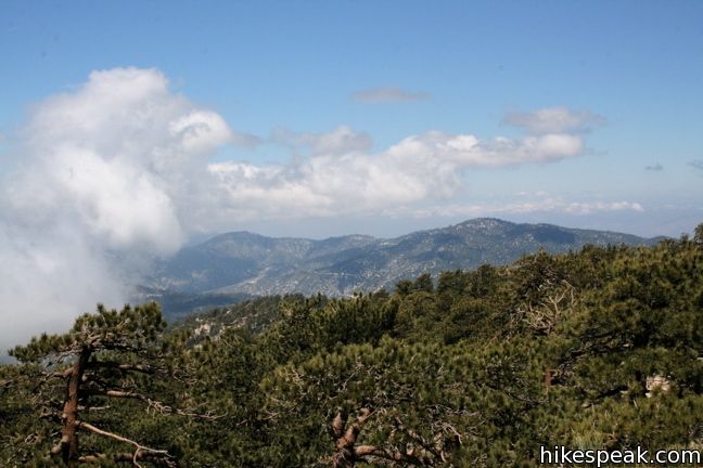
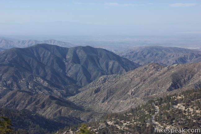
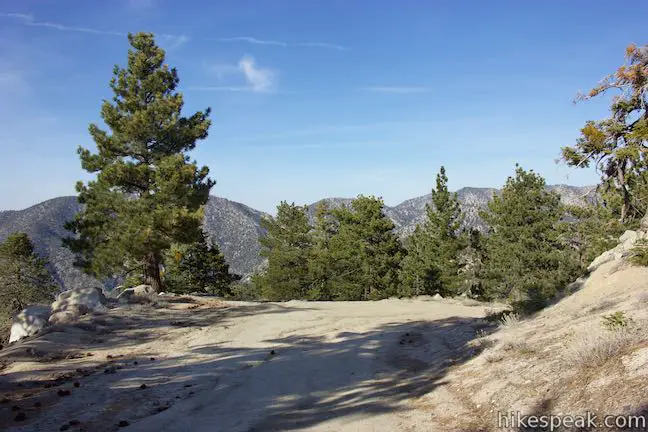
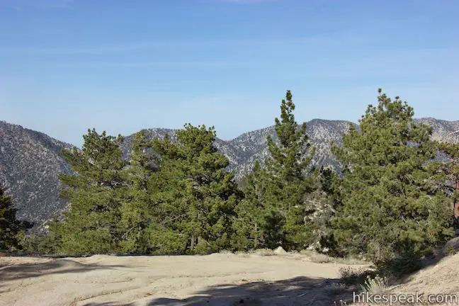
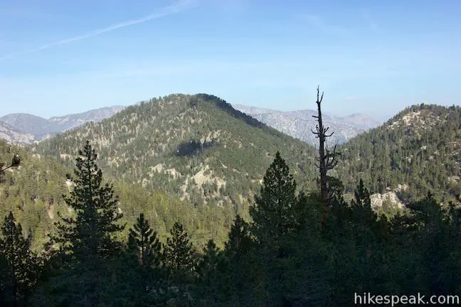
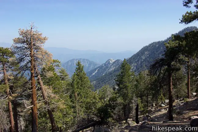
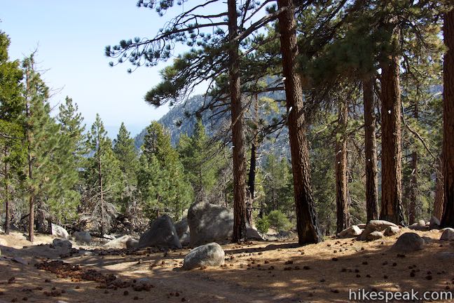
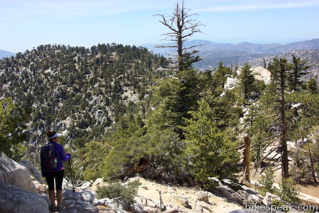
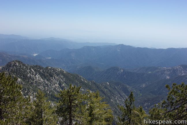
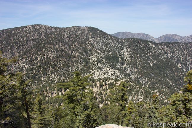
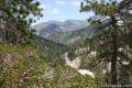
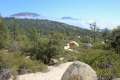
After one mile, the soothing trail reaches a ridge running east from Mount Waterman and curves to the right. New views to the south open up below the trail. The broad expanse of Bear Creek Canyon runs away from you, bordered by rugged ridges and peaks. Beyond the San Gabriel Mountains, you can look across the San Gabriel Valley toward the silhouette of Santiago Peak in the Santa Ana Mountains. This is one of the better views of the hike, so pause to appreciate it.

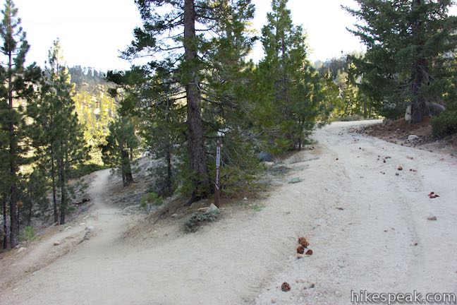
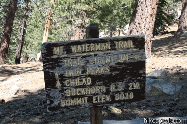
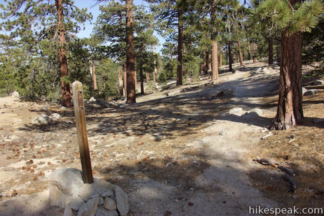
Mount Waterman Trail heads west up the ridgeline and maintains the ascent. At the two-mile mark, after gaining just over 900 feet, the trail comes to a marked junction. This is where the trail to Twin Peaks separates from the trail to the summit of Mount Waterman. The trail to the right can be used to reach the top of Mount Waterman in 3/4 of a mile. Getting to Twin Peaks is not so easy. The trail to the left sacrifices 1,145 feet to a saddle between the two mountains only to turn uphill and aggressively climb over twelve hundred feet of elevation to the top of Twin Peaks East.
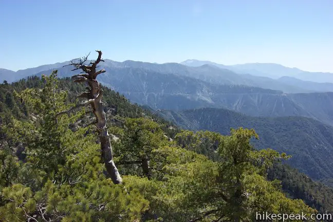
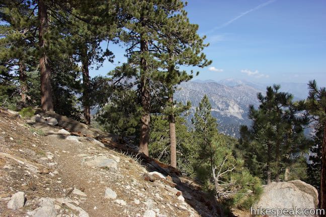
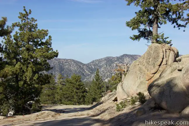
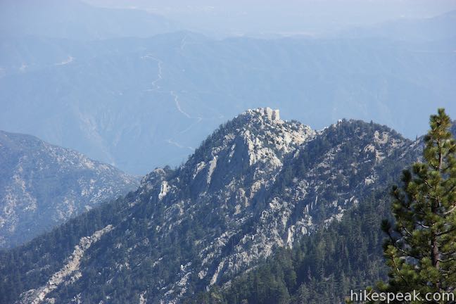
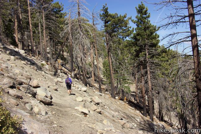
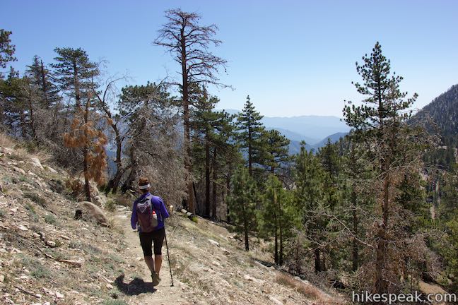
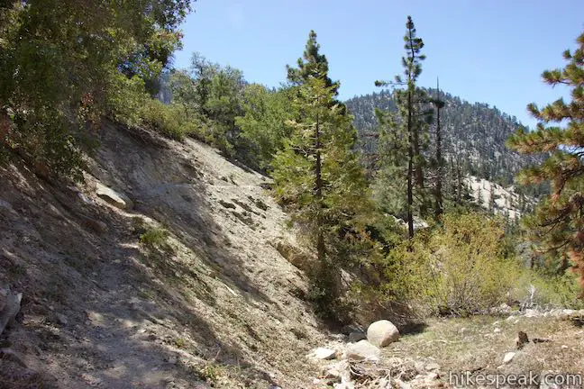
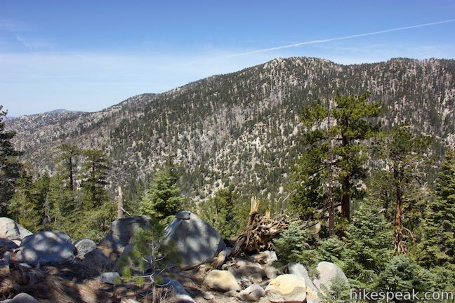
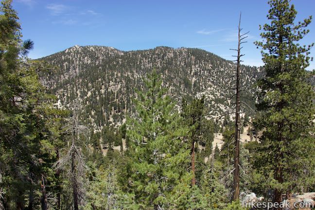
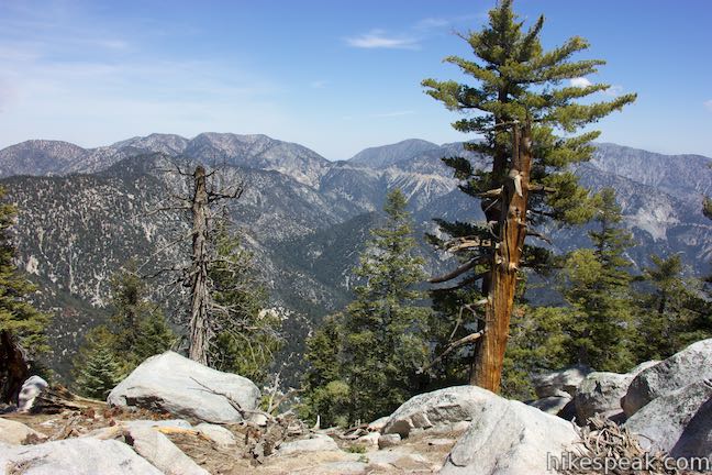
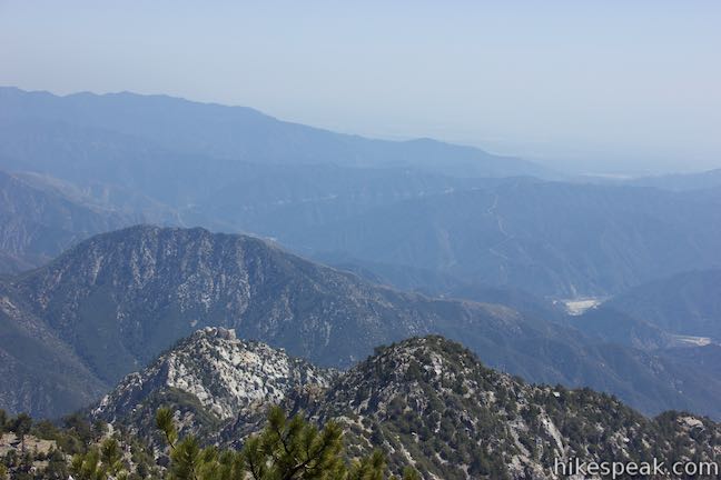
It is a 3-mile trek from the Mount Waterman Trail Junction to the summit of Twin Peaks, so get started. Head gradually down the mountainside as the trail becomes thinner than the one you hiked up. Watch for loose footing. Well-spaced pines cover the mountainside, providing partial shade and a blanket of needles on the ground. Gaze out through the forest toward Triplet Rocks, an imposing outcropping on a ridge below the east side of Twin Peaks that resembles a fortress from this angle.
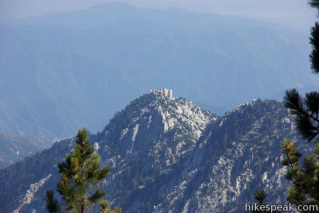
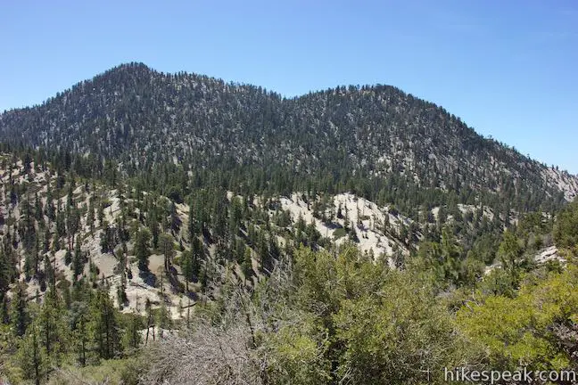
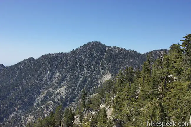
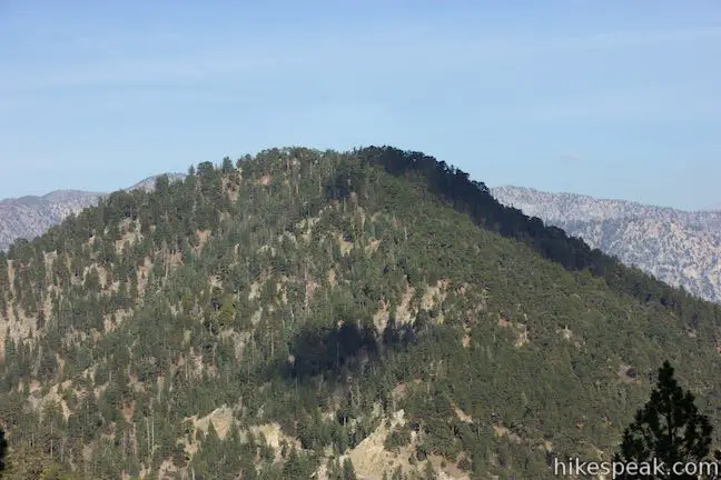
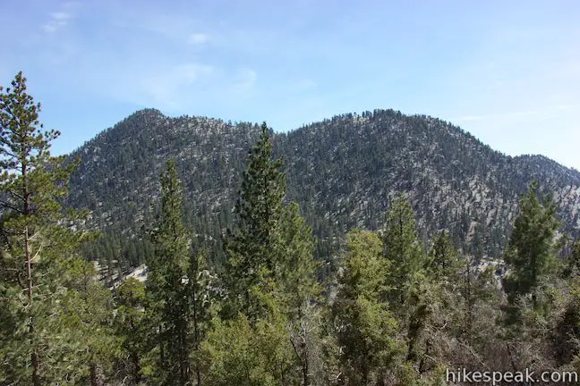
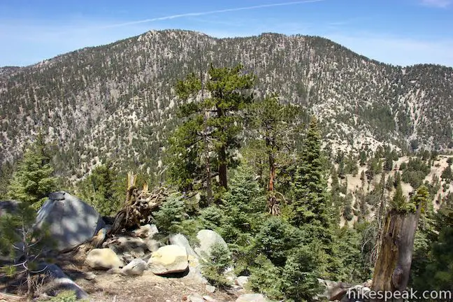
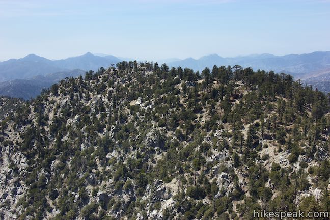
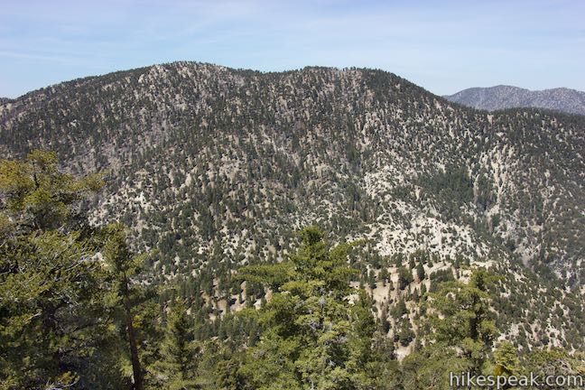
Winding down the south side of Mount Waterman offers views across the gap toward the two-humped profile of Twin Peaks, which is stretched over a roughly east-west running ridge. The higher eastern summit is your target. Switchbacks lead down to a junction with Three Points Trail, which approaches from the west, coming from an area on Angeles Crest Highway called Three Points (providing a route to Twin Peaks that skips the climb over Mount Waterman). The junction is unmarked and comes one mile from the previous, or 3 miles from the start.
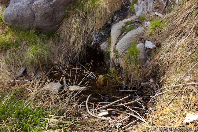
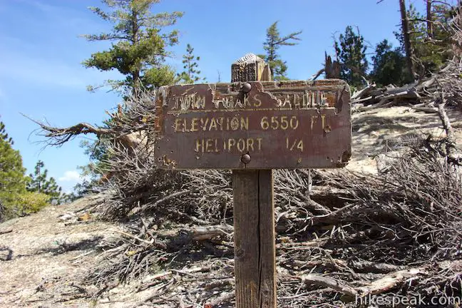
Turn left at the junction, heading east toward the saddle below Twin Peaks. Cross the mountainside past a spring that seeps out of the slope along the trail. This would be a desperate source of water in most seasons. The trail continues down a string of switchbacks, crosses a ravine, and pops over a brief rise to come to Twin Peaks Saddle, the bottom of the dip connecting Mount Waterman with Twin Peaks. Twin Peaks Saddle is 3.75 miles from the start of the hike and there is 1,230 feet to climb over the next 1.25 miles to the top of Twin Peaks.
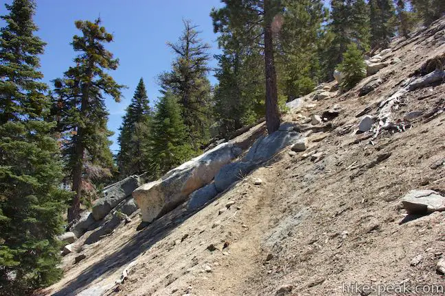
At first, the trail leaving Twin Peaks Saddle is fairly moderate and may give you a false impression of the ascent’s demands. Cross over a rise and drop to a second dip in the saddle. The ascent ramps up from here. Unlike the trail down to the saddle, which had abundant switchbacks, the trail up Twin Peaks is pretty much a straight shot. Apart from small bends, it’s a full-speed-ahead ascent up the steep mountainside. You’re in for a good cardio workout on the push to the top.
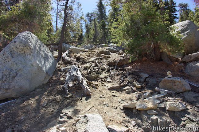
The trail is thin, so look for cairns marking the path. Even as late as April, you might pass patches of snow clinging to the north side of Twin Peaks. Stop to catch your breath on the hike up Twin Peaks and look back across the saddle toward Mount Waterman.

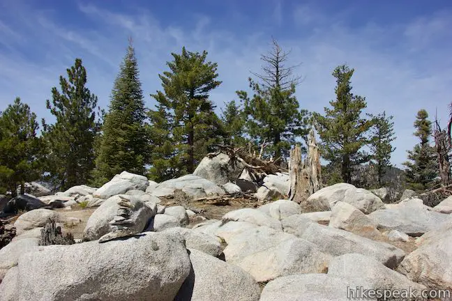
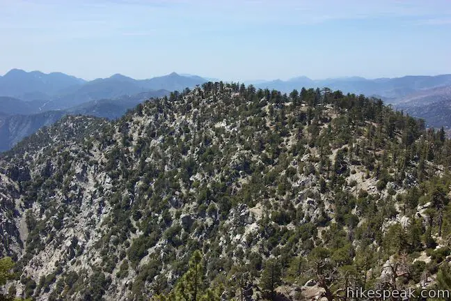
At 1.1 miles from Twin Peaks Saddle, the tiring ascent bears fruit, attaining the ridge that dips between Twin Peaks East and Twin Peaks West. A few paths split off when you reach the ridge, but the actual trail continues to the left, climbing just a bit farther to the top of Twin Peaks East.
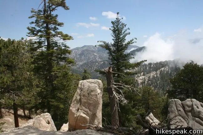
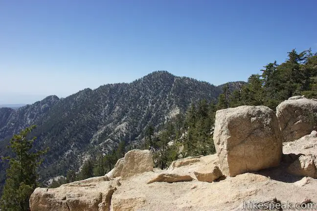
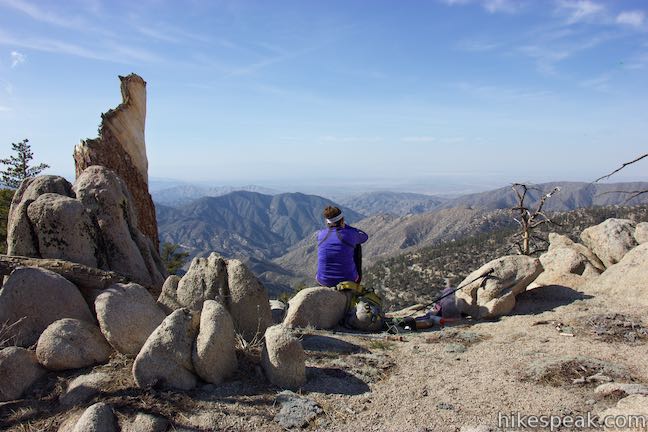
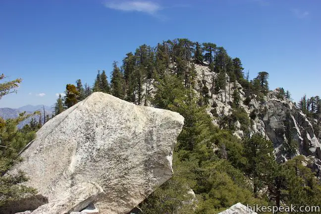
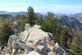
No trail goes to Twin Peaks West, the rounder, shorter summit, but hikers do venture off trail to grab that summit as well. An informal path cuts across rugged mountaintop terrain to the less-visited twin. Much closer to the actual trail is a pile of boulders stacked up along the ridge that rises above the trees. It’s an inviting vista point and you only need to walk 125 yards off the trail to scramble up these boulders for panoramic views of Twin Peaks’ two crowns and the surroundings.
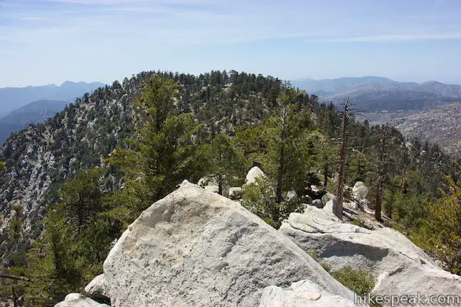
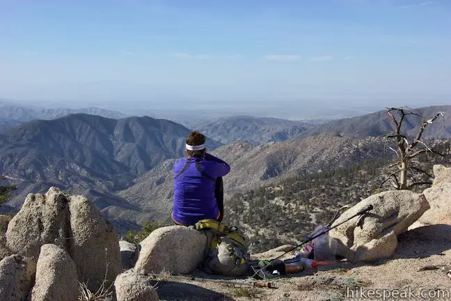
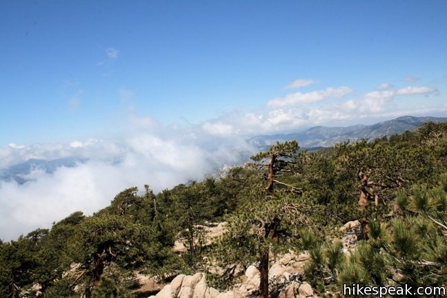
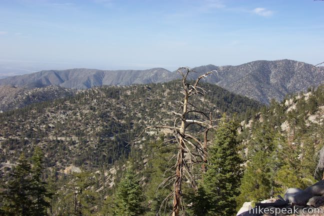
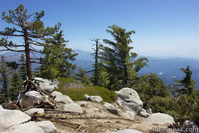
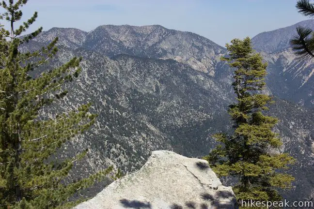
Stay to the left when you reach the ridge to continue ascending toward the summit. At the beginning of this last piece of the climb, get an eyeful to the south over a precarious dip between Twin Peak’s summits. Ascend a rocky slope to the top of Twin Peaks East where boulders are spread out over a small area of flat ground at the summit. Because of some surrounding trees, the summit doesn’t have a singular round-the-compass view. Stretch your legs and walk around Twin Peaks East to find windows between tree trunks that frame the wonderful surroundings.
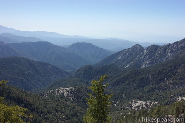
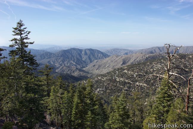
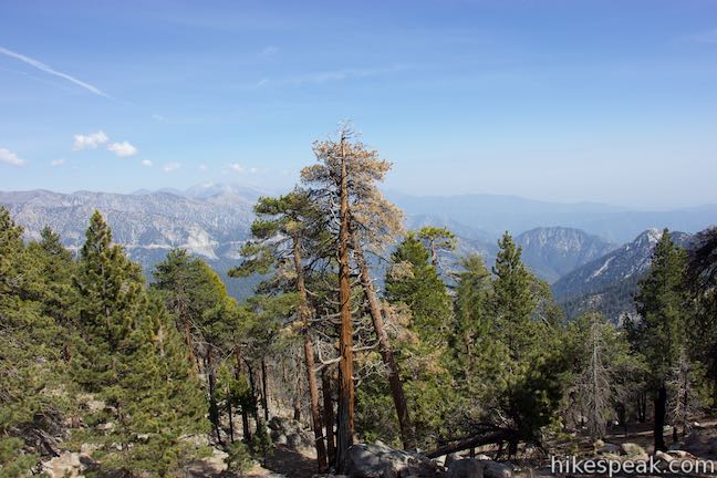
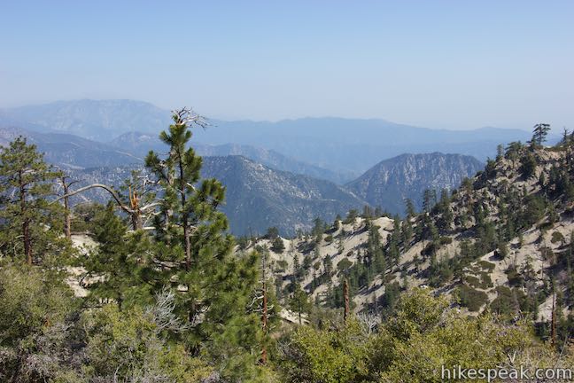
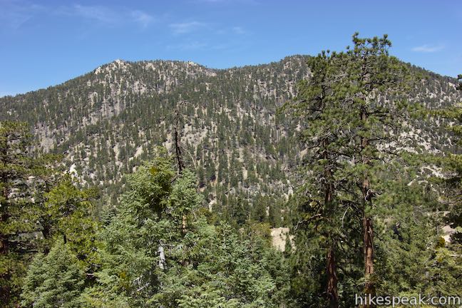
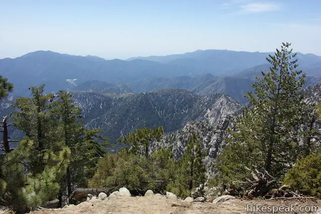
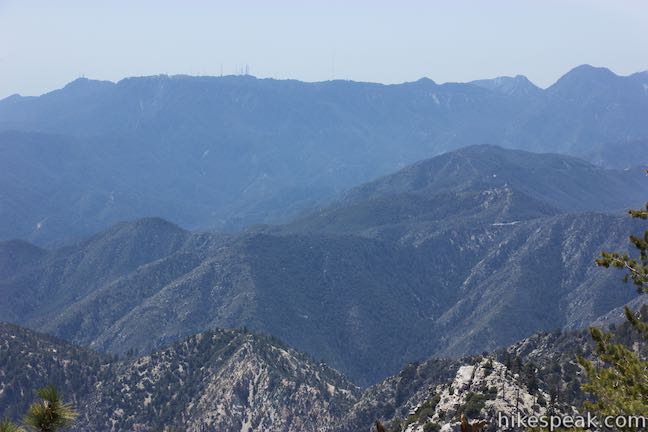
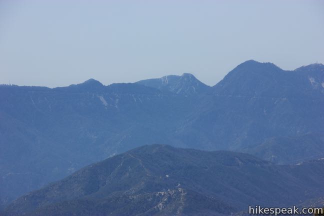
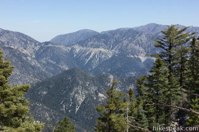
Looking southwest, you’ll spot the wide summit of Mount Wilson, which is topped by radio towers and harder-to-see observatory domes. To the right of Mount Wilson rise Mount Markham and San Gabriel Peak. Many more mountains rise to the east as well.
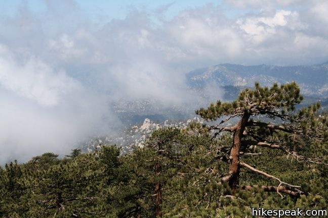
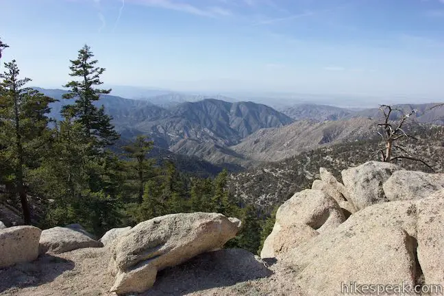
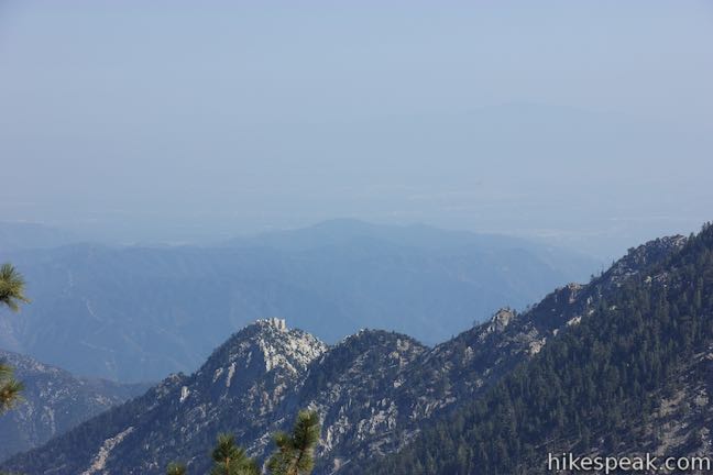
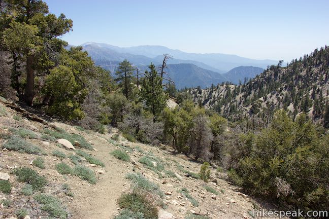
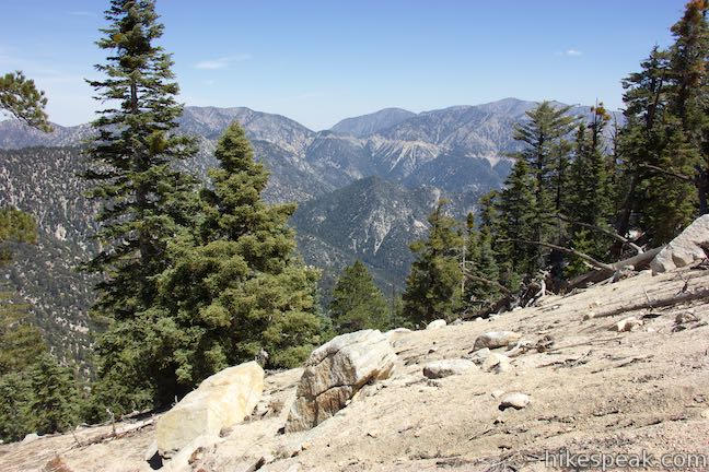
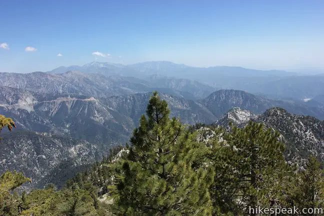
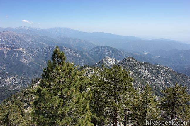
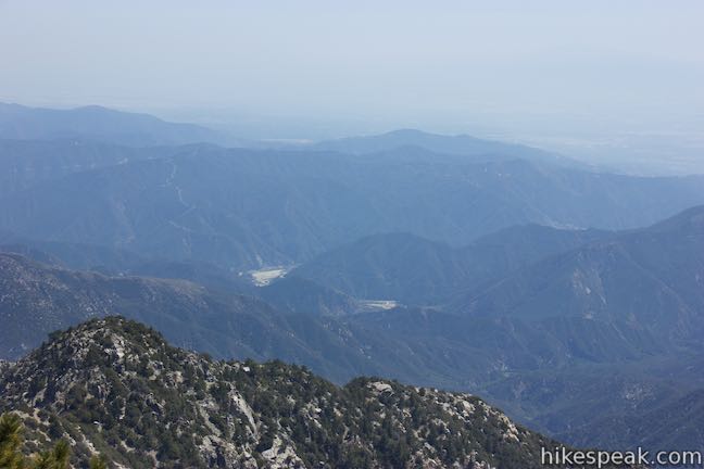
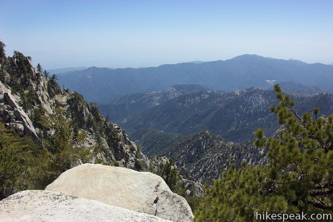
The terrain drops away to the south into the broad drainage of the West Fork of the San Gabriel River. Bear Creek Canyon lies to the southeast and is backed by Smith Mountain. Walk to the east side of the summit of Twin Peaks East for views of the highest summit in the San Gabriel Mountains, Mount Baldy, which is 2,300 feet taller than Twin Peaks. Big postcard-like views are available over the mountains in this direction.
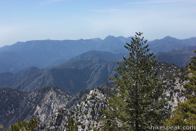
If you venture a short way down the slope on the east side of the mountain, you’ll reach outcroppings with views looking farther down the mountain’s eastern ridge toward Triplet Rocks, which looks different from this vantage. Accompanying Triplet Rocks are views of Mount Baldy and a perspective down the mountains toward the San Gabriel Valley to the southeast.
The summit of Twin Peaks East comes five miles from the start of the hike. Returning by the same route makes a ten-mile out and back hike, but what about Mount Waterman? The route passes so close to the summit that you might as well, right? Hiking back over Mount Waterman gives you 6 2/3 miles to go (or more).
Hike down to the ridge just below Twin Peaks East. Before proceeding with the descent, you can explore the outcropping of boulders on the ridge or push on for Twin Peaks West. When you’re ready to hike down, take Twin Peaks Trail back to Twin Peaks Saddle, doing the reverse of what you did before. You’ll then hike up to the junction with Three Points Trail. Turn right to keep heading up the side of Mount Waterman. Your legs will be thankful for all the switchback on this side of the divide.
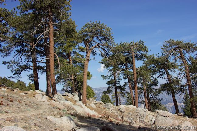
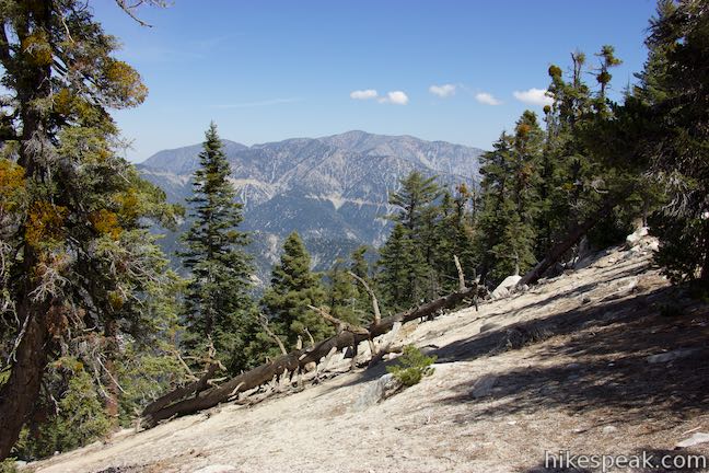
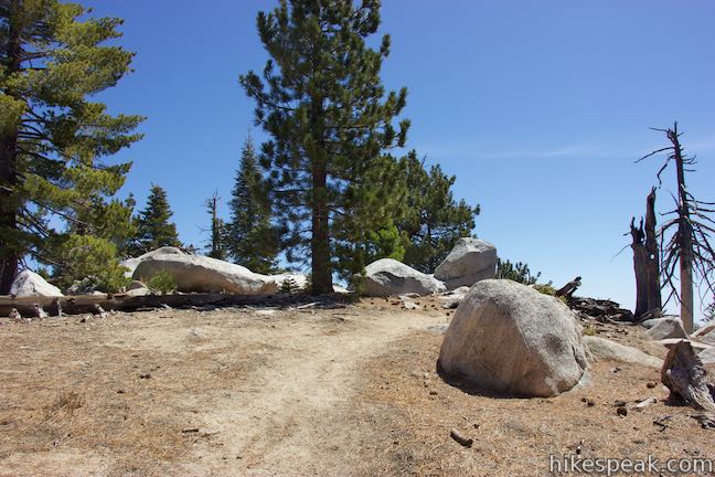
Return to Mount Waterman Trail Junction, 8 miles from the start. You have a couple options now. Turn right to return the way you came, hiking another two miles down the mountain. With just a bit more effort, you can cross the summit of Mount Waterman, ascending another 360 feet on a route that can get you back to the trailhead in 3.65 miles. While taller than Twin Peaks at 8,038 feet, Mount Waterman has a broad pine-covered summit that doesn’t deliver views quite as grand as Twin Peaks. Nevertheless, Mount Waterman has worthwhile panoramas if you’re wiling to seek them out.
The upper section of Mount Waterman Trail leaving the junction is pretty gradual. It heads north before curving to the west, crossing a crest with views to the northeast toward Pallett Mountain and the rest of Pleasant View Ridge. At 0.65 miles from the Mount Waterman Trail Junction, a split in the trail presents two options. A steeper path turns up the mountain to the left leading to the highest southern end of Mount Waterman. Take this route to summit the mountain after a steep tenth of a mile. The high point of the mountain is not prominent enough to offer completely sweeping views, but an overview can be pieced together by climbing atop boulder stacks to see over the trees and take in the surroundings.
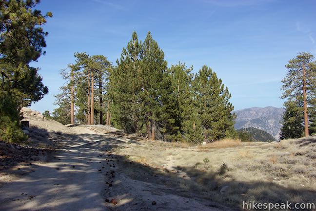
Continuing straight (bearing to the right) at the split, Mount Waterman Trail maintains a gradual course toward the center of the mountaintop. Mount Waterman has a large C-shaped summit with dispersed boulder formations.
At 0.95 miles above the Mount Waterman Trail Junction, the single-track trail comes to an end at a T-junction with a dirt road. You can bear left if you wish to explore the south side of the summit. Otherwise, turn right to hike the loop over the mountain. Come to a second junction after another tenth of a mile and bear right again to head north toward the start of the descent. Straying off the left side of the trail here, you can find excellent views from the edge of the mountaintop and look north and west over lower ridges toward the drainage of Rock Creek and the desert below.
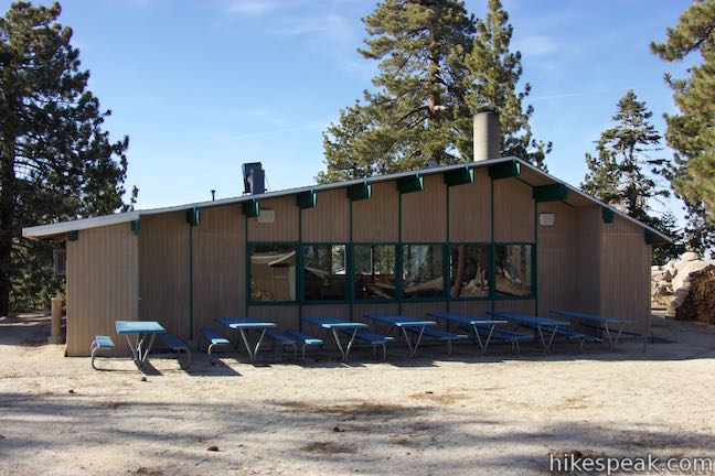
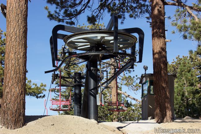
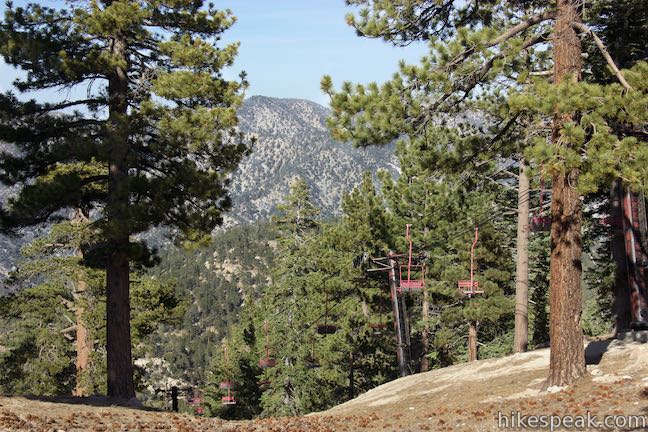
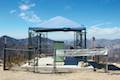
Hike north on Mount Waterman Road, passing some less used trails on the right that connect to the top of a chairlift. At 1.35 miles from the Mount Waterman Trail Junction, bear right at a split to stick with the main road down Mount Waterman. Hike past a few disc golf basket and descend toward Mount Waterman Village, where a small lodge is perched at the top of the main chairlift for Mount Waterman Resort, which has a very brief ski season. Bear right to continue down the road.
After another 1.15 miles of switchbacks, hit an intersection in the road and turn left. The road to the right is an alternate route down Mount Waterman. Descend for almost another 3/4 of a mile to the junction with the bottom of Mount Waterman Trail, just up from Angeles Crest Highway. Close Mount Waterman Loop and hike down the final stretch of the road to return to pavement. Turn left up Angeles Crest Highway to walk back to the parking area.
The basic directions for the hike to Twin Peaks and Mount Waterman are:
- Begin up Mount Waterman Road (0 miles)
- Bear left on the single-track Mount Waterman Trail (0.08 miles)
- Follow the trail to the right when it reaches the ridgeline (1 mile)
- Bear left at Mount Waterman Trail Junction toward Twin Peaks (2 miles)
- Turn left at a junction with the trail to Three Points (3 miles)
- Pass a small spring along the trail (3.2 miles)
- Cross Twin Peaks Saddle (3.75 miles)
- Reach the ridge across the top of Twin Peaks and stay to the left (4.85 miles)
- Summit Twin Peaks East (5 miles)
- Hike back down and cross Twin Peaks Saddle (6.25 miles)
- Turn right at the unmarked junction with the trail to Three Points (7 miles)
- Return to Mount Waterman Trail Junction and turn left toward the summit of Mount Waterman (8 miles)
- Reach a split in the trail and bear right to pass the south end of the summit (8.65 miles)
- Reach a post at the end of the single track and turn right on a dirt road (8.95 miles)
- Turn right at a T-junction onto another dirt road (9.05 miles)
- Pass a perch off the left side of the road with nice northwest views (9.1 miles)
- Pass side trails near a chair lift and then bear right past another dirt road (9.35 miles)
- Bear right past cottages (9.6 miles)
- Pass through Waterman Village (9.7 miles)
- Bear left through a junction with an alternate route down the mountain (10.85 miles)
- Pass the bottom of Mount Waterman Trail to close the loop (11.58 miles)
- Return to Angeles Crest Highway (11.65 miles)
The hike to Twin Peaks East and Mount Waterman is 11.65 miles round trip (plus any additional exploring you do on the summits). After putting in such an effort, you may not want to drive straight back to Los Angeles (it takes about an hour to drive out of the mountains). Consider staying overnight at Buckhorn Campground, which is just up the road from the trailhead. A trail beginning at the campground heads down to Cooper Canyon Falls. For another nearby hike that hits a pair of summits in a much shorter distance, check out Winston Ridge and Winston Peak. Dogs are welcome on these trails in the San Gabriel Mountains. While bikes are also permitted, Twin Peaks would be impossible to climb on two wheels and there aren’t any signs of mountain bikes using Twin Peaks Trail. A National Forest Adventure Pass may be needed to park at the trailhead. No permit is required to hike to Twin Peaks or Mount Waterman, so get out and enjoy!
Directions to the Trailhead
- From the 210 Freeway in La Cañada Flintridge, head northeast on Angeles Crest Highway (CA 2) for 35 miles.
- Pass Mount Waterman Ski Area and park in the small lot off the north side of the road, just past mile marker 58.
- If you reach the entrance for Buckhorn Campground you have gone too far.
- Walk along the road toward Buckhorn Day Use Area, which is just past the parking area.
- Cross Angeles Crest Highway to the start of Mount Waterman Road, a dirt road on the south side of the highway that is blocked by a white gate.
Trailhead Location
Trailhead address: Angeles Crest Highway, San Gabriel Mountains National Monument, Pearblossom, CA 93553
Trailhead coordinates: 34.3465, -117.921 (34° 20′ 47.39″N 117° 55′ 15.60″W)
View Mount Waterman Area Trails in a larger map
Or view a regional map of surrounding Los Angeles trails and campgrounds.
Mount Waterman Loop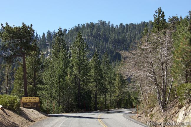


Twin Peaks Trail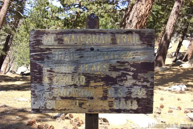


 | Mount Waterman The 5.5 to 6 miler can be completed as an out and back hike or a loop, traveling through a pine forest to a round summit near Twin Peaks. |
 | Cooper Canyon Falls This 3-mile hike leaves from Buckhorn Campground and visits a short waterfall in an enchanting glen of tall pines. |
 | Winston Ridge and Winston Peak This 4.85-mile partial loop bags a summit and a scenic ridge in the high San Gabriel Mountains. |
 | Mount Hillyer This 6,215-foot summit can be reach from two trailheads for a 3 to 6.25-mile hike gaining between 575 and 1,000 feet. |
 | Vetter Mountain This 3.8 or 4.4-mile hike ascends from Charlton Flats Picnic Area to Vetter Mountain, where there are exceptional 360-degree view from the site of an old fire lookout tower. |
 | More trails in the San Gabriel Mountains Explore other destinations in the range. |
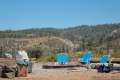
 | Buckhorn Campground This 38-site campground is an hour drive up the Angeles Crest Highway from LA and a great weekend spot for summer tent camping. |
 | Horse Flats Campground This 25-site campground in the Angeles National Forest in the San Gabriel Mountains offers first-come first-serve equestrian-friendly sites. |
 | Coulter Group Campground This single-site campground accommodates up to 50 people per night, offering fresh mountain air and sweeping views at 5,300 feet. |
Common Questions about Twin Peaks and Mount Waterman in the San Gabriel Mountains
- Is the trail open?
- Yes. You should expect to find that Mount Waterman & Twin Peaks is open. There are no recent reports of trail closures. If you discover that the trail is closed, please help your fellow hikers by reporting a closure.
- Do I need a permit for this hike?
- Yes. National Forest Adventure Pass.
- How much time does this hike take?
- It takes approximately 7 hours to hike Mount Waterman & Twin Peaks. Individual hiking times vary. Add extra time for breaks and taking in the views.
- How long is this hike?
- The hike to Mount Waterman & Twin Peaks is a 11.65 mile out and back with loop with 3640 feet of elevation change.
- Are dogs allowed on this trail?
- Yes, dogs are allowed on Mount Waterman & Twin Peaks. The trail is open to hikers, dogs.
- Is Mount Waterman & Twin Peaks a difficult hike?
- This hike should be considered strenuous. Hikers should be prepared for a workout covering 11.65 miles and 3640 feet of climbing.
- Does this trail go to a summit?
- Yes, Mount Waterman & Twin Peaks reaches a summit with panoramic views.
- What mountain range is this trail in?
- Mount Waterman & Twin Peaks is located in the San Gabriel Mountains.
- Where is the trailhead located?
- The trailhead for Mount Waterman & Twin Peaks is located in Pearblossom, CA.
Trailhead Address:
Angeles Crest Highway
Pearblossom, CA 93553
Trailhead Coordinates:
34.3465, -117.921 - What are the driving directions to the start of the hike?
To get to the trailhead: From the 210 Freeway in La Cañada Flintridge, head northeast on Angeles Crest Highway (CA 2) for 35 miles. Pass Mount Waterman Ski Area and park in the small lot off the north side of the road, just past mile marker 58. If you reach the entrance for Buckhorn Campground you have gone too far. Walk along the road toward Buckhorn Day Use Area, which is just past the parking area. Cross Angeles Crest Highway to the start of Mount Waterman Road, a dirt road on the south side of the highway that is blocked by a white gate.
View custom Google Maps directions from your current location.
- Are there other trails near Mount Waterman & Twin Peaks?
- Yes, you can find other nearby hikes using the Hikespeak Hike Finder Map.

Just finished this hike yesterday, plus the extra distance from the lower portion of Buckhorn Campground where my site was. So beautiful and such an amazingly strenuous adventure! I’d say it was more psychologically taxing than anything because of the seemingly multiple summits. The massive dip to the saddle and then arduous straight up the mountain climb to the summit was taxing but oh so worth it. Just as I was descending from the summit I saw two massive Big Horn Sheep dart across the trail not more than 20 feet in front of me! I was so caught off guard I was unable to get a picture but they were so magnificent that I will never forge the up close encounter. Awesome trail and didn’t see a single soul the whole way. Looking forward to my next time and a little more exploring around the area.
Sounds like a great outing!
We are planning on doing this on Sunday. Was there anything different from what this review says that we should be aware of? Signs, trails, points of reference?
Anyone know if there is water on this route if we want to camp on the saddle by twin peaks for a night?
same question… did you ever find out?