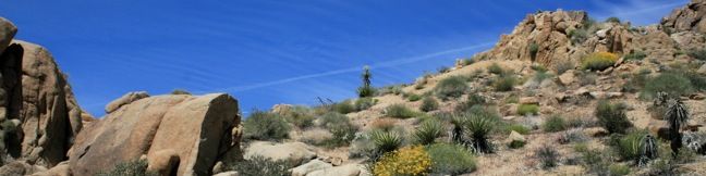
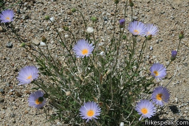
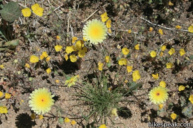
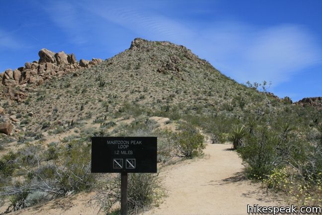
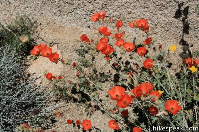
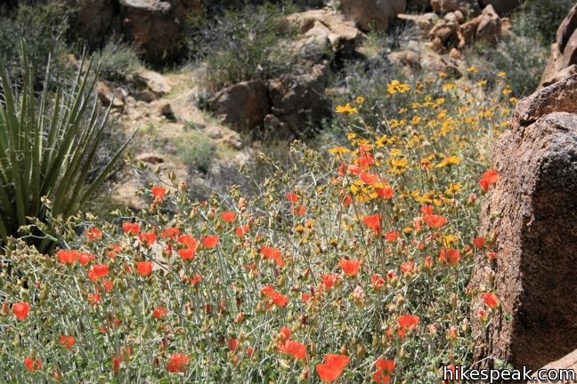
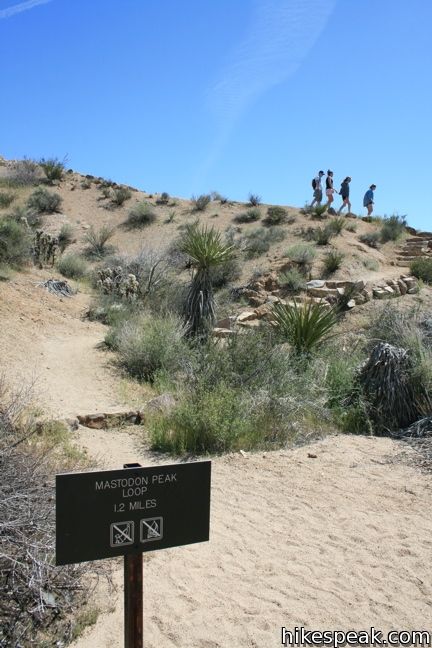
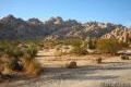
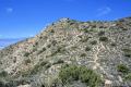
Mastodon Peak offers panoramic views of southeastern Joshua Tree National Park. The low summit is located in the Colorado Desert, so you will not see any Joshua trees around here. What you will see is some beautify desert that becomes populated with wildflowers come spring. Mastodon Peak can be reached via a 2.6-mile loop with 440 feet of elevation gain.
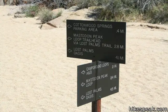
The easiest way to complete the loop trail is in a counter-clockwise direction. Start by taking the Lost Palms Oasis Trail from Cottonwood Spring and make a left at every junction you come to.
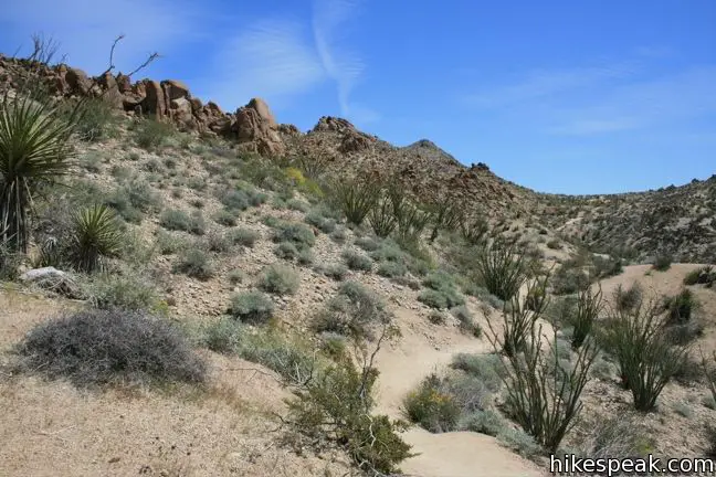
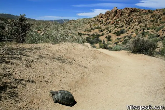
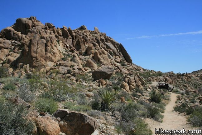
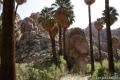
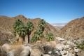
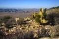
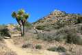
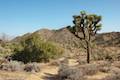
Start the hike by descending into Cottonwood Springs Oasis. Pass through the spring fed palms and continue up the opposite bank toward Lost Palms Oasis (3.6 miles away). The hard-packed trail ascends gradually to the east past yucca and ocotillo. At the first junction, 0.7 miles from the trailhead, turn left following the sign toward Mastodon Peak.
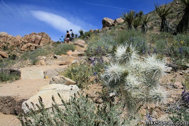
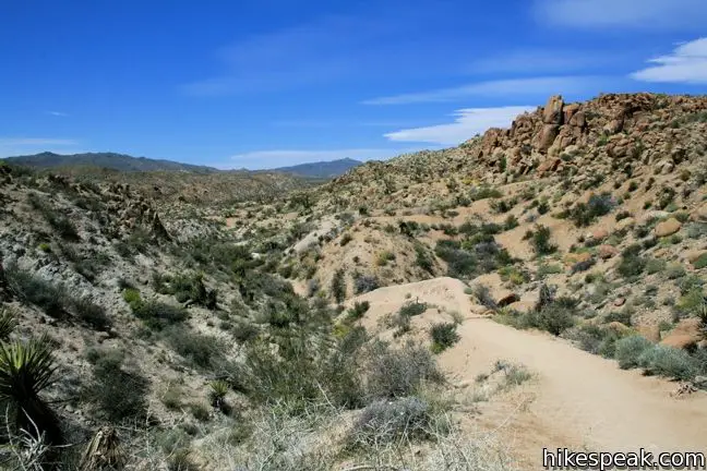
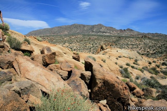
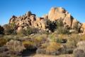
The trail gains 165 feet over the next quarter mile before coming to the base of Mastodon Peak. Break from the loop here and follow the use trail to the summit. The climb is just one tenth of a mile long, but the route is somewhat elusive to follow. A bit of light scrambling is required as the undeveloped trail wraps around the rocky east side of Mastodon to arrive at the 3,400-foot summit.
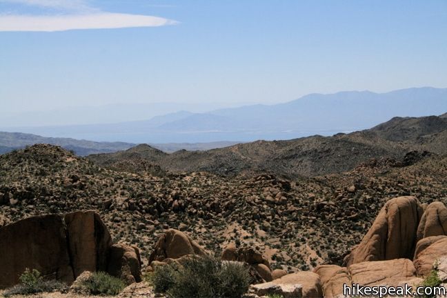
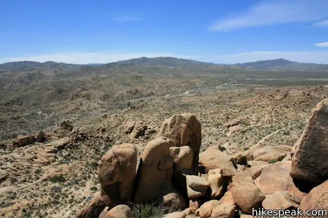
From here, the views are far and wide. That large blue body to the south is not a mirage. It’s the Salton Sea. To the east, the highest point in sight is Eagle Mountain at 5,350 feet.
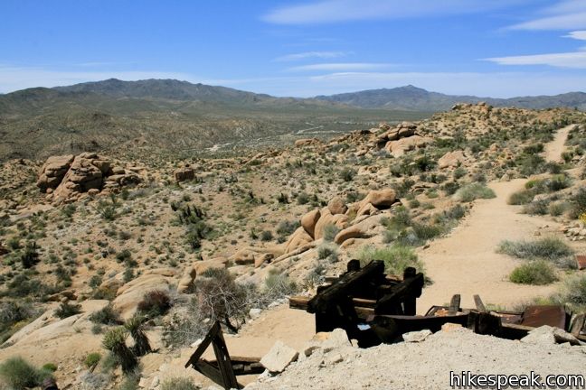
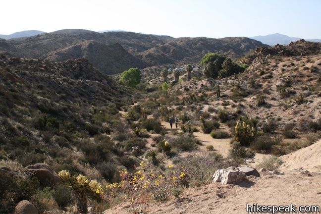
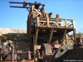
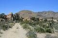
Descend from the summit and continue along the loop trail, passing the remains of Mastodon Mine, which operated here until 1971. The trail descends west toward Cottonwood Spring, crossing and traveling down a series of desert washes. This section of the loop is easier to follow in this direction than in the reverse, and hiking down the loose sand is certainly better than the alternative.
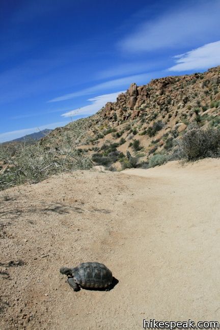
The trail comes to a final junction a mile from the peak, near another set of ruins at the former site of Winona Mine. For those staying at Cottonwood Spring Campground, a 0.2-mile trail continues straight ahead to return you to your campsite. For everyone else, turn left to return to the trailhead. The 0.4-mile long sandy track curves to the left, running alongside the paved road before returning to the start.
Directions to the Trailhead
- From the 10 Freeway, take exit 168 and head north on Cottonwood Spring Road.
- After 7 miles, turn right before the at Cottonwood Visitor Center and continue 1 mile to the trailhead at road's end.
- From within the park, Take Park Blvd to the junction with Pinto Basin Road.
- Take Pinto Basin Road thirty miles to the Cottonwood Visitor Center, turn east and continue one mile to the trailhead at road's end.
Trailhead Location
Trailhead address: Unnamed road off Pinto Basin Road, Joshua Tree National Park, CA 92277
Trailhead coordinates: 33.7370, -115.8107 (33° 44′ 13.2″N 115° 48′ 38.5″W)
View Joshua Tree National Park in a larger map
Or view a regional map of surrounding California Desert trails and campgrounds.


 | Lost Palms Oasis This 7.2-mile hike visits a desert oasis nestled between mountains in the southeast corner of the park. |
 | Bajada Trail This level 0.3-mile nature trail loop explores the plants living on a desert bajada. |
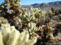 | Cholla Cactus Garden This quarter-mile loop allows visitors to stroll through an intense concentration of cholla cacti. |
 | Desert Queen Mine This 1.6-mile hike follows a level trail to an overlook before crossing a canyon to visits the ruins of one the most profitable gold mines in the California desert. |
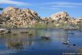 | Barker Dam This level 1.5-mile loop visits a small foreign-looking reservoir within the Wonderland of Rocks. |
 | Fortynine Palms Oasis The 3-mile round trip hike visits a cool desert oasis. |
 | Indian Cove The 101-site campground is home to a 0.6-mile interpretive trail and endless bouldering and rock climbing opportunities. |
 | Hidden Valley This one mile loop circles the interior of a small valley surrounded by tall rocks that serves as an excellent bouldering arena. |
 | Ryan Mountain This 3-mile hike offers summit views from the center of Joshua Tree National Park. |
 | Lost Horse Mine This 4-mile hike visits a well-preserved mine and mill. |
 | Inspiration Peak This 1.2-mile hike leaves the crowds at Keys View for even grander views at a 5,550-foot summit that looks out on the Coachella Valley, the Salton Sea, Mount San Jacinto, and much of Joshua Tree National Park. |
 | Warren Peak This 5.5-mile hike summits a peak with impressive views over the west side of Joshua Tree. |
 | High View Nature Trail This 1 1/3-mile loop climbs a ridge on the west side of the park that offers views of San Gorgonio Mountain and Yucca Valley, along with an introduction to desert plants. |
 | Lucky Boy Vista This level 2.5-mile hike visits a modest overlook at the site of an old mine. |
 | Hikes in the California Desert Explore more trails in Death Valley National Park, Joshua Tree National Park, Anza-Borrego Desert State Park, and Mojave National Preserve. |
 | Joshua Tree Campgrounds Nine campgrounds with 500 total sites are spread throughout the park to facilitate your visit. |
 | Joshua Tree Wildflowers The desert in bloom is something any outdoor enthusiast in California should see. |
Common Questions about Mastodon Peak in Joshua Tree National Park
- Is the trail open?
- Yes. You should expect to find that Mastadon Peak Trail is open. There are no recent reports of trail closures. If you discover that the trail is closed, please help your fellow hikers by reporting a closure.
- Do I need a permit for this hike?
- Yes. National Park Entrance Fee.
- How much time does this hike take?
- It takes approximately 1 hour 15 minutes to hike Mastadon Peak Trail. Individual hiking times vary. Add extra time for breaks and taking in the views.
- How long is this hike?
- The hike to Mastadon Peak Trail is a 2.6 mile loop with 440 feet of elevation change.
- Are dogs allowed on this trail?
- No, dogs are likely not allowed on Mastadon Peak Trail. The trail is primarily open to hikers.
- Does this trail go to a summit?
- Yes, Mastadon Peak Trail reaches a summit with panoramic views.
- Where is the trailhead located?
- The trailhead for Mastadon Peak Trail is located in Joshua Tree National Park, CA.
Trailhead Address:
Pinto Basin Road
Joshua Tree National Park, CA 92277
Trailhead Coordinates:
33.737, -115.8107 - What are the driving directions to the start of the hike?
To get to the trailhead: From the 10 Freeway, take exit 168 and head north on Cottonwood Spring Road. After 7 miles, turn right before the at Cottonwood Visitor Center and continue 1 mile to the trailhead at road's end.
From within the park, Take Park Blvd to the junction with Pinto Basin Road. Take Pinto Basin Road thirty miles to the Cottonwood Visitor Center, turn east and continue one mile to the trailhead at road's end.
View custom Google Maps directions from your current location.
- Are there other trails near Mastadon Peak Trail?
- Yes, you can find other nearby hikes using the Hikespeak Hike Finder Map.

In the earth view on Google maps there appears to be a trail connecting the parking lot of “echo tree” and the Barker Dam nature trail. But I can’t find any info on this trail. Is this still an open/usable trail to hikers and mountain bikers?
thanks
Hiked this trail from Cottonwood Campground last week. Its an amazing hike, took about 2 hours all in all, and there are a few areas where you have to climb/navigate rocks. Beware though that on the loop back to the campground after scaling the peak, one can easily walk off the trail if they’re not paying attention. And in the summer temperatures that’s that is dangerous
[…] This moderately challenging ~3-mile loop starts at the Cottonwood Spring Oasis parking lot, weaving through a unique fan palm oasis, arid scrubland, and ending with an optional scramble up Mastodon Peak. You’re rewarded with sweeping 360° views, including the Salton Sea to the south, Eagle Mountain to the east, and the surrounding desert expanse.National Park ServiceHikespeakBackpacker […]