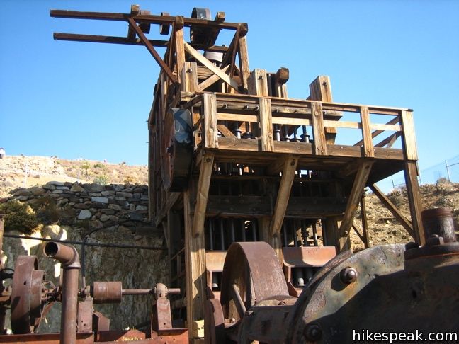
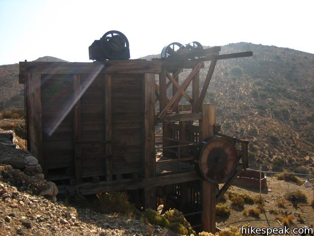
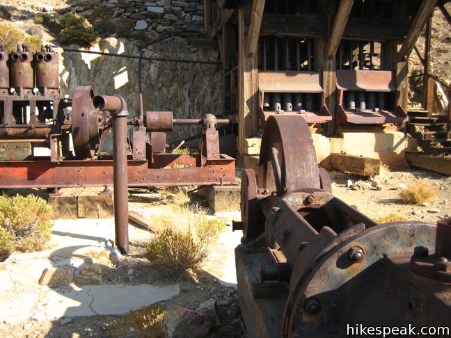
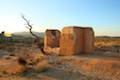
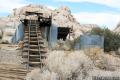
The ten-stamp mill and foundation of Lost Horse Mine stand at the end of a gradual 4-mile round trip trail. Lost Horse Mine has one of the best-preserved mills under National Park protection. Unlike less fortunate nearby efforts, Lost Horse Mine was one of the few mineral speculations in Joshua Tree National Park to be productive. According to the NPS, The mine yielded approximately 10,000 ounces of gold and 16,000 ounces of silver.
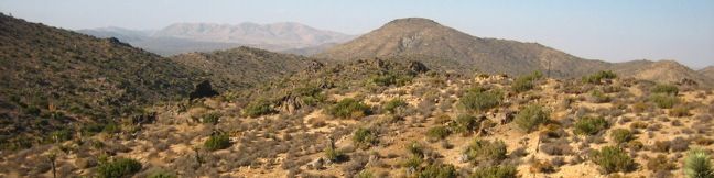
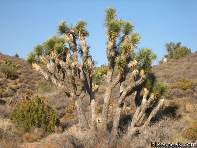
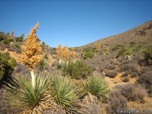
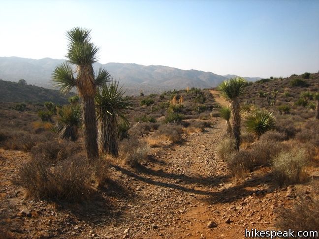
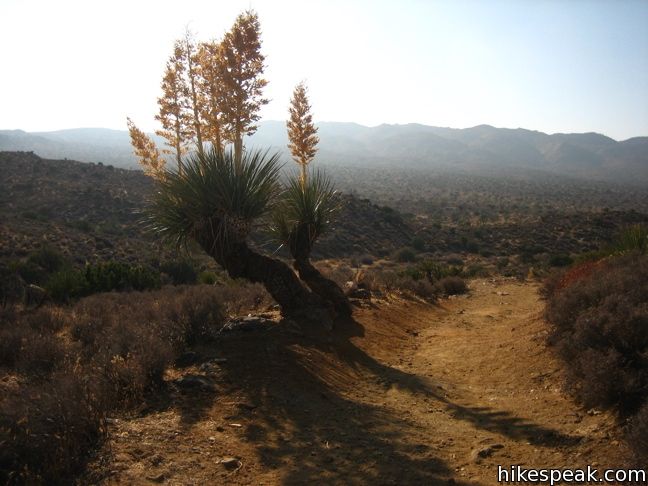
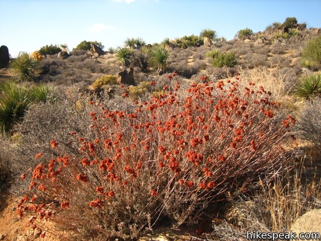
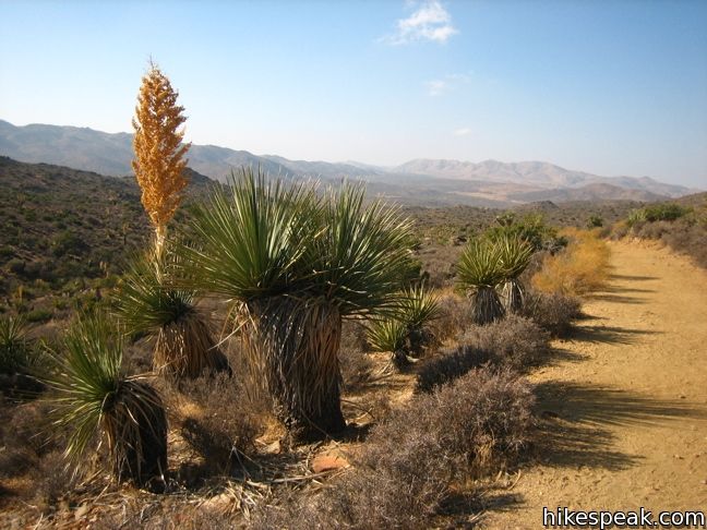
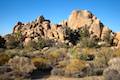
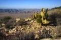
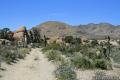
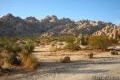
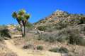
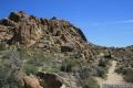
The hike to Lost Horse Mine is gentle with just a slight uphill grade. Joshua trees and yucca growl along the trail, and the surrounding landscape really comes alive during wildflower season. Outside of that time, the surrounding boulder strewn ridges can actually become monotonous en route to Lost Horse Mine.
From the trailhead, Lost Horse Mine Trail heads east, before turning southeast toward Lost Horse Mine. After a few miles, the trail begins to cling to the north side of a rocky slope. Wrap around a pair of ravines to spot Lost Horse Mine. The tall, intact mill is enclosed by a chain-link fence, so you must admire it from a safe distance.
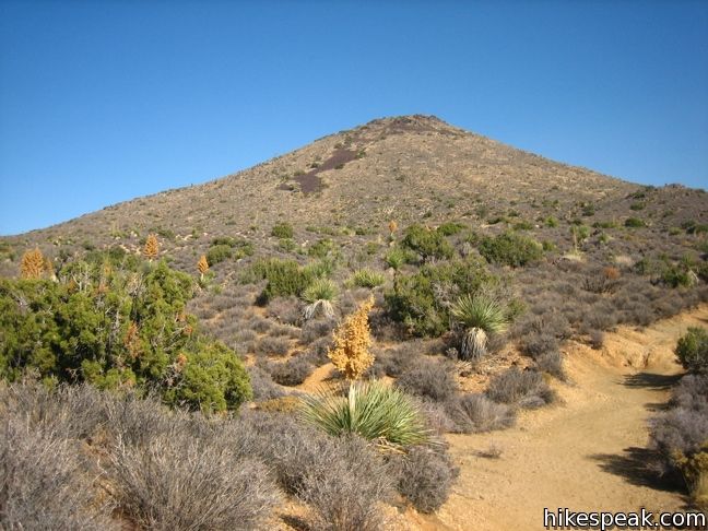
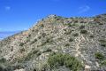
If you hike to Lost Horse Mine, it is advised to go the extra mile, or in this case the extra third of a mile, and continue up the steep ridge behind the mine to a vast overlook. You can return the way you came or follow a loop back to the trailhead. No permit is required to hike to Lost Horse Mine, so get out and enjoy!
Directions to the Trailhead
- From Park Boulevard, take Keys View Road south 2.4 miles and turn left onto a dirt road leading to the trailhead for Lost Horse Mine.
Trailhead Location
Trailhead address: Unnamed Road to Lost Horse Mine Trail off Keys View Road, Joshua Tree National Park, CA 92277
Trailhead coordinates: 33.9507, -116.15982 (33° 57′ 02.5″N 116° 09′ 35.4″W)
View Joshua Tree National Park in a larger map
Or view a regional map of surrounding California Desert trails and campgrounds.
 | Inspiration Peak This 1.2-mile hike leaves the crowds at Keys View for even grander views at a 5,550-foot summit that looks out on the Coachella Valley, the Salton Sea, Mount San Jacinto, and much of Joshua Tree National Park. |
 | Hidden Valley This one mile loop circles the interior of a small valley surrounded by tall rocks that serves as an excellent bouldering arena. |
 | Ryan Mountain This 3-mile hike offers summit views from the center of Joshua Tree National Park. |
 | Ryan Ranch This 0.8 or 1.2-mile round trip hike visits the ruins of an old adobe homestead beneath Ryan Mountain. |
 | Desert Queen Mine This 1.6-mile hike follows a level trail to an overlook before crossing a canyon to visits the ruins of one the most profitable gold mines in the California desert. |
 | Lucky Boy Vista This level 2.5-mile hike visits a modest overlook at the site of an old mine. |
 | Wall Street Mill This level 1.55 to 2.15-mile hike visits a well-reserved gold mill, exploring the mining history of Joshua Tree National Park. |
 | Barker Dam This level 1.5-mile loop visits a small foreign-looking reservoir within the Wonderland of Rocks. |
 | Contact Mine This 3.9-mile hike ascends 700 feet up a wash, a canyon, and an old road to a mountainside mine site that offers a glimpse into the mining history of Joshua Tree. |
 | Fortynine Palms Oasis The 3-mile round trip hike visits a cool desert oasis. |
 | Indian Cove The 101-site campground is home to a 0.6-mile interpretive trail and endless bouldering and rock climbing opportunities. |
 | Warren Peak This 5.5-mile hike summits a peak with impressive views over the west side of Joshua Tree. |
 | High View Nature Trail This 1 1/3-mile loop climbs a ridge on the west side of the park that offers views of San Gorgonio Mountain and Yucca Valley, along with an introduction to desert plants. |
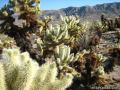 | Cholla Cactus Garden This quarter-mile loop allows visitors to stroll through an intense concentration of cholla cacti. |
 | Mastodon Peak This 2.6-mile loop visits a 3,400-foot summit with panoramic views of southeastern Joshua Tree. |
 | Lost Palms Oasis This 7.2-mile hike visits a desert oasis nestled between mountains in the southeast corner of the park. |
 | Hikes in the California Desert Explore more trails in Death Valley National Park, Joshua Tree National Park, Anza-Borrego Desert State Park, and Mojave National Preserve. |
 | Joshua Tree Campgrounds Nine campgrounds with 500 total sites are spread throughout the park to facilitate your visit. |
 | Joshua Tree Wildflowers The desert in bloom is something any outdoor enthusiast in California should see. |
Common Questions about Lost Horse Mine in Joshua Tree National Park
- Is the trail open?
- Yes. You should expect to find that Lost Horse Mine Trail is open. There are no recent reports of trail closures. If you discover that the trail is closed, please help your fellow hikers by reporting a closure.
- Do I need a permit for this hike?
- Yes. National Park Entrance Fee.
- How much time does this hike take?
- It takes approximately 2 hours to hike Lost Horse Mine Trail. Individual hiking times vary. Add extra time for breaks and taking in the views.
- How long is this hike?
- The hike to Lost Horse Mine Trail is a 4 mile out and back with 400 feet of elevation change.
- Are dogs allowed on this trail?
- No, dogs are likely not allowed on Lost Horse Mine Trail. The trail is primarily open to hikers.
- Where is the trailhead located?
- The trailhead for Lost Horse Mine Trail is located in Joshua Tree National Park, CA.
Trailhead Address:
Keys View Road
Joshua Tree National Park, CA 92277
Trailhead Coordinates:
33.9507, -116.15982 - What are the driving directions to the start of the hike?
To get to the trailhead: From Park Boulevard, take Keys View Road south 2.4 miles and turn left onto a dirt road leading to the trailhead for Lost Horse Mine.
View custom Google Maps directions from your current location.
- Are there other trails near Lost Horse Mine Trail?
- Yes, you can find other nearby hikes using the Hikespeak Hike Finder Map.

Two great hikes. The Lost Mine Trail described here as an out and back. But there’s also The Lost Horse Trail Loop which continues on from the mine and returns to the parking lot. The trailhead signs are a little confusing. If you go through the gate, you will indeed follow the 4 mile out and back described here. You could continue on in a clockwise fashion completing the Lost Horse Trail Loop for a total of 6.2 miles.
What is confusing is the other trailhead sign near the restrooms which say:
Lost Horse Trail Loop 6.2 miles
Lost Horse Mine 4.2 miles
You would be traveling in a counterclockwise direction. Many hikers thought they were hiking 4.2 miles TOTAL, when in fact, they had to complete the 6.2 miles loop. The sign doesn’t lie. It is just misread by almost a dozen hikers I met on the trail.
Either hike is worth it. Not mentioned is hiking to the summit of Lost Horse Mountain. Even more spectacular than the summit behind the mine that is mentioned, but there is no trail. You have to x-country. There are two peaks to the south. The farthest is Lost Horse Mountain.
[…] Lost Horse Mine – this was a great hike we did our first afternoon. It was about 4 miles out to the gold mine and back, and took us less than 3 hours! It was pretty neat seeing the old gold mine built into the mountain and imagining how the area looks pretty similar back then as it does today. […]
[…] the San Adreas Fault earlier in the morning. It was better but still pretty hazy. We stopped at Lost Horse Mine to hike out and see some of the remains of the mining operations that used to exist. It’s […]
[…] was my final day in Joshua Tree. I could say that the Lost Horse Loop trail chose me to explore her, which is as true as any statement I’ve made. My water is low, and […]