Latourell Falls
in Guy W. Talbot State Park
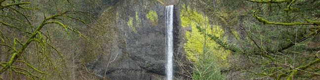
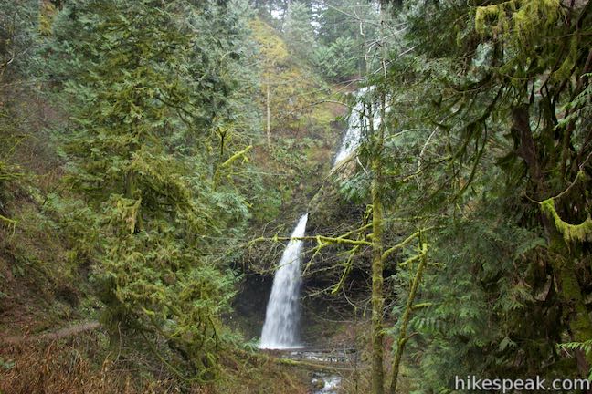
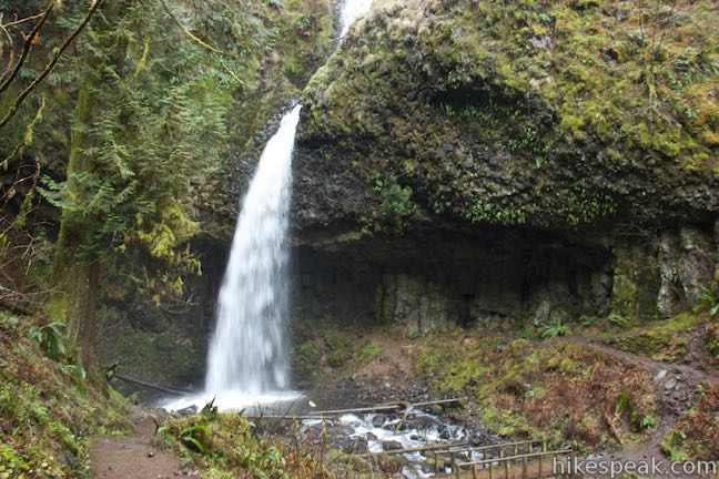
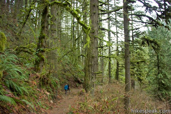
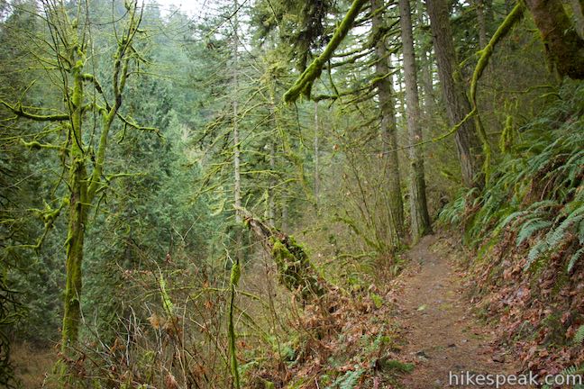
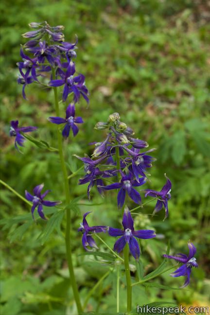
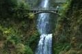
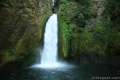
Latourell Falls is a stunning waterfalls tumbling into the Columbia River Gorge east of Portland. More precisely, there are two waterfalls on Latourell Creek totaling 359 feet of falls. Lower Latourell Falls is a beautiful 225-foot single drop waterfall that can be seen right from the trailhead along Historic Columbia River Highway. Farther up the canyon is Upper Latourell Falls, which is 134 feet tall, sliding down a basalt overhang before twisting to a freefalling plunge. Latourell Falls Trail reaches the bases of both falls on a 2.3-mile loop with 475 feet of elevation change. The trail passes through an enchanting mossy forest in Guy W. Talbot State Park typical to the Columbia River Gorge.
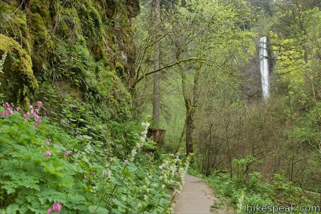
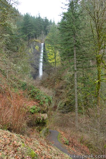
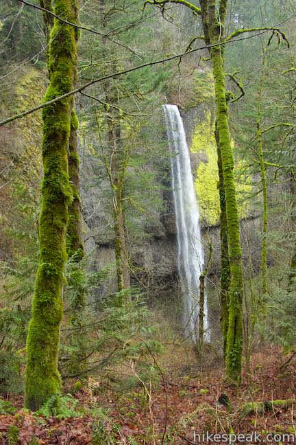
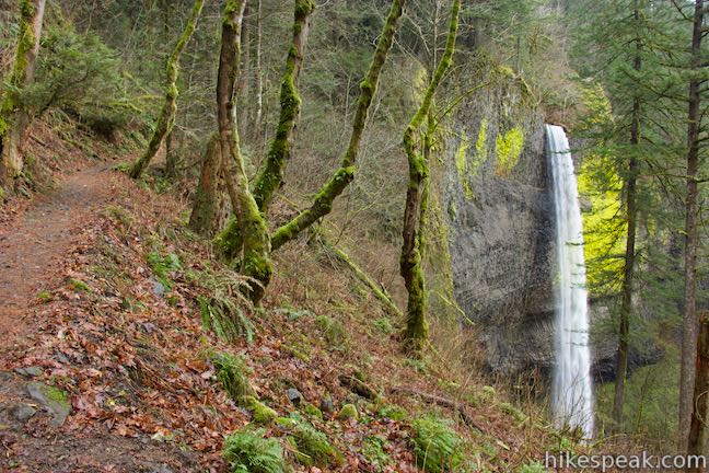
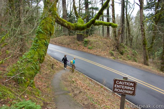
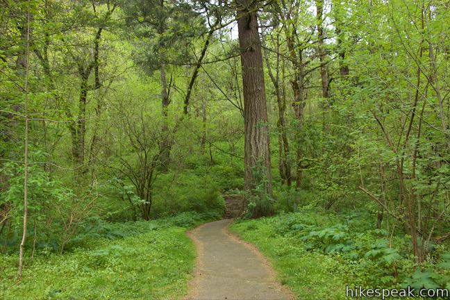
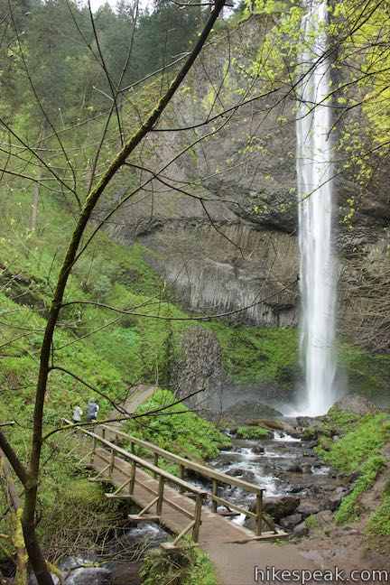
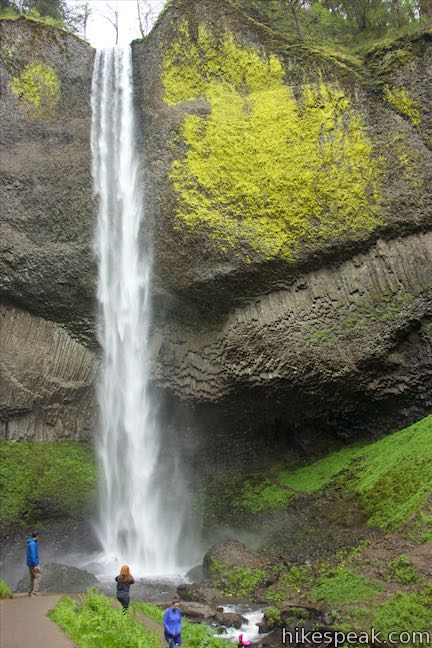
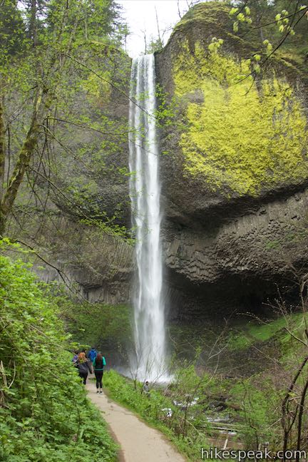
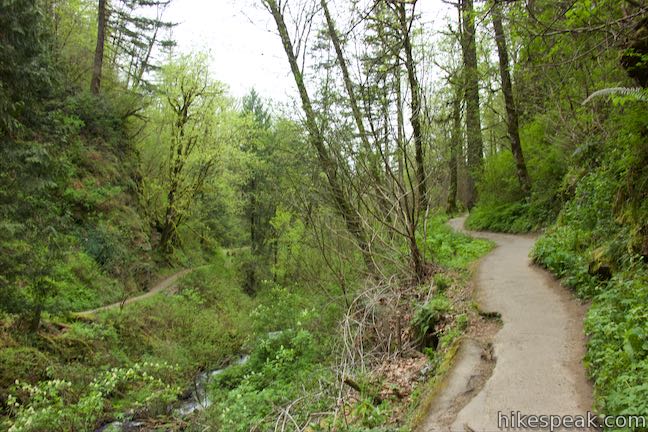
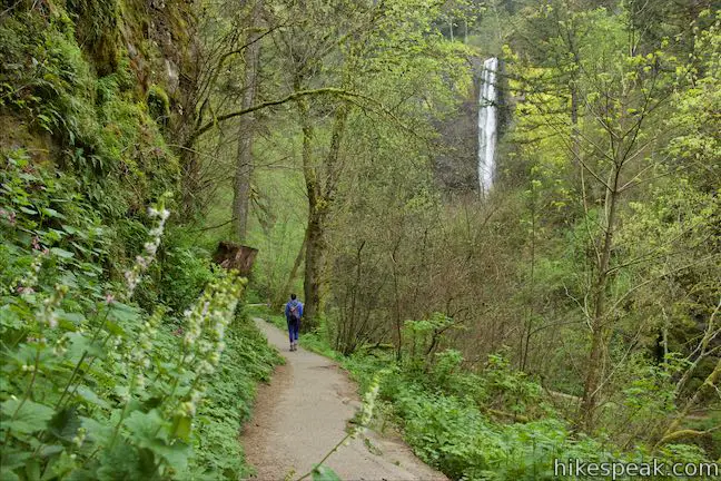
Start from a parking area along Historic Columbia River Highway (HCRH) in Guy W. Talbot State Park just east of a bridge over Latourell Creek. Lower Latourell Falls is in full view at the start and there’s an even better overlook a short distance up Latourell Falls Trail. The tall slender falls makes a straight, elegant drop in front of a basalt cliff. A large patch of lime green-colored lichens cling to the rock alongside the falls. The canyon framing the waterfall is covered in maples and cedars, adding to the ambiance. To get a closer look at Latourell Falls, continue up the trail, which heads south up the side of the canyon, aiming for the top of Lower Latourell Falls. As your go, there are nice views of the waterfall through the forest framed by bigleaf maples.
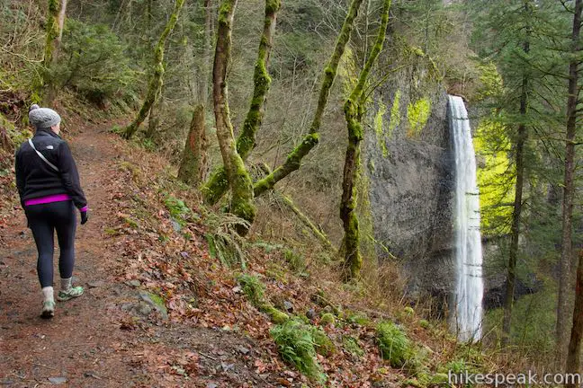
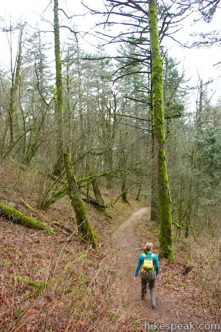
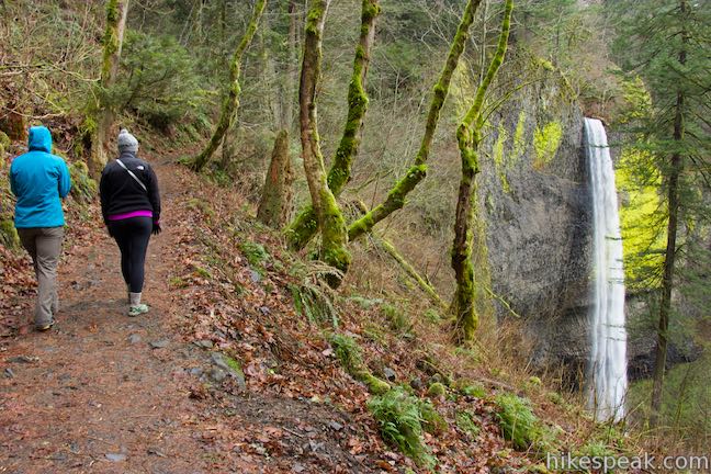
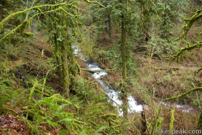
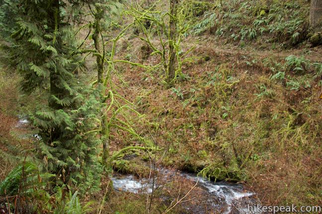
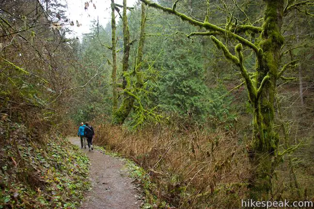
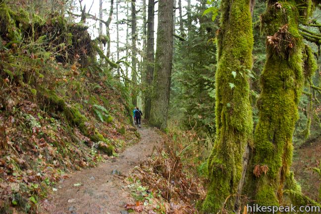
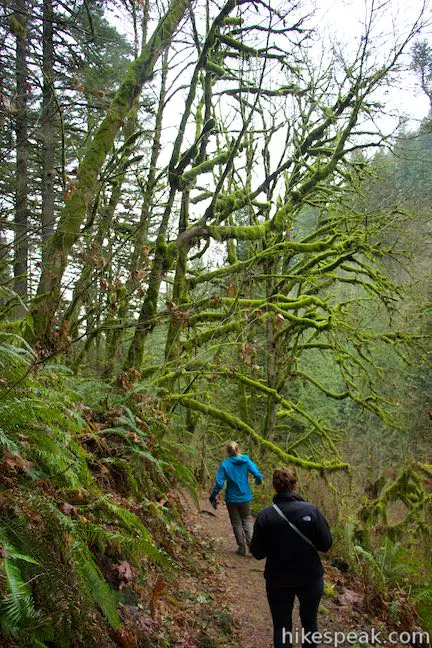
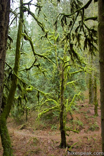
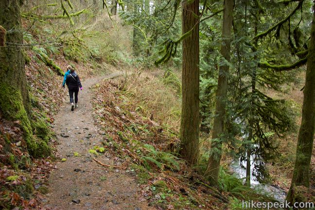
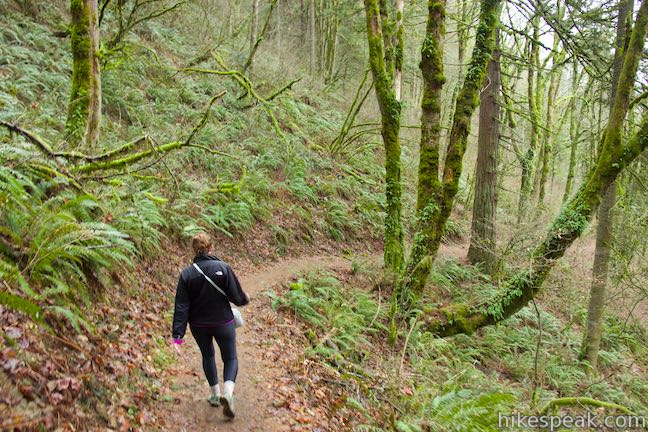
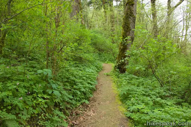
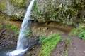
After a quarter mile, a tight, short switchback brings you up into the canyon above Lower Latourell Falls. The trail progresses up the gradual canyon, staying just above Latourell Creek. The trees lining the trail are covered in vibrant green moss. Cross a pair of footbridges on the side of the canyon and approach Upper Latourell Falls.
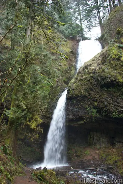
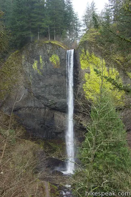
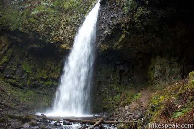
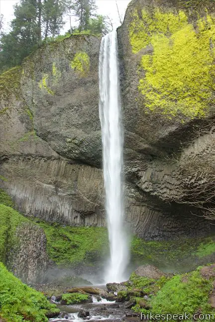
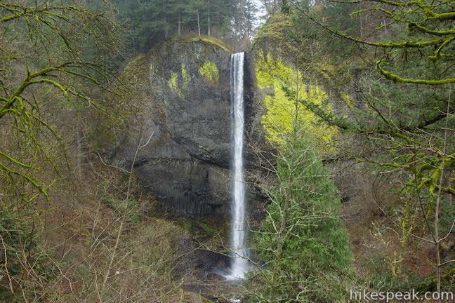
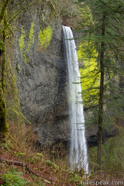
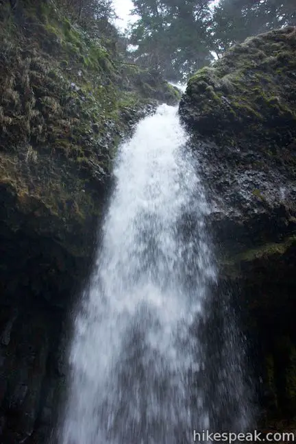
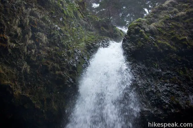
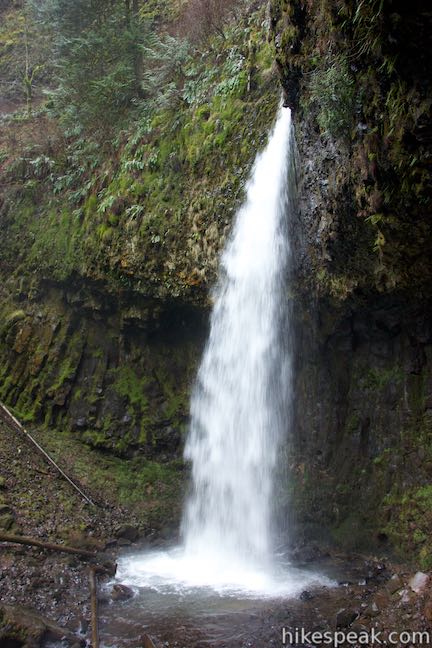
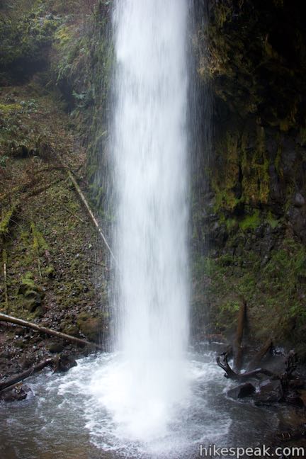
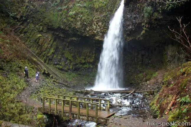
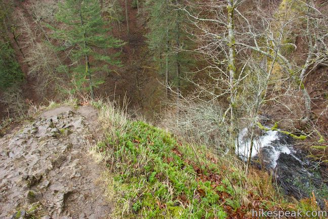
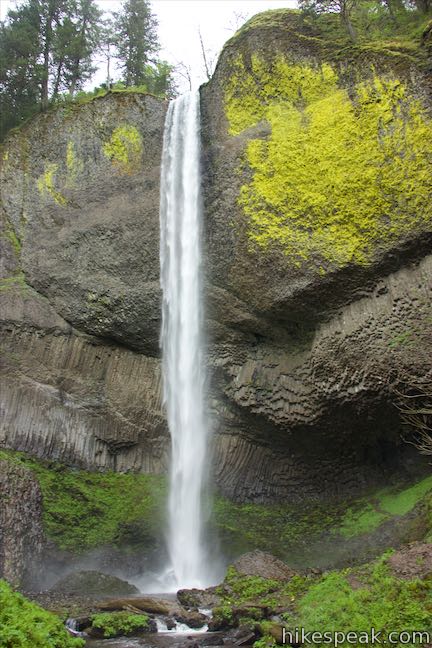
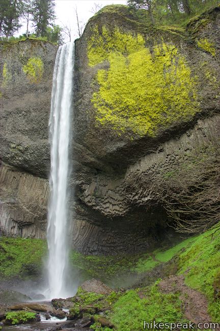
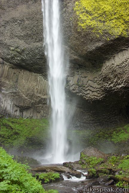
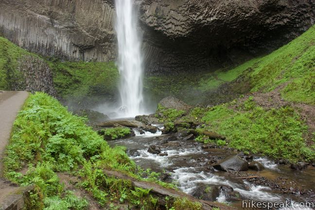
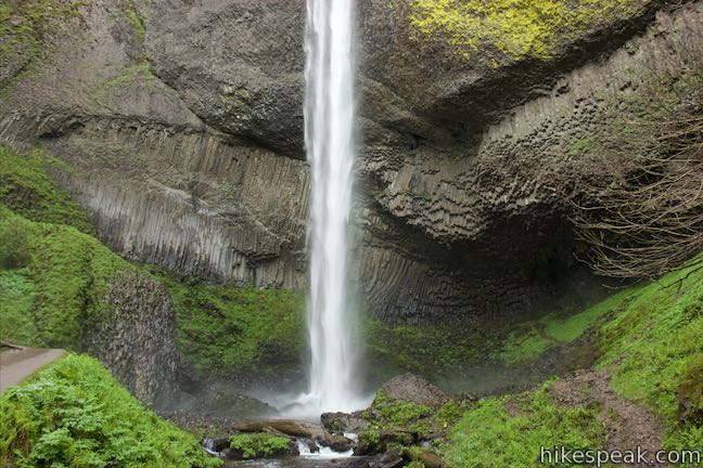
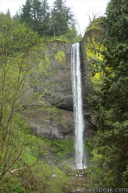
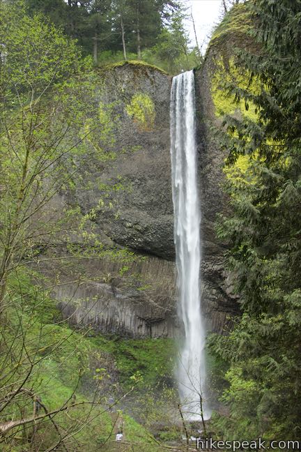
A bridge across Latourell Creek just below the waterfall is 0.85 miles from the start. Before crossing it, get a good look at the 134-foot waterfall. The top tier slides down a steep rock face of columnar basalt. Then the water twists and leaps from an overhang, dropping about 80 feet to the canyon floor, where it splashes down into a pool surrounded by dark volcanic rock. Step up close to the falls and get showered in the falling spray. Across the bridge, you can take a path up under the overhang and stand next to the freefalling water.
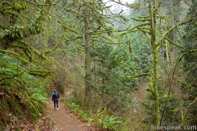
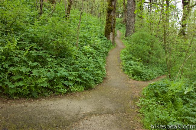
When you’re ready to go, continue on Latourell Falls Trail, which heads down the west side of the canyon across from the trail up. The earlier part of Latourell Falls Trail is visible at times across Latourell Creek. Ferns and moss-covered trees line the trail as you descend along the creek. Stick with the trail through a switchback and continue down the canyon.
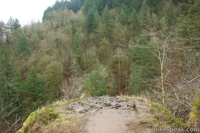
At just over half a mile from Upper Latourell Falls, come to an unmarked junction. The trail to the right is a spur that descends about 75 feet in 0.05 miles down to an overlook next to the brink of Lower Latourell Falls.
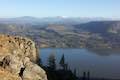
The overlook is on top of the sheer cliff alongside the falls and does not have railings, so be quite careful if you venture down to this point. Stay back from the edge. While you won’t get a very good view of the waterfall from this perch, you can look out over the tops of the evergreens across the Columbia River Gorge toward the state of Washington.
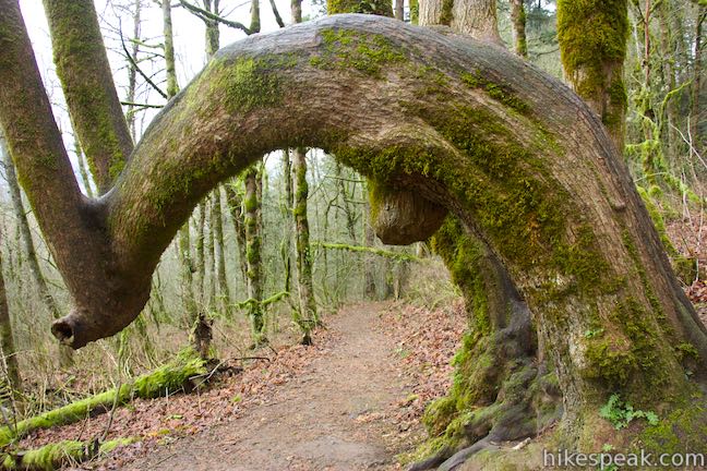
Backtrack to the junction and turn right (originally a left). The trail takes a longer course back down to Columbia River Highway than it did on the way up, exploring more of the woodland to the west. Latourell Falls Trail makes its way down a hillside covered in mixed forest of conifers and deciduous trees, accompanied by moss and ferns. One curiously-shaped bigleaf maples hangs over the trail like an arch.
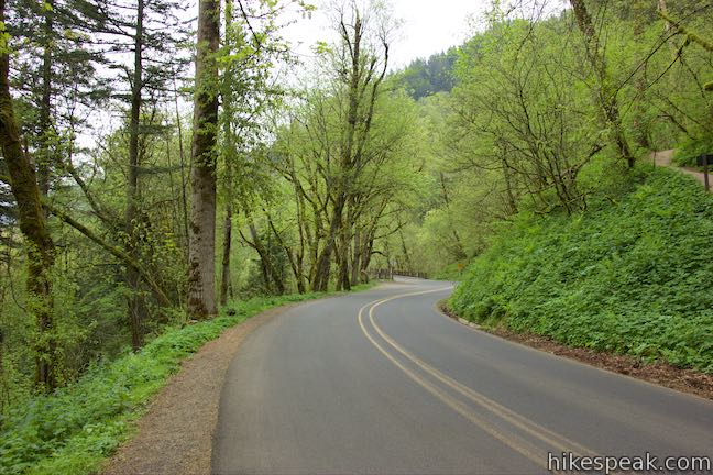
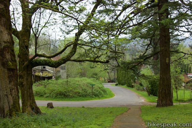
Half a mile from the spur to the overlook, and 1.9 miles from the start, the trail descends to Historic Columbia River Highway, which is a two-lane road. If you turned right here, you could walk 0.15 miles back along the road to the trailhead where you started. Instead, cross the road and continue down Latourell Falls Trail.
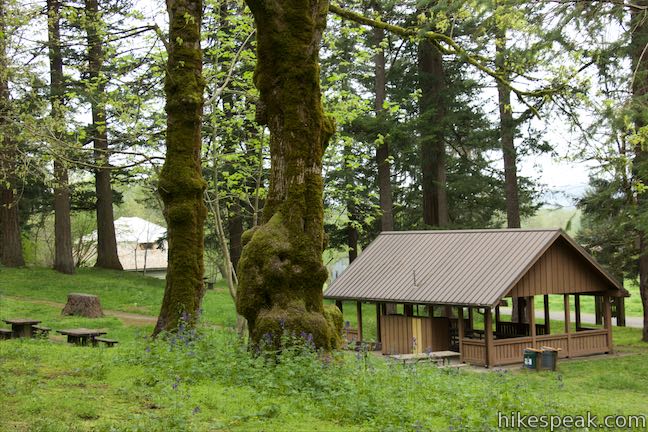
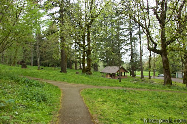
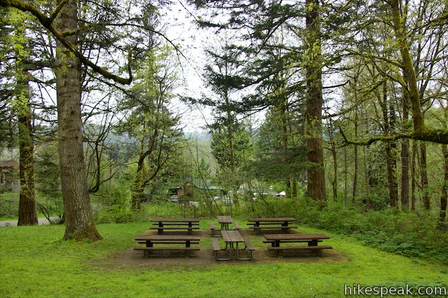
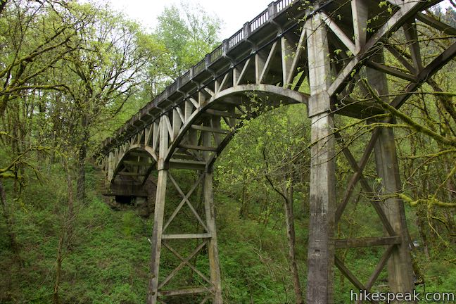
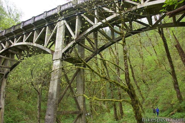
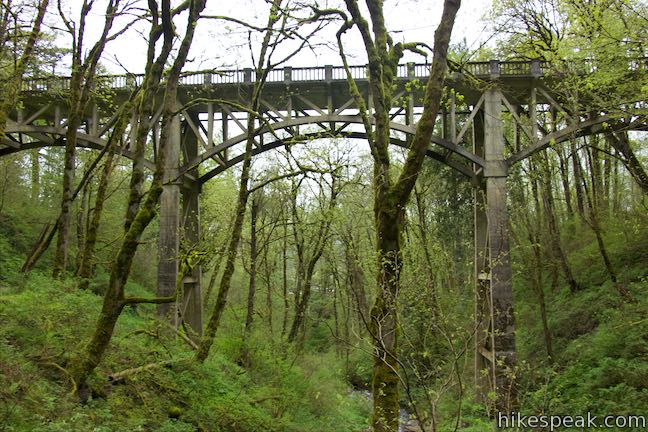
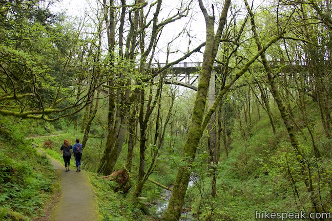
The trail curves to the right and drops below the road. Go left or straight at a 4-way junction (just don’t take the trail on the right going back up to the road). The other two branches leaving the junction go downhill and come together above a short flight of stone steps. Take these down into a lower part of Guy W. Talbot State Park. Pass a picnic area and bear right toward Latourell Creek, avoiding a trail down to Latourell Road. Curve to the right and follow the trail upstream below Latourell Bridge, which is over a hundred years old and still supports Historic Columbia River Highway. Pass below the elegant bridge and enjoy an easy walk up the canyon to the base of Lower Latourell Falls, where the water drops 225 feet in a single plunge from the canyon above. Cross a bridge and take the paved trail up the east side of the canyon for a tenth of a mile to return to the trailhead.
The loop on Latourell Falls Trail is 2.3 miles round trip with 475 feet of elevation change (add an extra tenth of a mile if you venture out to the overlook at the brink of Lower Latourell Falls). Dogs are welcome on leashes. No fee or permit is required to hike Latourell Falls Trail in Guy W. Talbot State Park, so get out and enjoy!
Latourell Falls is the westernmost waterfall hike in the Columbia River Gorge (which also includes Multnomah Falls and many other), making it the closest waterfall to Portland. Continue along Historic Columbia River Highway to see a lot more. Vista House is 2.4 miles west of Laturell Falls, with awesome views of Columbia River Gorge that don’t require hiking. Angel’s Rest Trail is 2.8 miles east of Latourell Falls, with awesome gorge views that do require hiking.
Directions to the Trailhead
- From Portland, take Interstate 84 east for about 25 miles to exit 28.
- The offramp becomes Bridal Veil Road.
- At the first intersection, make a big right turn to head west on Historic Columbia River Highway, passing Angel's Rest Trailhead.
- Drive 2.8 miles to the trailhead, which will be on the left.
- From The Dalles, take Interstate 84 west for 50 miles to exit 35 for Ainsworth State Park and Historic Columbia River Highway.
- At the end of the offramp, continue west on Historic Columbia River Highway.
- Drive 10 miles and the trailhead parking area will be on the left, just before Latourell Bridge.
Trailhead Location
Trailhead address: Historic Columbia River Highway, Corbett, OR 97019
Trailhead coordinates: 45.5387, -122.218 (45° 32′ 19.31″N 122° 13′ 04.80″W)
View Latourell Falls in Columbia River Gorge in a larger map
Or view a regional map of surrounding Oregon trails and campgrounds.


 | Angel's Rest This 4.8-mile hike ascends to a panoramic landing with spectacular views across Columbia River Gorge (particularly at sunrise). |
 | Multnomah Falls This 0.4 to 2.6-mile hike visits Oregon's tallest (and probably most visited) waterfall, offering something to hikers of all abilities. |
 | Multnomah-Wahkeena Loop This 6.05-mile loop uses Wahkeena Trail and Larch Mountain Trail to visit six glorious waterfalls (Wahkeena Falls, Fairy Falls, Ecola Falls, Weisendanger Falls, Dutchman Falls, and Multnomah Falls) as well as many fine cascades along Wahkeena Creek and Multnomah Creek in two beautiful canyons off Columbia River Gorge. |
 | Oneonta Gorge to Lower Oneonta Falls This 0.8-mile trek follows Oneonta Creek between the tall, mossy cliffs of a wild and beautiful gorge to the base of an enchanting 100-foot waterfall. |
 | Horsetail Falls Trail - Oneonta Trail Loop This 2.85-mile loop starts at Horsetail Falls, passes beneath an overhang behind Ponytail Falls, and crosses a bridge by Middle Oneonta Falls to hit three waterfalls and viewpoints looking out over the Columbia River Gorge. |
 | Wahclella Falls This 2-mile hike visits a sublime waterfall in a canyon within the Columbia River Gorge. |
 | Eagle Creek Trail This 4.55-mile hike ventures up a beautiful and dramatic canyon to impressive waterfalls like Metlako Falls, Lower Punchbowl Falls, and Punchbowl Falls. |
 | Mosier Twin Tunnels This 2 to 9.5-mile hike ventures up Historic Columbia River Highway State Trail to a pair of tunnels carved into basalt cliffs on the side of Columbia River Gorge. |
 | More trails in Oregon Explore other hikes in Oregon outside the Columbia River Gorge. |
Common Questions about Latourell Falls in Guy W. Talbot State Park
- Is the trail open?
- Yes. You should expect to find that Upper Latourell Falls Loop is open. There are no recent reports of trail closures. If you discover that the trail is closed, please help your fellow hikers by reporting a closure.
- Is this trail free to access?
- Yes, Upper Latourell Falls Loop is free to access. No entrance fee, pass, or permit is required. If you discover that access rules have changed, please provide feedback on your experience.
- How much time does this hike take?
- It takes approximately 1 hour 15 minutes to hike Upper Latourell Falls Loop. Individual hiking times vary. Add extra time for breaks and taking in the views.
- How long is this hike?
- The hike to Upper Latourell Falls Loop is a 2.3 mile loop with 475 feet of elevation change.
- Are dogs allowed on this trail?
- Yes, dogs are allowed on Upper Latourell Falls Loop. The trail is open to hikers, dogs.
- Will I see a waterfall on this hike?
- Yes, Upper Latourell Falls Loop features a waterfall.
- What mountain range is this trail in?
- Upper Latourell Falls Loop is located in the Cascade Range.
- Where is the trailhead located?
- The trailhead for Upper Latourell Falls Loop is located in Corbett, Oregon.
Trailhead Address:
Historic Columbia River Highway
Corbett, Oregon 97019
Trailhead Coordinates:
45.5387, -122.218 - What are the driving directions to the start of the hike?
To get to the trailhead: From Portland, take Interstate 84 east for about 25 miles to exit 28. The offramp becomes Bridal Veil Road. At the first intersection, make a big right turn to head west on Historic Columbia River Highway, passing Angel's Rest Trailhead. Drive 2.8 miles to the trailhead, which will be on the left.
From The Dalles, take Interstate 84 west for 50 miles to exit 35 for Ainsworth State Park and Historic Columbia River Highway. At the end of the offramp, continue west on Historic Columbia River Highway. Drive 10 miles and the trailhead parking area will be on the left, just before Latourell Bridge.
View custom Google Maps directions from your current location.
- Are there other trails near Upper Latourell Falls Loop?
- Yes, you can find other nearby hikes using the Hikespeak Hike Finder Map.

[…] Once you arrive you can choose an easy .8 mile hike from Latourell Falls trailhead directly to the upper part of the falls or you can hike the 2.4 mile loop through Guy Talbot State Park. I found a more detailed description of the trail in a great blog post by Hikespeak. […]
[…] Latourell Falls is a waterfall alongside the Columbia River Gorge within the U.S. state of Oregon, inside Man W. Talbot State Park […]
I’ve seen reviews re: difficulty ranging from “Super easy!” to “Steep and rocky!” Sooo…which one is it? Overall, I’m fit. However, I had a bad fall in November, still getting PT for it. Is this hike do-able, if I take it slow? Will hiking poles help?
Hi,
I would put the difficulty of this trail somewhere above “super easy.” The lower trail to the base of the waterfall is paved. Parts of this trail are level and not challenging.
The trail that goes above the waterfall is a dirt single-track. There are rocks and roots in the trail, so you will want to watch your step. There aren’t boulders to climb over or any particularly “rocky” obstacles that I recall (hiked spring 2021). There is some elevation to contend with though. The beginning of the trail might be the steepest part. If you can get through that, you shouldn’t have a problem later on. The trail goes along the side of a canyon, so some parts of the trail are a bit pitched, left to right (one side of the trail lower than the other) so hiking poles could be helpful.
Good luck with PT!