Pinnacles National Park is a spectacular place to hike with a High Peaks area covered in rock spires and equally impressive boulder-filled gorges with talus caves. See both the High Peaks and Balconies Cave on a great 9-mile loop through diverse Pinnacles landscapes. Starting in the east, this clockwise loop ascends 1,575 feet to a thrilling crossing of the High Peaks, then descends Juniper Canyon to the west side of the park, and passes through Balconies Cave to close the hike with an easy walk back on Old Pinnacles Trail.
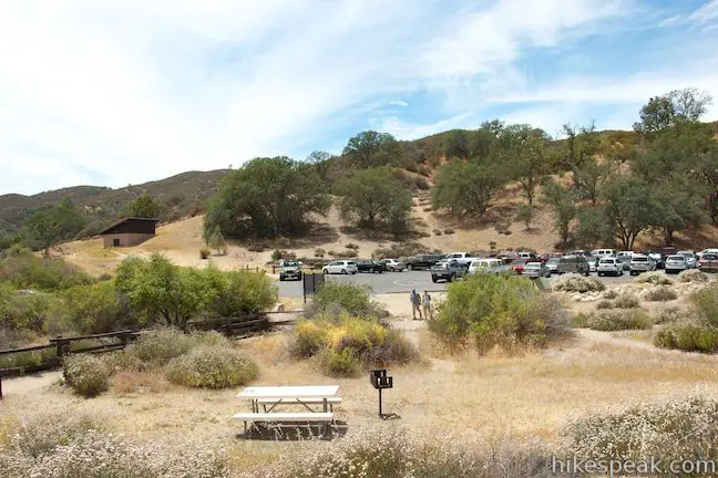
The directions provided here set out from Old Pinnacles Trailhead near Pinnacles Campground and the visitor center located on the east side of the park. (Roads enter the east and west sides of Pinnacles National Park, but no roads go across the park between the two sides).
Since the loop passes the Chaparral Trailhead on the west side of the park, you have the option start the hike from that trailhead instead, which actually trims about half a mile from the total length of the hike as you skip a short segment between Old Pinnacles Trailhead and the start of the loop. No matter where you begin or end this hike, the adventures in the middle are sure to amaze.
Three routes lead into the High Peaks from the east side of Pinnacles National Park. High Peaks – Condor Gulch Loop creates a circuit with two of these trails that start from Bear Gulch. High Peaks – Balconies Cave Loop takes the other route, the northeast end of High Peaks Trail, which begins its ascent near Old Pinnacles Trailhead.
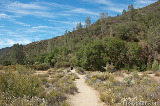
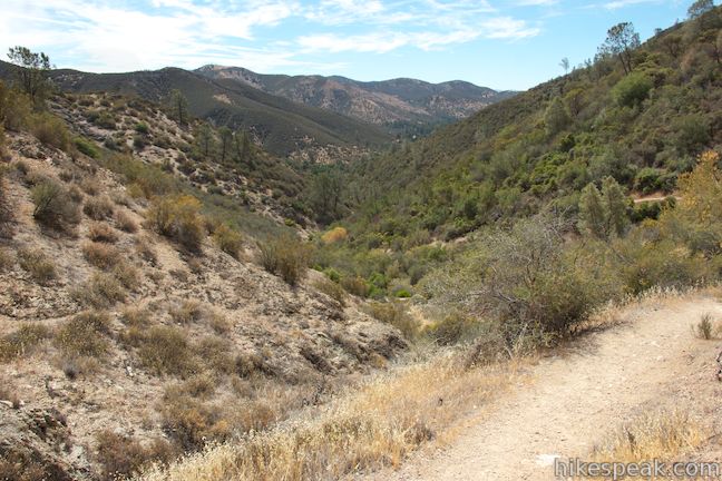
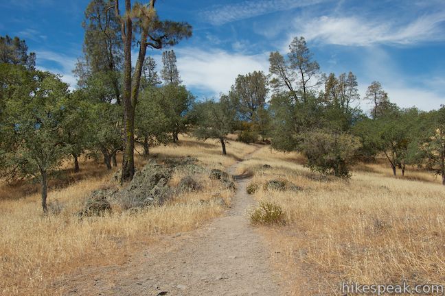
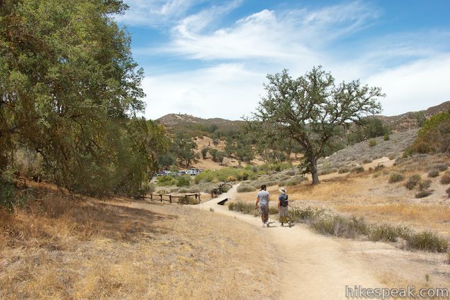
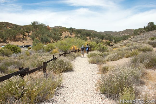
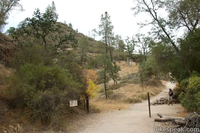
From the road end parking area, walk north up Old Pinnacles Trail, hugging the east bank of a wide sandy canyon. After a quarter mile, you will come to the hike’s first junction and the start of the loop. Old Pinnacles Trail continues to the right and reaches Balconies Cave after 1.85 miles. Save this wide, easy trail for the end of the loop and turn left at the junction onto Bench Trail so that you can tackle the High Peaks before visiting Balconies Cave.
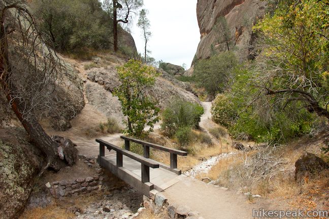
Cross a wooden footbridge and head south on Bench Trail. You will spot Old Pinnacles Trailhead across the canyon as you continue farther south. An easy half mile of hiking on Bench Trail brings you to a junction with High Peaks Trail. Turn right up High Peaks Trail and begin a steady climb into the mountains.
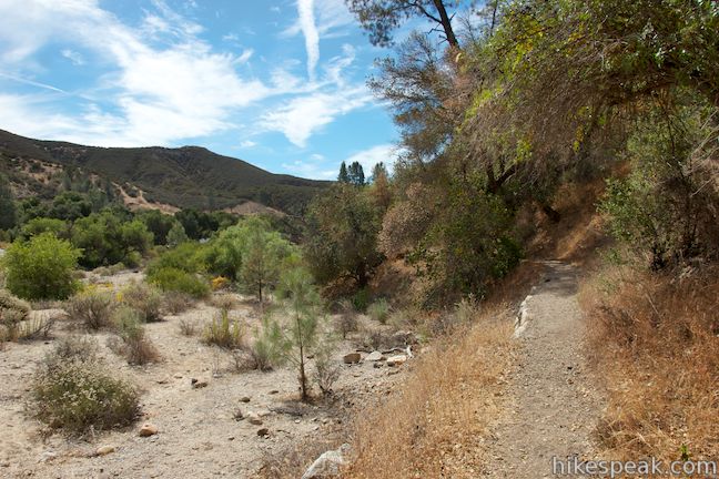
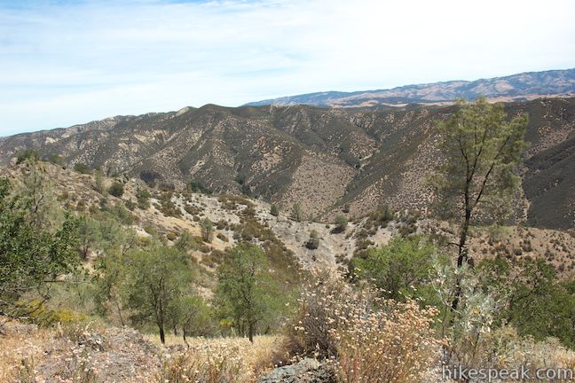
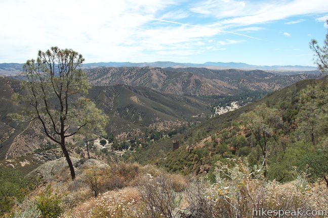
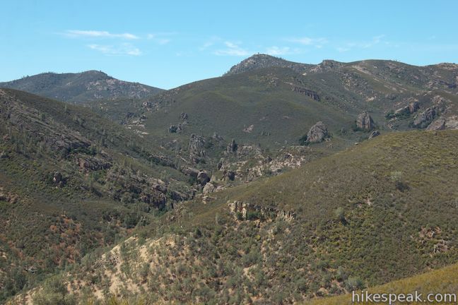
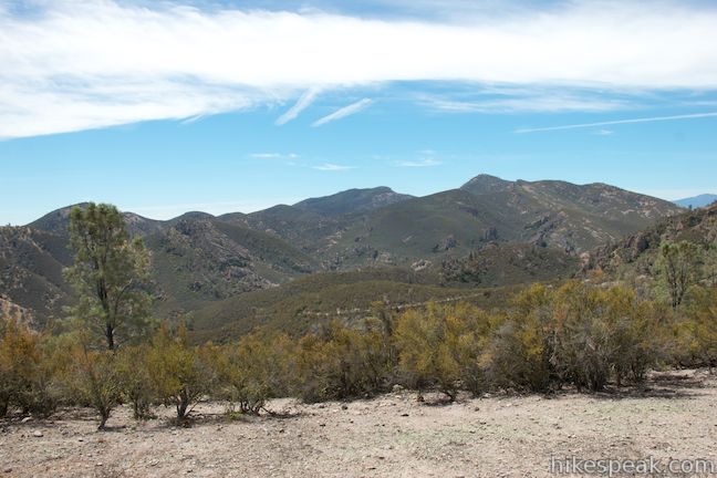
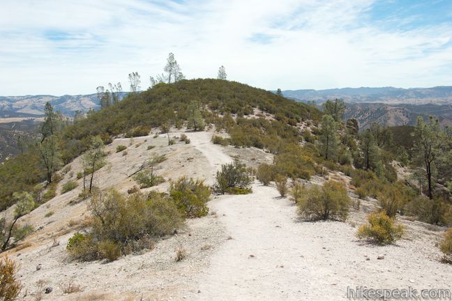
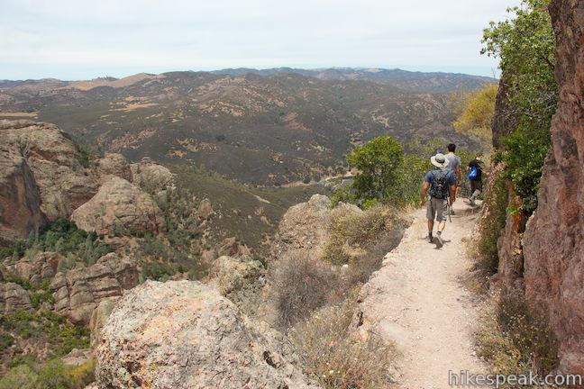
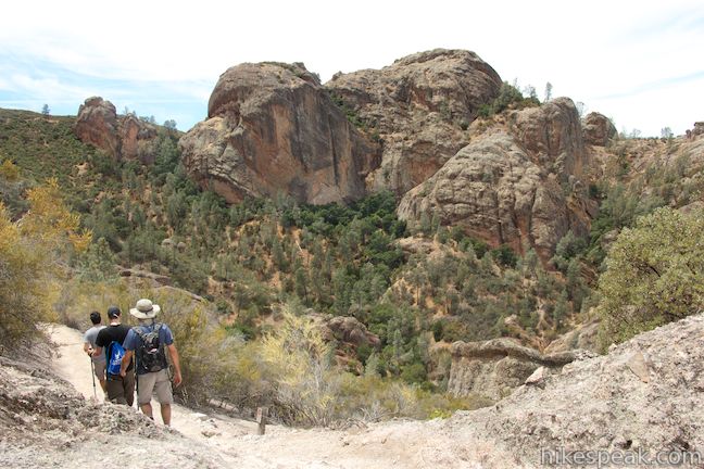
The trail weaves its way over ridges and around depressions carved into the slopes below the High Peaks. The views expand as you ascend and after 1.25 miles on High Peaks Trail, you will pass the edge of a bluff with huge views overlooking the canyons and ridges to the east. There are no rock formations anywhere in this direction to break up the rippled terrain, which only increases how unique the High Peaks look when you reach them.
High Peaks Trail climbs about 875 feet in the first 1.25 miles to reach an elevation of 1,875 feet. From here the trail becomes less steep and has less switchback as it continues west over ridge tops toward the High Peaks.
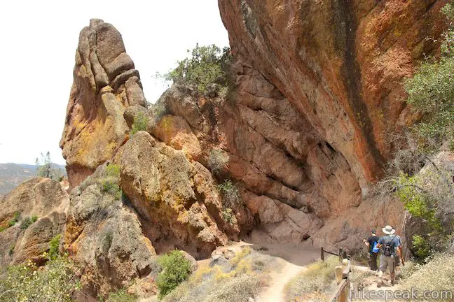
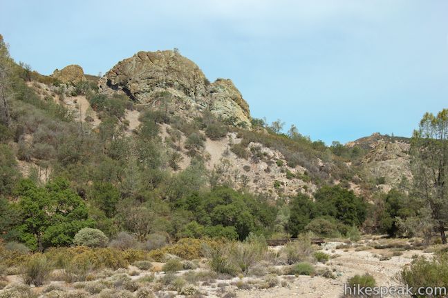
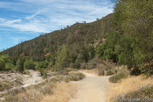
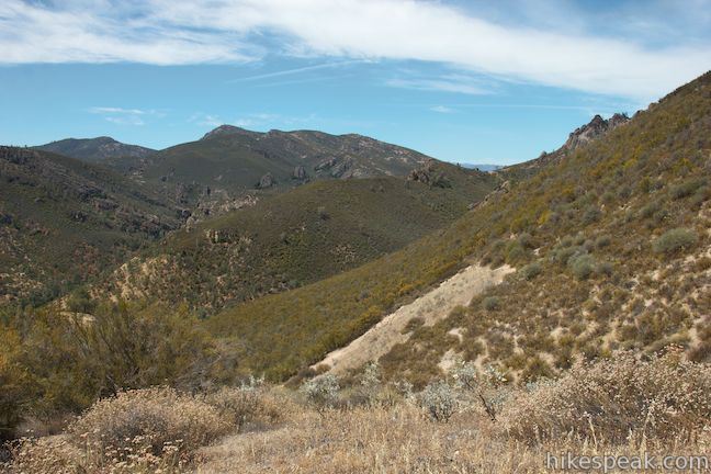
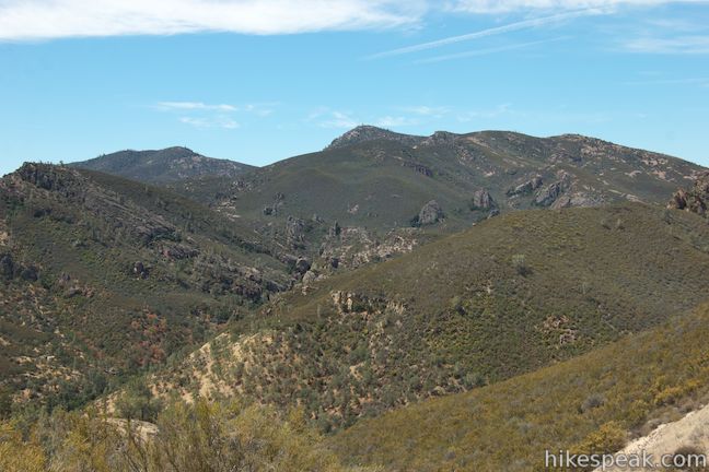
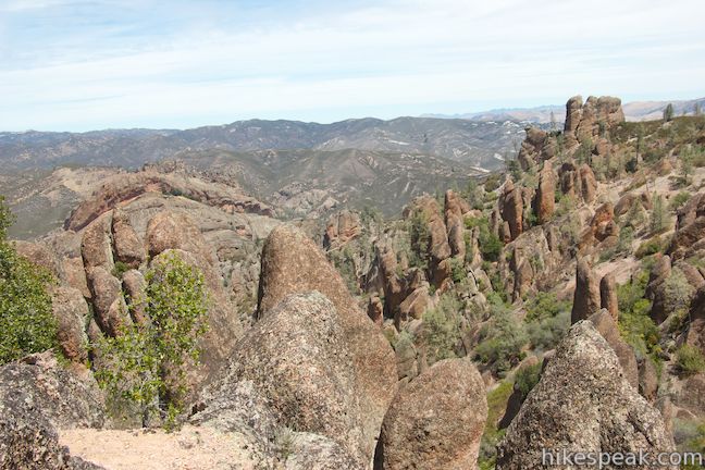
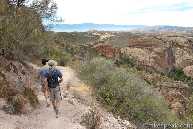
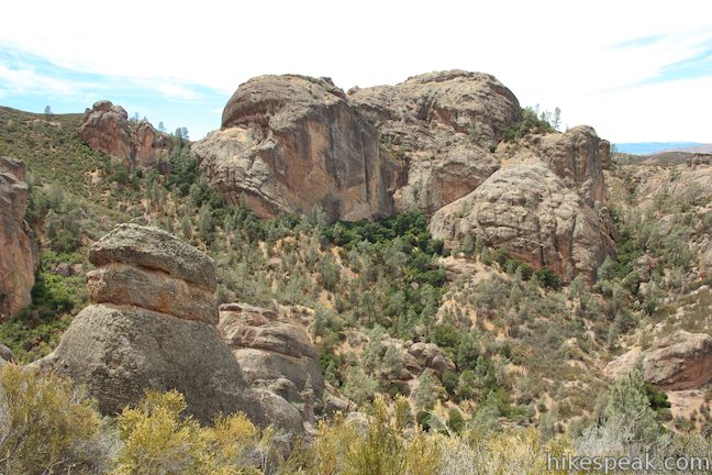
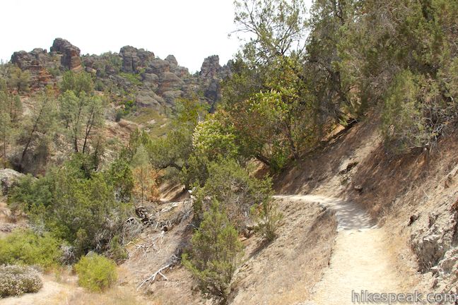
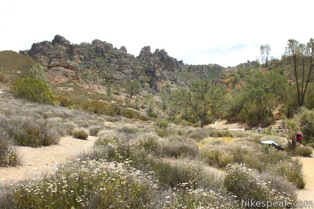
After another 3/4 of a mile on High Peaks Trail, and 2.75 miles from the start, you will cross a saddle in the ridgeline and come to a junction with Condor Gulch Trail (used on the other High Peaks Loop from the east side of the park). Stay to the right through this junction and continue up High Peaks Trail. To the left, you can look south over a unique landscape of rock spires that rise out of the pine and chaparral-covered ridges surrounding Bear Gulch. As you continue up the trail, you will discover views looking north down boulder-strewn slopes toward the Balconies. The Balconies are a dominant rock formation with bulging canyon walls that somewhat resembles a clam shell. Balconies Cave cuts through these rocks, as you will see later in the loop.
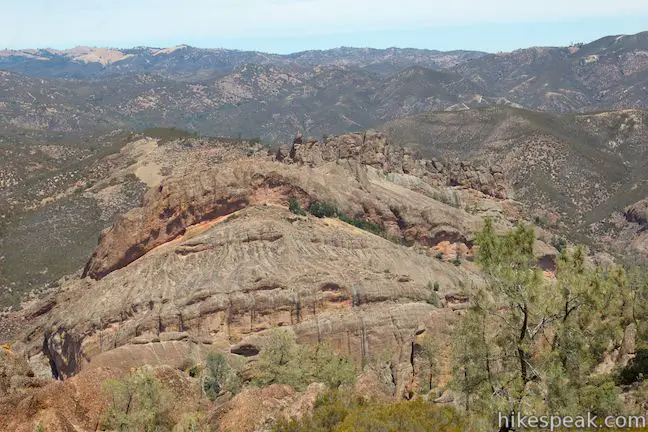
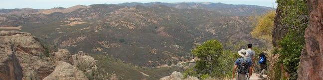
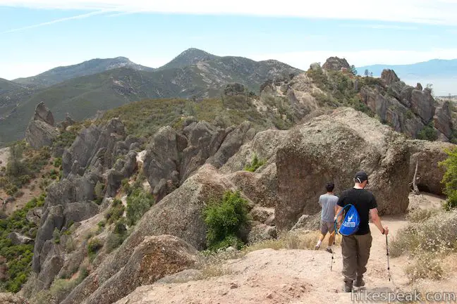
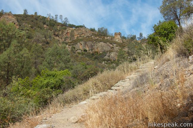
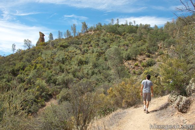
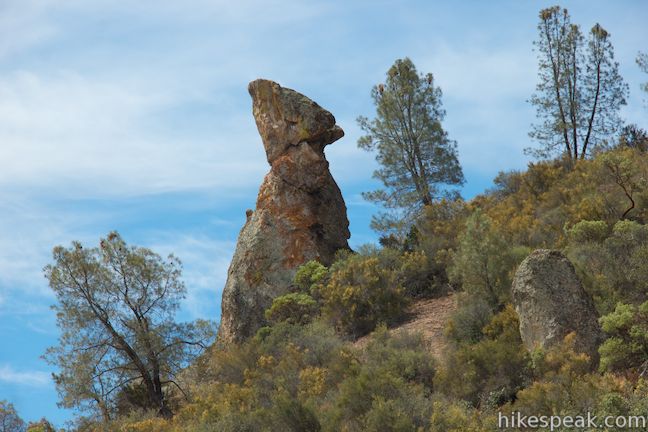
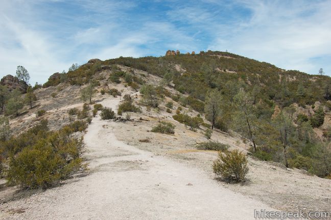
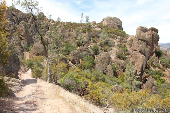
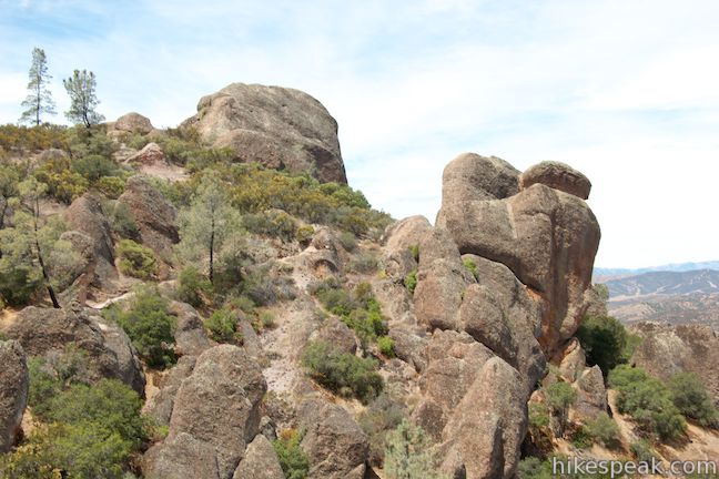
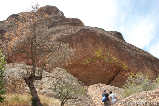
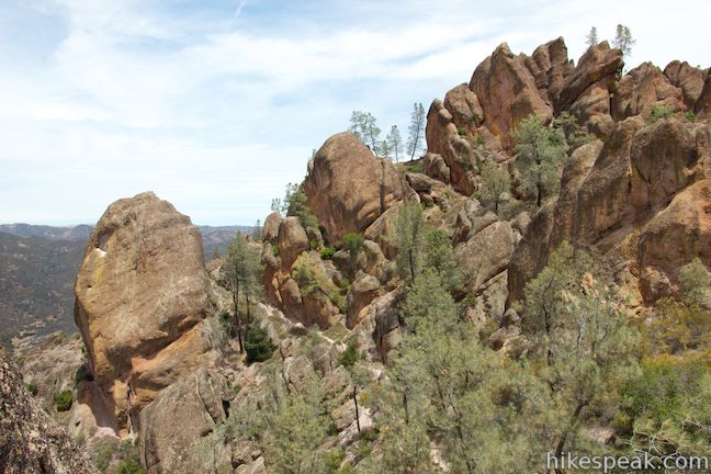
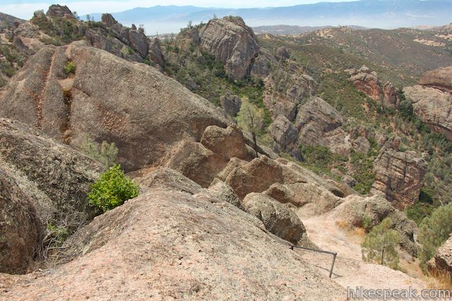
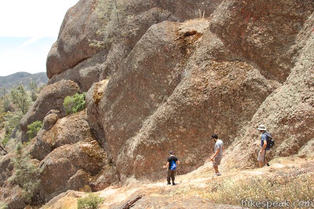
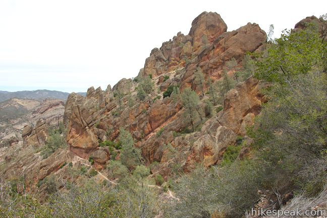
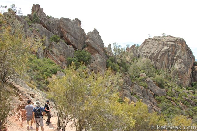
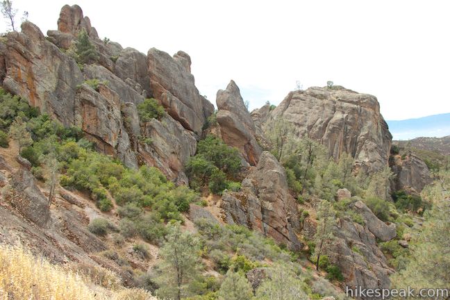
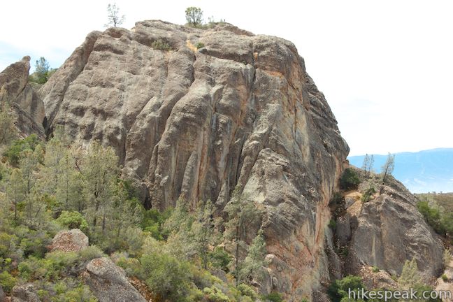
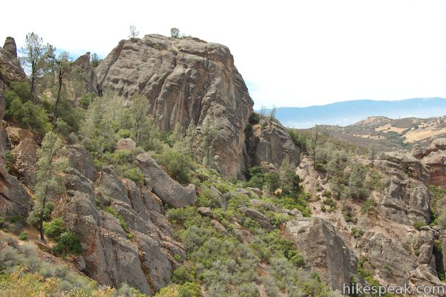
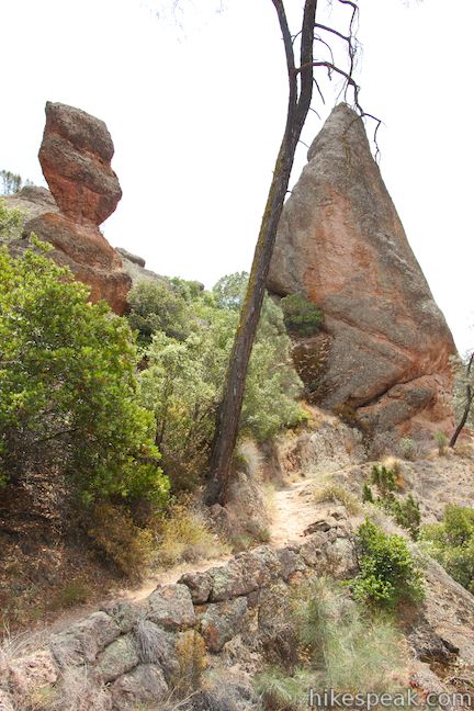
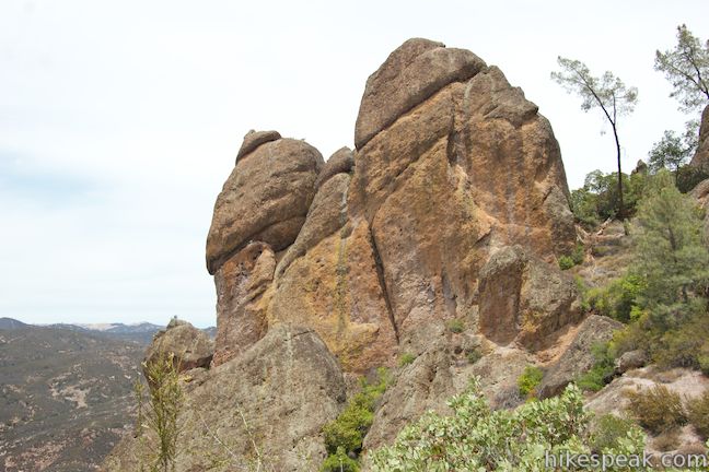
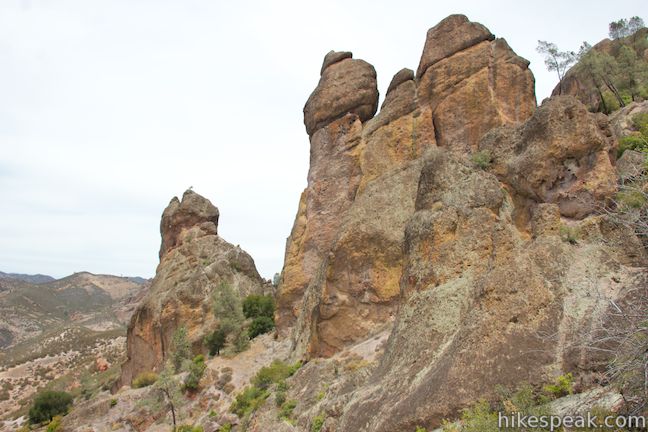
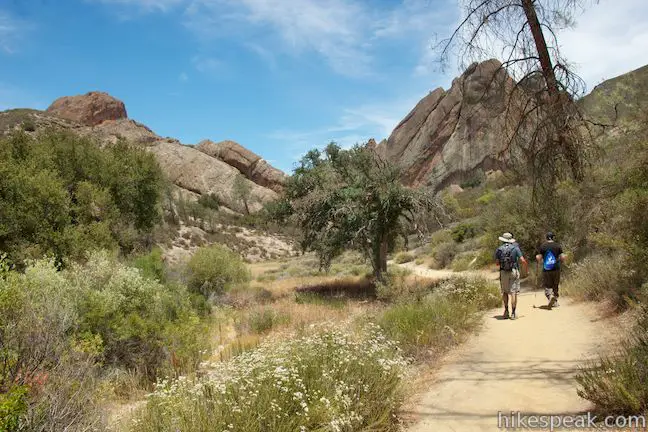
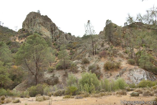
A jumble of misshapen boulders rise up on both sides of the trail as you enter the High Peaks, a ridge covered in amazing rocks that rises out of the center of Pinnacles National Park. It’s a wonderful thing, hiking High Peaks Trail and venturing deeper into a world of tall strangely-shaped monoliths that thrust out of the landscape like nothing else around. There are climbing routes for a few of the boulders along the trail, and smaller rocks that you can scurry up for bonus views if the trail leaves you wanting more.
As you cross the High Peaks, keep an eye out for California condors. These massive birds can weigh about 20 pounds and have a wingspan of 9½ feet. California condors were near extinction before being rescued and reintroduced by a captive breeding program. Pinnacles National Park (then Pinnacles National Monument) was a primary release point for condors, and the immense birds have reestablished themselves here. Park staff and volunteers continue to monitor the bird’s progress. If you come across someone tracking condors, you may be able to look through their telescope and get a closer look at these amazing birds. Remember to be respectful of these endangered birds if you are lucky enough to see one.
A junction with Tunnel Trail comes next. This trail descends to your right and connects to Juniper Canyon Trail (which the loop described here will take to leave the High Peaks for the west side of the park). If you would like to trim High Peaks – Balconies Cave Loop by 0.6 miles, you could turn down Tunnel Trail at this point, but then you would miss the most impressive part of High Peaks Trail.
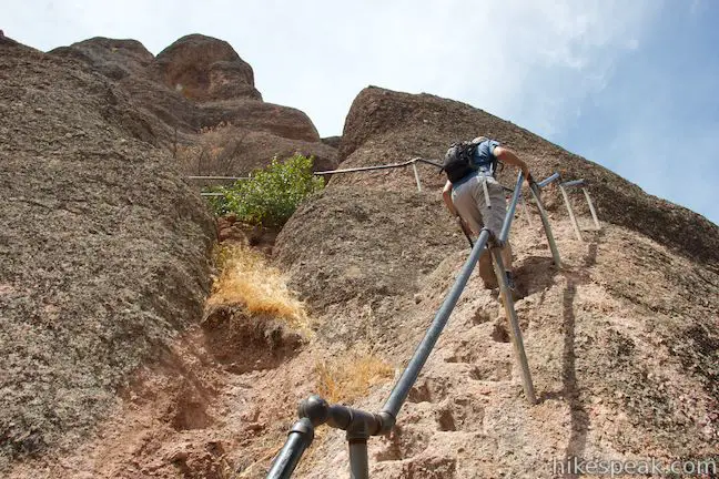
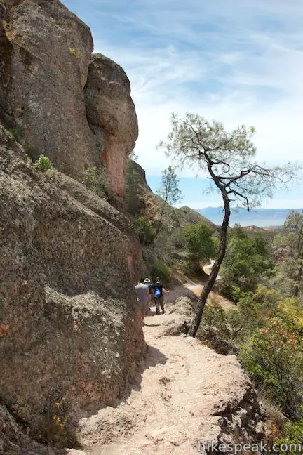
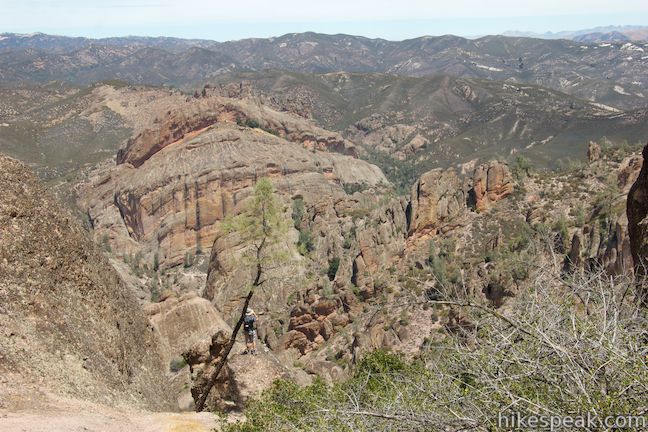
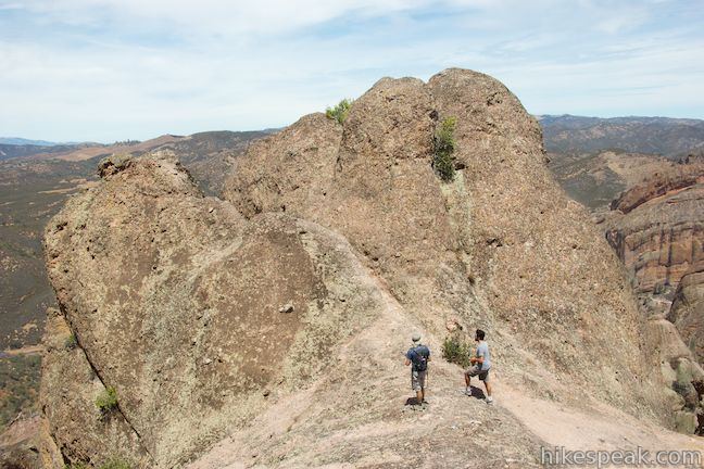
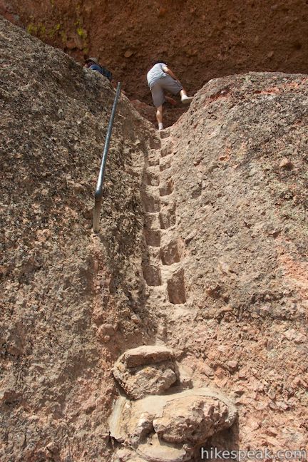
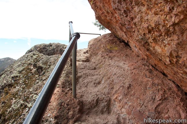
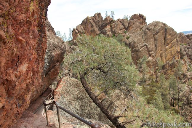
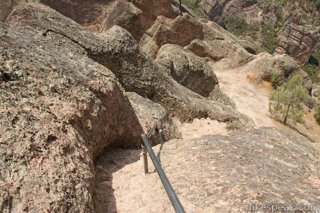
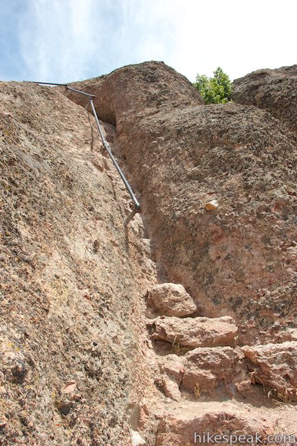
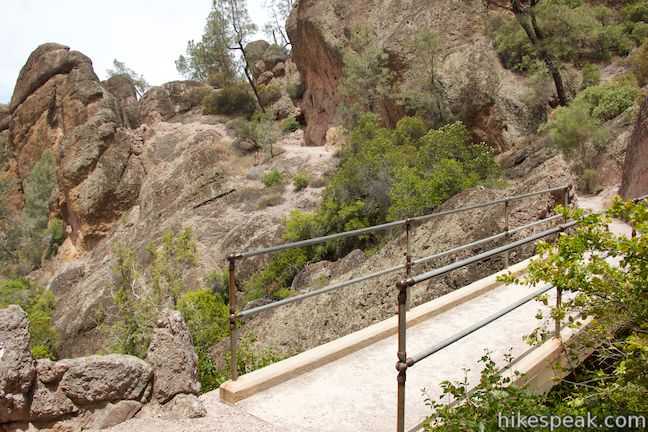
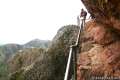
Just past the junction, High Peaks Trail gets narrow and steep, crossing through a rocky area where you can hardly imagine a trail could pass. Steps have been cut right into the rock to form steep staircases, and there are metal railings and wooden plant walkways to usher you across the crown of the pinnacles. Go up a couple flights of steps to a rock ledge and then venture south, putting the highest section of the High Peaks behind you.
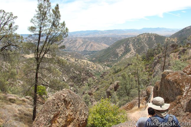
The High Peaks are the tallest mountains for many miles, so vast views of the surroundings back up the imposing boulders all around you. You will climb to around 2,575 feet above sea level on the highest section of High Peaks Trail, or 1,575 feet above where you started.
Descend staircases cut into the rock face and proceed through sky-pointed spires. Your tour on High Peaks Trail comes to an end after 3.35 miles on this glorious trail (4.1 miles of hiking from the trailhead). Reach a junction with Juniper Canyon Trail, which descends to the right toward the west side of the park. A toilet is located near the junction for those in need. When you’re ready to say goodbye to the High Peaks, turn right and begin down Juniper Canyon Trail.
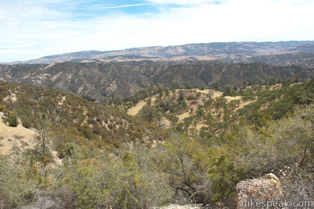
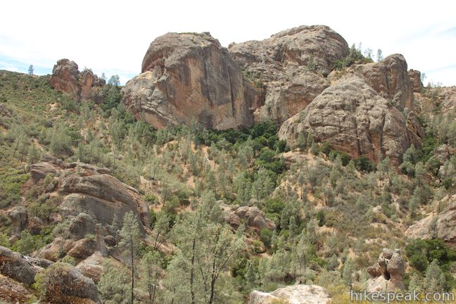
Juniper Canyon Trail descends 1,025 feet over the next 1.8 miles and the top of this trail is steep with some loose patches. The trail also boasts excellent scenery, with the High Peaks overhead and impressive boulders rising up along the trail. Views to the west across Juniper Canyon toward more pinnacles include a rock formation called Resurrection Wall.
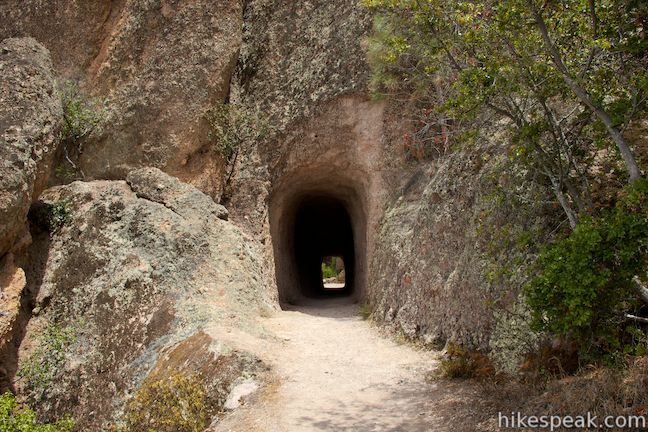
After descending 0.6 miles through boulders and chaparral, you will come to a junction with the other end of Tunnel Trail. To the right, this trail ascends for 0.6 miles back up to High Peaks Trail at the junction you previously passed through. If you would like to see the tunnel on Tunnel Trail, walk less then a tenth of a mile up a relatively level stretch of the trail to the entrance of the tunnel. Otherwise, stay to the left and continue down Juniper Canyon Trail.
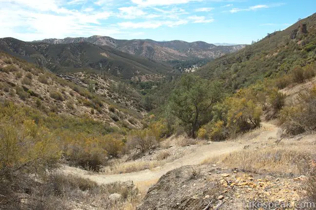
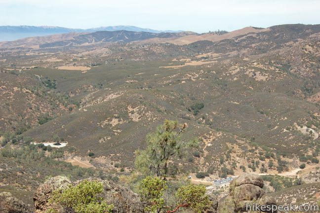
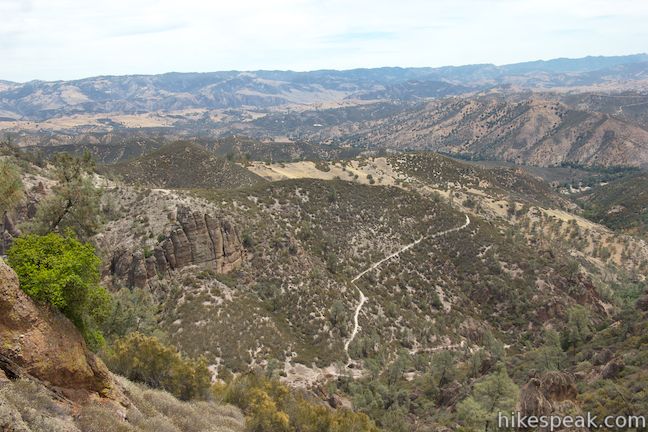
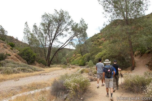
Juniper Canyon Trail drops through more switchbacks into the bowl-shaped depression of Juniper Canyon. Reach the canyon floor and pass through a shaded evergreen grove, taking the trail down the widening canyon toward Chaparral Trailhead. As you near the bottom of Juniper Canyon Trail, you will spot the parking area on the west side of the park. Be sure to look back over your shoulder toward the pinnacles above Juniper Canyon.
Just before reaching the end of Juniper Canyon Trail, bear right past a trail that goes to an overflow parking area. In another 0.05 miles, you will come to a junction by the Chaparral Trailhead. Pass the parking area and continue straight onto Balconies Trail. At this point, you will have hiked 5.9 miles from Old Pinnacles Trailhead and tackled all of the loop’s tough elevation. Over the next 3.1 miles, you’ll actually descend 400 feet to close out the loop.
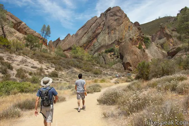
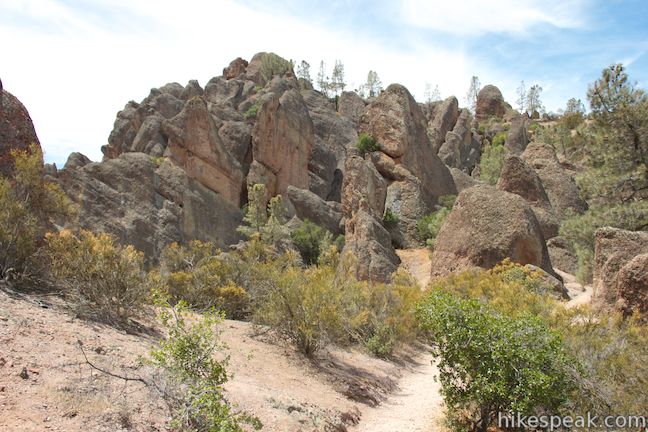
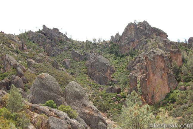
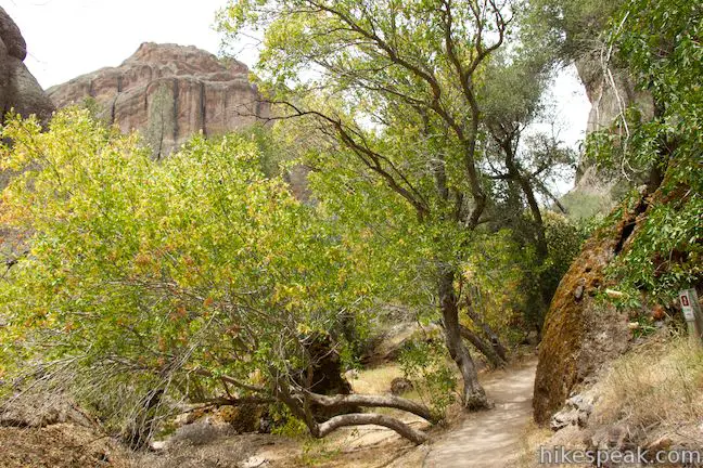
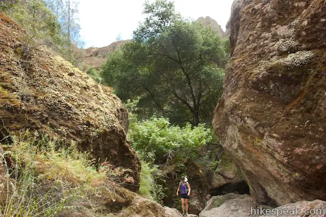
Balconies Trail turns northeast and heads gradually downhill into a canyon framed by tall rock formations. There are several climbing routes along the way, so keep an eye out for climbers in the rocks above. The trail weaves along the bottom of the canyon as the walls get closer together.
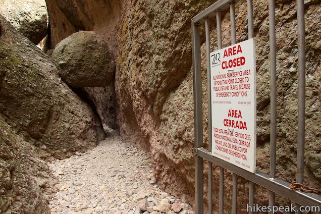
After 0.6 miles on Balconies Trail, pass through a junction with Balconies Cliffs Trail, which ascends to the left. The cliffs trail runs parallel to Balconies Cave Trail and meets back up on the other side of the cave. The cliffs trail can be used to as an alternative to the cave trail if the cave is closed. Balconies Cave closes anytime storms and high water levels make the cave dangerous. As an alternative to High Peaks – Balconies Cave Loop, hikers can combine Balconies Cliffs Trail and Balconies Cave Trail to form a shorter lollipop loop hike through the Balconies that excludes the High Peaks (a 2.4-mile round trip starting from Chaparral Trailhead).
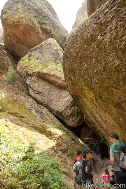
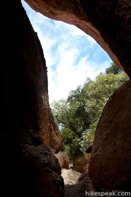
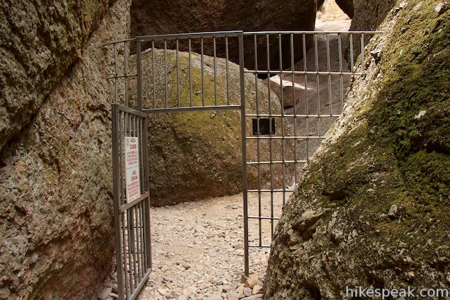
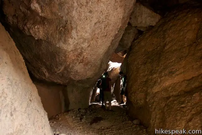
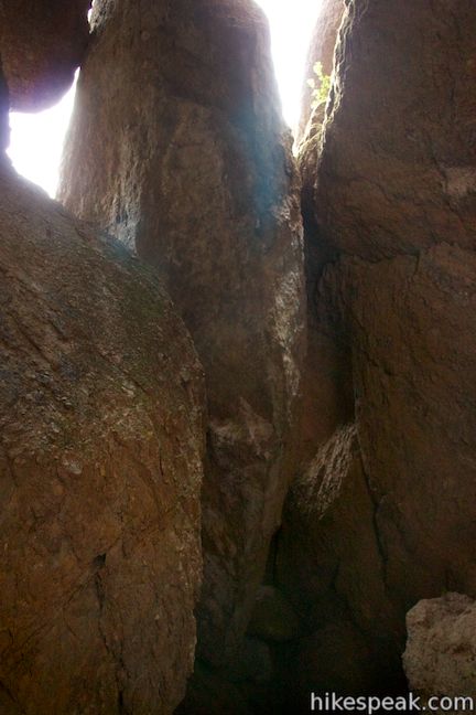
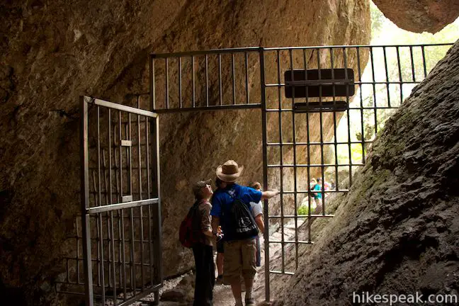
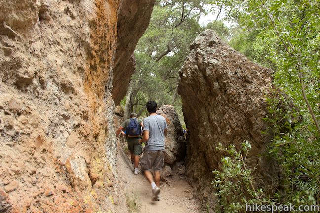
Just past this junction, the canyon walls seriously pinch together as you enter the next exciting chapter of the journey. The path into the caves is only a couple feet wide with steep walls on both sides. You will come to a metal gate at the entrance of Balconies Cave. If the gate is open, that’s your signal that it’s OK to proceed into the cave. Squeeze through the rocky gap and duck around boulders to reach to the dark cave.
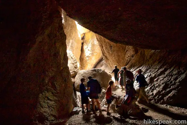
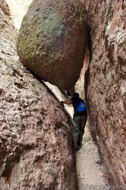
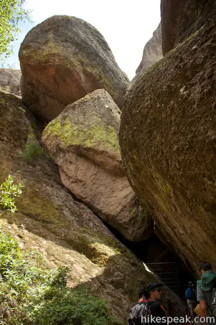
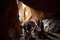
Balconies Cave is a talus cave, which means it was formed when boulders tumbled into this steep canyon and created a cave ceiling. In this case, the canyon itself came about when faults fractured the area’s volcanic rock. The boulders that make up the cave (some of which are bigger than houses) did not fall into the canyon in a neat, organized way. You will have to climb down and around boulders and through openings to get across Balconies Cave.
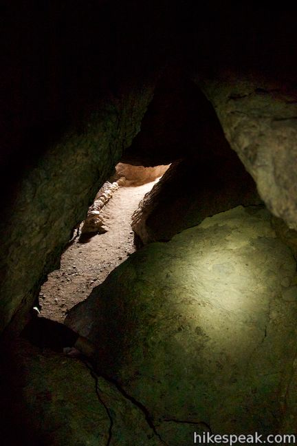
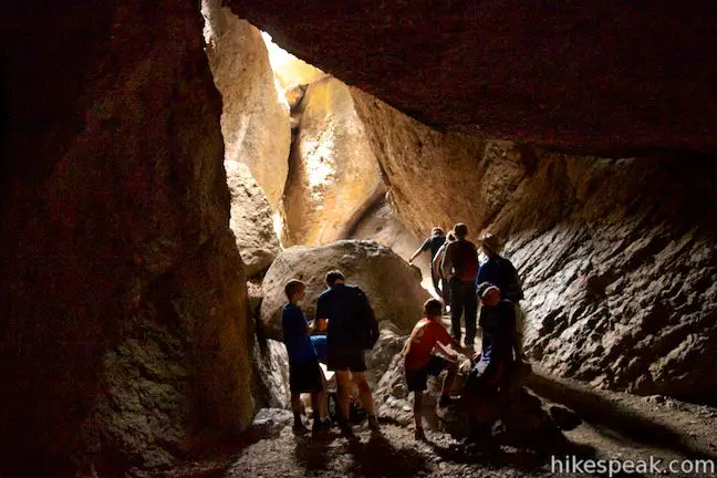
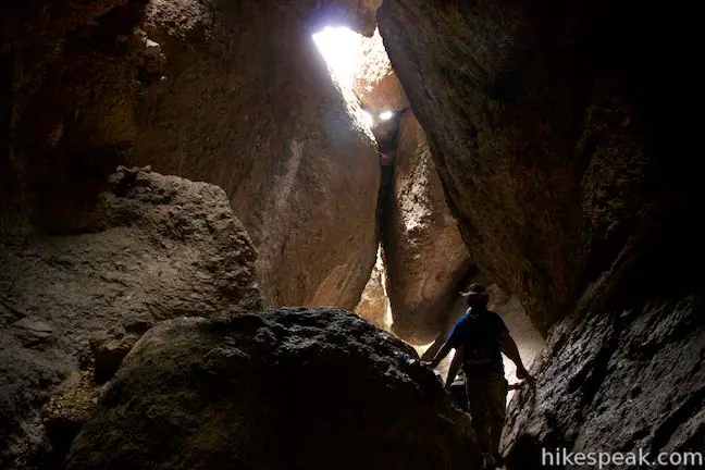
Take out your flashlight or put on your headlamp and follow the trail down into a dark chamber below the boulders. Pools of light illuminate small areas of the darkness adding dramatic flare to the fun route. Climb out of the first section of Balconies Cave and return the sunlight at the surface. Then plunge back into the darkness into a bigger chamber in a second section of the cave. Sunlight squeezes through cracks around the massive boulders overhead. Climb your way through twisting, turning passages to come to another gate at the end of Balconies Cave. Wasn’t that fun?
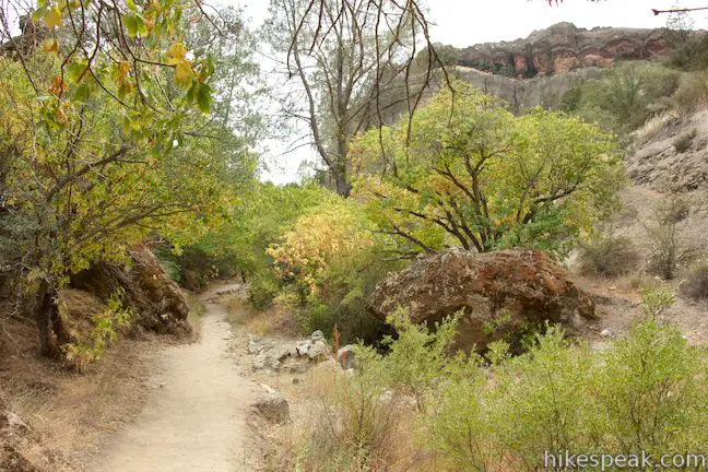
The trip through Balconies Cave will leave you wanting more, and you may actually decide to go back through the cave a couple times before continuing on. As you leave the boulder playground, you will come to a junction with the other end of Balconies Cliffs Trail, again on the left. Stay to the right at this junction and take Old Pinnacles Trail all the way back to the trailhead for the last 2.1 miles of the hike.
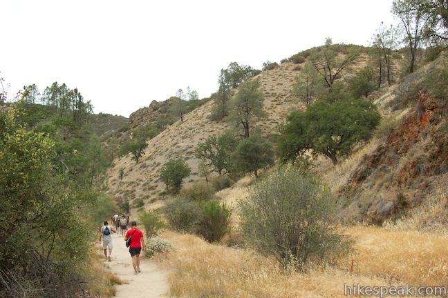
This wide sandy trail goes ever so gradually downhill along the bottom of the canyon. While you’ll only get glimpses of the impressive rock formations that surround you, this dry canyon has a fun old west vibe that makes it a pleasant place to finish the hike. Pines and brush along the trail add occasional shade over this easy last leg of the loop.
At 1.3 miles on Old Pinnacles Trail, make sure to stay to the right through a junction with North Wilderness Trail, which heads up another fork of the canyon. Proceed down the trail, crossing a wooden footbridge to reach the left (east) side of the seasonal creek bed. Things will start to look familiar again as you reach the junction with Bench Trail. This is where your loop began, several hours and several adventures ago. Stay to the left to stick with Old Pinnacles Trail and hike the final quarter mile back to Old Pinnacles Trailhead. Of course if you elected to start from the west side of the park, you’ll want to turn right here and begin the climb across the High Peaks.
No permit is required to hike High Peaks – Balconies Cave Loop. Pinnacles National Park has an entrance fee ($20 as of 2017). National Park Service passes may be used in place of the fee to gain entry. Dogs and bikes are prohibited on this loop.
Check the park’s cave status page to confirm that Balconies Cave is open before you set out. The park’s other talus cave, Bear Gulch Cave, closes at scheduled intervals to protect a colony of Townsend’s big-eared bats that live in the cave. If Bear Gulch Cave is open during your visit, it is definitely worth checking out. If it is closed, Balconies Cave will be the only place in the park where you can hike through a lengthy talus cave. You will want to have a light source with you when you pass through Balconies Cave, so pack a flashlight!
The basic directions for High Peaks – Balconies Cave Loop are:
- Turn left off Old Pinnacles Trail onto Bench Trail (0.25 miles)
- Turn right up High Peaks Trail (0.75 miles)
- Stay to the right past the top of Condor Gulch Trail (2.75 miles)
- Stay to the left past the top of Tower Trail (3.4 miles)
- Turn right down Juniper Canyon Trail (4.1 miles)
- Stay to the left past the bottom of Tunnel Trail (4.7 miles)
- Stay to the right past a trail to an overflow parking area on the west side of the park (5.85 miles)
- Pass the parking area at Chaparral Trailhead and continue onto Balconies Trail (5.9 miles)
- Stay to the right past Balconies Cliffs Trail (6.5 miles)
- Begin the passage through Balconies Cave (6.6 miles)
- After exiting Balconies Cave, stay to the right through a junction with the other end of Balconies Cliffs Trail, continuing onto Old Pinnacles Trail (6.9 miles)
- Stay to the right past North Wilderness Trail (8.2 miles)
- Close the loop and stay to the left past Bench Trail (8.75 miles)
- Return to the Old Pinnacles Trailhead (9 miles)
Directions to the Trailhead
- Take Highway 101 north to King City and exit onto First Street (exit 281).
- Turn right at the end of the ramp, heading north on First Street for 1.3 miles.
- The road makes a sharp right turn and becomes Lyons Street/Country Road G13.
- Take G13 out of the city, northeast for 14.3 to a T-junction with Route 25.
- Turn left and drive 14.2 miles to an intersection with Route 146.
- Turn left onto Route 146, following signs for Pinnacles National Park.
- Drive west into the park, passing the general store and campground on the left to reach the East Entrance Station after 2.5 miles.
- Pay the entry and proceed another 1.3 miles to the only real intersection on the park road.
- Bear right toward Old Pinnacles Trailhead (don't turn left toward Bear Gulch) and drive another 0.6 miles to the parking area at road's end where the hike begins.
Trailhead Location
Trailhead address: Chalone Creek Road (Highway 146), Pinnacles National Park, Paicines, CA 95043
Trailhead coordinates: 36.495027, -121.173052 (36° 29′ 42.09″N 121° 10′ 22.98″W)
View Pinnacles National Park in a larger map
Or view a regional map of surrounding Central Coast trails and campgrounds.


 | Balconies Cave This 2 to 2.4-mile hike is for those who want to see the cave without dealing with the High Peaks, venturing down Balconies Trail to the fun talus cave from Chaparral Trailhead. |
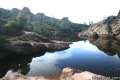 | Bear Gulch Reservoir This 1.5-mile hike passes through a talus cave to reach a reservoir on the east side of Pinnacles National Park. |
 | High Peaks - Condor Gulch Loop This 5.3 to 6-mile loop crosses the roof of Pinnacles National Park on an incredible trail. |
 | More Central Coast Hikes Explore other destinations along the California coast between Ventura and Monterey, including trails in Los Padres National Forest. |
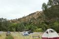 | Pinnacles Campground Pinnacles National Park has one campground with tent, RV, and group sites in an oak woodland on the east side of the park. |
- High Peaks - Balconies Cave Loop on modernhiker.com (opens in a new tab)
- High Peaks - Balconies Cave Loop on californiathroughmylens.com (opens in a new tab)
- High Peaks - Balconies Cave Loop on littlegrunts.com (opens in a new tab)
- Pinnacles National Park on wikipedia.org (opens in a new tab)
- The official trail page for Pinnacles National Park (opens in a new tab)
Common Questions about High Peaks – Balconies Cave Loop in Pinnacles National Park
- Is the trail open?
- This trail is subject to seasonal closures. While generally open, it closes annually for specific seasons (such as winter weather or wildlife protection). Please verify the current status with the managing agency before visiting. If you find the trail is unexpectedly closed, please report a closure.
- Do I need a permit for this hike?
- Yes. National Park Entrance Fee.
- How much time does this hike take?
- It takes approximately 4 hours 45 minutes to hike High Peaks — Balconies Cave Loop. Individual hiking times vary. Add extra time for breaks and taking in the views.
- How long is this hike?
- The hike to High Peaks — Balconies Cave Loop is a 9 mile loop with 1575 feet of elevation change.
- Are dogs allowed on this trail?
- No, dogs are likely not allowed on High Peaks — Balconies Cave Loop. The trail is primarily open to hikers.
- Is High Peaks — Balconies Cave Loop a difficult hike?
- This hike should be considered strenuous. Hikers should be prepared for a workout covering 9 miles and 1575 feet of climbing.
- Does this trail go to a summit?
- Yes, High Peaks — Balconies Cave Loop reaches a summit with panoramic views.
- Are there caves on this hike?
- Yes, High Peaks — Balconies Cave Loop features caves to explore.
- Where is the trailhead located?
- The trailhead for High Peaks — Balconies Cave Loop is located in Pinnacles National Park, CA.
Trailhead Address:
Chalone Creek Road
Pinnacles National Park, CA 95043
Trailhead Coordinates:
36.495027, -121.173052 - What are the driving directions to the start of the hike?
To get to the trailhead: Take Highway 101 north to King City and exit onto First Street (exit 281). Turn right at the end of the ramp, heading north on First Street for 1.3 miles. The road makes a sharp right turn and becomes Lyons Street/Country Road G13. Take G13 out of the city, northeast for 14.3 to a T-junction with Route 25. Turn left and drive 14.2 miles to an intersection with Route 146. Turn left onto Route 146, following signs for Pinnacles National Park. Drive west into the park, passing the general store and campground on the left to reach the East Entrance Station after 2.5 miles. Pay the entry and proceed another 1.3 miles to the only real intersection on the park road. Bear right toward Old Pinnacles Trailhead (don't turn left toward Bear Gulch) and drive another 0.6 miles to the parking area at road's end where the hike begins.
View custom Google Maps directions from your current location.
- Are there other trails near High Peaks — Balconies Cave Loop?
- Yes, you can find other nearby hikes using the Hikespeak Hike Finder Map.

7 Comments on High Peaks – Balconies Cave Loop in Pinnacles National Park
What hikers are saying:
✨ Generated summary of user commentsHikers describe this route as a remarkable experience that transitions from steep climbs to gentle strolls through wooded sections. The path offers the rare chance to see California Condors roosting on ledges and soaring above the peaks. Phil's tip is to be prepared to navigate through pitch black caves along the way.
“truly remarkable experience” Jump to comment ↓
Thanks for this great website. I am soon revisiting Pinnacles after 35 years away, and this was a great review of the many splendors there.
[…] a steep haul up the High Peaks Trail, especially when you’re seven months pregnant with your first child. But back then, giddy with […]
Hi, thanks for a great website. We plan on hiking the Juniper Canyon Trail and I was wondering if it’s too steep for comfortable walking (we plan on hiking it on our way down)? Also, is it a single or double track? How wide would you say it is? Thanks for your answer, take care!
Juniper Canyon Trail is a single track. It is 1.8 miles long and has a good amount of elevation change (1,025 feet) as it goes down from the High Peaks. Hope that helps. Enjoy your hike!
If you want to see the Balconies Caves but this hike looks a little too challenging, read my post about the 5 mile hike to the Balconies Caves from the Old Pinnacles trailhead! Check it out, here! https://adulthoodinslo.wordpress.com/2017/10/05/pinnacles-national-park-old-pinnacles-trail-to-balconies-cave-loop/
Followed your instructions to take this hike last week. Thank you!!! It had a little of everything from steep climbs (both up and down), to gentle strolls along wooded sections and challenging bits finding your way through pitch black caves. We were even lucky enough to get to see a group of 4 California Condors roosting on a ledge (up near the Steep and Narrow section) and then have them taking off and soaring around the peaks while we hiked.
All in all a truly remarkable experience!!
Is pinnacles national park open for day use parking. I would love to go on one of these trails.