The short interesting hike to Bear Gulch Reservoir ascends a beautiful boulder-filled gorge on the east side of Pinnacles National Park (known as Pinnacles National Monument prior to 2013). A split in the trail offers two parallel routes to reach the reservoir. Bear Gulch Cave Trail climbs through a talus cave, while Moses Spring Trail takes a scenic but less daring course along the rim of the gorge. The trails reunite and arrive at Bear Gulch Reservoir, 3/4 of a mile from the start.
Cave Trail closes periodically to accommodate the bats that reside there. When Bear Gulch Cave is open, it should not be missed.
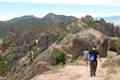
The 1.5-mile hike up and down Bear Gulch has 275 feet of elevation change. From the reservoir, Rim Trail heads north above the gorge connecting to High Peaks Trail. This provides an alternative return route for a 1.65-mile hike, and these trails can also be used to include Bear Gulch in a grander trek in Pinnacles National Park, the High Peaks Trail – Condor Gulch Loop.
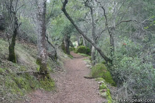
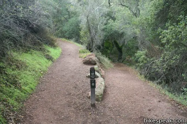
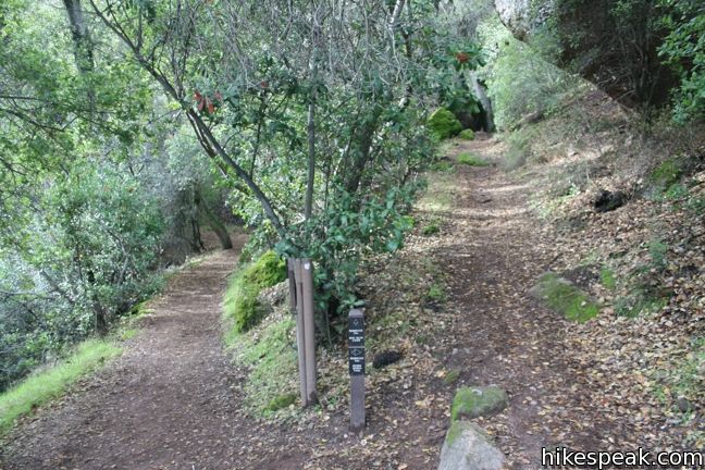
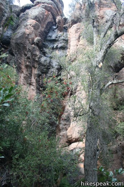
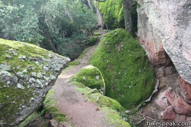
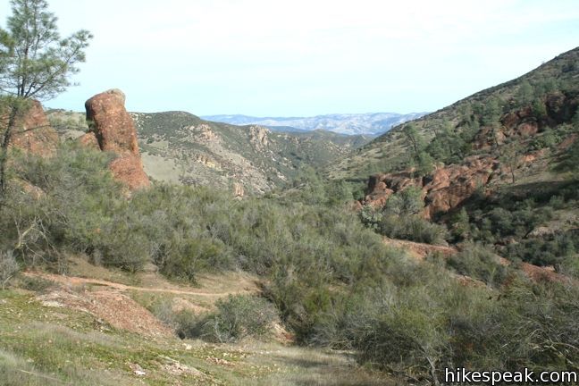
Begin hiking south from the Bear Gulch Day Use Area. After 0.2 miles, take the left split, following the sign for Moses Spring Trail, Cave, and Reservoir. To the right, High Peaks Trail heads west up the side of Bear Gulch to a junction with the Rim Trail, before pushing on to the Pinnacles above. Our single track continues south up the east side of Bear Gulch, passing through a riparian forest that is lush, ferny, and mossy. Impressive boulders decorate the trail, making this a popular alley with mountain climbers. Signs mark several climbing stations along the way.
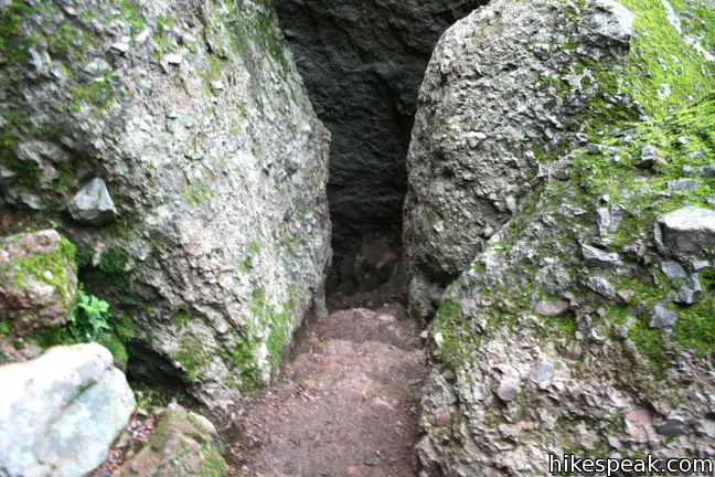
Pass through a short tunnel and arrive at the Moses Spring Trail – Cave Trail split. Both trails are about 1/6 of a mile long and reunite just below the reservoir. Those hiking the 1.5-mile out-and-back to the reservoir can simply hike up one trail and come down the other. The trails are equally enjoyable in both directions.
Hikers not traveling out and back on these trails, and continuing up to the High Peaks, should make a point to hike through the cave if it is open. Moses Spring Trail is desirable as well, so If you are willing to add an extra 0.25 miles to your trek, you could hike up Moses Spring Trail to the connection above Cave Trail, descend to the bottom of the cave, and then turn around and hike back up. The cave trail is an experience you will not mind repeating.
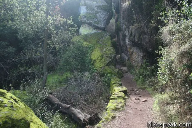
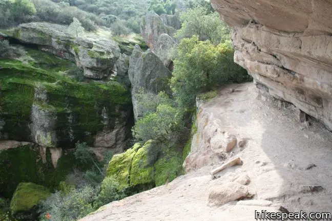
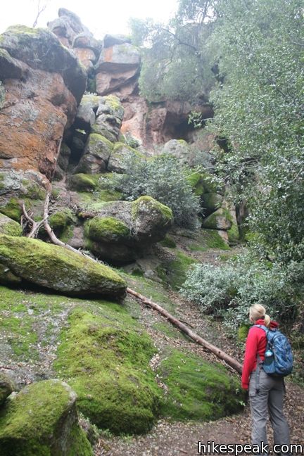
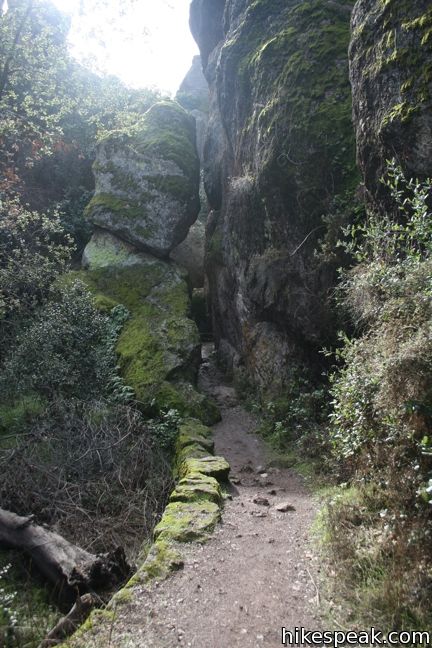
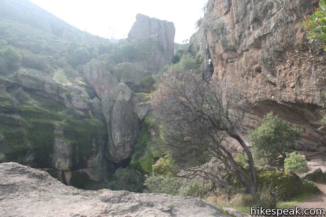
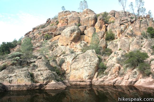
Moses Spring Trail heads right from the junction, ascending to Moses Spring, where water seeps down the stone wall to a hidden pool. The trail pushes south across a ledge on the west wall of Bear Gulch. Nice views up and down the canyon include a great perspective of the house-sized boulders enclosing the cave. The trail passes over these rocks, meeting the top of Lower Bear Gulch Cave Trail, before continuing up to the reservoir.
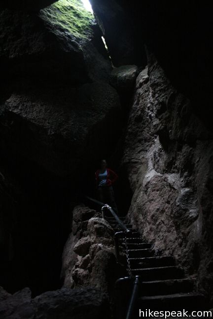
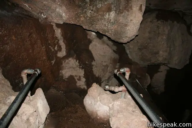
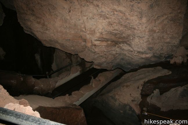
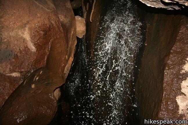
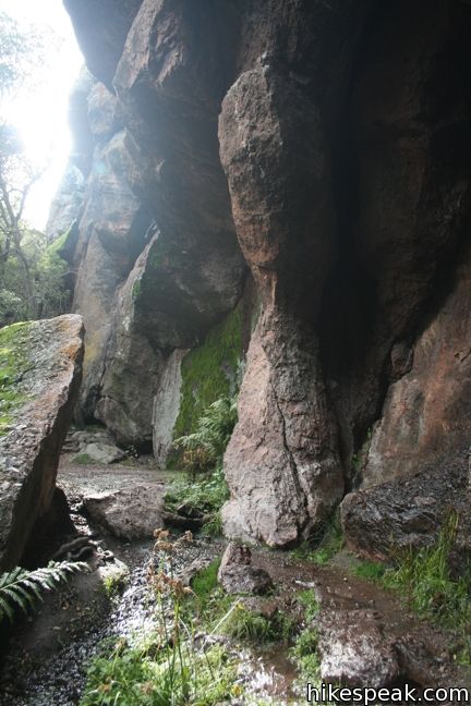
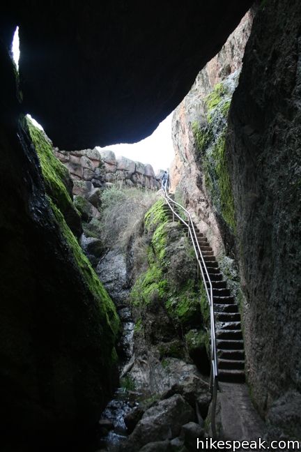
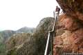
Bear Gulch Trail is level and straight leaving the lower junction, crossing the floor of Bear Gulch through tall rocks at the entrance of a talus cave. Use a flashlight and step inside this narrow section of the canyon covered by collapsed boulders. Railings and steps put in place by the CCC in the 1930s provide an adventurous hike. A few shafts of light slip through the boulder ceiling, but other areas are pitch black. Bear Gulch Creek shares the cave, tumbling over rocks, and adding a rich sound to the dark passageway. Follow the trail up steps and across metal scaffolding to progress out of the talus cave and back into the daylight.
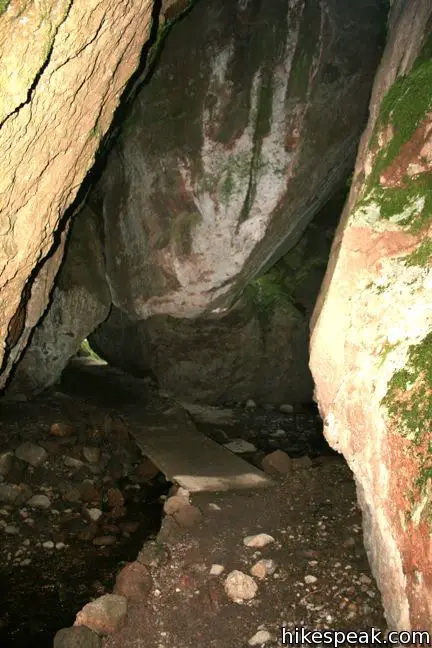
Bear Gulch Cave is home to a colony of Townsend’s big-eared bats. In order to protect their habitat, the park closes areas of the cave throughout the year. A short upper section of the cave is more often closed than the Lower Cave Trail. Call a ranger or check the Pinnacles National Park website for cave closure information.
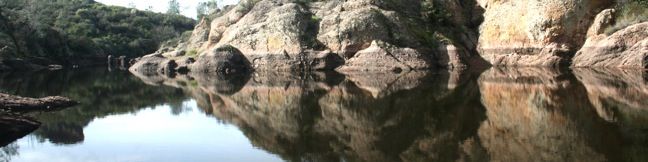
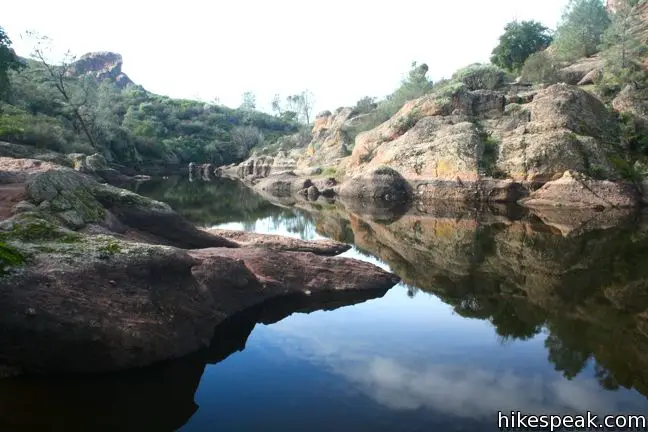
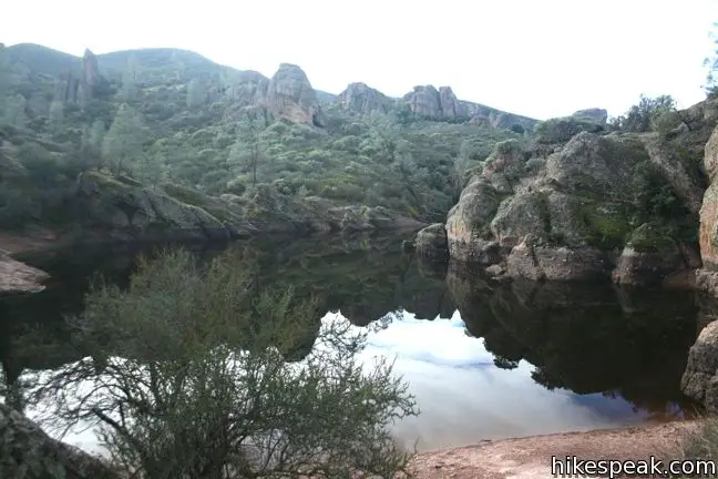
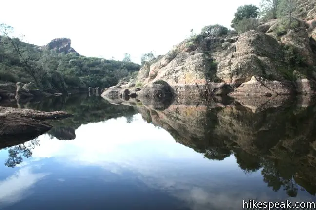
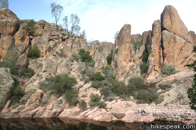
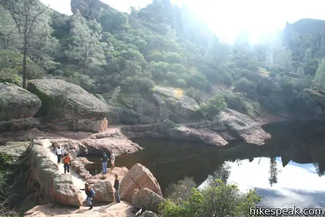
Above the Cave Trail – Moses Spring Trail reunion, the hike continues through 0.15 miles of boulders to Bear Gulch Reservoir. Take the stone steps up the back of the dam to reach the reflective pool. This is a great place to take a break and have a snack. Chalone Peak Trail crosses the east bank of the murky-watered reservoir en route to South Chalone Peak, 4.5-miles away. Walk a short ways on this trail to experience the reservoir from a few different angles.
After taking it in, head back down Bear Gulch for a 1.5-mile round trip hike. Alternatively, head north on Rim Trail above the west side of Bear Gulch, hiking 0.4 miles to a T-junction with High Peaks Trail where you can turn right and descend 0.3 miles down into Bear Gulch, 0.2 miles from the trailhead. Of course High Peaks Trail can also be used to reach the top of the Pinnacles. Cross the high peaks and descend Condor Gulch Trail to return to the trailhead for a 6-mile loop.
However you choose to hike to and from Bear Gulch Reservoir, the trek will be a memorable one. All trail junctions are clearly marked, and the surrounding landscape is unique and exciting. No permit is required to hike to Bear Gulch Reservoir. Pinnacles National Park has an entrance fee ($20 as of 2017). National Park Service passes may be used in place of the fee to gain entry. Dogs and bikes are prohibited on this loop.
Directions to the Trailhead
- Take Highway 101 north to King City and exit onto First Street (exit 281).
- Turn right at the end of the ramp, heading north on First Street for 1.3 miles.
- The road makes a sharp right turn and becomes Lyons Street/Country Road G13.
- Take G13 out of the city, northeast for 14.3 to a T-junction with Route 25.
- Turn left and drive 14.2 miles to an intersection with Route 146.
- Turn left onto Route 146, following signs for Pinnacles National Park.
- Drive west into the park, passing the general store and campground on the left to reach the East Entrance Station after 2.5 miles.
- Pay the entry and proceed another 1.3 miles to the only real intersection on the park road.
- Make a left and drive south for another 1.4 miles to the Bear Gulch Day Use Area at road's end.
Trailhead Location
Trailhead address: Pinnacles National Park, Paicines, CA 95043
Trailhead coordinates: 36.4785, -121.1838 (36° 28′ 42.6″N 121° 11′ 02″W)
You may also view a regional map of surrounding Central Coast trails and campgrounds.


 | High Peaks - Condor Gulch Loop This 5.3 to 6-mile loop crosses the roof of Pinnacles National Park on an incredible trail. |
 | High Peaks - Balconies Cave Loop This extensive 9-mile loop ventures between the east and west sides of Pinnacles National Park, crossing through the High Peaks and Balconies Cave. |
 | Balconies Cave This 2 to 2.4-mile hike venture down Balconies Trail past impressive rock formations and through a fun talus cave, starting from Chaparral Trailhead on the west side of Pinnacles National Park. |
 | More Central Coast Hikes Explore other destinations along the California coast between Ventura and Monterey, including trails in Los Padres National Forest. |
 | Pinnacles Campground Pinnacles National Park has one campground with tent, RV, and group sites in an oak woodland on the east side of the park. |
Common Questions about Bear Gulch Cave Trail and Moses Spring Trail to Bear Gulch Reservoir in Pinnacles National Park
- Is the trail open?
- This trail is subject to seasonal closures. While generally open, it closes annually for specific seasons (such as winter weather or wildlife protection). Please verify the current status with the managing agency before visiting. If you find the trail is unexpectedly closed, please report a closure.
- Do I need a permit for this hike?
- Yes. National Park Entrance Fee.
- How much time does this hike take?
- It takes approximately 45 minutes to hike Bear Gulch Cave Trail. Individual hiking times vary. Add extra time for breaks and taking in the views.
- How long is this hike?
- The hike to Bear Gulch Cave Trail is a 1.5 mile out and back with 275 feet of elevation change.
- Are dogs allowed on this trail?
- No, dogs are likely not allowed on Bear Gulch Cave Trail. The trail is primarily open to hikers.
- Is Bear Gulch Cave Trail good for kids?
- Yes, this hike is likely suitable for children. It is relatively short (1.5 miles) with manageable elevation gain.
- Are there caves on this hike?
- Yes, Bear Gulch Cave Trail features caves to explore.
- Is there a lake on this hike?
- Yes, Bear Gulch Cave Trail visits a lake.
- Where is the trailhead located?
- The trailhead for Bear Gulch Cave Trail is located in Pinnacles National Park, CA.
Trailhead Address:
Pinnacles National Park
Pinnacles National Park, CA 95043
Trailhead Coordinates:
36.4785, -121.1838 - What are the driving directions to the start of the hike?
To get to the trailhead: Take Highway 101 north to King City and exit onto First Street (exit 281). Turn right at the end of the ramp, heading north on First Street for 1.3 miles. The road makes a sharp right turn and becomes Lyons Street/Country Road G13. Take G13 out of the city, northeast for 14.3 to a T-junction with Route 25. Turn left and drive 14.2 miles to an intersection with Route 146. Turn left onto Route 146, following signs for Pinnacles National Park. Drive west into the park, passing the general store and campground on the left to reach the East Entrance Station after 2.5 miles. Pay the entry and proceed another 1.3 miles to the only real intersection on the park road. Make a left and drive south for another 1.4 miles to the Bear Gulch Day Use Area at road's end.
View custom Google Maps directions from your current location.
- Are there other trails near Bear Gulch Cave Trail?
- Yes, you can find other nearby hikes using the Hikespeak Hike Finder Map.

18 Comments on Bear Gulch Cave Trail and Moses Spring Trail to Bear Gulch Reservoir in Pinnacles National Park
What hikers are saying:
✨ Generated summary of user commentsThis trail offers a unique landscape that leaves a lasting impression on those who explore its rocky terrain. Sharon recommends visiting in March to enjoy the scenery when conditions are ideal.
“really enjoyed the unique landscape of Pinnacles” Jump to comment ↓
I can’t find any information regarding pets on trails. Can you please advise. Thanks!
Dogs are not allowed on any trails within Pinnacles National Monument
Also, are the distances shown for one-way or total lenght (out and back)? Thanks!!
Hi Brian,
Distances are shown as one-way unless noted as being round trip.
Is swimming allowed in the reservoir? Are there other swimming holes in the area?
I believe there is no swimming in the the reservoir. You can get sprayed a bit on the hike up though!
I’m headed up there this spring with the family with my son who loves fishing. Do you know if fishing is allowed in the resevior and what types of fish is in the resevior? Thanks.
My honey & I really enjoyed the unique landscape of Pinnacles and want to spend more time there on our next trip!
What was the purpose of Bear Gulch reservoir and why is the water so brown? Nice hike up and March is a good month to visit. Thanks
Glad you enjoyed the hike. I believe the reservoir was built by ranchers.
[…] and even has trails specifically to rock climbing areas. The trails are well maintained and the Bear Gulch Reservoir trail is absolutely fantastic. It’s an easy 1.5 mile round trip hike. It’s a loop trail […]
My son and I want to try a 2-night backpack trip in the Pinnacles in March. Other than Bear Gulch Reservoir, are there reliable water sources along the trails, and are there any areas particularly good to camp along the way? Can we camp wherever we wish? Thank you for your reply, Mark.
I believe that backcountry camping is not allowed in Pinnacles National Park. Water would be hard to find too.
I am looking for information about parking at the Bear Gulch Day Use Area. Could we park a motorhome there while hiking the Bear Gulch Cave Trail?
Can I hike to the reservoir from the west entrance? If so, how many miles is it to get there?
Is there anywhere to fish? ?
So is there any lodging near by, or camp grounds.
Can you fish here?