Gabrielino Trail to Gould Mesa Trail Camp
in the San Gabriel Mountains

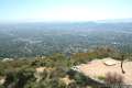
Gabrielino Trail is one of the principle trails through Angeles National Forest. Starting from the base of the San Gabriel Mountains, you can take this trail a short distance up a canyon along the lovely Arroyo Seco and come to Gould Mesa Trail Camp, a hike-in campground just a couple miles from civilization that delivers a quick escape from cities in the valley below. Starting in an Altadena neighborhood near Jet Propulsion Laboratories, spring free for a walk through riparian groves along a tranquil steam bracketed by steep ridges. A trek to Gould Mesa Trail Camp is 5.1 miles round trip with 300 feet of elevation change. There are options to hike even farther up Gabrielino Trail and the hike to Gould Mesa Trail Camp is worthwhile whether you stay overnight or not.
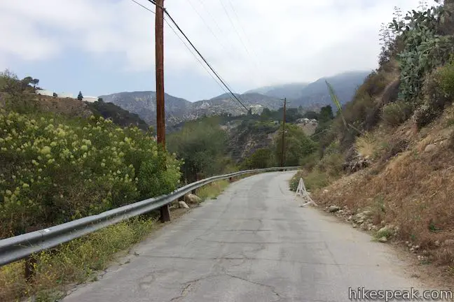
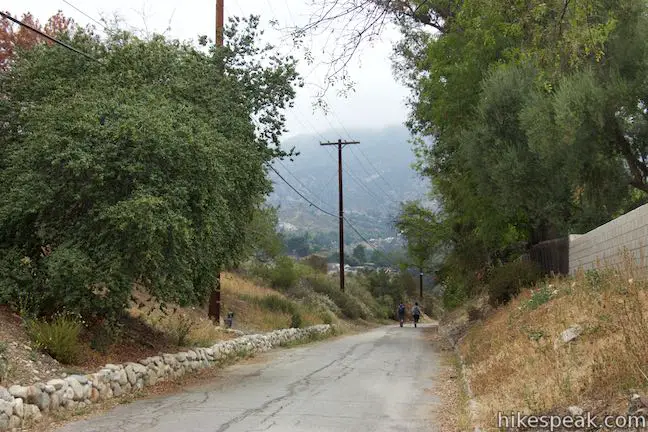
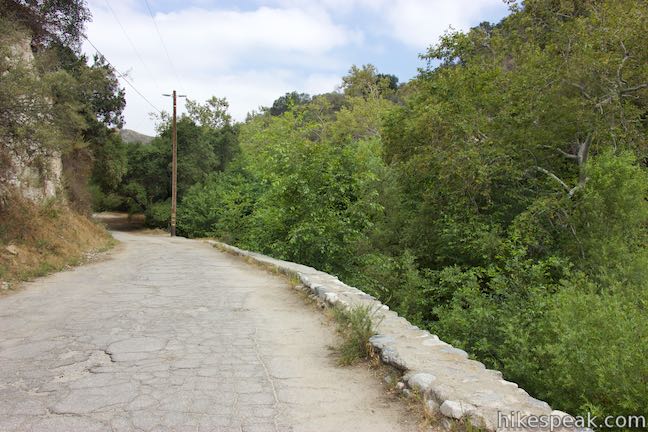
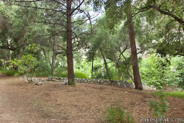
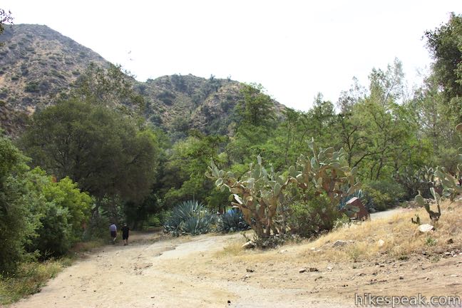
Start from the top of Windsor Avenue in Altadena and head north up a wide dirt trail. A yellow gate and a fire danger sign mark the start of Gabrielino Trail. A path just to the left, goes through an iron gate between stone walls labeled “Sunset Overlook.” This trail ventures up a small ridge west of Gabrielino Trail, leading to a path that reconnects with Gabrilino Trail. Be sure to avoid the paved road on the far left that descends northeast into Hahamongna Watershed Park. Gabrielino Trail might not look like a forest hiking trail at the start (the scenery and trail surface are not ideal), but it does become one. The setting is more urban than mountain for the first half mile and the trail is paved over the initial 1.15 miles.
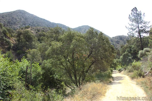
Head gradually downhill along a bluff that borders Arroyo Seco, a stream flowing out of the San Gabriels and down along the Rose Bowl toward Pasadena. You’ll be able to look west toward the San Rafael Hills.
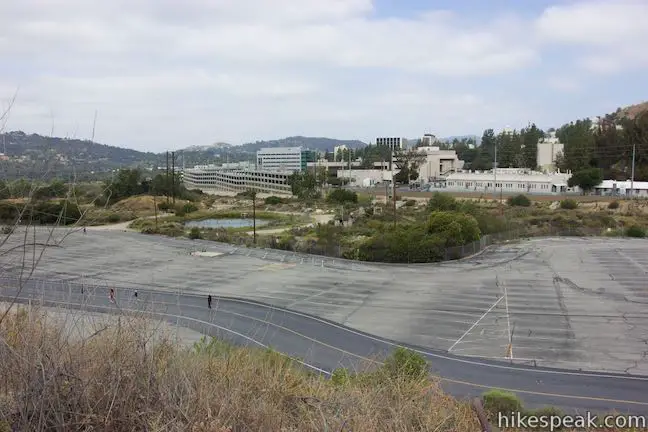
The wide paved road comes to an intersection, 0.55 miles from the start. First pass Altadena Crest Trail, a dirt trail on the right that runs along the top of Altadena. Next pass a paved road that breaks off to the left and descends to a large parking area at the top of Hahamongna Watershed Park. On the other side of this parking area is the campus of JPL. Continue straight up Gabrielino Trail toward a gap in the mountains.
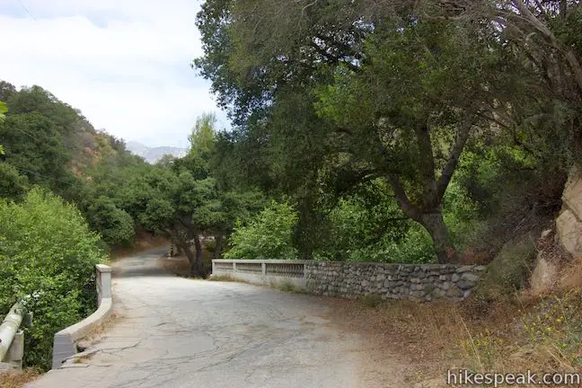
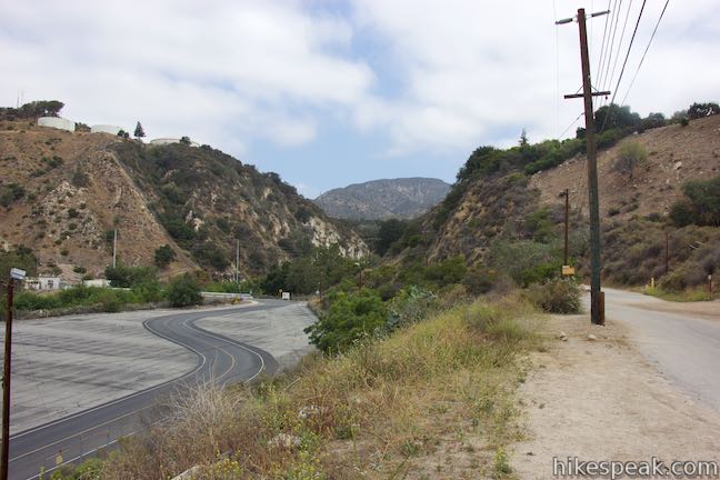
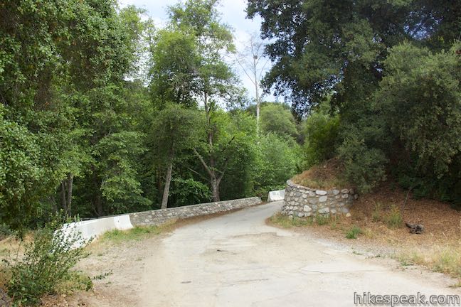
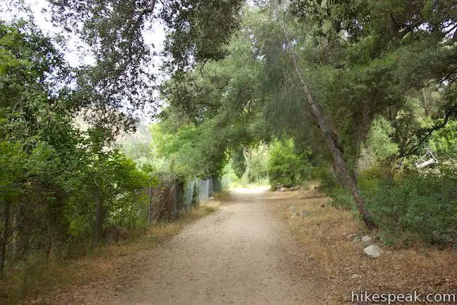
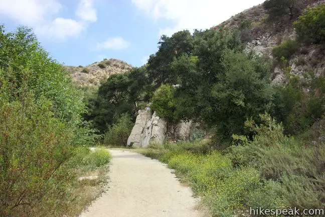
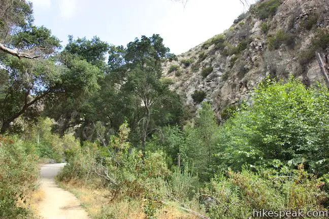
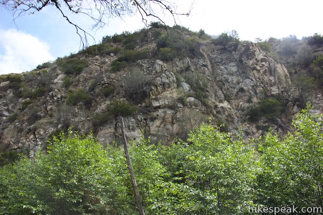
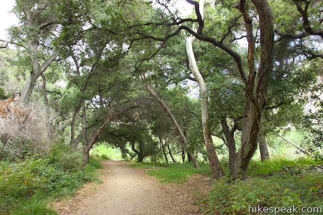
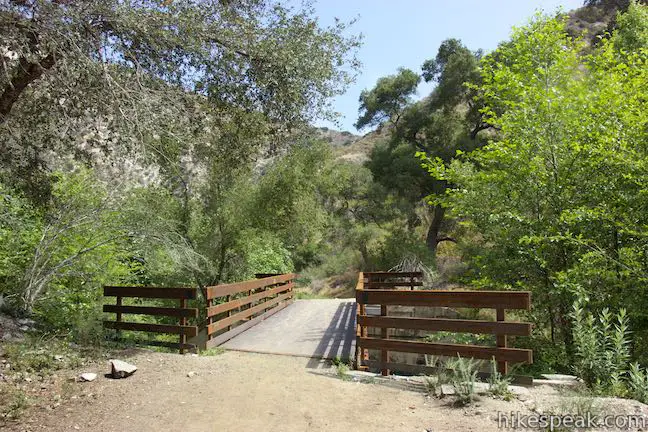
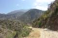
Past the junction, Gabrielino Trail curves to the left and slips between steep ridges to enter the San Gabriels. Just like that, the city is behind you. In another quarter mile, pass a dirt path breaking off to the right and approach the first of several bridges that cross Arroyo Seco. Elegant stonework on this bridge and others in the canyon date back to an earlier era of building into these mountains. Several bridges farther up the canyon have been washed out and destroyed, requiring you to rock hop across the Arroyo Seco instead.
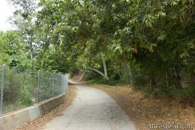
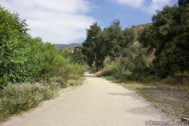
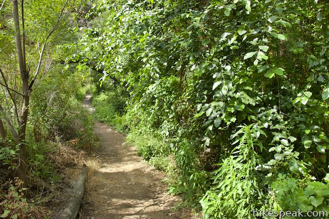
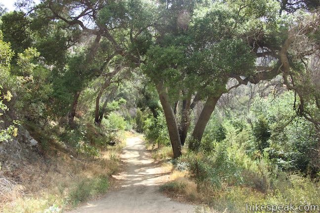
Cross the first bridge and then continue hiking north up the west side of the stream below oaks and alders clustered near the water. At the one-mile mark, cross another bridge that has a warning sign about bridge damage. The sign says that the bridge has a weight limit of 7,000 pounds, which should not bother any groups of hikers.
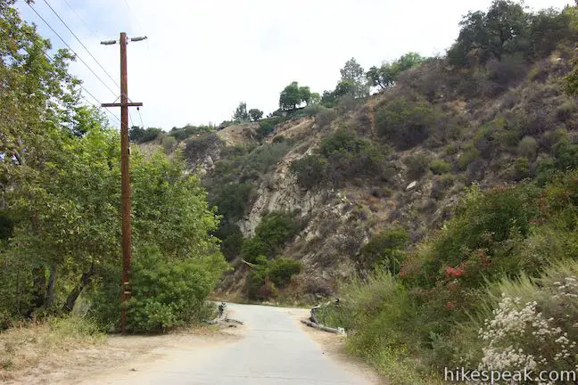
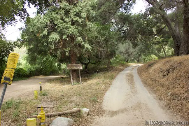
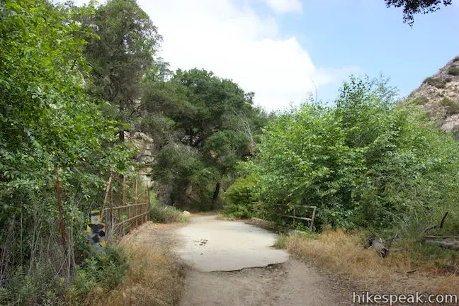
You will hit another junction at 1.15 miles where Gabrielino Trail becomes unpaved. Lower Brown Mountain Road ascends to the right, but stay to the left to continue up the canyon on Gabrielino Trail. A sign alongside Lower Brown Mountain Road lists distances for that route as a quarter mile to El Prieto Trail, four miles to Upper Brown Mountain Road, and eight miles to Millard Campground.
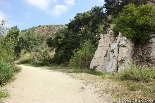
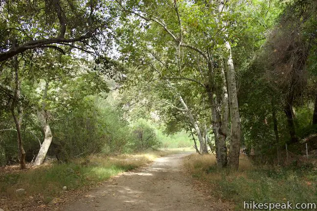
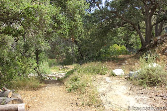
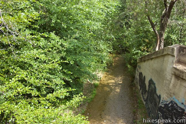
Another 0.2 miles up, Gabrielino Trail crosses a clearing where there is a water fountain on the right. Continue up the wide, gradual trail passing a rock outcropping on the right. In another 0.2 miles, or 1.55 miles from the start, a bridge crosses back to the west side of the stream. From this bridge’s metal railings, you’ll get a good perspective of the shallow, glistening stream passing down the canyon.
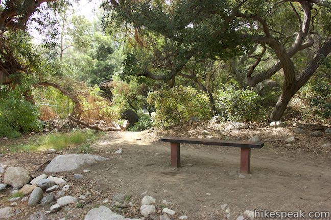
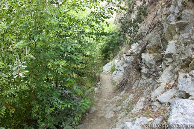
Pass a wooden bench after another tenth of a mile to come to a bridge that’s being repaired. When you cross this bridge, the road disappears and becomes a single track that is rocky and narrow. From this point on, the trail goes back and forth between being a wide road and a less established trail.
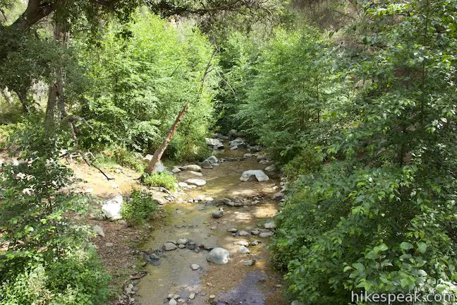
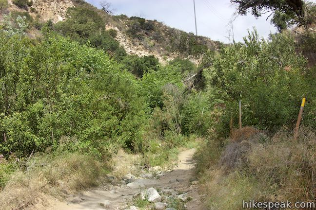
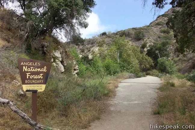
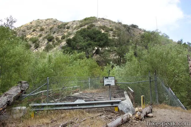
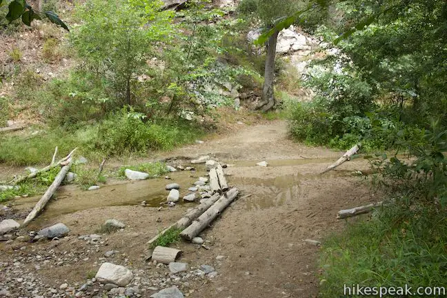
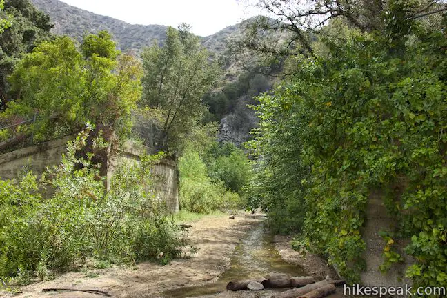
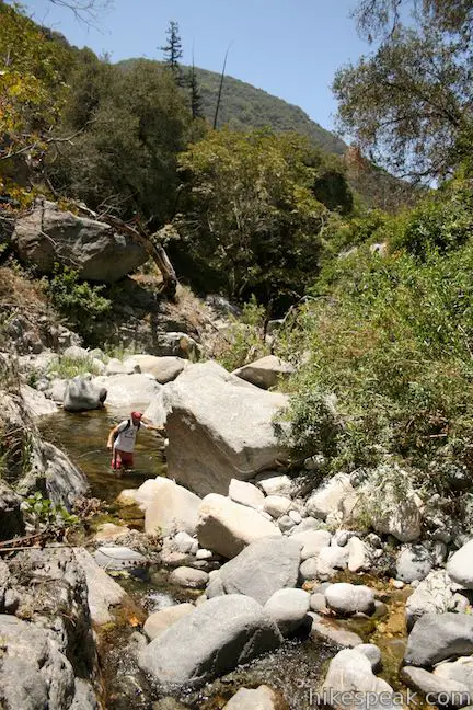
An intact bridge at the 1.8-mile mark, bringing you back across to the west side of the stream. You won’t stay there for long though, as the trail maneuvers up the narrow canyon bottom. Pass a sign at the boundary of Angeles National Forest and take the final intact bridge over to the east side of the stream. Two miles from the start, Gabrielino Trail passes Elmer Smith Bridge, which is fenced off and out of service. Without this bridge, you’ll have to step across logs to get to the west side of the stream. In another tenth of a mile, hit the first of three creek crossings that come over 0.3 miles.
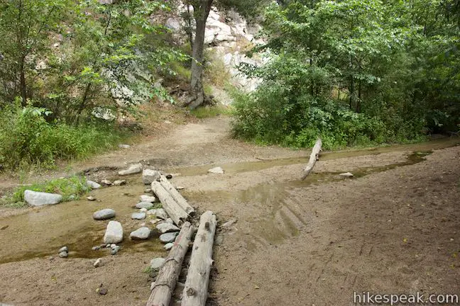
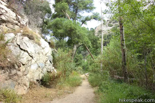
Hop across the stream and continue up the trail on the other side, passing an old stone wall and some grand oak trees. The trail seems to split now, with a narrower path on the left that might be an option for pushing up the west side of the canyon and avoiding the next two creek crossings. If you don’t try that route, cross the stream again through trees huddled by the stream, 2.25 miles into the hike.
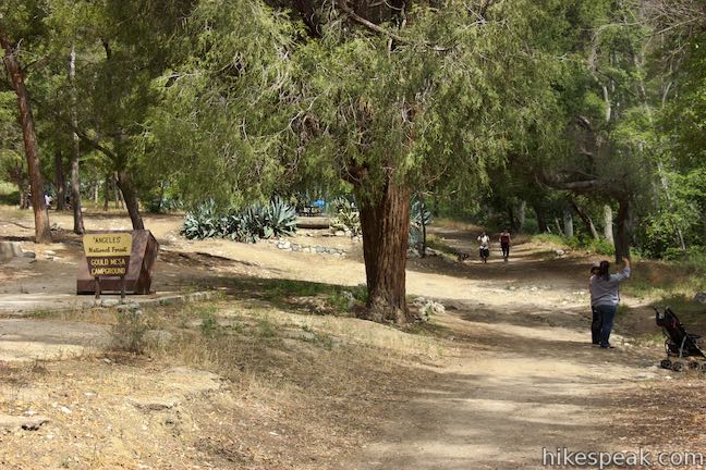
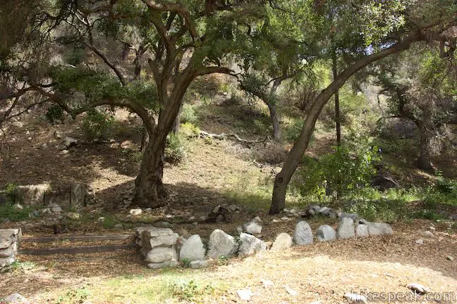
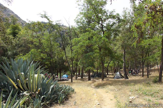
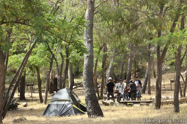
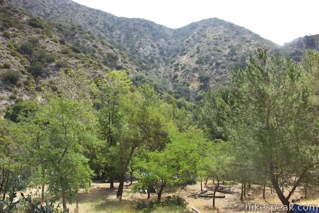
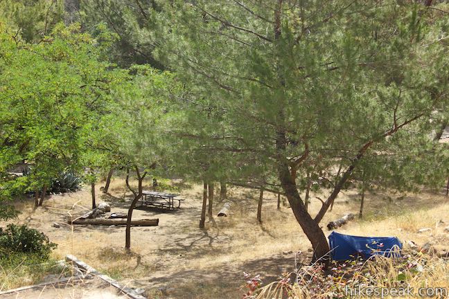
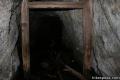
The single track now cuts into a steep slope on the east side of the canyon, eventually reaching a landing where the old trail must have passed through. To the right, you’ll see one end of a bridge that’s been removed. Bear left and descend to the stream, where you can cross a pile of logs to get to the other side. Look upstream through the foundations of the old bridge and then proceed up the west side of the canyon, knowing that you won’t have to cross the stream again. Pass stone ruins of an old cabin and walk around one last bend to reach Gould Mesa Trail Camp. The campground is to the left and on warm days, you’ll find children playing in the stream to the right, across from the campground.
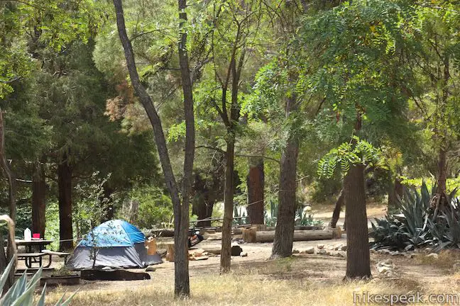
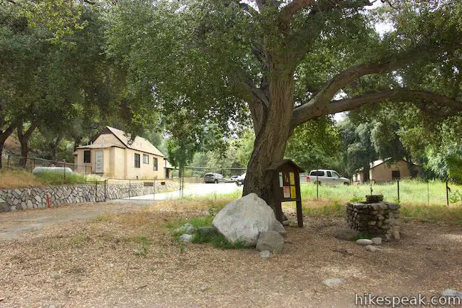
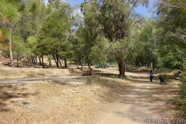
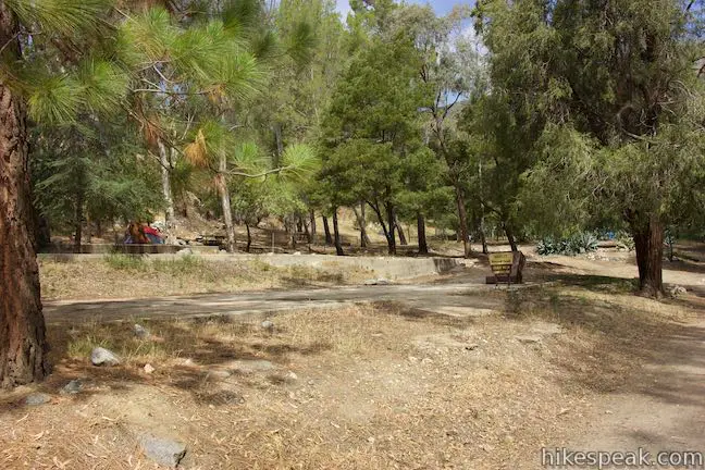
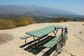
Gould Mesa Trail Camp has five hike-in campsites, although there appears to be space for a few more campers than that. Some picnic tables are spread around the campground, which has a trash receptacle, hitching post, and vault toilet. There are a few fire rings at sites in the campground. However, a posted sign states that camp stoves only are allowed and not ground fires. Downed logs throughout the campground provide natural benches for sitting. Since the stream is right there, campers should have a reliable source of water to treat and drink. Sites cannot be reserved. They are first-come first-served with no fee attached. Expect the campground to be full and busy on weekends. Being close to the city, Gould Mesa may have more of a party atmosphere than campgrounds deeper in the mountains.
The campground is 2.55 miles from the start of Gabrielino Trail. Just past that, you’ll come to a junction with Gould Mesa Road, 2.6 miles from the start. This dirt road heads up the ridge to the west behind the campground. It gets steep quickly and eventually becomes paved, passing an electrical substation to reach Angeles Crest Highway. Gould Mesa Road is 1.15 miles long with 525 feet of elevation change and can be used as an alternate route to Gould Mesa Trail Camp.
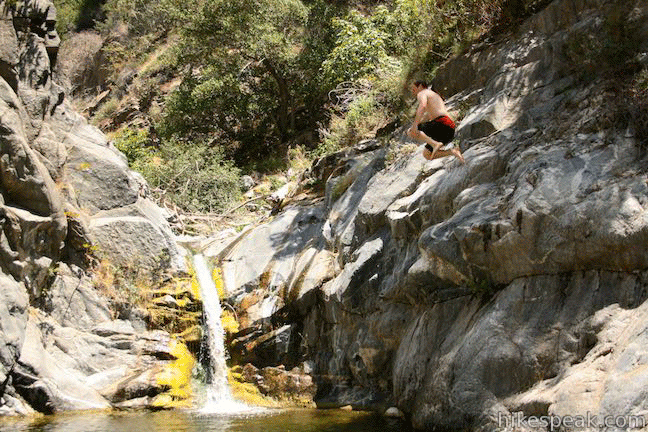
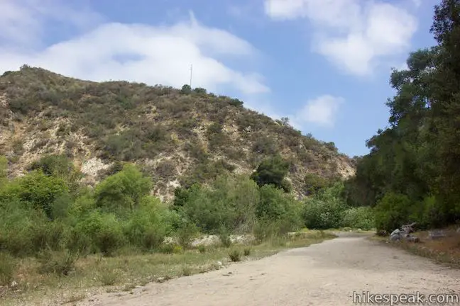
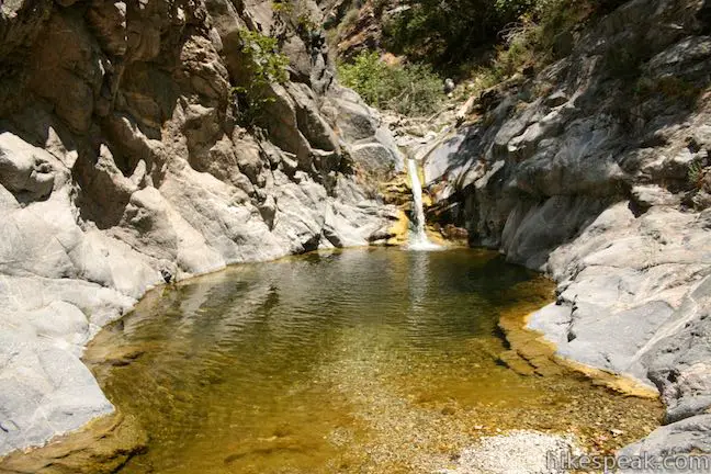
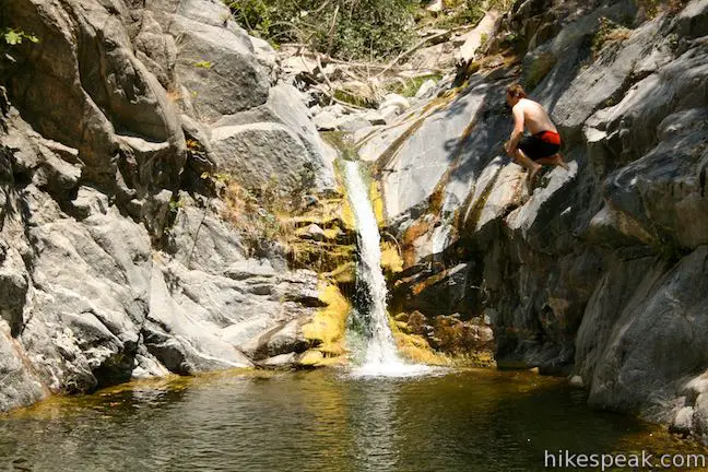
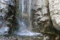
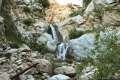
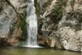
Gabrielino Trail continues up the canyon above Gould Mesa Trail Camp. It hugs the west side of the canyon, passing an old stone staircase left behind from an old cabin. At 0.3 miles above the junction with Gould Mesa Road, the trail crosses a bridge to the east side of Arroyo Seco. Almost instantly, the trail narrows to a rough single track. If you continue farther up the canyon, Gabrielino Trail becomes harder to follow. The trail goes through a pair of picnic areas and reaches Oakwilde Trail Camp about 2.5 miles from Gould Mesa Trail Camp. Gabrielino Trail, to the extent that it is still intact, ascends from the canyon bottom here and heads farther into the mountains, eventually passing Switzer Falls. Sticking with Arroyo Seco, you can rock hop up an adventurous section of the stream called Royale Gorge, where there is a 10-foot waterfall and a swimming hole, about 5 miles from Gould Mesa Trail Camp.
No fee or permit is required to hike Gabrielino Trail or stay overnight at Gould Mesa Trail Camp (you do not need an adventure pass). The campground is open year round with five first-come first-serve sites that are free to the public. Gabrielino Trail and Gould Mesa Trail Camp are open to dogs, horses, and bikes. For bikers, your progress will be slowed after the two-mile point when the trail gets rough with three stream crossings and uneven terrain. Gabrielino Trail provides convenient access to the San Gabriel Mountains, so get out and enjoy!
Directions to the Trailhead
- From the interchange between the 210 Freeway and Route 134, take 210 West (heading north) for 2.5 miles to exit 22b for Windsor Avenue.
- At the end of the off ramp, turn right and take Windsor Avenue north for 0.8 miles.
- Just past an intersection with Mountain View Street, pull into a parking area on the left.
- Walk up Windsor Avenue to an intersection at the end of Windsor Avenue, where it curves to the right and meets Ventura Street.
- Gabrielino Trail begins from the north side of this intersection.
Trailhead Location
Trailhead address: 2700 Block, North Windsor Avenue, Altadena, CA 91001
Trailhead coordinates: 34.1943, -118.168 (34° 11′ 39.47″N 118° 10′ 04.80″W)
You may also view a regional map of surrounding Los Angeles trails and campgrounds.


Royale Gorge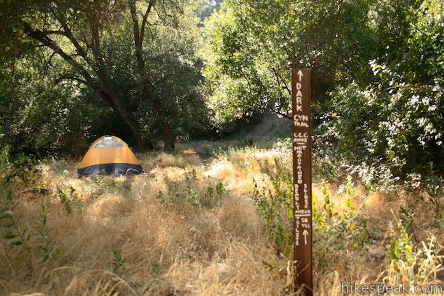
 | Gould Mesa Road to Gould Mesa Trail Camp This road descends 1.15 miles to a junction with Gabrielino Trail near Gould Mesa Trail Camp in Angeles National Forest, presenting a steep 2.4-mile round trip route to the campground with 525 feet of elevation change. |
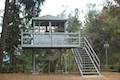
 | Cherry Canyon Park This 2.5-mile hike in the San Rafael Hills rises to panoramic views at Ultimate Destination Vista Point and a summit with an old lookout tower. |
 | Millard Falls This one mile hike visits a 50-foot waterfall up one of the most scenic canyons in the range. |
 | Dawn Mine This 6-mile hike from Millard Campground leads past Millard Falls to an old gold mine. |
 | Echo Mountain via Sam Merrill Trail This 5.8-mile hike visits a historic railway and ruins from a century old resort overlooking Pasadena. |
 | Rubio Canyon Trail This 1.3-mile round trip hike ventures into a rustic canyon to a double waterfall. |
 | Eaton Canyon Falls This 3.5-mile hike goes up Eaton Wash to a narrow stretch of Eaton Canyon containing a pleasant 40-foot waterfall. |
 | Henninger Flats via Mount Wilson Toll Road This 6-mile round trip hike ascends 1,325 feet to a trail camp, tree nursery, lookout tower, and visitor center on a landing in the San Gabriel Mountains operated by the Los Angeles County Fire Department. The hike can easily be extended to 8.7 miles by exploring a loop above Henninger Flats. |
 | More trails in the Los Angeles Explore other destinations in the Santa Monica Mountains, San Gabriel Mountains, and elsewhere. |
The official webpage for Gould Mesa Trail Camp
Arroyo Seco (including Gabrielino Trail to Gould Mesa Trail Camp) on Dan's Hiking Pages
Gabrielino Trail to Gould Mesa Trail Camp on avoidingregret.com
Gabrielino Trail to Gould Mesa Trail Camp on westernsojourns.blogspot.com
Gould Mesa Trail Camp on alltrails.com
Gould Mesa Trail Camp on hipcamp.com
A San Diego Reader article by Jerry Schad about Royale Gorge
Common Questions about Gabrielino Trail to Gould Mesa Trail Camp in the San Gabriel Mountains
- Is the trail open?
- Yes. You should expect to find that Gabrielino Trail to Gould Mesa Trail Camp is open. There are no recent reports of trail closures. If you discover that the trail is closed, please help your fellow hikers by reporting a closure.
- Is this trail free to access?
- Yes, Gabrielino Trail to Gould Mesa Trail Camp is free to access. No entrance fee, pass, or permit is required. If you discover that access rules have changed, please provide feedback on your experience.
- How much time does this hike take?
- It takes approximately 2 hours 15 minutes to hike Gabrielino Trail to Gould Mesa Trail Camp. Individual hiking times vary. Add extra time for breaks and taking in the views.
- How long is this hike?
- The hike to Gabrielino Trail to Gould Mesa Trail Camp is a 5.1 mile out and back with 300 feet of elevation change.
- Are dogs allowed on this trail?
- Yes, dogs are allowed on Gabrielino Trail to Gould Mesa Trail Camp. The trail is open to hikers, dogs, bikes.
- What mountain range is this trail in?
- Gabrielino Trail to Gould Mesa Trail Camp is located in the San Gabriel Mountains.
- Where is the trailhead located?
- The trailhead for Gabrielino Trail to Gould Mesa Trail Camp is located in Altadena, CA.
Trailhead Address:
North Windsor Avenue
Altadena, CA 91001
Trailhead Coordinates:
34.1943, -118.168 - What are the driving directions to the start of the hike?
To get to the trailhead: From the interchange between the 210 Freeway and Route 134, take 210 West (heading north) for 2.5 miles to exit 22b for Windsor Avenue. At the end of the off ramp, turn right and take Windsor Avenue north for 0.8 miles. Just past an intersection with Mountain View Street, pull into a parking area on the left. Walk up Windsor Avenue to an intersection at the end of Windsor Avenue, where it curves to the right and meets Ventura Street. Gabrielino Trail begins from the north side of this intersection.
View custom Google Maps directions from your current location.
- Are there other trails near Gabrielino Trail to Gould Mesa Trail Camp?
- Yes, you can find other nearby hikes using the Hikespeak Hike Finder Map.

Are camping/fire permits required for the campground? If so, where do we get them?
There is a narrower prettier trail right behind JPL that is much better and more scenic to take. The wide trails are dusty and with less vegetation. Beware of people without their dogs on leashes. It’s rampant in La Canada, land of the 1%.
Hi Barbara, do you have any more info on this alternate trail? I’d be interested in checking it out. Does it also lead to Gould Mesa Trail Camp?
Barbara: I’d also like more information on the alternate trail you have mentioned here.
Do you need to make a reservation to go hiking for the day?