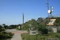
East Sepulveda Fire Road in Getty View Park
in the Santa Monica Mountains
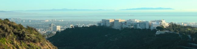
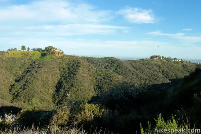
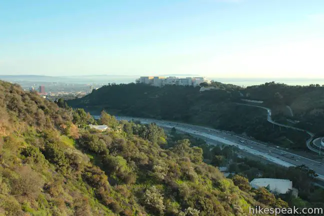
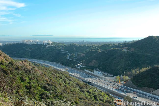
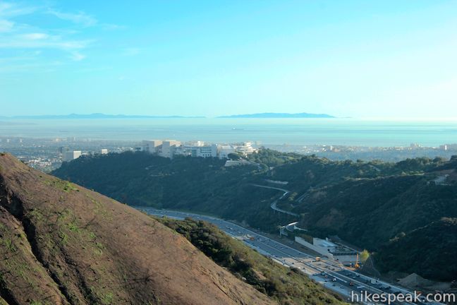
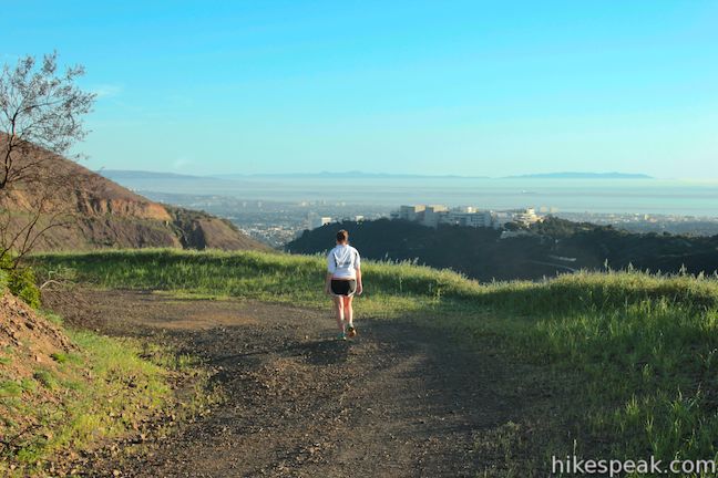
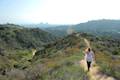
The Getty Museum sits on a ridge in the Santa Monica Mountains above the 405 Freeway and has sweeping views over the west side of Los Angeles. East Sepulveda Fire Road (also known as Casiano Fire Road) crosses the ridge on the opposite side of the freeway and has great views of the Getty Museum and Santa Monica Bay. The wide dirt trail crosses a protected section of the Santa Monica Mountains called Getty View Park, and is 1.5 miles from end to end. Get a Getty View on East Sepulveda Fire Road, covering 375 feet of elevation gain on a 3-mile round trip hike.
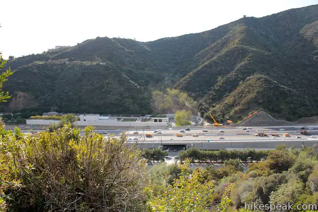
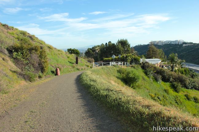
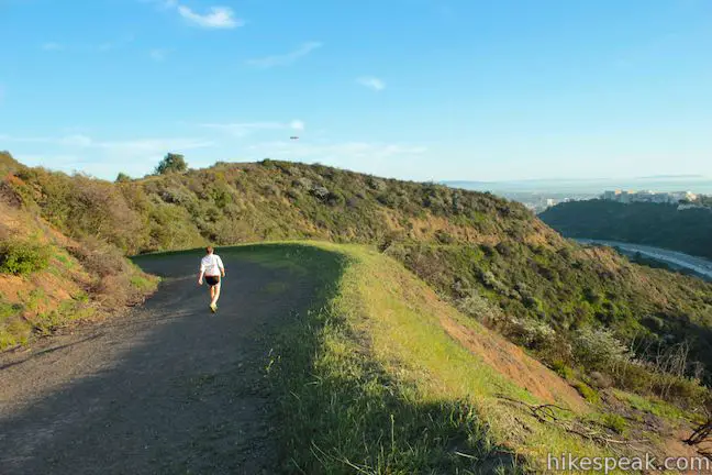
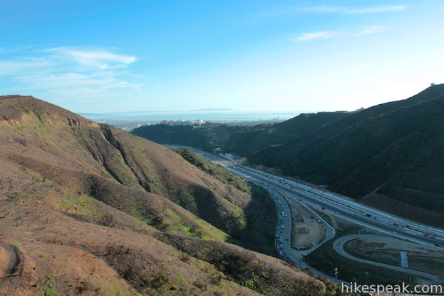
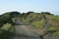
Beginning where the pavement ends at the top of Casiano Road in Bel Air, hike north up the wide dirt road. To the left, you can look down the west side of the ridge and across the 405 toward the parking area for the Getty Center. The tramline can be seen making its way up the to museum, which comes into view as you continue up East Sepulveda Fire Road.
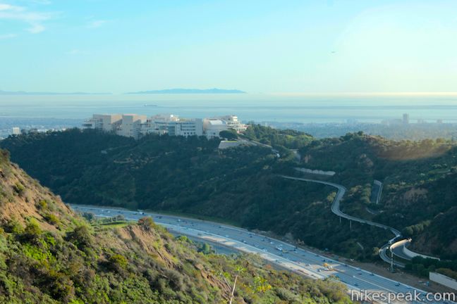
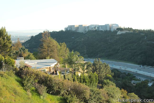
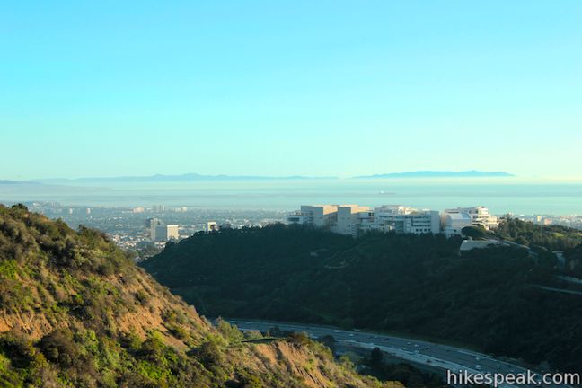
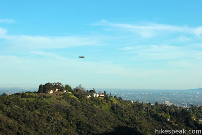
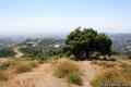
At 0.4 miles, reach a bend in the road with a good perspective of the Getty Museum, a commanding campus composed of beige travertine stone that sits on a ridge backed by the shimmering Pacific Ocean cradled Santa Monica Bay.
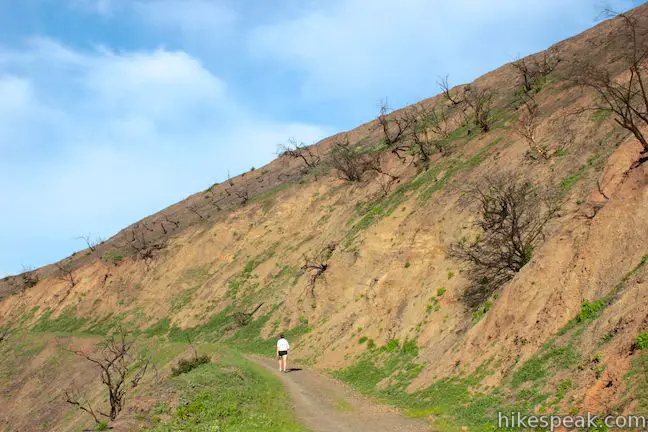
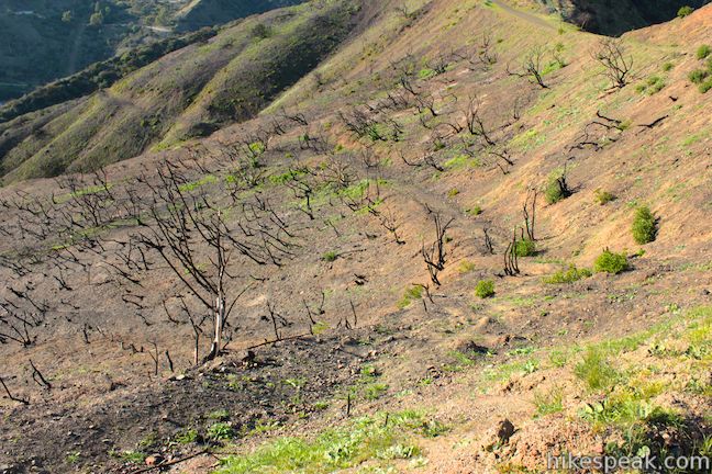
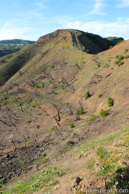
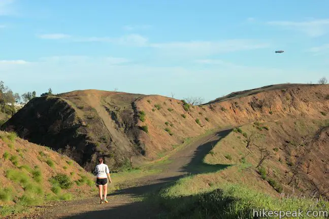
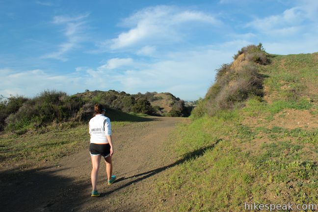
Just beyond this bend in the trail, you will enter the area burned in a brush fire in September of 2012. The quickly contained fire burned a half-mile long section of the west side of the ridge from top to bottom. The charred mountainside is dotted by burned breaches of dead chaparral.
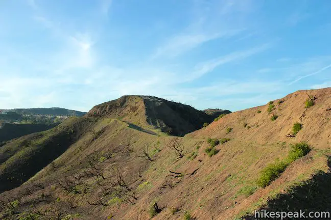
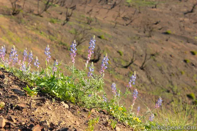
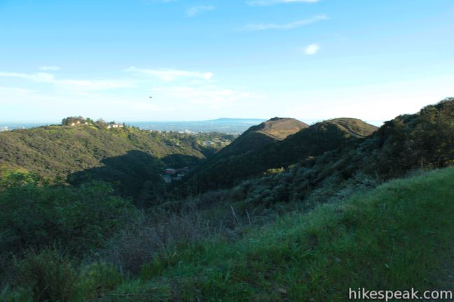
Follow the fire road around a burned-out bowl on the side of the ridge. Here you have views north up the canyon toward Sepulveda Pass. While the terrain looks desolate, new grasses are taking root and is leading plant-life back to the mountainside. The bright bloom of lupines is an optimistic symbol of the ridge’s recovery.
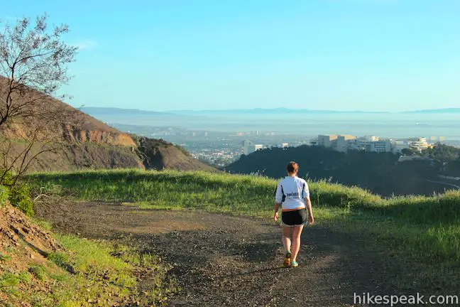
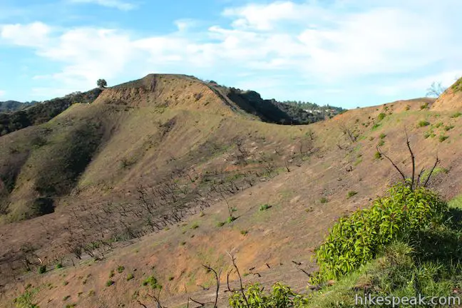
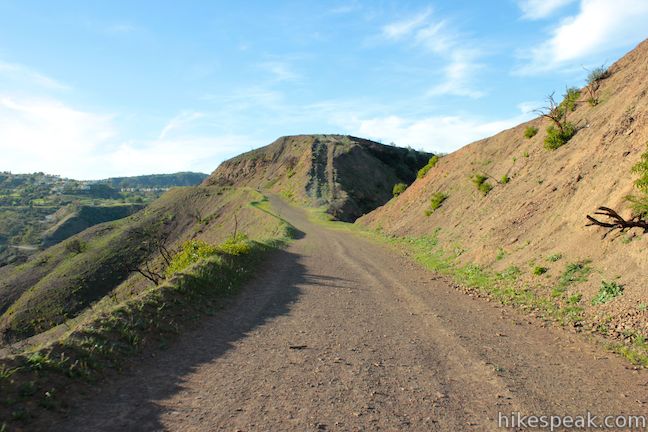
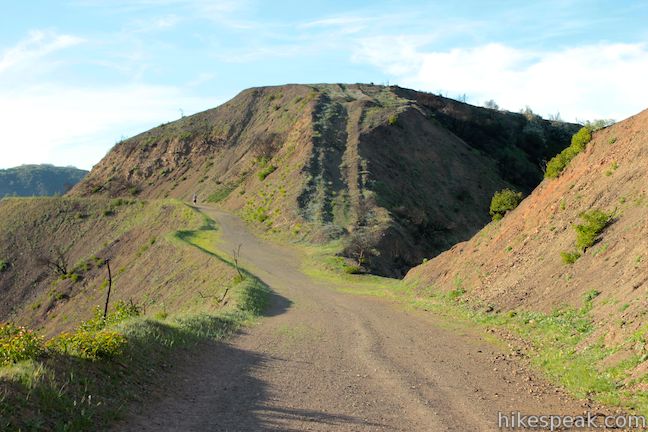
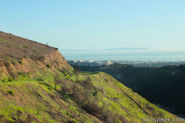
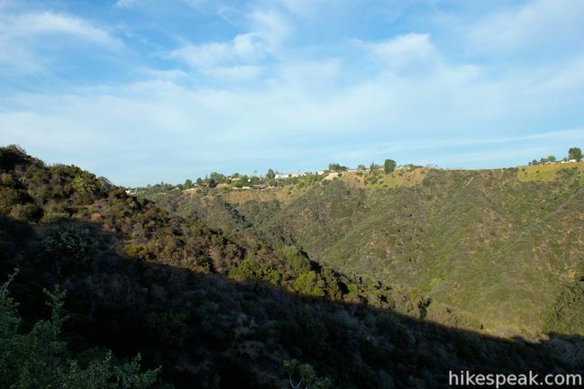
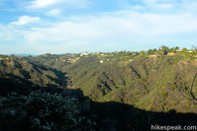
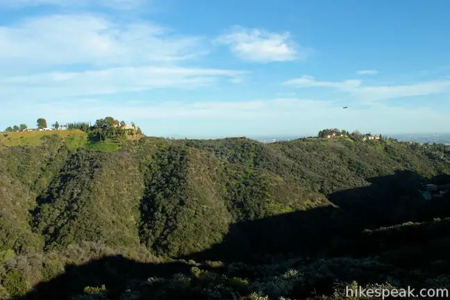
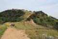
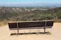
Almost 3/4 of a mile from the start, you will come to a saddle at the top the burn area that offers the hike’s first view to the east. Below the ridge is Hoag Canyon. The bottom of the canyon is undeveloped at this end, so you can look out over a little slice of wilderness in this urban world. Mansions atop the opposing ridge, will quickly remind you that you are hiking in the mountains of Bel Air.
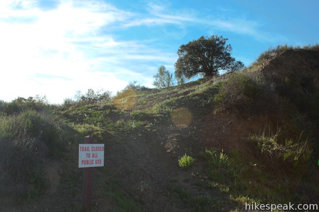
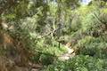
As the road continues, you will switch to the east side of the ridge for more views over Hoag Canyon. A mile from the start, as you leave views of the 405 and the Getty Center, you will pass the top of Getty View Trail on the left. Getty View Trail is an alternate route up the ridge starting from Sepulveda Boulevard. The single-track trail has reopened following closure due to construction on the 405 and damage from the 2012 brush fire. Just above Getty View Trail, there is an inviting-looking tree that would offer shade and good views.
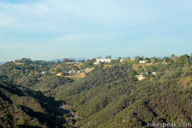
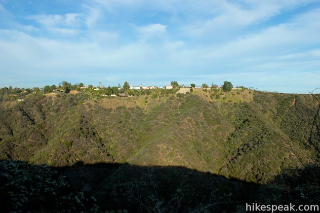
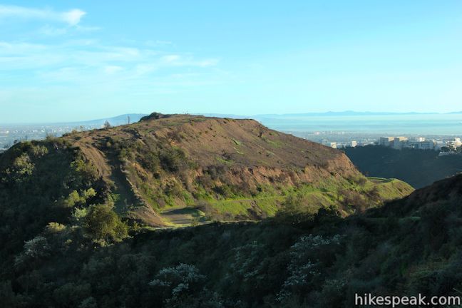
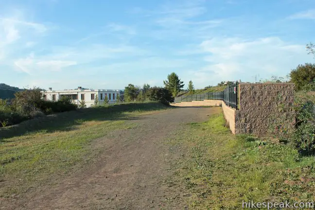
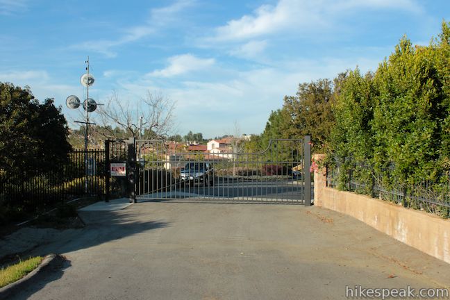
At 1.2 miles, there is a bend in the road (where it juts out to the east before turning left and north) that offers a nice perspective south down Hoag Canyon. This is the last good view of the hike and a good place to turn around. Ahead the road runs into the gated community, Bel Air Crest. East Sepulveda Fire Road becomes paved and you will hit a locked gate, 1.5 miles from the start, where hikers are forced to turn around.
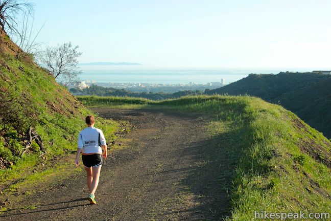
You are in for a treat as you hike back down East Sepulveda Fire Road. In addition to a gradual downhill finish, you will have all the good views in front of you. The Getty Museum makes routine appearances as you look down the trail, framed by the ridges of the Santa Monica Mountains and the glistening water of the Pacific Ocean. The view is like a work of art!
This is a short, easy hike with freeway noise and fine views. Bikes and dogs (on a leash) are welcome. There is an unusual sign at the trailhead stating that commercial dog walking is prohibited (so be suspicious of anyone with more than three dogs?). There is no fee or permit required to hike East Sepulveda Fire Road (Casiano Fire Road) in Getty View Park, so get out and enjoy!
Directions to the Trailhead
- From the northbound 405 Freeway, take exit 57B for Moraga Drive (north of Sunset Boulevard).
- At the bottom of the off-ramp, go straight through the intersection with Sepulveda Boulevard.
- Make an immediate left turn at the next intersection onto Casiano Road.
- Drive 0.9 miles up Casiano Road to the fire road at the top.
- From the southbound 405, take exit 57 for Sunset Boulevard.
- At the bottom of the off-ramp, turn right onto Church Lane.
- Drive under the 405.
- Turn left up Sepulveda Blvd.
- Turn right at the light onto Moraga Drive.
- Then make the left on Casiano Road to reach the trailhead where roadside parking is available.
Trailhead Location
Trailhead address: 1399 Casiano Road, Los Angeles, CA 90049
Trailhead coordinates: 34.088875, -118.472562 (34° 05′ 19.95″N 118° 28′ 21.22″W)
You may also view a regional map of surrounding Los Angeles trails and campgrounds.


 | Lower Canyonback Trail This 4.2 mile hike ascends Canyonback Ridge from Kenter Ave. in Brentwood to the Mountain Gate Country Club Estates. |
 | Upper Canyonback Trail This 3 mile hike descends Canyonback Ridge from Mulholland Drive to the Mountain Gate Country Club Estates. |
 | Mulholland Drive to San Vicente Mountain This 2-mile hike approaches the peak from the east and offers views to the north and south en route to the old Nike Missile site. |
 | Westridge Trail to San Vicente Mountain This 7.4-mile hike travels a scenic ridge between a Brentwood neighborhood and a summit that was once used as a Nike Missile site. |
 | Caballero Canyon Trail This 3.4-mile round trip hike ascends a canyon on the north side of the Santa Monica Mountains with views over the San Fernando Valley. |
 | Dixie Canyon Park This 0.55-mile hike forms a partial loop in a small wooded canyon on the Sherman Oaks side of the Santa Monica Mountains. |
 | Hastain Trail This pair of short loops explore Franklin Canyon Park and ridges in the Santa Monica Mountains above Beverly Hills. |
 | Franklin Canyon Lake Loop & Chaparral Trail This 2.5-mile hike loops around Franklin Canyon Lake and ascends Chaparral Trail (optionally) for an overview of Franklin Canyon. |
 | More trails in the Santa Monica Mountains Explore other destinations in the range. |
Common Questions about East Sepulveda Fire Road in Getty View Park in the Santa Monica Mountains
- Is the trail open?
- Yes. You should expect to find that East Sepulveda Fire Road is open. There are no recent reports of trail closures. If you discover that the trail is closed, please help your fellow hikers by reporting a closure.
- Is this trail free to access?
- Yes, East Sepulveda Fire Road is free to access. No entrance fee, pass, or permit is required. If you discover that access rules have changed, please provide feedback on your experience.
- How much time does this hike take?
- It takes approximately 1 hour 30 minutes to hike East Sepulveda Fire Road. Individual hiking times vary. Add extra time for breaks and taking in the views.
- How long is this hike?
- The hike to East Sepulveda Fire Road is a 3 mile out and back with 375 feet of elevation change.
- Are dogs allowed on this trail?
- Yes, dogs are allowed on East Sepulveda Fire Road. The trail is open to hikers, dogs, bikes.
- Are there ocean views on this hike?
- Yes, East Sepulveda Fire Road offers views of the ocean.
- What mountain range is this trail in?
- East Sepulveda Fire Road is located in the Santa Monica Mountains.
- Where is the trailhead located?
- The trailhead for East Sepulveda Fire Road is located in Los Angeles, CA.
Trailhead Address:
1399 Casiano Road
Los Angeles, CA 90049
Trailhead Coordinates:
34.088875, -118.472562 - What are the driving directions to the start of the hike?
To get to the trailhead: From the northbound 405 Freeway, take exit 57B for Moraga Drive (north of Sunset Boulevard). At the bottom of the off-ramp, go straight through the intersection with Sepulveda Boulevard. Make an immediate left turn at the next intersection onto Casiano Road. Drive 0.9 miles up Casiano Road to the fire road at the top.
From the southbound 405, take exit 57 for Sunset Boulevard. At the bottom of the off-ramp, turn right onto Church Lane. Drive under the 405. Turn left up Sepulveda Blvd. Turn right at the light onto Moraga Drive. Then make the left on Casiano Road to reach the trailhead where roadside parking is available.
View custom Google Maps directions from your current location.
- Are there other trails near East Sepulveda Fire Road?
- Yes, you can find other nearby hikes using the Hikespeak Hike Finder Map.

Thanks for posting the pictures and this recap. The trail was still in good shape when I visited yesterday, despite the rain.
A lovely hike. Don’t attempt it from the northern end ( it’s locked behind the gates of Bel Air ) – It’s possible to do the return route along the top of the ridge where the fire break was pushed through – a bit scrambly in places, but the view across the LA area from near the small radio mast (
34.094573, -118.471776) is worth the extra effort! Easy to see the route up from the isolated tree mentioned in the description.
Great views. Didn’t see one other person on this fireroad trail despite it being a Saturday. Very different from Westridge, Backbone, Kenter, or other fire trails to the west!
Kind of a mountain/city hike. City and/or freeway is never out of sight.
Okay hike and some decent views, but if you bring your dog, beware there is little to no shade! My very healthy/fit pit mix had trouble on our way back because it was so hot and there was nowhere for him to walk in the shade. So either bring lots and lots of water or find a shadier spot Otherwise hike is okay
Do NOT take a beginner mountain biker to this trail. If there is one thing that puts people who are just starting to mountain bike is to start at an uphill with no easy method of gaining momentum. This is more of a trail for someone who wants to be go in strong with a ton of uphill and reap the benefits of a full speed downhill reward.