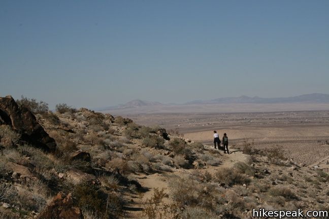
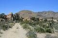
A secluded palm tree oasis is tucked away on the north end of Joshua Tree National Park. To reach the awesome oasis, you’ll hike 3 miles round trip with 350 feet of elevation gain, passing through a variety of desert scenery and panoramic views. The trail leads to a collection of palm trees wrapped around a rare spring, an out-of-place desert destination that’s a perfect target for hikers.
The trail to Fortynine Palms Oasis is located away from Park Boulevard (the main road through Joshua Tree National Park). This reduces the number of hikers this trail receives. The trail has a separate access road into the national park with no ranger station. This is an added bonus for anyone passing through the high desert who would like to go on a great hike in Joshua Tree National Park without paying an entrance fee.
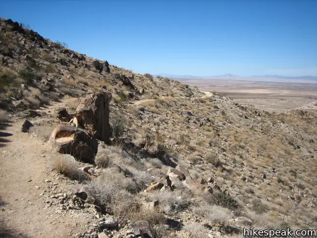
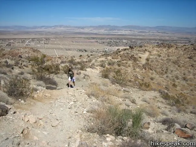
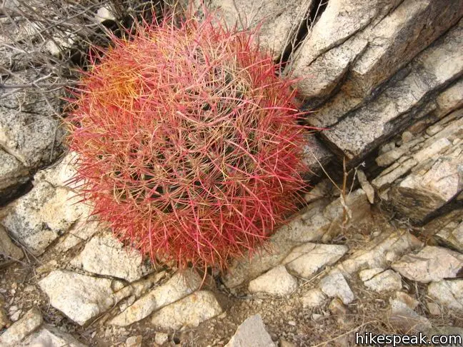
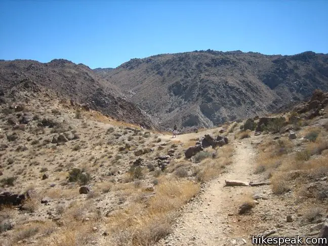
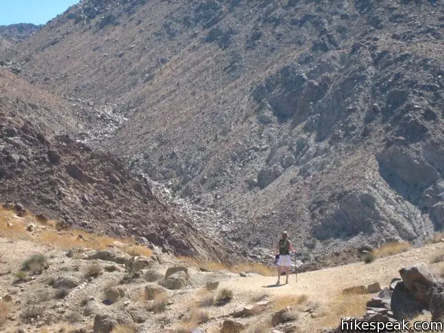
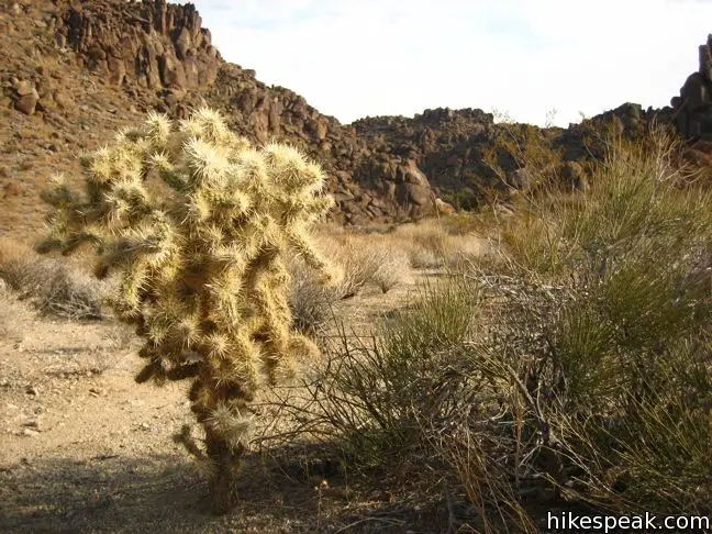
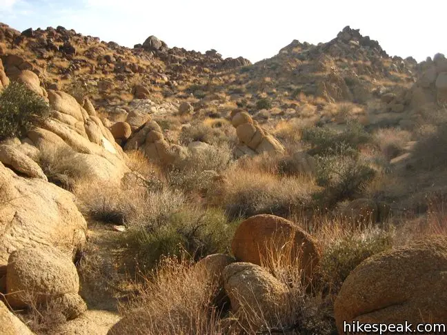
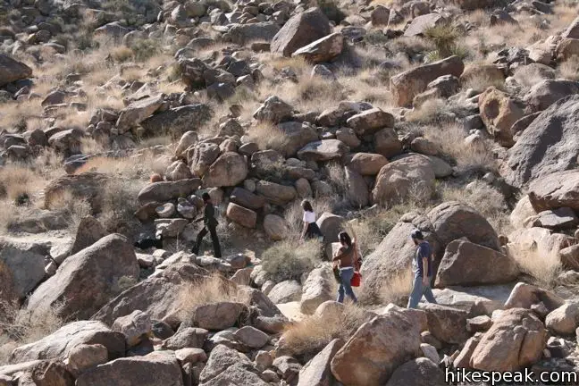
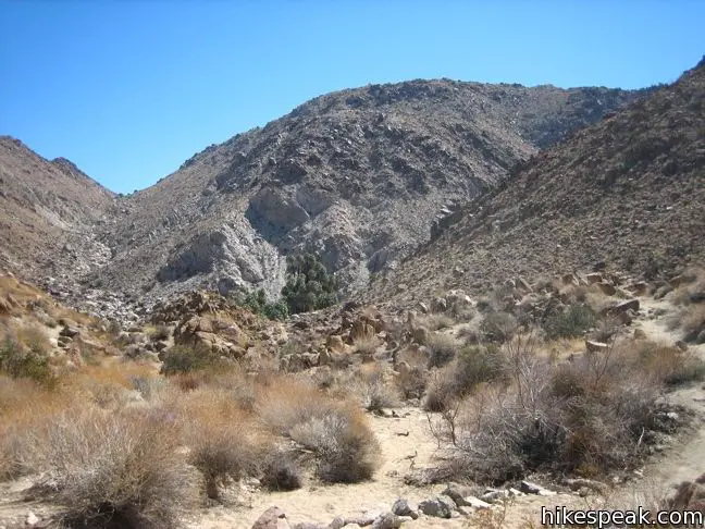
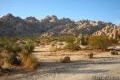
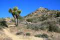
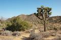
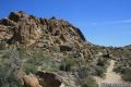
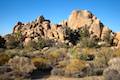
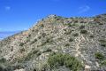
The trail heads uphill from the start on a well maintained single track. Each step increases the view of the surrounding desert. Red Barrel cacti line the trail. At the half way point, the trail begins descending toward the oasis. Enjoy grand views across a Fortynine Palms Canyon.
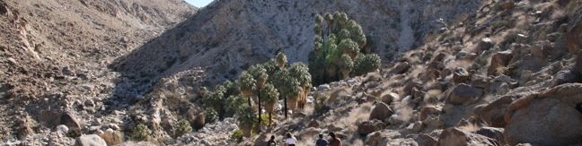
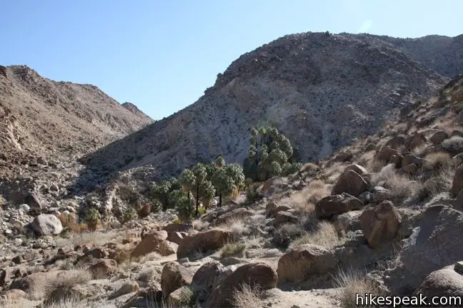
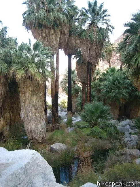
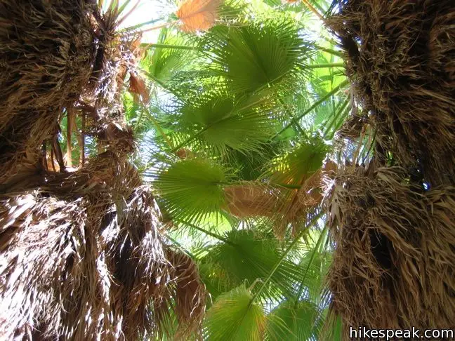
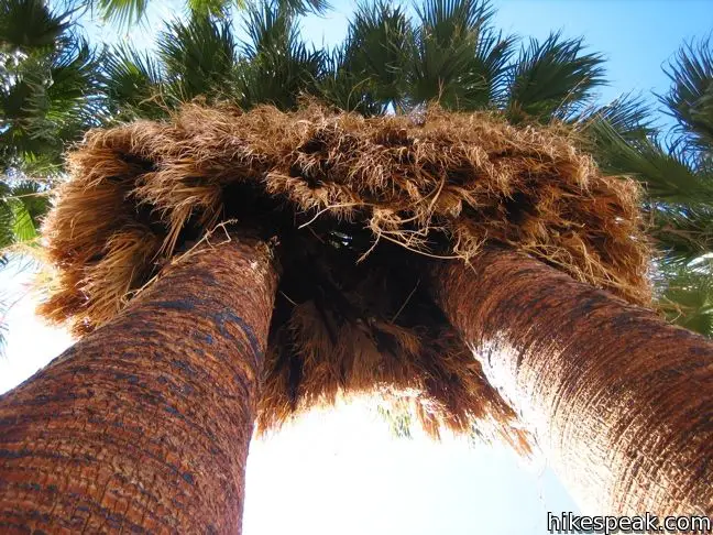
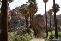
As you look down the trail, palm trees appear in the distance, appearing bizarrely out of place from the surrounding arid landscape. The trees were planted by miners to mark the spring that now irrigates the trees. The trail ends when you reach Fortynine Palms Oasis, where fan palms rise up between large boulders. Sit beside small pools of water in the shadow of the palm trees and ponder what it must have been like back then, wandering through the desert with an empty canteen.
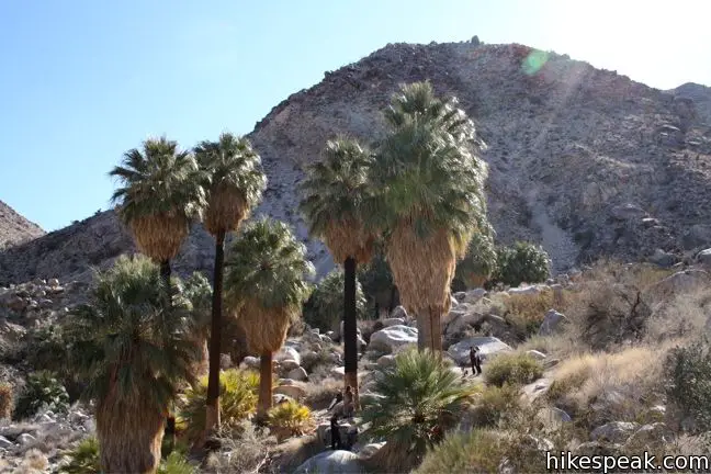
Bring a picnic lunch to Fortynine Palms Oasis and stay awhile, listening to the birds chirp at this out-of-place oasis. This three mile venture is a great desert hike (even if there are no actual Joshua trees to be seen). No permit is required for the hike to Fortynine Palms Oasis. The trail is free to access, so get out and enjoy!
If you’d like a longer hike to another palm tree oasis in Joshua Tree National Park, check out Lost Palms Oasis on the east side of the park.
Directions to the Trailhead
- From inside the park, exit the north entrance and make a left on Route 62.
- Drive 5 miles through the city of Twentynine Palms (They love counting palm trees in the desert) and turn south on Canyon Road.
- Drive 1.7 miles to the parking lot at road's end.
Trailhead Location
Trailhead address: Fortynine Palms Canyon Road, Joshua Tree National Park, Twentynine Palms, CA 92277
Trailhead coordinates: 34.1193, -116.1120 (34° 07′ 09.5″N 116° 06′ 43.2″W)
You may also view a regional map of surrounding California Desert trails and campgrounds.


 | Indian Cove The 101-site campground is home to a 0.6-mile interpretive trail and endless bouldering and rock climbing opportunities. |
 | Warren Peak This 5.5-mile hike summits a peak with impressive views over the west side of Joshua Tree. |
 | High View Nature Trail This 1 1/3-mile loop climbs a ridge on the west side of the park that offers views of San Gorgonio Mountain and Yucca Valley, along with an introduction to desert plants. |
 | Contact Mine This 3.9-mile hike ascends 700 feet up a wash, a canyon, and an old road to a mountainside mine site that offers a glimpse into the mining history of Joshua Tree. |
 | Lucky Boy Vista This level 2.5-mile hike visits a modest overlook at the site of an old mine. |
 | Desert Queen Mine This 1.6-mile hike follows a level trail to an overlook before crossing a canyon to visits the ruins of one the most profitable gold mines in the California desert. |
 | Wall Street Mill This level 1.55 to 2.15-mile hike visits a well-reserved gold mill, exploring the mining history of Joshua Tree National Park. |
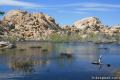 | Barker Dam This level 1.5-mile loop visits a small foreign-looking reservoir within the Wonderland of Rocks. |
 | Lost Palms Oasis This 7.2-mile hike visits a desert oasis nestled between mountains in the southeast corner of the park. |
 | Mastodon Peak This 2.6-mile loop visits a 3,400-foot summit with panoramic views of southeastern Joshua Tree. |
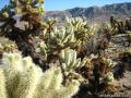 | Cholla Cactus Garden This quarter-mile loop allows visitors to stroll through an intense concentration of cholla cacti. |
 | Hidden Valley This one mile loop circles the interior of a small valley surrounded by tall rocks that serves as an excellent bouldering arena. |
 | Ryan Mountain This 3-mile hike offers summit views from the center of Joshua Tree National Park. |
 | Inspiration Peak This 1.2-mile hike leaves the crowds at Keys View for even grander views at a 5,550-foot summit that looks out on the Coachella Valley, the Salton Sea, Mount San Jacinto, and much of Joshua Tree National Park. |
 | Lost Horse Mine This 4-mile hike visits a well-preserved mine and mill. |
 | Hikes in the California Desert Explore more trails in Death Valley National Park, Joshua Tree National Park, Anza-Borrego Desert State Park, and Mojave National Preserve. |
 | Joshua Tree Campgrounds Nine campgrounds with 500 total sites are spread throughout the park to facilitate your visit. |
 | Joshua Tree Wildflowers The desert in bloom is something any outdoor enthusiast in California should see. |
Common Questions about Fortynine Palms Oasis in Joshua Tree National Park
- Is the trail open?
- Yes. You should expect to find that Fortynine Palms Trail is open. There are no recent reports of trail closures. If you discover that the trail is closed, please help your fellow hikers by reporting a closure.
- Is this trail free to access?
- Yes, Fortynine Palms Trail is free to access. No entrance fee, pass, or permit is required. If you discover that access rules have changed, please provide feedback on your experience.
- How much time does this hike take?
- It takes approximately 1 hour 30 minutes to hike Fortynine Palms Trail. Individual hiking times vary. Add extra time for breaks and taking in the views.
- How long is this hike?
- The hike to Fortynine Palms Trail is a 3 mile out and back with 350 feet of elevation change.
- Are dogs allowed on this trail?
- No, dogs are likely not allowed on Fortynine Palms Trail. The trail is primarily open to hikers.
- Where is the trailhead located?
- The trailhead for Fortynine Palms Trail is located in Twentynine Palms, CA.
Trailhead Address:
Fortynine Palms Canyon Road
Twentynine Palms, CA 92277
Trailhead Coordinates:
34.1193, -116.1120 - What are the driving directions to the start of the hike?
To get to the trailhead: From inside the park, exit the north entrance and make a left on Route 62. Drive 5 miles through the city of Twentynine Palms (They love counting palm trees in the desert) and turn south on Canyon Road. Drive 1.7 miles to the parking lot at road's end.
View custom Google Maps directions from your current location.
- Are there other trails near Fortynine Palms Trail?
- Yes, you can find other nearby hikes using the Hikespeak Hike Finder Map.

I’m planning a trip with a group of guys to go hike up to fortynine palms Oasis and was wondering if it is open? I have seen on some websites that it is closed and some say it is open?
It is marked with signs saying it is closed for “emergency conditions” (heat and drought, I think) and to allow wildlife access to the stream without human interference. The sign states that violation may result in up to $6000 fine or 6 months jail time. According to some locals, the closing may be related to an incident in which a hiker had to be rescued from the trail. These incidents are not uncommon among desert trails as inexperienced hikers come to hike the trails without enough water. The sign does not indicate how long it’ll be closed.
Thanks for the hike description. About how long did it take you?
I’ve done this hike a few times. It can be completed in 60-90 minutes, depending on how much time is spent at the oasis. Other hikers have commented that this trail may be temporarily closed, so you may want to check with a park ranger before heading to the trailhead.
Can i bring my mountain bike
[…] The Fortynine Palms Oasis Trail offers a secluded palm tree oasis with a 3-mile round trip hike and an elevation gain of 350 feet. This hidden gem is nestled on the north end of Joshua Tree National Park. […]