Dixie Canyon Park
in the Santa Monica Mountains
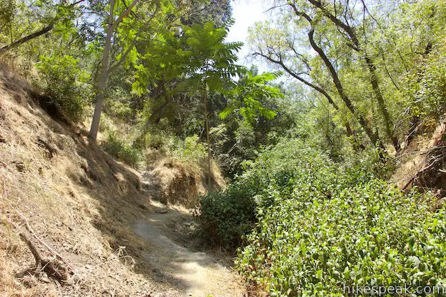
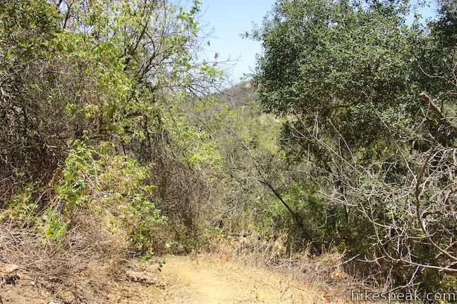
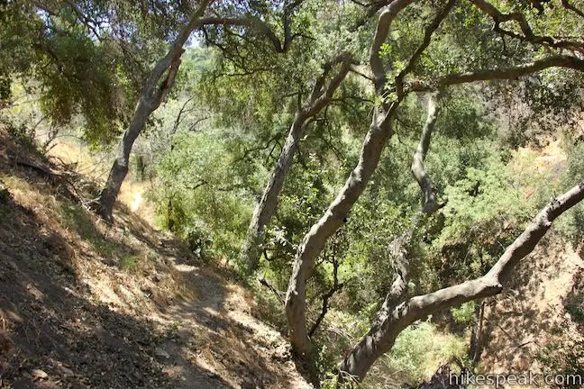
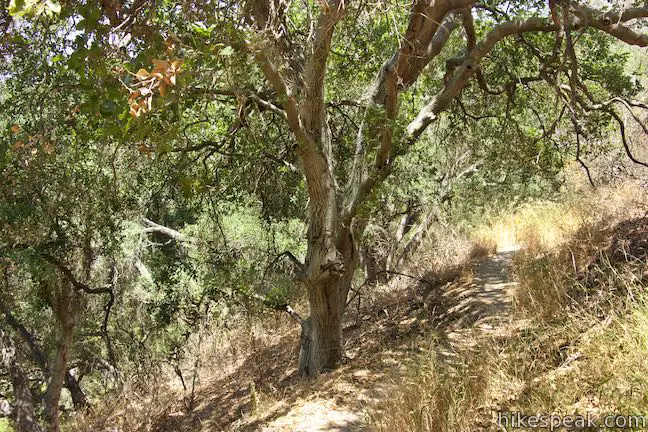
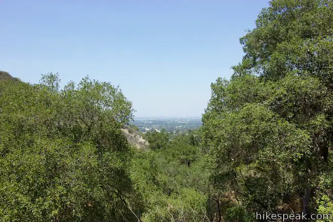
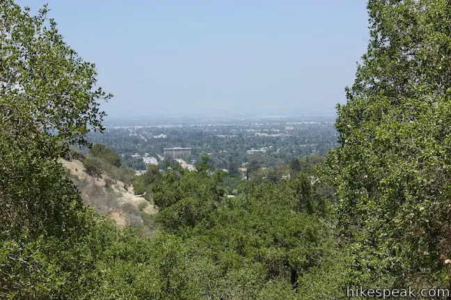
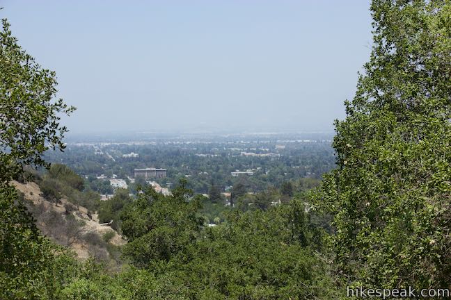
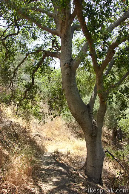
Dixie Canyon Park preserves twenty tucked-away acres in the Santa Monica Mountains on the north side of the range west of Coldwater Canyon. The park can be accessed from Sherman Oaks for a micro hike that is 0.55 miles round trip with 175 feet of elevation change. This partial loop follows a dirt single track that is narrow and sometime overgrown, finding shade from walnut trees and coast live oaks as it passes through Dixie Canyon Park. The trail provides one small view looking out across the San Fernando Valley.
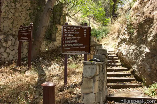
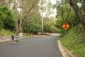
Dixie Canyon Park has one trailhead with parking spaces for a couple cars. The trailhead is less than a mile south of Ventura Boulevard at the top of Dixie Canyon Place. A sign at the trailhead explains that Dixie Canyon Park is:
A gift to the people of California by Warren Beatty.
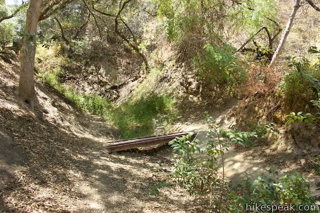
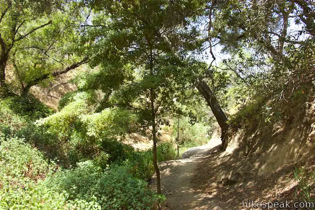
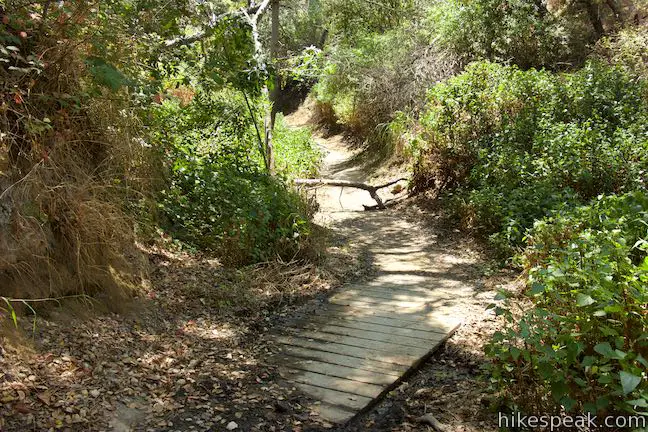
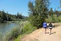
Take a flight of steps up from the end of the road and enter a wooded canyon. Stroll up the trail for 250 feet, bordering a perennial stream. Cross a wooden plank bridge to the right side of the creek and come to a junction by a slightly larger footbridge. This is the start of the loop, 0.08 miles from the trailhead. The trail leaves the canyon floor in two directions. The more gradual route (with switchbacks) up the side of the canyon ascends to the left. To take this route, cross the bridge and turn left, not heading any further up the bottom of the canyon. The other end of the loop is on the right. Make a sharp turn to head this way, climbing up the side of the canyon. The directions below assume that you turn right to tackle the loop in this counter clockwise direction.
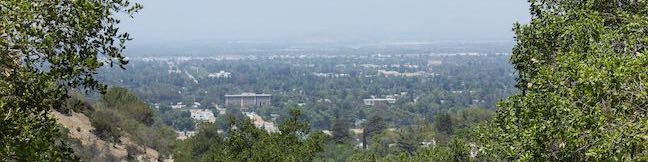
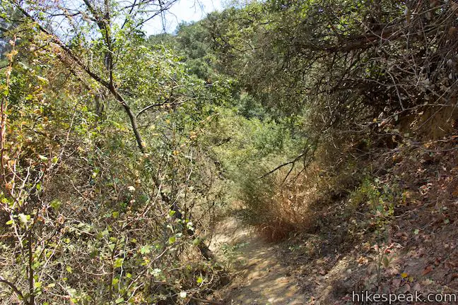
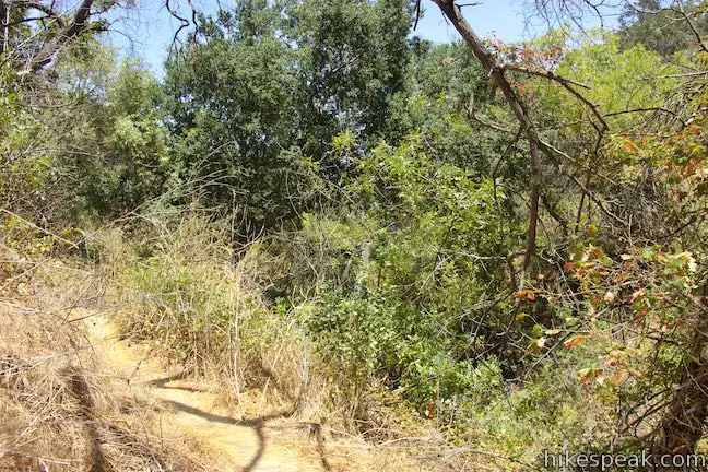
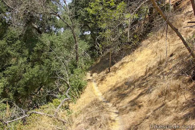
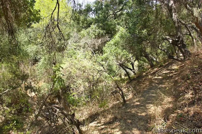
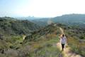
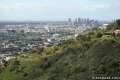
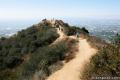
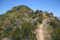
After ascending from the bottom of the canyon, the trail crosses a slope through grasses and brush that sometimes encroach on the trail. Make your way around the back of the canyon after 1/3 of a mile of hiking. Slip into an area of larger oak trees, being mindful that poison oak may be present along the trail (long pants recommended). As the trail tips downhill, you will find a view looking out between the oaks across the San Fernando Valley. While this isn’t an enormous vista, it is the only long view on the hike.
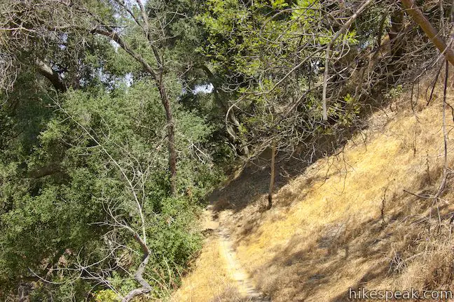
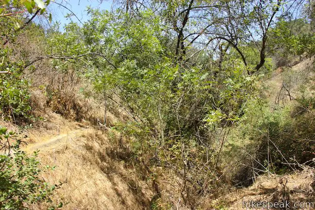
The side of the canyon is steep below. Luckily, switchbacks allow for a more gradual descent. After the view across the valley, turn left down a switchback. Pass between oaks as the trail curves back to the right. You will come to another left bend, passing a path that breaks off to the right and offers an alternate route down the canyon. Stick with the trail as it drops to the canyon floor. Cross the footbridge, close the loop, and turn right to return to the trailhead.
All in, this hike is just 0.55 miles long with 175 feet of elevation change. While that length might make this hike seem appealing for small children, be advised that the trail has loose soil, steep banks, poison oak, and overgrown brush that make it less suitable for little ones. Dogs are allowed but bikes are not. No fee or permit is required for this hike, so get out and enjoy. For a short hike on the ridge to the east, check out Longridge Park.
Directions to the Trailhead
- From Los Angeles, take the 101 Freeway north to exit 16 for Woodman Avenue.
- Drive south on Woodman Avenue to Ventura Boulevard.
- Turn left and go five blocks east to Dixie Canyon Avenue.
- Turn right and follow Dixie Canyon Avenue south for 0.7 miles.
- Dixie Canyon Avenue makes a horseshoe bend to the right.
- At that curve, turn left to proceed south up Dixie Canyon Place.
- Reach the end of the road after less than a quarter mile, finding parking in front of the trailhead.
Trailhead Location
Trailhead address: 3500 Dixie Canyon Place, Sherman Oaks, CA 91423
Trailhead coordinates: 34.13388, -118.42345 (34° 08′ 01.96″N 118° 25′ 24.42″W)
You may also view a regional map of surrounding Los Angeles trails and campgrounds.


 | Longridge Park This short hike on an undeveloped ridge in the Santa Monica Mountains has sweeping views over the San Fernando Valley. |
 | Fryman Canyon Loop This 3-mile loop follows Betty B. Dearing Trail through Wilacre Park and Coldwater Canyon Park around Fryman Canyon in the Studio City side of the Hollywood Hills. |
 | Franklin Canyon Lake Loop & Chaparral Trail This 2.5-mile hike loops around Franklin Canyon Lake and ascends Chaparral Trail (optionally) for an overview of Franklin Canyon. |
 | Hastain Trail This pair of short loops explore Franklin Canyon Park and ridges in the Santa Monica Mountains above Beverly Hills. |
 | Trebek Open Space This 2.5-mile hike incorporated Bantam Trail and Castair Trail in a park adjacent to Runyon Canyon. |
 | Runyon Canyon Tour Hollywood's most popular dog park on loops of various lengths that offer good exercise and views over Los Angeles. |
 | Cahuenga Peak This 3-mile hike on Burbank Peak Trail and Aileen Getty Ridge Trail ascends to Cahuenga Peak and the adjacent Mount Lee, home of the Hollywood Sign. |
 | Mount Lee and the Hollywood Sign This 6.4-mile hike crosses Griffith Park from Canyon Drive to the top of Mount Lee directly behind the landmark Hollywood Sign. |
 | More trails in Los Angeles Explore other hiking destinations around Los Angeles. |
Common Questions about Dixie Canyon Park in the Santa Monica Mountains
- Is the trail open?
- Yes. You should expect to find that Dixie Canyon Park Trail is open. There are no recent reports of trail closures. If you discover that the trail is closed, please help your fellow hikers by reporting a closure.
- Is this trail free to access?
- Yes, Dixie Canyon Park Trail is free to access. No entrance fee, pass, or permit is required. If you discover that access rules have changed, please provide feedback on your experience.
- How much time does this hike take?
- It takes approximately 15 minutes to hike Dixie Canyon Park Trail. Individual hiking times vary. Add extra time for breaks and taking in the views.
- How long is this hike?
- The hike to Dixie Canyon Park Trail is a 0.55 mile lollipop loop with 175 feet of elevation change.
- Are dogs allowed on this trail?
- Yes, dogs are allowed on Dixie Canyon Park Trail. The trail is open to hikers, dogs.
- Is Dixie Canyon Park Trail good for kids?
- Yes, this hike is likely suitable for children. It is relatively short (0.55 miles) with manageable elevation gain.
- What mountain range is this trail in?
- Dixie Canyon Park Trail is located in the Santa Monica Mountains.
- Where is the trailhead located?
- The trailhead for Dixie Canyon Park Trail is located in Sherman Oaks, CA.
Trailhead Address:
3500 Dixie Canyon Place
Sherman Oaks, CA 91423
Trailhead Coordinates:
34.13388, -118.42345 - What are the driving directions to the start of the hike?
To get to the trailhead: From Los Angeles, take the 101 Freeway north to exit 16 for Woodman Avenue. Drive south on Woodman Avenue to Ventura Boulevard. Turn left and go five blocks east to Dixie Canyon Avenue. Turn right and follow Dixie Canyon Avenue south for 0.7 miles. Dixie Canyon Avenue makes a horseshoe bend to the right. At that curve, turn left to proceed south up Dixie Canyon Place. Reach the end of the road after less than a quarter mile, finding parking in front of the trailhead.
View custom Google Maps directions from your current location.
- Are there other trails near Dixie Canyon Park Trail?
- Yes, you can find other nearby hikes using the Hikespeak Hike Finder Map.

Go the extra miles...
Submit a rating of this hike to go with your comment. Contribute to the average trail rating.