Dawn Mine offers a glimpse into the history of the San Gabriel Mountains. The abandoned shafts can be reached on a moderately strenuous 6-mile round trip hike up beautiful Millard Canyon.
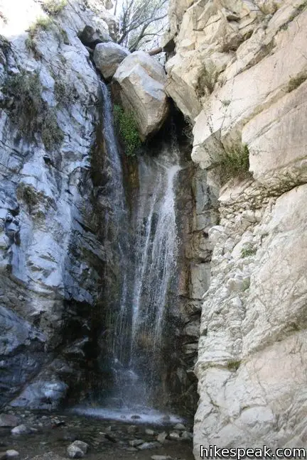
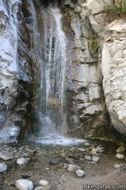
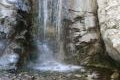
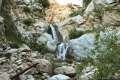
To visit the entrance to this forgotten gold mine, start from the Millard Campground parking area and hike half a mile up the canyon to Millard Falls. Take in the falls and back up three hundred feet. You will see a wooden post to your left, marking a steep path up the wall of the canyon. This is the start of the extended trail to Dawn Mine.
If the steep path isn’t appealing, you will find easier access to the canyon above Millard Falls by hiking up Sunset Ridge Trail.
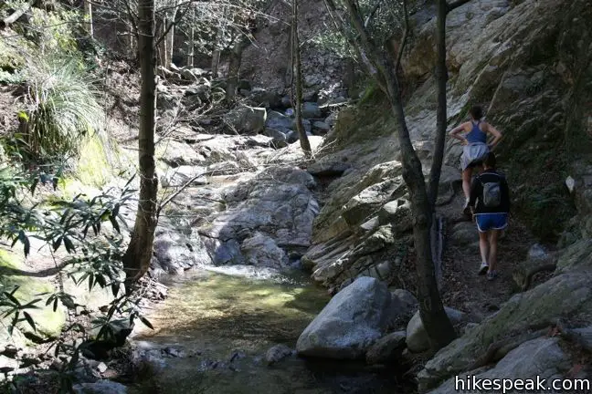
Take the steep path up along the right rim of the canyon, returning to the creek at a small landing above Millard Falls. Cross the water here and pick up the single track on the other side. The pleasant hike upstream begins anew.
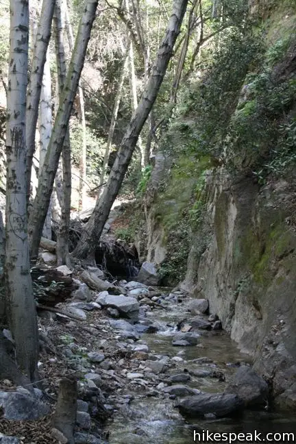
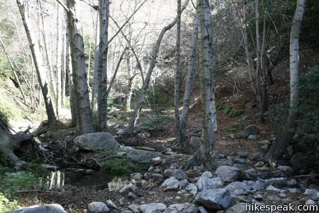
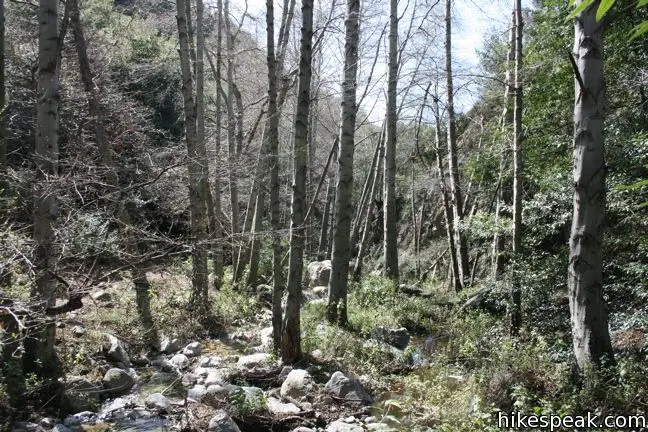
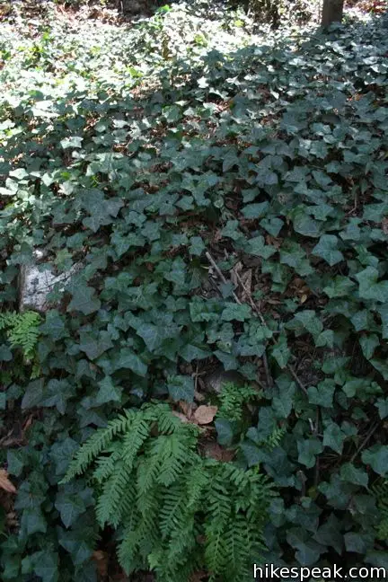
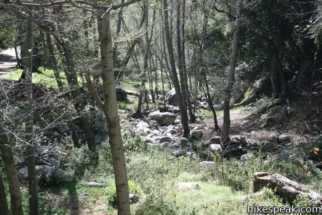
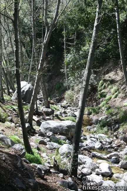
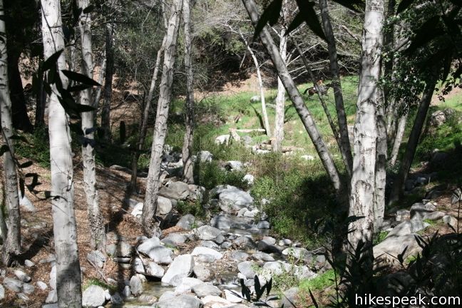
Follow the trail as it routinely crosses the creek, unable to decide which side it wants to be on. The trail breaks up some as the canyon widens, bringing in more California bays and other vegetation. Stick with the stream. As long as you do not exit the canyon, you will arrive at the destination.
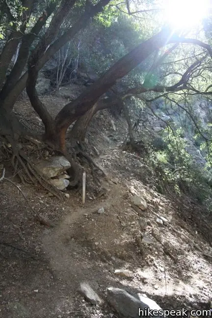
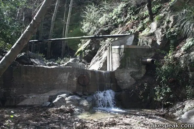
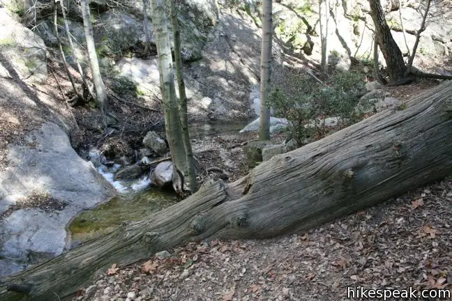
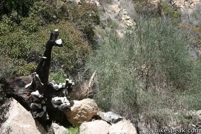
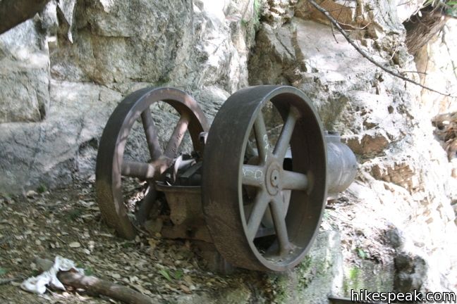
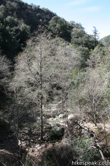
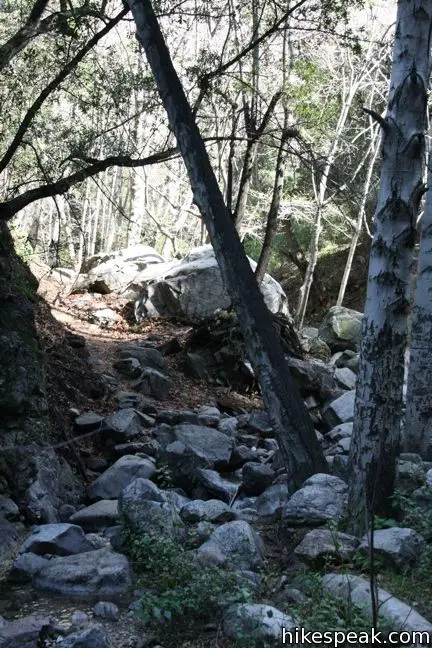
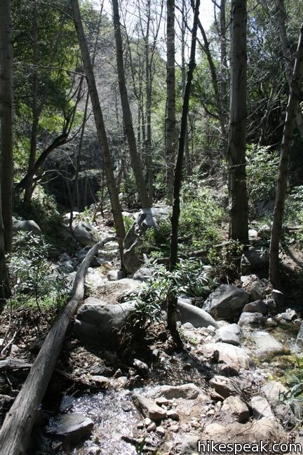
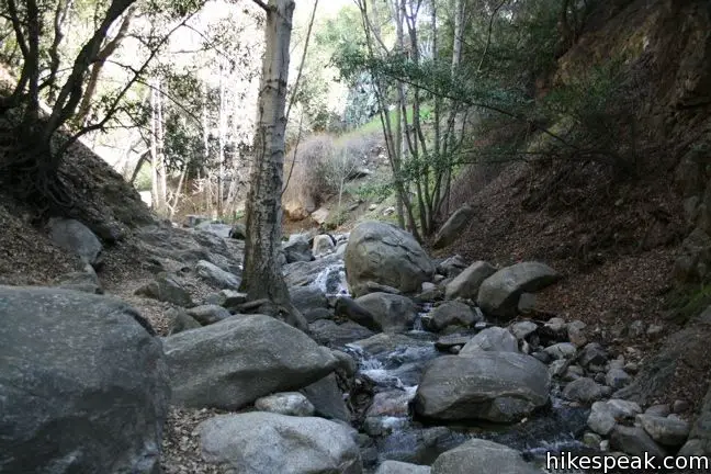
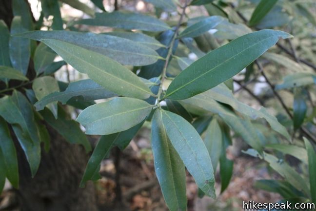
The photos in this report depict recognizable milestones to help guide you to the mine. The photos below offer more scenic views of the hike.
The trail passes over rusted out pipes and other man-made vestiges.
You will cross under and over a few logs along your way.
When you start to ask yourself, “how far away is this thing,” you are probably getting close. A miles from the mine, the canyon narrows and the creek may disappear underground. The stream bed becomes a boulder field, so take the trail to the left as it winds up a steep slope.
When you come back into the stream bed, you should see these blackened tree roots standing out and covered in white stones:
Follow the dry creek and trail into a wooded area, as you close in on the mine. The trail will cross back and forth across the creek. At one point, when you are walking along the right bank, there will be remnants of an old miners’ encampment in a clearing on the slope to the left. Pay a brief visit to the rusting relics and push on for the last third of a mile to the mine.
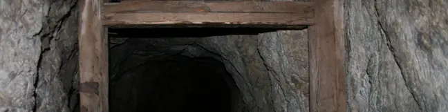
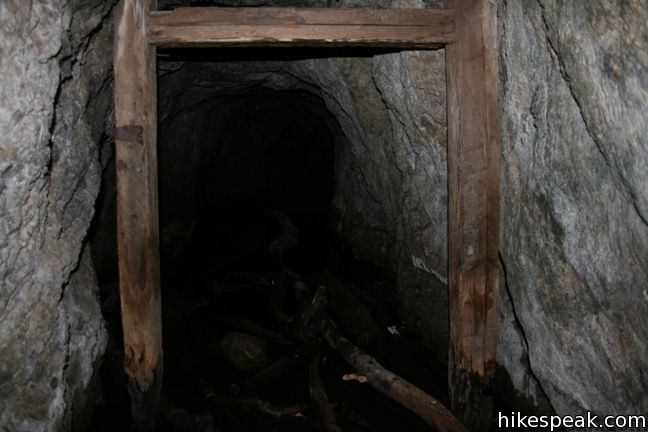
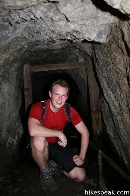
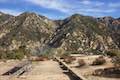
The canyon bends to the left, then to the right, as you rock-hop along. When the trail switches up the canyon wall to the left, you are there! Take a look at the rusted engine that once delivered gold from the mine, and ascend to the mouth of the mine. Climb inside and enjoy a moment in the cold shade. If you brought a flashlight you can have a look back into the dark recesses.
Leave the mine and retrace your steps down the canyon. Take your time and enjoy the calming creek as the sun plays on the water through the leaves of the bays above. You are sure to return to Millard Falls with a feeling of blissful accomplishment. An Adventure Pass is required to park at the trailhead for Dawn Mine in the Angeles National Forest. No other permit is required, so get out and enjoy!
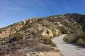
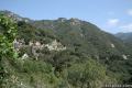
Alternate route: Sunset Ridge Trail can be used to access Millard Canyon above Millard Falls (avoiding the steep ridge ascent to get above the waterfall). Start hiking up Mount Lowe Road from Chaney Trail that is half a mile from the Millard Falls Trailhead). Hike 0.37 miles east on this paved road and turn left on Sunset Ridge Trail. The trail ventures up the canyon past views of Millard Falls. At 0.85 miles from the start, come to a split and turn left leaving Sunset Ridge Trail. This trail passes a cabin owned by Altadena Mountain Rescue Team. Beyond that, a path drops into the canyon that can be used to hike up the canyon to Dawn Mine.
Directions to the Trailhead
- Take the 210 freeway to Pasadena.
- Exit Lake Avenue and head north.
- After 3.5 miles, turn left at the T onto Loma Alta Drive.
- After one mile, make a right on Chaney Trail.
- The 1.5-mile road winds up to Sunset Ridge and down to the parking lot for Millard Campground and the trail to Dawn Mine.
Trailhead Location
Trailhead address: Chaney Trail, Angeles National Forest, Altadena, CA 91001
Trailhead coordinates: 34.2162, -118.1463 (34° 12′ 58.3″N 118° 08′ 46.7″W)
Use the map below to view the trail and get directions:
Dawn Mine


Millard Falls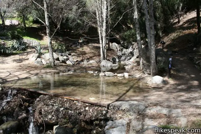


Millard Campground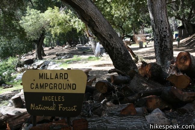

 | Millard Falls This one mile hike visits a 50-foot waterfall up one of the most scenic canyons in the range. |
 | Mount Lowe Road & Sunset Ridge Trail to Cape of Good Hope This pair of trails can be combined for a 5.2-mile round trip hike to a historic viewpoint called Cape of Good Hope. Follow the old route of Mount Lowe Railway to the ruins on Echo Mountain to extend the hike by two miles round trip or bring the distance up to 11.85 miles by visiting Echo Mountain, Inspiration Point, Mount Lowe Trail Camp, and other landmarks. |
 | Castle Canyon Trail to Inspiration Point (and beyond) This 2-mile long trail ascends from the ruins on Echo Mountain to a historic viewpoint that still offers hike-worthy panoramas. Form a loop back to Echo Mountain to visit Mount Lowe Trail Camp, Cape of Good Hope, and other landmarks on Mount Lowe Railway. |
 | Echo Mountain via Sam Merrill Trail This 5.8-mile hike visits a historic railway and ruins from a century old resort overlooking Pasadena. |
 | Rubio Canyon Trail This 1.3-mile round trip hike ventures into a rustic canyon to a double waterfall. |
 | More trails in the San Gabriel Mountains Explore other destinations in the range. |
 | Santa Anita Canyon Loop This 9.5-mile loop visits two peaceful creeks in sylvan canyons, passing a 60-foot waterfall and plenty of beautiful wilderness. |
 | Millard Campground This is the place to camp at the base of the San Gabriel Mountains (or the place to start on a hike to Millard Falls or Dawn Mine). |
Common Questions about Dawn Mine in the San Gabriel Mountains
- Is the trail open?
- Yes. You should expect to find that Dawn Mine in the San Gabriel Mountains is open. There are no recent reports of trail closures. If you discover that the trail is closed, please help your fellow hikers by reporting a closure.
- Do I need a permit for this hike?
- Yes. National Forest Adventure Pass.
- How much time does this hike take?
- It takes approximately 3 hours 15 minutes to hike Dawn Mine in the San Gabriel Mountains. Individual hiking times vary. Add extra time for breaks and taking in the views.
- How long is this hike?
- The hike to Dawn Mine in the San Gabriel Mountains is a 6 mile out and back with 1300 feet of elevation change.
- Are dogs allowed on this trail?
- Yes, dogs are allowed on Dawn Mine in the San Gabriel Mountains. The trail is open to hikers, dogs.
- What mountain range is this trail in?
- Dawn Mine in the San Gabriel Mountains is located in the San Gabriel Mountains.
- Where is the trailhead located?
- The trailhead for Dawn Mine in the San Gabriel Mountains is located in Altadena, CA.
Trailhead Address:
Chaney Trail
Altadena, CA 91001
Trailhead Coordinates:
34.2162, -118.1463 - What are the driving directions to the start of the hike?
To get to the trailhead: Take the 210 freeway to Pasadena. Exit Lake Avenue and head north. After 3.5 miles, turn left at the T onto Loma Alta Drive. After one mile, make a right on Chaney Trail. The 1.5-mile road winds up to Sunset Ridge and down to the parking lot for Millard Campground and the trail to Dawn Mine.
View custom Google Maps directions from your current location.
- Are there other trails near Dawn Mine in the San Gabriel Mountains?
- Yes, you can find other nearby hikes using the Hikespeak Hike Finder Map.

problem here 2011 , from millard campground to the waterfalls is fenced off and do not enter etc USFS signs , . remains closed untill ??
To get to the trailhead: Take the 210 freeway to Pasadena. Exit Lake Avenue and head north. After 3.5 miles, turn left at the T onto Loma Alta Drive. After one mile, make a right on Chaney Trail. The 1.5 mile road winds up to Sunset Ridge and down to the parking lot for Millard Campground and the trail to Dawn Mine. hi this is wrong there is no trail head to gold mine from parking lot at Millard Campground , to get to dawn mine trail head you park at top chaney trail ie locked gate sunset fire road before you get to end of road [ parking lot ] then follow cement road till you see sign gold mine trail
Find the Sunset Trail just off the road from the Gate. Go Left to River to then Right Up. Fallow the Black Spray Paint pass the big rock, up the Left to more Arrows to the Left, Cross the River bout 4 or more times, Look for @ Arrows back to back then look up the Mt for the Rock With a X on it & you are there. The 2nd Mine is up the Mt to the Left of the Arrow.
AUG 6 2012 MILLARD FALLS IS CLOSED. ALL OF MILLARD CREEK ALL THE WAY UP PAST DAWN GOLD MINE IS CLOSED. TAKING SUNSET TRAIL BY CABIN TO FALLS OR MINE IS ALSO CLOSED. A FEW HAVE GOTTEN CITATIONS ALREADY…
We attempted to reach the mine today by parking at the end of Chaney Trail Road and heading down into Millard Canyon. Once we hit the bottom, we walked upstream. We had to end up turning around before reaching the mine. The regrowth was very thick and hard to get through. A local we ran into advised us against that path. He said there are still some falling trees from the fire and also a very real bear presence. Another local informed us the mine can be reached via Sunset Ridge Trail or the paved fire road that runs parallel to it. Head towards Cape of Good Hope and Dawn Station.
The path in from sunset ridge fire road down into to millard canyon is open again, but from the campground to the mountain rescue cabin is still closed. *** The Falls still remain CLOSED ***
wrong , millard creek is in clousure area so is dawn gold mine , entering via sunset trail your in the usfs closed area . you can get a fine for being in closed area . map in angeles forest website shows closed area .
Just did dawn mine hike. GREAT trip. be prepared for many, many boulder hopping adventures, bring a camera and snakes. Don’t attempt with children, and if you are not experienced with hiking.
So is the hike to the mine open ore closed? How many miles round trip? What is the best safest way if I am taking less experienced hikers along?
This area of the Angeles NF is still closed due to damage from the Station Fire
as of march 20 2014 , dawn gold mine is still in closed area , usfs no hiking , millard falls is also still in closed to hiking area
This is now open and people have never stopped going since its closure. The following areas still remain closed:
Lower Gabrielino Trail (below Bear Canyon Trail)
Barley Flats Trail
Colby Trail
Ken Burton Trail
Millard Water Fall User Trail
Santa Clara Divide Road (FS3N17)
Messenger Flats Campground
Lightning Point Campground
Big Buck Campground
This is a fairly simple hike and a scramble up boulders. The mine entrance is behind a big boulder.
https://www.youtube.com/watch?v=fPBuCDzq9VA
According to the Angeles National Forest, the trail is still closed. Hopefully it will officially reopen soon though.
Colby Trail is now open. Law enforcement will not give you citations.
I hiked to the mine Nov of 2014. The trail is open above the waterfall although there are more obstacles now due to dead trees that have fallen as well as rockslides. Regards.
The trail is now open. The hike up the canyon has changed quite a bit, lots more zig-zagging across the stream and canyon. Lots of deadfall from the Station Fire, but an established path extists the entire way to the mine. The cliff-hugging trail to the left of the boulderfield has also been re-established.
Yesterday I brought a partner with limited hiking experience, and we made it about half way. There are footprints indicating the hikers are making it much further, but I think last summer’s intense rain washed out a lot of the trail. Plan for a little bit of rock scrambling and pushing through foliage. If I was to do this again, I’d think about following the fireroad on the ridge a big further before dropping into the canyon.
Made the hike today from the Millard Campground. A lot of heavy foliage but a path does exist that trails up just before Millard Falls that will lead you on top and over the falls and all the way to the Dawn Mine. [If you reach a second fall, you missed the path on the right, about 50 yards back before the second fall] Awesome hike, enter mine at your own risk!
After going to the waterfall, the cut up to the dawn mine trail from that post was totally unsafe. Loose dirt and rock, we basically had to use trees to pull us up the start of this hike!
I just came upon your website, and was amazed at the information available and how easy it is to access it. This does everything for a prospective hike. Excellent detail! Fine job! Thank You! -Gregory Olausen Sr.
[…] you are looking to extend this hike, consider checking out this post by Hikespeak, which helps you get to the mine that is located 3 miles past the […]
[…] Once you break off from Mount Lowe Road, it’s about 2.5 miles to the mine. I had read to keep an eye out for an old, rusted piece of mining equipment on the hillside to the left, because the mine entrance was only a few feet away. The equipment was easy to spot […]
To people who want to check out this mine, don’t bother… mine is closed off to the public…
https://data.ecosystem-management.org/nepaweb/nepa_project_exp.php?project=43653
However, the trail to the mine I’ve been told is much easier now. If I were to assume, if people were going to find the mine easier this time around, they may have decided to block it off in order for people to not crowd up and trash the mine….
Greetings! Dawn Mine Trail has been reworked and re-established along the entire length by the Restoration Legacy Crew of volunteers, so be sure to check out the current condition of the trail, there are no more dead trees to be climbed over or under, no more wash-outs, stairs have been established, a great deal of work has been done.
That’s excellent. How exciting!
April 27, 2019 update: I was just at Millard Falls/Campground this morning. Looks like the only way to get to Dawn Mine now is via Sunset Ridge but the signage will tell you as much too.
Thanks for all the incredible info!
[…] had read from another blogger that there is a way to get to Dawn Mine from […]
is the trail open? planning to hike this coming weekend 2-12-22.