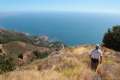
Everyone knows that Northern California is the place to go to see groves of giant redwoods, but few people know that you can get a taste of the redwoods in Southern California. Carbon Canyon Regional Park in Brea has a 10-acre grove of coastal redwoods, the largest grove of these trees in Southern California. Even through the could-be giants are relatively young and not really suited for the climate in Orange County, the 2.5-mile round trip hike to the redwood grove is a small treat for SoCal residents who can’t make it to the north end of the state.
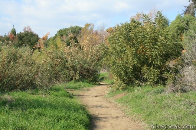
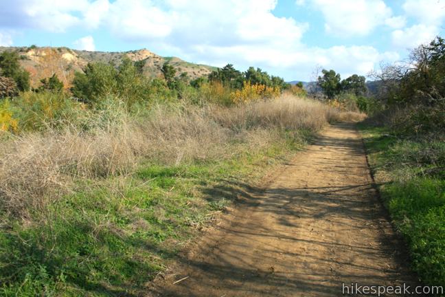
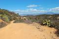
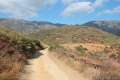
From a parking area at the east end of Carbon Canyon Regional Park, walk southeast for less than a tenth of a mile to the trailhead kiosk for Carbon Canyon Nature Trail. Set out on the dirt single track, which crosses the seasonal (and often dry) Carbon Canyon Creek, beginning a level and leisurely course to the redwood grove.
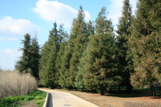
Carbon Canyon Nature Trail is lined by California walnut trees that (unlike the redwoods) are native to this region and thrive in the riparian area along the creek. The trail progresses south along the creek passing signs describing the birds that frequent Carbon Canyon Regional Park and nest in the walnut trees, like California quail, California towhees, black phoebes, western bluebirds, and America robins.
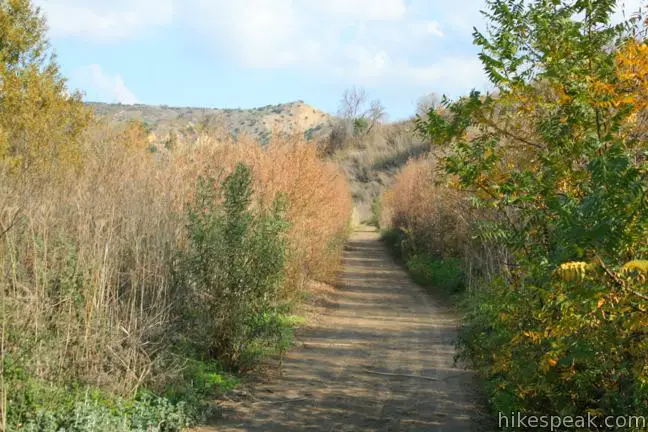
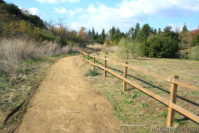
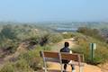
The trail passes a bench just before a junction that is 3/4 of a mile from the start. A trail to the right crosses Carbon Canyon Creek toward an alternate trailhead on the west side of the park (more on that later). For now, stay straight on Carbon Canyon Nature Trail, following the reassuring signs that point toward the redwood grove.
After another 0.2 miles, stay to the left through a junction with a dirt service road that breaks off to the right toward the Carbon Canyon Dam. This route can be used to create a short loop on the return from the redwood grove. Continuing to the left via the main trail, it is another 0.15 miles to the edge of the redwood grove.
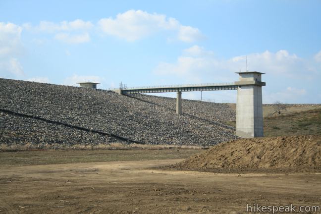
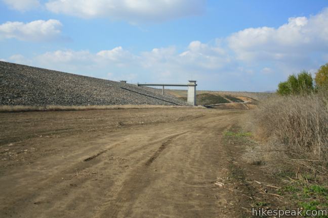
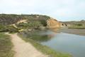
As you near the grove, the Carbon Canyon Dam comes into view. The U.S. Army Corps of Engineers built the dam in 1961, and afterward the land below the flood-control dam was leased to Orange County, allowing for the creation of Carbon Canyon Regional Park in 1975, the same year that the redwood grove was planted.
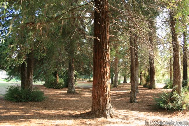
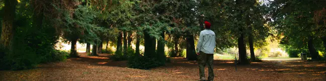
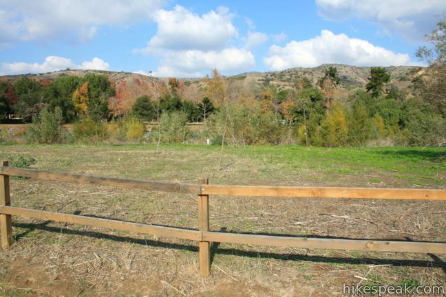
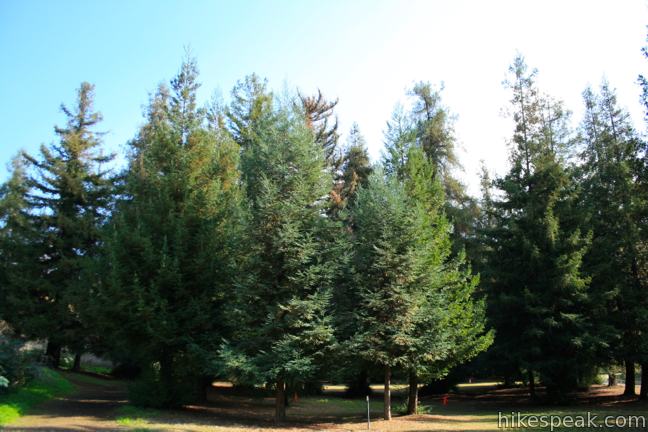
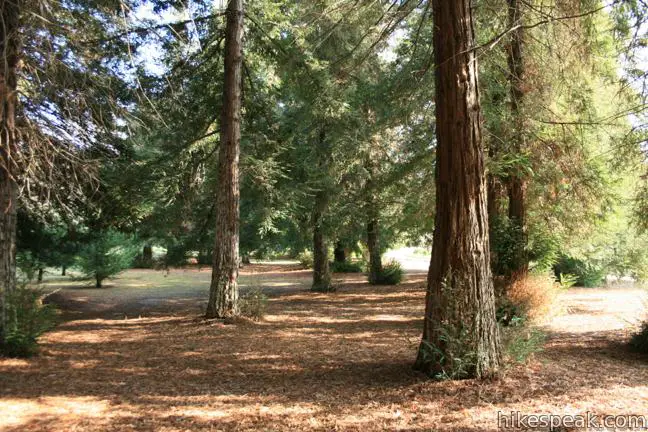
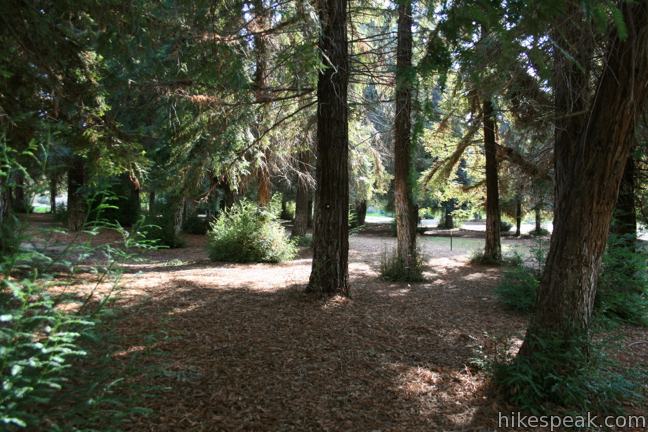
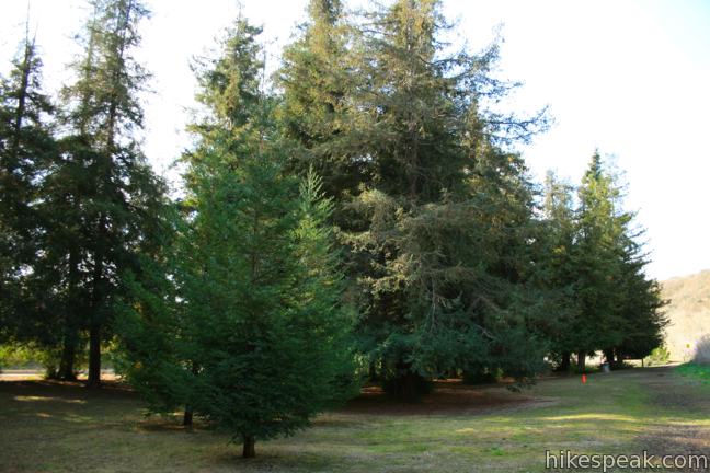
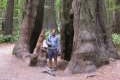
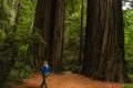
About 1.1 miles from the start, the trail arrives at the seemingly small redwood grove, which is actually Southern California’s largest grove of coastal redwoods. Though coastal redwoods can live to be over 2,000 years old, the planted 10-acre grove in Carbon Canyon Regional Park is only a few decades old. Additionally, Orange County does not offer an ideal climate for the world’s tallest trees to grow as enormous as they can in Northern California.
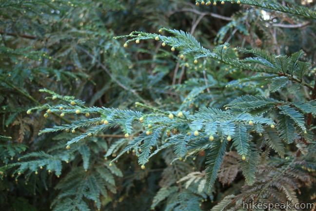
While coastal redwoods can grow to be over 300 feet tall with a diameter of over twenty feet, these redwoods are less than a hundred feet tall and look rail-thin compared to their impressive cousins to the north. Unless you want to drive up to Monterey County (the south end of the coastal redwoods natural habitat), these smaller redwoods will have to do.

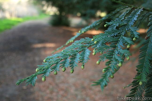
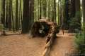
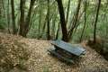
The trail circles the redwood grove past several benches that can be used to take a break beneath the tranquil trees. Over 200 Sequoia Sempervirens (coastal redwoods) are standing in this grove that survive thanks to frequent watering designed to mimic the cool, wet conditions that they enjoy in their natural environment. Instead of a lush forest floor of ferns, sorrel, and abundant fallen needles, like you would find in a natural redwood grove, the ground is covered in mulch, making it easy for you to walk off trails and around all of the trees.
After circling the grove, you may return the way you came or loop back through the park. To make a small loop past the dam, circle around the grove, following a road of concrete (which turns to dirt once you leave the grove, heading west toward Carbon Canyon Dam. The dirt road dips south and passes close to the tall gravel bank of the dam before returning to the main trail after less than half a mile.
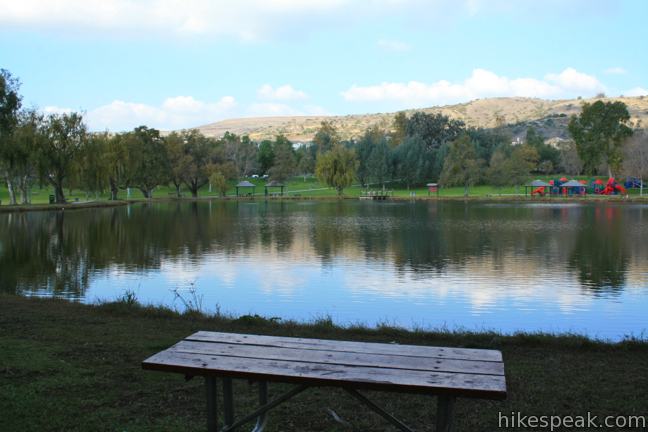
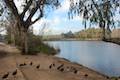
Another shorter route to the grove can be used as a variation of this hike or to create a loop. The main trailhead is found at the east end of Carbon Canyon Regional Park, but the west side of the park has another trailhead that is actually closer to the grove. From this second trailhead near the fishing pond, a dirt trail heads south across Carbon Canyon Creek and connects to Canyon Nature Trail at the junction half a mile from the end of the trail at the back of the grove. This route can be used to for a shorter 1 1/3-mile out and back hike, or to create a 2.25-mile loop incorporating a paved walking trail through the park that connects the two trailheads.
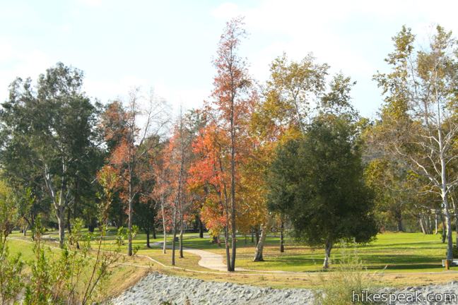
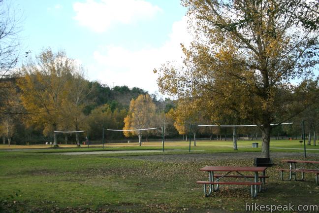
Hiking out and back on Carbon Canyon Nature Trail will give you a 2.5-mile round trip hike with 75 feet of elevation gain. Carbon Canyon Regional Park covers 124 acres and has abundance of amenities like picnic pavilions, tennis courts, volleyball courts, playgrounds, a fishing pond, paved biking and walking trails, and ball fields. Carbon Canyon Regional Park borders the much larger Chino Hills State Park, which preserves 13,000 acres that include several hiking trails. No permit is required to hike Carbon Canyon Nature Trail to the redwood grove, but there is an entrance fee for Carbon Canyon Regional Park ($3 weekdays / $5 weekends). Dogs are welcome in Carbon Canyon Regional Park, so get out and enjoy!
Directions to the Trailhead
- From Route 57, take exit 10 onto Lambert Road.
- Drive east for two miles until Lambert Road becomes Carbon Canyon Road.
- Proceed 0.6 miles and turn right into the main entrance for Carbon Canyon Regional Park.
- Inside the park, turn left when you come to an intersection and drive half a mile east to the last parking lot at the end of the road (which runs parallel to Carbon Canyon Road).
- The trail begins from the southeast corner of the lot.
Trailhead Location
Trailhead address: 4442 Carbon Canyon Road, Carbon Canyon Regional Park, Brea, CA 92823
Trailhead coordinates: 33.920923, -117.82935 (33° 55′ 15.32″N 117° 49′ 45.66″W)
You may also view a regional map of surrounding Southern California trails and campgrounds.


 | Weir Canyon Trail This 3.8-mile loop explores the side of a canyon in a wilderness connected to Santiago Oaks Regional Park near Anaheim. |
 | Lake View Loop & East Ridge Overlook This 3.65-mile loop expands on the 2.7-mile Lake View Loop with a small loop to the high point of Peters Canyon Regional Park. |
 | Lake Huntington This level and easy 3/4-mile loop circles a small lake in Huntington Beach Central Park. |
 | West Bluff Trail Loop This 2.5-mile loop combines trails above and below the West Bluff in Upper Newport Bay Nature Preserve to provide a variety of views across Upper Newport Bay. |
 | Geology Discovery Trail This 9-mile loop in Crystal Cove State Park follows guide markers exploring geology in the beautiful backcountry of this Orange County wilderness. |
 | Moro Beach This 2-mile round trip hike ventures down Moro Canyon to a picturesque beach in Crystal Cove State Park. |
 | Little Sycamore Canyon - Serrano Ridge - Camarillo Canyon - Stagecoach South Trails Loop This 5-mile loop uses four trails to explore two canyons and a ridge in Laguna Coast Wilderness Park. |
 | Heart Rock This 1 to 1.4-mile round trip hike follows a mountain stream to an overlook of an amazing heart-shaped formation in the rock wall along Seeley Creek Falls. |
 | Marshall Peak This 3.25-mile round trip hike reaches a panoramic summit above the foothills of the San Bernardino Mountains. |
 | More hikes in Southern California Explore more trails in Orange, Riverside, San Bernardino, and San Diego counties. |
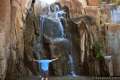
 | Buckeye Trail This hike of 6.5 miles or more passes incredible ocean vistas to reach a trail camp in a redwood grove in the Silver Peak Wilderness. |
 | Durphy Creek Trail - Tan Oak Springs Trail - Lookout Point Loop This 3.75-mile loop climbs 1,000 feet to a forest ridge before descending to Lookout Point, where you can enjoy an unimpressive view to the south. |
 | Founders Grove Nature Trail This 0.5 mile loop explores an ancient grove honoring the founders of the Save-the-Redwoods League in Humboldt Redwoods State Park. |
 | Gould Grove Trail This half mile loop explores an old growth redwood forest across from the visitor center in Humboldt Redwoods State Park. |
 | Stout Memorial Grove Trail This 0.55-mile hike explores an old growth grove of coastal redwoods in Jedediah Smith Redwoods State Park. |
 | Woodland Trail This 1.25-mile loop explores patches of redwoods surrounded by a shaded oak forest in Richardson Grove Redwoods State Park. |
Common Questions about Carbon Canyon Nature Trail to the Redwood Grove in Carbon Canyon Regional Park
- Is the trail open?
- Yes. You should expect to find that Carbon Canyon Nature Trail to the Redwood Grove is open. There are no recent reports of trail closures. If you discover that the trail is closed, please help your fellow hikers by reporting a closure.
- Do I need a permit for this hike?
- Yes. Park Entrance Fee.
- How much time does this hike take?
- It takes approximately 1 hour to hike Carbon Canyon Nature Trail to the Redwood Grove. Individual hiking times vary. Add extra time for breaks and taking in the views.
- How long is this hike?
- The hike to Carbon Canyon Nature Trail to the Redwood Grove is a 2.5 mile out and back with 75 feet of elevation change.
- Are dogs allowed on this trail?
- Yes, dogs are allowed on Carbon Canyon Nature Trail to the Redwood Grove. The trail is open to hikers, dogs.
- Are there redwood trees on this hike?
- Yes, Carbon Canyon Nature Trail to the Redwood Grove passes through a grove of redwood trees.
- Where is the trailhead located?
- The trailhead for Carbon Canyon Nature Trail to the Redwood Grove is located in Brea, CA.
Trailhead Address:
4442 Carbon Canyon Road
Brea, CA 92823
Trailhead Coordinates:
33.920923, -117.82935 - What are the driving directions to the start of the hike?
To get to the trailhead: From Route 57, take exit 10 onto Lambert Road. Drive east for two miles until Lambert Road becomes Carbon Canyon Road. Proceed 0.6 miles and turn right into the main entrance for Carbon Canyon Regional Park. Inside the park, turn left when you come to an intersection and drive half a mile east to the last parking lot at the end of the road (which runs parallel to Carbon Canyon Road). The trail begins from the southeast corner of the lot.
View custom Google Maps directions from your current location.
- Are there other trails near Carbon Canyon Nature Trail to the Redwood Grove?
- Yes, you can find other nearby hikes using the Hikespeak Hike Finder Map.

Nice find! Can’t wait to check this out
Is carbon Canyon dog friendly?
dogs are allowed on a leash. Enjoy your hike!
I just went on this hike today. I brought my medium sized dog and received dirty looks when I let him off leash. Their leash laws are strongly enforced. The grove itself is quite small and at the end of a short hike, paved in sand.
While the park is lovely,(and quite comparatively empty of people)I won’t be returning as I find the hike to be too short, the sand is difficult to walk on, and I prefer hikes my dog can roam off leash. The park is the real attraction here- the grove just a small perk. This isn’t a hike, it’s a short walk to a small grouping of trees.
Good, please stay away. Allowing your dogs to roam free ruins the hike for most people – lame.
Why would a benign dog roaming free ruin your hike? I think you should be leashed up. See how it feels.
Because the unexpected can always happen. Your dog may be set off by another owner’s leashed dog, come up to a child, etc etc
Funny you should write this. Yesterday, April 25, 2021, untethered chihuahua versus leashed pit bulls mix. It was not pretty. RIP little guy. Your owner did not love you enough to do the right thing. Lots of witnesses.
Agreed. That is why there are leash laws and dog parks and dog beaches.
I’ll make sure to stay away from hiking trails that allow dogs off leash to avoid selfish tools like you who willing to allow or intentionally have their dogs to attack innocent people. What kind of world are we coming to where dogs have more rights than humans?
WHAT IS THE TALLEST ONE?
HOW MUCH WATERING?
Have been here twice! Nice hike, redwood grove is the best part of it. A must and easy one for anyone.
Terrific article and beautiful pictures! Who knew!? I explored this area and had a question: there is a trail above this one that sits just below homes and is guarded with a white wood fence. Any idea about what this trail is or how to connect to it?
Hi, Than trail seems to go all around the neighborhood behind the redwood grove. There is a trail on the south side of the redwood the connects up to it.
You can get into the trail head at the end of Prospect off of Imperial Hwy. Park on the street and walk in. You can take the trail down to the red woods or stay on the upper trail (one with the white fence) to the right and go around behind the housing track. I love it out there!
I’ve done “Yellow Post” camping throughout the San Bernardino County Forest, and I noticed yellow posts throughout the Redwood grove… can you camp primitively here (ie no fire/water supply) overnight?
The Santa Barbara Botanic Garden has a short stretch of very nice redwoods. When you enter the redwood area you feel immediately peaceful. They are remarkable trees. It is worth visiting the botanic garden just for that short bit of redwood trail.
Do I need a photography permit if I take my camera?
Yes you do. If rangers see you with photography equipment without a permit you will be in trouble.
How big are the redwoods in the park?
How far is it from seal Beach?
Are there picnic tables in the Redwood grove?
Is it accessible for a person with a walker?
We found the redwoods and made a short video on them: https://youtu.be/kn6NPyGkkgY
where do I get a permit to take photo’s with my phone?
Stroller friendly?
Hi, I really appreciate how nicely this trail review printed out. Font size was 12, and there were no ads cluttering margins or between paragraphs. I was able to use the printed copy straight off the printer and onto the trail, with no need to edit first. Thanks very much!