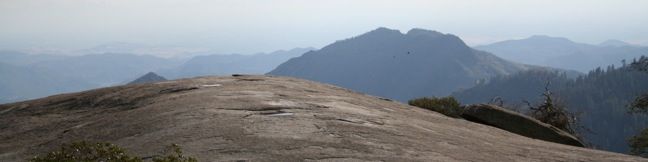
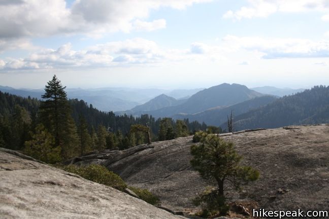
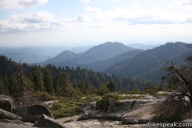
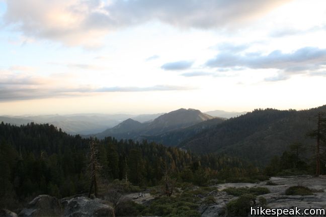
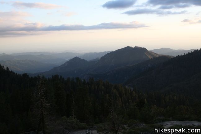
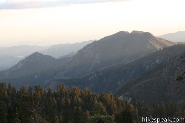
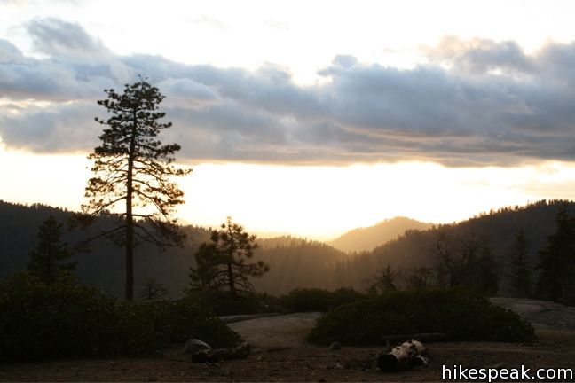
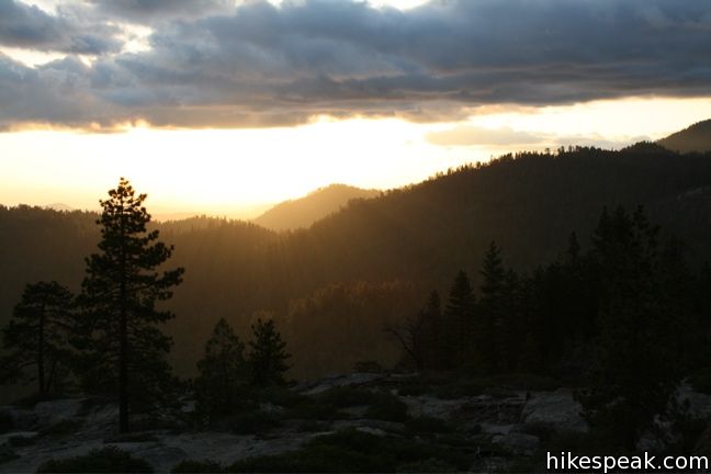
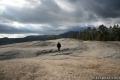
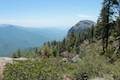
Beetle Rock looks down on the foothills of the Sierra Nevada Mountains from Giant Forest in Sequoia National Park and delivers tremendous views with little effort. While it doesn’t really qualify as a hike, (although those determined to hike to this granite dome can do so) the rock is definitely worth checking out.
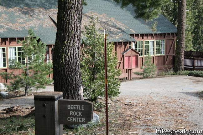
On the south side of the Giant Forest Museum parking lot, a short paved road leads up to the Beetle Rock Center, a facility for educational groups that are studying the park. If the road is open, it is possible to drive right up to Beetle Rock. If not, it is only a short walk up to this large granite slope with impressive views to the south and west.
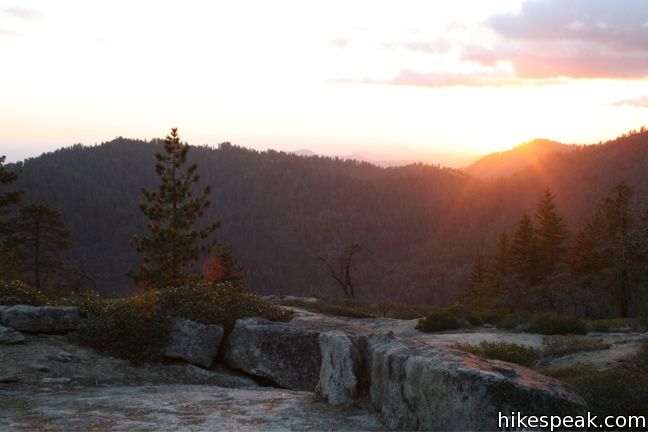
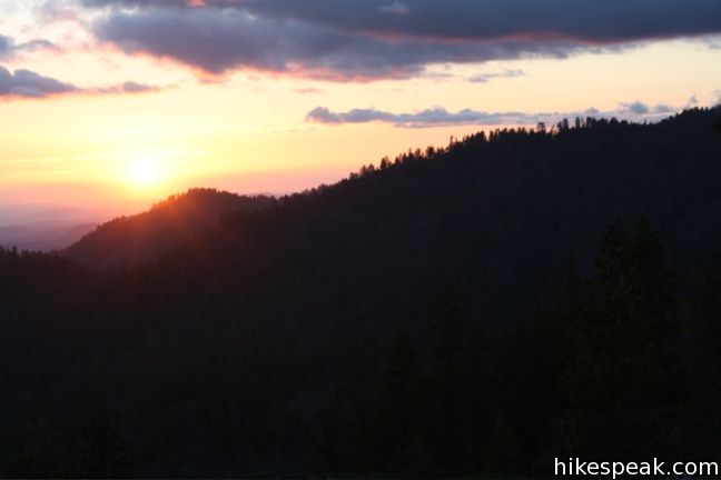
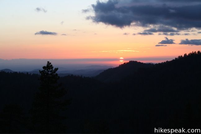
Much like nearby Sunset Rock, Beetle Rock is a great place to watch the sunset. Speaking of names, if you would like to impress people with your knowledge of park trivia, slip into conversation that Beetle Rock was named for the Trachykele Opulenta Beetle that was discovered here in 1905.
Those eager to hike may reach Beetle Rock as part of a half mile loop. Take the Sunset Rock Trail down to Little Deer Creek. Turn left and take the path that follows alongside the creek, before curving to the left and up to Beetle Rock.
Directions to the Trailhead
- From the Generals Highway, enter the parking lot across from the Giant Forest Museum and take the marked road south of the lot.
Trailhead address: Generals Highway (California 198), Sequoia National Park, CA 93262
Beetle Rock coordinates: 36.5647, -118.77425 (36° 33′ 52.9″N 118° 46′ 27.3″W)
You may also view a regional map of surrounding Sierra Nevada trails and campgrounds.


 | Sunset Rock This 2-mile hike visits a large granite dome with great views to the west, possibly the best place to end your day in the Giant Forest. |
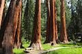 | Big Trees Trail This 1.4-mile stroll explores giant sequoias around Round Meadow on a paved nature trail that is easy, educational, and beautiful. |
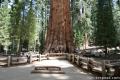 | General Sherman Tree This one-mile hike visits the world's biggest tree, a 275-foot tall Giant Sequoia that is 36.5 feet across at the base. |
 | Congress Loop This easy paved two mile loop visits the fourth and fifth tallest Sequoias in the world (among others). |
 | Hanging Rock Trail This short 0.35-mile hike passes views of Moro Rock en route to a balancing boulder on a canyon rim at the edge of the Giant Forest. |
 | Moro Rock This 0.6 mile hike sports panoramic views and should be considered a mandatory hike for first time visitors to Sequoia National Park. |
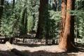
 | Crescent Meadow This level 1.6-mile loop visits a Sequoia you can stand inside (Chimney Tree) and another that someone used to live in (Tharp's Log). |
 | Sugar Pine Trail and Bobcat Point Trail Loop This short but diverse 1.5-mile loop peaks at Bobcat Point, which presents a fierce perspective of Moro Rock and a massive canyon. |
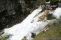
 | Tokopah Falls This 4.2-mile hike reaches the base of the tallest waterfall in Sequoia National Park. |
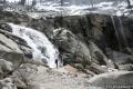
 | Marble Falls This 8-mile hike takes a flower-lined path up a mountain canyon to a powerful waterfall. |
 | Paradise Creek This short stroll leaves Buckeye Flat Campground to visit the perfect swimming hole for a hot summer day in the Sierra. |
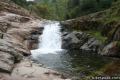
 | Panther Creek This 6-mile hike follows the Middle Fork Trail to a 100 foot waterfall that drops into the Middle Fork of Kaweah River. |
 | More trails in the Sierra Nevada Mountains Explore other destinations in Sequoia National Park and the rest of the range. |
 | Sequoia and Kings Canyon National Parks Campgrounds There are 14 campgrounds with over 1,000 total sites spread throughout the park to facilitate your visit. |
Common Questions about Beetle Rock in Sequoia National Park
- Is the trail open?
- Yes. You should expect to find that Beetle Rock Trail is open. There are no recent reports of trail closures. If you discover that the trail is closed, please help your fellow hikers by reporting a closure.
- Do I need a permit for this hike?
- Yes. National Park Entrance Fee.
- How much time does this hike take?
- It takes approximately 15 minutes to hike Beetle Rock Trail. Individual hiking times vary. Add extra time for breaks and taking in the views.
- How long is this hike?
- The hike to Beetle Rock Trail is a 0.25 mile out and back with 50 feet of elevation change.
- Are dogs allowed on this trail?
- No, dogs are likely not allowed on Beetle Rock Trail. The trail is primarily open to hikers.
- Is Beetle Rock Trail good for kids?
- Yes, this hike is likely suitable for children. It is relatively short (0.25 miles) with manageable elevation gain.
- Where is the trailhead located?
- The trailhead for Beetle Rock Trail is located in Sequoia National Park, CA.
Trailhead Address:
Generals Highway
Sequoia National Park, CA 93262
Trailhead Coordinates:
36.5647, -118.77425 - What are the driving directions to the start of the hike?
- To get to the trailhead: From the Generals Highway, enter the parking lot across from the Giant Forest Museum and take the marked road south of the lot.
View custom Google Maps directions from your current location. - Are there other trails near Beetle Rock Trail?
- Yes, you can find other nearby hikes using the Hikespeak Hike Finder Map.

Is there any damage from the fire