Badwater Basin
in Death Valley National Park
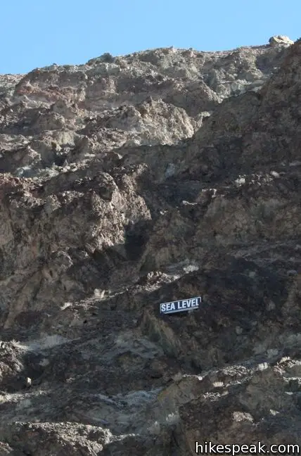
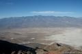
Badwater Basin is a must-stop on any first trip to Death Valley National Park. The elevation here is -282 feet, making this the lowest locale in North America. A wooden Sea Level plaque 282 feet over Badwater Basin lets visitors know just how low they’ve come.
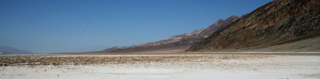
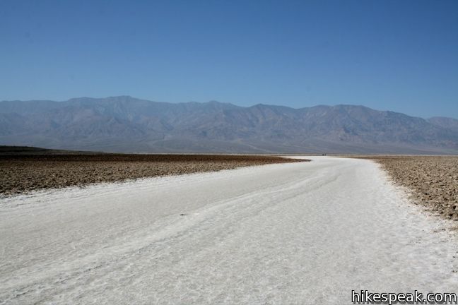
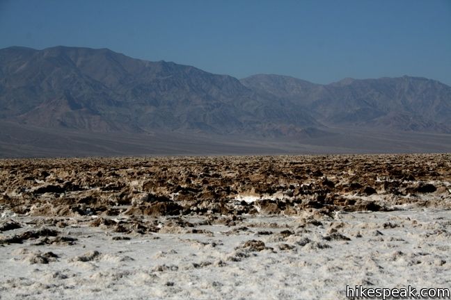
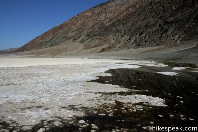
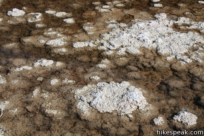
Being able to brag about how far below sea level you’ve been is not the only reason to stop at Badwater Basin. Because this area gets so little rainfall (less than two inches annually) and no water can flow out of the basin, the water gets trapped and evaporates, leaving behind mineral deposits that cover the basin like a salty dusting of snow.
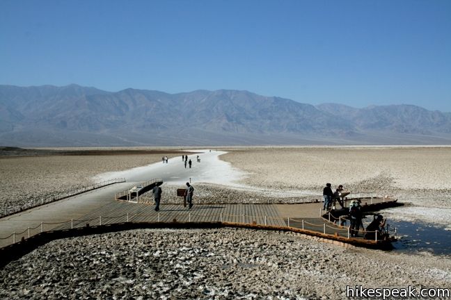
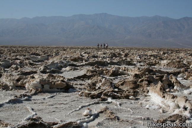
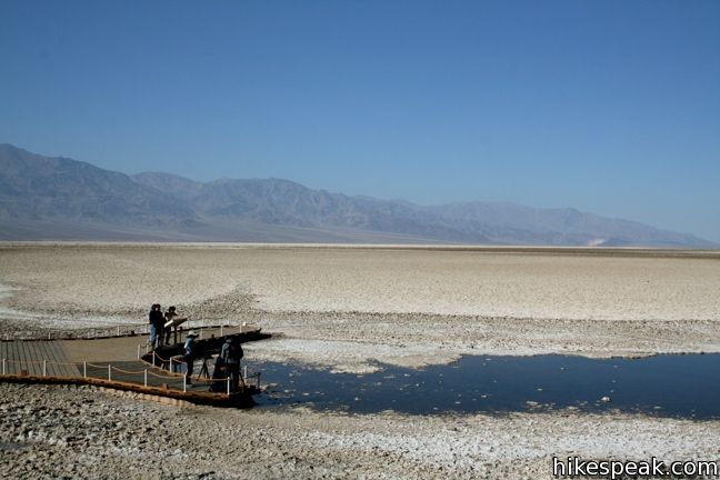
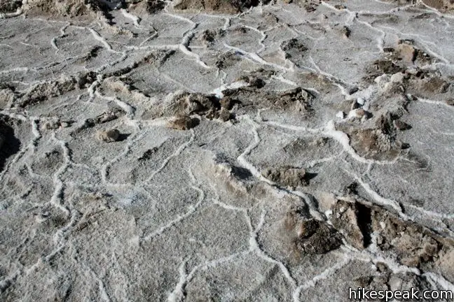
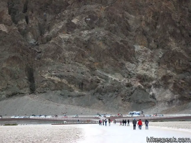
A boardwalk allows for a bizarre walk across the basin, and is the best way to take in the unique surroundings. The surface is made up of a chaotic network of rough fissures created when newer salt breaks out from beneath the crust. Stepping across this barren bed of NaCl offers a clear understanding of the extreme harshness of survival in Death Valley.
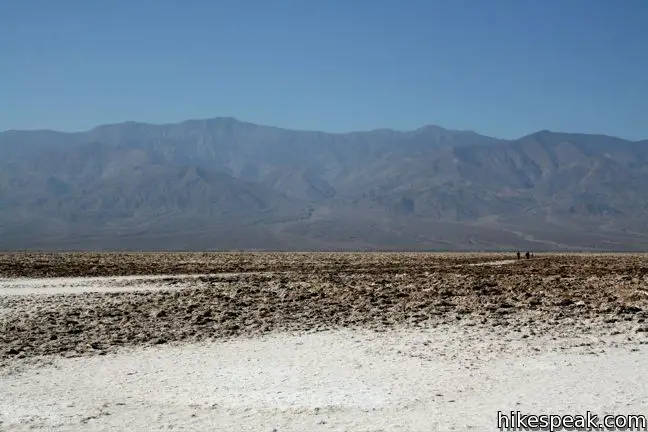
Across the valley rises the 11,049-foot tall Telescope Peak, the tallest in Death Valley. Mount Whitney, the highest point in the lower 48, is less than 100 miles away.
To look down on Badwater Basin from the Black Mountains behind the boardwalk, visit Dante’s View 5,700 feet above.
Directions to the Trailhead
- From Furnace Creek, drive seventeen miles south on Badwater Road.
- The parking area for Badwater Basin will be on the right.
- The road passes Artist's Drive, another worthy attraction with unique Death Valley geology.
Trailhead Location
Trailhead address: Badwater Basin, Badwater Road, Death Valley National Park, Death Valley, CA 92328
Trailhead coordinates: 36.2301, -116.7671 (36° 13′ 48.4″N 116° 46′ 01.6″W)
You may also view a regional map of surrounding California Desert trails and campgrounds.

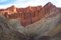
 | Artist's Drive This 9-mile drive crosses a sloping mountainside composed of vibrant soil colored by rich metals. |
 | Dante's View This towering overlook above Badwater Basin offers panoramic views of Death Valley. |
 | Golden Canyon - Gower Gulch Loop This 4-mile loop visits stunning terrain in the badlands region near Furnace Creek. |
 | Natural Bridge Canyon The 2-mile round trip hike up Natural Bridge Canyon is a great trek for those interested in learning about the geological history of Death Valley |
 | Sidewinder Canyon This 4 to 7-mile hike visits narrow slot canyons full of pour-overs, carve outs, and dark passages that beg to be explored. |
 | Death Valley Explore more destinations in Death Valley National Park. |
 | Death Valley Campgrounds Nine campgrounds are spread throughout this large park to facilitate your visit. |
Common Questions about Badwater Basin in Death Valley National Park
- Is the trail open?
- Yes. You should expect to find that Badwater Basin is open. There are no recent reports of trail closures. If you discover that the trail is closed, please help your fellow hikers by reporting a closure.
- Do I need a permit for this hike?
- Yes. National Park Entrance Fee.
- How much time does this hike take?
- It takes approximately 30 minutes to hike Badwater Basin. Individual hiking times vary. Add extra time for breaks and taking in the views.
- How long is this hike?
- The hike to Badwater Basin is Up to 1 mile or more (out and back) with 10 feet of elevation change.
- Are dogs allowed on this trail?
- No, dogs are likely not allowed on Badwater Basin. The trail is primarily open to hikers.
- Is Badwater Basin good for kids?
- Yes, this hike is likely suitable for children. It is relatively short (1 miles) with manageable elevation gain.
- Where is the trailhead located?
- The trailhead for Badwater Basin is located in Death Valley, CA.
Trailhead Address:
Badwater Road
Death Valley, CA 92328
Trailhead Coordinates:
36.2301, -116.7671 - What are the driving directions to the start of the hike?
To get to the trailhead: From Furnace Creek, drive seventeen miles south on Badwater Road. The parking area for Badwater Basin will be on the right. The road passes Artist's Drive, another worthy attraction with unique Death Valley geology.
View custom Google Maps directions from your current location.
- Are there other trails near Badwater Basin?
- Yes, you can find other nearby hikes using the Hikespeak Hike Finder Map.

[…] This trail allows you to walk to the lowest place in the U.S. As one might expect from a spot in Death Valley, the walk can be punishingly hot, so it’s best to look at the weather, bring a hat and go in the winter. Two-hundred and eighty-two feet below sea level, this 1.8-mile out and back trail gives you incredible views. With a long boardwalk, the view — but not the entirety of the trail — is available to wheelchair users. The cracked ground shows hexagons where water evaporates quickly on the salt flats. Get more info and directions here. […]