Sidewinder Canyon
in Death Valley National Park
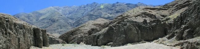
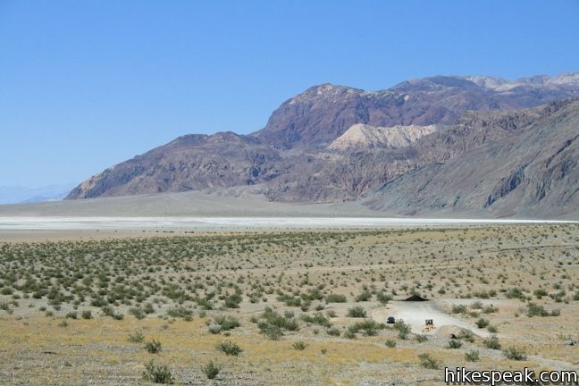
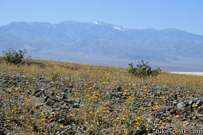
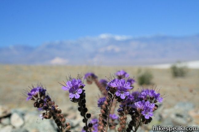
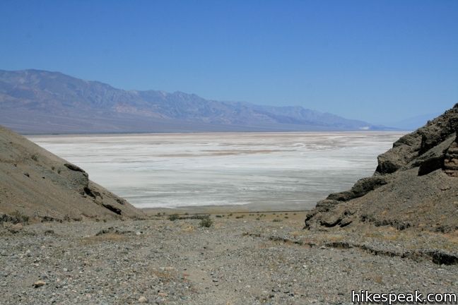
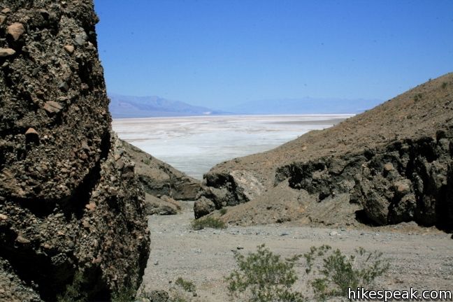
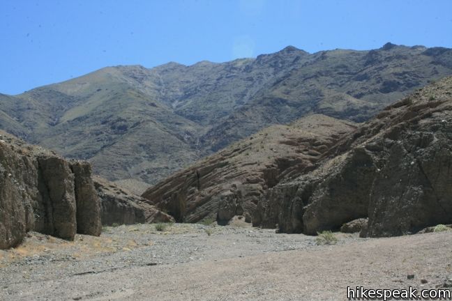
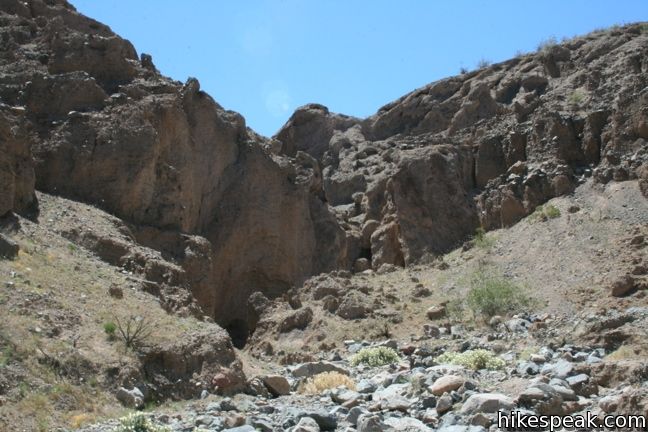
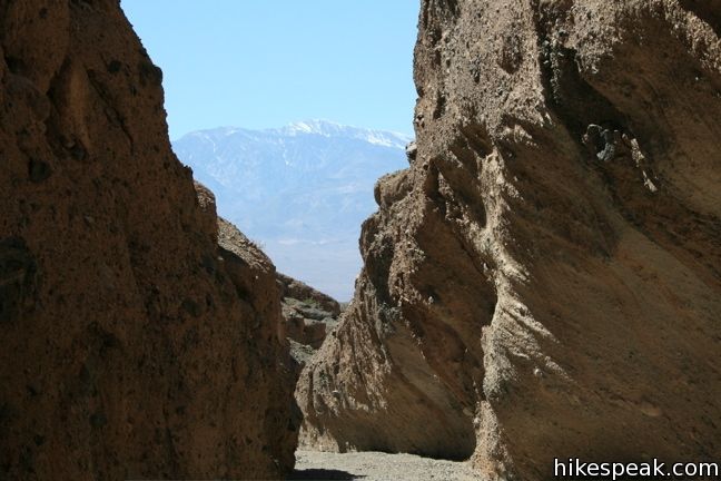
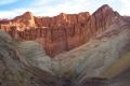
Sidewinder Canyon is located at the base of the Black Mountains on the east side of Death Valley National Park south of Badwater Basin. The canyon is fairly wide with a gravel bottom and forty-foot stone walls on both side. Within these walls lie tight slot canyons with pour-overs, carve outs, and dark passages that beg to be explored. There are three slot canyons off the south wall of the canyon and other slightly wider side canyons worth experiencing. The trailhead is unmarked and the trail only has occasional cairns along the way for guidance, creating a remote trek in a Death Valley canyon.
The narrow slots are not GPS friendly, so the exact length of this hike is difficult to provide. Plan to hike about four miles. The trailhead lies at 240 feet below sea level and the start of the third slot is around 400 feet above.
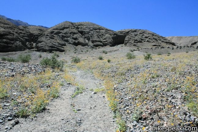
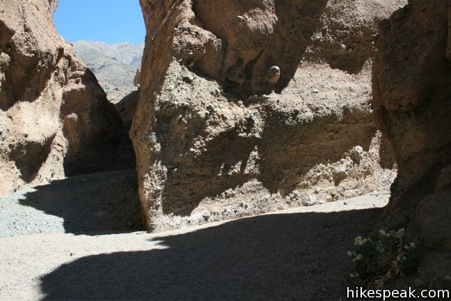
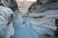
The mouth of the canyon is difficult to spot from the trailhead. Begin hiking south toward the gravel fan exiting the canyon. Cairns and footprints will appear, marking the way. After 0.4 miles, the path enters the canyon. Turn left and march up the semi-steep gravel. A side canyon on the left and another on the right come before the first real slot canyon. The side canyon to the left climbs gradually up out of the canyon, while the canyon on the right goes back for some distance before dead-ending at a dry falls. Either is worth checking out, especially on the way back.
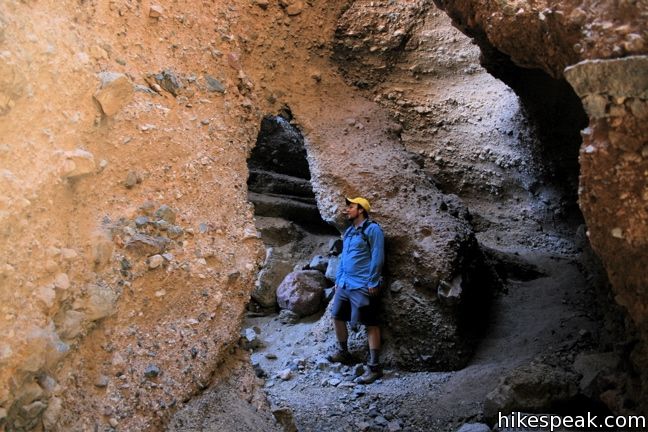
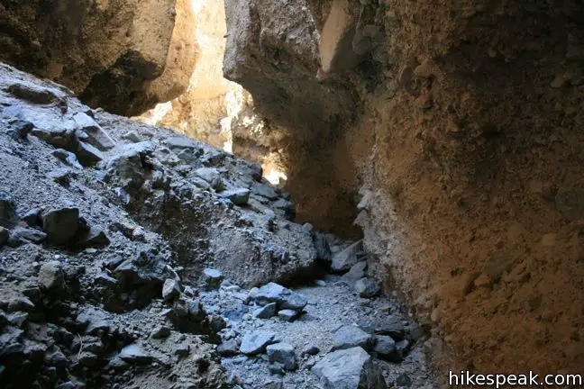
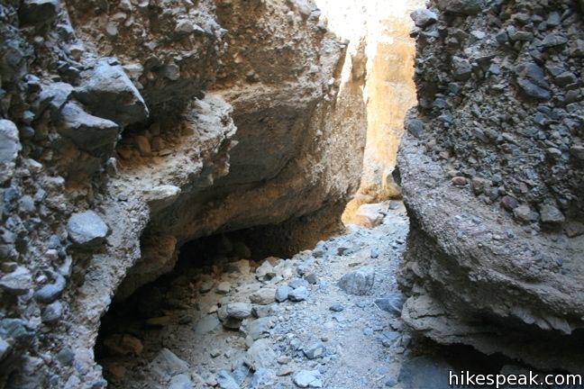
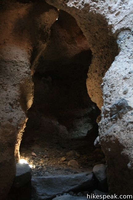
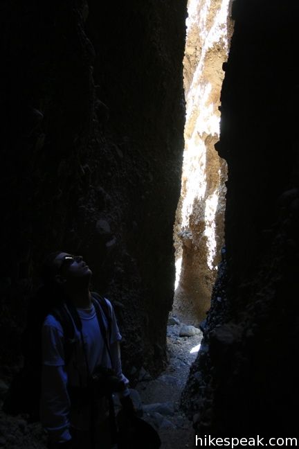
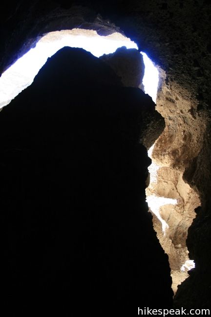
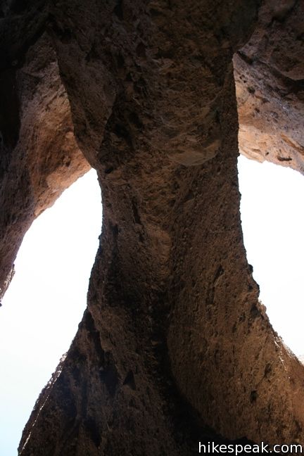
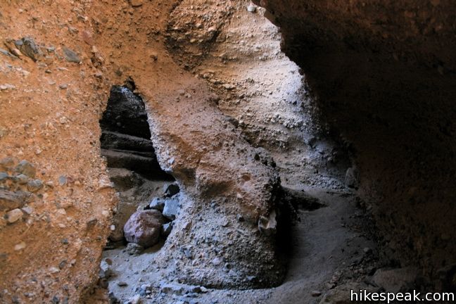
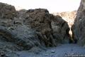
The first slot canyon is the most interesting. It has areas so dark a flashlight is required, and venturing up its narrow winding passages feels like an adventure into uncharted territory.
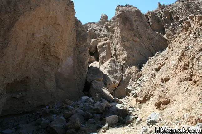
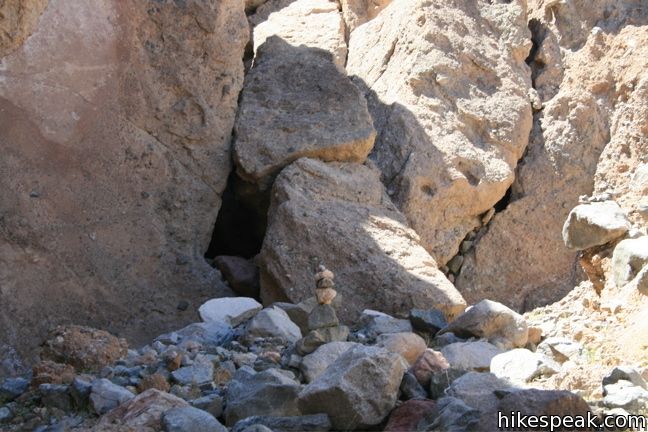
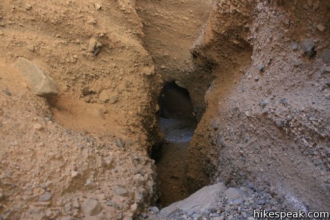
Finding the slot is a bit tricky. Look for a wide opening on the right side (south side), 0.6 miles from the mouth of the canyon. The entrance to the slot canyon is on the left side of the opening, covered over with large boulders.
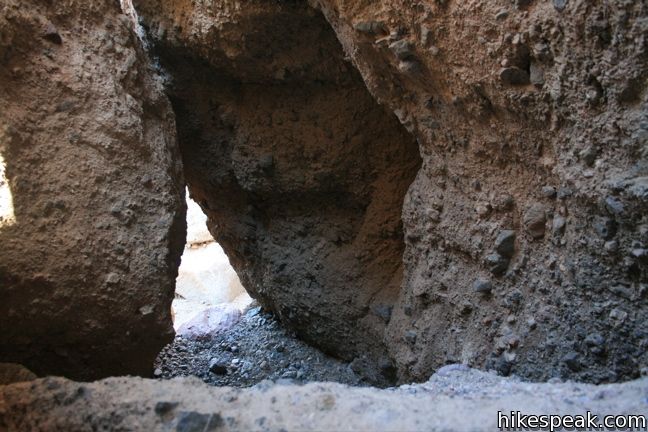
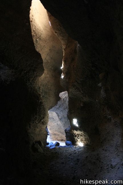
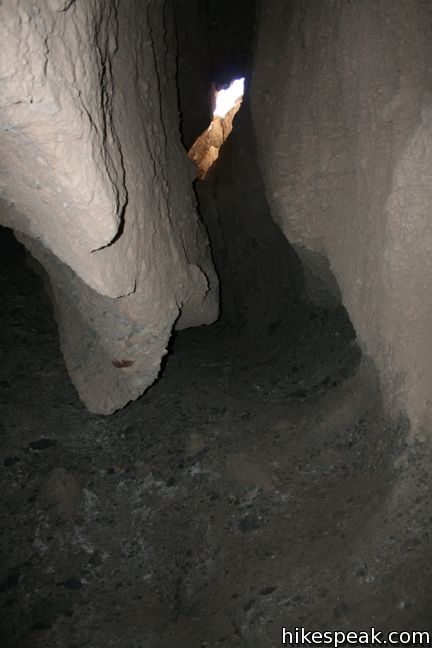
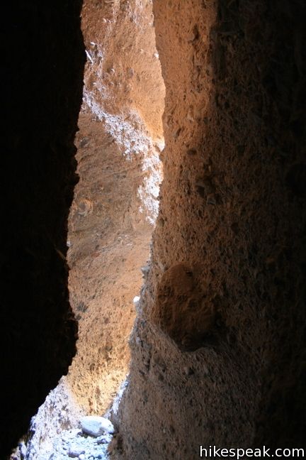
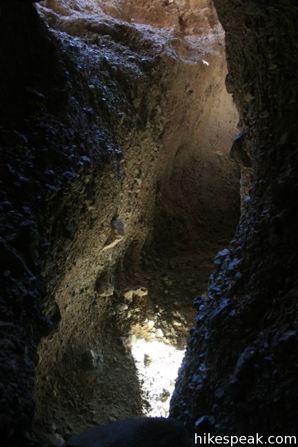
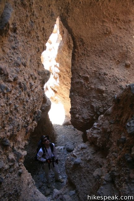
Only a small window exists through which to access the slot. Climb through the opening and around the boulders lodged in the entryway. It’s hard to believe this is way, but it is. Beyond the boulders, the canyon is clear but only a few feet wide with numerous elegant bends and sharp curves.
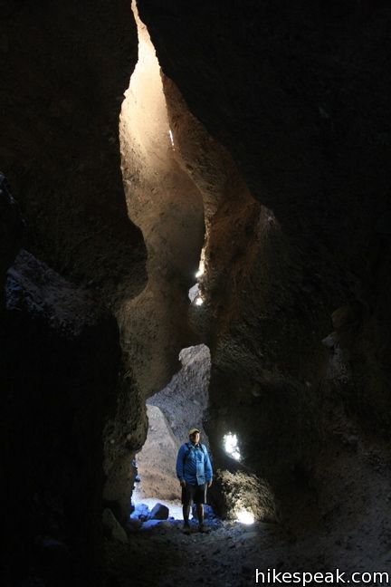
It takes about five minutes to reach a point where technical climbing is required to continue. This comes at the back of a dark chamber, where the walls curl in overhead, allowing for only small windows of light. The canyon is incredibly dark – creepy dark – but there is also something exciting about stepping into a place like this. If you are not prepared to climb up a steep rock wall in a dark grotto, turn around and head back to Sidewinder Canyon.
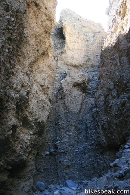
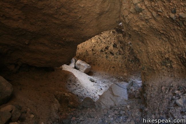
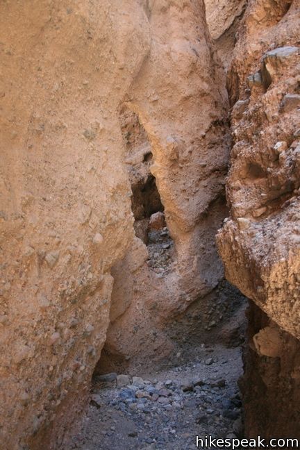
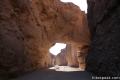
The second slot comes just a tenth of a mile farther. The entrance is not hidden this time, just look for the next obvious departure on the south wall. Slot two is about three times longer than the first, but without the dramatic dark passages. What the canyon does have is an archway carved out by the floodwaters that created these canyons. Past the arch, the canyon widens dramatically before narrowing again. The canyon has about ten pour-overs of a few feet in height to climb up, leading to a 12-foot dry falls that prevents non-climbers from continuing.
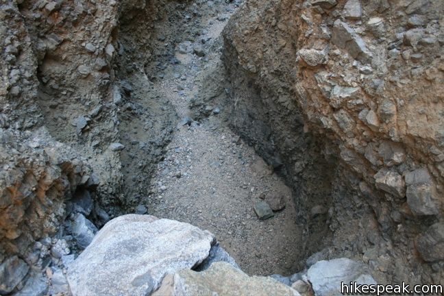
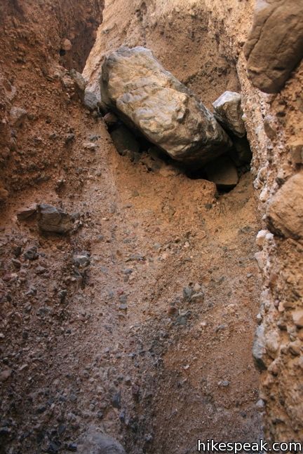
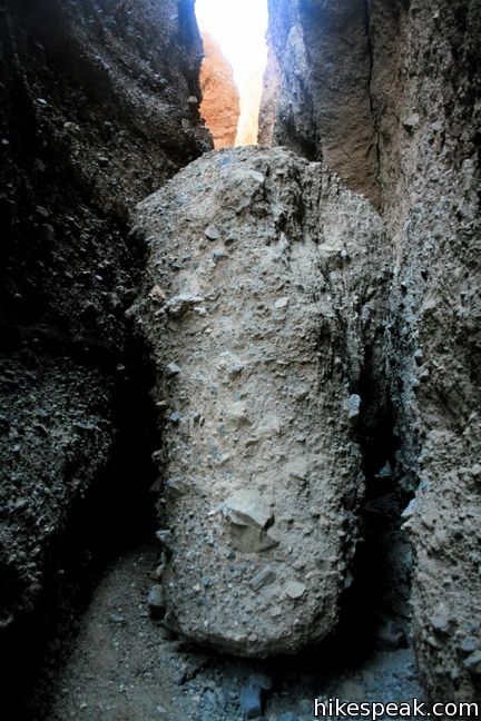
The third slot is a quarter mile past the second, but its explore-ability has been diminished by heavy rains that swept gravel down the canyon in the spring of 2010. A large boulder not far from the start of the canyon halts hiker’s advancement. Previously, one could crawl through a space around the base of the rock, but too much gravel has deposited there now to continue that way. It would be possibly to chimney up the side of the chokestone, but descending the other side might prove challenging, and this would not be good place to break a leg. A fine arch is just beyond the entrance to the third slot, so it is still worth venturing in to the chokestone.
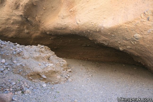
Sidewinder Canyon continues beyond the slots, narrowing considerably. Just past the third slot is a large overhang on the south wall of the canyon where floodwaters have carved out the rock. Continue up canyon for another mile, or return to the trailhead.
The walk down over the lose gravel takes far less time than the ascent. In this direction you are also treated to a nice view of Telescope Peak. A hike up the neighboring Willow Canyon begins from the north end of the trailhead parking lot for those with additional time and energy.
Directions to the Trailhead
- From Furnace Creek, drive 31.2 miles miles south on Badwater Road (15 miles past Badwater Basin) and turn east (left) on an unmarked dirt road on the outside of a sharp bend in the road.
- Drive through a small working gravel pit and turn right into the southern end of the parking area not far from Badwater Road.
Trailhead Location
Trailhead address: Badwater Road, Death Valley National Park, CA 92328
Trailhead coordinates: 36.0650, -116.7448 (36° 03′ 54″N 116° 44′ 41.3″W)
View Death Valley National Park in a larger map
Or view a regional map of surrounding California Desert trails and campgrounds.
 | Natural Bridge Canyon The 2-mile round trip hike up Natural Bridge Canyon is a great trek for those interested in learning about the geological history of Death Valley. |
 | Golden Canyon - Gower Gulch Loop This 4-mile loop visits some of the most stunning terrain in Death Valley. |
 | Mosaic Canyon This 1 to 4-mile hike starts up a smooth marble slot canyon and exposes visitors to unique Death Valley geology. |
 | Grotto Canyon This 2 to 4 mile hike requires a bit of climbing and is a lesser-visited trail in Death Valley. |
 | Death Valley Explore more destinations in Death Valley National Park. |
 | Death Valley Campgrounds Nine campgrounds are spread throughout this large park to facilitate your visit. |
Common Questions about Sidewinder Canyon in Death Valley National Park
- Is the trail open?
- Yes. You should expect to find that Sidewinder Canyon Trail is open. There are no recent reports of trail closures. If you discover that the trail is closed, please help your fellow hikers by reporting a closure.
- Do I need a permit for this hike?
- Yes. National Park Entrance Fee.
- How much time does this hike take?
- It takes approximately 3 hours 15 minutes to hike Sidewinder Canyon Trail. Individual hiking times vary. Add extra time for breaks and taking in the views.
- How long is this hike?
- The hike to Sidewinder Canyon Trail is a 7 mile out and back with 750 feet of elevation change.
- Are dogs allowed on this trail?
- No, dogs are likely not allowed on Sidewinder Canyon Trail. The trail is primarily open to hikers.
- Where is the trailhead located?
- The trailhead for Sidewinder Canyon Trail is located in Death Valley National Park, CA.
Trailhead Address:
Badwater Road
Death Valley National Park, CA 92328
Trailhead Coordinates:
36.0650, -116.7448 - What are the driving directions to the start of the hike?
To get to the trailhead: From Furnace Creek, drive 31.2 miles miles south on Badwater Road (15 miles past Badwater Basin) and turn east (left) on an unmarked dirt road on the outside of a sharp bend in the road. Drive through a small working gravel pit and turn right into the southern end of the parking area not far from Badwater Road.
View custom Google Maps directions from your current location.
- Are there other trails near Sidewinder Canyon Trail?
- Yes, you can find other nearby hikes using the Hikespeak Hike Finder Map.

6 Comments on Sidewinder Canyon in Death Valley National Park
What hikers are saying:
✨ Generated summary of user commentsHikers describe these slot canyons as beautiful yet slightly creepy, offering an immersive desert experience. Kevin advises travelers to go beyond the eight-foot wall in the second slot, as climbing it reveals a path that continues to the peak for superior views. While standard clearance vehicles can reach the start of the trail from Badwater Road, drivers must remain alert for washed-out sections along the way.
“the slots are pretty amazing and a little creepy” Jump to comment ↓
I have been here. Its such a beautiful place
I hiked Sidewinder in 2011, the slots are pretty amazing and a little creepy, well worth the drive and the hike up the fan to the canyon mouth.
We hiked this Dec 2016. Fantastic! However in the second slot don’t stop at the supposed “12ft wall” It’s about 8 ft and is easily climbed. After that the slot just keeps going and going and getting better! You can actually hike it all the way to the top of the peak and look over the other side! Well worth the time.
Great note. Sounds like you had a fun hike!
Is the trailhead head accessible without a 4WD High clearance vehicle? Going to be there next month and looking for interesting hikes I can do without an offroad vehicle. Thanks in advance for your time.
Hi-
You should be able to get in there with a standard clearance vehicle. Look out for washed-out spots just in case. It isn’t far from Badwater Road to the start of the trail.