Natural Bridge Canyon
in Death Valley National Park

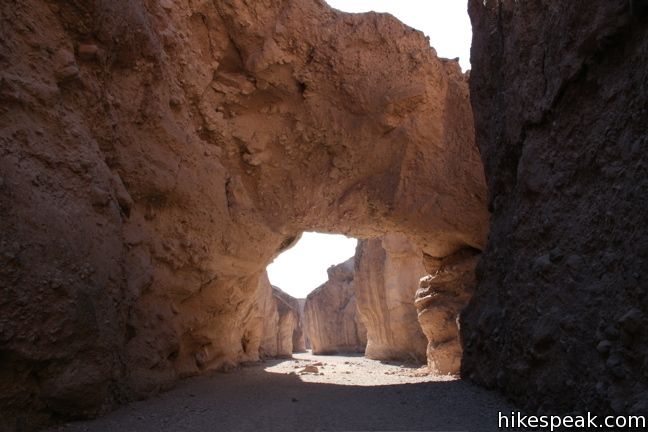
The 2-mile round trip hike up Natural Bridge Canyon is a great trek for those interested in learning about the geological history of Death Valley National Park. Also, the natural bridge is just cool to walk under.
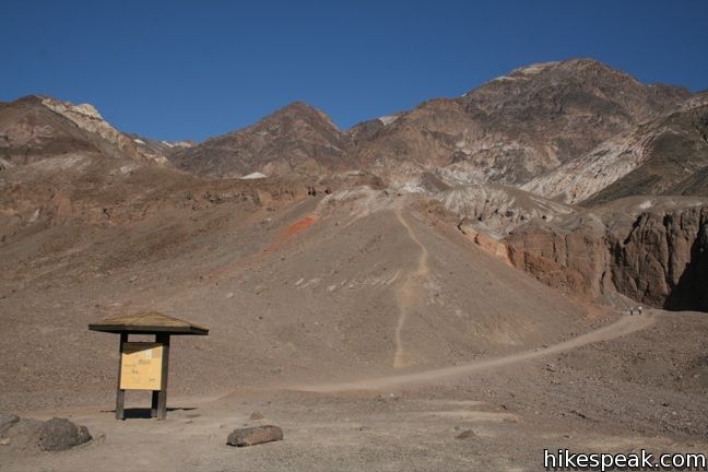
A panel at the trailhead provides illustrations of the various geological features visible in the canyon, making it easy for hikers to spot the faults, chutes, and mud drippings along the way.
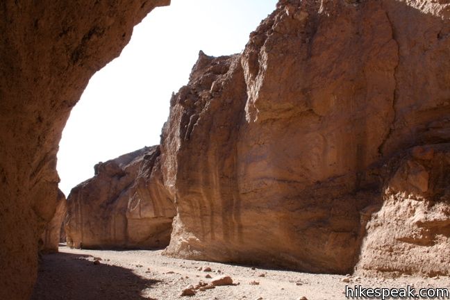
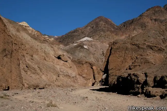
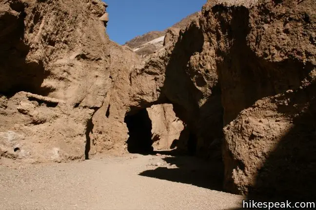
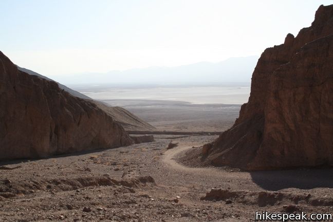
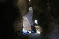
From the panel, the trail quickly enters the mouth of the canyon. The gravel floor makes hiking uphill a bit tiresome (but hiking back down is a breeze). Half a mile from the start, the walls of the canyon narrow and the 50-foot tall natural bridge spans the canyon.
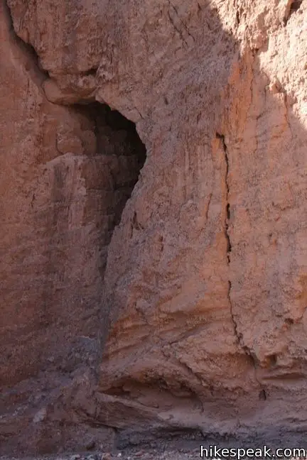
Differential erosion created the impressive bridge. This is the main attraction of the hike of course, but the canyon has more to offer.
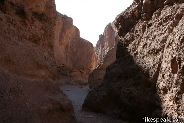
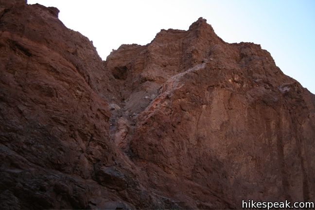
Continue under the bridge and the canyon will bend past a dry falls that pours into the canyon. Thousands of years ago, a stream flowed into the canyon here. The long vertical chute was created when the canyon eroded much more rapidly than the stream bed above.
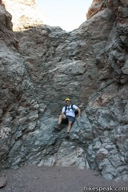
The trail then presents two easy obstacles. Scrunch down to get around a large bolder lodged in a narrow part of the canyon. Then cross a sloping marble dry falls, which can be easily climbed, before coming to a 20-foot dry falls that cannot. The trail stops here. Turn around and hike back out the canyon, enjoying another passage under the nature bridge.
Directions to the Trailhead
- From Furnace Creek, drive 13 miles south on Badwater Road and turn east (left) on to a dirt road toward Natural Bridge Canyon.
- It is 1.5 miles from Badwater Road to the trailhead.
Trailhead Location
Trailhead address: Natural Bridge Road, Death Valley National Park, CA 92328
Trailhead coordinates: 36.28115, -116.7699 (36° 16′ 52.1″N 116° 46′ 11.6″W)
View Death Valley National Park in a larger map
Or view a regional map of surrounding California Desert trails and campgrounds.


 | Golden Canyon - Gower Gulch Loop This 4-mile loop visits stunning terrain in the badlands region near Furnace Creek. |
 | Artist's Drive This 9-mile drive crosses a sloping mountainside composed of vibrant soil colored by rich metals. |
 | Badwater Basin This is the lowest place in North America -- a required stop for first time visitors to Death Valley. |
 | Sidewinder Canyon This 4 to 7-mile hike visits narrow slot canyons full of pour-overs, carve outs, and dark passages that beg to be explored. |
 | Death Valley Explore more destinations in Death Valley National Park. |
 | Death Valley Campgrounds Nine campgrounds are spread throughout this large park to facilitate your visit. |
Common Questions about Natural Bridge Canyon in Death Valley National Park
- Is the trail open?
- Yes. You should expect to find that Natural Bridge Canyon is open. There are no recent reports of trail closures. If you discover that the trail is closed, please help your fellow hikers by reporting a closure.
- Do I need a permit for this hike?
- Yes. National Park Entrance Fee.
- How much time does this hike take?
- It takes approximately 1 hour to hike Natural Bridge Canyon. Individual hiking times vary. Add extra time for breaks and taking in the views.
- How long is this hike?
- The hike to Natural Bridge Canyon is a 2 mile out and back with 400 feet of elevation change.
- Are dogs allowed on this trail?
- No, dogs are likely not allowed on Natural Bridge Canyon. The trail is primarily open to hikers.
- Is Natural Bridge Canyon good for kids?
- Yes, this hike is likely suitable for children. It is relatively short (2 miles) with manageable elevation gain.
- Where is the trailhead located?
- The trailhead for Natural Bridge Canyon is located in Death Valley National Park, CA.
Trailhead Address:
Natural Bridge Road
Death Valley National Park, CA 92328
Trailhead Coordinates:
36.28115, -116.7699 - What are the driving directions to the start of the hike?
To get to the trailhead: From Furnace Creek, drive 13 miles south on Badwater Road and turn east (left) on to a dirt road toward Natural Bridge Canyon. It is 1.5 miles from Badwater Road to the trailhead.
View custom Google Maps directions from your current location.
- Are there other trails near Natural Bridge Canyon?
- Yes, you can find other nearby hikes using the Hikespeak Hike Finder Map.

5 Comments on Natural Bridge Canyon in Death Valley National Park
What hikers are saying:
✨ Generated summary of user commentsHikers find excitement in exploring the canyon's unique geological features. Reaching the final waterfall chute provides a rewarding sense of accomplishment for those navigating the rocky terrain.
[…] Gain: About 450 feet in elevation. The sites I’m looking at (here and here) don’t agree so I’ll average […]
[…] ensuite le Natural Bridge Canyon, une ballade par 45°C à l’ombre qui nous a mené jusqu’à cette arche de roche, nous […]
[…] We veer off Badwater road onto a rutted dirt road towards Natural Bridge parking area as the cloud of dust trails our car. A short, hot hike later, we reach an arch formation that bridge both side of the small canyon […]
[…] veer off Badwater road onto a rutted dirt road towards Natural Bridge parking area as the cloud of dust trails our car. A short, hot hike later, we reach an arch […]
Climbed up to the last waterfall chute!
https://noahlangphotography.com/blog/natural-bridge-canyon-trail-death-valley-national-park