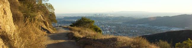
Bike Trails in Los Angeles

While hikespeak.com has hike in its name, mountain bikers can enjoy a lot of the trails on this website too. Many trails around Los Angeles are open for biking, so if you like to bike, check out the selection of trails below, which all permit mountain bikes. To make it easier to navigate read, the trails listed below are divided into groups by LA's main mountain ranges: Santa Monica Mountains San Gabriel Mountains Verdugo Mountains Elsewhere in Los Angeles County Jump right to the area that interests you or keep scrolling down. ... Read more.
Colby Canyon Trail to Josephine Peak in the San Gabriel Mountains
Want to hike to a mile-high summit in the San Gabriel Mountains with grand views over Los Angeles? Set your aim for Josephine Peak in the front range of the San Gabriel Mountains next to Strawberry Peak. Colby Canyon Trail offers a scenic route to the summit, traveling from Angeles Crest Highway up a withdrawn canyon to Josephine Saddle, a dip in the ridgeline west of Strawberry Peak. ...Read more.
Distance: 8.7 miles · Elevation change: 2050 feet
By: Published: March 23, 2016 Last updated: May 5, 2026
China Flat and Simi Peak in the Simi Hills
Looking up at the orange sandstone outcroppings on the rugged slopes of the Simi Hills, you would hardly expect the terrain above to host a peaceful oak savanna. Walk through this grassy area shade by tall oaks to ascend to Simi Peak, the highest point in a mountain range that spans the boundary between Ventura County and Los Angeles County just north of the 101 Freeway. ...Read more.
Distance: 6.2 miles · Elevation change: 1090 feet
By: Published: February 22, 2016 Last updated: December 5, 2025
Mount Lowe Road and Sunset Ridge Trail to Cape of Good Hope and Echo Mountain in the San Gabriel Mountains
Starting near the base of the San Gabriel Mountains in Altadena, Mount Lowe Road is an 8.9-mile long partially paved trail rising up the range to an intersection with Mount Wilson Red Box Road near the summit of Mount Wilson. Of course, you don't have to go that full distance on a hike up Mount Lowe Road. Sunset Ridge Trail intersects and parallels the bottom of Mount Lowe Road and is even more enjoyable to hike on, providing both an alternative to Mount Lowe Road and the possibility to form a loop. ...Read more.
Distance: 5.2 miles · Elevation change: 1425 feet
By: Published: February 16, 2016 Last updated: December 5, 2025
Castle Canyon Trail to Inspiration Point in the San Gabriel Mountains
Castle Canyon Trail is a dirt single track that connects the ruins at Echo Mountain to Inspiration Point, which was a premier vista point for the resort's visitors and still offers sweeping views. In the past, a railway took Echo Mountain's guests up into the mountains, but now leg power is required to get up Castle Canyon Trail to Inspiration Point. ...Read more.
Distance: 4 miles · Elevation change: 1325 feet
By: Published: February 16, 2016 Last updated: December 6, 2025
Las Flores Motorway to Mount Thom in the Vedugo Mountains
Las Flores Motorway weaves its way up ridges on the southeast end of the Verdugo Mountains in Glendale. The wide dirt trail blooms when it reaches Mount Thom, a 2,460-foot summit with panoramic views over surrounding city-flanked mountain ranges and the skyline of downtown Los Angeles. Las Flores Motorway gains 1,220 feet in 2.5 miles to join Beaudry Motorway just below the summit. ...Read more.
Distance: 5.3 miles · Elevation change: 1260 feet
By: Published: January 2, 2016 Last updated: December 5, 2025