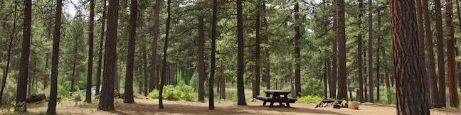
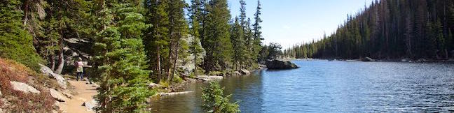
Benham Falls Hike Deschutes River Trail Bend Oregon Deschutes National Forest Sunriver
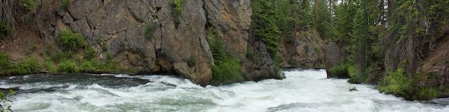
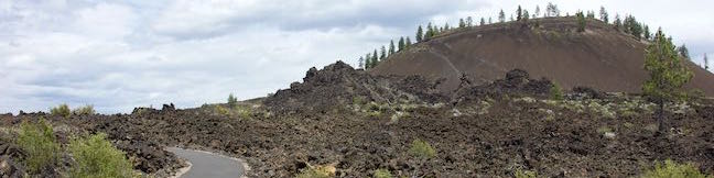
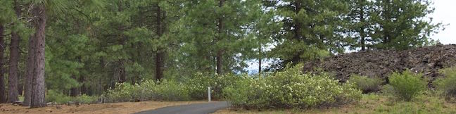
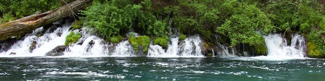
Strolling down Deschutes River Trail toward Benham Falls, you might be skeptical that this calm river will hasten into rapids and cascades. The wall of volcanic rock on the far side of the river does offer an early clue that something dramatic could happen. The Deschutes River was rerouted by Lava Butte Lava Flow, causing it to tumble over a few waterfalls on its path north toward Bend. ...Read more.
My Hikes: Completed hikeA green icon of shows a picture of a landscape with a check mark in the upper right corner, signifying that this is a hike you would like to put on your completed list.OK! Add to trails I've hiked
My Hikes: Want to hikeA green icon of shows a picture of a landscape with a heart in the upper right corner, signifying that this is a hike you would like to put on your to-do list.OK! Add to trails I want to hike
TagsA green icon depicting a tags represents a list of words and phrases that this content is tagged with Tagged with · Bend · Cascade Range · Deschutes National Forest · Lava Butte Lava Flow · Sunriver · Waterfalls
Hike DistanceA green icon of a hiker used to label information about the length of the hike Distance: 1.9 miles · Elevation change: 50 feet
By: Published: Last updated: July 23, 2019
Trail of the Molten Land Newberry National Volcanic Monument Deschutes National Forest Bend Lava Butte Lava Flow Trail Central Oregon Hike
You'll be grateful to find pavement and not melting hot lava on Trail of the Molten Land. This impressive trail is built atop a barren landscape of dark volcanic rock, the Lava Butte Lava Flow in Newberry National Volcanic Monument, which is part of Deschutes National Forest. Panels along the trail provide information about how the lava flow began at Lava Butte, a cinder cone above the trail. ...Read more.
My Hikes: Completed hikeA green icon of shows a picture of a landscape with a check mark in the upper right corner, signifying that this is a hike you would like to put on your completed list.OK! Add to trails I've hiked
My Hikes: Want to hikeA green icon of shows a picture of a landscape with a heart in the upper right corner, signifying that this is a hike you would like to put on your to-do list.OK! Add to trails I want to hike
TagsA green icon depicting a tags represents a list of words and phrases that this content is tagged with Tagged with · Bend · Deschutes National Forest · Lava Butte Lava Flow · Nature Trails · Newberry National Volcanic Monument · Sunriver
Hike DistanceA green icon of a hiker used to label information about the length of the hike Distance: 1.25 miles · Elevation change: 135 feet
By: Published: Last updated: August 29, 2019
Trail of the Whispering Pines Newberry National Volcanic Monument Deschutes National Forest Bend Interpretive Botanical Trail Central Oregon Hike
Trail of the Whispering Pines is an interpretive botanical trail highlighting high desert plants in Newberry National Volcanic Monument. This short and level paved path covers just a quarter mile. Trail of the Whispering Pines can easily be explored as a 0.4-mile walk beginning and ending at Lava Lands Visitor Center. This short hike can be connected to Trail of the Molten Land, which is even more impressive, for a 1. ...Read more.
My Hikes: Completed hikeA green icon of shows a picture of a landscape with a check mark in the upper right corner, signifying that this is a hike you would like to put on your completed list.OK! Add to trails I've hiked
My Hikes: Want to hikeA green icon of shows a picture of a landscape with a heart in the upper right corner, signifying that this is a hike you would like to put on your to-do list.OK! Add to trails I want to hike
TagsA green icon depicting a tags represents a list of words and phrases that this content is tagged with Tagged with · Bend · Deschutes National Forest · Lava Butte Lava Flow · Nature Trails · Newberry National Volcanic Monument · Sunriver · Wheelchair-Friendly
Hike DistanceA green icon of a hiker used to label information about the length of the hike Distance: 0.4 miles · Elevation change: 5 feet
By: Published: Last updated: January 25, 2018
Lava Butte Trail Newberry National Volcanic Monument Deschutes National Forest Bend Lava Butte Hike Central Oregon Lava Butte Lookout
Lava Butte is a 500-foot tall cinder cone along the Northwest Rift of Newberry Volcano in Central Oregon. It rises prominently over Route 97 between Bend and Sunriver. A fire lookout tower sits atop Lava Butte and is joined by a rim trail that offers panoramic views over a dark volcanic landscape. Lava Butte also provides majestic views of the Cascade Mountains to the west. ...Read more.
My Hikes: Completed hikeA green icon of shows a picture of a landscape with a check mark in the upper right corner, signifying that this is a hike you would like to put on your completed list.OK! Add to trails I've hiked
My Hikes: Want to hikeA green icon of shows a picture of a landscape with a heart in the upper right corner, signifying that this is a hike you would like to put on your to-do list.OK! Add to trails I want to hike
TagsA green icon depicting a tags represents a list of words and phrases that this content is tagged with Tagged with · Bend · Buttes · Deschutes National Forest · Lookout Towers · Newberry National Volcanic Monument · Summits · Sunriver
Hike DistanceA green icon of a hiker used to label information about the length of the hike Distance: 3.85 miles · Elevation change: 520 feet
By: Published: Last updated: May 13, 2025
Black Butte Trail Deschutes National Forest Camp Sherman Sisters Central Oregon Summit Hike
Black Butte is one of the most identifiable summits in Central Oregon. This conical volcano rises 3,000 feet over tapered terrain on the east side of the Cascade Mountains. Black Butte stands on its own and offers tremendous views over the surroundings including peaks in the Central Oregon Cascades to the north, west, and south. Grand views make Black Butte an ideal site for fire lookout towers, which you will find at the summit. ...Read more.
My Hikes: Completed hikeA green icon of shows a picture of a landscape with a check mark in the upper right corner, signifying that this is a hike you would like to put on your completed list.OK! Add to trails I've hiked
My Hikes: Want to hikeA green icon of shows a picture of a landscape with a heart in the upper right corner, signifying that this is a hike you would like to put on your to-do list.OK! Add to trails I want to hike
TagsA green icon depicting a tags represents a list of words and phrases that this content is tagged with Tagged with · Deschutes National Forest · Lookout Towers · Sisters · Summits
Hike DistanceA green icon of a hiker used to label information about the length of the hike Distance: 4 miles · Elevation change: 1550 feet
By: Published: Last updated: April 1, 2017
West Metolius River Trail Deschutes National Forest Gushing Springs Metolius River Hike Wizard Falls Fish hatchery
For a relaxing and fascinating hike in Central Oregon, take an easy stroll along the Metolius River. Leaving Lower Canyon Creek Campground, West Metolius River Trail quickly passes fantastical springs where water gushes from a riverbank. Summer wildflowers line the dirt single track as you continue downriver past calms and rapids. Follow the lovely river for 2. ...Read more.
My Hikes: Completed hikeA green icon of shows a picture of a landscape with a check mark in the upper right corner, signifying that this is a hike you would like to put on your completed list.OK! Add to trails I've hiked
My Hikes: Want to hikeA green icon of shows a picture of a landscape with a heart in the upper right corner, signifying that this is a hike you would like to put on your to-do list.OK! Add to trails I want to hike
TagsA green icon depicting a tags represents a list of words and phrases that this content is tagged with Tagged with · Camp Sherman · Cascade Range · Deschutes National Forest · Fish Hatchery · Free Trails · Sisters
Hike DistanceA green icon of a hiker used to label information about the length of the hike Distance: 5.4 miles · Elevation change: 100 feet
By: Published: Last updated: December 21, 2017
Lower Canyon Creek Campground Deschutes National Forest Metolius River Camp Sherman Oregon
Seven sites are spread below ponderosa pines on a loop in Lower Canyon Creek Campground. This small and spacious campground is located in Deschutes National Forest near Camp Sherman and Sisters, Oregon. The campground borders the confluence of Canyon Creek and the Metolius River. Hikers can leave the campground on West Metolius River Trail to hike a short distance to a surprising springs and a fish hatchery. ...Read more.
TagsA green icon depicting a tags represents a list of words and phrases that this content is tagged with Tagged with · Camp Sherman · Cascade Range · Creeks · Deschutes National Forest · Tent Camping
By: Published: Last updated: July 25, 2025
Punchbowl Falls Hike Eagle Creek Trail Metlako Falls Viewpoint Columbia River Gorge National Scenic Area Oregon
Fantastic waterfalls, dramatic cliffs, charming cascades, and handsome forests entertain hikers on the first couple miles of Eagle Creek Trail. Venture up a scenic canyon on the Oregon side of the Columbia River Gorge near Cascade Locks, following the tumbling water of Eagle Creek. Trek under and across steep cliffs that place cascades in your path. ...Read more.
My Hikes: Completed hikeA green icon of shows a picture of a landscape with a check mark in the upper right corner, signifying that this is a hike you would like to put on your completed list.OK! Add to trails I've hiked
My Hikes: Want to hikeA green icon of shows a picture of a landscape with a heart in the upper right corner, signifying that this is a hike you would like to put on your to-do list.OK! Add to trails I want to hike
TagsA green icon depicting a tags represents a list of words and phrases that this content is tagged with Tagged with · Cascade Locks · Cascade Range · Columbia River Gorge National Scenic Area · Fish Hatchery · Waterfalls
Hike DistanceA green icon of a hiker used to label information about the length of the hike Distance: 4.55 miles · Elevation change: 400 feet
By: Published: Last updated: July 25, 2025
Cascade Mountain Trail Porter Mountain Trail Adirondack Mountains New York hike
Southeast of Lake Placid, you'll find a popular hike to a pair of scenic summits. Cascade Mountain (4,098 feet) and Porter Mountain (4,059 feet) are the thirty-sixth and thirty-eighth tallest peaks in the Adirondack Mountains and are members of the 46 Adirondack High Peaks. Cascade and Porter are two of the easiest High Peaks to reach, thanks to maintained trails and a relatively manageable hike length (that still delivers a workout). ...Read more.
My Hikes: Completed hikeA green icon of shows a picture of a landscape with a check mark in the upper right corner, signifying that this is a hike you would like to put on your completed list.OK! Add to trails I've hiked
My Hikes: Want to hikeA green icon of shows a picture of a landscape with a heart in the upper right corner, signifying that this is a hike you would like to put on your to-do list.OK! Add to trails I want to hike
TagsA green icon depicting a tags represents a list of words and phrases that this content is tagged with Tagged with · Adirondack High Peaks · Adirondack Mountains · Adirondack Park · Free Trails · Lake Placid · Summits
Hike DistanceA green icon of a hiker used to label information about the length of the hike Distance: 6.2 miles · Elevation change: 1925 feet
By: Published: Last updated: September 9, 2019
Emerald Lake Trail Nymph Lake Dream Lake Emerald Lake Rocky Mountain National Park Bear Lake to Emerald Lake Hike Colorado
Emerald Lake Trail visits a trio of beautiful mountain lakes in Rocky Mountain National Park, easing past Nymph Lake and Dream Lake on the way to Emerald Lake, which is cradled below 12,000-foot peaks along the Continental Divide. This three-lake hike is 3.6 miles round trip with 650 feet of elevation change. This scenic hike begins from Bear Lake Trailhead, where a fourth lake can added to the outing with Bear Lake Nature Trail. ...Read more.
My Hikes: Completed hikeA green icon of shows a picture of a landscape with a check mark in the upper right corner, signifying that this is a hike you would like to put on your completed list.OK! Add to trails I've hiked
My Hikes: Want to hikeA green icon of shows a picture of a landscape with a heart in the upper right corner, signifying that this is a hike you would like to put on your to-do list.OK! Add to trails I want to hike
TagsA green icon depicting a tags represents a list of words and phrases that this content is tagged with Tagged with · Continental Divide · Lakes · National Parks · Rocky Mountains
Hike DistanceA green icon of a hiker used to label information about the length of the hike Distance: 3.6 miles · Elevation change: 650 feet
By: Published: Last updated: May 19, 2024