Cascade Mountain and Porter Mountain
in the Adirondack Mountains
Southeast of Lake Placid, you’ll find a popular hike to a pair of scenic summits. Cascade Mountain (4,098 feet) and Porter Mountain (4,059 feet) are the thirty-sixth and thirty-eighth tallest peaks in the Adirondack Mountains and are members of the 46 Adirondack High Peaks. Cascade and Porter are two of the easiest High Peaks to reach, thanks to maintained trails and a relatively manageable hike length (that still delivers a workout). The primary target for this hike is the large bald summit of Cascade Mountain, which boasts extraordinary 360-degree views.
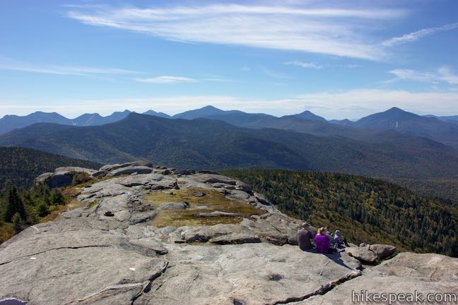
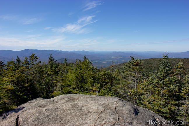
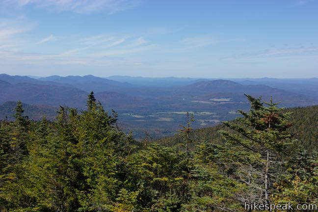
Cascade Mountain is recognized as having one of the best summit views in the Adirondacks, with about two-thirds of the High Peaks, Lake Placid, and even Lake Champlain in sight on clear days. Cascade Mountain Trail ascends 1,925 feet over 2.4 miles. Porter Mountain Trail parts from a junction below the summit of Cascade Mountain and drops across a col to the second summit, 0.7 miles away. Visit both mountains on a 6.2-mile trek or turn around at Cascade for a 4.8-mile hike.
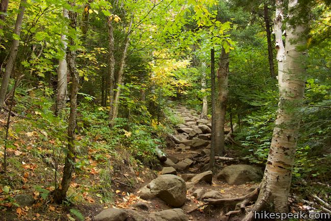
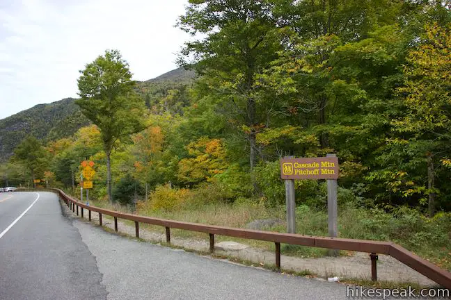
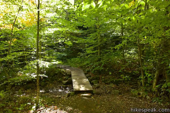
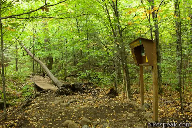
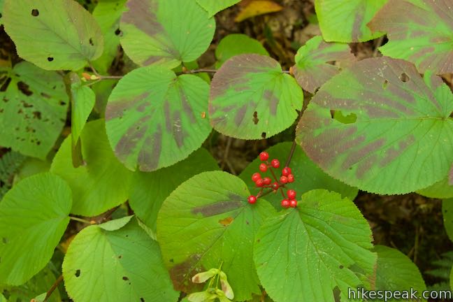
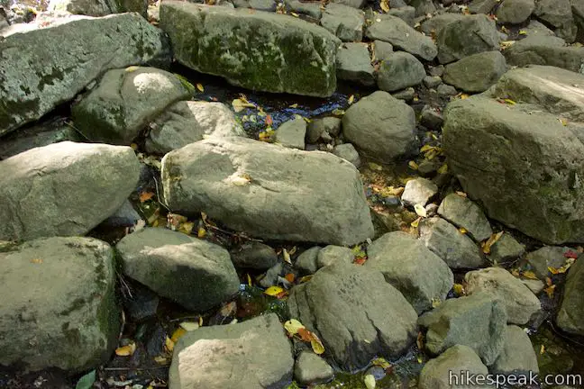
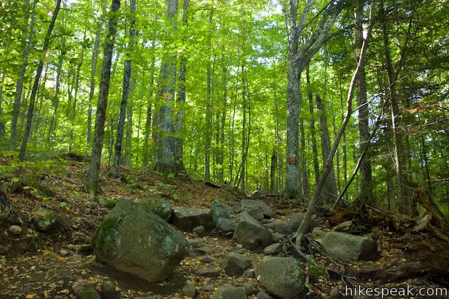
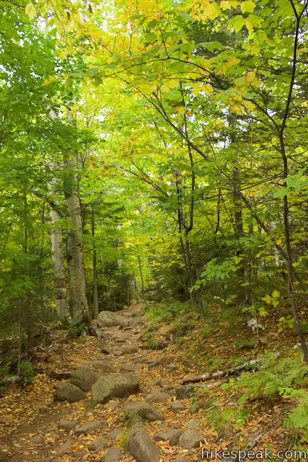
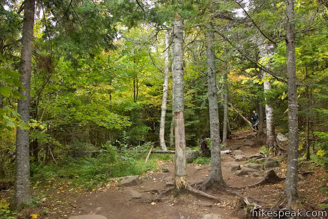
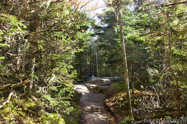
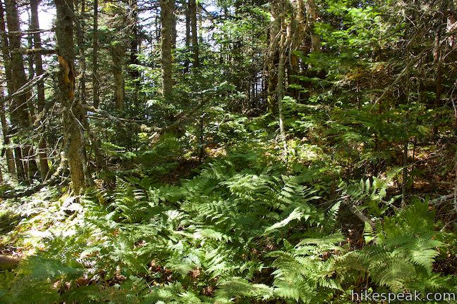
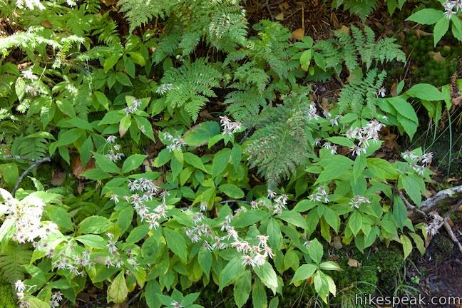
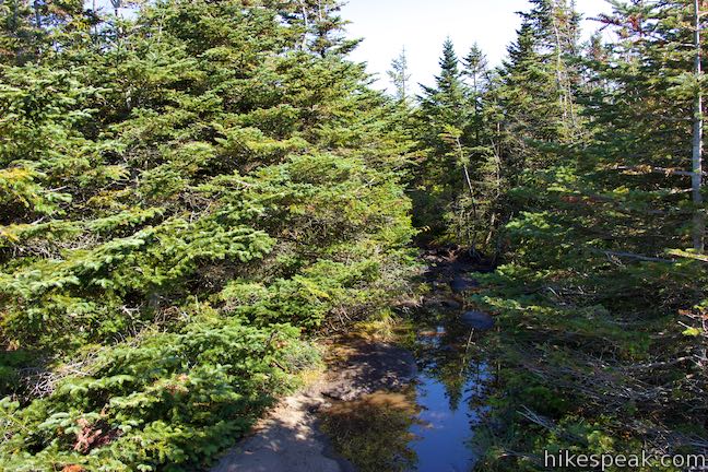
Cascade Mountain Trail starts from Route 73, about halfway between Lake Placid and Keene. The trail goes south, taking a staircase down to a footbridge over Cascade Brook. After the bridge, you’ll find a trail register where you can sign in with your hiking party. Just beyond the trail register, and about 0.05 miles from the start, a path parts to the right to a pair of privies for those who need to relieve themselves (a portable toilet should also be available along Route 73). The trail now heads uphill through a mixed forest of maple, oak, birch, and beech trees. In the spring, hikers can enjoy blooming trillium and bunchberries. Fall hikers are treated to changing leaves that color to the forest. Cross Cascade Brook again, 1/3 of a mile from the start. Rock hop across the trickling stream just below a cascade where the water slides down a pitched rock face.
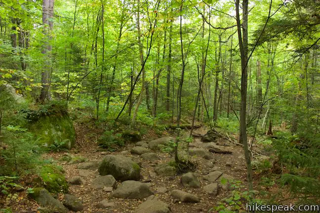
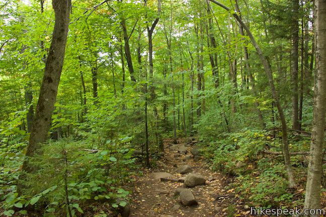
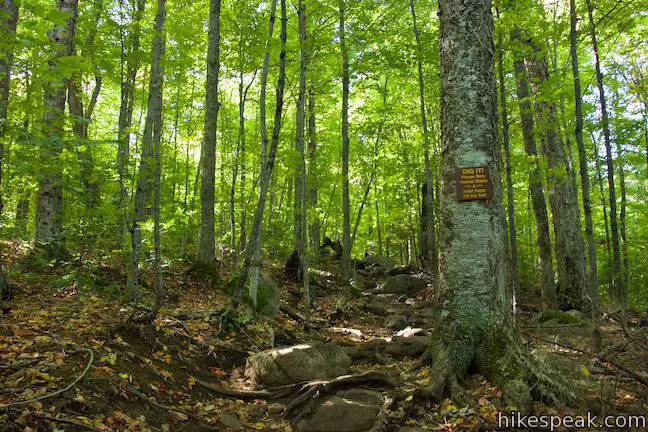
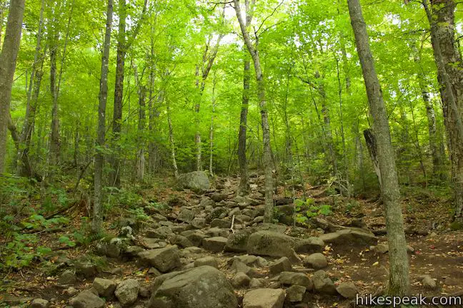
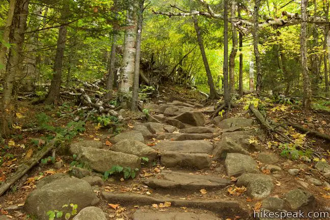
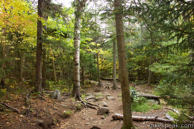
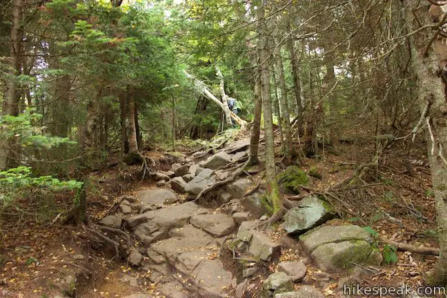
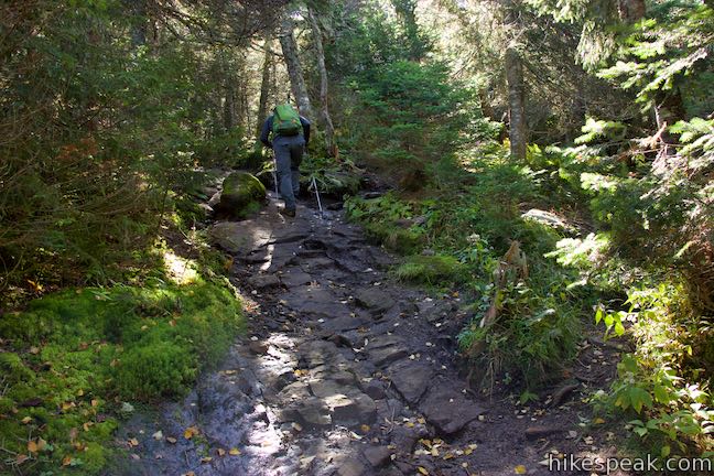
Cascade Mountain Trail has lots of elevation to climb, so you will get a good workout on the way up. The trail’s steep pitches are balanced out by level spots where you can catch your breath. Use boulders and roots for steps to weave through the forest and up the mountainside. Stone staircases have been built over a couple stretches of the trail to minimize erosion and assist with the ascent. About a mile in to the hike, you’ll tackle what seems like the steepest section of the hike. Push up stone steps to reach a notch on the ridge that drops to the west from Cascade Mountain. After 1.2 miles of hiking, the ascent lets up and the trail finds a level spot. Cascade Mountain Trail turns to the right and heads up the ridge.
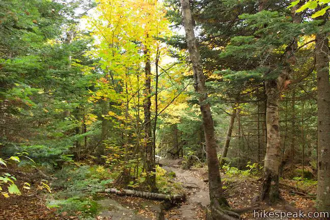
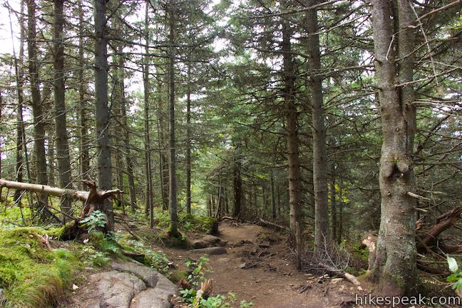
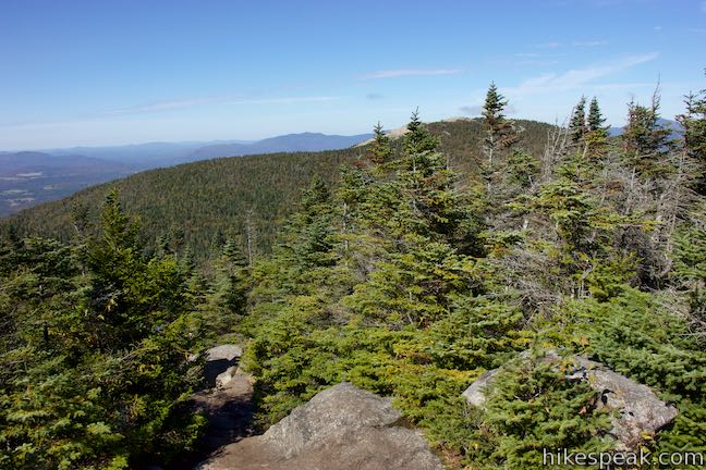
Pass another flat spot around the 1.4-mile mark where paths break off from the trail. Proceed straight up Cascade Mountain Trail over rocks and roots in a forest that becomes dominated by conifers.
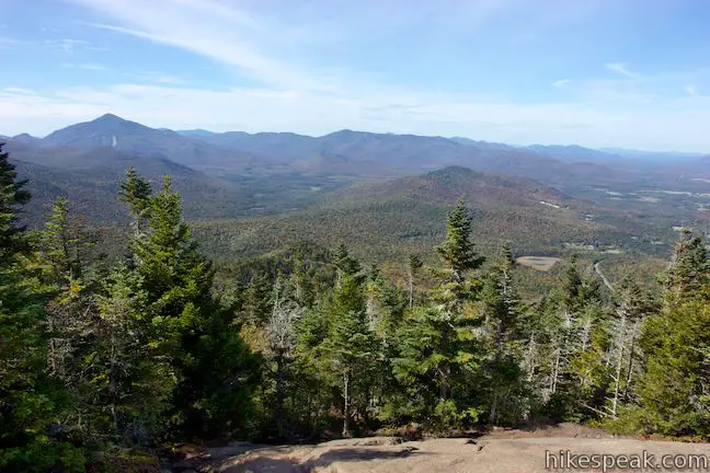
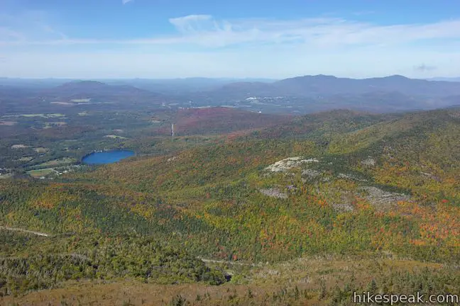
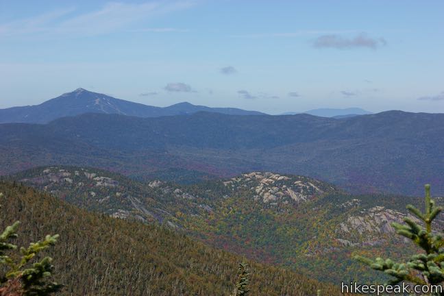
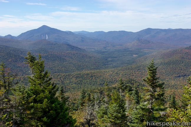
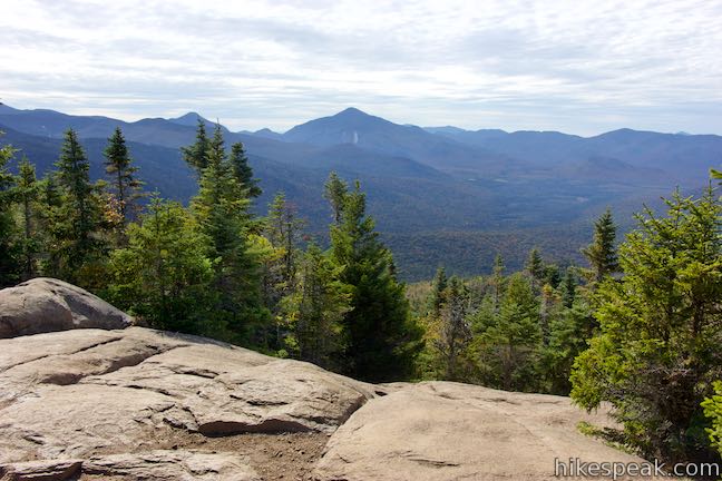
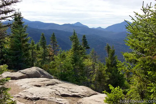
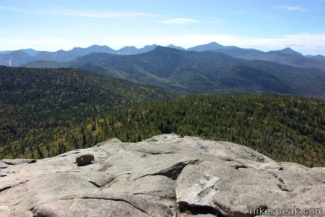
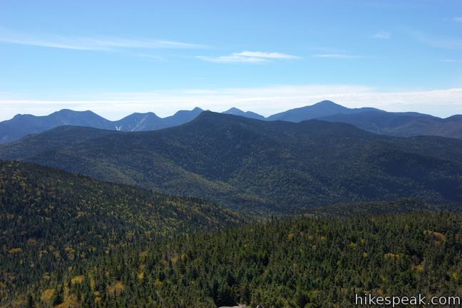
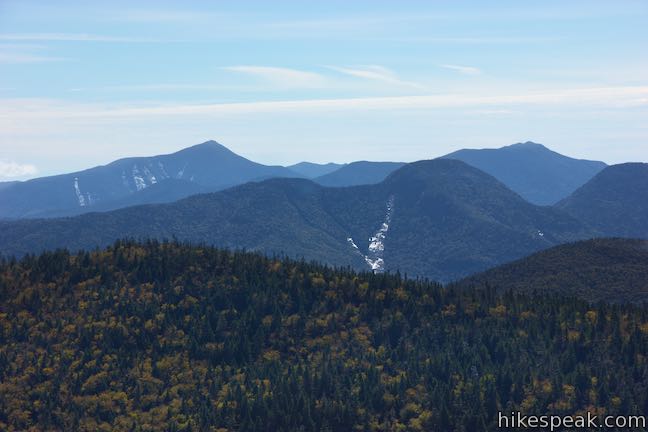
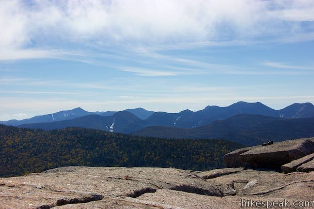
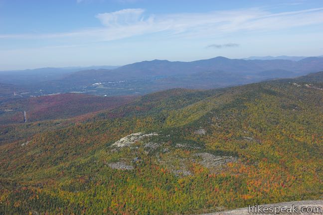
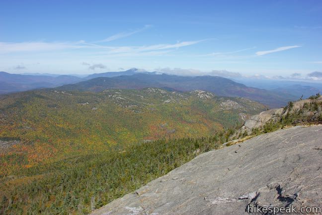
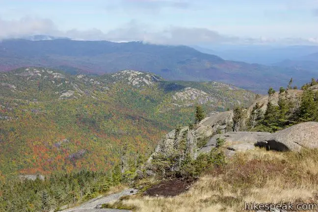
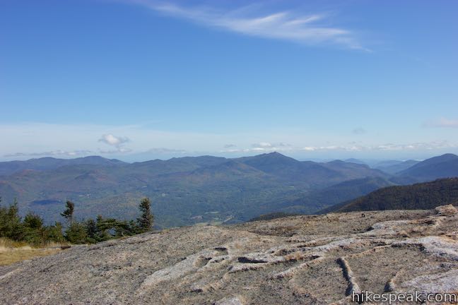
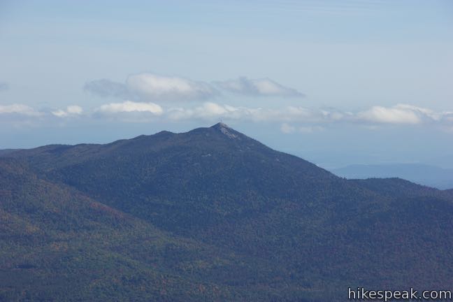
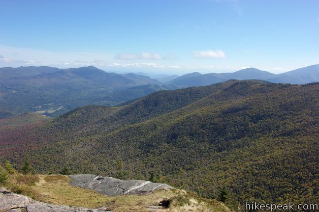
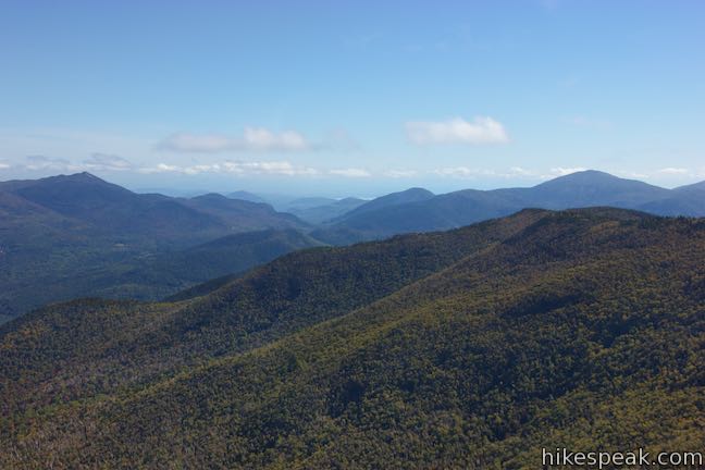
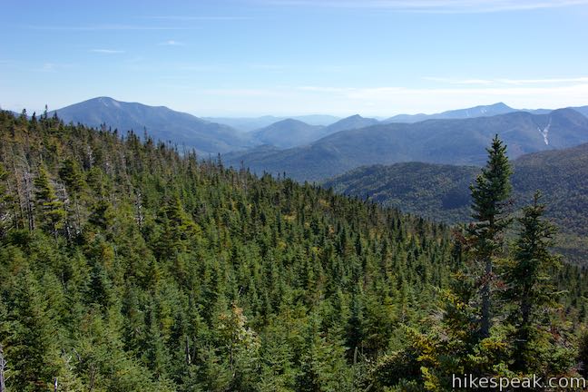
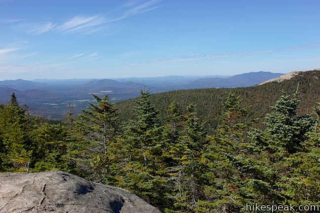
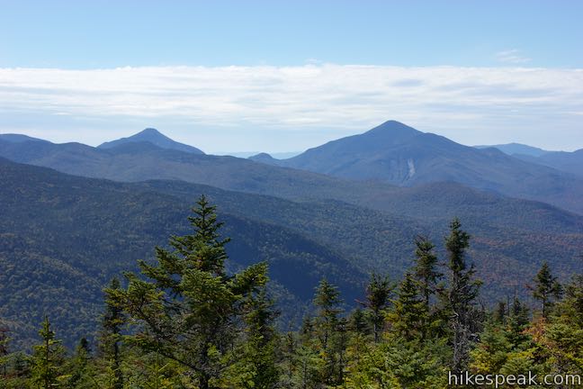
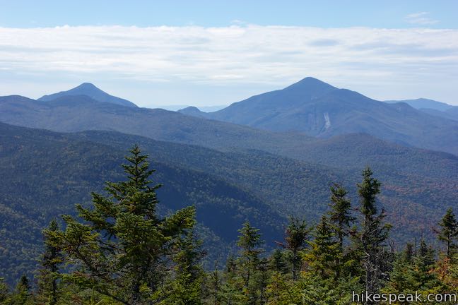
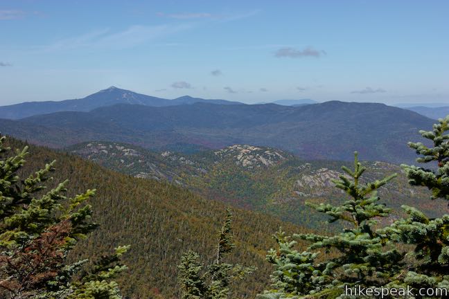
The trail launches up another steep grade. If you feel demoralized, press on to a motivational treat. At 1.9 miles from the trailhead, the trail climbs to an opening in the forest at a patch of exposed bedrock. Enjoy a 180-degree preview of the summit offerings. Valleys below are covered by forests and water. Looking northwest toward Lake Placid, you’ll spot the unique landmark of the Olympic Ski Jump rising out of the forest. Nye Mountain is to the west. Algonquin Peak rises prominently over the end of the valley to the southwest. Southeast of Algonquin is Mount Colden, and if you stand in the right spot, you’ll also see Mount Marcy, the highest mountain in New York State, rising to the south.
While this view is expansive enough to justify the hike so far, you’d be a fool to turn back. The summit is half a mile away and under 300 vertical feet remain. The trail dips back into the forest and passes through short conifers that let in more sunlight than you’ve had so far.
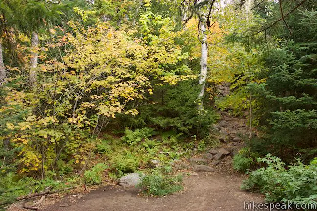
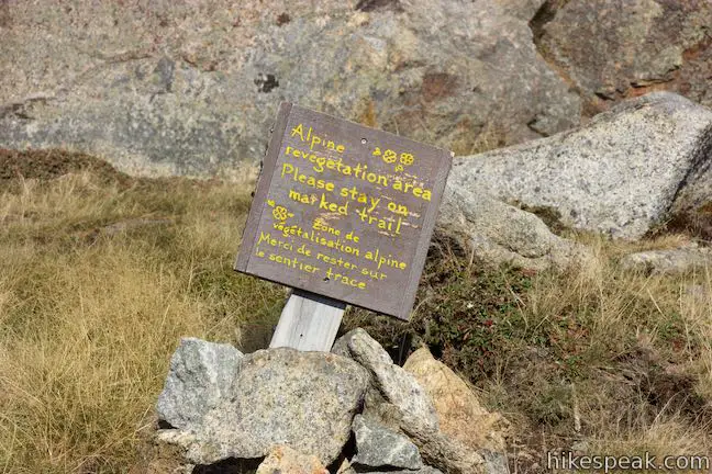
Note: The NYS Department of Environment Conservation and Adirondack Mountain Club ask hikers to carry rocks to the top of Cascade Mountain to help stabilize soils and protect the fragile vegetation. Unless you want the extra effort of carrying a rock for the entire hike, this next stretch of trail is good for rock collecting.
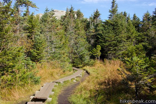
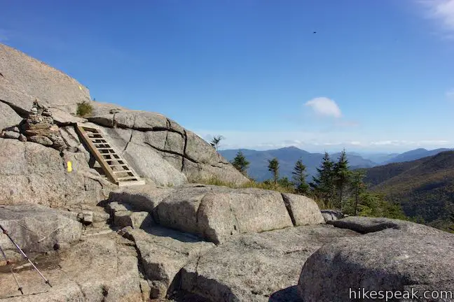
Ascend gradually to a junction, 2.1 miles from the start. Porter Mountain Trail branches off to the right. A posted sign lists the distance to that summit at 0.7 miles. Consider visiting Porter after you reach the summit of Cascade Mountain. Stay to the left at the junction to hike the final 0.3 miles to the top of Cascade.
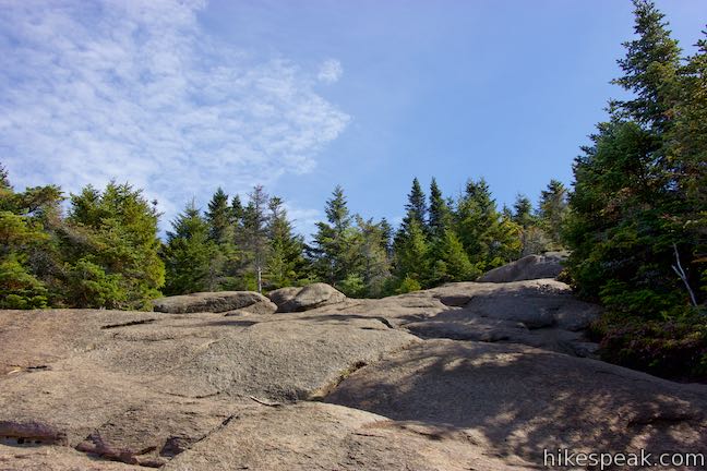
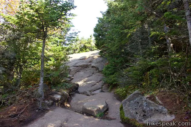
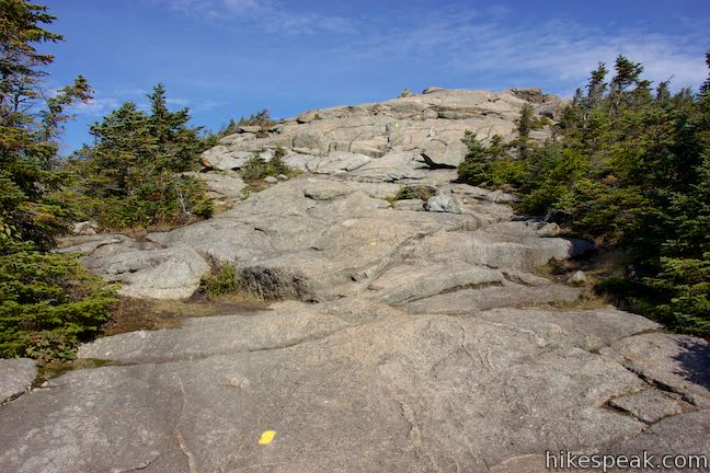
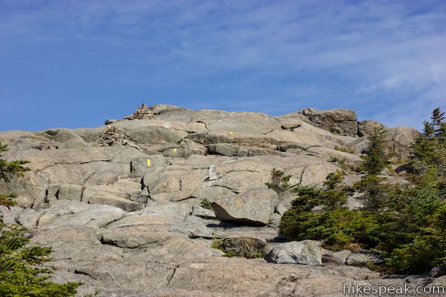
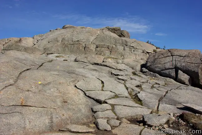
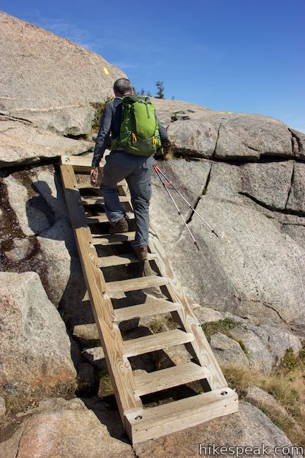
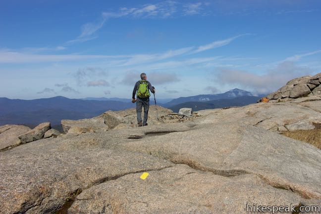
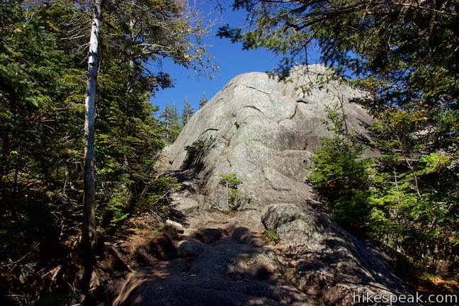
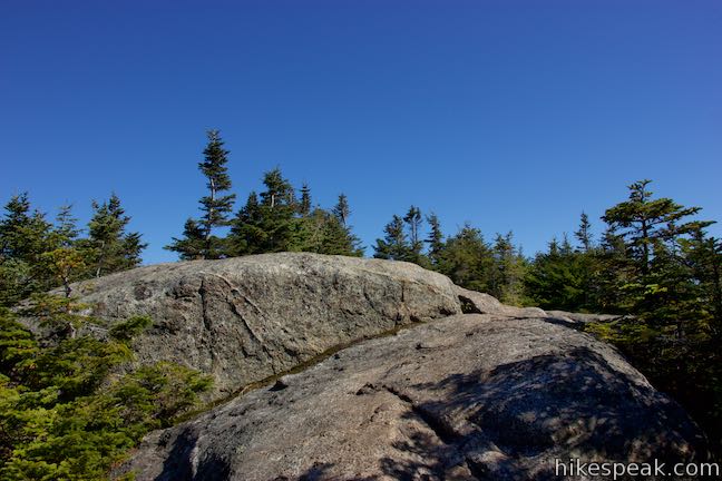
A short stretch of boardwalk leads you through a grassy area to the edge of the forest surrounding the top of Cascade Mountain. Look up at the rocky cap and find your way to the summit. Follow a line of yellow stripes painted on the bedrock that provide the best route to the top. Cairns (pyramid-shaped piles of rocks) also mark the route and will be more useful for winter visitors. Make your way up the marked route and avoid trampling grasses in the revegetation areas.
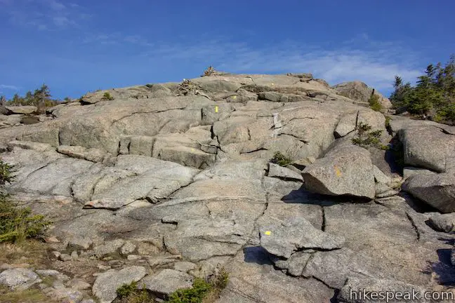
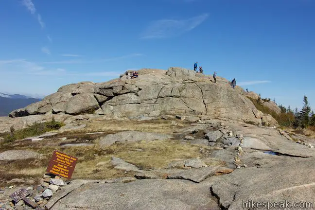
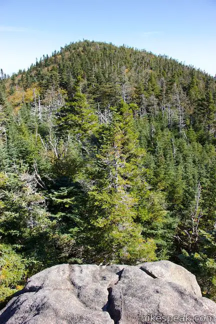
Despite its appearance, Cascade Mountain is not a true alpine summit like some of the other High Peaks (it is not quite tall enough). The bare summit was caused by a 1903 wildfire the burnt down all the mountaintop trees. The erosion that followed exposed a rocky dome. While it may not be an actual alpine summit, Cascade Mountain has all the open views of one, and isn’t that what’s really important?
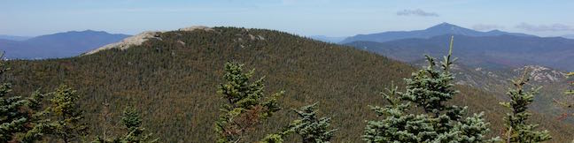
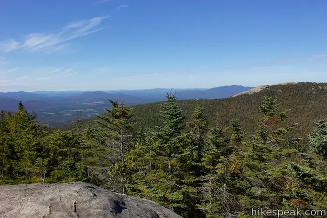
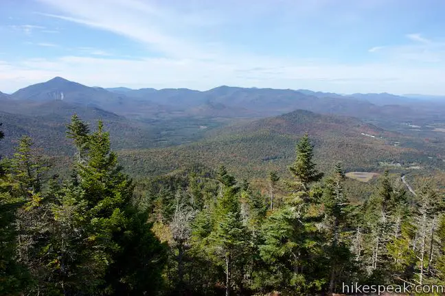
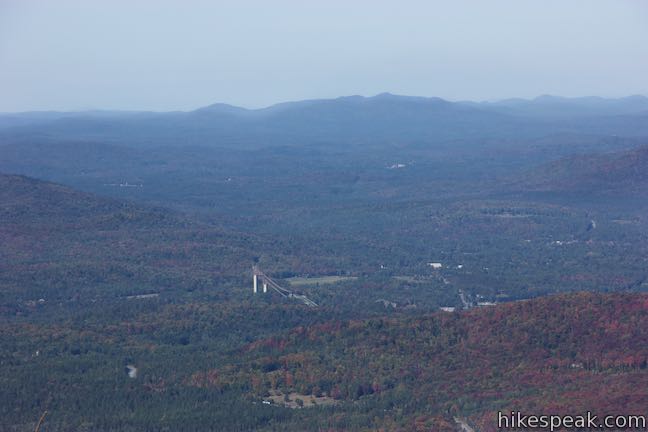
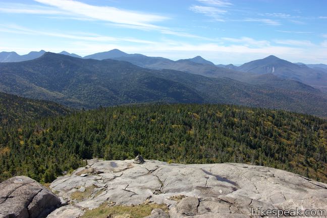
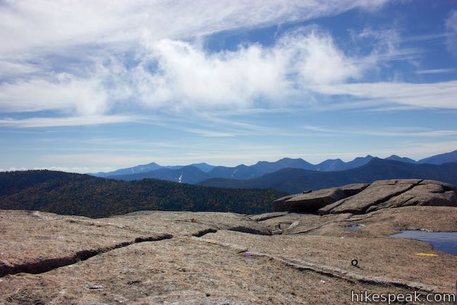
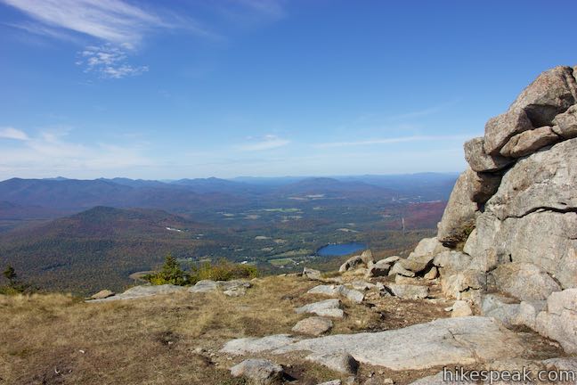
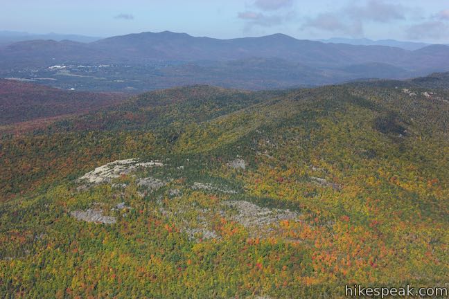
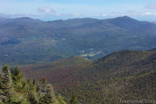
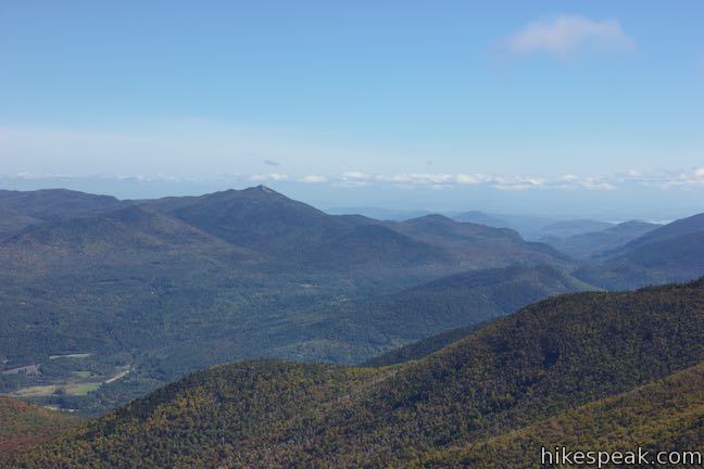
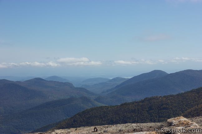
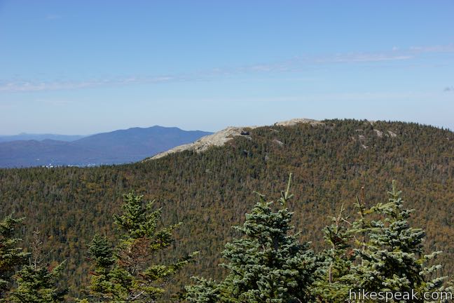
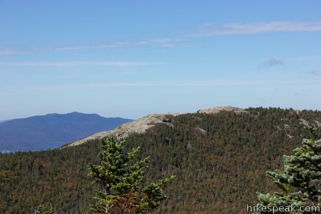
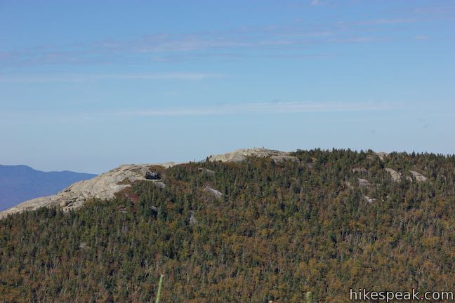
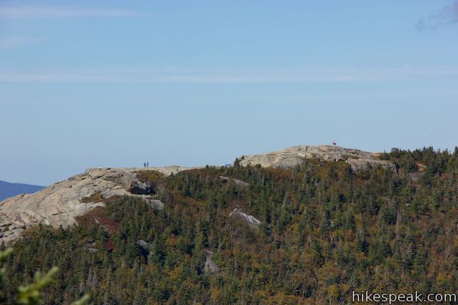
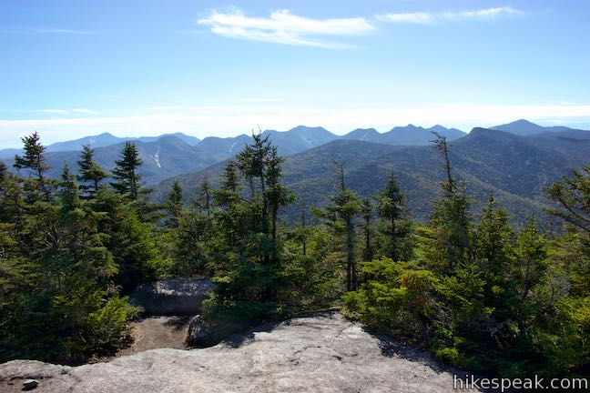
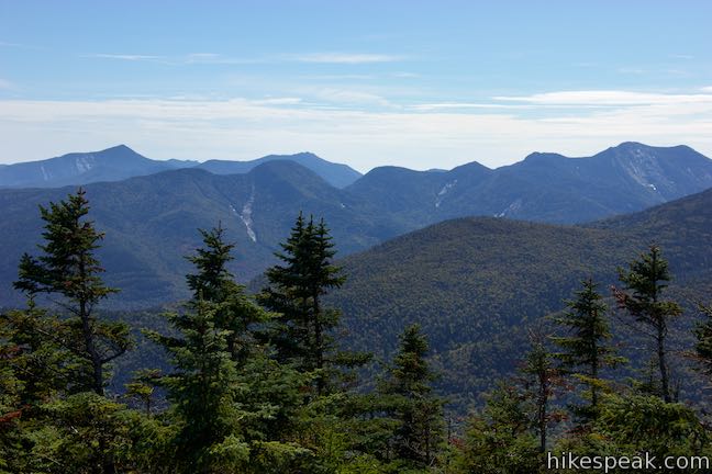
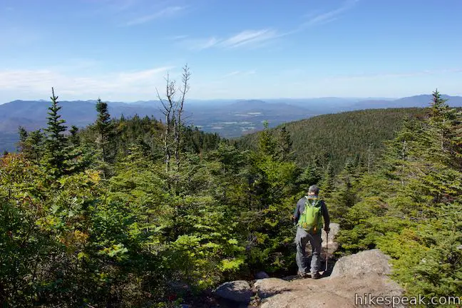
Follow the yellow lines to the right side of the summit and take a staircase up a ledge. Ascending this part of the summit, you’ll find great views to the east across Keene Valley toward Hurricane Mountain, which rises to a rocky point that has a fire lookout tower. You’ll have to squint to see the tower, which is 7.5 miles away. Up the valley on the south side of Hurricane Mountain, you’ll catch sight of Lake Champlain, over 20 miles away, when conditions are clear. You will also see the closest summit to Cascade, Porter Mountain, which takes the form of a cresting wooded ridge. Unlike Cascade Mountain, Porter Mountain only has a small rocky area at the summit from which to admire the surroundings.
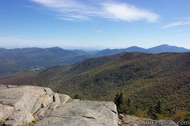

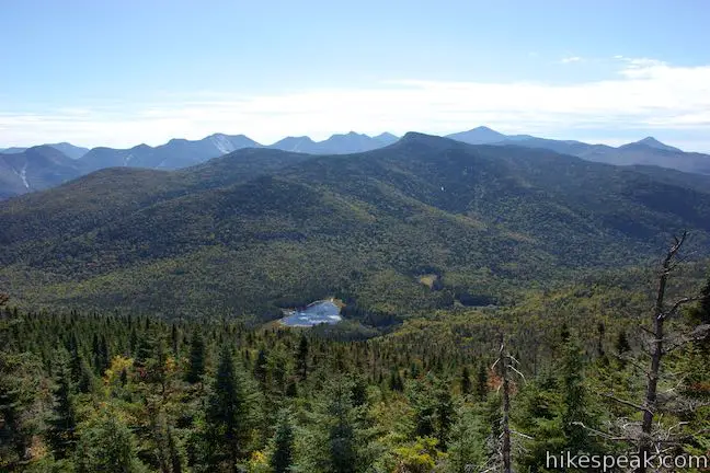
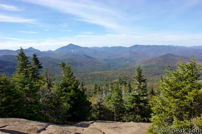
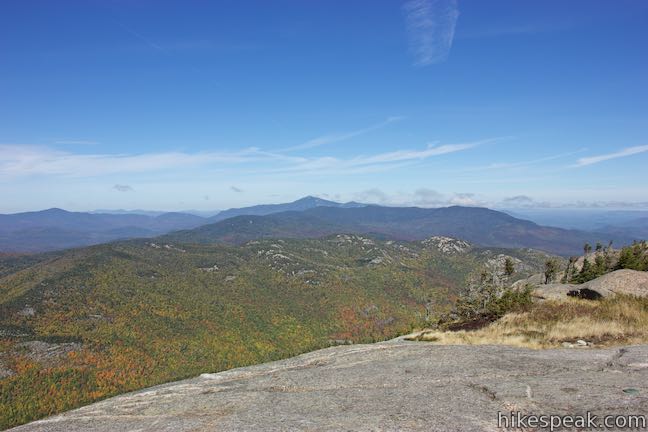
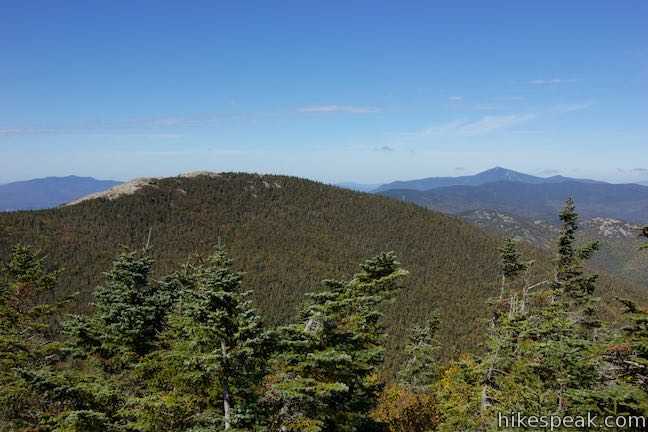
As you proceed up the route to the very top of the mountain, you’ll get views looking back the way you came. Beyond the trail out of the forest, you’ll see many of the High Peaks in the Adirondack Mountains. Big Slide Mountain and Yard Mountain rise to the south of Cascade and Porter. Beyond those two rise several more High Peaks, including Mount Marcy, which is 5,344 feet tall and 8 miles from the summit of Cascade Mountain.

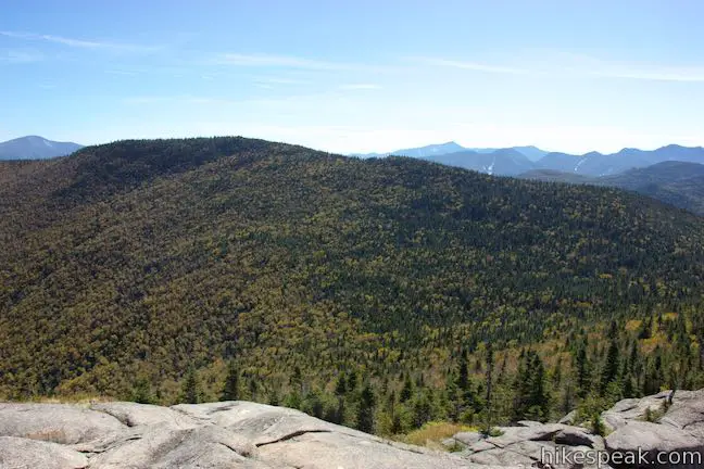
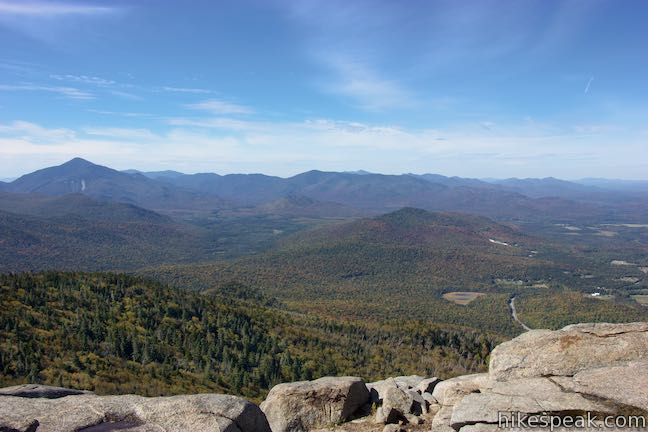
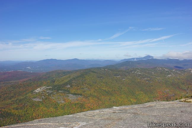
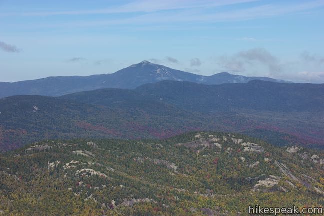
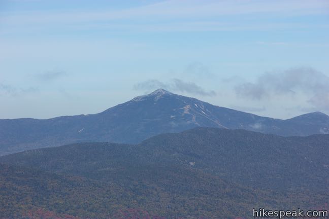
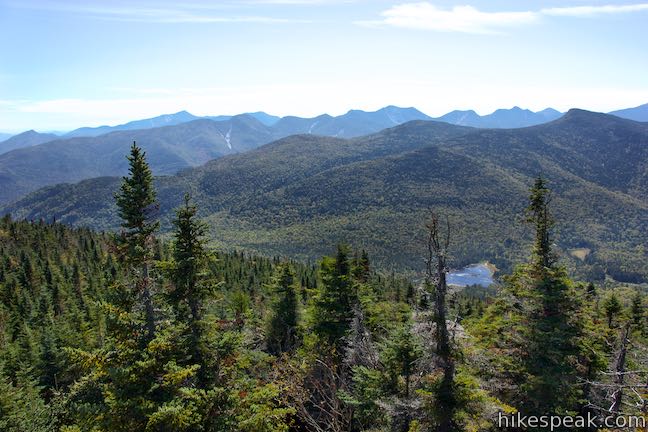
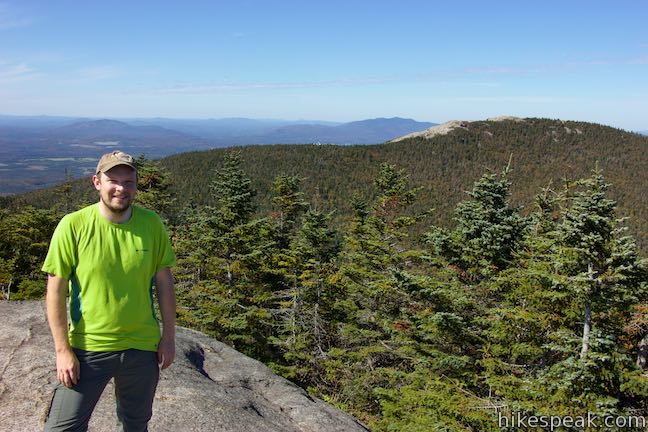
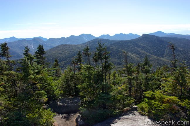
Push north up a final rise in the rocks to attain the actual summit, nearly 4,100 feet above sea level. When you reach the top, you’ll discover views to the north over enticing outcroppings around Sentinel Mountain toward the fifth tallest summit in the Adirondacks. Whiteface Mountain is easy to spot thanks to the ski slopes built on the 4,867-foot mountain. To the northeast, it feels like you could see all the way to Canada on a clear day.
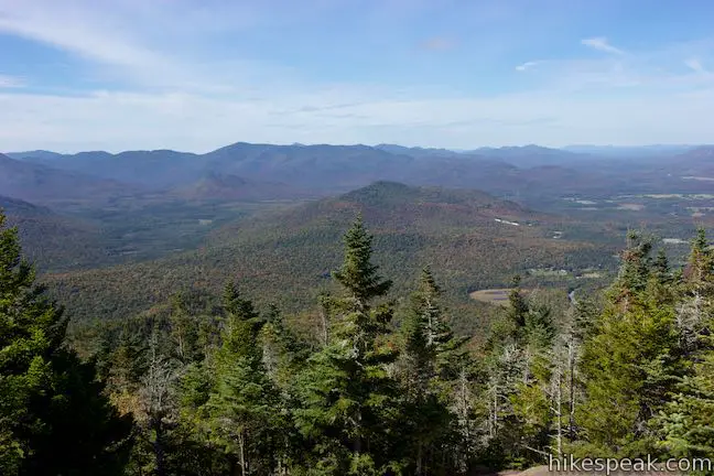
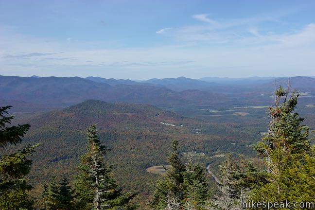
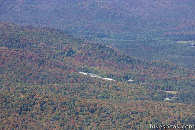
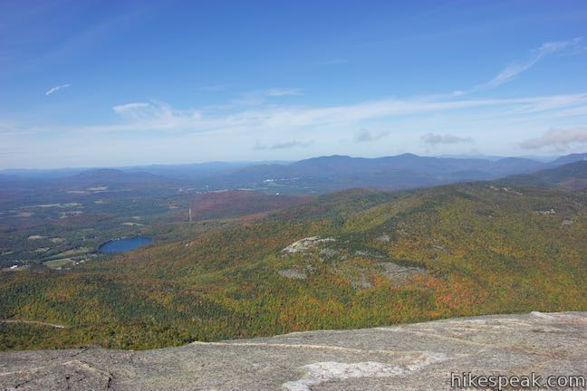
On the northwest side, Cascade Mountain drops away steeply toward Route 73, which is mostly out of view. Pitchoff Mountain rises on the other side. The city of Lake Placid and some of the lake can be seen beyond that. The views from the summit are quite lovely in every direction, especially in the fall when the leaves change color.
The path up to the summit is lined by rocks that protect small patches of grass regrowing on the summit. The rock you carried up can be deposited at a marked location for trail crews to use to outline the route and protect fragile grasses. Cascade Mountain’s exposed summit can be quite windy and much colder than the trail up, so pack extra layers. Obviously, it would be dangerous to hike up to the summit during a lightning storm, so use caution.
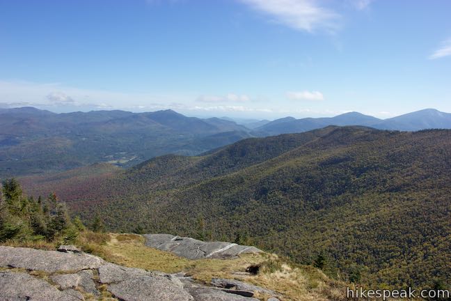
After enjoying the excellent summit views, follow the painted yellow dashes back down to the trail in the forest. Return to the junction with Porter Mountain Trail and decide whether to hike to a second 46er or simply head back down the trail. Porter Mountain Trail drops across a saddle, sacrificing 150 feet before gaining about 275 feet to a small rocky opening at the top of the mountain. While the views from Porter Mountain are not as good as those from Cascade Mountain, this second summit offers a closer view of the High Peaks to the south. It also has a nice perspective looking back at Cascade Mountain. Hiking to Porter Mountain adds 1.4 miles round trip to the hike up Cascade Mountain, bringing the distance from 4.8 miles up to 6.2 miles round trip.
Coming from the summit of Cascade Mountain, turn left to hike southeast on Porter Mountain Trail. Though you’d rather not do it, the trail takes you downhill before rising up Porter Mountain. Descend a rocky slope through firs and ferns. Cross the col between the two mountains after 0.2 miles and venture up the west side of Porter Mountain. This foot trail is less traveled than Cascade Mountain Trail but also has lots of steps made of rocks and roots. Trapped water can create puddles along the trail.
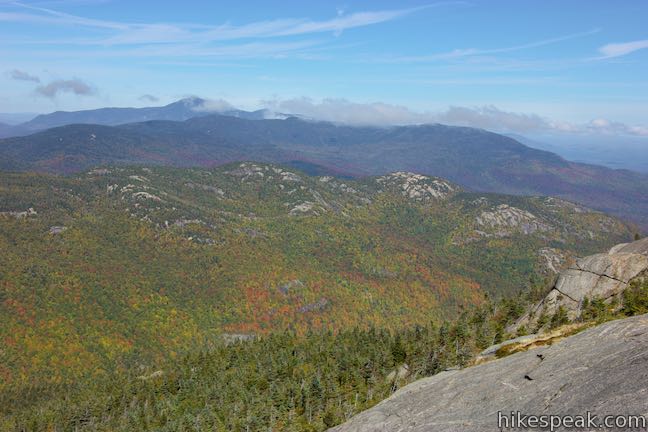
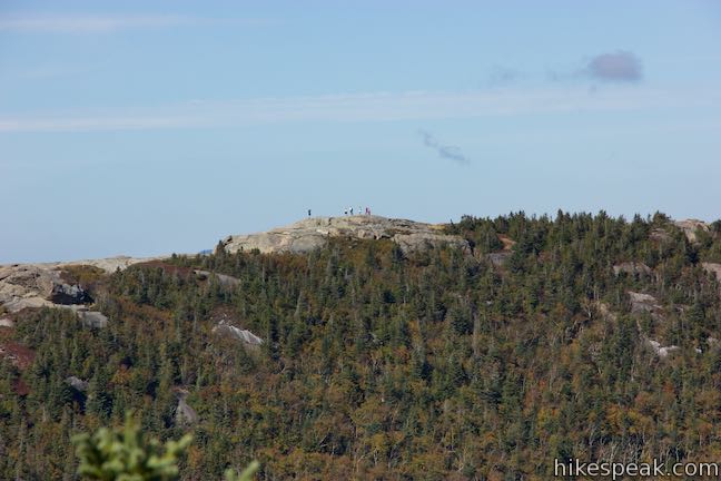
Half a mile from the junction, reach a scenic spot by a large rock outcropping that has the feel of a false summit. The trail runs straight into a steep rock. You can climb up the side of the rock on the left and find a panoramic view from the top. Look east for a clear perspective of the round summit. Look south across a valley toward Big Slide Mountain and rows of High Peaks.
If you stick with the trail when it hits the boulder, it will curve to the right and pass a ledge with similarly great views to the south. Hike down around the boulder and continue east up the trail. After a bit more ascending, the trail exits the dwarf conifers and reaches a small area of open rock at the crown of Porter Mountain. Walk up the boulders and enjoy views of Cascade Mountain to the northwest, Whiteface Mountain to the north, and numerous High Peaks to the south.
A fainter trail continues down the east side of Porter Mountain, passing the lower summit of Blueberry Mountain to reach another trailhead along Route 73. Unless you’ve arranged for a car shuttle, turn around at the summit and hike back across the col to the junction on Cascade Mountain. Turn left and hike 1.9 miles back down Cascade Mountain Trail to return to the trailhead and complete this 6.2-mile hike.
Leashed dogs are welcome on Cascade Mountain Trail and Porter Mountain Trail, but bikes are not allowed. Skis and snowshoes should be used on the trail in the winter. The maximum size for hiking groups is 15 members. The trailhead is marked with signs for Cascade Mountain and Pitchoff Mountain (Pitchoff Mountain Trail begins from the opposite side of Route 73). No permit is required for day hikes to Cascade Mountain and Porter Mountain. Parking at the trailhead is free. The trailhead parking can fill up, so get an early start if you can.
To get to the trailhead: From Saranac Lake, take Sara-Placid Road (Route 86) east for 6 miles toward Lake Placid. Turn right on Old Military Road and drive 3.6 miles to Route 73. Bear right and drive 6 miles down to the trailhead, which is on the right. Cascade Mountain Trail starts from the second of three parking areas of the south side of the road.
Coming from the southeast, take Interstate 87 to exit 30 (signs for Keene Valley). Turn left at the end of the offramp onto Route 9. Drive 2.2 miles and bear left onto Route 73. Go 13.3 miles to Keene and bear left to stay on Route 73. Drive another 6.6 miles and find the trailhead on the left.
Trailhead address: Route 73, Lake Placid, NY 12946
Trailhead coordinates: 44.2189, -73.8876 (44° 13′ 08.03″N 073° 53′ 15.36″W)
View Cascade Mountain in a larger map
Or view a regional map of surrounding New York trails and campgrounds.


Porter Mountain


 | Sawyer Mountain This 2.5-mile round trip hike ascends 650 feet to a summit with panoramic viewpoints overlooking the surrounding Adirondack peaks and valleys. |
 | Rock Lake This easy 1.6-mile round trip hike visits a backcountry lake in the Adirondack Mountains near Blue Mountain. |
 | Grassy Pond This 1-mile round trip hike crosses level terrain to a peaceful pond, and the hike can be extended to 6 miles by hiking to the end of the trail and Wilson Pond. |
 | Buttermilk Falls This 0.5-mile round trip hike visits a pleasant waterfall on the Raquette River near Long Lake. |
 | More trails in New York explore other hikes in the Empire State. |
 | Camping on Blue Mountain Lake There are six designated primitive sites on Blue Mountain Lake's wilderness islands and shore. Are you ready to boat to your campsite? |
I’ve heard so much about how magnificent the view at the peak of Cascade Mountain. I’m thinking about taking my 10 year-old kid with me. Do you think the trail is not too strenuous for children?
On our hike down, we passed several kids coming up who did not look like they were having fun. If your child likes the outdoors and has done some hiking, this trail should be quite feasible. The summit views are awesome.
Is cascade mountain kids friendly hiking?
Are there streams to use water pumps in?
Cascade Brook flows near the start of the hike, but there’s not really water that you’d want to rely on.
Is there a place to camp overnight on this trail? We want to backpack not just do the whole thing in one day.
[…] two highly popular hikes in the area. So, after Ausable Chasm we headed to the trailhead for the Cascade Mountain Trail. Cascade Mountain is one of the 46 famed “High Peaks” of the Adirondacks with a 2,000-foot […]