Sawyer Mountain
in the Adirondack Mountains

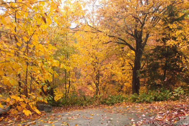
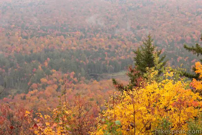
For summit views without the usual summit effort, head to Sawyer Mountain in the Adirondacks. The trail to the top of the mountain gains 650 feet over a 2.5-mile round trip hike. While the trail travels through a sheltered hardwood forest the entire way, there are two overlooks around the summit that provide far-reaching views over the trees across the surrounding valleys, ridges, and summits. Sawyer Mountain tops out at 2,600 feet and the peak can be bagged with one hour of enjoyable effort.
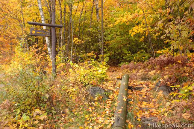
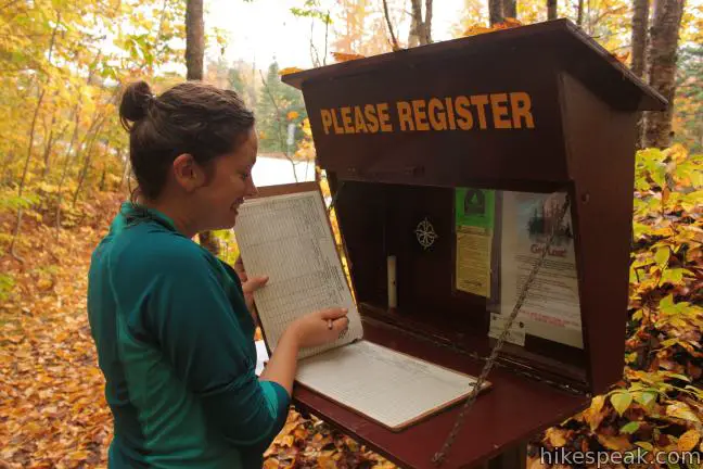
Start from a trailhead on the south side of Route 28 between the towns of Blue Mountain Lake and Indian Lake in Hamilton County. Sign in at the trail register and begin up the shaded single-track trail maintained by the New York State Department of Environmental Conservation. There are yellow markers posted to trees along the trail to keep you on course.
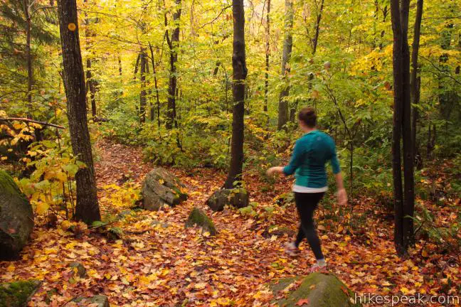
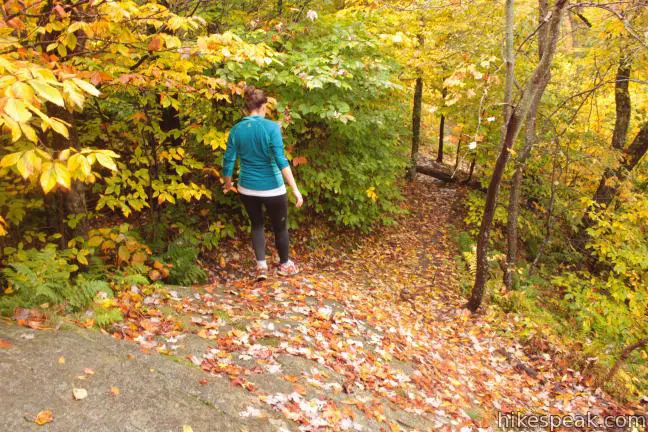
After a gradual opening leg, the trail ramps up and begins a moderate climb. There are a few short steep segments over fun rock obstacles, so shoes with good traction are a real asset. Overall, the trail maintains a not-too-aggressive climb.
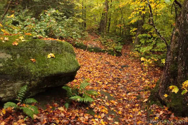
Less than a quarter mile from the start, the trail passes through one area that has the potential to be muddy and confusing. Stay to the right, following the defined trail up Sawyer Mountain. A mixed forest of maple, fir, beech, and birch trees shade the hike, while the ground is covered in moss, ferns and even the occasional toad.

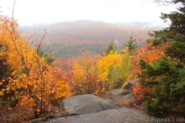
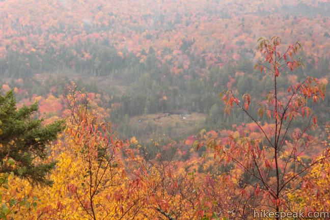
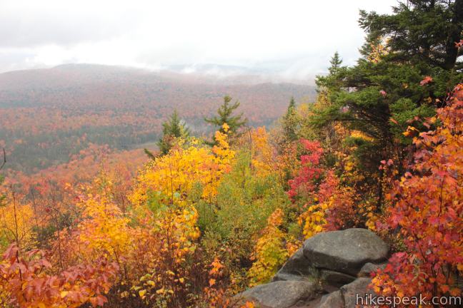
The uphill, undulating climb over dirt, rock, and roots eventually reaches a long slope of exposed bedrock, about a mile from the start. Continue up the rock and to the right, following the trail for another hundred yards to the hike’s first viewpoint. Take a brief detour over the path breaking off to the left to a ledge at the top of the rock slope. From here you gain a fine view over the rolling forest to the southeast.
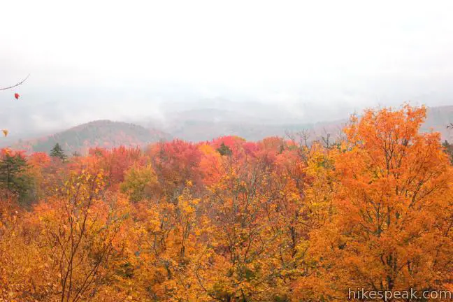
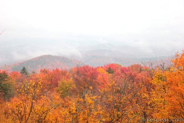
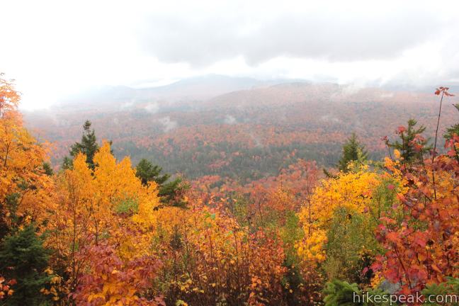
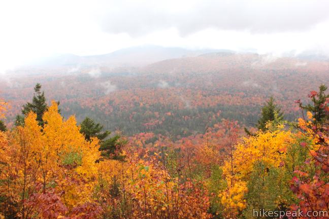
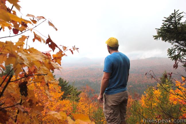
From the first viewpoint, it is another tenth of a mile to the top of the round summit. Passing the high point, the trail turns downhill for the first time. In another hundred yards (or about the time you realize you’ve crossed the summit), the trail comes to an end at the second, more impressive viewpoint. The overlook sits atop a giant rock staircase that creates a tree-less window looking out from Sawyer Mountain. The panoramic view peers west over the Cedar River Valley, framed by Wakely Mountain to the south and Blue Mountain to the north.
The trail ends at the second lookout, so return the way you came. Allot one hour to hike Sawyer Mountain Trail and enjoy all the views. This hike can easily be combined with the nearby trail to Rock Lake. No fee or permit is required to hike this trail and dogs are welcome, so get out and enjoy!
Directions to the Trailhead
- From Blue Mountain Lake at the intersection of routes 28, 28N and 30, drive east toward Indian Lake on Route 28/30 for 6.8 miles to the trailhead on the south side of the road.
- The trailhead is 4.4 miles west of the town of Indian Lake.
Trailhead Location
Trailhead address: Route 28, Indian Lake, NY 12842
Trailhead coordinates: 43.810842, -74.321284 (43° 48′ 39.03″N 74° 19′ 16.62″W)
View Sawyer Mountain in the Adirondack Mountains in a larger map
Or view a regional map of surrounding New York trails and campgrounds.


 | Rock Lake This easy 1.6-mile round trip hike visits a backcountry lake in the Adirondack Mountains near Blue Mountain. |
 | Grassy Pond This 1-mile round trip hike crosses level terrain to a peaceful pond, and the hike can be extended to 6 miles by hiking to the end of the trail and Wilson Pond. |
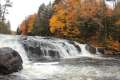 | Buttermilk Falls This 0.5-mile round trip hike visits a pleasant waterfall on the Raquette River near Long Lake. |
 | Cascade Mountain & Porter Mountain This 6.2-mile hike bags a pair of High Peaks near Lake Placid with excellent views over the Adirondack Mountains. |
 | More trails in New York explore other hikes in the Empire State. |
 | Camping on Blue Mountain Lake There are six designated primitive sites on Blue Mountain Lake's wilderness islands and shore. Are you ready to boat to your campsite? |
- Sawyer Mountain on summitpost.org (opens in a new tab)
- Sawyer Mountain on cnyhiking.com (opens in a new tab)
- Sawyer Mountain on nyskiblog.com (opens in a new tab)
- Sawyer Mountain on peakbagger.com (opens in a new tab)
- The Adirondack Mountains on wikipedia.org (opens in a new tab)
- The Adirondack Region on visitadirondacks.com (opens in a new tab)
- The official website for the Adirondack Forest Preserve (opens in a new tab)
Common Questions about Sawyer Mountain in the Adirondack Mountains
- Is the trail open?
- Yes. You should expect to find that Sawyer Mountain Trail is open. There are no recent reports of trail closures. If you discover that the trail is closed, please help your fellow hikers by reporting a closure.
- Is this trail free to access?
- Yes, Sawyer Mountain Trail is free to access. No entrance fee, pass, or permit is required. If you discover that access rules have changed, please provide feedback on your experience.
- How much time does this hike take?
- It takes approximately 1 hour 30 minutes to hike Sawyer Mountain Trail. Individual hiking times vary. Add extra time for breaks and taking in the views.
- How long is this hike?
- The hike to Sawyer Mountain Trail is a 2.5 mile out and back with 650 feet of elevation change.
- Are dogs allowed on this trail?
- Yes, dogs are allowed on Sawyer Mountain Trail. The trail is open to hikers, dogs.
- Does this trail go to a summit?
- Yes, Sawyer Mountain Trail reaches a summit with panoramic views.
- Where is the trailhead located?
- The trailhead for Sawyer Mountain Trail is located in Indian Lake, New York.
Trailhead Address:
Route 28
Indian Lake, New York 12842
Trailhead Coordinates:
43.810842, -74.321284 - What are the driving directions to the start of the hike?
To get to the trailhead: From Blue Mountain Lake at the intersection of routes 28, 28N and 30, drive east toward Indian Lake on Route 28/30 for 6.8 miles to the trailhead on the south side of the road. The trailhead is 4.4 miles west of the town of Indian Lake.
View custom Google Maps directions from your current location.
- Are there other trails near Sawyer Mountain Trail?
- Yes, you can find other nearby hikes using the Hikespeak Hike Finder Map.

Go the extra miles...
Submit a rating of this hike to go with your comment. Contribute to the average trail rating.