Design Village Trail San Luis Obispo Cal Poly Architectural Design Village Cal Poly Canyon Road hike Poly Canyon Design Village unique structures architecture students California Polytechnic State University
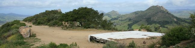
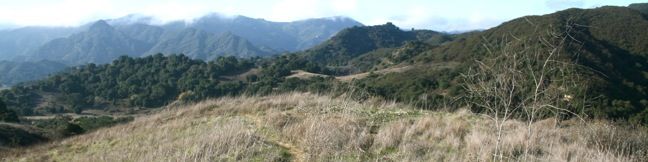
The Poly Canyon Design Village is a hamlet of unique and varied structures built over the decades by architecture students at California Polytechnic State University. Design Village is located on a quiet grassy hillside contoured by babbling creeks shaded by coast live oaks. The village is a short distance from the Cal Poly campus and creates a pleasant and interesting destination for a... Read more.
By: Published: Last updated: April 2, 2019
Bishops Peak Bishop Peak summit hike San Luis Obispo County Nine Sisters volcanic Morros Bishop's peak
Sometimes called Bishop's Peak, but more formally known as Bishop Peak, this mountain is the most sought after summit in San Luis Obispo. Bishop Peak is the tallest of the Nine Sisters, the picturesque volcanic Morros stretching across San Luis Obispo. The iconic mountain has a rocky crown shaped like a bishop's miter, which provides panoramic views over the city and nearby peaks. The... Read more.
By: Published: Last updated: May 13, 2025
San Luis Mountain Hike Laguna Lake Park Cerro San Luis Obispo Madonna Mountain Trail
Located just west of downtown San Luis Obispo, the 1,292-foot Cerro San Luis (or San Luis Mountain) offers sweeping views of the Santa Lucia Mountains and other peaks in the Morros, the chain of mountains that Cerro San Luis is a part of. The Morros, or Nine Sisters, are a line of prominent volcanic peaks between Morro Bay and San Luis Obispo. These beautiful peaks set the postcard-like... Read more.
By: Published: Last updated: April 2, 2019
San Luis Obispo South Hills Open Space Ridge Trail hike
While shorter than the more celebrated peaks around San Luis Obispo (those attention-seeking Morros known as the Nine Sisters), the 580-foot summit of the South Hills provides excellent easy-to-reach views of San Luis Obispo. A perimeter loop trail tours the 133-acre South Hills Open Space, along with a ridge trail that provides a 1.5-mile round trip hike as it ascends 450 feet to the top of... Read more.
By: Published: Last updated: April 2, 2019
Cistern Trail Lookout Trail Crags Road Malibu Creek State Park Hike Cage Creek Trail MASH set Century Lake Malibu Hike
While relatively short, Cistern Trail and Lookout Trail offer some of the very best views of Malibu Creek State Park. By entering the park at the middle of Crags Road (the main trail across the park), these less-used trails provide quick access to many of Malibu Creek's major hiking destinations. A number of possible hikes begin from Cistern Trail. A short loop to Century Lake is 2.25... Read more.
By: Published: Last updated: May 13, 2025
Lost Cabin Trail Malibu Creek State Park California Hiking Trail
Lost Cabin Trail is a 0.75-mile long dead-end single track departing from Crags Road near the location where the MASH television show was filmed. The trail ends in a mountain canyon at an empty plot where a cabin once stood. Though there is no longer evidence of the cabin's existence, the trek still offers hikers immersion into a remote section of Malibu Creek State Park behind the Goat... Read more.
By: Published: Last updated: December 22, 2018
MASH television set Malibu Creek State Park hike
Far from the Hollywood Sign and the Walk of Fame, Malibu Creek State Park holds its own bit of Hollywood history. The exterior set for the long-running television show M*A*S*H was filmed in a Korea-resembling corner of park. While the medic tents have been removed, the location is still recognizable, and Malibu Creek State Park has gone above and beyond to create a rich experience for... Read more.
By: Published: Last updated: May 13, 2025
Talepop Loop Hike Malibu Creek State Park Talepop Loop Trail North Grassland Trail Las Virgenes Valley Liberty Canyon Trail Las Virgenes Canyon Trail
Talepop Loop explores the north end of Malibu Creek State Park through a region long inhabited by Chumash Indians who had a village here named Talepop. Hikers today are exposed to signs of modern humanity like ranches and electric lines, but despite being suspiciously close to two major roadways, Talepop Trail escapes the man-made world to explore a beautiful patch of the Santa Monica... Read more.
By: Published: Last updated: May 13, 2025
South Grassland Trail Hike to Rock Pool in Malibu Creek State Park Crags Road lollipop loop Mulholland Highway hike Grassland Trailhead.
South Grassland Trail enters Malibu Creek State Park from Mulholland Highway, providing a scenic stroll over rolling hills. The trail ends at Crags Road, the major hiking artery through the park. If you are familiar with hiking out of the main parking lot, starting on the Grassland Trail adds about 0.9 miles to those hikes. By entering on Grassland Trail, visitors also avoid driving into... Read more.
By: Published: Last updated: May 13, 2025
Wonderland Wash Trail Joshua Tree National Park Wonderland Wash Hike
In between Barker Dam Trail and Wall Street Mill Trail is Wonderland Wash Trail, an unmaintained single track through the Wonderland of Rocks in Joshua Tree National Park. This less-traveled trail passes monzogranite mounds that are a popular playground for rock climbers and bouldering enthusiasts. There is no defined end to the trail, but a hike to the prominent rock formation known as the... Read more.
By: Published: Last updated: January 16, 2020