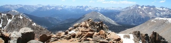
Mount Pickering rises to 13,485 feet and offers fine views over the Sierra. While not tall enough to be called a 14er, this 13er offers great views of two of those exclusive peaks, Mount Whitney and Mount Langley, as well as several other high peaks. This remote mountain is located west of the Sierra Crest in the Whitney Region of Sequoia National Park. The backpackers trek to the summit provides stunning scenery and plenty of privacy.
A few routes can be taken to ascend Mount Pickering. This report will concentrate on the northeast approach from Sky Blue Lake. Consult the Sierra Nevada hiker’s bible, The High Sierra: Peaks, Passes, and Trails by R. J. Secor, or summitpost.org for information on other approaches.
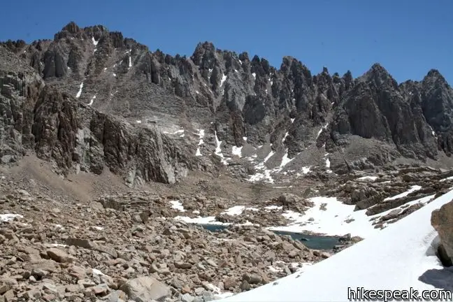
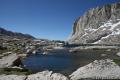
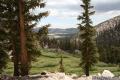
Mount Pickering is a two-mile class two climb from Sky Blue Lake at the top of Miter Basin. The hike to Sky Blue Lake is an amazing 26-mile round trip adventure of its own, starting from Horseshoe Meadow. Most backpackers will make camp somewhere around Lower Soldier Lake and reach Sky Blue Lake and Mount Pickering on day two.
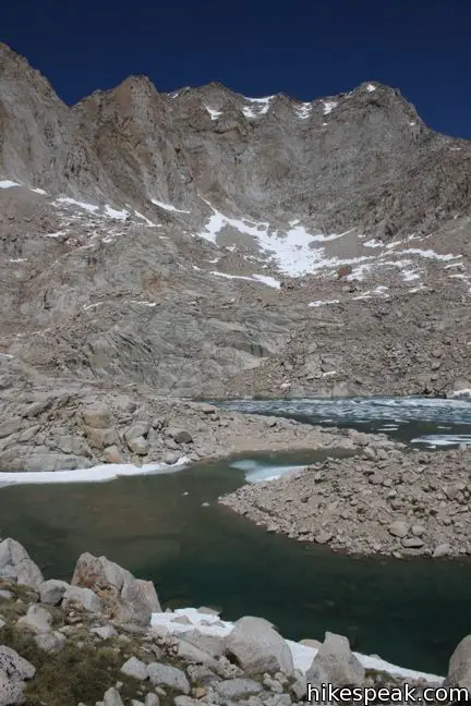
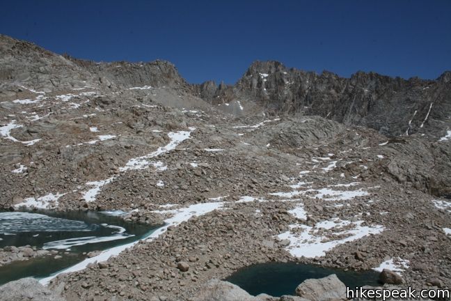
While a partial path leads up to Sky Blue Lake, at 11,550 feet, the trail is completely yours to create to the summit. In fact, based on the register, only a handful of hikers reach the top of the mountain each year.
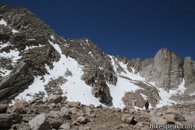
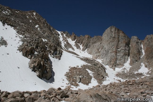
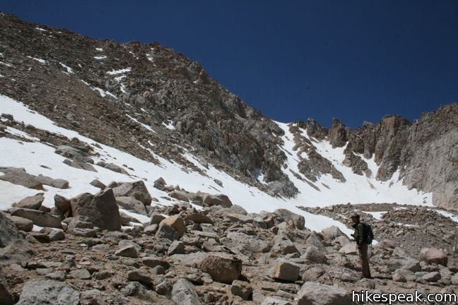
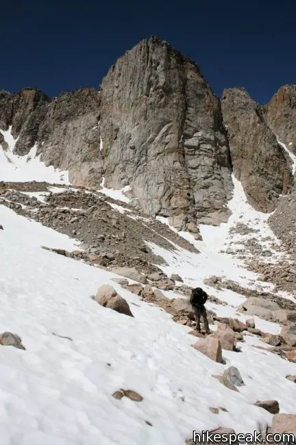
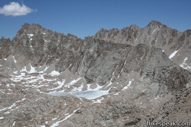
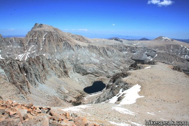
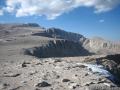
To climb Pickering, follow the creek flowing into the back of Sky Blue Lake up to a depression between Mount Pickering and Mount Newcomb. Circumnavigate one last lake and make your way to the base of the slope beneath Pickering. Select your route and start toward the saddle to the left of the summit. Be careful crossing the loose gravel and lingering slips of snow. Seek out stable rocks and climb a thousand feet to the saddle. There are very few large boulders, making the climb fairly straight forward.
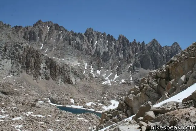
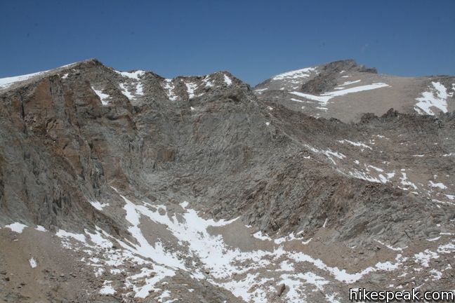
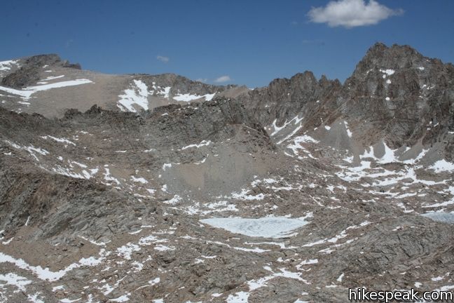
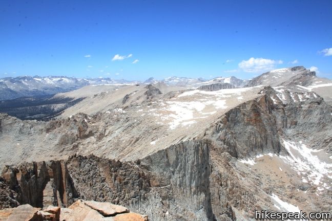
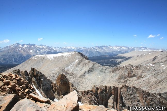
From the saddle, swing around to the south and take in the sight of Mount Langley, Primrose Lake, and Joe Devel Peak. Catch the view, catch your breath, and push on up the final five hundred vertical feet to the summit.
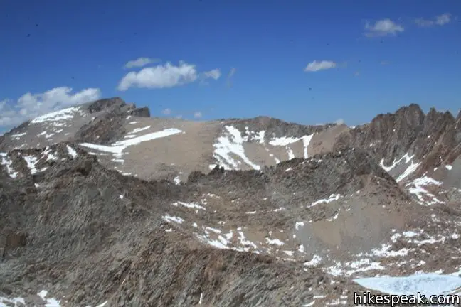
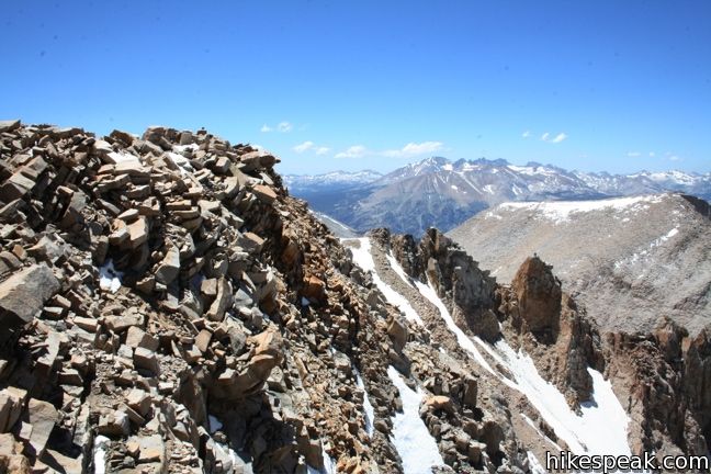
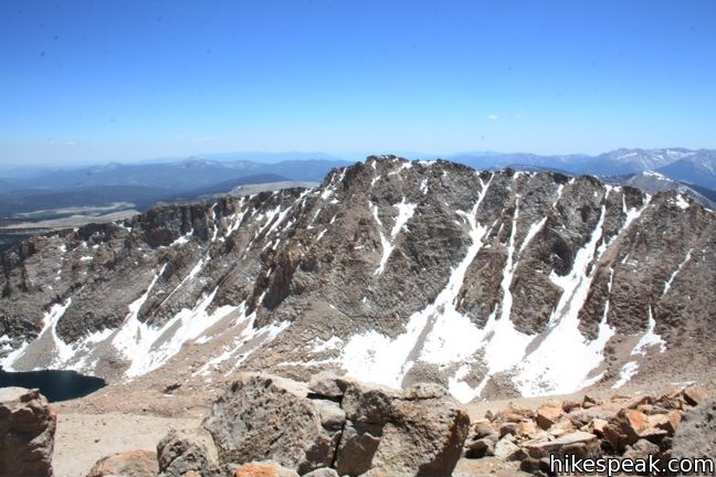
Large boulders toward the top make summiting Pickering more tiring than it would first appear. Boulder your way around the larger rocks and patches of snow. A cairn marks the highest point on the west end of the mountain. Just past the cairn, and down on the next large rock, is the peak register. Enjoying the vast view across the Sierra before returning the way you came.
As a variation, serious hikers may continue on to the adjacent Joe Devel Peak. Others will be tempted to descend the ridge to the southeast toward Primrose Lake. While this is a shortcut back, think twice. The Primrose Lake approach is called a class 2 in the annals of R. J. Secor (and it may be in late summer when the snow has melted), this path proved to be a tough class three (with a bit of class four mixed in) in July of 2009. After a strong winter, the long snowfield probably took up the easiest terrain. Unless you are a skilled mountain climber, you will be better off descending the way you came.
To reach Mount Pickering: Starting from Horseshoe Meadow, take either Cottonwood Lakes Trail or Cottonwood Pass Trail to Rock Creek at Lower Soldier Lake. Trek up Miter Basin to Sky Blue Lake and carry on from there.
Directions to the Trailhead
- It takes half an hour to ascend from the city of Lone Pine to the trailhead campgrounds.
- From Route 395 in Lone Pine, turn west at the traffic light on to Whitney Portal Road.
- After three miles, turn left on Horseshoe Meadow Road.
- Drive twenty miles up mountain switchbacks to the end of the road at Horseshoe Meadow.
- Turn right, following signs for Cottonwood Lakes and park at the trailhead.
Trailhead Location
Trailhead address: Horseshoe Meadows Road, Inyo National Forest, Lone Pine, CA 93545
Trailhead coordinates: 36.44834, -118.17065 (36° 26′ 54″N 118° 10′ 14.3″W)
View Eastern Sierra in a larger map
Or view a regional map of surrounding Sierra Nevada trails and campgrounds.


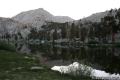
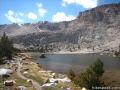
 | Sky Blue Lake This hike extends beyond Lower Soldier Lake up Miter Basin to a deep blue lake surrounded by towering peaks. |
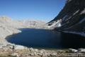 | Primrose Lake This sidetrek visits a lake between Miter Basin and Mount Pickering en route to Sky Blue Lake. |
 | Lower Soldier Lake This 19.2-mile loop crosses Cottonwood Pass and New Army Pass to visit a beautiful lake that is an ideal camping spot for backpackers heading higher and deeper into the Sierra. |
 | Cottonwood Pass This 7-mile round trip trail ascends 1,200 feet to an 11,200-foot pass and a junction with the Pacific Crest Trail, with access to Golden Trout Wilderness and Sequoia National Park. |
 | Cottonwood Lakes This scenic trail through a lake-filled basin provides a 10-mile round trip day hike to Long Lake and a 7.5-miles one-way trek to New Army Pass on the border of Sequoia National Park near Mount Langley. |
 | Old Cottonwood Creek Trail This 8 to 9-mile day hike follows a secluded trail through mountain meadows to the South Fork Lakes and Cirque Lake. |
 | Mount Langley This 22-mile trek travels past Cottonwood Lakes Trail over New Army Pass to a 14,042-foot summit with towering views of the Sierra. |
| Old Cottonwood Creek Trail This 8 to 9-mile day hike follows a secluded trail through mountain meadows to the South Fork Lakes and Cirque Lake. |
 | More trails in the Sierra Nevada Mountains Explore other destinations in Sequoia National Park and the rest of the range. |
 | Horseshoe Meadow Campgrounds This pair of campgrounds offer 40 sites and serve as a great base for the Cottonwood Pass and Cottonwood Lakes trails. |
- Mount Pickering via Sky Blue Lake on Bob Burds Trip Reports (opens in a new tab)
- Mount Pickering on summitpost.org (opens in a new tab)
- Mount Pickering in The High Sierra: Peaks Passes, and Trails by R. J. Secor (opens in a new tab)
- Trail and campground status page for the Mount Whitney Ranger District of Inyo National Forest (opens in a new tab)
- Inyo National Forest bear canister page (opens in a new tab)
- The official website for Inyo National Forest (opens in a new tab)
- The official website for Sequoia National Park (opens in a new tab)
Common Questions about Mount Pickering in Sequoia National Park
- Is the trail open?
- Yes. You should expect to find that Mount Pickering ascent from Sky Blue Lake is open. There are no recent reports of trail closures. If you discover that the trail is closed, please help your fellow hikers by reporting a closure.
- Do I need a permit for this hike?
- Yes. National Forest Wilderness Permit and bear canister required for overnight trips.
- How much time does this hike take?
- It takes approximately 14 hours 45 minutes to hike Mount Pickering ascent from Sky Blue Lake. Individual hiking times vary. Add extra time for breaks and taking in the views.
- How long is this hike?
- The hike to Mount Pickering ascent from Sky Blue Lake is 4-mile (out and back) leg of a 30-mile round trip hike via Cottonwood Pass with leg: 1925 feet - full hike: 3500 feet of elevation change.
- Are dogs allowed on this trail?
- No, dogs are likely not allowed on Mount Pickering ascent from Sky Blue Lake. The trail is primarily open to hikers.
- Is Mount Pickering ascent from Sky Blue Lake a difficult hike?
- This hike should be considered strenuous. Hikers should be prepared for a workout covering 30 miles and 3500 feet of climbing.
- Does this trail go to a summit?
- Yes, Mount Pickering ascent from Sky Blue Lake reaches a summit with panoramic views.
- Where is the trailhead located?
- The trailhead for Mount Pickering ascent from Sky Blue Lake is located in Lone Pine, CA.
Trailhead Address:
Horseshoe Meadows Road
Lone Pine, CA 93545
Trailhead Coordinates:
36.44834, -118.17065 - What are the driving directions to the start of the hike?
To get to the trailhead: It takes half an hour to ascend from the city of Lone Pine to the trailhead campgrounds. From Route 395 in Lone Pine, turn west at the traffic light on to Whitney Portal Road. After three miles, turn left on Horseshoe Meadow Road. Drive twenty miles up mountain switchbacks to the end of the road at Horseshoe Meadow. Turn right, following signs for Cottonwood Lakes and park at the trailhead.
View custom Google Maps directions from your current location.
- Are there other trails near Mount Pickering ascent from Sky Blue Lake?
- Yes, you can find other nearby hikes using the Hikespeak Hike Finder Map.

Nice post and mount views. I love to them and wanna go their if i can. Thanks
anyone know what the weather is like throughout the year in this particular area and elevation?
https://www.mountain-forecast.com gives accurate weather info