Sullivan Canyon
in the Santa Monica Mountains
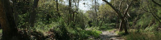
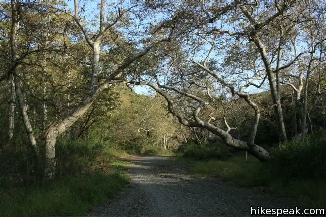
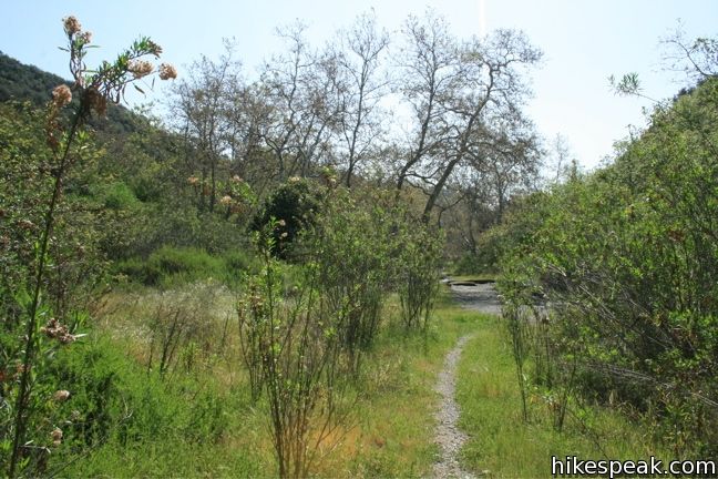
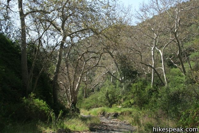
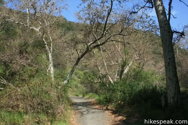
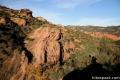
Sullivan Canyon runs north to south in the Santa Monica Mountains east of Will Rodgers State Park. This 8.5-mile round trip hike departs from a residential street a couple miles north of Sunset Boulevard and follows a wide trail up the center of a sycamore-filled canyon.
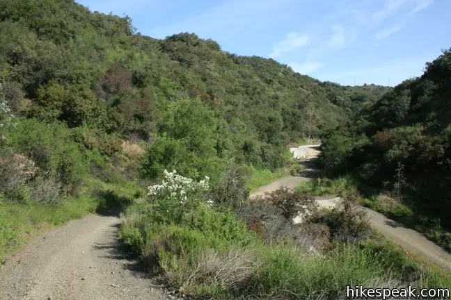
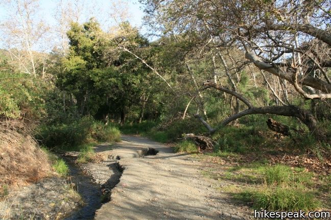
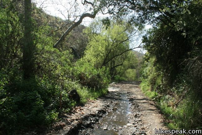
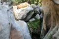
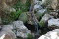
A green wall across Queensferry Road marks the start of the hike. Beyond the gate, the road descends for another quarter-mile, leaving Brentwood’s affluence for nature’s riches. When the pavement ends, turn right and cross a wide swatch of gravel with a seasonal creek flowing down the center. Concrete mats installed by the Gas Company allow easy travel up the canyon.
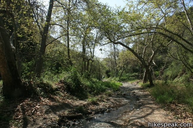
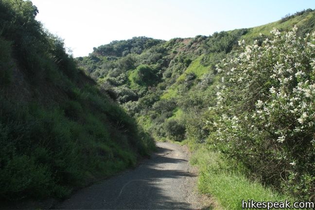
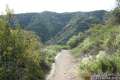
The dirt and gravel trail heads north on a gentile grade running parallel to and overlapping the small seasonal creek. Yellow posts every few hundred feet serve as a reminder that The Gas Company has a pipeline running through the canyon. In the spring, be sure to unplug your iPod and enjoy the abundant birdsong along the trail.
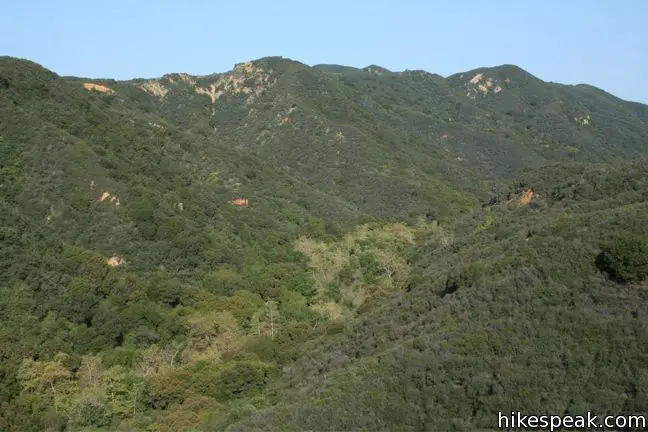
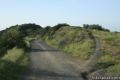
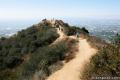
After 4.25 miles, Sullivan Canyon Trail comes to an end. For those looking to extend the hike, there is a fire road to the left that climbs 0.5 miles up the west wall of the canyon to Sullivan Ridge. From here, one can hike 1.5 miles to San Vicente Mountain by making a right on Sullivan Fire Road and a right on unpaved Mulholland Drive. Additionally, there is a connection path 0.9 miles from the start of Sullivan Canyon Trail that ascends the east wall of the canyon to Westridge Fire Road. This path climbs a steep dirt rut, and can be used to create a ten-mile loop encompassing Sullivan Canyon and Westridge Fire Road to visit San Vicente Mountain. Hiking up this path at the end of a long hike can be brutal, so better to descend this way at the start if you wish to attempt the loop starting from the Westridge Trailhead.
Like the surrounding trails, Sullivan Canyon is popular with mountain bikers, but the trail is quite peaceful in the early morning, visited only by a few neighborhood dog walkers. The scenery along the trail is fairly redundant, so one could turn around early and not miss out on much. No fee or permit is required, so get out and enjoy.
Directions to the Trailhead
- From Sunset Boulevard, 2.3 miles west of the 405, turn north at the light onto Mandeville Canyon Road.
- After a third of a mile, turn left onto Westridge Road.
- Drive uphill on Westridge Road for 1.2 miles and turn left on Bayliss Road.
- Drive two blocks and make another left on Queensferry Road and find a place to park.
- The trailhead is at the bottom of the road, but for some reason street parking is not allowed right next to the trailhead.
- Park where it is legal, and walk down the road to the gate.
Trailhead Location
Trailhead address: 2120 Queensferry Road, Los Angeles, CA 90049
Trailhead coordinates: 34.073771, -118.506863 (34° 04′ 25.6″N 118° 30′ 24.7″W)
(Sullivan Canyon Trail is in red)
View Santa Monica Mountains in a larger map
Or view a regional map of surrounding Los Angeles trails and campgrounds.


 | Sullivan Ridge A prominent lone-standing Live Oak along Sullivan Ridge makes a natural turnaround point and a 7.5 to 8.3 mile round trip hike. |
 | Murphy Ranch This 3.85-mile loop descending from Sullivan Ridge Fire Road into Rustic Canyon to abandoned buildings that had unusual occupants. |
 | Westridge Trail to San Vicente Mountain This 7.4-mile hike travels a scenic ridge between a Brentwood neighborhood and a summit that was once used as a Nike Missile site. |
 | Mulholland Drive to San Vicente Mountain This 2-mile hike approaches the peak from the east and offers views to the north and south en route to the old Nike Missile site. |
 | Temescal Canyon This 2.6-mile loop offers a variety of scenery and decent exercise, despite its relative brevity. |
 | Mandeville Canyon to San Vicente Mountain Loop This 5-mile hike incorporating a few trails, taking a DWP road up to Westridge to visit San Vicente Mountain, before crossing Mulholland Drive and Canyonback Ridge to return to Mandeville Canyon via Hollyhock Fire Road. |
 | Santa Ynez Falls This 2.5-mile follows a shaded creek to a gorge containing a short waterfall. |
 | More trails in the Santa Monica Mountains Explore other destinations in the range. |
 | Zuma Canyon Trail This 2.8-mile hike leaves a coastal Malibu neighborhood to explore rustic Zuma Canyon. |
 | Solstice Canyon This easy and level 2.6-mile out and back hike visits the ruins of a burned down ranch and a small waterfall. |
 | Red Rock Canyon The trails in the beautifully sculpted Red Rock Canyon are 2.5 and 5.2 miles in length. |
 | Eaton Canyon Falls This 3.5-mile hike goes up Eaton Wash to a narrow stretch of Eaton Canyon containing a pleasant 40-foot waterfall. |
 | Runyon Canyon Tour Hollywood's most popular dog park on loops of various lengths, offering good exercise and views over Los Angeles. |
Common Questions about Sullivan Canyon in the Santa Monica Mountains
- Is the trail open?
- Yes. You should expect to find that Sullivan Canyon Trail is open. There are no recent reports of trail closures. If you discover that the trail is closed, please help your fellow hikers by reporting a closure.
- Is this trail free to access?
- Yes, Sullivan Canyon Trail is free to access. No entrance fee, pass, or permit is required. If you discover that access rules have changed, please provide feedback on your experience.
- How much time does this hike take?
- It takes approximately 4 hours 15 minutes to hike Sullivan Canyon Trail. Individual hiking times vary. Add extra time for breaks and taking in the views.
- How long is this hike?
- The hike to Sullivan Canyon Trail is a 8.5 mile out and back with 950 feet of elevation change.
- Are dogs allowed on this trail?
- Yes, dogs are allowed on Sullivan Canyon Trail. The trail is open to hikers, dogs, bikes.
- Is Sullivan Canyon Trail a difficult hike?
- This hike should be considered strenuous. Hikers should be prepared for a workout covering 8.5 miles and 950 feet of climbing.
- What mountain range is this trail in?
- Sullivan Canyon Trail is located in the Santa Monica Mountains.
- Where is the trailhead located?
- The trailhead for Sullivan Canyon Trail is located in Los Angeles, CA.
Trailhead Address:
2120 Queensferry Road
Los Angeles, CA 90049
Trailhead Coordinates:
34.07377, -118.50686 - What are the driving directions to the start of the hike?
To get to the trailhead: From Sunset Boulevard, 2.3 miles west of the 405, turn north at the light onto Mandeville Canyon Road. After a third of a mile, turn left onto Westridge Road. Drive uphill on Westridge Road for 1.2 miles and turn left on Bayliss Road. Drive two blocks and make another left on Queensferry Road and find a place to park. The trailhead is at the bottom of the road, but for some reason street parking is not allowed right next to the trailhead. Park where it is legal, and walk down the road to the gate.
View custom Google Maps directions from your current location.
- Are there other trails near Sullivan Canyon Trail?
- Yes, you can find other nearby hikes using the Hikespeak Hike Finder Map.

9 Comments on Sullivan Canyon in the Santa Monica Mountains
What hikers are saying:
✨ Generated summary of user commentsThis trail offers a beautiful and serene escape through trees and bushes, providing a sense of solitude on weekday afternoons. Hikers appreciate the friendly atmosphere where mountain bikers and dog walkers share the path respectfully.
“The single tracks coming down hill are a lot of fun.” Jump to comment ↓
Is it safe to walk with two leashed 20 pound terriers? Will the dogs attract coyotes?
When are the most and least hiking traffic days and times?
Thank you.
Hi-
There seem to be a lot of people walking with dogs on weekends and weekday mornings. Also, mountain bikers down this trail on weekends.
I love this hike. I hiked up to sullivan ridge making for a 9.5 mile hike. This trail is not crowded at least not on a Thursday afternoon. The bikers are respectful and friendly. Thank you hikespeak folk.
Great trail, I ride my bike every weekend and this is a fun one. The single tracks coming down hill are a lot of fun. And everyone I’ve met is pretty nice.
For those with dogs wondering: This is, unfortunately, an on-leash only trail.
There is a ranger pick-up truck driving up and down the trail on the lookout for the horrible crime of well-behaved dogs off-leash.
You will likely get a warning the first time, but they looped around several times on that particular day.
Walking a dog on a leash for a ~15 mile hike is fun for neither dog nor owner, so while this trail is probably great for humans and mountain-bikers, be aware of the restrictions.
Love this hike, I live in that area so it is super convenient for us. M-F it is a bit empty (not too many hikers but folks on bikes) and kind of creepy but beautiful. My dog loves running trough the trees and bushes and lass time we went (beginning of November 2015) she found a deer leg… and I thought she was running with a stick…double creepy. Wondering what she will find on our next hike there.
Is there an address of the street where to park
Bayliss or Queensferry
Does anyone know if the Sullivan Canyon Trail is open during all the craziness?