Sandstone Peak
in the Santa Monica Mountains
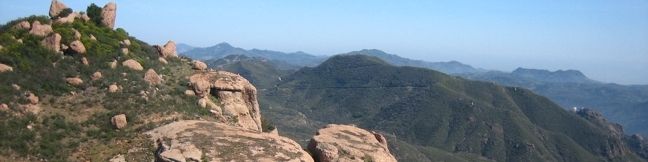
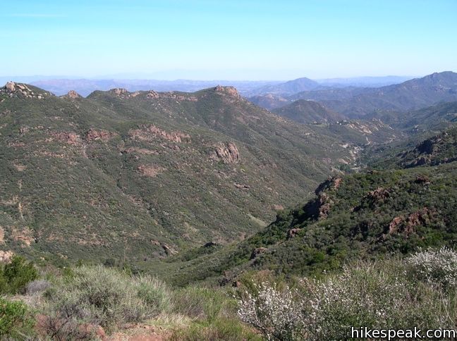
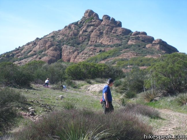
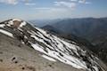
At 3,111 feet, Sandstone Peak is the tallest point in the Santa Monica Mountains. The summit can be reached via a 6.25-mile loop with 1,075 feet of elevation gain that (in addition to bragging rights) offers expansive views of the range.
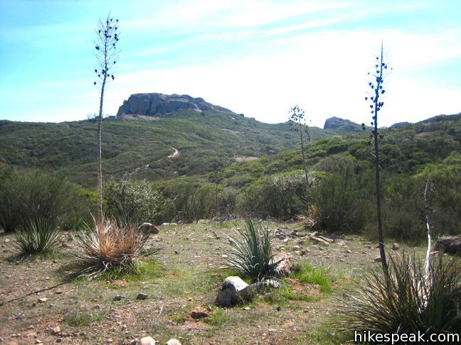
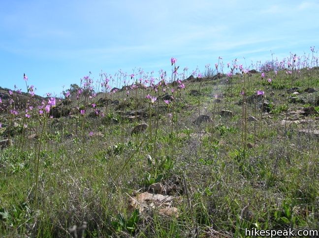
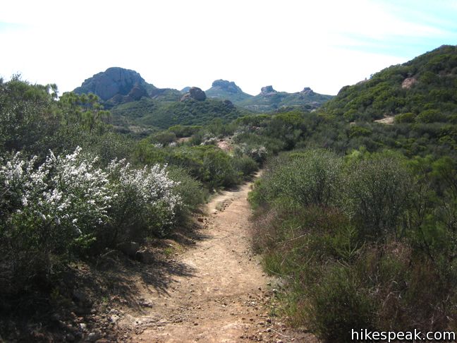
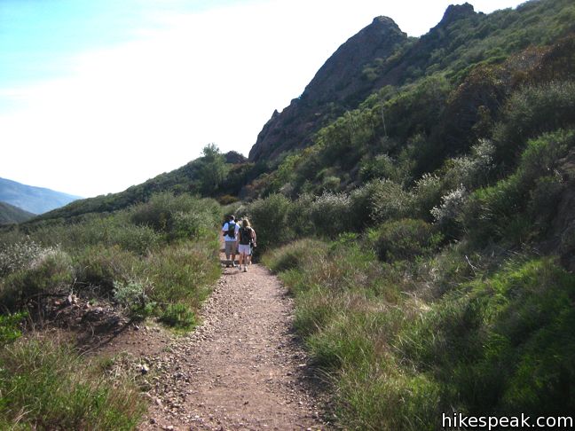
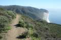
Head to Circle X Ranch in the Santa Monica Mountains, and start up the Backbone Trail toward Sandstone Peak. After a third of a mile, turn right, taking the connection to Mishe Mokwa Trail. This path runs parallel to Yerba Buena Road and offers great early views.
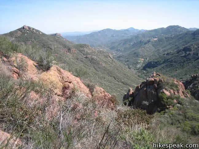
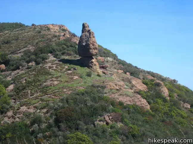
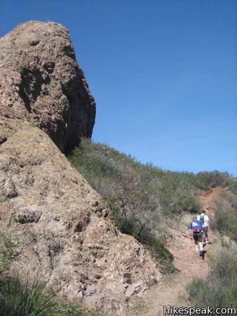
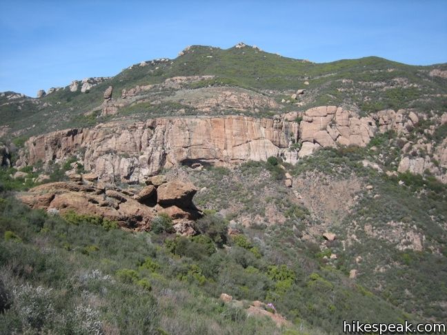
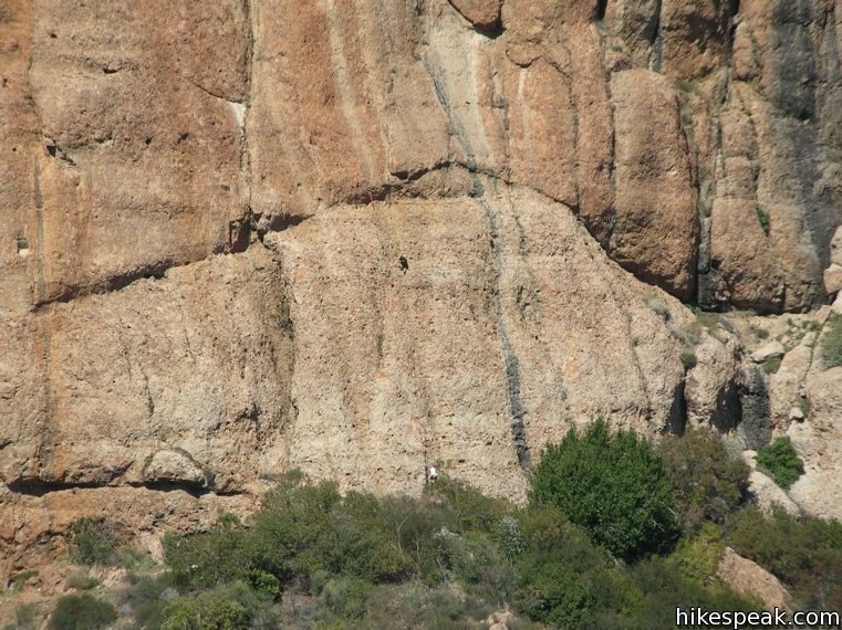
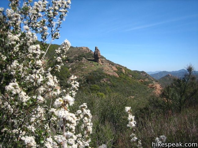
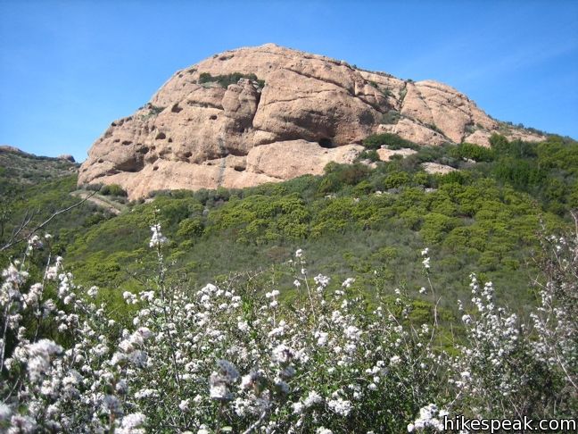
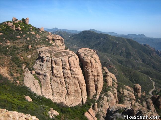
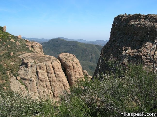
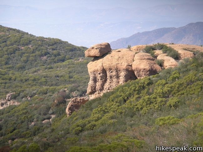
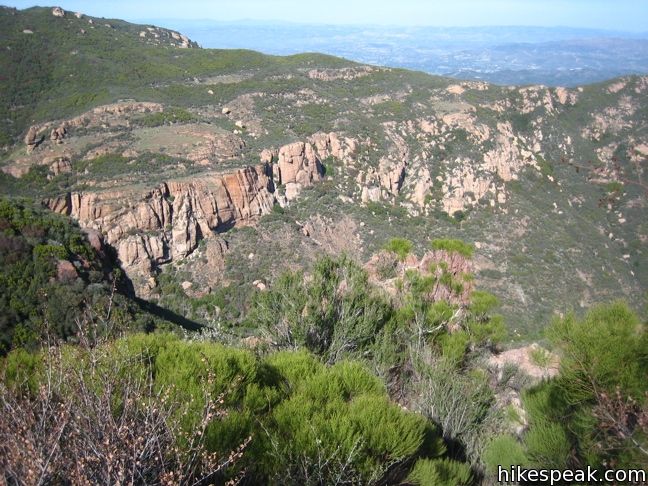
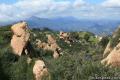
The vistas will only improve once you turn left and hike up Mishe Mokwa. The wide rock and dirt track passes a ravine with bold sandstone cliffs. These Echo Cliffs are a popular spot for mountain climbers, and you may spot a few making their ascent. A balancing rock at the northwest end of these cliffs appears to be standing in defiance of gravity.
Just ahead on the trail, enters a riparian forest and crosses a stream to arrive at Split Rock Picnic Area. After hiking nearly two miles, this is a good spot for a break. The picnic area offers plenty of shade, which is otherwise elusive on this hike.
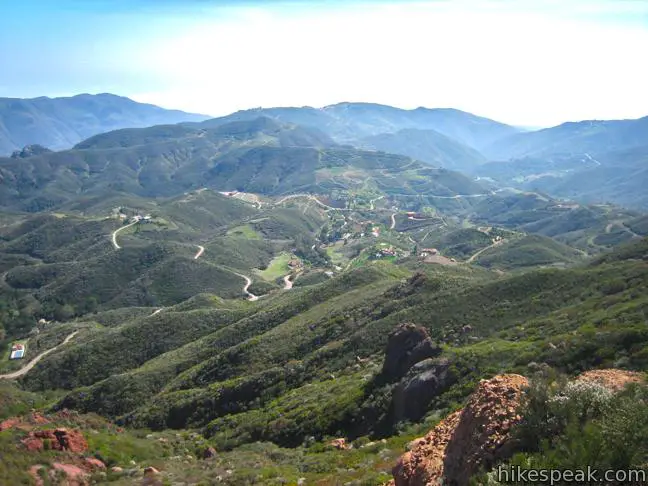
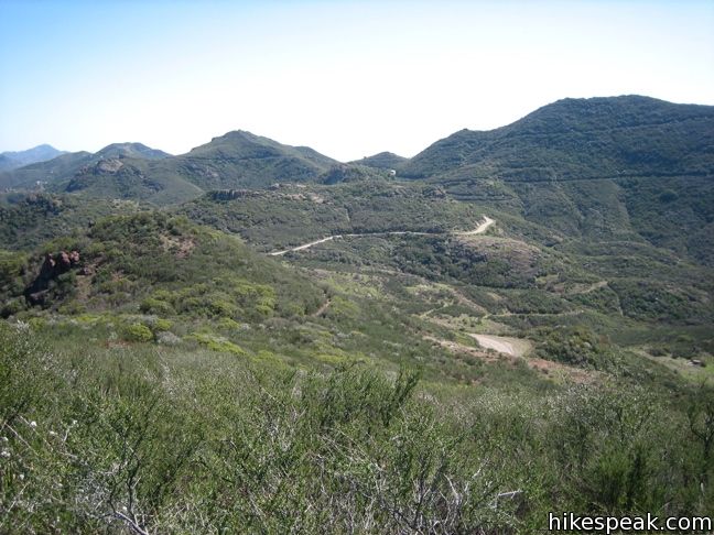
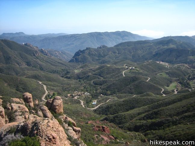
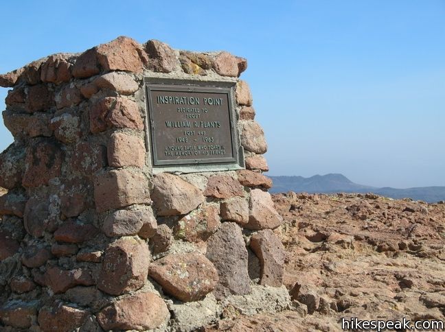
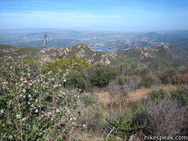
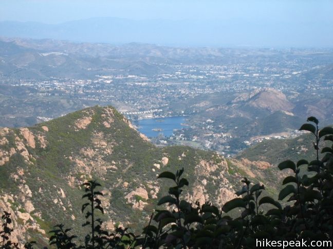
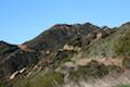
Past the picnic area, the trail climbs for nearly a mile and a half to join the Backbone Trail, 3 1/3 miles from the start. Turn left to continue on the loop, or make a right turn on the spur trail out to Tri Peaks, which adds 1.2 miles to the hike along with fine views to the west. To reach Sandstone Peak, continue on the Backbone Trail, which curves southward and then east. The next turnoff is for Inspiration Point, where a short path leads to vast views, making for a very worthy side venture.
The lookout should “inspire” you to get back on the trail and push on for the peak, one mile away. While never too steep, the Backbone Trail provides a steady climb. It passes just beneath the summit, where a short side trail must be taken to reach the top.
Sign the registry and have a look around. You are 1,075 feet above the trailhead at the highest point in the Santa Monica Mountains. Enjoy the views and remind yourself, “it’s all down hill from here.”
Almost…
Once you return to the Backbone Trail, it continues slightly uphill for a few hundred feet before making a steep descent to the parking lot.
Hikers are welcome to bring dogs on this loop. Hike the reverse direction direction up Sandstone Peak for a more strenuous workout. Just down the road, you’ll find a short hike to interesting boulders and pools called The Grotto.
If standing at the top of the Santa Monica Mountains inspires you to get even higher, hike to the highest point in Los Angeles County’s other major mountain range, the San Gabriel Mountains. Reaching the summit of Mount Baldy is a rewarding experience.
No fee is required to park at the trailhead for Sandstone Peak and you do not need a permit, so get out and enjoy!
Woolsey Fire Update: Trails around Circle X Ranch have reopened following the November 2018 Woolsey Fire. Check the NPS Circle X Ranch webpage for more information.
View the Circle X Ranch Map in a new window
Directions to the Trailhead
- Take PCH to the far west end of Malibu.
- Make a right on Yerba Buena Road (just past Neptune's Net Restaurant) and drive up Yerba Buena for 5.5 miles to the Circle X Ranch Ranger Station.
- Continue past the ranger station up Yerba Buena Road another mile and turn left into the Sandstone Peak trailhead parking lot.
- There is a bathroom at the trailhead and the Circle X Ranch Ranger Station.
Trailhead Location
Trailhead address: 12896 Yerba Buena Road, Malibu, CA 90265
Trailhead coordinates: 34.1116, -118.9268 (34° 06′ 41.8″N 118° 55′ 36.5″W)
View Santa Monica Mountains in a larger map
Or view a regional map of surrounding Los Angeles trails and campgrounds.
 | Tri Peaks This 1.2-mile addition to the Sandstone Peak loop adds extra views to the hike (and some great views). |
 | The Grotto This 3-mile out and back hike visits a remote grotto in the Santa Monica Mountains National Recreation Area. |
 | Arroyo Sequit This 2.05-mile loop winds around the upper reaches of a canyon carved by the East Fork of Arroyo Sequit and has grand views of the Santa Monica Mountains. |
 | Nicholas Flat via Malibu Springs Trail This scenic 7-mile round trip hike ascends 1,425 feet to meadows and a pond on Nicholas Flat in Leo Carrillo State Park. |
 | La Jolla Canyon Loop This 11.75-mile hike explores Point Mugu State Park on the west end of the Santa Monica Mountains, offering extraordinary ocean views. |
 | Mugu Peak This 6.5-mile hike ascends from the bottom of La Jolla Canyon to the top of a 1,266-foot peak, providing exceptional ocean and canyon views. |
 | More trails in the Santa Monica Mountains Explore beyond Circle X Ranch to other destinations in the range. |
 | Mount Lee, the Hollywood Sign, and Cahuenga Peak This 6.4-mile hike crosses Griffith Park from Canyon Drive to the top of Mount Lee, directly behind the landmark Hollywood Sign. |
 | Mount Baldy Loop This 11.3-mile hike incorporates Devil's Backbone and Baldy Bowl - Ski Hut Trail into one see-all loop. |
 | Stunt High Trail to Saddle Peak This 7.5-mile hike combines Stunt High Trail and a section of the Backbone Trail to visit the 6th tallest summit in the Santa Monica Mountains. |
 | Parker Mesa Overlook This steep out-and-back hike rewards the effort with excellent views of the Pacific Ocean. |
 | Calabasas Peak This 3.6-mile hike travels an easy-to-follow fire road, climbing 900 feet to panoramic views of the Santa Monica Mountains and San Fernando Valley. |
Common Questions about Sandstone Peak in the Santa Monica Mountains
- Is the trail open?
- Yes. You should expect to find that Sandstone Peak Loop & Tri Peaks is open. There are no recent reports of trail closures. If you discover that the trail is closed, please help your fellow hikers by reporting a closure.
- Is this trail free to access?
- Yes, Sandstone Peak Loop & Tri Peaks is free to access. No entrance fee, pass, or permit is required. If you discover that access rules have changed, please provide feedback on your experience.
- How much time does this hike take?
- It takes approximately 3 hours 15 minutes to hike Sandstone Peak Loop & Tri Peaks. Individual hiking times vary. Add extra time for breaks and taking in the views.
- How long is this hike?
- The hike to Sandstone Peak Loop & Tri Peaks is a 6.25 mile loop with 1075 feet of elevation change.
- Are dogs allowed on this trail?
- Yes, dogs are allowed on Sandstone Peak Loop & Tri Peaks. The trail is open to hikers, dogs.
- Does this trail go to a summit?
- Yes, Sandstone Peak Loop & Tri Peaks reaches a summit with panoramic views.
- What mountain range is this trail in?
- Sandstone Peak Loop & Tri Peaks is located in the Santa Monica Mountains.
- Where is the trailhead located?
- The trailhead for Sandstone Peak Loop & Tri Peaks is located in Malibu, CA.
Trailhead Address:
12896 Yerba Buena Road
Malibu, CA 90265
Trailhead Coordinates:
34.1116, -118.9268 - What are the driving directions to the start of the hike?
To get to the trailhead: Take PCH to the far west end of Malibu. Make a right on Yerba Buena Road (just past Neptune's Net Restaurant) and drive up Yerba Buena for 5.5 miles to the Circle X Ranch Ranger Station. Continue past the ranger station up Yerba Buena Road another mile and turn left into the Sandstone Peak trailhead parking lot. There is a bathroom at the trailhead and the Circle X Ranch Ranger Station.
View custom Google Maps directions from your current location.
- Are there other trails near Sandstone Peak Loop & Tri Peaks?
- Yes, you can find other nearby hikes using the Hikespeak Hike Finder Map.

22 Comments on Sandstone Peak in the Santa Monica Mountains
What hikers are saying:
✨ Generated summary of user commentsHikers celebrate this trail for its inspirational 360-degree views and striking rock formations that overlook the coast. Because the sun is relentless and shade is limited, Jon warns that visitors must carry extra water and begin before 8 a.m. to protect dogs from fatal heat exhaustion. This area is also active mountain lion territory, so staying alert is essential while navigating the remote terrain. The trailhead bathroom is reportedly in rough condition, making a stop before reaching the mountains a practical choice.
“It was an amazing and inspirational 360 view of inland to the coast.” Jump to comment ↓
“The views are sweeping and spectacular.” Jump to comment ↓
Great hike, my new favorite. Also, to update your details, there is now a bathroom at the trailhead!
This hike is great. Without the Tri Peaks and Inspiration point detours, my GPS read 5.8 miles with about 1400 feet of climb, 40% more than the absolute elevation difference (trailhead to summit) listed above.
Brings lots of water, there is very little shade on ~ 4 miles of this hike.
[…] Sunday, June 1st, David and I ventured out to Sandstone Peak (which we later came to find out is highest point of all the Santa Monica peaks, standing tall at […]
This is a very nice hike. It has stunning view and the scenery changes as the miles go on. It’s challenging enough to really feel like you did some good hiking, yet certain areas are flat enough where you can simply enjoy the beauty. We decided to go the long way — making it to the peak last after hiking 6 or so miles (there is a shortcut from the parking lot where you can go straight for the peak, we avoided this and did the full hike).
The only downside to the day we visited was that it was a windy day in general in Southern California, which gave us 60+mph wind gusts at the peak. We were holding on for dear life. Go on a day that isn’t windy!
This is pretty much our favorite hike in SoCal, there’s nothing like the views from the top and even the drive there and back through Malibu is stunning! Check out our post with more hiking tips and some awesome photos:
https://mrandmrsadventure.com/2014/06/19/our-favorite-socal-hike-sandstone-peak/
This hike is amazing. One note about the bathroom at the trailhead. It’s a little rough, especially for the ladies. I’d suggest stopping at Neptune’s Net before driving up to the trailhead.
This truly is one of the best hikes in the Santa Monica Mountains. It is tough to beat. It is a challenging 6-7 mile hike, with (according to my FitBit Surge) 1300 feet elevation gain if you do the full loop. The views are sweeping and spectacular. There are portions in a canyon environment, portions overlooking incredible sandstone formations in the distance, and portions of ascending that get your legs fired up as you approach the summit. The majority of people come to this trail and immediately turn left at the first fork to go to the summit — don’t do this!!!!!! Go right, do the 5 mile loop that ENDS at Sandstone Peak and then descend this last bit of the loop to the parking lot. It’s a shame to see so many people going straight to the peak and back (1.5 miles each way) and missing the incredible views the rest of the loop has to offer. Stay right in the first fork of the road, enjoy the spectacular views over the next 5 miles, be challenged by the gradual ascent and enjoy the peak at the end. Then a quick 1.5 miles to complete the loop back to the parking lot.
Spectacular hike. Not really safe for people to do by themselves — too deep in the mountains (no cell service, mountain lion territory). Go in a group of two or more, bring lots of water, and enjoy this amazing hike.
Also— use caution if it is a particularly windy day. The first time I did this hike, the winds on the ground were about 30 mph (unusual for California). The winds at the peak were strong enough to blow you over. Today however, we went with winds less than 10mph, it was pleasant the entire way.
[…] Site where we found the hike. […]
Great hike. Beautiful views. Not too strenuous but still enough of a workout. Ocean vistas and unique rocks!
How many miles is the hike if you take the shortcut off the loop trail to the top, sign the book, and then hike the downhill loop trail back to the parking lot?
Are dogs on leashes allowed on this trail?
yes
Thank you
Please be careful with dogs on this hike. A park ranger told me multiple dogs have died on this trail this year due to dehydration / exhaustion The heat can be quite intense.
Hit the trail early and bring PLENTY of water
[…] Black Friday, I did manage to come off a 10 hour flight from Taiwan to hike Sandstone Peak in Malibu, CA as part of Rei’s #OptOutside campaign to go outdoors instead of stampede […]
Any particular animals to worry about?
This is one of my favorite trail runs in the Santa Monica Mountains. Fortunately after 44 years of running I finally ran into a full grown Mountain Lion. It was an early morning surprise. Needless to say a Mountain Lion that was about 7′ from tail to nose standing just a few yards from me with no one else on the mountain that morning was quite a frightening experience. I hope by next week to return same time, same place to complete my run. I just have to get over the fear that I presently have…
[…] been wanting to hike the “best hike in the LA area” for a long time. Sandstone Peak is the highest peak in the Santa Monica Mountains. The trail to the peak is quite beautiful. We […]
We have. We did this in the early morning. We actually started hiking while it was still dark, with headlamps, during the week in October to watch the sunrise and ate at the top. It was an amazing and inspirational 360 view of inland to the coast.
[…] old MASH TV set is located or Sandstone Peak, another Malibu iconic hiking location. We settled on Sandstone Peak. Once we got off the freeway, the drive was very pretty through the Santa Monica Mountains to the […]
[…] the Sandstone Peak Loop Trail comes out to about 7.5 miles. The Loop combines the Backbone and Mishe Mokwa Trails together. Once you reach the summit of Sandstone Peak, you can continue along the Backbone Trail […]
[…] Clerb embraces California’s biodiversity, taking to trails in Eaton Canyon, Sandstone Peak, and Eagle Rock, and hikes always incorporate a “why,” whether that means setting an intention […]